
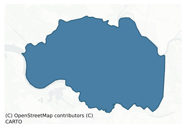
North Liberties is a barony of County Limerick, in the historical province of Munster (Irish: Na Líbeartaí Thuaidh), covering 30.8 km² of land. The barony records 195 NMS archaeological sites and 731 NIAH listed buildings, placing it at around the 98th percentile among 280 ROI baronies for sites per km². This means it is in the top tenth of all baronies for sites per km². Dated archaeological evidence runs from the Early Bronze Age through to the Modern, spanning 7 of 9 archaeological periods, placing the barony in the 38th percentile among 280 ROI baronies for chronological depth. This means it is in the lower half of all baronies for chronological depth. The largest dated subset of recorded sites dates to the Medieval.
Heritage at a glance
Percentile rankings throughout this profile compare each barony only against the other 279 Republic of Ireland baronies.
The recorded heritage of North Liberties
The National Monuments Service Sites and Monuments Record (SMR) is the statutory inventory of archaeological sites for the Republic of Ireland, maintained by the Department of Tourism, Culture, Arts, Gaeltacht, Sport and Media. Sites recorded here include earthworks, ringforts, megalithic tombs, ecclesiastical remains, and post-medieval features; not every record is legally protected, but each is registered as a monument of archaeological interest.
The National Monuments Service records 195 archaeological sites in North Liberties, putting it at the 98th percentile among 280 ROI baronies for sites per km². This means it is in the top tenth of all baronies for sites per km². Protection coverage is near-universal — 178 sites (91%) fall within a recorded monument protection zone, indicating an extensively surveyed landscape. The record is dominated by ecclesiastical sites — churches, graveyards, and holy wells (36 sites, 18% of the total), with defensive sites forming a substantial secondary presence (23 sites, 12%). Excavation – miscellaneous is the most prevalent type, making up 10% of the barony's recorded sites (20 records) — well above the ROI average of 4% across all baronies where this type occurs. Other significant types include Graveslab (11) and Graveyard (10). Graveslab is a recumbent grave-marking slab, dated 1200–1700 AD; Graveyard is a burial area associated with a church, in use from the medieval period onwards. Across the barony's 30.8 km², this gives a recorded density of 6.34 sites per km².
Most common monument types
Hover or tap a monument type to see its definition.
| Type | Count |
|---|---|
| Excavation – miscellaneous | 20 |
| Graveslab a recumbent grave-marking slab, dated 1200–1700 AD | 11 |
| Graveyard a burial area associated with a church, in use from the medieval period onwards | 10 |
| Castle – unclassified a castle whose form cannot be precisely classified, dating somewhere between the late 12th and 16th centuries | 9 |
| Church a building used for public Christian worship, of any date from c. 500 AD onwards | 8 |
| Bridge a built structure spanning a river or ravine to allow crossing, dated medieval onwards | 6 |
Chronological distribution
The dated archaeological record for North Liberties spans from the Early Bronze Age through to the Modern, with activity attested across 7 of 9 archaeological periods. Every period from earliest to latest is represented in the record — an unbroken sequence of dated activity across the full chronological span. Activity concentrates most heavily in the Medieval (76 sites, 62% of dated material), with the Early Medieval forming a secondary peak (15 sites, 12%). A further 72 recorded sites (37% of the overall NMS register for the barony) carry no period attribution — appearing as 'Unknown' in the bar chart below. This typically reflects either records that pre-date the standardised period vocabulary or sites awaiting specialist dating review, rather than a genuine absence of chronological evidence.
Sample of recorded monuments
Show 25 sample monuments (of 195 total)
A representative sample of 25 recorded monuments drawn from the barony’s 195 total NMS entries. Sites within a recorded monument protection zone and rarer site types are prioritised so the list shows a meaningful cross-section rather than only the most common type. Each entry shows the official Sites and Monuments Record reference number and the description published by the National Monuments Service.
Brickworks
The OS 25-inch map depicts a rectangular feature (50m x 40m) which is titled "Brick Field". This feature is not depicted on the 1840 six-inch OS map and is therefore probably late-19th century in date.
Compiled by:…
The OS 25-inch map depicts a rectangular feature (50m x 40m) which is titled "Brick Field". This feature is not depicted on the 1840 six-inch OS map and is therefore probably late-19th century in date.
Compiled by: Denis Power
Date of upload: 26 February 2013
Cairn – burial cairn
Situated on a rise, in the lowlying floodplain of the river Shannon. A flat-topped circular mound (diam. 23m; H 1.5m) with a near vertical gradient on the N side and more gentle gradients at S and W. The site was…
Situated on a rise, in the lowlying floodplain of the river Shannon. A flat-topped circular mound (diam. 23m; H 1.5m) with a near vertical gradient on the N side and more gentle gradients at S and W. The site was partially archaeologically excavated in advance of road construction works. Prior to archaeological investigation, the site consisted of a circular mound (diam. c. 23m; H 1.5m). In 2003 archaeological test excavation was carried out by Florence Hurley under licence No. 03E1144. Two hand-dug trenches, one on the W edge of the mound (7m by 1m) and one on top of the mound (2m by 2m), were excavated. These confirmed that the mound, or cairn, was made up of small and medium-sized stones (D 1m). A combination of larger stones and natural bedrock acted as revetting on the western side of the cairn. Fragments of cremated human bone were found in a discrete deposit on the old ground surface beneath the cairn. No evidence for any cists or deposits of bone within the cairn was found in the limited area examined. No external ditch was present.
See attached Google Earth orthoimages taken 19/11/2019 and 02/07/2018
Compiled by Edmond O'Donovan and Caimin O'Brien
Date of upload: 26 June 2020
Historic town
The historic city of Limerick was described in the Urban Survey (Bradley et. al. 1989, 241-67) as following; 'The city of Limerick is situated on the river Shannon in the north-east corner of County Limerick. The…
The historic city of Limerick was described in the Urban Survey (Bradley et. al. 1989, 241-67) as following; 'The city of Limerick is situated on the river Shannon in the north-east corner of County Limerick. The placename is derived from Luimneach "bare or barren land", a name which originally appears to have been applied to part of the Shannon estuary rather than just the immediate site of the city itself. The handful of prehistoric finds from the city indicates only that the site of the future settlement was occasionally frequented by man in early times. The fact that there are not more is surprising because the presence of the Curragour Falls must have given Limerick a topographical significance even in prehistoric times. There are many artefacts in the collections of the National Museum and elsewhere which were found in the river Shannon "near Limerick" but only two stone axeheads and two bronze dirks can be pinned down to the actual vicinity of the old would seem to have been an into early historic times.
The Hiberno-Scandinavian Town
The first evidence for the presence of Scandinavians occurs in 845 (AFM: 843) when Viking fleets appeared on the Shannon estuary and launched raids into county Limerick. It is unlikely that they settled, however, but there are a few scattered references which may indicate that a base existed at or near Limerick for a short time in the later ninth century. An eleventh century saga states that the Vikings Hona and Tomrir Torra were a…
Water mill – unclassified
Annotated 'Mill' on the 1840 ed. OS 6-inch map where it is depicted standing on the W bank of the River Shannon at the S end of a V-shaped salmon weir (LI005-110—-). This building was Curragour Mill, which was built…
Annotated 'Mill' on the 1840 ed. OS 6-inch map where it is depicted standing on the W bank of the River Shannon at the S end of a V-shaped salmon weir (LI005-110—-). This building was Curragour Mill, which was built in 1672, destroyed by fire and ruins removed in 1858 (O'Flaherty 2010, 30; Fitzgerald and McGregor 1826, 507). A second 'Mill' (LI005-017074-) is depicted on this map directly opposite on the E bank of the River Shannon. Curragour Mill was shown on a map called "A Plan of the city and suburbs of Limerick", by Christopher Colles 1769 (Ferrar 1787, xviii; BL, Add. MS 27391/E).
Test excavation was carried out by Edmond O'Donovan on behalf of Margaret Gowen under licence No. 98E0578 near the site of Curragour Mill which is depicted at the western edge of Curragour Falls on Phillips's map of 1685. A single test-trench was opened at the manhole shaft on Clancy's Strand. It was 10m long and revealed a 19th-century soil profile over natural. The deposits were interpreted as ground reclamation for the construction of the road adjacent to the River Shannon. No walls or other archaeological indicators suggesting the presence of a structure were found during the assessment (O'Donovan 2000, 171; www.excavations.ie).
Compiled by: Caimin O'Brien
Date of upload: 8 June 2020
Mound
In generally level, poorly drained pasture, on the floodplain of the River Shannon and Abbey River, c. 250m to W and c. 180m to S, respectively. Depicted on the 1841 ed. OS 6-inch map and on the revised 1938 ed. OS…
In generally level, poorly drained pasture, on the floodplain of the River Shannon and Abbey River, c. 250m to W and c. 180m to S, respectively. Depicted on the 1841 ed. OS 6-inch map and on the revised 1938 ed. OS 25-inch map as a circular-shaped mound (approx. overall diam. 16m). Visible as a roughly circular-shaped light-brown cropmark (diam. 16m) on Google Earth orthoimage taken 19/11/2019.
See attached Google Earth orthoimage 19/11/2019.
Compiled by: Alison McQueen and Vera Rahilly
Date of upload: 22 June 2020
Gallows
Modern housing estate built on site of Gallows Green annotated in this area on the 1840 ed. OS 6-inch map. Gallows Green is depicted on the 17th century Down Survey map of St Patrick's Parish (NLI, MS 718).
See…
Modern housing estate built on site of Gallows Green annotated in this area on the 1840 ed. OS 6-inch map. Gallows Green is depicted on the 17th century Down Survey map of St Patrick's Parish (NLI, MS 718).
See attached Down Survey map of the parish of St. Patrick's which shows the gallows or gibbet of 'Gallows Green'.
Compiled by: Caimin O'Brien
Date of upload: 8 June 2020
Town defences
The medieval town defences of Limerick city were described in the Urban Survey (Bradley et. al. 1989, 266-87) as following; 'The documentary references detailed in the historical introduction, above, clearly show that…
The medieval town defences of Limerick city were described in the Urban Survey (Bradley et. al. 1989, 266-87) as following; 'The documentary references detailed in the historical introduction, above, clearly show that Viking Limerick was defended by walls with towers and gates. The exact course of these walls, however, is unknown and it is not clear if they coincide at some points or not with the late medieval defences of the town whose course can be accurately traced from a number of maps, including the "Hardiman" map of c.1590 (Hardiman Ms. TCD Ms 1209/57, partly reproduced in nineteenth century re-drawing in fig. 56, for the remaining part see Lynch 1984, pl. I), the Pacata Hibernia map of c.1600 (see cover), John Speed’s map of 1610 (fig. 57), Thomas Phillips" view and map of c.1685 (NLI), and the "French" map of 1691 (reproduced in Lenihan 1866, opp. 258). The defences have been the subject of a detailed study by Leask (1941) while the excavations by Lynch (1984) Charlotte’s Quay have shed much new light on the nature and construction of the wall of Irishtown.
In terms of documentary references it is clear that works were being carried out on the defences from the thirteenth right through until the seventeenth century. Murage grants are attested from 1237 (Sweetman 1875-86, i, no. 2405) and further grants were made in 1310-11, "to enclose the suburbs" (Tresham 1828, p. 18: no. 134), 1375 (ibid., p. 95: no. 176) and 1400 (ibid., p. 163: no. 118). Work continued on th…
Castle – Anglo-Norman masonry castle
National monument No. 288. The Anglo-Normans first established a presence in Limerick in 1171 when Donal O’Brien, King of Limerick and Thomond, paid homage to King Henry II at Cashel, and afterwards King Henry II sent…
National monument No. 288. The Anglo-Normans first established a presence in Limerick in 1171 when Donal O’Brien, King of Limerick and Thomond, paid homage to King Henry II at Cashel, and afterwards King Henry II sent ‘Keepers’ to Cork and Limerick (Furnivall 1896, 60). In 1175, Donal O'Brien, King of Limerick, rebelled against the King of England and Raymond le Gros assembled an army of 120 men-at-arms, 300 horse solider and 400 archers on foot and marched on the 1st of October to attack Limerick (Scott and Martin 1978, 149-53). In 1217, King Henry III granted Reginald de Breouse [Braose], 'custody of the castle and city of Limerick, to hold till the K.'s 14th year' (Cal. doc. Ire. No. 787, 118). In this year the King notified the 'knights, free tenants, and others on the lands of William de Breouse in Ireland, that Reginald de Breouse having come to his fealty, the K. restores to him all the lands which belonged to his father ere Meyler Fitz Henry, then justiciary of Ireland, divided them between Munster and Desmond' (Cal. doc. Ire. No. 786, 118). In 1223 King Henry III granted Richard de Burgh the seneschalship of Munster along with the castle of Limerick with the condition that he serve as the king's bailiff under the justiciary (Cal. doc. Ire. No. 1114, 170).
The royal castle of Limerick known as King John’s (1199-1216) Castle was described in the Urban Survey (Bradley et. al. 1989, 288-99) as following: ‘Work on this castle appears to have commenced in the f…
Cathedral
The cathedral church of the Blessed Virgin Mary in the city of Limerick was described in the Urban Survey (Bradley et. al. 1989, 300-15) as following; 'The cathedral appears to have been established at the Synod of…
The cathedral church of the Blessed Virgin Mary in the city of Limerick was described in the Urban Survey (Bradley et. al. 1989, 300-15) as following; 'The cathedral appears to have been established at the Synod of Rathbressail in 1111 (Gwynn and Hadcock 1970, 90) but the earliest parts of the present structure date to c. 1180-95 (fig. 61; Leask 1955-60, ii; Clapham 1952, 29). This late twelfth century building was essentially a cruciform structure consisting of nave, chancel, transepts and side aisles. A number of side-chapels were added in the fifteenth and sixteenth centuries and these have obscured somewhat the original cruciform plan; they have caused considerable alteration to the side aisles and a large tower has also been added onto the west end of the nave. There have also been extensive modern restorations, especially in the chancel. The masonry of all medieval phases is roughly coursed rubble limestone, but the original work is distinguished by the use of sandstone quoins and mouldings in contrast to the limestone of the later phases.
Choir
Externally the walls are c.10m high with the east gable rising to c.14-15m. The angles retain the original sandstone quoins and a battered plinth below a roll moulding in sandstone at the base. Angle buttresses in limestone ashlar, of late medieval date, have been added. The walls are topped with stepped battlements above a parapet c.2.5m high also of late medieval date, which are carried on moulded sandstone corbels which…
Cross-slab
14th/15th century cross slab in St. Mary's Cathedral (LI005-017015-) described in the Urban Survey of Limerick (Bradley et. al. 1989, 316) as following; ‘Black limestone slab set into a tomb transept. It has an incised…
14th/15th century cross slab in St. Mary's Cathedral (LI005-017015-) described in the Urban Survey of Limerick (Bradley et. al. 1989, 316) as following; ‘Black limestone slab set into a tomb transept. It has an incised two-line on a fleur-de-lis base and the head of the cross. Dims: L. 2.33m W. 0.63m T. 0.08m'.
Compiled by: Caimin O'Brien
Date of upload: 15 November 2019
Metalworking site
In an undeveloped greenfield plot, to E of McGuire’s Yard and W of an oil storage depot. Not depicted on OS historic mapping. Identified by Celie O'Rahilly, archaeologist, Limerick Corporation, during the course of…
In an undeveloped greenfield plot, to E of McGuire’s Yard and W of an oil storage depot. Not depicted on OS historic mapping. Identified by Celie O'Rahilly, archaeologist, Limerick Corporation, during the course of field survey. Described by O'Rahilly as visible as a spread of possible slag, located in the angle of a recently deepened drain.
See attached Google Earth orthoimage 02/07/2018 and field map by O'Rahilly showing location of iron slag find.
Compiled by: Alison McQueen, Vera Rahilly and Caimin O’Brien
Date of upload: 26 June 2020
Armorial plaque
16th/17th century armorial plaque in N side of the chancel in St. Mary's Cathedral (LI005-017015-) described in the Urban Survey of Limerick (Bradley et. al. 1989, 319-20) as following; ‘Donogh O’Brien. 16th-17th cent.…
16th/17th century armorial plaque in N side of the chancel in St. Mary's Cathedral (LI005-017015-) described in the Urban Survey of Limerick (Bradley et. al. 1989, 319-20) as following; ‘Donogh O’Brien. 16th-17th cent. Square limestone plaque with a chevron between three lions in relief. The name DONOH is inscribed above the arms in Gothic lettering. On the wall to the left of the Thomond memorial (LI005-017029-). The ascription of this monument to Bishop Donough O’Brien is incorrect on chronological grounds. (Talbot 1976, 60)'.
Compiled by: Caimin O'Brien
Date of upload: 18 November 2019
Tomb – effigial
17th century effigial tomb in N side of the chancel of St. Mary's Cathedral (LI005-017015-) described in the Urban Survey of Limerick (Bradley et. al. 1989, 320-1) as following; ‘Thomond monument. 1624 (restored 1678)…
17th century effigial tomb in N side of the chancel of St. Mary's Cathedral (LI005-017015-) described in the Urban Survey of Limerick (Bradley et. al. 1989, 320-1) as following; ‘Thomond monument. 1624 (restored 1678) Large wall memorial set in an arch on the north side of the chancel. It consists of three tiers with reclining effigies of Donough O’Brien, 4th earl of Thomond, in the lower tier and his wife, Elizabeth FitzGerald, above. Incised inscription on a slab at the back of the third tier:
THIS MONVENT BEING DEFACED IN YE TIME OF YE LATE REBEL/
LION OF IRELAND WAS BY HENRY YE SECOND [sic, ?seventh]
EARLE OF THOMOND/ OF ANEVE REEDIFYED AN 1678 IN MEMORY
OF HIS MOST NOBLE/ GRANDFATHER DONAGH O’BRIEN EARLE OF
THOMOND, BARON/ OF IBREACAN, PRESIDENT OF MVNSTER, & ONE
OF HIS MAIS PRI/ VY COVNCIL, WHO HAVING DERIVED HIS
TITLES FROM AN AN-/ CIENT & HONOVRABLE FAMILY SOMETIME
FOVNDERS OF THIS/ CHVRCH LEFT THEM TO POSTERITY MORE
ENNOBLED BY HIS OWN/ VERTVE FOR GIVING EQVALL PROOFES
BOTH FOR COVRAGE &/ CONDVCT OF HIS LOYALTY & WORTH HE
WAS REWARDED BY YE/ HIGH & MIGHTY MONARCHS QVEEN
ELIZABETH & KING/ IAMES WITH HONOVRS ABOWE YE NOBILITY OF HIS TIME
The monument is flanked by ionic columns in its lower register with Corinthian columns above. It is surmounted by obelisks and, in the centre, the sculpted arms of the O’Brien's still retaining its colours and gilding. Projecting from the monument on a rod is a coroneted helmet with a barred visor. (FitzGerald 1910…
Tomb – unclassified
17th century memorial in the graveyard (LI005-017044-) of St. Munchin's Church (LI005-017043-) described in the Urban Survey of Limerick (Bradley et. al. 1989, 328-9) as following; ‘Elinor Young 1649. A large slab with…
17th century memorial in the graveyard (LI005-017044-) of St. Munchin's Church (LI005-017043-) described in the Urban Survey of Limerick (Bradley et. al. 1989, 328-9) as following; ‘Elinor Young 1649. A large slab with a marginal inscription to the memory of Elinor, daughter of Thomas Young (1895-7, 104).
Described in the late 19th century as following; 'Contains the following tomb and inscription' : "HERE ELINOR YOUNGE HER BODY / LIES OF
WHO TIS TRULY SAID SHE AITHER A VIRGIN
LIVED / AND ERE DECEAST A MAIDEN. / THE
DAUGHTER OF THOMAS AND MARY YOUNGE
26TH FEB. 1649."
This inscription is cut round the margin of a very large slab (Anon 1898, 104)'.
Compiled by: Caimin O'Brien
Date of upload: 18 November 2019
Religious house – Augustinian nuns
The Augustinian Priory of St. Peter in the city of Limerick (LI005-017—-) was described in the Urban Survey (Bradley et. al. 1989, 330) as following; 'Founded by Donal O’Brien for Augustinian Black nuns at about the…
The Augustinian Priory of St. Peter in the city of Limerick (LI005-017—-) was described in the Urban Survey (Bradley et. al. 1989, 330) as following; 'Founded by Donal O’Brien for Augustinian Black nuns at about the time of the arrival of the Anglo-Normans (Gwynn and Hadcock 1970, 322). The priory is shown on the 1590 map as situated between Bishop Street and the town wall (LI005-017010-) in the area known today as St Peter’s Cell. At the time of the dissolution in 1541 the buildings were already ruinous but occupied three-quarters of an acre (Gwynn and Hadcock 1970, 322). A stone head was discovered in the area in 1946 and Hunt (1949-52,16-7) suggested that the carving, which considered to be Romanesque in style, may have come from the priory. This limestone head is now in the Limerick Museum'.
Compiled by: Caimin O'Brien
Date of upload: 18 November 2019
Religious house – Dominican friars
Dominican Priory of St. Saviour described in the Urban Survey (Bradley et. al. 1989, 331-3) as following: 'Founded by Donnchad Cairbreach O’Briain, king of Thomond in 1227 (Gwynn and Hadcock 1970, 226). The buildings…
Dominican Priory of St. Saviour described in the Urban Survey (Bradley et. al. 1989, 331-3) as following: 'Founded by Donnchad Cairbreach O’Briain, king of Thomond in 1227 (Gwynn and Hadcock 1970, 226). The buildings were badly destroyed in an attack on the town in 1369 and were so ruinous that in 1377 the king made an annual grant of 40s towards their repair (ibid.). The 1590 map depicts a lofty belfry ,without battlements, four ranges of buildings in repair and the side arcades or windows of the ruined church.
Today only the north wall and a short section of the east wall of the church survives in the grounds of St Mary’s Convent. The masonry is roughly coursed rubble limestone and the wall is 55-60m long (the west end is unclear), up to high and 1.2m thick. The north splay of the east window, with chamfered and rebated jambs of sandstone, can be seen in the east wall and a similar splay can be seen in a short section of wall, north of the north wall, which may have been a window in a sacristy or chapel on the north of the chancel.
To the west of this externally there are three segmentally-arched recesses or, perhaps, blocked doorways. Above these there is a groove in the wall, 10m long, 25cms high and 15cms deep (for supporting joists of a floor/ roof). Above the middle recess there is a small segmentally-arched window, which may be inserted, splaying externally with pointed rear arch. 13m from the east end is the gable line of the east range of the cloister, c. 7….
Religious house – Franciscan friars
Excavations carried out at St. Francis Street by Florence Hurley in 1996 under licence No. 95E0218 were summarised as following; 'This site is one of a number that will be affected by the construction of the Northern…
Excavations carried out at St. Francis Street by Florence Hurley in 1996 under licence No. 95E0218 were summarised as following; 'This site is one of a number that will be affected by the construction of the Northern Relief Road through this part of Englishtown. Trial-trenching in 1988 had indicated the presence of walls and human bone. The site has long been associated with the Franciscan friary founded in 1267. It lies just outside the eastern part of the town wall, and to the south lies Long Lane. The structures of the friary went gradually into ruin after its dissolution between 1540 and 1548. What remained was removed when the county courthouse was built on the site c. 1732. It was demolished in the middle of the last century. Twelve trenches were opened along the rake of the new road, and archaeological material was found in eight of these. This can be divided into five main phases.
Pre-friary activity
This consisted of a series of organic deposits, 1.5m deep. From these came a relatively large amount of animal bone and occasional sherds of local and imported medieval pottery. Near the base of these deposits was a cobbled surface.
The friary
The organic deposits were covered by a silty clay layer, 0.25m thick, laid down to seal the underlying material. The western end of the nave and part of a southern aisle were found. These were constructed predominantly of brown sandstone. A 1 3m section of the southern aisle wall was found, consisting of five blind arches, ea…
Barracks
Leask (1941, 98-9) recorded that during the reing of Charles II (1660-85) a barracks was 'erected on the ground now occupied by St. Mary's Convent and the schools: the space within the great gap. The French map does…
Leask (1941, 98-9) recorded that during the reing of Charles II (1660-85) a barracks was 'erected on the ground now occupied by St. Mary's Convent and the schools: the space within the great gap. The French map does not show it, while the map of 1786 in Ferrar's History indicates several regular blocks of buildings call "Barracks, later Brewery" '.
Compiled by: Caimin O'Brien
Date of upload: 18 November 2019
Market-house
Late 17th century market house built on site of 'Thom Cor Castle' (LI005-017099-) in the city of Limerick (LI005-017—-) described in the Urban Survey (Bradley et. al. 1989, 259) as following; 'stood at the junction of…
Late 17th century market house built on site of 'Thom Cor Castle' (LI005-017099-) in the city of Limerick (LI005-017—-) described in the Urban Survey (Bradley et. al. 1989, 259) as following; 'stood at the junction of Mungret St. and John St. in the Irish town. It appears on the 1580 map (Hardiman Mss, TCD) but was demolished in 1696 and a market house was built on the site at a cost of £210 (Westropp 1906-7, 79).
Compiled by: Caimin O'Brien
Date of upload: 21 November 2019
House – fortified house
Galwey's Castle (Ireton’s House) described in the Urban Survey of Limerick (Bradley et. al. 1989, 262) as following; ‘Located near the cathedral [LI005-017015-]. It may have been built in the early 17th century and was…
Galwey's Castle (Ireton’s House) described in the Urban Survey of Limerick (Bradley et. al. 1989, 262) as following; ‘Located near the cathedral [LI005-017015-]. It may have been built in the early 17th century and was repaired in 1650-54. It was demolished in 1894 (Westropp 1906-7, 80)'.
This castle and its demolition was described by Barry (1894, 386-9) as following; 'The only matter I have to report on is the history of the disappearance of one of the most remarkable and interesting of the castellated houses of old Limerick, viz. Galwey's Castle, commonly known as Ireton's House. It was a large stone structure, with pointed gables in the Elizabethan style, with stone-mullioned windows, and a round-headed stone-arched doorway leading into Gridiron-lane, which separated it from St. Mary's churchyard [LI005-017016-] and the old Exchange. Its high Dutch gable front of red brick, evidently an insertion of later date, facing Nicholas-street the main street of the English town gave one a good idea of the houses of old Limerick. This front of imported Dutch brick was, according to local tradition, the first brick-fronted house erected in Limerick. In 1661 Lord Orrery was made Governor of the Castle and City of Limerick. In a letter from King Charles, he is directed to "employ himself" in getting English and Dutch merchants to settle in Limerick.
By a letter of Orrery's, he would seem to have been successful, as he says he expects more Dutch merchants to settle in the ci…
Tomb – chest tomb
The 'monument' of Thomas and Johanna Rice dated 1622 which seems not to have survived the rebuilding of St John's (LI005-017041-) in 1761 (Bradley et. al. 1989, 325-6; Westropp 1904-5, 358).
Fitzgerald (1826-7,558-9)…
The 'monument' of Thomas and Johanna Rice dated 1622 which seems not to have survived the rebuilding of St John's (LI005-017041-) in 1761 (Bradley et. al. 1989, 325-6; Westropp 1904-5, 358).
Fitzgerald (1826-7,558-9) described this tomb as following; 'Before the alterations in 1763, it contained a handsome monument of the Power family, which was surrounded by figures of the twelve Apostles carved in stone, with the family arms, &c. and underneath was the following inscription
THOMAS POWER, quondam civis Limericensis, et ejus uxor JOANNA RICE, hoc monumentum haeredibus suis
construxerunt, in quo ambo sepeliuntur. Ora pro eis pius lector
Quisquis eris qui transis,
Sta, perlege, plora,
Sum quod eris, fueramque quod es,
Pro me precor ora.
Hoc finito, A. D. 1622.
Thomas Power, formerly citizen of Limerick, and Joanna his wife, erected this tomb for their posterity, in which both of them are interred. Pious reader, pray for them!
Traveller, pause, improve your time
I, like you, have seen my prime,
What I am, thou soon must be,
Then prepare to follow me.
Finished in the year of our Lord, 1622.
Compiled by: Caimin O'Brien
Date of upload: 21 November 2019
Religious house – Fratres Cruciferi
Priory & Hospital of St Mary & St Edward described in the Urban Survey (Bradley et. al. 1989,329-30) as following; 'PRIORY & HOSPITAL OF ST MARY & ST EDWARD, alias HOLY CROSS (FRATRES CRUCIFERI) – According to Ware,…
Priory & Hospital of St Mary & St Edward described in the Urban Survey (Bradley et. al. 1989,329-30) as following; 'PRIORY & HOSPITAL OF ST MARY & ST EDWARD, alias HOLY CROSS (FRATRES CRUCIFERI) – According to Ware, Simon Minor placed Augustinians in the priory of SS Mary & Edward before 1216. This was, in fact, a house of Augustinian Cruciferi dedicated to SS Mary, Edward and the Holy Cross (Gwynn and Hadcock 1970, 214; Begley 1906, 270-4). Described as "near the bridge" in 1321 (Westropp 1904-5, 360) it is shown on the 1590 map as situated in the angle of the town walls, south of the Franciscan Friary, at Sir Harry’s Mall. In 1559 it consisted of the body of the church, a hospital, steeple and a waste garden, barns and close (Westropp 1904-5, 361). Gwynn and Hadcock (1970, 214) have suggested that there were two sets of buildings St Mary and St Edward, and Holy Cross, one the priory the other the hospital. It is possible that the references to the church of "Sancte Marie Rotunda" in the inquisition of 1201-2 (MacCaffrey 1907, 28) relates to this site. It cannot be the same, however, as the church of St Mary Magdalen listed in Bishop Donatus O’Brien’s ordinance of 1204-6 (MacCaffrey 1907, 116) because the dedication of the Cruciferi house was clearly to the BVM (Gwynn and Hadcock 1970, 214)'.
Archaeological testing carried out at 57-8 Mary Street and 1-4 Sir Harry's Mall by Frank Coyne, Aegis Archaeology Ltd, under licence no. 03E1610, uncovered the remains of the grave…
Monumental structure
This is the Treaty Stone. The treaty stone was moved from its former position beside Thomond Bridge (LI005-017002-) to the north to its present location.
Architectural fragment
Collection of stone fragments in grounds of Mercy Convent. Described in the Urban Survey (Bradley et. al. 1989, 333) as following; 'Gathered in the garden are a number of dressed stones including one which appears to be…
Collection of stone fragments in grounds of Mercy Convent. Described in the Urban Survey (Bradley et. al. 1989, 333) as following; 'Gathered in the garden are a number of dressed stones including one which appears to be part of a chimney mantle with the initials WMC, heraldic shields and tracery. There is also a stone with the letters SFA and another stone with a fragmentary Latin letttered inscription'. Most probably came from cloister of Dominican Priory (LI005-015047-) but 'some pieces of elaborate foliated carvings probably come from a tomb or sedelia' (Twohig 1995, 110 & Illus. 8b).
Compiled by: Caimin O'Brien
Date of upload: 25 November 2019
Excavation – miscellaneous
On intertidal zone of the River Shannon estuary, at the mouth of Meelick Creek and c. 48m SE of a navigation buoy on the Shannon navigation channel. Not depicted on OS historic mapping. Listed as ‘Meelick Rocks 2’ by…
On intertidal zone of the River Shannon estuary, at the mouth of Meelick Creek and c. 48m SE of a navigation buoy on the Shannon navigation channel. Not depicted on OS historic mapping. Listed as ‘Meelick Rocks 2’ by O’ Sullivan (2001, 311) who described the site as following; 'Findspot of stone axe, recovered from gravels on a peat and clay ridge at the LWM [Low Water Mark], 48m due SE of the modern navigation beacon. Cattle, pig and dog bone recovered from the peat in the immediate vicinity of the findspot, with recumbent tree trunks and bark located 1m to the SW. Radiocarbon sample from tree bark in peat 1m E of the findspot dated to 6240 ± 25 BP (5299-5078 cal. BC; GrN-21929). September 1995'.
See attached Google Earth orthoimages
Compiled by: Alison McQueen and Vera Rahilly
Date of upload: 19 June 2020
Listed buildings
The National Inventory of Architectural Heritage (NIAH) is a state survey appraising buildings of architectural, historical, archaeological, artistic, cultural, scientific, social, or technical interest. Each surveyed structure receives a rating from International (the highest, for buildings of European importance) through National, Regional, Local, and Record-Only.
The National Inventory of Architectural Heritage records 731 listed buildings in North Liberties, placing it in the top 1% of ROI baronies for listed-building density. Among these, 27 are graded National — buildings of interest to the whole of Ireland rather than only its region. The Republic holds 937 National-graded buildings in total, so this barony accounts for around 3% of the national total. Construction dates concentrate most heavily in the Victorian (1830-1900) period. The most-recorded building type is house (489 examples, 67% of the listed stock).
Terrain and environment
Mean elevation across the barony is 9m — the 0th percentile among 280 ROI baronies for elevation. This means it is in the bottom tenth of all baronies for elevation. This is a relatively low-lying landscape by ROI standards. Elevation matters for heritage because higher-altitude baronies typically favour defensive monuments — ringforts and hilltop forts placed on prominent ground — while lowland baronies are more likely to carry the dense settlement and church networks of intensive agricultural landscapes. Mean slope is 2.5° — the 27th percentile among 280 ROI baronies for slope. This means it is in the bottom third of all baronies for slope. Slope is a key control on both land use and archaeological preservation: steep ground resists ploughing and tends to preserve earthworks intact, while gentle slopes favour intensive cultivation that damages or destroys surface archaeology over time. The Topographic Wetness Index averages 11.5, the 73rd percentile among 280 ROI baronies for wetness. This means it is in the top third of all baronies for wetness. Drainage matters for heritage because poorly-drained ground preserves organic archaeology (wooden trackways, leather, textiles, and on rare occasions human remains) far better than free-draining soil; well-drained ground favours arable use but destroys organic material rapidly. Urban land covers 34% of the barony (the 99th percentile among 280 ROI baronies for urban cover. This means it is in the top tenth of all baronies for urban cover). Heavy urban coverage compresses heritage analysis: many archaeological features have been buried or destroyed by development, but the surviving record is concentrated in protected city-centre cores, and the NIAH listed-buildings count is typically high. The land-cover mosaic combines improved grassland (36%), urban land (34%), and woodland (22%), giving a mixed agricultural and semi-natural landscape. In overall character, this is low-lying, gently-sloping terrain — characteristic of Ireland's central plain and coastal lowlands, with land use dominated by improved grassland.
Terrain measurements
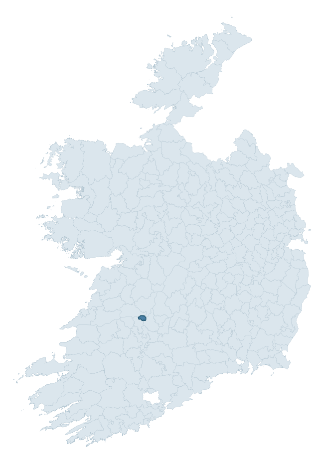
Where this barony sits in the Republic of Ireland
Geology and preservation
Bedrock geology shapes the landscape long before any settlement begins — controlling soil drainage, agricultural potential, the survival of upstanding monuments, and the preservation of buried archaeology. The figures below come from the Geological Survey Ireland 1:100,000 bedrock map.
The bedrock underlying North Liberties is predominantly limestones (92% of the barony by area), laid down during the Carboniferous period (100% by area, around 359 to 299 million years ago). Limestone is the most heritage-rich bedrock in Ireland. It supports fertile, well-drained soils that favoured dense Early Medieval settlement and Norman manorial agriculture, and it weathers into karst features — sinkholes, caves, swallow holes, and souterrains — that frequently carry archaeology. Where peat overlies limestone, organic preservation can be exceptional. The single largest mapped unit is the Visean Limestones (undifferentiated) (92% of the barony's bedrock). With only 2 distinct rock types mapped, the barony is geologically uniform compared to the rest of the Republic (15th percentile for diversity) — a single coherent bedrock landscape.
Rock type composition
Largest mapped unit: Visean Limestones (undifferentiated) (92% of the barony)
Placename evidence
Logainm records 4 heritage-diagnostic placenames for North Liberties, a modest sample drawn predominantly from the townland record. The dominant stratum is pre-christian defensive. The most frequent diagnostic roots are cill- (2) and ráth- (1). With a sample of this size the count should be treated as indicative rather than definitive.
Pre-Christian / Early Medieval Defensive
| Root | Count | Meaning |
|---|---|---|
| ráth- | 1 | earthen ringfort |
| cathair- | 1 | stone fort |
Early Christian Ecclesiastical
| Root | Count | Meaning |
|---|---|---|
| cill- | 2 | church (early) |
Other baronies in Limerick
- Kenry
- Smallcounty
- Glenquin
- Connello Lower
- Clanwilliam
- Coshma
- Shanid
- Kilnamanagh Lower — Tipperary
- Ikerrin — Tipperary
- Clanmaurice — Kerry
See all 280 baronies in the Republic of Ireland Heritage Tool.

Explore further
Grounding History: 10 Maps of Northern Ireland’s Past
If you’re interested in Irish heritage more widely, the companion report for Northern Ireland brings together the analysis of all 462 NI wards into one place through 10 high-quality maps — covering monument density, archaeological periods, placename heritage, terrain, wetland, and the historic landscape at first survey. Take a look.
About this profile
Click any section below to expand.
What is a barony?
A barony is a historic administrative unit in Ireland, broadly equivalent to an English hundred. The 280 baronies used here are from the OSi 2019 National Statutory Boundaries (generalised 20m), covering the 26 counties of the Republic of Ireland. Baronies derive from the Norman period, were formalised in the 17th century, and have not been redrawn for statistical purposes. They vary enormously in area, from compact urban baronies in Dublin to vast upland baronies in Connacht, and should not be compared by raw site count without accounting for area differences.
What counts as a site?
This profile combines three distinct heritage registers, each with its own definition of what constitutes a recordable site:
- Archaeological sites (NMS). The National Monuments Service Sites and Monuments Record (SMR) catalogues every known archaeological monument or site of archaeological interest in the Republic, from prehistoric burial mounds and ringforts to medieval churches and post-medieval defensive works. Inclusion does not require legal protection — only that the site has been identified, surveyed, and assessed as having archaeological value. A separate subset of these sites lies within a recorded protection zone, which gives them statutory protection under the National Monuments Acts.
- Listed buildings (NIAH). The National Inventory of Architectural Heritage records buildings of architectural, historical, archaeological, artistic, cultural, scientific, social, or technical interest. Each surveyed structure is appraised on a five-tier scale: International, National, Regional, Local, and Record-Only. The NIAH appraisal is informational rather than strictly statutory, but it underpins local-authority Record of Protected Structures (RPS) listings.
- Heritage placenames (Logainm). Logainm is the authoritative database of Irish placenames maintained by the Placenames Branch. This profile applies a heritage-diagnostic classifier to the Irish-language form of each townland name, flagging roots that signal defensive sites (ráth-, lios-, dún-, caiseal-, cathair-), ecclesiastical foundations (cill-, teampall-, domhnach-, mainistir-), prehistoric burial-ritual features (tuaim-, carn-, leaba-), or Norse-contact settlement (gall-). Townlands without one of these diagnostic roots are not flagged here — they may still carry historical significance, but that significance is not encoded in the name itself.
Editorial principles
The narrative sections of this profile follow several explicit principles:
- Evidential. Every claim about this barony’s heritage character is anchored in the underlying register data. Where a site count, a placename count, or a percentile rank is cited, it is computed from the source datasets at export time, not estimated.
- Comparative. Counts and metrics are reported alongside their percentile rank against the other 279 ROI baronies. A barony with 50 ringforts in absolute terms could be unusually high or unusually low depending on its size and regional context; percentile ranking removes that ambiguity.
- Transparent on limits. Where a register has known coverage gaps, survey biases, or data-quality issues that affect this barony’s figures, the profile flags them rather than presenting the numbers as definitive.
- No interpretation beyond what the data supports. The narrative does not speculate about historical events, social dynamics, or cultural meaning beyond what the recorded heritage and placename evidence directly attests.
Data caveats and limits
- NMS Sites and Monuments Record is the product of survey campaigns conducted at different intensities across different counties and decades. Some baronies have been surveyed more thoroughly than others, and absolute counts should be read in that light. Sites destroyed by development before survey are typically not represented; sites in heavily forested or upland terrain are sometimes under-recorded.
- NIAH coverage is broadly complete for the Republic of Ireland but the survey was conducted on a rolling county-by-county basis, and the most recent appraisal date varies. Buildings demolished or substantially altered after their original survey may still appear in the register; conversely, recent buildings of merit may not yet have been appraised.
- Logainm classification applies a deliberately conservative pattern-matching approach to the Irish-language townland forms. The classifier prioritises true positives over recall: a townland may carry a heritage signal that the classifier doesn’t recognise, particularly where the diagnostic root has been heavily anglicised or where the townland name draws on a less common term. The 60,000+ townland records and ~9,800 classified placenames give a substantial signal at barony scale, but individual townland names should be checked against Logainm directly for definitive interpretation.
- Period attribution. The chronological distribution reflects only those NMS sites that carry a recognised period attribution in the source data. Sites listed as “Unknown” period are excluded from the dated subset.
- Boundary changes. Some baronies have undergone minor boundary adjustments since their 19th-century definition; the OSi 2019 generalised boundaries used here are the current statutory definition and may differ slightly from historical maps in border areas.
- Bedrock geology is mapped at 1:100,000 scale, which means local variation within a barony — small pockets of different rock type, mineral veins, alluvium overlying bedrock — is generalised. The dominant-system and rocktype figures are area-weighted, so a barony reading “70% Carboniferous limestone” may still contain small but archaeologically important pockets of older or younger rock. Around 3% of GSI polygons do not match the lexicon and contribute no rocktype or system attribution.
Data sources
- National Monuments Service — Sites and Monuments Record (SMR) https://data.gov.ie/dataset/national-monuments-service-archaeological-survey-of-ireland
- National Inventory of Architectural Heritage (NIAH) https://data.gov.ie/dataset/national-inventory-of-architectural-heritage-niah-national-dataset
- Logainm — Placenames Database of Ireland https://www.logainm.ie/
- Ordnance Survey Ireland — National Statutory Barony Boundaries 2019 https://data-osi.opendata.arcgis.com/
- EURODEM — European Digital Elevation Model https://www.mapsforeurope.org/datasets/euro-dem
- ESA WorldCover https://esa-worldcover.org/en
- Geological Survey Ireland — 1:100,000 Bedrock Geology https://www.gsi.ie/en-ie/data-and-maps/Pages/Bedrock.aspx
Explore more: Search any of the 280 ROI baronies, browse by historical province, or read the methodology and data sources for the full Republic of Ireland Heritage Tool.