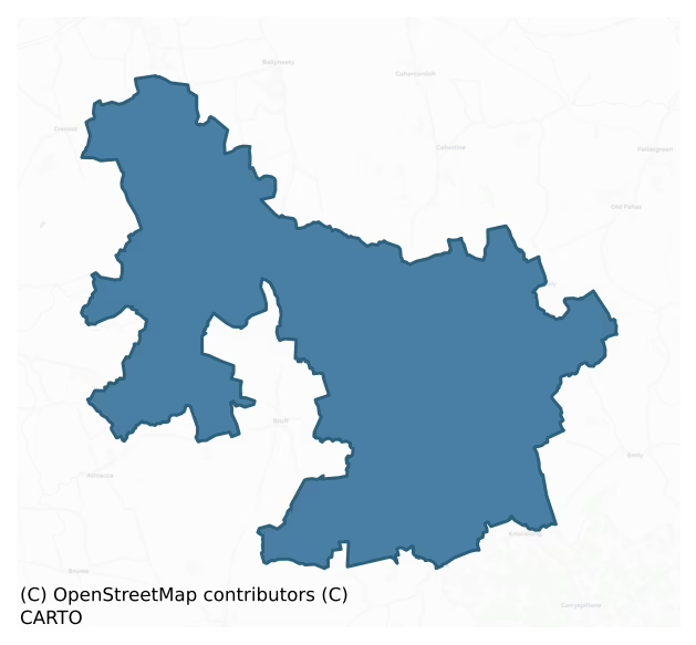
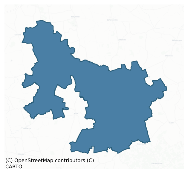
Smallcounty is a barony of County Limerick, in the historical province of Munster (Irish: An Déis Bheag), covering 180 km² of land. The barony records 1,284 NMS archaeological sites and 100 NIAH listed buildings, placing it at around the 99th percentile among 280 ROI baronies for sites per km². This means it is in the top tenth of all baronies for sites per km². Dated archaeological evidence runs from the Neolithic through to the Modern, spanning 8 of 9 archaeological periods, placing the barony in the 75th percentile among 280 ROI baronies for chronological depth. This means it is in the top third of all baronies for chronological depth. The largest dated subset of recorded sites dates to the Early Bronze Age. Logainm flags 26 placenames in the barony as carrying a recognised heritage root; the largest share — around 54% — are names associated with early Christian church and monastic foundations.
Heritage at a glance
Percentile rankings throughout this profile compare each barony only against the other 279 Republic of Ireland baronies.
The recorded heritage of Smallcounty
The National Monuments Service Sites and Monuments Record (SMR) is the statutory inventory of archaeological sites for the Republic of Ireland, maintained by the Department of Tourism, Culture, Arts, Gaeltacht, Sport and Media. Sites recorded here include earthworks, ringforts, megalithic tombs, ecclesiastical remains, and post-medieval features; not every record is legally protected, but each is registered as a monument of archaeological interest.
The National Monuments Service records 1,284 archaeological sites in Smallcounty, putting it at the 99th percentile among 280 ROI baronies for sites per km². This means it is in the top tenth of all baronies for sites per km². Protection coverage is near-universal — 1,275 sites (99%) fall within a recorded monument protection zone, indicating an extensively surveyed landscape. The record is dominated by defensive sites — ringforts, enclosures, hillforts, and stone forts (506 sites, 39% of the total), with burial and ritual monuments forming a substantial secondary presence (252 sites, 20%). The most diagnostically specific type is Barrow – unclassified (122 records, 10% of the barony's NMS total) — compared to an ROI average of 3% across all baronies where this type occurs. Barrow – unclassified is a prehistoric burial mound where the specific barrow type cannot be determined from surface evidence. The broader 'Enclosure' classification — which catches unclassified ringforts and field enclosures — accounts for a further 228 records (18%) and reflects the difficulty of sub-classifying degraded earthworks from surface evidence alone. Other significant types include Barrow – ring-barrow (102) — a Bronze/Iron Age burial monument: a low circular area enclosed by ditch and outer bank. Across the barony's 180 km², this gives a recorded density of 7.14 sites per km².
Most common monument types
Hover or tap a monument type to see its definition.
| Type | Count |
|---|---|
| Enclosure a banked or ditched feature of uncertain type, used as a catch-all where the original function cannot be determined from surface evidence | 228 |
| Barrow – unclassified a prehistoric burial mound where the specific barrow type cannot be determined from surface evidence | 122 |
| Barrow – ring-barrow a Bronze/Iron Age burial monument: a low circular area enclosed by ditch and outer bank | 102 |
| Earthwork an unclassified earthen structure with no diagnostic features that allow a more specific classification | 98 |
| Ringfort – rath an earthen ringfort enclosed by a bank and external ditch — the most common Early Medieval farmstead, broadly dated 500–1000 AD | 79 |
| Standing stone a deliberately set upright stone, used variously as a Bronze/Iron Age burial marker, route marker or commemorative monument | 60 |
| Ringfort – cashel the stone-walled equivalent of the rath, found mainly in upland or western areas, broadly dated 500–1000 AD | 29 |
Chronological distribution
The dated archaeological record for Smallcounty spans from the Neolithic through to the Modern, with activity attested across 8 of 9 archaeological periods. This is the 75th percentile across ROI baronies for chronological depth — an above-average span. Every period from earliest to latest is represented in the record — an unbroken sequence of dated activity across the full chronological span. Activity concentrates most heavily in the Early Bronze Age (584 sites, 51% of dated material), with the Iron Age forming a secondary peak (275 sites, 24%). A further 137 recorded sites (11% of the overall NMS register for the barony) carry no period attribution — appearing as 'Unknown' in the bar chart below. This typically reflects either records that pre-date the standardised period vocabulary or sites awaiting specialist dating review, rather than a genuine absence of chronological evidence.
Sample of recorded monuments
Show 25 sample monuments (of 1,284 total)
A representative sample of 25 recorded monuments drawn from the barony’s 1,284 total NMS entries. Sites within a recorded monument protection zone and rarer site types are prioritised so the list shows a meaningful cross-section rather than only the most common type. Each entry shows the official Sites and Monuments Record reference number and the description published by the National Monuments Service.
Castle – ringwork
Situated immediately S of a field boundary on a S-facing slope in woodland bordering rolling pasture. Truncates a henge monument (LI013-089—-) to NW. This monument consists of a circular area (diam. 28m E-W; 28m N-S)…
Situated immediately S of a field boundary on a S-facing slope in woodland bordering rolling pasture. Truncates a henge monument (LI013-089—-) to NW. This monument consists of a circular area (diam. 28m E-W; 28m N-S) enclosed by a bank with an external fosse. The bank (int. H 0.3 – 0.5m ; Wth 1.1m; ext. H 0.9 – 1.5m) consists mainly of loose stonework covered by earth and moss, and has been robbed of stone at several locations. In the SSE a dip in the bank (Wth 4m) may represent an entrance. The fosse (Wth 2.45m; H 0.7m) is flat-bottomed and uniform all round; apart from in the SSE at the location of the possible entrance, where it is not evident. A bank (H 0.1m; Wth 1.6m) acting as a field boundary runs N-S across the interior. The interior surface is uneven and slopes down to S. It has been suggested (Kelly and Condit 1998) that this monument may be a ringwork.
Compiled by: Denis Power
Date of upload: 26 April 2013
Well
Described in 1840 as following; 'There are five forts in Ballyea Townland, one of which is called Rath na Gréine (LI022-139—-), which signifies the Rath of the Sun. Here is a spring well called Tobar Rath na Gréine,…
Described in 1840 as following; 'There are five forts in Ballyea Townland, one of which is called Rath na Gréine (LI022-139—-), which signifies the Rath of the Sun. Here is a spring well called Tobar Rath na Gréine, that is the Well of the Rath' (OSL, Parish of Fedamore).
Site of well described in 1943 as following; 'O'Donovan mentions a well called Tobar Ratha na Gréine, which, he says, stood beside a fort called Rath na Gréine. The fort exists, but the well has disappeared' (O'Kelly 1942-3, 222).
Well depicted on 25-inch OS map 30m S of ringfort (LI022-139—-) known as 'Rath na Gréine' and immediately N of the Camoge River is probably the site of the well called 'Tobar Ratha na Gréine'.
Compiled by: Caimin O'Brien
Date of upload: 28 February 2020
Platform
In wet, low-lying pasture, in the angle of two land drains, 160m SW of a townland boundary with Ballingoola. Three ring-barrows (LI023-069002-/003-/004-) are cut into the surface of a rectangular-shaped platform. Not…
In wet, low-lying pasture, in the angle of two land drains, 160m SW of a townland boundary with Ballingoola. Three ring-barrows (LI023-069002-/003-/004-) are cut into the surface of a rectangular-shaped platform. Not depicted on OSi historic maps. Identified by Ó Ríordáin and MacDermott (1949, 127) as a rectangular-shaped platform on which there are three ring-barrows. This monument was described earlier by O'Kelly (1944, 48) as a 'very low rectangular platform surrounded by a very shallow fosse. The entrance is not recognisable. It measures overall 75' [22.8m] N-S by 45' [13.7m] E-W. At its S end and lying sided by side are two barrows, one oval and the other circular. These are low mounds surrounded by shallow fosses which are joined into that of the rectangle. The oval barrow is 45' [13.7m] N-S by 23' [7m] E-W while the other is 24' [7.3m] in diameter. The third one, also 24' [7.3m] in diameter, lies to the south of the oval barrow, both fosses being conjoined. The monuments are situated just beyond the edge of an extensive marsh'.
Monuments are not visible on Digital Globe orthophotos taken 2011-13 and on Google Earth orthoimages taken 28/06/2018.
See attached Google Earth orthoimages and location map showing platform marked Y after Ó Ríordáin and MacDermott 1949.
Compiled by: Alison McQueen and Vera Rahilly
Date of upload: 29 August 2020
Ecclesiastical enclosure
Possible ecclesiastical enclosure with 'Cillín' [LI030-040002-] and cross-inscribed stone [LI030-040003-] in SE quadrant. Enclosure described by O'Kelly (1943, 234-5) as following; 'The enclosure consists of a…
Possible ecclesiastical enclosure with 'Cillín' [LI030-040002-] and cross-inscribed stone [LI030-040003-] in SE quadrant. Enclosure described by O'Kelly (1943, 234-5) as following; 'The enclosure consists of a rectangular space in the form of a platform with a bank around its edge. On the north there is a little triangular annexe the surface of which is lower than that of the main enclosure but remains higher than the field outside. This seems to have been separated from the main enclosure by a bank. The whole monument is surrounded by a water-logged fosse. Access to the enclosure is gained by a causeway across the fosse at the S.W. corner of the main enclosure. The causeway slopes up to the interior level. The overall dimensions of it are 333' [100m] north-south (max.), by 270' [82m]. In the south east corner of the main enclosure is the Killeen [LI030-040002-]. This consists of a mound on top of which is a cross-inscribed standing stone [LI031-040003-]'.
See attached drawing of enclosure taken from O'Kelly 1942-3, Fig. 16
Compiled by: Caimin O'Brien
Date of upload: 25 July 2017
Cross-inscribed stone
Cross-inscribed stone standing inside a cillín both of which are located in SE quadrant of a possible ecclesiastical enclosure [LI031-040001-]. Described by O'Kelly (1943, 235) as following; 'In the south east corner…
Cross-inscribed stone standing inside a cillín both of which are located in SE quadrant of a possible ecclesiastical enclosure [LI031-040001-]. Described by O'Kelly (1943, 235) as following; 'In the south east corner of the main enclosure [LI031-040001-] is the Killeen [LI031-040002-]. This consists of a mound on top of which is a cross-inscribed standing stone. This was cut off from the main enclosure by a stone wall, which is now very collapsed. The standing stone of 4' [1.2m] high and measures 2' [0.6m] by 1' 4" [0.4m] at the base. It is limestone. The cross is on the west face and is lightly incised. It is 10" [0.25m] high and 5" [0.12m] across the arms. Its top is 10" [0.25m] from the top of the stone. The maximum depth of the incision is 1 centimeter. In 1935 the stone had fallen flat to the west. In that year the late Archdeacon Begley of Bruff had it re-erected. In doing this a number of circular flat pebbles were found around the base of the stone. The monument is called Kilorath on the O.S. map. The townland also has this name and is one of the places mentioned as having been visited by St. Patrick in his journey through Limerick'.
See attached drawing of cross-inscribed stone taken from O'Kelly 1942-3, Fig. 16
Compiled by: Caimin O'Brien
Date of upload: 25 July 2017
Settlement deserted – medieval
Medieval village earthworks described in 1942-3 as following; 'Mediaeval Village and complex of other remains of various periods. This complex of monuments covers some 500 acres in area and includes the remains of a…
Medieval village earthworks described in 1942-3 as following; 'Mediaeval Village and complex of other remains of various periods. This complex of monuments covers some 500 acres in area and includes the remains of a group of houses, ancient field fences, roads and forts. For full list of monuments, detailed descriptions, aerial photo, historical references and an account of the excavation of two house sites, see Ó Ríordáin and Hunt: J.R.S.A.I., LXXII (1942), 37 ff.' (O'Kelly 1942-3, 232-3). Earthworks visible today on Digital Globe aerial photographs.
Compiled by: Caimin O'Brien
Date of upload: 3 March 2020
Concentric enclosure
In reclaimed pasture, immediately W of enclosures (LI031-068002/003-). Depicted on the OSi 25-inch map as a raised circular-shaped area (diam. c. 29m) defined by a scarp with wide fosse and external bank from SE-S-SW.…
In reclaimed pasture, immediately W of enclosures (LI031-068002/003-). Depicted on the OSi 25-inch map as a raised circular-shaped area (diam. c. 29m) defined by a scarp with wide fosse and external bank from SE-S-SW. Monument described by O’Kelly (1943, 232) as a Type C earthwork consisting of ‘a large flat-topped platform surrounded by a fosse. Outside this is a narrow, low bank, surrounded by a second fosse. Lastly a large, wide, high bank surrounds the whole. The banks have been completely levelled on the N and NW sides. A small, low circular mound occupies the NE quadrant of the platform. In the centre of the SE quadrant of the outer bank is a narrow break and inside it a causeway leads across the fosse to the top of the inner bank, but does not continue across the inner fosse. The maximum height of the platform over the fosse-bottom is 15’ [4.5m] and the overall diameter of the structure is 250’ [76m].
Outline of much degraded monument consisting of a circular-shaped area defined by a tree-lined scarp with fosse, and remains of an outer bank from SE-S-W, faint traces of an external fosse visible on OSi orthophoto taken between 2005-12 and Digital Globe orthoimage taken 20/09/2020. Trace of possible causeway at SE visible on the Google Earth orthoimage taken 03/03/2013.
The monument is located within a large rectangular-shaped field, visible on the OSi orthophoto taken 2005-12 and Digital Globe orthoimage taken 20/09/2020. A field boundary running NW-SE to the…
Henge
This monument is in a low-lying situation SSE of the Camoge river with a full vista of the surrounding hills. It consists of an oval circuit of bank inside of which is a wide fosse (Wth c. 7m-10m, D 1m ) with an overall…
This monument is in a low-lying situation SSE of the Camoge river with a full vista of the surrounding hills. It consists of an oval circuit of bank inside of which is a wide fosse (Wth c. 7m-10m, D 1m ) with an overall diameter of c. 70m. The enclosing bank, which is under a thick growth of thorn and vegetation is disturbed in a number of places by cattle (Wth 9m, H 1m). The N portion of the monument has been incorporated into a field. The interior is level with external ground level (O'Kelly, 1942, 90; O'Kelly 1944, 50).
Compiled by: Geraldine Stout
Date of upload: 3 February 2012
See attached ASI aerial photographs ASIAP – 307/17 taken 13/09/2002.
Designed landscape – folly
19th century folly belonging to Camas House located 240m to S. Described by the National Inventory of Architectural Heritage [NIAH] as follows; 'Freestanding square-plan two-stage turret, built c. 1820. Battlemented…
19th century folly belonging to Camas House located 240m to S. Described by the National Inventory of Architectural Heritage [NIAH] as follows; 'Freestanding square-plan two-stage turret, built c. 1820. Battlemented top to turret with carved copings. Roughly dressed limestone walls having dressed quoins and cut limestone stringcourses to upper stage. Loop openings. Located within rubble stone boundary wall to Camas House' (www.buildingsofireland.ie; NIAH Reg. No. 21903128).
Compiled by: Martin Fitzpatrick
Date of upload: 1 April 2021
Megalithic tomb – court tomb
National monument No. 247. A levelled possible embanked stone circle (LI032-003—-) with adjoining megalithic structure to SSE is located in grassland 550m W of Lough Gur with Limerick-Cork road immediately to E. The…
National monument No. 247. A levelled possible embanked stone circle (LI032-003—-) with adjoining megalithic structure to SSE is located in grassland 550m W of Lough Gur with Limerick-Cork road immediately to E. The megalithic structure annotated as a 'Stone Avenue' on the 1927 ed. OS 6-inch map and as a 'Stone Circle' on the OS 25-inch map is located in an area with a large concentration of prehistoric monuments. Two standing stones (LI032-009-/010002-) lie 255m and 340m respectively to the NE, two stone circles (LI032-006—-/005) lie 150m to E, a roadway depicted as 'Cladh na Leac' (LI032-010001-) running roughly N-S lies 375m to E. Grange embanked stone circle (LI032-004001-) with site of megalithic structure depicted as Dolmen (Site of) (LI032-004002-) stands 150m to SSE, a standing stone marked as 'Cloch á bhíle' stands 275m to SSE with a levelled megalithic structure (LI032-010003-) depicted as 'Giants Grave (Site of) lies 465m to SSE. Grange Castle (LI032-001002-) and Cathar Chinn Chon (LI032-001002-) stands 215m to W.
No monument is depicted at this location on the first edition Ordnance Survey [OS] 6-inch map. However on the revised 1927 edition OS map, the monument is depicted an oval-shaped area delimited by 7 orthostats and annotated as a 'Stone Avenue' immediately SSE of a levelled embanked stone circle (LI032-002—-). On the 25-inch OS map the monument is depicted as an oval-shaped area (approx. diam. 20m NW-SE x 8m NE-SW) delimited by 11…
Pit-burial
On former rocky pasture 23m NE of the NE shore of Lough Gur beside a 19th century cart track that led to the top of a limekiln. The cart track is 11m NE and parallel to the modern shore-side road. The Food Vessel Burial…
On former rocky pasture 23m NE of the NE shore of Lough Gur beside a 19th century cart track that led to the top of a limekiln. The cart track is 11m NE and parallel to the modern shore-side road. The Food Vessel Burial was located 35m NW of the Lough Gur Visitor’s Centre 1m down slope (SW) from the trackway. The trackway has since been upgraded into the access way to the visitors centre. The site is located within an area of dense archaeological activity dating from the Neolithic up to the present day around Lough Gur (Cleary 2018). The Early Medieval settlement site known as the ‘Spectacles’ at Drumlaegh (LI032-014012-) is located 80m to NNW; a crannóg known as Bolin Island (LI032-027—-) located 140m to SW; a Middle Bronze Age house site (LI032-014014-) excavated as part of the same campaign of archaeological excavations that uncovered the Food Vessel Burial was excavated 40m to SE and a ring cairn on the summit of Knockfennell Hill (LI032-014009-) lies 500m to NW.
The Bronze Age burial was discovered during excavations carried out in advance of the construction of the Lough Gur Visitors Centre access path in 1977-8. The burial site was not depicted on historic OSi maps prior to its discovery. The modern access path is visible on OSi orthoimages taken 2005-12 and on the Digital Globe orthoimages taken 2011-2013. Rose Cleary (1982, 7-8) describes the site as follows: ‘During the cutting of Trench 3 a charcoal stained layer was uncovered beneath the modern horizon. This…
Bullaun stone
Described by O'Kelly (1944, 28) as following: 'This is a circular hole cut in a piece of naturally outcropping rock. It measures 1' [0.3m] in diameter at the top and is 1' 3" [0.38m] deep. Locally it is called a wart…
Described by O'Kelly (1944, 28) as following: 'This is a circular hole cut in a piece of naturally outcropping rock. It measures 1' [0.3m] in diameter at the top and is 1' 3" [0.38m] deep. Locally it is called a wart well'.
Compiled by: Caimin O'Brien
Date of upload: 2 October 2010
Religious house – Augustinian nuns
Situated on E facing slope of Ballynagallagh Hill with good views of the surrounding countryside. The S shoreline of Lough Gur lies 650m to the N. In 1840 the Ordnance Survey Letters recorded that 'the old church of…
Situated on E facing slope of Ballynagallagh Hill with good views of the surrounding countryside. The S shoreline of Lough Gur lies 650m to the N. In 1840 the Ordnance Survey Letters recorded that 'the old church of Baile na gCailleach [town of the nuns] stood on the eastern slope of the hill of the same name. It is believed that a nunnery stood here formerly from which the place was Baile na gCailleach or Nunstown'. Mistakenly identified as a foundation dedicated to St. Catherine for the Canonesses of St. Augustine (Ware 1705, 103; Croker 1833, 103; Dowd 1896, 79). This dedication was confused with Old Abbey or St. Catherine de O'Conyl (LI019-026009-) (Dowd 1896, 186; Gwynn and Hadcock 1970, 313). The nunnery at Lough Gur was referred to in historical documents as 'Ballynagallagh by Lough Gur' and was reputedly founded by the Fitzgibbon family in 1283 and dissolved around 1540-1 (Gwynn and Hadcock 1970, 310, 313). This foundation was a daughter house of St. Peter's Cell (LI005-017046-) in Limerick City which was founded in 1171 by Donal Mór O'Brien, King of Limerick for the Black Nuns of the Order of St. Augustine (White 1943, 209). At the Dissolution of the Monasteries around 1540-1 the lands of Ballynagallagh also known as Temple na Gallagh was described as consisting of 30 acres of arable land, 1 acre of underwood that was 'lately leased for 16s. now waste by rebellion of Obrynne [O'Brien]. Ballenegallagh 60 acr. ar. and p., lately leased with the tithes for 26s….
Megalithic tomb – unclassified
National monument No. 247. National monument in state guardianship No. 247. Described by de Valera and Ó Nualláin (1982, No. 5) as following; 'This monument is situated on a low ridge overlooking Lough Gur. It is in a…
National monument No. 247. National monument in state guardianship No. 247. Described by de Valera and Ó Nualláin (1982, No. 5) as following; 'This monument is situated on a low ridge overlooking Lough Gur. It is in a very ruinous condition and only four stones survive. The more southerly stone leans heavily northwards. It is 1.8m long and 0.25m thick and if erect would be 1m high. It could be the sidestone of a chamber. Beyond its eastern end is a stone, loosely set in the ground and measuring 1.2m long, 0.2m thick and 0.7m high. It leans to the east. Between these two stones are two more, lying one above the other. The upper stone measures 2.2m by 2.1m and 0.4m thick and the other measures 1.4m by 1m and 0.3m thick. The stone probably represents the remnants of a megalithic tomb, quite possibly of the wedge-tomb class but the remains are insufficient to allow classification' (O'Kelly 1944, 18-9).
The Guardianship Deed dated 19/08/1942 described the monument as 'Leaba-na-muice Dolmen & Fort'. It is not clear from the file as to what monument was being described as a 'Fort'. On Google Earth orthophotos taken 16/03/2016 the cropmark of an enclosure (approx. dims. 50m N-S x 35m E-W) is visible with the meaglithic structure standing in N quadrant of this enclosure. This cropmark may have been the 'Fort' listed in the Guardianship deed dated 19/08/1942 rather than the Cairn (LI032-041002-) annotated 'The Hero's Grave' located 310m to the SSW.
This monument is subject…
Religious house – Knights Hospitallers
National monument No. 194. The medieval church ruins of the Hospital of Any belonging to the Order of the Knights Hospitallers was dedicated to St. John the Baptist. It now stands on N side of a graveyard…
National monument No. 194. The medieval church ruins of the Hospital of Any belonging to the Order of the Knights Hospitallers was dedicated to St. John the Baptist. It now stands on N side of a graveyard (LI032-147003-) with R. C. Church standing immediately to WNW. The R. C. church also dedicated to St. John the Baptist was built in 1852. The Order of the Hospital of St John of Jerusalem originated in a hospice founded in Jerusalem around 1070 to care for pilgrims and was dedicated to St John the Baptist. The Hospital of Any or Hospital of St. John of Jerusalem is also known today as the Knights Hospitaller and the Knights of Malta. The Order of the Hospital of St John of Jerusalem in Ireland consisted of a central Priory founded at Kilmainham (DU018-020286-), Co. Dublin in 1174 with subordinate houses known as preceptories located through the country. The preceptory at Hospital was second in importance after Kilmainham Priory (Gwynn and Hadcock 1970, 336).
The church ruins formed part of the 13th century preceptory dedicated to St. John the Baptist (Ware 1658, 234; Gwynn and Hadcock 1970, 336). The church belonged to the Order of the Knights of St. John of Jerusalem, and was known as the Hospital of Any or the Hospital of St. John of Jerusalem (De Montmortency-Morres 1817, cixxi). The hospital was founded in the year 1215 by Geoffrey de Marisco (Mariscis), Justiciar of Ireland (RIA Ms. 14/D/17/27 (iii)). According to Ferrar (1784, 432) the hospital may have be…
Holed stone
Holed stone described in 1942-3 as following; 'This is a flag of limestone well weathered and worn. It looks ancient. It is 5' [1.5m] high and at the base measures 1' 3" [0.38m] wide by 6" [0.15m] thick, but for the…
Holed stone described in 1942-3 as following; 'This is a flag of limestone well weathered and worn. It looks ancient. It is 5' [1.5m] high and at the base measures 1' 3" [0.38m] wide by 6" [0.15m] thick, but for the greater part of its height it is 3½" [0.09m] to 4" [0.1m] thick. At a distance of 9" [0.23m] from the centre point of the top edge of the stone a small hole is bored right through. The section of the boring is conical and measures 2" [0.05m] in diameter on the south west face and 1" [0.02m] on the north-east. Locally it is believed to be ancient. It is possible that it was at one time a stone used as a gate post and later erected as a cattle scratching post' (O'Kelly 1942-3, 237).
Compiled by: Caimin O'Brien
Date of upload: 4 March 2020
Cultivation ridges
In reclaimed pasture. Not depicted on OSi historic maps. Identified as a potential earthwork complex (possibly cultivation ridges and drainage ditches) on Bord Gáis Éireann aerial photographs (BGE 1:5000, 2555 Site No.…
In reclaimed pasture. Not depicted on OSi historic maps. Identified as a potential earthwork complex (possibly cultivation ridges and drainage ditches) on Bord Gáis Éireann aerial photographs (BGE 1:5000, 2555 Site No. 040219) taken 03/11/1984. Cultivation ridges and linear drainage channels visible on Bord Gáis Éireann aerial photographs. No surface remains visible on Google Earth orthoimage dated 14/09/2019 where rough ground is intersected by linear drains running predominantly N-S and E-W. Earthworks consist of cultivation ridges and post-1700 drainage ditches.
See attached Bord Gáis Éireann aerial photographs and Google Earth orthoimages.
Compiled by: Martin Fitzpatrick
Date of upload: 26 May 2021
Barrow – stepped barrow
In reclaimed pasture 30m SE of a watercourse and 100m W of the townland boundary with Adamstown. One of 13 barrows (LI040-070001/013-) recorded within an area measuring 200m N-S x 250m E-W. Not depicted on OSi historic…
In reclaimed pasture 30m SE of a watercourse and 100m W of the townland boundary with Adamstown. One of 13 barrows (LI040-070001/013-) recorded within an area measuring 200m N-S x 250m E-W. Not depicted on OSi historic maps. Identified by the Discovery Programme as a potential barrow on examination of Bord Gáis Éireann aerial photograph (BGE 2557; Site No. 6) taken 03/11/1984. No surface remains visible on Google Earth orthoimages.
See attached Bord Gáis Éireann aerial photograph and Google Earth orthoimages.
Compiled by: Martin Fitzpatrick
Date of upload: 26 May 2021
Quarry
Situated on a S-facing slope in rolling pasture with good views to S, W and E. The monument is heavily obscured by scrub vegetation as well as fallen trees and a large amount of stones and boulders. A curvilinear bank…
Situated on a S-facing slope in rolling pasture with good views to S, W and E. The monument is heavily obscured by scrub vegetation as well as fallen trees and a large amount of stones and boulders. A curvilinear bank (int. H 0.7m; Wth. 1.2m; ext. H 0.1m) of stones is visible from N to E, immediately N of a depression which is covered by a growth of scrub, and scattered with large stones and boulders. The area appears to have been quarried extensively. This curvilinear bank is probably upcast from post-1700 quarrying as this appears to be the site of a quarry and not the remains of a cashel. This location is depicted as an area of rock outcrop on OS 25-inch map.
Compiled by: Caimin O'Brien
Date of upload: 2 March 2020
Mill – unclassified
The 'Old Mill' of Glenogra was described in the Urban Survey of Limerick as following; 'According to Westropp (1906-7, 177-8) a water-mill existed within the castle bawn (LI031-038004-) but the mill race is actually…
The 'Old Mill' of Glenogra was described in the Urban Survey of Limerick as following; 'According to Westropp (1906-7, 177-8) a water-mill existed within the castle bawn (LI031-038004-) but the mill race is actually some distance to the west and north of the castle. The ruins of an old mill are marked on the O.S. map to the south east of the castle on the mill race and this may be the site of the medieval mill. The mill-race itself is 1m deep and 3-4m wide. The mill is mentioned in the extent of 1298 when it was valued at 30s. (Sweetman 1875-86, iv, p. 255)' (Bradley et. al. 1989, 139). The 1654-56 Civil Survey of Limerick recorded that Henry, Earl of Bath, was in possession of Glenogra on which there was a 'Castle a Bawne, 30 houses & Cabbins & a Mill together with a Court leet & Court Barron' (Simington 1938, 105).
Compiled by: Caimin O'Brien
Date of upload: 29 January 2019
See attached ASI aerial photograph ASIAP – 307/6 & 7 taken 13/09/2002 and 329/11 & 12 taken 05/10/2002.
Castle – Anglo-Norman masonry castle
Poorly preserved remains of an impressive multi-period castle which was first built as a Desmond Castle in the 13th century and later enclosed to the S with a bawn wall of possible 15th/16th century date. O'Donovan…
Poorly preserved remains of an impressive multi-period castle which was first built as a Desmond Castle in the 13th century and later enclosed to the S with a bawn wall of possible 15th/16th century date. O'Donovan recorded a local tradition in 1840 that the castle was first built by the Earl of Desmond around the beginning of the 15th century although this dating may refer to the building of the bawn rather than the earlier octagonal shaped donjon.
The castle and manor of Glenogra was described in the Desmond Survey of 1584 as ‘A castle very ruinous there without room or roof, and an enclosure or balne [bawn] whose walls are in great decay so that the castle is not defensible. There is near the castle an empty house having only one solar' or story habitable. It is situate on exceedingly fertile level land. Adjacent and belonging to said castle are divers demesne lands of divers kinds the best and most fertile of their kind containing 4 carucates of land which are valued in lawful-money and provisions to be delivered as aforesaid viz:— 6l. 13s. 4d. money, 12 cows, 20 pecks of wheat, 20 pecks of barley malt and 40 pecks of oaten malt. A water mill now in very great decay and therefore valued by said commissioners in lawful English money payable yearly at said feasts only at 10s. sterling. The vill or villate called Creans which before the rebellion had buildings now altogether devastated (the walls of an old chapel only being left. This vill with its lands which are v…
Designed landscape – ornamental lake
Semi-circular 'pond' feature immediately west of Cahir Guillamore House (LI031-041019-), depicted as a v-shaped ornamental pond on the 1840 ed. OS 6-inch map. Probably an ornamental pond associated with post-1700…
Semi-circular 'pond' feature immediately west of Cahir Guillamore House (LI031-041019-), depicted as a v-shaped ornamental pond on the 1840 ed. OS 6-inch map. Probably an ornamental pond associated with post-1700 landscaping of the grounds on the demesne of Cahir Guillamore House.
Compiled by: Caimin O'Brien
Date of upload: 3 March 2020
Crucifixion plaque
The Urban Survey of Limerick (Bradley et. al. 1989, 182) recorded the following about a 17th century crucifixion plaque in Knockainy graveyard (LI032-141005-); 'Crucifixon plaque. 17th cent. A limestone panel, which…
The Urban Survey of Limerick (Bradley et. al. 1989, 182) recorded the following about a 17th century crucifixion plaque in Knockainy graveyard (LI032-141005-); 'Crucifixon plaque. 17th cent. A limestone panel, which may have come from a table tomb, is in the porch of the church. Christ is shown in the centre in relief in a recessed panel flanked by two shallower panels inscribed with an IHS and phaeons. His feet rest on a third IHS. This slab is said to have had an inscription in memory of the Countess of Bath. Dims: H. 63cm W. 66.5cm T. 13cm.
Described by Rev. Seymour as following; 'In the belfry of the older church (all now remaining) are two carved stones 'A small square one with our Lord crucified. The letters I.H.S. are cut on it three times, and under two of them is a pheon. This stone originally bore an inscription to the memory of Rachel, Countess of Bath, who resided at Doon Castle, and built and endowed the church at Loughgur. A former rector, apparently disliking the wording of this inscription, had it broken off, and it is not now to be found' (Seymour 1907-9, 398).
A similar crucifixion slab to the one described above is now standing up against the E wall inside St. John's Church. It is similar but not the same as the one described above by Seymour and appears to have possibly been one of the end panels of a table tomb with the other end panel described above now missing. The present slab contains a crucified Christ on the Cross carved in false relief…
Clapper bridge
Site of clapper (claperium meaning pile of stones) bridge over the Camoge River at the NE side of the village of Knockainey annotated as 'Cloghaunainy' (Clochán Áine) on the current ed. OS 6-inch map and as 'Stepping…
Site of clapper (claperium meaning pile of stones) bridge over the Camoge River at the NE side of the village of Knockainey annotated as 'Cloghaunainy' (Clochán Áine) on the current ed. OS 6-inch map and as 'Stepping Stones' on the 1840 ed. OS 6-inch map. Only a few stones possibly belonging to this clapper bridge remains visible above the water of the Camoge River. The bridge was described in 1917 as following; 'This interesting structure spans the Camoge River near the village. It is attributed to Áine, the daughter of an early Munster king. From her the parish and the adjoining hill are named; the bridge also preserves her name, being known as Clochaunainey: the impressions of her footsteps are pointed out on the stones. The arrangement of the bridge seems to show the way in which regular bridge building developed from the simpler stepping stones. The latter are usually large blocks placed in the stream, intervals to allow the water to run between. The next step would be to place flagstones from one another, so as to provide a continuous pathway. Clochaunainey shows a further step; for here small stones are used to support the flags, the weight of which is relied on to hold them in position against the force of the current. The flagstones used are from 12 to 14 inches [0.3-03.5m] thick, and the largest is 8 feet 3 inches [2.5m] in length by 6 feet 3 inches [1.9m] in breadth. About a hundred and twenty yards lower down, the river into a wide channel, and there is a s…
Enclosure
Site of fort described in 1942-3 as following; 'All traces of this are now gone. It is not possible to say what it looked like (O'Kelly 1942-3, 244). Partial cropmark visible on OSi aerial photographs, no cropmark…
Site of fort described in 1942-3 as following; 'All traces of this are now gone. It is not possible to say what it looked like (O'Kelly 1942-3, 244). Partial cropmark visible on OSi aerial photographs, no cropmark visible today on Digital Globe aerial coverage.
Compiled by: Caimin O'Brien
Date of upload: 9 March 2020
Listed buildings
The National Inventory of Architectural Heritage (NIAH) is a state survey appraising buildings of architectural, historical, archaeological, artistic, cultural, scientific, social, or technical interest. Each surveyed structure receives a rating from International (the highest, for buildings of European importance) through National, Regional, Local, and Record-Only.
The NIAH records 100 listed buildings in Smallcounty (50th percentile across ROI baronies). All recorded buildings carry Regional or lower grading; the barony does not contain any structures appraised as being of National or International architectural importance. Construction dates concentrate most heavily in the Victorian (1830-1900) period. The most-recorded building type is house (46 examples, 46% of the listed stock).
Terrain and environment
Mean elevation across the barony is 77m — the 38th percentile among 280 ROI baronies for elevation. This means it is in the lower half of all baronies for elevation. Elevation matters for heritage because higher-altitude baronies typically favour defensive monuments — ringforts and hilltop forts placed on prominent ground — while lowland baronies are more likely to carry the dense settlement and church networks of intensive agricultural landscapes. Mean slope is 2.4° — the 25th percentile among 280 ROI baronies for slope. This means it is in the bottom third of all baronies for slope. This is broadly flat terrain, the kind of landscape best suited to intensive agriculture. Slope is a key control on both land use and archaeological preservation: steep ground resists ploughing and tends to preserve earthworks intact, while gentle slopes favour intensive cultivation that damages or destroys surface archaeology over time. The Topographic Wetness Index averages 11.6, the 81st percentile among 280 ROI baronies for wetness. This means it is in the top fifth of all baronies for wetness. This is wet, slow-draining ground by ROI standards — the kind of landscape that may carry waterlogged archaeological sites of unusual preservation value. Drainage matters for heritage because poorly-drained ground preserves organic archaeology (wooden trackways, leather, textiles, and on rare occasions human remains) far better than free-draining soil; well-drained ground favours arable use but destroys organic material rapidly. The land cover is dominated by improved grassland (91%) and woodland (7%).
Terrain measurements
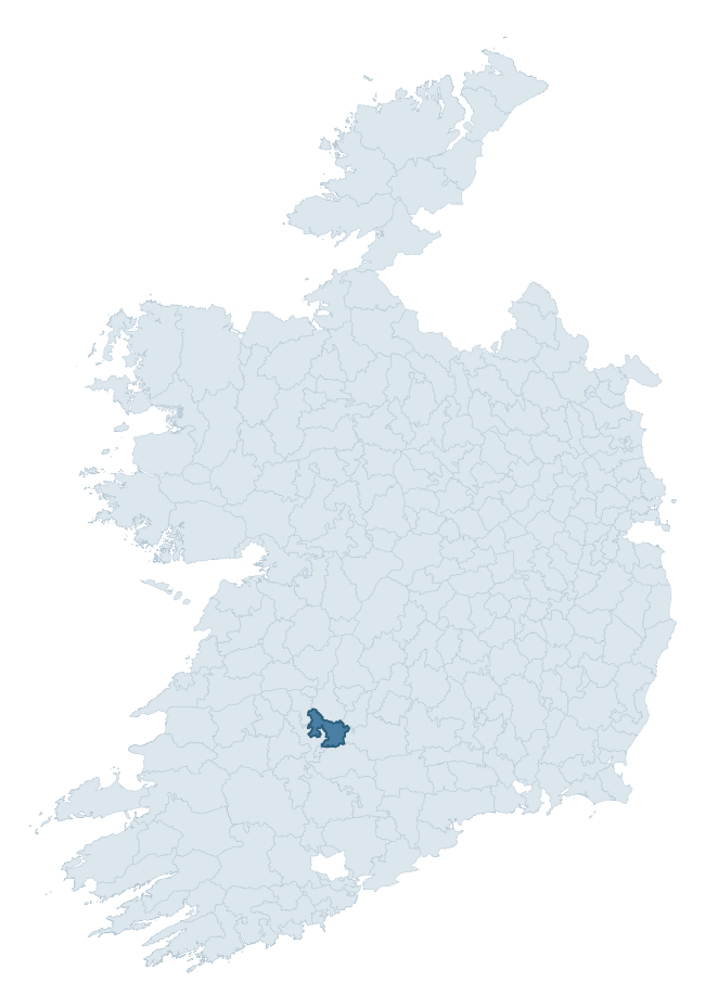
Where this barony sits in the Republic of Ireland
Geology and preservation
Bedrock geology shapes the landscape long before any settlement begins — controlling soil drainage, agricultural potential, the survival of upstanding monuments, and the preservation of buried archaeology. The figures below come from the Geological Survey Ireland 1:100,000 bedrock map.
The bedrock underlying Smallcounty is predominantly limestone (86% of the barony by area), laid down during the Carboniferous period (98% by area, around 359 to 299 million years ago). Limestone is the most heritage-rich bedrock in Ireland. It supports fertile, well-drained soils that favoured dense Early Medieval settlement and Norman manorial agriculture, and it weathers into karst features — sinkholes, caves, swallow holes, and souterrains — that frequently carry archaeology. Where peat overlies limestone, organic preservation can be exceptional. The single largest mapped unit is the Ballysteen Formation (42% of the barony's bedrock).
Rock type composition
Largest mapped unit: Ballysteen Formation (42% of the barony)
Placename evidence
Logainm records 26 heritage-diagnostic placenames for Smallcounty, drawn from townland and civil-parish names across the barony. The dominant stratum is Early Christian ecclesiastical — cill-, teampall-, and domhnach-prefixed names that record the dense network of early church foundations established between the fifth and tenth centuries. The leading diagnostic roots are cill- (11 — church), ráth- (6 — earthen ringfort), and cathair- (3 — stone fort). This is broadly in line with the ROI average of 30.7 heritage placenames per barony. The presence of multiple heritage strata side by side indicates layered occupation of the landscape across successive prehistoric and historic periods. Logainm records 134 placenames for Smallcounty (predominantly townland names). Of these, 26 (19%) carry one of the diagnostic Gaelic roots tracked above; the remainder draw on more generic landscape vocabulary that does not encode a heritage period.
Pre-Christian / Early Medieval Defensive
| Root | Count | Meaning |
|---|---|---|
| ráth- | 6 | earthen ringfort |
| cathair- | 3 | stone fort |
| lios- | 1 | ringfort or enclosure |
| caiseal- | 1 | stone ringfort |
Early Christian Ecclesiastical
| Root | Count | Meaning |
|---|---|---|
| cill- | 11 | church (early) |
| mainistir- | 1 | monastery |
| tobar- | 1 | holy well |
| gráinseach- | 1 | monastic farm / grange |
Burial, Ritual, and Norse-Contact
| Root | Count | Meaning |
|---|---|---|
| carn- | 1 | cairn |
| gall- | 1 | foreigner — Norse settlement marker |
Other baronies in Limerick
- Kilmallock
- Coonagh
- Glenquin
- Pubblebrien
- Clanwilliam
- Connello Upper
- Owneybeg
- Duhallow — Cork
- Tulla Upper — Clare
- Condons And Clangibbon — Cork
See all 280 baronies in the Republic of Ireland Heritage Tool.

Explore further
Grounding History: 10 Maps of Northern Ireland’s Past
If you’re interested in Irish heritage more widely, the companion report for Northern Ireland brings together the analysis of all 462 NI wards into one place through 10 high-quality maps — covering monument density, archaeological periods, placename heritage, terrain, wetland, and the historic landscape at first survey. Take a look.
About this profile
Click any section below to expand.
What is a barony?
A barony is a historic administrative unit in Ireland, broadly equivalent to an English hundred. The 280 baronies used here are from the OSi 2019 National Statutory Boundaries (generalised 20m), covering the 26 counties of the Republic of Ireland. Baronies derive from the Norman period, were formalised in the 17th century, and have not been redrawn for statistical purposes. They vary enormously in area, from compact urban baronies in Dublin to vast upland baronies in Connacht, and should not be compared by raw site count without accounting for area differences.
What counts as a site?
This profile combines three distinct heritage registers, each with its own definition of what constitutes a recordable site:
- Archaeological sites (NMS). The National Monuments Service Sites and Monuments Record (SMR) catalogues every known archaeological monument or site of archaeological interest in the Republic, from prehistoric burial mounds and ringforts to medieval churches and post-medieval defensive works. Inclusion does not require legal protection — only that the site has been identified, surveyed, and assessed as having archaeological value. A separate subset of these sites lies within a recorded protection zone, which gives them statutory protection under the National Monuments Acts.
- Listed buildings (NIAH). The National Inventory of Architectural Heritage records buildings of architectural, historical, archaeological, artistic, cultural, scientific, social, or technical interest. Each surveyed structure is appraised on a five-tier scale: International, National, Regional, Local, and Record-Only. The NIAH appraisal is informational rather than strictly statutory, but it underpins local-authority Record of Protected Structures (RPS) listings.
- Heritage placenames (Logainm). Logainm is the authoritative database of Irish placenames maintained by the Placenames Branch. This profile applies a heritage-diagnostic classifier to the Irish-language form of each townland name, flagging roots that signal defensive sites (ráth-, lios-, dún-, caiseal-, cathair-), ecclesiastical foundations (cill-, teampall-, domhnach-, mainistir-), prehistoric burial-ritual features (tuaim-, carn-, leaba-), or Norse-contact settlement (gall-). Townlands without one of these diagnostic roots are not flagged here — they may still carry historical significance, but that significance is not encoded in the name itself.
Editorial principles
The narrative sections of this profile follow several explicit principles:
- Evidential. Every claim about this barony’s heritage character is anchored in the underlying register data. Where a site count, a placename count, or a percentile rank is cited, it is computed from the source datasets at export time, not estimated.
- Comparative. Counts and metrics are reported alongside their percentile rank against the other 279 ROI baronies. A barony with 50 ringforts in absolute terms could be unusually high or unusually low depending on its size and regional context; percentile ranking removes that ambiguity.
- Transparent on limits. Where a register has known coverage gaps, survey biases, or data-quality issues that affect this barony’s figures, the profile flags them rather than presenting the numbers as definitive.
- No interpretation beyond what the data supports. The narrative does not speculate about historical events, social dynamics, or cultural meaning beyond what the recorded heritage and placename evidence directly attests.
Data caveats and limits
- NMS Sites and Monuments Record is the product of survey campaigns conducted at different intensities across different counties and decades. Some baronies have been surveyed more thoroughly than others, and absolute counts should be read in that light. Sites destroyed by development before survey are typically not represented; sites in heavily forested or upland terrain are sometimes under-recorded.
- NIAH coverage is broadly complete for the Republic of Ireland but the survey was conducted on a rolling county-by-county basis, and the most recent appraisal date varies. Buildings demolished or substantially altered after their original survey may still appear in the register; conversely, recent buildings of merit may not yet have been appraised.
- Logainm classification applies a deliberately conservative pattern-matching approach to the Irish-language townland forms. The classifier prioritises true positives over recall: a townland may carry a heritage signal that the classifier doesn’t recognise, particularly where the diagnostic root has been heavily anglicised or where the townland name draws on a less common term. The 60,000+ townland records and ~9,800 classified placenames give a substantial signal at barony scale, but individual townland names should be checked against Logainm directly for definitive interpretation.
- Period attribution. The chronological distribution reflects only those NMS sites that carry a recognised period attribution in the source data. Sites listed as “Unknown” period are excluded from the dated subset.
- Boundary changes. Some baronies have undergone minor boundary adjustments since their 19th-century definition; the OSi 2019 generalised boundaries used here are the current statutory definition and may differ slightly from historical maps in border areas.
- Bedrock geology is mapped at 1:100,000 scale, which means local variation within a barony — small pockets of different rock type, mineral veins, alluvium overlying bedrock — is generalised. The dominant-system and rocktype figures are area-weighted, so a barony reading “70% Carboniferous limestone” may still contain small but archaeologically important pockets of older or younger rock. Around 3% of GSI polygons do not match the lexicon and contribute no rocktype or system attribution.
Data sources
- National Monuments Service — Sites and Monuments Record (SMR) https://data.gov.ie/dataset/national-monuments-service-archaeological-survey-of-ireland
- National Inventory of Architectural Heritage (NIAH) https://data.gov.ie/dataset/national-inventory-of-architectural-heritage-niah-national-dataset
- Logainm — Placenames Database of Ireland https://www.logainm.ie/
- Ordnance Survey Ireland — National Statutory Barony Boundaries 2019 https://data-osi.opendata.arcgis.com/
- EURODEM — European Digital Elevation Model https://www.mapsforeurope.org/datasets/euro-dem
- ESA WorldCover https://esa-worldcover.org/en
- Geological Survey Ireland — 1:100,000 Bedrock Geology https://www.gsi.ie/en-ie/data-and-maps/Pages/Bedrock.aspx
Explore more: Search any of the 280 ROI baronies, browse by historical province, or read the methodology and data sources for the full Republic of Ireland Heritage Tool.