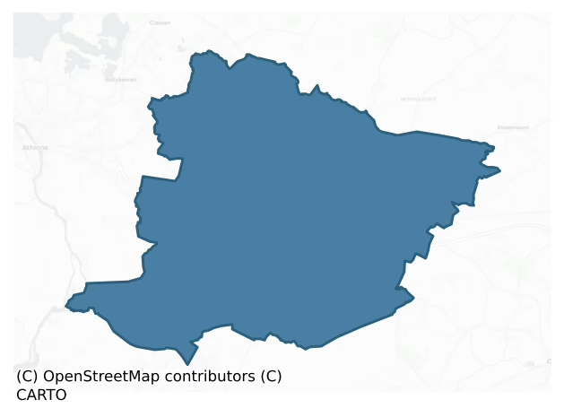
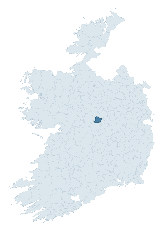
Clonlonan is a barony of County Westmeath, in the historical province of Leinster (Irish: Cluain Lonáin), covering 130 km² of land. The barony records 252 NMS archaeological sites and 114 NIAH listed buildings, placing it at around the 53rd percentile among 280 ROI baronies for sites per km². This means it is in the upper half of all baronies for sites per km². Dated archaeological evidence runs from the Early Bronze Age through to the Modern, spanning 6 of 9 archaeological periods, placing the barony in the 12th percentile among 280 ROI baronies for chronological depth. This means it is in the bottom fifth of all baronies for chronological depth. The largest dated subset of recorded sites dates to the Early Medieval. Logainm flags 25 placenames in the barony as carrying a recognised heritage root; the largest share — around 76% — are names associated with early Christian church and monastic foundations.

Heritage at a glance
Percentile rankings throughout this profile compare each barony only against the other 279 Republic of Ireland baronies.
The recorded heritage of Clonlonan
The National Monuments Service Sites and Monuments Record (SMR) is the statutory inventory of archaeological sites for the Republic of Ireland, maintained by the Department of Tourism, Culture, Arts, Gaeltacht, Sport and Media. Sites recorded here include earthworks, ringforts, megalithic tombs, ecclesiastical remains, and post-medieval features; not every record is legally protected, but each is registered as a monument of archaeological interest.
The National Monuments Service records 252 archaeological sites in Clonlonan, putting it at the 53rd percentile among 280 ROI baronies for sites per km². This means it is in the upper half of all baronies for sites per km². Protection coverage is near-universal — 232 sites (92%) fall within a recorded monument protection zone, indicating an extensively surveyed landscape. The dominant category is defensive sites — ringforts, enclosures, hillforts, and stone forts (152 sites, 60% of the record). Ringfort – rath is the most prevalent type, making up 39% of the barony's recorded sites (98 records) — well above the ROI average of 20% across all baronies where this type occurs. Ringfort – rath is an earthen ringfort enclosed by a bank and external ditch — the most common Early Medieval farmstead, broadly dated 500–1000 AD. Other significant types include Enclosure (15) and Road – class 3 togher (13). Enclosure is a banked or ditched feature of uncertain type, used as a catch-all where the original function cannot be determined from surface evidence; Road – class 3 togher is a short wooden peatland trackway up to 15m long, deliberately laid to cross a small area of bog; Neolithic to medieval. Across the barony's 130 km², this gives a recorded density of 1.94 sites per km².
Most common monument types
Hover or tap a monument type to see its definition.
| Type | Count |
|---|---|
| Ringfort – rath an earthen ringfort enclosed by a bank and external ditch — the most common Early Medieval farmstead, broadly dated 500–1000 AD | 98 |
| Enclosure a banked or ditched feature of uncertain type, used as a catch-all where the original function cannot be determined from surface evidence | 15 |
| Road – class 3 togher a short wooden peatland trackway up to 15m long, deliberately laid to cross a small area of bog; Neolithic to medieval | 13 |
| Earthwork an unclassified earthen structure with no diagnostic features that allow a more specific classification | 9 |
| Bullaun stone a boulder or rock outcrop with hemispherical hollows ('bulláin'), commonly associated with ecclesiastical sites and holy wells | 8 |
| Church a building used for public Christian worship, of any date from c. 500 AD onwards | 7 |
| Castle – tower house a fortified residential tower of four or five storeys, mostly built by lords in the 15th and 16th centuries and often within a defended bawn | 6 |
| Castle – unclassified a castle whose form cannot be precisely classified, dating somewhere between the late 12th and 16th centuries | 6 |
Chronological distribution
The dated archaeological record for Clonlonan spans from the Early Bronze Age through to the Modern, with activity attested across 6 of 9 archaeological periods. This is the 12th percentile across ROI baronies — a relatively narrow chronological band, with much of Irish prehistory not represented in the dated record. The record is near-continuous, with only the Middle Late Bronze Age period falling inside the span without any recorded sites. Activity concentrates most heavily in the Early Medieval (115 sites, 55% of dated material), with the Iron Age forming a secondary peak (55 sites, 26%). A further 43 recorded sites (17% of the overall NMS register for the barony) carry no period attribution — appearing as 'Unknown' in the bar chart below. This typically reflects either records that pre-date the standardised period vocabulary or sites awaiting specialist dating review, rather than a genuine absence of chronological evidence.
Sample of recorded monuments
Show 25 sample monuments (of 252 total)
A representative sample of 25 recorded monuments drawn from the barony’s 252 total NMS entries. Sites within a recorded monument protection zone and rarer site types are prioritised so the list shows a meaningful cross-section rather than only the most common type. Each entry shows the official Sites and Monuments Record reference number and the description published by the National Monuments Service.
Cross – High cross (present location)
National Monument No. 223. In 1837 the Ordnance Survey recorded the following about the location of Bealin High Cross; ‘On Cross hill in the parish of Ballyloughloe there is a curiously sculptured ancient cross said to…
National Monument No. 223. In 1837 the Ordnance Survey recorded the following about the location of Bealin High Cross; ‘On Cross hill in the parish of Ballyloughloe there is a curiously sculptured ancient cross said to have been removed thither from an old graveyard (WM029-009002-) in Twy [ford] by the father of the present Lord Castlemaine. No trace of this graveyard is now visible, but the cross proves that there was an ancient church (WM029-009—-) there’ (OSL 1837, vol. 1, 68).
Bealin High Cross described by Harbison (1992, vol. 1, 25-6) as following; 'The cross now standing on top of a hill in the former Twyford demesne, close to a lane leading northwards from Bealin Post Office, is almost certainly not in its original location. It is said to have formerly stood beside a well (WM029-009001-) in the demesne. Henry assumed that it was taken from Clonmacnoise, but there would not appear to be any evidence that it is to be identified with a cross marked with the letter R on Blaymires' 17th century view of Clonmacnoise. Its original location must remain a mystery. The cross stands to a height of about 2.1m above a modern base, and is 27cm thick. Its north arm has been badly damaged, but the original width across the arms must have been about 1.06m. Of the ring, only the lower segment of the south side has been preserved, and its edges have raised mouldings of the same kind as found on the shaft and arms of the cross.
EAST FACE
Shaft: A lion, with projecting t…
Inauguration site
The precise location of the inauguration place of the Mac Amhalghaidh / Magawley clan has not been identified and several locations have been suggested (Fitzpatrick 2004, 170-1). In 1837 O’Donovan suggested that the…
The precise location of the inauguration place of the Mac Amhalghaidh / Magawley clan has not been identified and several locations have been suggested (Fitzpatrick 2004, 170-1). In 1837 O’Donovan suggested that the hill beside Tullymagawley House may have been the hill on which Magawley was ‘made’. The Ordnance Survey Letters of 1837 records that the ‘hill of Tullymagawley preserves as a ‘monumentum aere perennius’ the name of the ancient Lord of the soil (Walsh 1957, 7). Dalton (1926, 52) recorded that the ‘inauguration chair of the Magawley chiefs stood on the hillock now called Tullymagawley’. This ‘hill of Tullymagawley’ may be the place described by Cox (1970, 62) in 1970 as a ‘grave-like mound’. A natural looking hillock in the field to the N of Tullymagawly House (WM029-031—-) may mark the site of the 'Hill of Tully Mac Awley'. It is possible that this roughly circular shaped mound or hillock is entirely natural with no archaeological features visible (SMR File 23/08/1983). Fitzpatrick suggested that this hill was an unlikely location for inauguration ceremonies and that the 'Hill of Tully Mac Awley' identified by O'Donovan was possibly located in the neighbouring townland of Ballymurry (Fitzpatrick 2004, 170). A hilltop enclosure (WM030-065—-) 1.1km to the E of Tullymagawly House standing in the townland of Ballymurry is locally believed to be the inauguration place of the Mac Amhalghaidh clan (ibid.). Fitzpatrick (2004, 171) however suggests that the…
Barrow – ring-barrow
Situated on a slight rise in undulating poorly drained pasture with good views of surrounding countryside. A large roughly circular area (overall diam. c. 75m E-W; int. diam. c. 30m E-W) delimited by a wide shallow…
Situated on a slight rise in undulating poorly drained pasture with good views of surrounding countryside. A large roughly circular area (overall diam. c. 75m E-W; int. diam. c. 30m E-W) delimited by a wide shallow flat-bottomed fosse with a substantial earth and stone bank well preserved from S-W-N-NE but elsewhere it is lower in height and has been defaced in places. There is a modern gap in bank at NE and some old quarry holes at WNW and WSW. The interior of the monument along with the enclosing fosse is traversed by old cultivation ridges running N-S. Most of the interior of the monument has been disturbed by these cultivation ridges. An old ESB pole has been placed on top of the bank at NE. It has been suggested that this monument may be the remains of a possible henge due to the large diameter of the monument or may be an example of a large ring-barrow (SMR File 29/03/1973).
Compiled by: Caimin O’Brien
Date of upload: 20 July 2015
Cross-slab (present location)
Early Christian cross-inscribed slab (dims. L 0.9m; Wth 0.43m) that has been built into the S face of a short section of the upstanding remains of the N wall of a medieval church (WM030-045001-) located 9m S of the…
Early Christian cross-inscribed slab (dims. L 0.9m; Wth 0.43m) that has been built into the S face of a short section of the upstanding remains of the N wall of a medieval church (WM030-045001-) located 9m S of the post-medieval ruins of Holy Trinity Church standing in the centre of the graveyard (WM030-045—-). The slab has been built into the S face of the wall at a height of 0.9m above the surface of the graveyard. The slab contains a small incised linear Latin cross with bifid terminals also known as a cross fourchee and a Goidelic inscription which reads Or do Maelmaire that has be inset into the wall of the old mortuary chapel of the Magawley family. The inscription Or do Mael Maire can be expanded into Oroit Do Maelmaire, meaning Pray for Maelmaire. The cross-inscribed slab was formerly located in the grounds of Shurock House located 2.3km to the SE. In the 1872 it was recorded that the ‘inscribed stone Or do Mailmaire, now preserved at Shurock, near moate, was carried thither, as Dr. Petrie learned from an old inhabitant of the place, from Calraighe. This was the ancient name of the M’Gawleys’ country in Westmeath – a territory comprising the parish of Ballyloughloe, in which Shurock is situated. There is an old church in the neighbourhood called Culree [Calry], from which this stone was taken, and placed on the side of a small moat in the demesne of Shurock House, where it may still be seen. In the Ordnance Survey Letters (County Westmeath, pp. 29, 30)…
Enclosure – large enclosure
Situated in pasture. Depicted on the revised 1910 ed. OS 25-inch map as a curvilinear field boundary defining a semicircular-shaped area (approx. diam. 100m) from E-S-WSW. Monument is visible today as a tree-lined…
Situated in pasture. Depicted on the revised 1910 ed. OS 25-inch map as a curvilinear field boundary defining a semicircular-shaped area (approx. diam. 100m) from E-S-WSW. Monument is visible today as a tree-lined curvilinear field boundary from E-S-WSW on Digital Globe aerial photography. There is no cropmark defining the N half of this potential enclosure.
Compiled by Alison McQueen, Vera Rahilly and Caimin O’Brien.
Date of upload: 08 November 2019
Barrow – stepped barrow
Situated on top of a hill with commanding views of the surrounding countryside. According to local tradition this hilltop enclosure was the inauguration place of the Mac Amhalghaidh / Magawley clan (Cox 1972, 155). …
Situated on top of a hill with commanding views of the surrounding countryside. According to local tradition this hilltop enclosure was the inauguration place of the Mac Amhalghaidh / Magawley clan (Cox 1972, 155). Fitzpatrick (2004, 171) however suggests that the bowl-barrow (WM030-104—-) on Knockdomny Hill is the more likely location for the inauguration place of the Mac Amhalghaidh clan. Monument consists of a circular raised area or platform (diam. c. 29m) enclosed by an earth and stone bank, berm and outer bank. Gap in bank at W appears to be of recent origin, second gap in bank at NNE may be remains of original entrance feature. A trackway leading up to this possible entrance gap may be remains of an ancient pathway. The interior of the monument is divided by a field boundary consisting of a low bank and fosse running N-S. This field boundary is a later feature as it runs across and cuts into the enclosing bank and scarp of the monument at NNW. At the S end of this bank there are two stones set in line with the bank which suggests contemporaneity with this feature. The N stone (H 1.25m x 1.25m x 1m) is higher than the S stone which is more stump like in its appearance. Large boulders and rock outcrop can be seen protruding from the surface of the interior and from the top of the enclosing bank. A small depression in the N quadrant of the interior facing onto the inner face of the enclosing bank may be the remains of a possible hut site or could be the remains of a…
Barrow – bowl-barrow
Situated on top of a hill with commanding views of the surrounding countryside. Fitzpatrick (2004, 171) has suggested that this bowl-barrow on the summit of Knockdomny Hill is the most likely location of 'Tulach Mic…
Situated on top of a hill with commanding views of the surrounding countryside. Fitzpatrick (2004, 171) has suggested that this bowl-barrow on the summit of Knockdomny Hill is the most likely location of 'Tulach Mic Amhalghaidh' [Tullymagawly] which was the inauguration place of the Magawley clan. In 1579 and 1599 the townland of Knockdomny was recorded as the inauguration place of the chief of the Mic Amhalghaidh (ibid.). Monument consists of a small circular mound (top diam. c. 5m; base diam. 10m; H c. 2m) of earth and stones enclosed by a shallow fosse (Wth c. 2m; ext. D c. 0.35m) with external bank which is destroyed at E. There is some evidence of recent disturbance on the summit of the mound. A limestone flag is visible on the summit. The summit of this mound was used by the Ordnance Survey as an OD station for the spot height of 515 ft on 1837 ed. OS 6-inch map. No antiquity is depicted at this location on the 1837 ed. OS 6-inch map. The earthwork may have been modified by the Ordnance Survey in the early 19th century.
Compiled by: Caimin O’Brien
Date of upload: 21 July 2015
Architectural fragment
Situated at the edge of the public road, c. 300m to S of the Athlone-Mullingar railway line and c. 325m to N of the M6 motorway. Architectural fragment is not visible on Digital Globe aerial photography.
Compiled by…
Situated at the edge of the public road, c. 300m to S of the Athlone-Mullingar railway line and c. 325m to N of the M6 motorway. Architectural fragment is not visible on Digital Globe aerial photography.
Compiled by Alison McQueen, Vera Rahilly and Caimin O’Brien.
Date of upload: 10 November 2019
Bastioned fort
Situated on the demesne lands of Castle Daly now Kilcleagh Park (WM036-011—-), which lies c. 285m to NE. A corn mill (WM036-010—-) and castle (WM036-011—-) lies c. 185m to ENE. Annotated 'Battery' on the 1837 ed.…
Situated on the demesne lands of Castle Daly now Kilcleagh Park (WM036-011—-), which lies c. 285m to NE. A corn mill (WM036-010—-) and castle (WM036-011—-) lies c. 185m to ENE. Annotated 'Battery' on the 1837 ed. OS 6-inch map and depicted as a rectangular-shaped earthwork (approx. dims. 27m E-W; 24m N-S). Not shown on revised ed. OS maps. According to O’Donovan (OSNB 34, 37), this is an ornamental mound shaped constructed to resemble an artillery fortification known as a battery. There is a flagstaff on the mound but no military arsenal is mounted. Described in 1977 as a roughly rectangular-shaped platform (approx. dims. 17m x 17m) defined by a ditch with traces of bastions at each corner. The W side is better preserved than the E side. Bushes growing on the edge of the platform and cattle have denuded much of the surface. The earthwork overlooks the old road which runs E-W past Castle Daly now Kilcleagh Park. Monument is visible today as a rectangular-shaped partially tree-lined earthwork on Digital Globe aerial photography. Possibly the remains of a 17th century star-shaped earthen fort or constructed as an ornamental landscaped feature designed to look like a 17th century artillery fortification on the demesne of Castle Daly (WM036-011—-).
Compiled by Alison McQueen, Vera Rahilly and Caimin O’Brien.
Date of upload: 28 November 2019
Mill – corn
The precise location of the medieval corn mill in the townland of Kilcleagh has not been identified. The terrier of the 1659 Down Survey map of Kilcleagh parish barony states that there was in ‘Killcleagh a Castle in…
The precise location of the medieval corn mill in the townland of Kilcleagh has not been identified. The terrier of the 1659 Down Survey map of Kilcleagh parish barony states that there was in ‘Killcleagh a Castle in repaier and a Corne Mill in repaire’ (NLI, MS 723-4 ). The 1659 Down Survey map depicts the medieval mill standing on a mill race or stream in close proximity in an area to the S of the castle (WM036-011—) at Kilcleagh. The mill was located on the demesne lands of Castle Daly somewhere along the present watercourse running past Kilcleagh Park [Castle Daly] the line of which is shown on the OS 25-inch map.
Compiled by: Caimin O'Brien
Date of upload: 22 July 2015
Well
Situated in low-lying poorly drained pasture, c. 10m to E of a stream. Annotated ‘Toorard Well’ and on the 1837 ed. OS 6-inch map. Described in 1982 as no surface remains visible. Well is not visible today on Digital…
Situated in low-lying poorly drained pasture, c. 10m to E of a stream. Annotated ‘Toorard Well’ and on the 1837 ed. OS 6-inch map. Described in 1982 as no surface remains visible. Well is not visible today on Digital Globe aerial photography.
Compiled by Alison McQueen, Vera Rahilly and Caimin O’Brien.
Date of upload: 28 November 2019
Water mill – horizontal-wheeled
Horizontal watermill located on wet marshy land with bullaun stone (WM036-019—) 20m to NE and castle (WM036-018—) 150m to WNW. In 1980 the following was recorded about this horizontal mill it was ‘found in a…
Horizontal watermill located on wet marshy land with bullaun stone (WM036-019—) 20m to NE and castle (WM036-018—) 150m to WNW. In 1980 the following was recorded about this horizontal mill it was ‘found in a field-drainage operation in 1965, the drain being enlarge on the edge of marginal land on the slightly rising ground towards Moate. This must at one time have been a small rivulet or stream with a relatively small flow of water. Nothing now remain of the mill at the original find-spot. Some 20m away in the next field is a bullaun stone (WM036-019—-) to the NE. Thus the mill may be associated with a church site as in so many other cases. The side-beams from the site have been removed for use as a field-fence in the next field. One of these is 2.7m long, and is squared 0.3m x 0.28m. This is of oak. Another plank from the floor of the wheelhouse is 1.7m long, 30cm wide and 10cm thick. Both are of oak. The plank was taken for dating by dendro-chronological examination. In the corner of the field where the mill was found, half of the upper stone of the mill was recovered. It has a fine raised lip around the central hole, and is a millstone grit type of rock’ (SMR File 07/10/1980).
Compiled by: Caimin O'Brien
Date of upload: 22 July 2015
Moated site
Situated on a low ridge running N-S, in rough pasture, with good views of the surrounding landscape. Depicted on the revised 1910 ed. OS 25-inch map as a subrectangular-shaped earthwork. Monument described as a roughly…
Situated on a low ridge running N-S, in rough pasture, with good views of the surrounding landscape. Depicted on the revised 1910 ed. OS 25-inch map as a subrectangular-shaped earthwork. Monument described as a roughly circular-shaped area (diam. 42m) enclosed by an earth and stone bank with external fosse. The bank is wide and is low on the interior and is steep on the exterior (H 2-3m). There is a shallow fosse which has been infilled in some places with field clearance material. The interior rises gently from the perimeter towards the centre and the surface is quite uneven. Monument is visible today as a roughly rectangular-shaped tree-lined earthwork on Digital Globe aerial photography.
Compiled by Alison McQueen, Vera Rahilly and Caimin O’Brien.
Date of upload: 29 November 2019
Sheela-na-gig
Sheela-na-gig incorporated into wall of outbuilding located in farmyard immediately E of Moate Castle (WM030-112—-). The carving of the sheela-na-gig is situated above a pointed doorway which has been rebuilt into an…
Sheela-na-gig incorporated into wall of outbuilding located in farmyard immediately E of Moate Castle (WM030-112—-). The carving of the sheela-na-gig is situated above a pointed doorway which has been rebuilt into an 18th /19th century outbuilding. The doorway and sheela-na-gig may have come from the adjacent Moate Castle (WM030-112—-). Described by Freitag as a sheela-na-gig that has been, ‘carved in an oval impression of roughly rectangular slab. All features asymmetrical. Huge head, wavy lines across forehead, ovoid eyes (left empty, right with eyeball), puffy cheeks, grim open mouth showing teeth. Tiny breasts; protruding belly; arms reaching down in front of body with fingers of both hands grabbing oval vulva. Of legs only left thigh is discernible. A belt passes obliquely round abdomen’ (Freitag 2004, 138).
Compiled by: Caimin O'Brien
Date of upload: 22 May 2012
Inscribed stone
In SW sector of Quaker burial ground (WM030-113—-) in the town of Moate there is a partially surviving section of upstanding wall which represents the S wall of the Quaker meeting house (WM030-113001-). In the centre…
In SW sector of Quaker burial ground (WM030-113—-) in the town of Moate there is a partially surviving section of upstanding wall which represents the S wall of the Quaker meeting house (WM030-113001-). In the centre of the wall there is an arched doorway. There are three plaques on the wall. Two on the W side of the doorway. The first reads: “Site of friends meeting house
AD 1694 By John Glibborn The Castle, Moate Taken down by order of Dublin meeting 1921.”
The second plaque which is lozenge shaped reads: “Rebuilt in the year 1768.”
A third plaque is visible on the wall to E of the doorway. This reads: “Built by John Glibborn Ad 1694.”
Compiled by Alison McQueen, Vera Rahilly and Caimin O’Brien.
Date of upload: 10 November 2019
Mound
In the centre of a partially dried up pond on poorly drained pasture at base of N facing slop of Knockdomny Hill. Depicted as a small pond with stream or water outlet at SSE on the 1837 ed. OS 6-inch map. No antiquity…
In the centre of a partially dried up pond on poorly drained pasture at base of N facing slop of Knockdomny Hill. Depicted as a small pond with stream or water outlet at SSE on the 1837 ed. OS 6-inch map. No antiquity depicted inside the pond on this map. Oval-shaped mound (H 1m; dims. c.8m E-W; c.3.5m N-S) the base of which is defined by an external water-filled fosse (Wth c.2.2m top; Wth 0.8m base; D c.0.9m) visible from WSW-N-ESE with causeway (Wth c.1.8m) at NNW. Fosse or moat supplied with water flowing from pond adjoining to SSE. Depicted on revised ed. OS 6-inch map as circular feature (diam. c.9m) with no pond area shown as it had been reclaimed by this period. According to landowner, this is an artificial feature constructed to counteract winter flooding in this field, it is unclear exactly how it serves this particular function.
Compiled by: Caimin O'Brien based on information provided by Alison McQueen
Date of upload: 07 November 2019
Bullaun stone (present location)
Standing incorporated into the S field boundary with stream 70m to N. Bullaun stone (WM036-038—-) 90m to E. Irregular-shaped conglomerate boulder (0.75m x 0.72m; H 0.5m) with quartz inclusions containing a small…
Standing incorporated into the S field boundary with stream 70m to N. Bullaun stone (WM036-038—-) 90m to E. Irregular-shaped conglomerate boulder (0.75m x 0.72m; H 0.5m) with quartz inclusions containing a small circular hollow (diam. 0.08m; D 0.05m). The boulder has been moved from its original location in the field and is now located in the field boundary. Known locally as St. Patrick's knee stone (pers. comm. local farmer), this stone was originally located a few metres to the N of its current location.
Compiled by: Caimin O’Brien
Date of upload: 11 August 2014
Barrow – pond barrow
Situated atop low rise of ground with good views in all directions, bullaun stone (WM036-038—-) in same field c. 70m to NE. Circular-shaped sunken area (diam. 17m; D 0.4m) enclosed by a low poorly preserved earthen…
Situated atop low rise of ground with good views in all directions, bullaun stone (WM036-038—-) in same field c. 70m to NE. Circular-shaped sunken area (diam. 17m; D 0.4m) enclosed by a low poorly preserved earthen bank (Wth. 5m; ext. H 0.2m), no entrance feature visible. There has been some dumping of material inside the centre of the possible barrow.
See attached Bing Maps aerial photograph taken November 2011 which shows outline of possible pond barrow, taken from www.bing.com/maps/.
Compiled by: Caimin O’Brien
Date of upload: 11 August 2014
Barrow – unclassified
Situated on flat poorly drained land with drainage channels traversing the field. Outline of circular shaped area (approx. int. diam. 40m; overall ext. diam. 60m) defined by a fosse, earthen bank and external fosse…
Situated on flat poorly drained land with drainage channels traversing the field. Outline of circular shaped area (approx. int. diam. 40m; overall ext. diam. 60m) defined by a fosse, earthen bank and external fosse visible on Digital Globe aerial imagery. The W quadrant of the monument has been intersected by a post-1700 field boundary running N-S. Earlier OSI aerial photography shows the outline of this monument to the W of the field boundary. The poorly drained land suggests that this may be the remains of a possible barrow although due to the large size of the monument it could be the remains of a ringfort of a raised platform nature.
See attached image from Google Earth taken 02/04/2013
Compiled by: Caimin O'Brien based on details kindly provided by Eoghan Doyle
Date of upload: 11 March 2019
House – early medieval
Situated at the N edge of a ridge running E-W, with extensive views to W and N and overlooked by higher ground to E and S. In the S quadrant of ringfort (WM030-003—-) are the remains of a low subrectilinear mound…
Situated at the N edge of a ridge running E-W, with extensive views to W and N and overlooked by higher ground to E and S. In the S quadrant of ringfort (WM030-003—-) are the remains of a low subrectilinear mound (dims. 7m NW-SE; 7m NE-SW) defined by faint traces of a low bank of earth and stone.
Compiled by Alison McQueen, Vera Rahilly and Caimin O’Brien.
Date of upload: 07 November 2019
Designed landscape – summer house
The ruins of a late 18th or early 19th century Summer House standing on top of an artificial mound covering an icehouse (WM029-052—-) stands inside a walled woodland area. An entrance gate and pathway though the…
The ruins of a late 18th or early 19th century Summer House standing on top of an artificial mound covering an icehouse (WM029-052—-) stands inside a walled woodland area. An entrance gate and pathway though the woodland to north-north-east provides access to Moydrum Castle (NIAH Reg. No. 15402917; RPS No. 029-006) and pond located immediately to NNE. The pond now dried up is clearly shown on the 1837 edition of the OSi six-inch. The walled garden (NIAH Reg. No. 15402918; RPS No. 029-007) of Moydrum Castle stands 78 metres to the south. A range of buildings forming a quadrangular-shaped area stand immediately to the south of the walled woodland area and is annotated ‘Hill House’ on the 1837 ed. OSi six-inch map.
Present remains consist of a square-shaped summer house (ext. dims. 5.72m N-S x 5.77m E-W) standing on top of an earthen mound covering an icehouse which is entered through an entrance passage at base of mound on north-west side. The summer house stands one story high and is entered through a doorway at NNE accessed via a series of stone steps. This doorway faces a walkway running through the woodland towards a broken-out entrance in the northern wall enclosing the woodland as shown on the OSi 25-inch map.
The summer house has an external square-shaped plan built with redbrick-lined internal wall and rubble stone wall (T. 0.43m) covered with a gravel dash render. The flat-headed doorway (H 2.1m; Wth 1.08m) at NNE leads into a circular-shaped chambe…
Icehouse
The ruins of a late 18th or early 19th century Summer House (WM029-051—-) standing on top of an artificial mound covering an icehouse stands inside a walled woodland area. An entrance gate and walkway though the…
The ruins of a late 18th or early 19th century Summer House (WM029-051—-) standing on top of an artificial mound covering an icehouse stands inside a walled woodland area. An entrance gate and walkway though the woodland to north-north-east provides access to Moydrum Castle (NIAH Reg. No. 15402917; RPS No. 029-006) and pond located immediately to NNE. The pond now dried up is clearly shown on the 1837 edition of the OSi six-inch. The walled garden (NIAH Reg. No. 15402918; RPS No. 029-007) of Moydrum Castle stands 78 metres to the south. A range of buildings forming a quadrangular-shaped area stand immediately to the south of the walled woodland area and is annotated ‘Hill House’ on the 1837 ed. OSi six-inch map.
Present remains consist of a summer house standing on top of an earthen mound covering an icehouse which is entered through an entrance passage at base of mound on north-west side. The covering of earth acted as an insulating layer for the icehouse. The entrance tunnel or passage (L 7.65m; Wth 1.22m; H 1.14m) with brick-lined vaulted roof and rubble side-walls running eastwards towards a lobby area (dims. 1.82m E-W x 1.97m N-S) with redbrick floor off which the redbrick-lined ice chamber (diam. 4.36m; H c. 5.5m) was accessed. The entrance to the tunnel was protected by a doorway now removed, with two doorways protecting the lobby area. This lobby area lies directly beneath the flight of steps leading to the doorway of the summer house directly abov…
Crannog
Described by O'Sullivan (2004, 117-8) as 'Originally located at east end of Twy Lough (a long, deep lake), formerly surrounded by water but now separated from the shoreline by marshes to east and southeast. The site was…
Described by O'Sullivan (2004, 117-8) as 'Originally located at east end of Twy Lough (a long, deep lake), formerly surrounded by water but now separated from the shoreline by marshes to east and southeast. The site was 130m from nearest original shoreline to south. This crannóg is a low cairn (diam. 27m; H 1.3m, 0.3m above water) of stone, earth and timber in shallow water at the east end of Twy Lough. The crannóg is a low, level cairn, with gradually sloping sides, apart from the east side where it slopes steeply into the water. The cairn has been heavily eroded by wave action on the west side, revealing a palisade of vertical wooden posts, set in irregular concentric rows 3-4 deep. There was no evidence for horizontal timbers. Animal bone was also common here and across the surface o f the site. The crannóg is heavily overgrown today with large trees and bushes and is surrounded by reeds. The crannóg was clearly used as a fishing station in the 18th-19th century. A small rectangular summer house (dims. 5.3m N-S x 3.6m E-W), with drystone walls, mortared and whitewashed interior walls and a possible fireplace at the east end sits in the middle of the island. There is also an old wooden jetty on the southwest side, 4m in length (in 1m depth of water), bound with rope and on stilts. This was probably associated with the summer house. Local folklore has it that this lake (apparently formerly known as Loch Lochraighi, 'lake of the lake-folk’) was the site of an event in th…
Castle – motte
Situated on a low rise, in undulating pasture, c. 20m to SW of a townland boundary. Depicted on the revised 1910 ed. OS 25-inch map as a circular-shaped earthwork (approx. dims. 15m NE-SW; 14m NW-SE). Monument described…
Situated on a low rise, in undulating pasture, c. 20m to SW of a townland boundary. Depicted on the revised 1910 ed. OS 25-inch map as a circular-shaped earthwork (approx. dims. 15m NE-SW; 14m NW-SE). Monument described in 1980 as a small high steep-sided circular-shaped flat-topped mound (H 3-4m) of earth and stone. The summit is fairly flat and the monument is overgrown with impenetrable vegetation, which prevented a detailed inspection. There is no definite trace of an external fosse around the base of the mound. A field fence flanks the base of the earthwork to NW. The classification of this monument is uncertain and may be the remains of a small motte or possible burial mound. Monument is visible today as a tree-planted earthwork on Digital Globe aerial photography.
Compiled by Alison McQueen, Vera Rahilly and Caimin O’Brien.
Date of upload: 07 November 2019
Ringfort – rath
Situated on a slight rise, in gently undulating pasture. Ringfort (WM030-094—-) lies c. 130m to WSW. According to O’ Donovan (OSL 1837, 46), this ringfort was known locally as the ‘Cave Fort’ (OSNB 2). Depicted on the…
Situated on a slight rise, in gently undulating pasture. Ringfort (WM030-094—-) lies c. 130m to WSW. According to O’ Donovan (OSL 1837, 46), this ringfort was known locally as the ‘Cave Fort’ (OSNB 2). Depicted on the revised 1910 ed. OS 25-inch map as a roughly circular-shaped earthwork. Monument described in 1973 as a roughly circular-shaped area (diam. 33m) enclosed by a bank. The low bank is constructed of earth and stone and is almost reduced to a scarp. The interior rises from the perimeter towards the centre and has an uneven surface where some boulders project across the S half. Souterrain (WM030-095001-) located in the centre. Outline of monument is visible today as an earthwork on Digital Globe aerial photography.
Compiled by Alison McQueen, Vera Rahilly and Caimin O’Brien.
Date of upload: 09 November 2019
Listed buildings
The National Inventory of Architectural Heritage (NIAH) is a state survey appraising buildings of architectural, historical, archaeological, artistic, cultural, scientific, social, or technical interest. Each surveyed structure receives a rating from International (the highest, for buildings of European importance) through National, Regional, Local, and Record-Only.
The NIAH records 114 listed buildings in Clonlonan (56th percentile across ROI baronies). The highest-graded structures include 2 of National significance. The Republic holds 937 National-graded buildings in total, so this barony accounts for around 0% of the national total. Construction dates concentrate most heavily in the Victorian (1830-1900) period. The most-recorded building type is house (32 examples, 28% of the listed stock).
Terrain and environment
Mean elevation across the barony is 67m — the 30th percentile among 280 ROI baronies for elevation. This means it is in the bottom third of all baronies for elevation. This is a relatively low-lying landscape by ROI standards. Elevation matters for heritage because higher-altitude baronies typically favour defensive monuments — ringforts and hilltop forts placed on prominent ground — while lowland baronies are more likely to carry the dense settlement and church networks of intensive agricultural landscapes. Mean slope is 2.7° — the 30th percentile among 280 ROI baronies for slope. This means it is in the bottom third of all baronies for slope. Slope is a key control on both land use and archaeological preservation: steep ground resists ploughing and tends to preserve earthworks intact, while gentle slopes favour intensive cultivation that damages or destroys surface archaeology over time. The Topographic Wetness Index averages 11.3, the 68th percentile among 280 ROI baronies for wetness. This means it is in the top third of all baronies for wetness. Drainage matters for heritage because poorly-drained ground preserves organic archaeology (wooden trackways, leather, textiles, and on rare occasions human remains) far better than free-draining soil; well-drained ground favours arable use but destroys organic material rapidly. The land cover is dominated by improved grassland (86%) and woodland (12%). In overall character, this is low-lying, gently-sloping terrain — characteristic of Ireland's central plain and coastal lowlands, with land use dominated by improved grassland.
Terrain measurements
Where this barony sits in the Republic of Ireland
Geology and preservation
Bedrock geology shapes the landscape long before any settlement begins — controlling soil drainage, agricultural potential, the survival of upstanding monuments, and the preservation of buried archaeology. The figures below come from the Geological Survey Ireland 1:100,000 bedrock map.
The bedrock underlying Clonlonan is predominantly limestone (90% of the barony by area), laid down during the Carboniferous period (90% by area, around 359 to 299 million years ago). Limestone is the most heritage-rich bedrock in Ireland. It supports fertile, well-drained soils that favoured dense Early Medieval settlement and Norman manorial agriculture, and it weathers into karst features — sinkholes, caves, swallow holes, and souterrains — that frequently carry archaeology. Where peat overlies limestone, organic preservation can be exceptional. The single largest mapped unit is the Ballysteen Formation (28% of the barony's bedrock). With only 2 distinct rock types mapped, the barony is geologically uniform compared to the rest of the Republic (10th percentile for diversity) — a single coherent bedrock landscape.
Rock type composition
Largest mapped unit: Ballysteen Formation (28% of the barony)
Placename evidence
Logainm records 25 heritage-diagnostic placenames for Clonlonan, drawn from townland and civil-parish names across the barony. The dominant stratum is Early Christian ecclesiastical — cill-, teampall-, and domhnach-prefixed names that record the dense network of early church foundations established between the fifth and tenth centuries. The leading diagnostic roots are cill- (15 — church), dún- (3 — hilltop fort or promontory fort), and cillín- (2 — killeen). This is broadly in line with the ROI average of 30.7 heritage placenames per barony. The presence of multiple heritage strata side by side indicates layered occupation of the landscape across successive prehistoric and historic periods. Logainm records 135 placenames for Clonlonan (predominantly townland names). Of these, 25 (19%) carry one of the diagnostic Gaelic roots tracked above; the remainder draw on more generic landscape vocabulary that does not encode a heritage period.
Pre-Christian / Early Medieval Defensive
| Root | Count | Meaning |
|---|---|---|
| dún- | 3 | hilltop or promontory fort |
Early Christian Ecclesiastical
| Root | Count | Meaning |
|---|---|---|
| cill- | 15 | church (early) |
| cillín- | 2 | unconsecrated burial ground |
| teampall- | 1 | church (later medieval) |
| domhnach- | 1 | pre-Patrician or earliest Patrician church |
Burial, Ritual, and Norse-Contact
| Root | Count | Meaning |
|---|---|---|
| carn- | 2 | cairn |
| sián- | 1 | fairy mound |
Other baronies in Westmeath
About this profile
Click any section below to expand.
What is a barony?
A barony is a historic administrative unit in Ireland, broadly equivalent to an English hundred. The 280 baronies used here are from the OSi 2019 National Statutory Boundaries (generalised 20m), covering the 26 counties of the Republic of Ireland. Baronies derive from the Norman period, were formalised in the 17th century, and have not been redrawn for statistical purposes. They vary enormously in area, from compact urban baronies in Dublin to vast upland baronies in Connacht, and should not be compared by raw site count without accounting for area differences.
What counts as a site?
This profile combines three distinct heritage registers, each with its own definition of what constitutes a recordable site:
- Archaeological sites (NMS). The National Monuments Service Sites and Monuments Record (SMR) catalogues every known archaeological monument or site of archaeological interest in the Republic, from prehistoric burial mounds and ringforts to medieval churches and post-medieval defensive works. Inclusion does not require legal protection — only that the site has been identified, surveyed, and assessed as having archaeological value. A separate subset of these sites lies within a recorded protection zone, which gives them statutory protection under the National Monuments Acts.
- Listed buildings (NIAH). The National Inventory of Architectural Heritage records buildings of architectural, historical, archaeological, artistic, cultural, scientific, social, or technical interest. Each surveyed structure is appraised on a five-tier scale: International, National, Regional, Local, and Record-Only. The NIAH appraisal is informational rather than strictly statutory, but it underpins local-authority Record of Protected Structures (RPS) listings.
- Heritage placenames (Logainm). Logainm is the authoritative database of Irish placenames maintained by the Placenames Branch. This profile applies a heritage-diagnostic classifier to the Irish-language form of each townland name, flagging roots that signal defensive sites (ráth-, lios-, dún-, caiseal-, cathair-), ecclesiastical foundations (cill-, teampall-, domhnach-, mainistir-), prehistoric burial-ritual features (tuaim-, carn-, leaba-), or Norse-contact settlement (gall-). Townlands without one of these diagnostic roots are not flagged here — they may still carry historical significance, but that significance is not encoded in the name itself.
Editorial principles
The narrative sections of this profile follow several explicit principles:
- Evidential. Every claim about this barony’s heritage character is anchored in the underlying register data. Where a site count, a placename count, or a percentile rank is cited, it is computed from the source datasets at export time, not estimated.
- Comparative. Counts and metrics are reported alongside their percentile rank against the other 279 ROI baronies. A barony with 50 ringforts in absolute terms could be unusually high or unusually low depending on its size and regional context; percentile ranking removes that ambiguity.
- Transparent on limits. Where a register has known coverage gaps, survey biases, or data-quality issues that affect this barony’s figures, the profile flags them rather than presenting the numbers as definitive.
- No interpretation beyond what the data supports. The narrative does not speculate about historical events, social dynamics, or cultural meaning beyond what the recorded heritage and placename evidence directly attests.
Data caveats and limits
- NMS Sites and Monuments Record is the product of survey campaigns conducted at different intensities across different counties and decades. Some baronies have been surveyed more thoroughly than others, and absolute counts should be read in that light. Sites destroyed by development before survey are typically not represented; sites in heavily forested or upland terrain are sometimes under-recorded.
- NIAH coverage is broadly complete for the Republic of Ireland but the survey was conducted on a rolling county-by-county basis, and the most recent appraisal date varies. Buildings demolished or substantially altered after their original survey may still appear in the register; conversely, recent buildings of merit may not yet have been appraised.
- Logainm classification applies a deliberately conservative pattern-matching approach to the Irish-language townland forms. The classifier prioritises true positives over recall: a townland may carry a heritage signal that the classifier doesn’t recognise, particularly where the diagnostic root has been heavily anglicised or where the townland name draws on a less common term. The 60,000+ townland records and ~9,800 classified placenames give a substantial signal at barony scale, but individual townland names should be checked against Logainm directly for definitive interpretation.
- Period attribution. The chronological distribution reflects only those NMS sites that carry a recognised period attribution in the source data. Sites listed as “Unknown” period are excluded from the dated subset.
- Boundary changes. Some baronies have undergone minor boundary adjustments since their 19th-century definition; the OSi 2019 generalised boundaries used here are the current statutory definition and may differ slightly from historical maps in border areas.
- Bedrock geology is mapped at 1:100,000 scale, which means local variation within a barony — small pockets of different rock type, mineral veins, alluvium overlying bedrock — is generalised. The dominant-system and rocktype figures are area-weighted, so a barony reading “70% Carboniferous limestone” may still contain small but archaeologically important pockets of older or younger rock. Around 3% of GSI polygons do not match the lexicon and contribute no rocktype or system attribution.
Data sources
- National Monuments Service — Sites and Monuments Record (SMR) https://data.gov.ie/dataset/national-monuments-service-archaeological-survey-of-ireland
- National Inventory of Architectural Heritage (NIAH) https://data.gov.ie/dataset/national-inventory-of-architectural-heritage-niah-national-dataset
- Logainm — Placenames Database of Ireland https://www.logainm.ie/
- Ordnance Survey Ireland — National Statutory Barony Boundaries 2019 https://data-osi.opendata.arcgis.com/
- EURODEM — European Digital Elevation Model https://www.mapsforeurope.org/datasets/euro-dem
- ESA WorldCover https://esa-worldcover.org/en
- Geological Survey Ireland — 1:100,000 Bedrock Geology https://www.gsi.ie/en-ie/data-and-maps/Pages/Bedrock.aspx
Explore more: Search any of the 280 ROI baronies, browse by historical province, or read the methodology and data sources for the full Republic of Ireland Heritage Tool.