Connell is a barony of County Kildare, in the historical province of Leinster (Irish: Connail), covering 141 km² of land. The barony records 135 NMS archaeological sites and 135 NIAH listed buildings, placing it at around the 12th percentile among 280 ROI baronies for sites per km². This means it is in the bottom fifth of all baronies for sites per km². Dated archaeological evidence runs from the Neolithic through to the Post Medieval, spanning 7 of 9 archaeological periods, placing the barony in the 36th percentile among 280 ROI baronies for chronological depth. This means it is in the lower half of all baronies for chronological depth. The largest dated subset of recorded sites dates to the Iron Age.
Heritage at a glance
Percentile rankings throughout this profile compare each barony only against the other 279 Republic of Ireland baronies.
The recorded heritage of Connell
The National Monuments Service Sites and Monuments Record (SMR) is the statutory inventory of archaeological sites for the Republic of Ireland, maintained by the Department of Tourism, Culture, Arts, Gaeltacht, Sport and Media. Sites recorded here include earthworks, ringforts, megalithic tombs, ecclesiastical remains, and post-medieval features; not every record is legally protected, but each is registered as a monument of archaeological interest.
The National Monuments Service records 135 archaeological sites in Connell, putting it at the 12th percentile among 280 ROI baronies for sites per km². This means it is in the bottom fifth of all baronies for sites per km². A sparse recorded total of this kind in Ireland often reflects survey priority rather than genuine absence of past activity. Of these, 117 (87%) fall within a recorded monument protection zone. The record is dominated by defensive sites — ringforts, enclosures, hillforts, and stone forts (46 sites, 34% of the total), with ecclesiastical sites forming a substantial secondary presence (32 sites, 24%). The most diagnostically specific type is Burial (10 records, 7% of the barony's NMS total) — compared to an ROI average of 2% across all baronies where this type occurs. Burial is an isolated interment of human or animal remains, not associated with a formal burial ground. The broader 'Enclosure' classification — which catches unclassified ringforts and field enclosures — accounts for a further 21 records (16%) and reflects the difficulty of sub-classifying degraded earthworks from surface evidence alone. Across the barony's 141 km², this gives a recorded density of 0.96 sites per km².
Most common monument types
Hover or tap a monument type to see its definition.
| Type | Count |
|---|---|
| Enclosure a banked or ditched feature of uncertain type, used as a catch-all where the original function cannot be determined from surface evidence | 21 |
| Burial an isolated interment of human or animal remains, not associated with a formal burial ground | 10 |
| Graveyard a burial area associated with a church, in use from the medieval period onwards | 10 |
| Ringfort – rath an earthen ringfort enclosed by a bank and external ditch — the most common Early Medieval farmstead, broadly dated 500–1000 AD | 10 |
| Church a building used for public Christian worship, of any date from c. 500 AD onwards | 9 |
| Mound an artificial earthen elevation of unknown date and function that cannot be classified as another known monument type | 6 |
| Cross-slab a stone slab inscribed with a cross, used as a grave-marker or memorial, dated pre-1200 AD | 5 |
Chronological distribution
The dated archaeological record for Connell spans from the Neolithic through to the Post Medieval, with activity attested across 7 of 9 archaeological periods. Every period from earliest to latest is represented in the record — an unbroken sequence of dated activity across the full chronological span. Activity concentrates most heavily in the Iron Age (30 sites, 32% of dated material), with the Early Medieval forming a secondary peak (29 sites, 31%). A further 40 recorded sites (30% of the overall NMS register for the barony) carry no period attribution — appearing as 'Unknown' in the bar chart below. This typically reflects either records that pre-date the standardised period vocabulary or sites awaiting specialist dating review, rather than a genuine absence of chronological evidence.
Sample of recorded monuments
Show 25 sample monuments (of 135 total)
A representative sample of 25 recorded monuments drawn from the barony’s 135 total NMS entries. Sites within a recorded monument protection zone and rarer site types are prioritised so the list shows a meaningful cross-section rather than only the most common type. Each entry shows the official Sites and Monuments Record reference number and the description published by the National Monuments Service.
Cross
Recorded by Fitzgerald (1891-5, 205); 'In the possession of Dr. J. M. Neale, of Newington House, near Feighcullen, is the cap or top-stone, of granite, of a Celtic cross; it is shaped like the gable ends and roof of a…
Recorded by Fitzgerald (1891-5, 205); 'In the possession of Dr. J. M. Neale, of Newington House, near Feighcullen, is the cap or top-stone, of granite, of a Celtic cross; it is shaped like the gable ends and roof of a house; the two gable-ends are plain, but the roof is cut into squares as imitation of slates or tiles, alternately, six in one row, and seven in the next. Its measurements are, 15 in. (0.38m) in height, 14 in. (c.0.35m) in length at the base; and 12 in. (c.0.3m) at the top; in depth at the base, 9.5 inches (c.0.24m). There is a socket underneath 5.5 (0.14m) in by 4 (0.10m). It is not known where this cross-cap was brought from.' (Crawford 1907, 237)
Compiled by: Gearóid Conroy
Date of upload: 10 June 2011
Burial ground
According to Sheil O'Grady (1905, 465), it was '… called the Kells (probably from Cealtrach, i.e., an old burying-ground). This is the 'Caemeteria de Kill-balle-barruin', (cemetary of Baronstown) mentioned in Dr. Mac…
According to Sheil O'Grady (1905, 465), it was '… called the Kells (probably from Cealtrach, i.e., an old burying-ground). This is the 'Caemeteria de Kill-balle-barruin', (cemetary of Baronstown) mentioned in Dr. Mac Geoghean's list' . In a possible ecclesiastical enclosure (KD018-018002-). No visible surface trace of the monument survives.
Compiled by: Gearóid Conroy
Date of upload: 10 June 2011
Cist
Prominently sited on top of what's left of the forested Hill of Allen (OD 676 feet). According to O'Grady (1903-5, 454-5), 'On the summit stands a tower (KD018-021003-) in the centre of a raised mound (KD018-021001-),…
Prominently sited on top of what's left of the forested Hill of Allen (OD 676 feet). According to O'Grady (1903-5, 454-5), 'On the summit stands a tower (KD018-021003-) in the centre of a raised mound (KD018-021001-), where a cist-vein is said to have been unearthed by the workmen employed in digging the foundations.
Compiled by: Gearóid Conroy
Date of upload: 10 June 2011
Standing stone
Near the highest point of a gravel ridge. A tapering granite stone with a roughly rectangular cross-section (H. 1.9m; L 0.4m N-S; Wth 0.3m tapering to L 0.2m; Wth 0.14m at the top). There are two depressions (possibly…
Near the highest point of a gravel ridge. A tapering granite stone with a roughly rectangular cross-section (H. 1.9m; L 0.4m N-S; Wth 0.3m tapering to L 0.2m; Wth 0.14m at the top). There are two depressions (possibly mortices cut for cross arms) on opposing, originally N and S, faces. The stone was removed in 1979 and re-erected at Baroda stud in Greatconnell townland, but was moved again subsequently. Burials (KD023-071—-) have been discovered in this general area since the late-1940’s. (Meagher 1979-80, 123)
Compiled by: Gearóid Conroy
Date of upload: 06 June 2012
Religious house – Augustinian canons
In level pasture at the W foot of a low rise, some 300m E of the River Liffey. Augustinian Abbey/Priory founded in 1202 by Meyler Fitzhenry and dedicated to the Blessed Virgin Mary and St David (Gwynn and Hadcock 1970,…
In level pasture at the W foot of a low rise, some 300m E of the River Liffey. Augustinian Abbey/Priory founded in 1202 by Meyler Fitzhenry and dedicated to the Blessed Virgin Mary and St David (Gwynn and Hadcock 1970, 154, 177). It housed regular canons from the Monastery of Llanthony, in Monmouthshire, Wales. In 1458, the 'rectory and towns of Morristown and Ladytown' were granted to the Prior (Fitzgerald 1896-9, 305, 313).
The monastery as suppressed on the 24th of November 1540 and the monastic estate was described as following; 'Robert Wesley (presumably the last prior) was granted a pension of over £13, five other canons smaller amounts; the jurors found that all the buildings were standing as at the time of dissolution; the body of the church had been the parish ch[urch] from time immemorial, the chancel and the chapel of B.M. [Blessed Mary] to the north of it could be demolished, but the belfry could be converted into a castle or fortilage to defend the town (KD023-016004-) and district by the farmer who would need all other buildings, etc., on the 4-acre site; there was a dovecote (KD023-016003-) on the town walls (KD023-016005-), the demesne being 131 acres, and the possessions included over 1,260 acres, a mill (KD023-016006-), five castles, many messuages and cottages' (White 1943, 157; Gwynn and Hadcock 1970, 177). The monastic estate was granted to Edward Randolfe and in reversion to Sir Edw. Butler, and re-granted in 1560 to Sir Nicholas White: and to Sir…
Inscribed stone (present location)
According to Rynne (SMR File, 1962) this is, 'a large, flattish boulder (limestone?)' apparently found on the Hill of Allen in 1961, which was moved to outside the doorway of Ballyteague Castle (KD013-020001-), owned by…
According to Rynne (SMR File, 1962) this is, 'a large, flattish boulder (limestone?)' apparently found on the Hill of Allen in 1961, which was moved to outside the doorway of Ballyteague Castle (KD013-020001-), owned by Mr. Hendry. Rynne's sketch shows an apparently compass-drawn palmette-style design. The stone is no longer outside the castle.
Compiled by: Gearóid Conroy
Date of upload: 10 June 2011
Bawn
On the possible site of an unclassified castle (KD013-02—-). A shallow L-shaped fosse (Wth 4-6m; D 0.2-0.5m) is traceable for c. 60m running in a NW-SE direction and then right-angling at the SE end to run a further…
On the possible site of an unclassified castle (KD013-02—-). A shallow L-shaped fosse (Wth 4-6m; D 0.2-0.5m) is traceable for c. 60m running in a NW-SE direction and then right-angling at the SE end to run a further c. 80m NE. It is infilled with a loose, dark, rich organic material which may have come from one of the several garden centres in the area. In 2004, archaeological test-trenching (Licence No. 04E0368) in advance of the construction of a private dwelling house immediately to the W, and its associated driveway to the S, revealed no archaeological deposits. (Purcell 2007, 197 (No. 823))
Compiled by: Gearóid Conroy
Date of upload: 10 June 2011
Structure – peatland
A single piece worked brushwood of willow/poplar (L 0.61m; diam. 0.31m) was exposed on the bog surface. It bore a single chisel point and was dated AD1430-1650.
Compiled by: Gearóid Conroy
Date of upload: 10 June…
A single piece worked brushwood of willow/poplar (L 0.61m; diam. 0.31m) was exposed on the bog surface. It bore a single chisel point and was dated AD1430-1650.
Compiled by: Gearóid Conroy
Date of upload: 10 June 2011
Platform – peatland
Three roundwoods were exposed in a drain face, all with bark intact (min. Wth 2.46m; D 0.10m) and comprised one piece orientated NE-SW which was supported at each end by the other two pieces which were orientated…
Three roundwoods were exposed in a drain face, all with bark intact (min. Wth 2.46m; D 0.10m) and comprised one piece orientated NE-SW which was supported at each end by the other two pieces which were orientated NW-SE.
Compiled by: Gearóid Conroy
Date of upload: 10 June 2011
Inscribed stone
Described by Rynne (SMR file, 1962) as 'a large, flattish boulder (limestone?)' apparently found on the Hill of Allen in 1961, and moved to outside the doorway of Ballyteague Castle (KD013-020—-). Rynne's sketch shows…
Described by Rynne (SMR file, 1962) as 'a large, flattish boulder (limestone?)' apparently found on the Hill of Allen in 1961, and moved to outside the doorway of Ballyteague Castle (KD013-020—-). Rynne's sketch shows an apparently compass-drawn palmette-style design. An inspection in 1999 failed to locate this stone.
Compiled by: Gearóid Conroy, Paul Walsh
Date of upload: 22 March 2014
Sheela-na-gig
A Sheela-na-gig carved on the underside of a capital on the tomb of Bishop Wellesley (d. 1539) (KD022-029034-) which was originally located at Great Connell Priory (KD023-016—-), and has since been re-erected in…
A Sheela-na-gig carved on the underside of a capital on the tomb of Bishop Wellesley (d. 1539) (KD022-029034-) which was originally located at Great Connell Priory (KD023-016—-), and has since been re-erected in Kildare Cathedral (KD022-029005-) (Freitag 2004, 134). This Sheela-na-gig was described by Freitag (op. cit.) as being ‘carved on slab; head cut off; arms splayed out with hands joining over pudenda; legs widely splayed, knees bent’. See KD022-029075- for present location.
Compiled by: Caimin O'Brien
Date of upload: 24 May 2012
Field system
In level tillage, skirted from SW-W-N by a small N-flowing stream. Visible on a Bing aerial photograph as an extensive series of cropmarks covering an area of c. 570m NNE-SSW by c. 415m WNW-ESE, possibly representing…
In level tillage, skirted from SW-W-N by a small N-flowing stream. Visible on a Bing aerial photograph as an extensive series of cropmarks covering an area of c. 570m NNE-SSW by c. 415m WNW-ESE, possibly representing the ploughed out remains of a medieval landscape comprising a field system containing a multi-vallate ringfort enclosing a smaller enclosure with cropmarks of possible souterrains, a second, bivallate enclosure and a possible roadway (pers. comm. G. Stout 20-05-2015).
Compiled by: Gearóid Conroy
Date of upload: 25 May 2015
Prehistoric site – lithic scatter
Situated on high ground, in tillage field immediately W and S of church (KD023-008—-) and graveyard (KD023-008001-). Inspection of the field by David Brennan over several seasons has retrieved hundreds of flint and…
Situated on high ground, in tillage field immediately W and S of church (KD023-008—-) and graveyard (KD023-008001-). Inspection of the field by David Brennan over several seasons has retrieved hundreds of flint and chert artefacts lying on the surface of the plough soil. All the lithic artefacts are now with the National Museum of Ireland. In 2009, a Neolithic stone axe (possibly Dolerite) was also found on the surface of the plough soil, approximately 60 metres downslope of the western edge of the newly discovered sub-circular shaped enclosure (KD023-128—-). The late Professor Peter Woodman visited the site and recorded the scatter as a probable Early Mesolithic site (Woodman 2015, ). However, examination of the complete lithic assemblage indicates that there was activity present at this site from the Mesolithic right through to later prehistoric periods.
See attached plan showing location of lithic scatter
Compiled by: Caimin O'Brien based on details kindly provided by David Brennan
Date of upload: 04 December 2018
Designed landscape – ornamental lake
Partial cropmark of ornamental pond belonging to Newpark House located 150m to NW visible on Digital Globe aerial photograph taken 28/06/2018. ornamental pond depicted on the revised ed. OS 6-inch map
See attached…
Partial cropmark of ornamental pond belonging to Newpark House located 150m to NW visible on Digital Globe aerial photograph taken 28/06/2018. ornamental pond depicted on the revised ed. OS 6-inch map
See attached image of Google Earth photograph taken 28/06/2018 which shows cropmark of the ornamental pond based on information supplied by Anthony Murphy
Compiled by: Caimin O'Brien based on details kindly provided by Anthony Murphy
Date of upload: 19 February 2019
Dovecote
In level pasture at the W foot of a low rise, some 300m E of the River Liffey. Augustinian Abbey/Priory (KD023-016—–) founded in 1202 by Meyler Fitzhenry and dedicated to the Blessed Virgin Mary and St David (Gwynn…
In level pasture at the W foot of a low rise, some 300m E of the River Liffey. Augustinian Abbey/Priory (KD023-016—–) founded in 1202 by Meyler Fitzhenry and dedicated to the Blessed Virgin Mary and St David (Gwynn and Hadcock 1970, 154, 177). The monastery was suppressed on the 24th of November 1540 and the monastic estate was described as following; 'Robert Wesley (presumably the last prior) was granted a pension of over £13, five other canons smaller amounts; the jurors found that all the buildings were standing as at the time of dissolution; the body of the church had been the parish ch[urch] from time immemorial, the chancel and the chapel of B.M. [Blessed Mary] to the north of it could be demolished, but the belfry could be converted into a castle or fortilage to defend the town (KD023-016004-) and district by the farmer who would need all other buildings, etc., on the 4-acre site; there was a dovecote on the town walls (KD023-016005-), the demesne being 131 acres, and the possessions included over 1,260 acres, a mill (KD023-016006-), five castles, many messuages and cottages' (White 1943, 157; Gwynn and Hadcock 1970, 177). The monastic estate was granted to Edward Randolfe and in reversion to Sir Edw. Butler, and re-granted in 1560 to Sir Nicholas White: and to Sir Edmond Butler in 1566' (Gwynn and Hadcock 1970, 177).
Small circular-shaped cropmark (approx. diam. 7m) visible on Google Earth aerial imagery taken 28/06/2018 may possibly represent the remains…
Town defences
In level pasture at the W foot of a low rise, some 300m E of the River Liffey. Augustinian Abbey/Priory (KD023-016—-) founded in 1202 by Meyler Fitzhenry and dedicated to the Blessed Virgin Mary and St David (Gwynn…
In level pasture at the W foot of a low rise, some 300m E of the River Liffey. Augustinian Abbey/Priory (KD023-016—-) founded in 1202 by Meyler Fitzhenry and dedicated to the Blessed Virgin Mary and St David (Gwynn and Hadcock 1970, 154, 177). The monastery was suppressed on the 24th of November 1540 and the monastic estate including a medieval settlement with town walls were described as following; 'Robert Wesley (presumably the last prior) was granted a pension of over £13, five other canons smaller amounts; the jurors found that all the buildings were standing as at the time of dissolution; the body of the church had been the parish ch[urch] from time immemorial, the chancel and the chapel of B.M. [Blessed Mary] to the north of it could be demolished, but the belfry could be converted into a castle or fortilage to defend the town (KD023-016004-) and district by the farmer who would need all other buildings, etc., on the 4-acre site; there was a dovecote (KD023-016003-) on the town walls, the demesne being 131 acres, and the possessions included over 1,260 acres, a mill (KD023-016006-), five castles, many messuages and cottages' (White 1943, 157; Gwynn and Hadcock 1970, 177). The monastic estate was granted to Edward Randolfe and in reversion to Sir Edw. Butler, and re-granted in 1560 to Sir Nicholas White: and to Sir Edmond Butler in 1566' (Gwynn and Hadcock 1970, 177).
The E gable of the Lady Chapel of the Augustinian abbey was incorporated into the E and S wall…
Water mill – unclassified
In level pasture at the W foot of a low rise, 200m E of the River Liffey. Augustinian Abbey/Priory (KD023-016—-) founded in 1202 by Meyler Fitzhenry and dedicated to the Blessed Virgin Mary and St David (Gwynn and…
In level pasture at the W foot of a low rise, 200m E of the River Liffey. Augustinian Abbey/Priory (KD023-016—-) founded in 1202 by Meyler Fitzhenry and dedicated to the Blessed Virgin Mary and St David (Gwynn and Hadcock 1970, 154, 177). The monastery was suppressed on the 24th of November 1540 and the monastic estate including a medieval mill was described as following; 'Robert Wesley (presumably the last prior) was granted a pension of over £13, five other canons smaller amounts; the jurors found that all the buildings were standing as at the time of dissolution; the body of the church had been the parish ch[urch] from time immemorial, the chancel and the chapel of B.M. [Blessed Mary] to the north of it could be demolished, but the belfry could be converted into a castle or fortilage to defend the town (KD023-016004-) and district by the farmer who would need all other buildings, etc., on the 4-acre site; there was a dovecote (KD023-016003-) on the town walls (KD023-016005-), the demesne being 131 acres, and the possessions included over 1,260 acres, a mill (KD023-016006-), five castles, many messuages and cottages' (White 1943, 157; Gwynn and Hadcock 1970, 177). The monastic estate was granted to Edward Randolfe and in reversion to Sir Edw. Butler, and re-granted in 1560 to Sir Nicholas White: and to Sir Edmond Butler in 1566' (Gwynn and Hadcock 1970, 177). The E gable of the Lady Chapel of the Augustinian abbey was incorporated into the E and S walls of a post-…
Ford
Augustinian Abbey/Priory (KD023-016—-) founded in 1202 by Meyler Fitzhenry which was founded 590m NE of a fording point over the River Liffey annotated 'Connell Ford' on the 1837 ed. OS 6-inch map. The present…
Augustinian Abbey/Priory (KD023-016—-) founded in 1202 by Meyler Fitzhenry which was founded 590m NE of a fording point over the River Liffey annotated 'Connell Ford' on the 1837 ed. OS 6-inch map. The present disused roadway which runs immediately N of the monastery and then turns SW towards the river probably follows the line of a medieval routeway which traversed the River Liffey at 'Connell Ford'. The terrier of the 17th century Down Survey map for the barony of Great Connell recorded the presence of 'Connell Foords' over the River Liffey.
Compiled by: Caimin O'Brien
Date of upload: 24 April 2019
Tomb – effigial
Now located in S transept of Kildare Cathedral (KD022-029005-). The County Kildare Archaeological Society were responsible for removing the Walter Wellesley Tomb from Great Connell Abbey (KD023-016—) to Kildare…
Now located in S transept of Kildare Cathedral (KD022-029005-). The County Kildare Archaeological Society were responsible for removing the Walter Wellesley Tomb from Great Connell Abbey (KD023-016—) to Kildare Cathedral for safekeeping in 1971. The tomb was re-erected in S transept of Kildare Cathedral on 17 July 1971. Prior to this move the effigial tomb had been broken up into several fragments that had been inserted into the S face of the W wall of the graveyard either side of the entrance gate. Photographs taken by Edwin Rae show the fragments incorporated into the W wall of the abbey graveyard (KD023-016001-) ( http://hdl.handle.net/2262/34868).
The Urban Survey of Kildare (Bradley et. al. 1986 vol. 3, 228-9 Fig. 104) described the effigial tomb as following; 'Of limestone, the end panels are complete but the side panels only survive in fragmentary sections (L 1.9m; Wth 0.98m; H 0.94m). The Bishop is depicted under a pinnacled and crocketed canopy which is supported by two angels carrying shields emblazoned with crosses, the arms of Wellesley. He wears an amice or neck-scarf, a chasuble decorated with a central panel of fine embroidery, a fringed dalmatic, an alb and a girdle. His manipled left hand holds a foliated, in-turned crozier and the gloved right hand is raised in blessing. The feet rest against a socle decorated with foliage. The lower edge of the slab has a concave chamfer decorated in relief with sprays of foliage, three face masks with foliage s…
Castle – tower house
In open, level pasture. A fairly well-preserved four-storied structure, which may originally have had an attic, is almost square in plan (int. dims. L 5.1m E-W; Wth 4.4m; av. wall T 1.2m) and has a barrel vault…
In open, level pasture. A fairly well-preserved four-storied structure, which may originally have had an attic, is almost square in plan (int. dims. L 5.1m E-W; Wth 4.4m; av. wall T 1.2m) and has a barrel vault orientated N-S over first-floor level. It is built of uncoursed limestone rubble masonry with some dressed quoins but without a base batter. The building was inhabited up to the late 1970's and contains some modern alterations. The entrance doorway in the N wall is accessed through a later shed and has been raised in height and cased in timber (H 1.8m; Wth 0.97m). It gives immediately S into the ground floor chamber and there is a very narrow (Wth 0.67m) intramural stairs immediately inside the doorway to the right (W), which climbs up to the W. At ground-floor level the N wall contains a very large and deep fireplace (Wth 1.6m; D 1.12m) with a red brick arch, which may have been inserted into a small guard room flanking the entrance doorway. There is a centrally placed, broadly splaying embrasure in the E wall which contains a now blocked-up window. The S wall contains a straight-sided, brick-lined recess (probably an altered window ope) at its E end. It contains a blocked doorway which gave access to a later building abutting the S end of the tower house, which has since been demolished. First-floor level was accessed off the stairs through a plain, square-headed doorway, the top of which is cut into the barrel-vault above, at the S end of the N wall. The floor le…
Moated site
On level pasture c. 50m N of the SW-flowing Slate River and located almost equidistantly between two raths; KD017-002—- c. 700m to the WSW and KD017-004—- c. 800m to the ESE. A large square area (int. dims. L c.…
On level pasture c. 50m N of the SW-flowing Slate River and located almost equidistantly between two raths; KD017-002—- c. 700m to the WSW and KD017-004—- c. 800m to the ESE. A large square area (int. dims. L c. 40m; Wth c. 40m) is defined by a very poorly preserved inner earthen bank (Wth 2.6m; int H 0.2m; ext. H 1.7m) along the E side, and by a broad, steep-sided outer fosse (Wth. 4.9-5.6m; D 1-1.3m). A large limestone block (L 0.8m; H 0.15m) retains the outer face of the fosse mid-way along the N side and to its E several even larger blocks (L 1.1m; Wth 0.8m; H 0.9m) have slipped to the bottom of the fosse but may originally have been part of an entrance to the site. The fosse is heavily poached by livestock along the S side and a later field bank runs on its outer edge along the W. The interior is almost completely overgrown with blackthorn, briar, holly and hazel, some of which is coppiced.
Compiled by: Gearóid Conroy
Date of upload: 10 June 2011
Castle – tower house
According to O'Grady (1904-5, 462-4), the castle was a stronghold of a branch of the Fitzgerald family, and is mentioned in 1553 and in 1650 when it was taken by Cromwellian troops under Hewson. O'Grady also reproduces…
According to O'Grady (1904-5, 462-4), the castle was a stronghold of a branch of the Fitzgerald family, and is mentioned in 1553 and in 1650 when it was taken by Cromwellian troops under Hewson. O'Grady also reproduces a photograph taken c. 1900, entitled 'Remains of Kilmeague Castle' which shows a two-storied structure with traces of an almost destroyed third-floor, and a possible bawn wall. The castle was built of sandstone with randomly coursed, rubble masonry, and appears to have had a mural stairs. It stood at the foot of a S-facing, pasture slope with wet, marshy ground immediately to the S, but no upstanding remains survived in 1986 (SMR File). (Valkenburg 1970, 525)
Compiled by: Gearóid Conroy
Date of upload: 10 June 2011
House – 17th century
According to Bence-Jones (1978, 211), the house was built in 1692 by the Lattin family. It was of two storeys with a dormered attic and had a deep, one-bay projection at either end of its SE-facing front. By the…
According to Bence-Jones (1978, 211), the house was built in 1692 by the Lattin family. It was of two storeys with a dormered attic and had a deep, one-bay projection at either end of its SE-facing front. By the beginning of the 19th century various alterations included the addition of a four-storey tower, while in 1825 it was remodelled in Tudor-Revival style by the architect W. D. Butler: a new front was added, a tower was built at the NE end and the roof was raised. Although damaged by fire in the early 1980's the original house is still substantially intact and original features include the Jacobean-style chimneys. Stands near the S bank of a broad, sweeping bend in the River Liffey, at the end of a fine, long drive. (Sheehy 1966-7, 167-173)
Compiled by: Gearóid Conroy
Date of upload: 10 June 2011
Castle – motte and bailey
On the E side of a shallow, marshy valley through which a small stream flows N c. 70m to the W of the monument and forms the baronial boundary between the Barony of Connell to the E and the Barony of Offaly East to the…
On the E side of a shallow, marshy valley through which a small stream flows N c. 70m to the W of the monument and forms the baronial boundary between the Barony of Connell to the E and the Barony of Offaly East to the W. A tall, steep-sided, uneven-topped, circular earthen mound is enclosed by a fosse at the base (H above fosse at N 9m; diam. of summit 10m). An earthen causeway at SSE links to an approximately triangular bailey (L. 80m; W at causeway 40m; H. at E 5m, H. above valley at S and W 8.5m) which appears to have been quarried in places. There is a low earthen bank on the bailey at E.
Compiled by: Gearóid Conroy
Date of upload: 23 May 2012
Enclosure
Visible on a GSI aerial photo (N 374-5) as the cropmarks of three, small, closely associated, roughly circular enclosures (KD018-023001-, KD018-023002-, KD018-023003-). Near the top of a gentle S-facing pasture slope,…
Visible on a GSI aerial photo (N 374-5) as the cropmarks of three, small, closely associated, roughly circular enclosures (KD018-023001-, KD018-023002-, KD018-023003-). Near the top of a gentle S-facing pasture slope, formerly in tillage. There is no visible surface trace of the features.
Compiled by: Gearóid Conroy
Date of upload: 10 June 2011
Listed buildings
The National Inventory of Architectural Heritage (NIAH) is a state survey appraising buildings of architectural, historical, archaeological, artistic, cultural, scientific, social, or technical interest. Each surveyed structure receives a rating from International (the highest, for buildings of European importance) through National, Regional, Local, and Record-Only.
The NIAH records 135 listed buildings in Connell (62nd percentile across ROI baronies). The highest-graded structure include 1 of National significance. The Republic holds 937 National-graded buildings in total, so this barony accounts for around 0% of the national total. Construction dates concentrate most heavily in the Victorian (1830-1900) period. The most-recorded building type is house (71 examples, 53% of the listed stock).
Terrain and environment
Mean elevation across the barony is 90m — the 50th percentile among 280 ROI baronies for elevation. This means it is in the upper half of all baronies for elevation. Elevation matters for heritage because higher-altitude baronies typically favour defensive monuments — ringforts and hilltop forts placed on prominent ground — while lowland baronies are more likely to carry the dense settlement and church networks of intensive agricultural landscapes. A maximum elevation of 221m gives the barony meaningful vertical relief. Mean slope is 2.4° — the 24th percentile among 280 ROI baronies for slope. This means it is in the bottom third of all baronies for slope. This is broadly flat terrain, the kind of landscape best suited to intensive agriculture. Slope is a key control on both land use and archaeological preservation: steep ground resists ploughing and tends to preserve earthworks intact, while gentle slopes favour intensive cultivation that damages or destroys surface archaeology over time. The Topographic Wetness Index averages 11.6, the 81st percentile among 280 ROI baronies for wetness. This means it is in the top fifth of all baronies for wetness. This is wet, slow-draining ground by ROI standards — the kind of landscape that may carry waterlogged archaeological sites of unusual preservation value. Drainage matters for heritage because poorly-drained ground preserves organic archaeology (wooden trackways, leather, textiles, and on rare occasions human remains) far better than free-draining soil; well-drained ground favours arable use but destroys organic material rapidly. Urban land covers 5% of the barony (the 90th percentile among 280 ROI baronies for urban cover. This means it is in the top tenth of all baronies for urban cover). Heavy urban coverage compresses heritage analysis: many archaeological features have been buried or destroyed by development, but the surviving record is concentrated in protected city-centre cores, and the NIAH listed-buildings count is typically high. The land-cover mosaic combines improved grassland (60%), woodland (19%), and arable farmland (15%), giving a mixed agricultural and semi-natural landscape.
Terrain measurements
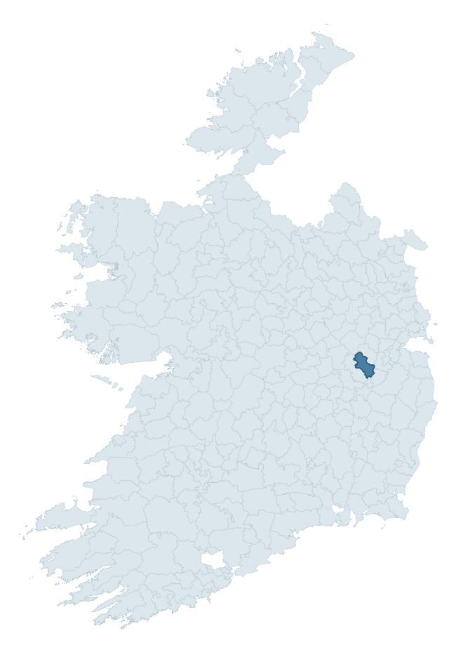
Where this barony sits in the Republic of Ireland
Geology and preservation
Bedrock geology shapes the landscape long before any settlement begins — controlling soil drainage, agricultural potential, the survival of upstanding monuments, and the preservation of buried archaeology. The figures below come from the Geological Survey Ireland 1:100,000 bedrock map.
The bedrock underlying Connell is predominantly limestone (84% of the barony by area), laid down during the Carboniferous period (88% by area, around 359 to 299 million years ago). Limestone is the most heritage-rich bedrock in Ireland. It supports fertile, well-drained soils that favoured dense Early Medieval settlement and Norman manorial agriculture, and it weathers into karst features — sinkholes, caves, swallow holes, and souterrains — that frequently carry archaeology. Where peat overlies limestone, organic preservation can be exceptional. With 7 distinct rock types mapped, the barony sits in the top third of ROI baronies for geological diversity (72nd percentile) — typically a sign of complex tectonic history or coastal mosaics of differing rock units.
Rock type composition
Largest mapped unit: Boston Hill Formation (24% of the barony)
Placename evidence
The Logainm record for Connell contains only 3 heritage-diagnostic placenames — 2 cill-names and 1 ráth-name. With this few records, the count should be read as indicative rather than as a firm characterisation of the linguistic heritage layers; a larger sample would be needed to reliably distinguish defensive, ecclesiastical, or other stratigraphic signals from chance occurrence.
Pre-Christian / Early Medieval Defensive
| Root | Count | Meaning |
|---|---|---|
| ráth- | 1 | earthen ringfort |
Early Christian Ecclesiastical
| Root | Count | Meaning |
|---|---|---|
| cill- | 2 | church (early) |
Other baronies in Kildare
About this profile
Click any section below to expand.
What is a barony?
A barony is a historic administrative unit in Ireland, broadly equivalent to an English hundred. The 280 baronies used here are from the OSi 2019 National Statutory Boundaries (generalised 20m), covering the 26 counties of the Republic of Ireland. Baronies derive from the Norman period, were formalised in the 17th century, and have not been redrawn for statistical purposes. They vary enormously in area, from compact urban baronies in Dublin to vast upland baronies in Connacht, and should not be compared by raw site count without accounting for area differences.
What counts as a site?
This profile combines three distinct heritage registers, each with its own definition of what constitutes a recordable site:
- Archaeological sites (NMS). The National Monuments Service Sites and Monuments Record (SMR) catalogues every known archaeological monument or site of archaeological interest in the Republic, from prehistoric burial mounds and ringforts to medieval churches and post-medieval defensive works. Inclusion does not require legal protection — only that the site has been identified, surveyed, and assessed as having archaeological value. A separate subset of these sites lies within a recorded protection zone, which gives them statutory protection under the National Monuments Acts.
- Listed buildings (NIAH). The National Inventory of Architectural Heritage records buildings of architectural, historical, archaeological, artistic, cultural, scientific, social, or technical interest. Each surveyed structure is appraised on a five-tier scale: International, National, Regional, Local, and Record-Only. The NIAH appraisal is informational rather than strictly statutory, but it underpins local-authority Record of Protected Structures (RPS) listings.
- Heritage placenames (Logainm). Logainm is the authoritative database of Irish placenames maintained by the Placenames Branch. This profile applies a heritage-diagnostic classifier to the Irish-language form of each townland name, flagging roots that signal defensive sites (ráth-, lios-, dún-, caiseal-, cathair-), ecclesiastical foundations (cill-, teampall-, domhnach-, mainistir-), prehistoric burial-ritual features (tuaim-, carn-, leaba-), or Norse-contact settlement (gall-). Townlands without one of these diagnostic roots are not flagged here — they may still carry historical significance, but that significance is not encoded in the name itself.
Editorial principles
The narrative sections of this profile follow several explicit principles:
- Evidential. Every claim about this barony’s heritage character is anchored in the underlying register data. Where a site count, a placename count, or a percentile rank is cited, it is computed from the source datasets at export time, not estimated.
- Comparative. Counts and metrics are reported alongside their percentile rank against the other 279 ROI baronies. A barony with 50 ringforts in absolute terms could be unusually high or unusually low depending on its size and regional context; percentile ranking removes that ambiguity.
- Transparent on limits. Where a register has known coverage gaps, survey biases, or data-quality issues that affect this barony’s figures, the profile flags them rather than presenting the numbers as definitive.
- No interpretation beyond what the data supports. The narrative does not speculate about historical events, social dynamics, or cultural meaning beyond what the recorded heritage and placename evidence directly attests.
Data caveats and limits
- NMS Sites and Monuments Record is the product of survey campaigns conducted at different intensities across different counties and decades. Some baronies have been surveyed more thoroughly than others, and absolute counts should be read in that light. Sites destroyed by development before survey are typically not represented; sites in heavily forested or upland terrain are sometimes under-recorded.
- NIAH coverage is broadly complete for the Republic of Ireland but the survey was conducted on a rolling county-by-county basis, and the most recent appraisal date varies. Buildings demolished or substantially altered after their original survey may still appear in the register; conversely, recent buildings of merit may not yet have been appraised.
- Logainm classification applies a deliberately conservative pattern-matching approach to the Irish-language townland forms. The classifier prioritises true positives over recall: a townland may carry a heritage signal that the classifier doesn’t recognise, particularly where the diagnostic root has been heavily anglicised or where the townland name draws on a less common term. The 60,000+ townland records and ~9,800 classified placenames give a substantial signal at barony scale, but individual townland names should be checked against Logainm directly for definitive interpretation.
- Period attribution. The chronological distribution reflects only those NMS sites that carry a recognised period attribution in the source data. Sites listed as “Unknown” period are excluded from the dated subset.
- Boundary changes. Some baronies have undergone minor boundary adjustments since their 19th-century definition; the OSi 2019 generalised boundaries used here are the current statutory definition and may differ slightly from historical maps in border areas.
- Bedrock geology is mapped at 1:100,000 scale, which means local variation within a barony — small pockets of different rock type, mineral veins, alluvium overlying bedrock — is generalised. The dominant-system and rocktype figures are area-weighted, so a barony reading “70% Carboniferous limestone” may still contain small but archaeologically important pockets of older or younger rock. Around 3% of GSI polygons do not match the lexicon and contribute no rocktype or system attribution.
Data sources
- National Monuments Service — Sites and Monuments Record (SMR) https://data.gov.ie/dataset/national-monuments-service-archaeological-survey-of-ireland
- National Inventory of Architectural Heritage (NIAH) https://data.gov.ie/dataset/national-inventory-of-architectural-heritage-niah-national-dataset
- Logainm — Placenames Database of Ireland https://www.logainm.ie/
- Ordnance Survey Ireland — National Statutory Barony Boundaries 2019 https://data-osi.opendata.arcgis.com/
- EURODEM — European Digital Elevation Model https://www.mapsforeurope.org/datasets/euro-dem
- ESA WorldCover https://esa-worldcover.org/en
- Geological Survey Ireland — 1:100,000 Bedrock Geology https://www.gsi.ie/en-ie/data-and-maps/Pages/Bedrock.aspx
Explore more: Search any of the 280 ROI baronies, browse by historical province, or read the methodology and data sources for the full Republic of Ireland Heritage Tool.