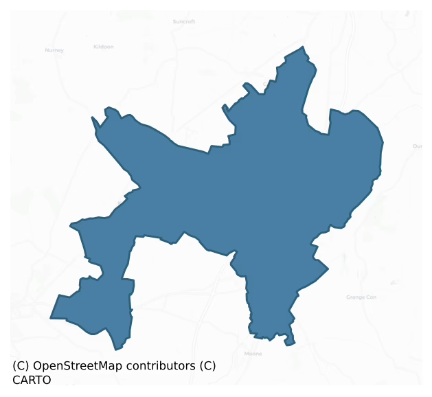
Narragh And Reban East is a barony of County Kildare, in the historical province of Leinster (Irish: An Fhorrach agus an Réabán Thoir), covering 87 km² of land. The barony records 184 NMS archaeological sites and 84 NIAH listed buildings, placing it at around the 60th percentile among 280 ROI baronies for sites per km². This means it is in the upper half of all baronies for sites per km². Dated archaeological evidence runs from the Neolithic through to the Modern, spanning 7 of 9 archaeological periods, placing the barony in the 29th percentile among 280 ROI baronies for chronological depth. This means it is in the bottom third of all baronies for chronological depth. The largest dated subset of recorded sites dates to the Iron Age.
Heritage at a glance
Percentile rankings throughout this profile compare each barony only against the other 279 Republic of Ireland baronies.
The recorded heritage of Narragh And Reban East
The National Monuments Service Sites and Monuments Record (SMR) is the statutory inventory of archaeological sites for the Republic of Ireland, maintained by the Department of Tourism, Culture, Arts, Gaeltacht, Sport and Media. Sites recorded here include earthworks, ringforts, megalithic tombs, ecclesiastical remains, and post-medieval features; not every record is legally protected, but each is registered as a monument of archaeological interest.
The National Monuments Service records 184 archaeological sites in Narragh And Reban East, putting it at the 60th percentile among 280 ROI baronies for sites per km². This means it is in the upper half of all baronies for sites per km². Protection coverage is near-universal — 175 sites (95%) fall within a recorded monument protection zone, indicating an extensively surveyed landscape. The record is dominated by defensive sites — ringforts, enclosures, hillforts, and stone forts (81 sites, 44% of the total), with ecclesiastical sites forming a substantial secondary presence (37 sites, 20%). The most diagnostically specific type is Church (10 records, 5% of the barony's NMS total) — compared to an ROI average of 4% across all baronies where this type occurs. Church is a building used for public Christian worship, of any date from c. 500 AD onwards. The broader 'Enclosure' classification — which catches unclassified ringforts and field enclosures — accounts for a further 52 records (28%) and reflects the difficulty of sub-classifying degraded earthworks from surface evidence alone. Across the barony's 87 km², this gives a recorded density of 2.12 sites per km².
Most common monument types
Hover or tap a monument type to see its definition.
| Type | Count |
|---|---|
| Enclosure a banked or ditched feature of uncertain type, used as a catch-all where the original function cannot be determined from surface evidence | 52 |
| Church a building used for public Christian worship, of any date from c. 500 AD onwards | 10 |
| Ringfort – rath an earthen ringfort enclosed by a bank and external ditch — the most common Early Medieval farmstead, broadly dated 500–1000 AD | 10 |
| Graveyard a burial area associated with a church, in use from the medieval period onwards | 9 |
| Ogham stone a stone bearing an inscription in Ogham script, used as a memorial or boundary marker between the late 4th and early 8th centuries AD | 7 |
| Burial ground an area set apart for burial that is not associated with a church, in use from the medieval period onwards | 6 |
| Moated site | 6 |
Chronological distribution
The dated archaeological record for Narragh And Reban East spans from the Neolithic through to the Modern, with activity attested across 7 of 9 archaeological periods. The record is near-continuous, with only the Post Medieval period falling inside the span without any recorded sites. Activity concentrates most heavily in the Iron Age (58 sites, 42% of dated material), with the Early Medieval forming a secondary peak (28 sites, 20%). A further 45 recorded sites (24% of the overall NMS register for the barony) carry no period attribution — appearing as 'Unknown' in the bar chart below. This typically reflects either records that pre-date the standardised period vocabulary or sites awaiting specialist dating review, rather than a genuine absence of chronological evidence.
Sample of recorded monuments
Show 25 sample monuments (of 184 total)
A representative sample of 25 recorded monuments drawn from the barony’s 184 total NMS entries. Sites within a recorded monument protection zone and rarer site types are prioritised so the list shows a meaningful cross-section rather than only the most common type. Each entry shows the official Sites and Monuments Record reference number and the description published by the National Monuments Service.
Quarry
Depicted as a quarry or pond feature on the 1838 ed. OS 6-inch map with field boundaries radiating out from hollow depression at E and W. Hollow depression now filled in shows up on as the cropmark of a filled in pit…
Depicted as a quarry or pond feature on the 1838 ed. OS 6-inch map with field boundaries radiating out from hollow depression at E and W. Hollow depression now filled in shows up on as the cropmark of a filled in pit on Digital Globe aerial photograph taken 28/06/2018. Does not appear to be the remains of an archaeological monument of pre-1700 date. The cropmark of a similar feature can be seen on Google Earth 180m to NE.
See attached image taken from Google Earth
Compiled by: Gearóid Conroy
Revised by: Caimin O'Brien based on details kindly provided by Pat Reid
Date of revised upload: 05 December 2018
House – fortified house
Shown on Noble and Keenan’s 1752 Map of County Kildare as a large house and also recorded by Taylor on his 1783 map of the county. In 1837, according to O’Conor (Herity 2002, 96 [28]) who co-compiled the OSL for County…
Shown on Noble and Keenan’s 1752 Map of County Kildare as a large house and also recorded by Taylor on his 1783 map of the county. In 1837, according to O’Conor (Herity 2002, 96 [28]) who co-compiled the OSL for County Kildare, ‘In the S.W. side of Usk townland are the ruins of a dwelling house called a Castle by the people.’ By the time the OS 25-inch map was drawn, the ‘Castle’ was recorded ‘Site of’, ie destroyed. It was possibly a fortified house rather than a tower house or castle proper. No visible surface trace survives.
Compiled by: Gearóid Conroy
Date of upload: 16 October 2013
Ceremonial enclosure
Protected by Preservation Order No. 32/1976, together with the possible stone circle – ‘The Piper’s Stones’ (KD032-026002-) – it encloses. In pasture on the summit of Brewel Hill (OD 726 ft. / c. 221m). Four…
Protected by Preservation Order No. 32/1976, together with the possible stone circle – ‘The Piper’s Stones’ (KD032-026002-) – it encloses. In pasture on the summit of Brewel Hill (OD 726 ft. / c. 221m). Four ringbarrows (KD032-022—-, KD032-023—-, KD032-024—- and KD032-025—-) lie downslope to the NE and a possible cursus (KD032-058—-) lies to the ESE.
Monument described by FitzGerald (1896-9, 158) as being ‘encircled by a wide double entrenchment (now much levelled, and not marked on six inch Ordnance Survey map) is a group of four large boulders, of which two are granite, another of white quartz, and the fourth of red “pudding-stone”; they are known as the “Piper’s Stones” (KD032-026002-). In 1931 Walshe (1931, 126-7) recorded the monument as consisting of ‘a wide double entrenchment now much levelled, is a group of four large boulders (KD032-026002-) of which two are granite, another is of white quartz while the fourth is of red “pudding stone”. Locally they are known as the “Piper’s Stones”, the quartz one being called the “Piper’s Chair”, from the resemblance its form bears to that of a chair. Of the two granite stones, the smaller lies against the adjacent fence and appears as if it had been broken at some time. The large granite stone, the white quartz and the red pudding stone lie close to each other, but the smaller granite stone is some paces from its larger companion on the one side and the pudding stone on the other. The dimensions of these s…
Stone circle
Protected by Preservation Order No. 32/1976, together with the surrounding enclosures (KD032-026001-), near the centre of which the surviving stones stand. An arc of four unworked boulders may be the surviving S portion…
Protected by Preservation Order No. 32/1976, together with the surrounding enclosures (KD032-026001-), near the centre of which the surviving stones stand. An arc of four unworked boulders may be the surviving S portion (ESE, SSE, SSW and WNW) of a stone circle (est. original diam. c. 16m). A modern field bank and drain bisect the putative circle E-W and a belt of coniferous trees has been planted to the S of this boundary, across the site. Two of the boulders are granite, (1.2m E-W; 1m N-S; H 0.9m and 1.9m N-S; 1.3m E-W; H 0.95m), one is a red conglomerate ‘puddingstone’ (2.2m E-W; 1.5m N-S; H 1.3m) and one is of white quartz (1.9m N-S; 1.8m E-W; H 0.89m) and is known locally as the ‘Piper’s Chair’. Three of the stones appear earthfast, but the one at SW does not appear to be so. A curving arc of low bank (Wth. 6.4m; H 0.4m) is traceable ESE-S-WSW running some 5m outside the arc of stones. Its line, however, is not concentric with the main enclosing bank outside, suggesting it may be associated chronologically with the stone circle, while the large outer enclosure may be a later feature of the monument. In 1975 Ó Nualláin (1975, 112) recorded the monument as consisting of ‘4 large boulders, one of quartz, lying within a hilltop earthwork. (O Riordain 1953, 89, called it “Kilgowan2). None of the stones are set in the ground and there is no evidence that they formed part of a circle’. (Walshe 1931, 126-7; Killanin and Duignan 1967, 266)
Compiled by: Gearóid Conroy…
Tomb – chest tomb
In a graveyard (KD032-037004-) which also contains a ruined church (KD032-037001-) and a cross (KD032-037003-). According to Fitzgerald (1912-14b, 1913, 83), ‘All the stone fragments … were discovered by me deeply sunk…
In a graveyard (KD032-037004-) which also contains a ruined church (KD032-037001-) and a cross (KD032-037003-). According to Fitzgerald (1912-14b, 1913, 83), ‘All the stone fragments … were discovered by me deeply sunk in the ground in different parts of the churchyard in March 1898 and April 1900. I caused them to be dug up with local assistance in order to take photographs of and make rubbings from them.’ The fragments comprise two end pieces (L c. 0.64m; Wth c. 0.54m), one bearing the Fitzgerald family arms, the other the Crucifixion, the Blessed Virgin Mary and St. John, together with three fragments from the front of the tomb, divided into plain oblong niches, each containing a male or female figure, the former clad in armour. Fitzgerald (op. cit) says it was originally a three-sided tomb which stood against a wall above the vault in the graveyard.
Compiled by: Gearóid Conroy
Date of upload: 30 October 2013
House – 17th century
At the SW foot of a low hill upon which the late 18th-century Calverstown House stands. A poorly preserved roofless, three storied, rectangular structure (c. 21.5m NNE-SSW; c. 14m ESE-WNW) built of rubble masonry (av.…
At the SW foot of a low hill upon which the late 18th-century Calverstown House stands. A poorly preserved roofless, three storied, rectangular structure (c. 21.5m NNE-SSW; c. 14m ESE-WNW) built of rubble masonry (av. wall T 0.9m) has a Jacobean-style chimney projecting from each gable, with a third similar chimney internally, just N of centre. The ESE façade is badly robbed out leaving no trace of the doorway or any windows. An earlier tower house (KD032-047001-) is incorporated in the N corner of the building.
Compiled by: Gearóid Conroy
Date of upload: 12 November 2013
Castle – motte
On a hilltop with panoramic views over mixed pasture and tillage. While, traditionally, the site of a battle between the Leinstermen and the Munstermen in the second century AD, there are no documentary references to…
On a hilltop with panoramic views over mixed pasture and tillage. While, traditionally, the site of a battle between the Leinstermen and the Munstermen in the second century AD, there are no documentary references to Ardscull before the coming of the Normans, after which it’s likely that Ardscull became a borough (KD035-010002-) of some importance (Bradley et al. 1986 Vol. I, 23-4). Further, there are no specific medieval references to this imposing earthwork; the first clear reference not occurring until 1654 when the Book of General Orders noted a request from the inhabitants of Co. Kildare for the State to contribute £30 “towards the finishing of a Fort that they have built at the Mote of Ardscull (op. cit. 27). A substantial tree-clad, oval-shaped, earthen mound, the upper surface of which, enclosed by a bank, has been extensively dug out (possibly as a result of the construction of the 17th-century ‘Fort’) and the base of which is girdled by a narrow shallow fosse (base Wth 2m; D 1m) – infilled between ENE and ESE – and a denuded outer bank (H 0.5m at N – 2.3m at S), outside of which a later lane and road run E-S-W (base diams. 122m E-W; 98m N-S; surface diams. base of bank to base of bank 33m E-W; 33m N-S; diams. crest of bank to crest of bank 62m E-W; 46.5m N-S; H above outer ground level to top of bank at N c.8m; at E c.11m; at S c.9m; at W c.10m). At W, a gap (Wth 2m) in the outer bank leads to a ramped causeway (base Wth 8.5m; surface Wth 1.9m) which crosses the…
Children's burial ground
In level pasture just outside, to NW of, a very large ecclesiastical enclosure (KD035-012002-) surrounding Ardscull graveyard (KD035-012004-). In an annotated portion of the OS 6-inch map accompanying his article on…
In level pasture just outside, to NW of, a very large ecclesiastical enclosure (KD035-012002-) surrounding Ardscull graveyard (KD035-012004-). In an annotated portion of the OS 6-inch map accompanying his article on Ardscull motte (KD035-010001-), OMURETHI (1891-5, 197), indicates a small square area in the corner of a roadside field which he calls, 'The Dullagh (burial place of unbaptised children)’. There are no visible surface trace of grave-markers.
Compiled by: Gearóid Conroy
Date of upload: 28 November 2013
Earthwork
Square-shaped earthwork visible today as a leveled earthwork which was excavated in 1983 and the results indicated that it was an earthwork associated with post-medieval land reclamation. It have previously been…
Square-shaped earthwork visible today as a leveled earthwork which was excavated in 1983 and the results indicated that it was an earthwork associated with post-medieval land reclamation. It have previously been speculated that this earthwork may be the remains of a bawn or enclosure around a castle site (KD036-007001-). In 1900 FitzGerald (1899-1902, 151-2) recorded the following ; ‘Between the cemetery (KD032-044—-) and Knockbauniah there are some indications of a square structure, in the centre of which are the remains of a circular building (KD036-007002-); there is no appearance of stones above the surface. A slight grassy elevation marks most distinctly the ground-plan of the building’. FitzGerald also recorded a local tradition that ‘these earthworks are the site of a castle which was thrown down some years ago for the sake of the stones; but according to the Ordnance Survey maps, the castle formerly stood near Colbinstown railway station’ (ibid.). This square-shaped feature is clearly visible on aerial photographs taken between 1963 and 1970 (CUCAP AIC088:1963; BDH045: 1970).
In 1983 an archaeological cutting measuring 42m by 22m was opened up in this area in advance of the Cork-Dublin natural gas pipeline (O’Donnell 1983, 277-82). The cutting was located to the SE of Killeencormac graveyard (KD032-044—-) in the area where the earthwork was visible on aerial photographs. The excavation uncovered the remains of three large drains of post-medieval date wh…
Ecclesiastical site
A seventh century foundation of St Moling, Bishop of Ferns. There is no visible trace of any structure of this date. According to an inquisition held at Naas (1541) monastery at time of suppression consisted of 'site…
A seventh century foundation of St Moling, Bishop of Ferns. There is no visible trace of any structure of this date. According to an inquisition held at Naas (1541) monastery at time of suppression consisted of 'site and precincts of the abbey … of the walls of a church, a belfrey, a dormitory, a courtyard (aula), and three rooms within the precincts there' (JKAS 1896, 413-25). Fitzgerald also quotes two accounts of a seige of Timolin (1643) which mention a nunnery (KD036-025002-), a church and belfry (presumably associated with the monastery?) and a castle (KD036-026—-), of which there are no visible surface traces. The Aroasian convent was probably founded c. 1200 by FitzRichard (see effigy (KD036-025004-)). Fitzgerald also describes two possible souterrains; one (KD036-025005-) discovered below the road to N of the present cemetery, and the second (KD036-025006-) close to E end of present church.
Date of upload: 5 September 2016
Religious house – Augustinian, of Arrouaise nuns
A seventh century monastic foundation (KD036-025001-) of St Moling, Bishop of Ferns. There is no visible trace of any structure of this date. According to an inquisition held at Naas (1541) monastery at time of…
A seventh century monastic foundation (KD036-025001-) of St Moling, Bishop of Ferns. There is no visible trace of any structure of this date. According to an inquisition held at Naas (1541) monastery at time of suppression consisted of 'site and precincts of the abbey … of the walls of a church, a belfry, a dormitory, a courtyard (aula), and three rooms within the precincts there' (JKAS 1896, 413-25). Fitzgerald also quotes two accounts of a siege of Timolin (1643) which mention a nunnery (KD036-025002-), a church and belfry (presumably associated with the monastery?) and a castle (KD036-026—-), of which there are no visible surface traces. The Aroasian convent was probably founded c. 1200 by FitzRichard (see effigy (KD036-025004-)). Fitzgerald also describes two possible souterrains; one (KD036-025005-) discovered below the road to N of the present cemetery, and the second (KD036-025006-) close to E end of present church. (Gwynn and Hadcock 1970, 325)
Date of upload: 5 September 2016
Standing stone
Fitzgerald (JKAS 1906, 464-465) records that a standing stone (similar to the Simmonstown stone (KD038-005—-)) formerly stood near the village of Timolin, but that it had been removed, 'many years ago' . A possible…
Fitzgerald (JKAS 1906, 464-465) records that a standing stone (similar to the Simmonstown stone (KD038-005—-)) formerly stood near the village of Timolin, but that it had been removed, 'many years ago' . A possible cist (KD036-027002-) containing bones was, 'discovered near its base'.
Date of upload: 5 September 2016
Armorial plaque
A small limestone slab (dims 0.4m x 0.4m) bearing the coat of arms of the Archbold family, and the inscription 'BEATUS QUI TELLIGIT SVP EGENVM ET PAVPERE 1630'. It set into a W facing wall of a house in Timolin. (JKAS…
A small limestone slab (dims 0.4m x 0.4m) bearing the coat of arms of the Archbold family, and the inscription 'BEATUS QUI TELLIGIT SVP EGENVM ET PAVPERE 1630'. It set into a W facing wall of a house in Timolin. (JKAS 1893, 205; JKAS 1899, 424-5).
Date of upload: 5 September 2016
Architectural fragment
Mounted high on the W gable of a 19th-century church, standing in a graveyard (KD032-041001-) which also contained an earlier, medieval church (KD032-041—-). There is also a medieval font (KD032-041002-) in the…
Mounted high on the W gable of a 19th-century church, standing in a graveyard (KD032-041001-) which also contained an earlier, medieval church (KD032-041—-). There is also a medieval font (KD032-041002-) in the graveyard. The gargoyle is a well-preserved and well-executed representation of a devil’s head.
Compiled by: Gearóid Conroy
Date of upload: 31 October 2013
Sheela-na-gig
This sheela-na-gig formerly was located to the right hand side of the doorway of the tower house (KD032-019—-). The E section of the tower house collapsed in a storm prior to 2004. The carving was rescued from the…
This sheela-na-gig formerly was located to the right hand side of the doorway of the tower house (KD032-019—-). The E section of the tower house collapsed in a storm prior to 2004. The carving was rescued from the rubble and set in a niche in the interior of the N wall.
Compiled by: Caimin O'Brien
Updated by: Paul Walsh
Date of upload: 5 December 2014
Ringfort – unclassified
Aerial photograph (GB89.AF.31) shows cropmark of a circular enclosure (approx. diam. 30m) defined by a fosse with entrance gap at E and second gap at SSW. First recorded as a positive cropmark in July 1989 by Dr.…
Aerial photograph (GB89.AF.31) shows cropmark of a circular enclosure (approx. diam. 30m) defined by a fosse with entrance gap at E and second gap at SSW. First recorded as a positive cropmark in July 1989 by Dr. Gillian Barrett.
See attached images taken from Google Earth aerial photographs taken 28/06/2018
Compiled by: Gillian Barrett
Revised by: Caimin O'Brien
Date of revised upload: 12 December 2011
Road – road/trackway
Aerial photograph (GB89.AI.11) shows the cropmark of four linear fosses defining a co-axial field system (KD035-050001-), incorporating a possible trackway(KD035-050002-) associated with an enclosure…
Aerial photograph (GB89.AI.11) shows the cropmark of four linear fosses defining a co-axial field system (KD035-050001-), incorporating a possible trackway(KD035-050002-) associated with an enclosure (KD035-050—-).
Compiled by: Gillian Barrett
Date of upload: 12 December 2011
Cursus
Visible on a Google Earth image (21-04-2011) as the cropmarks of two parallel fosses defining a long linear area (pers. comm. I. Kenny, 21-08-2013). On freshly re-seeded ground, level at the SE end but rising gently…
Visible on a Google Earth image (21-04-2011) as the cropmarks of two parallel fosses defining a long linear area (pers. comm. I. Kenny, 21-08-2013). On freshly re-seeded ground, level at the SE end but rising gently towards the NW. A shallow linear hollow (D 0.3m; Wth 10m) while not particularly well-defined, is nonetheless traceable (est. L c. 130m NW-SE), and terminates in a curved end at NW. From the NW, looking SE along its line, the cursus appears to line up with Keadeen Mountain and Brusselstown Ring (WI027-018—-) to the SE; notably there is a cursus monument on the slopes of Keadeen (WI027-089—-).
Compiled by: Chris Corlett
Date of upload: 18 October 2013
Cross-slab
One of two possible cross slabs (KD032-044010- and KD032-044015-) recorded by Fitzgerald (1899-1902(f), 161 (C)) in ‘Killeen Cormac’ burial ground (KD032-044—-), and described as a ‘green-flag … standing 4ft [c.…
One of two possible cross slabs (KD032-044010- and KD032-044015-) recorded by Fitzgerald (1899-1902(f), 161 (C)) in ‘Killeen Cormac’ burial ground (KD032-044—-), and described as a ‘green-flag … standing 4ft [c. 1.22m] above the ground, 2ft [c. 0.61m] in breadth and about 5 in. [c. 0.13m] in thickness [with] on it a plain cross 23 in. [c. 0.59m] long and 18 in. [c. 0.46m] across the arms. … the workmanship very rude’ (op. cit 159-60). The slab was not located.
Compiled by: Gearóid Conroy
Date of upload: 21 November 2013
Road – hollow-way
Cropmark of parallel linear earthworks (approx. L. 500m; Wth 11m) running E-W visible on Google Earth aerial photograph taken 28/06/2018. Faint outline of cropmarks visible on Digital Globe aerial photograph. The…
Cropmark of parallel linear earthworks (approx. L. 500m; Wth 11m) running E-W visible on Google Earth aerial photograph taken 28/06/2018. Faint outline of cropmarks visible on Digital Globe aerial photograph. The linear earthworks may represent the remains of a medieval roadway running towards Ardscull Moat (KD035-010001-) located at E end of linear earthworks. Cropmark of field system to N of roadway and moated site (KD035-121—-) in N quadrant of field.
See attached image taken from Google Earth
Compiled by: Caimin O'Brien based on details kindly provided by Chris Corlett
Date of upload: 27 November 2018
Ring-ditch
Cropmark of circular-shaped ring ditch (approx. diam. 6m) visible on Google Earth aerial imagery taken 28/06/2018.
See attached image taken from Google Earth.
Compiled by: Caimin O'Brien based on details…
Cropmark of circular-shaped ring ditch (approx. diam. 6m) visible on Google Earth aerial imagery taken 28/06/2018.
See attached image taken from Google Earth.
Compiled by: Caimin O'Brien based on details provided by Seán Sourke
Date of upload: 20 April 2021
Ritual site – holy well
In a small clearing in a coniferous plantation on a moderately steep E-facing slope, c. 175m SE of a medieval church (KD032-005—-) and graveyard (KD032-005001-). While its existence is mentioned by O’Conor (Herity…
In a small clearing in a coniferous plantation on a moderately steep E-facing slope, c. 175m SE of a medieval church (KD032-005—-) and graveyard (KD032-005001-). While its existence is mentioned by O’Conor (Herity 2002, 96 [30]) who co-compiled the OSL for County Kildare, nothing else is recorded about the well. A wooden post and plastic trellis fence encloses an oval well (2.4m NW-SE; 2.1m NE-SW; D 0.9m) which is retained by a mortared stone wall (T 0.6m) which doesn’t rise above ground level. A circular concrete cistern and feed pipe abuts the well at NE and a modern cross slab (H 0.6m; Wth 0.45m; T 0.05m) is erected on its NE edge. (Jackson 1979-80, 155)
Compiled by: Gearóid Conroy
Date of upload: 14 October 2013
Ritual site – holy well
Near the S end of a narrow N-S valley or glen, some 290m SE of Glassely church (KD-32-037001-) and graveyard (KD-32-037004-). At the foot of a low rock outcrop, large slabs have been cemented together to form a roughly…
Near the S end of a narrow N-S valley or glen, some 290m SE of Glassely church (KD-32-037001-) and graveyard (KD-32-037004-). At the foot of a low rock outcrop, large slabs have been cemented together to form a roughly rectangular surround to a natural spring (2m E-W; 0.8m N-S; D of water 0.5m). Two mature ash trees stand to the NE and ESE and beside the latter a low thorn bush has a metal hook in it from which three mugs hang. The surrounding area has been landscaped with plants and shrubs, and a fine statue of St. Patrick stands nearby. (Fitzgerald 1912-14b, 99 – for a photo of well in the early 20th-century; Jackson 1979-80, 155-6)
Compiled by: Gearóid Conroy
Date of upload: 31 October 2013
Mound
Small mound (diam. c. 4m; H. c. 1m) on the top of a hill. In good condition: it may be a trig base, but is shown on 1837 OS 6-inch map.
Date of upload: 5 September 2016
Enclosure
Shown on the OS 25-inch map as a D-shaped area (est. diam. c. 45m E-W) with a straight W side (est. L c. 44m N-S) enclosed by a broad bank (est. Wth c. 8m) and a wide outer fosse (est. Wth c. 7m). The monument is…
Shown on the OS 25-inch map as a D-shaped area (est. diam. c. 45m E-W) with a straight W side (est. L c. 44m N-S) enclosed by a broad bank (est. Wth c. 8m) and a wide outer fosse (est. Wth c. 7m). The monument is annotated ‘Molly Dillon’s Rath’ on a copy of the OS 6-inch map by Fitzgerald (1912-14c, 263). Upon inspection in 1972, the monument was found to have been levelled, a slight depression marking where it once stood (SMR file). The monument is visible as a cropmark on one of Dr. Gillian Barrett’s aerial photos (GB89.AF.36) which also shows the cropmark of a possible associated field system (KD032-042001-).
Compiled by: Gearóid Conroy
Date of upload: 07 November 2013
Listed buildings
The National Inventory of Architectural Heritage (NIAH) is a state survey appraising buildings of architectural, historical, archaeological, artistic, cultural, scientific, social, or technical interest. Each surveyed structure receives a rating from International (the highest, for buildings of European importance) through National, Regional, Local, and Record-Only.
The NIAH records 84 listed buildings in Narragh And Reban East (44th percentile across ROI baronies). All recorded buildings carry Regional or lower grading; the barony does not contain any structures appraised as being of National or International architectural importance. Construction dates concentrate most heavily in the Victorian (1830-1900) period. The most-recorded building type is house (33 examples, 39% of the listed stock).
Terrain and environment
Mean elevation across the barony is 108m — the 65th percentile among 280 ROI baronies for elevation. This means it is in the upper half of all baronies for elevation. Elevation matters for heritage because higher-altitude baronies typically favour defensive monuments — ringforts and hilltop forts placed on prominent ground — while lowland baronies are more likely to carry the dense settlement and church networks of intensive agricultural landscapes. A maximum elevation of 223m gives the barony meaningful vertical relief. Mean slope is 2.9° — the 36th percentile among 280 ROI baronies for slope. This means it is in the lower half of all baronies for slope. Slope is a key control on both land use and archaeological preservation: steep ground resists ploughing and tends to preserve earthworks intact, while gentle slopes favour intensive cultivation that damages or destroys surface archaeology over time. The Topographic Wetness Index averages 11.2, the 64th percentile among 280 ROI baronies for wetness. This means it is in the upper half of all baronies for wetness. Drainage matters for heritage because poorly-drained ground preserves organic archaeology (wooden trackways, leather, textiles, and on rare occasions human remains) far better than free-draining soil; well-drained ground favours arable use but destroys organic material rapidly. The land-cover mosaic combines improved grassland (58%), arable farmland (32%), and woodland (9%), giving a mixed agricultural and semi-natural landscape.
Terrain measurements
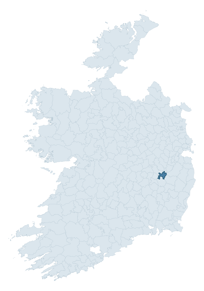
Where this barony sits in the Republic of Ireland
Geology and preservation
Bedrock geology shapes the landscape long before any settlement begins — controlling soil drainage, agricultural potential, the survival of upstanding monuments, and the preservation of buried archaeology. The figures below come from the Geological Survey Ireland 1:100,000 bedrock map.
The bedrock underlying Narragh And Reban East is predominantly calcareous greywacke (60% of the barony by area), laid down during the Silurian period (67% by area, around 444 to 419 million years ago). A substantial secondary geology of limestone (30%) adds further variety to the underlying landscape. The single largest mapped unit is the Carrighill Formation (60% of the barony's bedrock).
Rock type composition
Largest mapped unit: Carrighill Formation (60% of the barony)
Placename evidence
The Logainm record for Narragh And Reban East contains only 1 heritage-diagnostic placename — 1 ráth-name. With this few records, the count should be read as indicative rather than as a firm characterisation of the linguistic heritage layers; a larger sample would be needed to reliably distinguish defensive, ecclesiastical, or other stratigraphic signals from chance occurrence.
Pre-Christian / Early Medieval Defensive
| Root | Count | Meaning |
|---|---|---|
| ráth- | 1 | earthen ringfort |
Other baronies in Kildare
About this profile
Click any section below to expand.
What is a barony?
A barony is a historic administrative unit in Ireland, broadly equivalent to an English hundred. The 280 baronies used here are from the OSi 2019 National Statutory Boundaries (generalised 20m), covering the 26 counties of the Republic of Ireland. Baronies derive from the Norman period, were formalised in the 17th century, and have not been redrawn for statistical purposes. They vary enormously in area, from compact urban baronies in Dublin to vast upland baronies in Connacht, and should not be compared by raw site count without accounting for area differences.
What counts as a site?
This profile combines three distinct heritage registers, each with its own definition of what constitutes a recordable site:
- Archaeological sites (NMS). The National Monuments Service Sites and Monuments Record (SMR) catalogues every known archaeological monument or site of archaeological interest in the Republic, from prehistoric burial mounds and ringforts to medieval churches and post-medieval defensive works. Inclusion does not require legal protection — only that the site has been identified, surveyed, and assessed as having archaeological value. A separate subset of these sites lies within a recorded protection zone, which gives them statutory protection under the National Monuments Acts.
- Listed buildings (NIAH). The National Inventory of Architectural Heritage records buildings of architectural, historical, archaeological, artistic, cultural, scientific, social, or technical interest. Each surveyed structure is appraised on a five-tier scale: International, National, Regional, Local, and Record-Only. The NIAH appraisal is informational rather than strictly statutory, but it underpins local-authority Record of Protected Structures (RPS) listings.
- Heritage placenames (Logainm). Logainm is the authoritative database of Irish placenames maintained by the Placenames Branch. This profile applies a heritage-diagnostic classifier to the Irish-language form of each townland name, flagging roots that signal defensive sites (ráth-, lios-, dún-, caiseal-, cathair-), ecclesiastical foundations (cill-, teampall-, domhnach-, mainistir-), prehistoric burial-ritual features (tuaim-, carn-, leaba-), or Norse-contact settlement (gall-). Townlands without one of these diagnostic roots are not flagged here — they may still carry historical significance, but that significance is not encoded in the name itself.
Editorial principles
The narrative sections of this profile follow several explicit principles:
- Evidential. Every claim about this barony’s heritage character is anchored in the underlying register data. Where a site count, a placename count, or a percentile rank is cited, it is computed from the source datasets at export time, not estimated.
- Comparative. Counts and metrics are reported alongside their percentile rank against the other 279 ROI baronies. A barony with 50 ringforts in absolute terms could be unusually high or unusually low depending on its size and regional context; percentile ranking removes that ambiguity.
- Transparent on limits. Where a register has known coverage gaps, survey biases, or data-quality issues that affect this barony’s figures, the profile flags them rather than presenting the numbers as definitive.
- No interpretation beyond what the data supports. The narrative does not speculate about historical events, social dynamics, or cultural meaning beyond what the recorded heritage and placename evidence directly attests.
Data caveats and limits
- NMS Sites and Monuments Record is the product of survey campaigns conducted at different intensities across different counties and decades. Some baronies have been surveyed more thoroughly than others, and absolute counts should be read in that light. Sites destroyed by development before survey are typically not represented; sites in heavily forested or upland terrain are sometimes under-recorded.
- NIAH coverage is broadly complete for the Republic of Ireland but the survey was conducted on a rolling county-by-county basis, and the most recent appraisal date varies. Buildings demolished or substantially altered after their original survey may still appear in the register; conversely, recent buildings of merit may not yet have been appraised.
- Logainm classification applies a deliberately conservative pattern-matching approach to the Irish-language townland forms. The classifier prioritises true positives over recall: a townland may carry a heritage signal that the classifier doesn’t recognise, particularly where the diagnostic root has been heavily anglicised or where the townland name draws on a less common term. The 60,000+ townland records and ~9,800 classified placenames give a substantial signal at barony scale, but individual townland names should be checked against Logainm directly for definitive interpretation.
- Period attribution. The chronological distribution reflects only those NMS sites that carry a recognised period attribution in the source data. Sites listed as “Unknown” period are excluded from the dated subset.
- Boundary changes. Some baronies have undergone minor boundary adjustments since their 19th-century definition; the OSi 2019 generalised boundaries used here are the current statutory definition and may differ slightly from historical maps in border areas.
- Bedrock geology is mapped at 1:100,000 scale, which means local variation within a barony — small pockets of different rock type, mineral veins, alluvium overlying bedrock — is generalised. The dominant-system and rocktype figures are area-weighted, so a barony reading “70% Carboniferous limestone” may still contain small but archaeologically important pockets of older or younger rock. Around 3% of GSI polygons do not match the lexicon and contribute no rocktype or system attribution.
Data sources
- National Monuments Service — Sites and Monuments Record (SMR) https://data.gov.ie/dataset/national-monuments-service-archaeological-survey-of-ireland
- National Inventory of Architectural Heritage (NIAH) https://data.gov.ie/dataset/national-inventory-of-architectural-heritage-niah-national-dataset
- Logainm — Placenames Database of Ireland https://www.logainm.ie/
- Ordnance Survey Ireland — National Statutory Barony Boundaries 2019 https://data-osi.opendata.arcgis.com/
- EURODEM — European Digital Elevation Model https://www.mapsforeurope.org/datasets/euro-dem
- ESA WorldCover https://esa-worldcover.org/en
- Geological Survey Ireland — 1:100,000 Bedrock Geology https://www.gsi.ie/en-ie/data-and-maps/Pages/Bedrock.aspx
Explore more: Search any of the 280 ROI baronies, browse by historical province, or read the methodology and data sources for the full Republic of Ireland Heritage Tool.