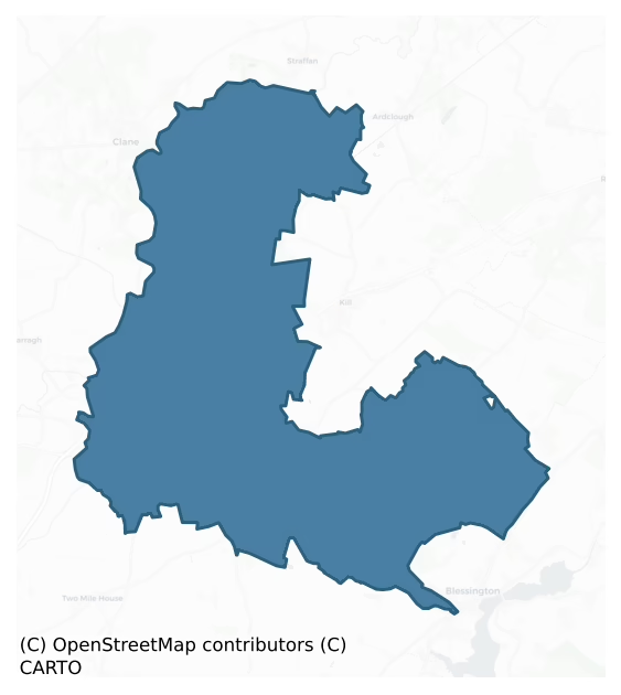
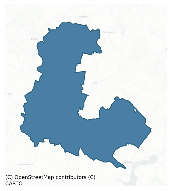
Naas North is a barony of County Kildare, in the historical province of Leinster (Irish: An Nás Thuaidh), covering 103 km² of land. The barony records 209 NMS archaeological sites and 202 NIAH listed buildings, placing it at around the 56th percentile among 280 ROI baronies for sites per km². This means it is in the upper half of all baronies for sites per km². Dated archaeological evidence runs from the Early Bronze Age through to the Modern, spanning 6 of 9 archaeological periods, placing the barony in the 14th percentile among 280 ROI baronies for chronological depth. This means it is in the bottom fifth of all baronies for chronological depth. The largest dated subset of recorded sites dates to the Iron Age.
Heritage at a glance
Percentile rankings throughout this profile compare each barony only against the other 279 Republic of Ireland baronies.
The recorded heritage of Naas North
The National Monuments Service Sites and Monuments Record (SMR) is the statutory inventory of archaeological sites for the Republic of Ireland, maintained by the Department of Tourism, Culture, Arts, Gaeltacht, Sport and Media. Sites recorded here include earthworks, ringforts, megalithic tombs, ecclesiastical remains, and post-medieval features; not every record is legally protected, but each is registered as a monument of archaeological interest.
The National Monuments Service records 209 archaeological sites in Naas North, putting it at the 56th percentile among 280 ROI baronies for sites per km². This means it is in the upper half of all baronies for sites per km². Protection coverage is near-universal — 198 sites (95%) fall within a recorded monument protection zone, indicating an extensively surveyed landscape. The record is dominated by defensive sites — ringforts, enclosures, hillforts, and stone forts (54 sites, 26% of the total), with ecclesiastical sites forming a substantial secondary presence (36 sites, 17%). The most diagnostically specific type is Ring-ditch (14 records, 7% of the barony's NMS total) — compared to an ROI average of 6% across all baronies where this type occurs. Ring-ditch is a circular ditch under 20m across, often the ploughed-out remains of a barrow, ring-barrow or roundhouse. The broader 'Enclosure' classification — which catches unclassified ringforts and field enclosures — accounts for a further 26 records (12%) and reflects the difficulty of sub-classifying degraded earthworks from surface evidence alone. Across the barony's 103 km², this gives a recorded density of 2.02 sites per km².
Most common monument types
Hover or tap a monument type to see its definition.
| Type | Count |
|---|---|
| Enclosure a banked or ditched feature of uncertain type, used as a catch-all where the original function cannot be determined from surface evidence | 26 |
| Ring-ditch a circular ditch under 20m across, often the ploughed-out remains of a barrow, ring-barrow or roundhouse | 14 |
| Graveyard a burial area associated with a church, in use from the medieval period onwards | 13 |
| Fulacht fia a horseshoe-shaped Bronze Age burnt mound built around a sunken trough beside a water source, traditionally interpreted as a cooking site | 11 |
| Church a building used for public Christian worship, of any date from c. 500 AD onwards | 10 |
| Castle – tower house a fortified residential tower of four or five storeys, mostly built by lords in the 15th and 16th centuries and often within a defended bawn | 7 |
Chronological distribution
The dated archaeological record for Naas North spans from the Early Bronze Age through to the Modern, with activity attested across 6 of 9 archaeological periods. This is the 14th percentile across ROI baronies — a relatively narrow chronological band, with much of Irish prehistory not represented in the dated record. The record is near-continuous, with only the Post Medieval period falling inside the span without any recorded sites. Activity concentrates most heavily in the Iron Age (39 sites, 29% of dated material), with the Medieval forming a secondary peak (32 sites, 24%). A further 74 recorded sites (35% of the overall NMS register for the barony) carry no period attribution — appearing as 'Unknown' in the bar chart below. This typically reflects either records that pre-date the standardised period vocabulary or sites awaiting specialist dating review, rather than a genuine absence of chronological evidence.
Sample of recorded monuments
Show 25 sample monuments (of 209 total)
A representative sample of 25 recorded monuments drawn from the barony’s 209 total NMS entries. Sites within a recorded monument protection zone and rarer site types are prioritised so the list shows a meaningful cross-section rather than only the most common type. Each entry shows the official Sites and Monuments Record reference number and the description published by the National Monuments Service.
Moated site
In level, improved pasture immediately NE of a small, NW-flowing stream. A rectangular area (int. dims. L 53m NE-SW; Wth 46m) is defined by a low, inner, earthen bank (Wth 1m; int H 0.3m; ext H 1.5m), and a broad, outer…
In level, improved pasture immediately NE of a small, NW-flowing stream. A rectangular area (int. dims. L 53m NE-SW; Wth 46m) is defined by a low, inner, earthen bank (Wth 1m; int H 0.3m; ext H 1.5m), and a broad, outer fosse (Wth 7.6m; D 1.5m) which has been recut as a field drain along the N and W sides. The drain extends S along the line of a possible leat to join the nearby stream. A second, outer bank along the S appears to be a modern field boundary. Visible with an overgrown bank and fosse on a 2005 aerial photograph (OSi Orthophoto). (Killanin and Duignan 1967, 60)
Compiled by: Gearóid Conroy
Date of upload: 10 June 2011
This monument is subject to a preservation order made under the National Monuments Acts 1930 to 2014 (PO no. 14/1956).
Ecclesiastical enclosure
Shown on the 1st. ed. (1838) of the OS 6-inch map as a long, curving arc of field boundary (est. L c. 200m N-E-SE) which at SE forms the SE limits of a graveyard (KD014-022005-), and contains a possible holy well…
Shown on the 1st. ed. (1838) of the OS 6-inch map as a long, curving arc of field boundary (est. L c. 200m N-E-SE) which at SE forms the SE limits of a graveyard (KD014-022005-), and contains a possible holy well (KD014-022004-), a medieval fortified church (KD014-022001-) and a baptismal font (KD014-022007-). Visible on a 1971 aerial photograph (CUCAP BGM 76) which also shows a possible associated field system (KD014-022003-) immediately to the NW. Just off the crest at the E end of a low, E-W pasture ridge. The boundary has been removed and even the graveyard which it enclosed has shrunk to the W. Archaeological test-trenching (Licence No. 00E0708: www.archaeology.ie) and subsequent monitoring of topsoil stripping (Licence No. 00E0708 ext.: www.archaeology.ie) associated with a private development 50-80m away, in the adjoining field to the E, revealed nothing of archaeological significance.
Compiled by: Gearóid Conroy
Date of upload: 10 June 2011
Field system
Visible on a 1971 aerial photograph (CUCAP BGN 76) as a series of low earthworks with curving banks immediately outside, to the NW of, a possible ecclesiastical enclosure (KD014-022002-) which contains a possible holy…
Visible on a 1971 aerial photograph (CUCAP BGN 76) as a series of low earthworks with curving banks immediately outside, to the NW of, a possible ecclesiastical enclosure (KD014-022002-) which contains a possible holy well (KD014-022004-), a graveyard (KD014-022005-), a medieval fortified church (KD014-022001-) and a baptismal font (KD014-022007-). Just off the crest at the E end of a low, E-W pasture ridge. Land improvement has resulted in local field boundaries being removed with some replaced by wire-and-post fencing. No visible surface traces were noted.
Compiled by: Gearóid Conroy
Date of upload: 10 June 2011
Ringfort – unclassified
The monument is shown on the 1st ed. (1838) of the OS 6-inch map as circular area (est. max. diam. c. 70m) defined by a bank. (Also shown, as a dotted line, is a very large, outer enclosing feature (est. max. diam. c.…
The monument is shown on the 1st ed. (1838) of the OS 6-inch map as circular area (est. max. diam. c. 70m) defined by a bank. (Also shown, as a dotted line, is a very large, outer enclosing feature (est. max. diam. c. 400m) concentric with the monument from E-N, which is of uncertain significance). On level, improved pasture. No visible surface trace of either feature survives, and a modern house with extensive outbuildings occupies part of the site.
Compiled by: Gearóid Conroy
Date of upload: 10 June 2011
Cross – Wayside cross
The original, roadside location of the cross, as shown on the latest ed. (1939) of the OS 6-inch map. This cross, together with a second, nearby, roadside-cross (KD014-042002-), was subsequently moved to Sherlockstown…
The original, roadside location of the cross, as shown on the latest ed. (1939) of the OS 6-inch map. This cross, together with a second, nearby, roadside-cross (KD014-042002-), was subsequently moved to Sherlockstown Graveyard (KD014-043003-), where its present location is designated KD014-042001-.
Compiled by: Gearóid Conroy
Date of upload: 10 June 2011
Earthwork
Recorded on the 1st ed. (1838) of the OS 6-inch map as a large, oval area (est. diams. c. 60m ESE-WNW; c. 50M NNE-SSW) defined by a scarp. On level ground in a now subdivided, hedged and wooded stud farm, and no longer…
Recorded on the 1st ed. (1838) of the OS 6-inch map as a large, oval area (est. diams. c. 60m ESE-WNW; c. 50M NNE-SSW) defined by a scarp. On level ground in a now subdivided, hedged and wooded stud farm, and no longer visible at ground level.
Compiled by: Gearóid Conroy
Date of upload: 10 June 2011
Historic town
According to Bradley et al (1986 vol. 4, 343-383), Naas was the site of an Early Christian monastery known as 'Cill Corbain' or 'Cill Náis' (KD019-030046—-), the former's name being preserved in the present day…
According to Bradley et al (1986 vol. 4, 343-383), Naas was the site of an Early Christian monastery known as 'Cill Corbain' or 'Cill Náis' (KD019-030046—-), the former's name being preserved in the present day Corban's Lane, whose curving course may preserve the line of a pre-Norman monastic enclosure. However, the precise location of the monastery is uncertain. The town is also known as 'Nás na Rí'/'The assembly place of the Kings', because between the 8th and 10th century it was a seat of the Kings of Leinster. The fort ('dún') of Naas is first referred to in 705 AD, and may subsequently have been incorporated into the Anglo-Norman motte (KD019-030009-). A second motte (KD019-030023—-) may have stood at the S end of the town. After the arrival of the Normans, Naas was granted by Strongbow to Maurice Fitzgerald, and the Augustinian Priory (KD019-030010-) and parish church (KD019-030020-) were both in existence by the beginning of the 13th c. There was also a Dominican Friary (KD019-030012-) in the town. Naas had been granted a weekly market as early as c. 1186, and it may have originally been held at the N end of South Main Street where the tholsel/townhall (KD019-030008-) subsequently stood, before moving to 'the Green of Naas' (presumably the Fair Green at the S-end of the town), probably in the 16th C; and there is a 17th century reference to a market cross (KD019-030047-). Naas was reputedly burnt and plundered by Edmund Bruce in 1316. There is little information…
Designed landscape – formal garden
The Stafford Papers of c. 1665 describe Jigginstown House (KD019-033001-) and gardens as having been, 'A Noble Howse built in Siggenstown by my Lords your ffather which cost £20,000. It is a Double Brick howse all in…
The Stafford Papers of c. 1665 describe Jigginstown House (KD019-033001-) and gardens as having been, 'A Noble Howse built in Siggenstown by my Lords your ffather which cost £20,000. It is a Double Brick howse all in length, free stone about the Windowes and some Collumes and pavem[en]ts of Marble. The ffront thereof 120 yards and it is the largest and most magnificent front that ever I saw to w[hi]ch proportions the Gardens answere in a Square having a sweet rivulett running through it: fromerly very beautiful in Walles Groves and Trees. But now theise are not only cutt down and defaced but a great [?] of the floores in the middle p[ar]ts of the Howse are fal[l]en downe.' According to tradition, the gardens were formally laid out with terraces and fishponds (Bence-Jones 1978, 161). The majority of these features have apparently been levelled by modern road-making and the construction of the Grand Canal, but the remains of a sunken garden (dims. L c. 80m E-W; Wth c. 55m N-S) and gazebo survive to the S of the house. An ongoing conservation programme was informed by a detailed survey of the building and some archaeological excavation (Licence nos. 01E1109 and 02E1603: www.excavations.ie). An upcast bank was found, set against the south side of the building, providing a terrace overlooking the remains of the garden. The bank was built up late in the construction of the house and was built against scaffolding. A limekiln (KD019-033004-) was built into the bank. The terrace ar…
Souterrain
In a rectangular enclosure (KD019-036001-). According to local information, in the 1930's, the souterrain could be entered through a hole in the stone-lintelled roof of an E-chamber, to the W of which a second chamber…
In a rectangular enclosure (KD019-036001-). According to local information, in the 1930's, the souterrain could be entered through a hole in the stone-lintelled roof of an E-chamber, to the W of which a second chamber was also accessible, and beyond which lay a narrower passage, possible an original entrance, which was blocked. In 1972, the souterrain was inaccessible but a depression in the NW corner of the enclosure and a second depression running N-S through the interior and turning to run inside the enclosing bank along the S, and turning again to runs a short distance along the W might indicate its course (SMR file). The depression survives (D 0.4m; av. Wth 2m), and suggests the line of a partially robbed-out souterrain.
Compiled by: Gearóid Conroy
Date of upload: 10 June 2011
Settlement deserted – medieval
According to Bradley et al (1986 vol. 4, 422-35), the place name Rathmore derives from 'Rath Mhór', "the big fort", but it's unclear whether this refers to the motte (KD020-009004-) or to an earlier ringfort. Prince…
According to Bradley et al (1986 vol. 4, 422-35), the place name Rathmore derives from 'Rath Mhór', "the big fort", but it's unclear whether this refers to the motte (KD020-009004-) or to an earlier ringfort. Prince John, in a document of 1185-9, confirmed the grant of Rathmore to Gerald Fitzgerald, ancestor of the Fitzgerald barons of Offaly and earls of Kildare, and also granted him a weekly market there. The granting of a charter establishing a borough at Rathmore by Gerald Fitzmaurice before his death in 1203 is confirmed by reference to it in another charter of c. 1220 by Gerald's son Maurice, in which Maurice granted the burgesses the liberties of Breteuil and 96 burgages with their appurtenances at an annual rent of 12d. Of the 96 burgages, 85 were to contain seven acres and a frontage each, and 11 were of a half-acre with frontage. An extent of the possessions of Richard FitzThomas, earl of Kildare, drawn up in 1331, included £19 in rents from the burgesses and tenants of Rathmore. Several long, narrow plots running SW between Main St. and a wide, grassy track running parallel to Main St. and which is shown as a road on a 17th century map of the village, may preserve some of burgage-plot lines, while others may survive as low earthworks NW of the road between the motte and Segrave's Castle (KD020-009002-). Rathmore's frontier location is illustrated by the fact that in 1355-6, Maurice Fitzgerald, earl of Kildare, was ordered by the King, on pain of forfeiting the m…
Rock art
In 1949, a cist (KD020-015001-) was accidentally uncovered during the bulldozing of topsoil from the highest point of a low drumlin to expose gravel deposits. It was roofed by two slabs, one of which was decorated on…
In 1949, a cist (KD020-015001-) was accidentally uncovered during the bulldozing of topsoil from the highest point of a low drumlin to expose gravel deposits. It was roofed by two slabs, one of which was decorated on its underside. It is a sandstone slab, roughly triangular in shape with one end coming to a point (dims. L 1m; max Wth 0.7m; T 0.2m). One surface carried a pecked decorative pattern of several scattered motifs, including a penannular or horseshoe-shaped pecked area, small pecked cupmarks, a pair of conjoined pecked circles, irregular patches of pecking, and a pecked lozenge-shaped area with an incised outline. (Hartnett 1950, 193-8; Waddell 1970, 120)
Compiled by: Gearóid Conroy
Date of upload: 10 June 2011
Hearth
A ‘cist-like setting of stones with evidence for extensive in situ burning’ (pers. comm. M. Cahill NMI).
Compiled by: Gearóid Conroy
Date of upload: 24 July 2012
Town defences
According to Bradley et al (1986 vol. 4, 355-9), there are no references to town defences in Naas before 1415, when the King granted the provosts and burgesses the customs of the town for 20 years in order to fortify…
According to Bradley et al (1986 vol. 4, 355-9), there are no references to town defences in Naas before 1415, when the King granted the provosts and burgesses the customs of the town for 20 years in order to fortify it. Further murage grants were made by parliament between 1451 and 1468; the latter being a grant for ten years to pay for the immediate walling of the town which was 'like to be destroyed or burned, unless it is walled'. Charters of 1568 and 1609 both granted tolls and customs to the Corporation to pay for the walling of the town, and a further grant was made by Charles 1 in 1629 'towards repairing of their buildings and walls'. De Burgh (1891-5, 319) refers to a feature mentioned in leases as 'The Barrier' or 'North Barrier', the precise location of which is unknown, but which he suggested may have been in the vicinity of St. David's Castle (KD019-030019-). Murtagh (1983-4, 356) suggests it may have formed an inner defensive line, while Healy (1984, 5) regarded it as the original N-boundary of the town. Bradley et al (1986 vol. 4, 358) are sceptical of either suggestion. While there are references to a number of gatehouses (see below), little physical evidence of the presence or course of a town wall is known. However, traces of a defensive ditch have been found. In 1996, archaeological excavation (Licence no. 96E0124: www.excavations.ie) identified part of a possible defensive ditch adjacent to Corban's Lane In 1998 an archaeological evaluation (Licence no….
Town hall
According to Bradley et al (1986 vol. 4, 348) there are several references to the Tholsel of Naas between 1664 and 1681, when it was apparently replaced by a new Sessions House. It stood in the market place at the N end…
According to Bradley et al (1986 vol. 4, 348) there are several references to the Tholsel of Naas between 1664 and 1681, when it was apparently replaced by a new Sessions House. It stood in the market place at the N end of South Main Street and contained assembly rooms, with cellars below and garrets above. The assembly rooms were approached by an external flight of steps on the S side of the building. In 1997, archaeological monitoring (Licence no. 97E0151: www.excavations.ie) of the mechanical excavation of pipe trench cuttings in Market Square found the western face of a lime-mortared stone wall (Wth 1.38m – 1.8m) between 0.31m and 0.5m below the existing road surface. It was built of a mix of thin stones laid on their natural beds (dims. L 0.6m; Wth 0.02m – L 0.14m; Wth 0.06m), pebbles and small pieces of slate. To the east there was a short projecting return wall or partition (L 0.6m: Wth 0.26m) at right angles to the main wall. Back-fill to the east of the wall consisted of mortar, stones and sandy soil, possibly representing the remains of cellars. The pipe trench was subsequently rerouted to allow the features to be preserved in situ.
Compiled by: Gearóid Conroy
Date of upload: 10 June 2011
Religious house – Augustinian canons
According to Bradley et al. (1986 vol. 4, 367-8), the Augustinian Priory of St John the Baptist was founded in the late 12th-century (Gwynn and Hadcock 1970, 189), but there are few references to it prior to the 14th…
According to Bradley et al. (1986 vol. 4, 367-8), the Augustinian Priory of St John the Baptist was founded in the late 12th-century (Gwynn and Hadcock 1970, 189), but there are few references to it prior to the 14th -century. The church is described in an extent of 1540 as being used as a barn, while the precinct also included a hall, a tower, stables, a dovecote, a watermill and an orchard (White 1943, 154-5). The priory was probably on, or near, the site of the present parochial house, and was known in the 19th-century as St John's Abbey. Digging in the area in the 1950's revealed sections of stone walls which may have belonged to the priory. In 1990, archaeological testing (O’Carroll F. Excavation Licence No. 90E0022) identified a ditch (Wth 3.3-3.7m; D 1.2m; est. traceable L c. 25m N-S) from which two sherds of medieval Leinster Cooking Ware were recovered. The ditch was interpreted as possibly forming a boundary for the priory. A font (KD019-030058-) was also recorded at the site. In 1995, archaeological testing led in 2000 to archaeological monitoring and excavation at a previously unrecorded graveyard (KD019-030042-) associated with the priory.
Compiled by: Gearóid Conroy
Date of upload: 10 June 2011
House – 16th/17th century
According to Bradley et al. (1986 vol. 4, 351-2), a slated house called the Rose and Crown is mentioned in the Civil Survey (1654), and Costello's suggestion (Leinster Leader, 2 November 1985) is quoted; that it stood…
According to Bradley et al. (1986 vol. 4, 351-2), a slated house called the Rose and Crown is mentioned in the Civil Survey (1654), and Costello's suggestion (Leinster Leader, 2 November 1985) is quoted; that it stood opposite the present Town Hall, on the E side of North Main Street, where No. 25 has a stone built N wall with a rounded corner projecting towards the street. It's also suggested that this may have been Wheatley's Castle (KD019-030017-).
Compiled by: Gearóid Conroy
Date of upload: 10 June 2011
Tomb – table tomb
According to Bradley et al. (1986 vol. 4, 363-4), the rectangular, limestone end-panel (dims. H 0.91m; Wth 0.66m; T 0.1m) of a table tomb is set against the outer face of the S wall of St. David's Church…
According to Bradley et al. (1986 vol. 4, 363-4), the rectangular, limestone end-panel (dims. H 0.91m; Wth 0.66m; T 0.1m) of a table tomb is set against the outer face of the S wall of St. David's Church (KD019-030020-). It bears a Latin inscription commemorating its maker; Peter Walsh 1606.
Compiled by: Gearóid Conroy
Date of upload: 10 June 2011
House – medieval
In 2002, archaeological excavation (Licence no. 02E0955: www.excavations.ie) revealed medieval and early post-medieval deposits behind the buildings fronting the W side of the N end of North Main St. These deposits…
In 2002, archaeological excavation (Licence no. 02E0955: www.excavations.ie) revealed medieval and early post-medieval deposits behind the buildings fronting the W side of the N end of North Main St. These deposits suggest the presence of a late medieval building (c. AD 1300), where partial evidence of a house floor and hearth were uncovered. The superstructure of the building was presumably fashioned from timber, as no masonry remains were identified on the old ground surface (1.6m below present ground level). The occupation level was followed by evidence of cultivation indicated by the presence of garden soils dating from the medieval to the early post-medieval period. This deposit sequence was followed by later, cobbled occupation surfaces, indicating the presence of a yard to the rear of the premises that fronted onto Main Street. A 19th-century deposit of cattle horn-cores suggests butchering activity in the early modern period. Pottery finds included Ham Green B and locally manufactured medieval jugs, and indicated occupation from the 13th to the 18th century.
Compiled by: Gearóid Conroy
Date of upload: 10 June 2011
Well
In 1998, archaeological monitoring (Licence no. 98E0030: www.excavations.ie) of groundworks associated with an extension to the rear of premises on South Main Street uncovered two distinct features of archaeological…
In 1998, archaeological monitoring (Licence no. 98E0030: www.excavations.ie) of groundworks associated with an extension to the rear of premises on South Main Street uncovered two distinct features of archaeological interest. One was a layer (Wth 0.56m; T 0.1-0.12m) of black, organic silt running along the northernmost edge of the development and into the adjacent property to the north. It lay directly upon the sterile subsoil. The second feature was a well situated in the central area of the extension. The structural integrity of the well was not endangered by the development, and it was covered over with slabs.
Compiled by: Gearóid Conroy
Date of upload: 10 June 2011
Midden
An ongoing conservation programme at Jigginstown House (KD019-033001-) was informed by a detailed survey of the building and some archaeological excavation (Licence nos. 01E1109 and 02E1603: www.excavations.ie). A…
An ongoing conservation programme at Jigginstown House (KD019-033001-) was informed by a detailed survey of the building and some archaeological excavation (Licence nos. 01E1109 and 02E1603: www.excavations.ie). A midden was found and contained window glass and kitchen waste, and suggested that the house was occupied before construction was complete.
Compiled by: Gearóid Conroy
Date of upload: 10 June 2011
Designed landscape – tree-ring
Cropmark of circular-shaped tree-ring (approx. diam. 48m) visible on Google earth aerial imagery. Depicted as a tree-ring on the first ed. OS 6-inch map.
See attached image taken from Google Earth aerial…
Cropmark of circular-shaped tree-ring (approx. diam. 48m) visible on Google earth aerial imagery. Depicted as a tree-ring on the first ed. OS 6-inch map.
See attached image taken from Google Earth aerial photographs taken 12/07/2013
Compiled by: Caimin O'Brien based on details provided by Jean-Charles Caillère
Date of upload: 28 May 2019
Castle – motte and bailey
In a narrow strip of woodland flanking the S-bank of the River Liffey, and apparently truncating the E-end of a low, tree-clad ridge. A large, steep-sided, flat-topped, circular earthen mound (dims. H c. 4m at E – c. 7m…
In a narrow strip of woodland flanking the S-bank of the River Liffey, and apparently truncating the E-end of a low, tree-clad ridge. A large, steep-sided, flat-topped, circular earthen mound (dims. H c. 4m at E – c. 7m at W; base diam. 30m; summit diam. 15m) has traces of a shallow fosse girdling the base N-E-S. There is a shallow depression at the centre of the summit . The 1st ed. (1838) of the OS 6-inch map shows a long, narrow, rectangular area (est. dims L c. 50m NE-SW; Wth c. 20m) defined by a scarp, extending to the NE of the monument, a possible bailey.
In 2002, an archaeological assessment (Licence No. 02E1513: www.excavations.ie) was carried out before construction of the south golf course of the K Club. A 30m buffer zone from the base of the motte was to be left undisturbed. Archaeological monitoring of ground works followed (Licence No. 02E1781: www.excavations.ie) covering an area of 26.2ha., in which a limekiln (KD014-017001-) of apparent medieval date was discovered, and a substantial medieval ditch (dims Wth c. 5.5m; D c. 2.2m; traced L 50m north-west/south-east) located c. 60m south-west of the motte. The disturbed remains of a later structure, possibly of late or post-medieval date, were exposed overlying the tertiary fills of the ditch. In addition, a range of post-medieval structural debris was exposed in the vicinity. These appeared to relate to a largely demolished farm depicted on the first-edition OS 6-inch maps. The limekiln and medieval ditch ap…
Architectural feature
Turnings House is a heavily rendered, three storied, five-bayed structure, built in the early-18th century according to the owner. At ground-floor level it incorporates a fine, late-15th century ogival, twin-light…
Turnings House is a heavily rendered, three storied, five-bayed structure, built in the early-18th century according to the owner. At ground-floor level it incorporates a fine, late-15th century ogival, twin-light window, the head of which is decorated with a knot pattern, a monkey, a bird and an unidentified animal. (Fitzgerald 1902, 482) The original location of the window is unknown. The house also contains a late-15th century ogival, single-light window (KD014-023002-) and there are two small, early-18th century date stones (KD014-023003-, KD014-023004-) on the grounds. (Record number KD014-023005- has been created to cover the (unknown) Original location of the twin-light window (KD014-023001-) and record number KD014-023006- covers the (unknown) original location of the single-light window (KD014-023002-).
Compiled by: Gearóid Conroy
Date of upload: 10 June 2011
Barrow – unclassified
At the NE foot of a low ridge in improved, mixed tillage and pasture. A low, circular, earthen mound (diam. 9m; H c. 1m), has a shallow depression (D 0.2-0.4m) on its upper surface, and is girdled by a shallow fosse…
At the NE foot of a low ridge in improved, mixed tillage and pasture. A low, circular, earthen mound (diam. 9m; H c. 1m), has a shallow depression (D 0.2-0.4m) on its upper surface, and is girdled by a shallow fosse (Wth 2m; D 0.15m), with a causeway at SE.
Compiled by: Gearóid Conroy
Date of upload: 10 June 2011
Enclosure
Recorded on Taylor's 1783 Map of County Kildare as circular feature, and shown as an enclosure named 'Moat' on a manuscript map in the National Library of Ireland (NLI Ms 21.F.35 (1727-1838) Map 43). Not recorded on any…
Recorded on Taylor's 1783 Map of County Kildare as circular feature, and shown as an enclosure named 'Moat' on a manuscript map in the National Library of Ireland (NLI Ms 21.F.35 (1727-1838) Map 43). Not recorded on any edition of the OS 6-inch mapping, the latest ed. of which (1938-9) shows the engine house at Sallins train station on the presumed location of the site.
Compiled by: Gearóid Conroy
Date of upload: 10 June 2011
Listed buildings
The National Inventory of Architectural Heritage (NIAH) is a state survey appraising buildings of architectural, historical, archaeological, artistic, cultural, scientific, social, or technical interest. Each surveyed structure receives a rating from International (the highest, for buildings of European importance) through National, Regional, Local, and Record-Only.
The NIAH records 202 listed buildings in Naas North, the 80th percentile across ROI baronies for listed-building density. The highest-graded structures include 4 of National significance. The Republic holds 937 National-graded buildings in total, so this barony accounts for around 0% of the national total. Construction dates concentrate most heavily in the Victorian (1830-1900) period. The most-recorded building type is house (113 examples, 56% of the listed stock).
Terrain and environment
Mean elevation across the barony is 125m — the 75th percentile among 280 ROI baronies for elevation. This means it is in the top third of all baronies for elevation. This is a relatively elevated landscape by ROI standards. Elevation matters for heritage because higher-altitude baronies typically favour defensive monuments — ringforts and hilltop forts placed on prominent ground — while lowland baronies are more likely to carry the dense settlement and church networks of intensive agricultural landscapes. The barony reaches 350m at its highest point — a vertical span of more than 225m within its boundary, indicating significant topographic diversity. Mean slope is 3.2° — the 41st percentile among 280 ROI baronies for slope. This means it is in the lower half of all baronies for slope. Slope is a key control on both land use and archaeological preservation: steep ground resists ploughing and tends to preserve earthworks intact, while gentle slopes favour intensive cultivation that damages or destroys surface archaeology over time. The Topographic Wetness Index averages 11.0, the 58th percentile among 280 ROI baronies for wetness. This means it is in the upper half of all baronies for wetness. Drainage matters for heritage because poorly-drained ground preserves organic archaeology (wooden trackways, leather, textiles, and on rare occasions human remains) far better than free-draining soil; well-drained ground favours arable use but destroys organic material rapidly. Urban land covers 6% of the barony (the 92nd percentile among 280 ROI baronies for urban cover. This means it is in the top tenth of all baronies for urban cover). Heavy urban coverage compresses heritage analysis: many archaeological features have been buried or destroyed by development, but the surviving record is concentrated in protected city-centre cores, and the NIAH listed-buildings count is typically high. The land-cover mosaic combines improved grassland (70%), woodland (12%), and arable farmland (11%), giving a mixed agricultural and semi-natural landscape. In overall character, this is elevated but relatively gentle terrain — typical of plateau country, with land use dominated by improved grassland.
Terrain measurements
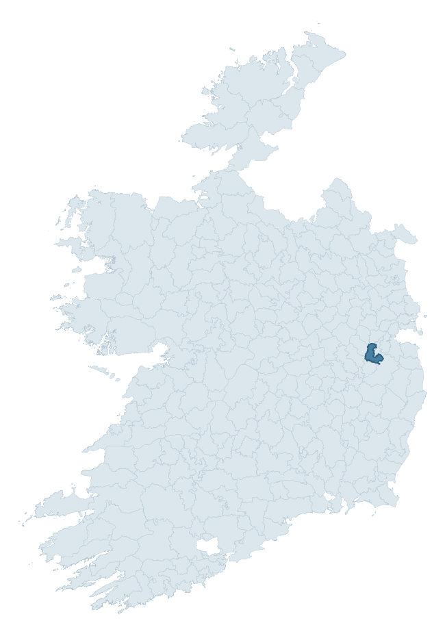
Where this barony sits in the Republic of Ireland
Geology and preservation
Bedrock geology shapes the landscape long before any settlement begins — controlling soil drainage, agricultural potential, the survival of upstanding monuments, and the preservation of buried archaeology. The figures below come from the Geological Survey Ireland 1:100,000 bedrock map.
The bedrock underlying Naas North is predominantly limestone (55% of the barony by area), laid down during the Carboniferous period (57% by area, around 359 to 299 million years ago). Limestone is the most heritage-rich bedrock in Ireland. It supports fertile, well-drained soils that favoured dense Early Medieval settlement and Norman manorial agriculture, and it weathers into karst features — sinkholes, caves, swallow holes, and souterrains — that frequently carry archaeology. Where peat overlies limestone, organic preservation can be exceptional. A substantial secondary geology of calcareous greywacke (22%) and greywacke and shale (11%) adds further variety to the underlying landscape.
Rock type composition
Largest mapped unit: Carrighill Formation (22% of the barony)
Placename evidence
Logainm records 4 heritage-diagnostic placenames for Naas North, a modest sample drawn predominantly from the townland record. The dominant stratum is early christian ecclesiastical. The most frequent diagnostic roots are ráth- (1) and cill- (1). With a sample of this size the count should be treated as indicative rather than definitive.
Pre-Christian / Early Medieval Defensive
| Root | Count | Meaning |
|---|---|---|
| ráth- | 1 | earthen ringfort |
Early Christian Ecclesiastical
| Root | Count | Meaning |
|---|---|---|
| cill- | 1 | church (early) |
| teampall- | 1 | church (later medieval) |
| tobar- | 1 | holy well |
Other baronies in Kildare
About this profile
Click any section below to expand.
What is a barony?
A barony is a historic administrative unit in Ireland, broadly equivalent to an English hundred. The 280 baronies used here are from the OSi 2019 National Statutory Boundaries (generalised 20m), covering the 26 counties of the Republic of Ireland. Baronies derive from the Norman period, were formalised in the 17th century, and have not been redrawn for statistical purposes. They vary enormously in area, from compact urban baronies in Dublin to vast upland baronies in Connacht, and should not be compared by raw site count without accounting for area differences.
What counts as a site?
This profile combines three distinct heritage registers, each with its own definition of what constitutes a recordable site:
- Archaeological sites (NMS). The National Monuments Service Sites and Monuments Record (SMR) catalogues every known archaeological monument or site of archaeological interest in the Republic, from prehistoric burial mounds and ringforts to medieval churches and post-medieval defensive works. Inclusion does not require legal protection — only that the site has been identified, surveyed, and assessed as having archaeological value. A separate subset of these sites lies within a recorded protection zone, which gives them statutory protection under the National Monuments Acts.
- Listed buildings (NIAH). The National Inventory of Architectural Heritage records buildings of architectural, historical, archaeological, artistic, cultural, scientific, social, or technical interest. Each surveyed structure is appraised on a five-tier scale: International, National, Regional, Local, and Record-Only. The NIAH appraisal is informational rather than strictly statutory, but it underpins local-authority Record of Protected Structures (RPS) listings.
- Heritage placenames (Logainm). Logainm is the authoritative database of Irish placenames maintained by the Placenames Branch. This profile applies a heritage-diagnostic classifier to the Irish-language form of each townland name, flagging roots that signal defensive sites (ráth-, lios-, dún-, caiseal-, cathair-), ecclesiastical foundations (cill-, teampall-, domhnach-, mainistir-), prehistoric burial-ritual features (tuaim-, carn-, leaba-), or Norse-contact settlement (gall-). Townlands without one of these diagnostic roots are not flagged here — they may still carry historical significance, but that significance is not encoded in the name itself.
Editorial principles
The narrative sections of this profile follow several explicit principles:
- Evidential. Every claim about this barony’s heritage character is anchored in the underlying register data. Where a site count, a placename count, or a percentile rank is cited, it is computed from the source datasets at export time, not estimated.
- Comparative. Counts and metrics are reported alongside their percentile rank against the other 279 ROI baronies. A barony with 50 ringforts in absolute terms could be unusually high or unusually low depending on its size and regional context; percentile ranking removes that ambiguity.
- Transparent on limits. Where a register has known coverage gaps, survey biases, or data-quality issues that affect this barony’s figures, the profile flags them rather than presenting the numbers as definitive.
- No interpretation beyond what the data supports. The narrative does not speculate about historical events, social dynamics, or cultural meaning beyond what the recorded heritage and placename evidence directly attests.
Data caveats and limits
- NMS Sites and Monuments Record is the product of survey campaigns conducted at different intensities across different counties and decades. Some baronies have been surveyed more thoroughly than others, and absolute counts should be read in that light. Sites destroyed by development before survey are typically not represented; sites in heavily forested or upland terrain are sometimes under-recorded.
- NIAH coverage is broadly complete for the Republic of Ireland but the survey was conducted on a rolling county-by-county basis, and the most recent appraisal date varies. Buildings demolished or substantially altered after their original survey may still appear in the register; conversely, recent buildings of merit may not yet have been appraised.
- Logainm classification applies a deliberately conservative pattern-matching approach to the Irish-language townland forms. The classifier prioritises true positives over recall: a townland may carry a heritage signal that the classifier doesn’t recognise, particularly where the diagnostic root has been heavily anglicised or where the townland name draws on a less common term. The 60,000+ townland records and ~9,800 classified placenames give a substantial signal at barony scale, but individual townland names should be checked against Logainm directly for definitive interpretation.
- Period attribution. The chronological distribution reflects only those NMS sites that carry a recognised period attribution in the source data. Sites listed as “Unknown” period are excluded from the dated subset.
- Boundary changes. Some baronies have undergone minor boundary adjustments since their 19th-century definition; the OSi 2019 generalised boundaries used here are the current statutory definition and may differ slightly from historical maps in border areas.
- Bedrock geology is mapped at 1:100,000 scale, which means local variation within a barony — small pockets of different rock type, mineral veins, alluvium overlying bedrock — is generalised. The dominant-system and rocktype figures are area-weighted, so a barony reading “70% Carboniferous limestone” may still contain small but archaeologically important pockets of older or younger rock. Around 3% of GSI polygons do not match the lexicon and contribute no rocktype or system attribution.
Data sources
- National Monuments Service — Sites and Monuments Record (SMR) https://data.gov.ie/dataset/national-monuments-service-archaeological-survey-of-ireland
- National Inventory of Architectural Heritage (NIAH) https://data.gov.ie/dataset/national-inventory-of-architectural-heritage-niah-national-dataset
- Logainm — Placenames Database of Ireland https://www.logainm.ie/
- Ordnance Survey Ireland — National Statutory Barony Boundaries 2019 https://data-osi.opendata.arcgis.com/
- EURODEM — European Digital Elevation Model https://www.mapsforeurope.org/datasets/euro-dem
- ESA WorldCover https://esa-worldcover.org/en
- Geological Survey Ireland — 1:100,000 Bedrock Geology https://www.gsi.ie/en-ie/data-and-maps/Pages/Bedrock.aspx
Explore more: Search any of the 280 ROI baronies, browse by historical province, or read the methodology and data sources for the full Republic of Ireland Heritage Tool.