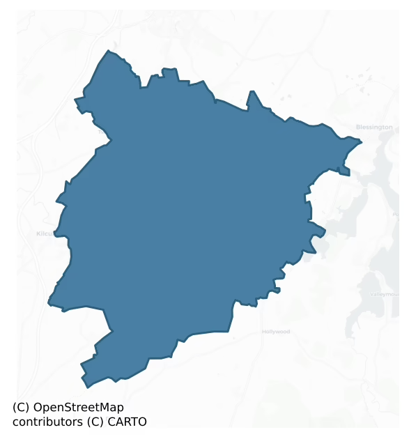
Naas South is a barony of County Kildare, in the historical province of Leinster (Irish: An Nás Theas), covering 111 km² of land. The barony records 170 NMS archaeological sites and 77 NIAH listed buildings, placing it at around the 34th percentile among 280 ROI baronies for sites per km². This means it is in the lower half of all baronies for sites per km². Dated archaeological evidence runs from the Early Bronze Age through to the Post Medieval, spanning 6 of 9 archaeological periods, placing the barony in the 16th percentile among 280 ROI baronies for chronological depth. This means it is in the bottom fifth of all baronies for chronological depth. The largest dated subset of recorded sites dates to the Iron Age.

Heritage at a glance
Percentile rankings throughout this profile compare each barony only against the other 279 Republic of Ireland baronies.
The recorded heritage of Naas South
The National Monuments Service Sites and Monuments Record (SMR) is the statutory inventory of archaeological sites for the Republic of Ireland, maintained by the Department of Tourism, Culture, Arts, Gaeltacht, Sport and Media. Sites recorded here include earthworks, ringforts, megalithic tombs, ecclesiastical remains, and post-medieval features; not every record is legally protected, but each is registered as a monument of archaeological interest.
The National Monuments Service records 170 archaeological sites in Naas South, putting it at the 34th percentile among 280 ROI baronies for sites per km². This means it is in the lower half of all baronies for sites per km². Protection coverage is near-universal — 165 sites (97%) fall within a recorded monument protection zone, indicating an extensively surveyed landscape. The record is dominated by defensive sites — ringforts, enclosures, hillforts, and stone forts (68 sites, 40% of the total), with ecclesiastical sites forming a substantial secondary presence (37 sites, 22%). The most diagnostically specific type is Ringfort – rath (11 records, 6% of the barony's NMS total) — compared to an ROI average of 20% across all baronies where this type occurs. Ringfort – rath is an earthen ringfort enclosed by a bank and external ditch — the most common Early Medieval farmstead, broadly dated 500–1000 AD. The broader 'Enclosure' classification — which catches unclassified ringforts and field enclosures — accounts for a further 41 records (24%) and reflects the difficulty of sub-classifying degraded earthworks from surface evidence alone. Across the barony's 111 km², this gives a recorded density of 1.53 sites per km².
Most common monument types
Hover or tap a monument type to see its definition.
| Type | Count |
|---|---|
| Enclosure a banked or ditched feature of uncertain type, used as a catch-all where the original function cannot be determined from surface evidence | 41 |
| Ringfort – rath an earthen ringfort enclosed by a bank and external ditch — the most common Early Medieval farmstead, broadly dated 500–1000 AD | 11 |
| Church a building used for public Christian worship, of any date from c. 500 AD onwards | 9 |
| Graveyard a burial area associated with a church, in use from the medieval period onwards | 9 |
| Graveslab a recumbent grave-marking slab, dated 1200–1700 AD | 8 |
| Castle – unclassified a castle whose form cannot be precisely classified, dating somewhere between the late 12th and 16th centuries | 5 |
| Mound an artificial earthen elevation of unknown date and function that cannot be classified as another known monument type | 5 |
Chronological distribution
The dated archaeological record for Naas South spans from the Early Bronze Age through to the Post Medieval, with activity attested across 6 of 9 archaeological periods. This is the 16th percentile across ROI baronies — a relatively narrow chronological band, with much of Irish prehistory not represented in the dated record. Every period from earliest to latest is represented in the record — an unbroken sequence of dated activity across the full chronological span. Activity concentrates most heavily in the Iron Age (52 sites, 42% of dated material), with the Early Medieval forming a secondary peak (31 sites, 25%). A further 47 recorded sites (28% of the overall NMS register for the barony) carry no period attribution — appearing as 'Unknown' in the bar chart below. This typically reflects either records that pre-date the standardised period vocabulary or sites awaiting specialist dating review, rather than a genuine absence of chronological evidence.
Sample of recorded monuments
Show 25 sample monuments (of 170 total)
A representative sample of 25 recorded monuments drawn from the barony’s 170 total NMS entries. Sites within a recorded monument protection zone and rarer site types are prioritised so the list shows a meaningful cross-section rather than only the most common type. Each entry shows the official Sites and Monuments Record reference number and the description published by the National Monuments Service.
Souterrain
A Registered Historic Monument (No. 2/2009). In a slight hollow on a gentle S-facing slope at the S end of a low, N-S pasture ridge. The souterrain complex lies in the adjoining field immediately SW of a possible early…
A Registered Historic Monument (No. 2/2009). In a slight hollow on a gentle S-facing slope at the S end of a low, N-S pasture ridge. The souterrain complex lies in the adjoining field immediately SW of a possible early ecclesiastical site (KD024-003005-) on which a medieval church (KD024-003002-) and graveyard (KD024-003004-) stand. According to Beauford (1789, 84), 'On the west end of the church [KD024-003002-] under a rising ground are a number of subterraneous artificial caves, in a dry sandy soil, with pediment roofs, and communicating with each other by small apertures. One of these caves, near the church, had its sides composed of stone, and covered with flat stones, in which was found part of a quern and the bones of some fowls. The other caves have no other wall or covering than the native earth.' Moore (1918-19, 198) explored the 'caves’ in 1881 and described them as consisting of four branches; 'The passages were clean cut in sand, and the roof was well tapered.' No visible surface trace was evident in 2001, but in 2009 the souterrain was rediscovered when a small portion of a passage collapsed under the weight of passing farm machinery (pers. comm. Mr. Brian McCabe).
Compiled by: Gearóid Conroy
Date of upload: 07 June 2012
Field system
Occupying the W-half of a narrow N-S valley, in wet pasture. A very long, roughly rectangular area (c. 500m N-S; c. 125m E-W) of low, earthworks consisting chiefly of small rectangular enclosures, with circular…
Occupying the W-half of a narrow N-S valley, in wet pasture. A very long, roughly rectangular area (c. 500m N-S; c. 125m E-W) of low, earthworks consisting chiefly of small rectangular enclosures, with circular platforms in one corner. A possible moated site (KD024-019002-) lies towards the S-end of the system. (CUCAP API 10)
Compiled by: Gearóid Conroy
Date of upload: 12 June 2012
Burial ground
On a W-facing pasture slope. An oval area (50m NNW – SSE; 25m NNE – SSW) defined by a vegetation band (Wth 2m) ESE-S-W-NNE, with faint traces of an earthen bank elsewhere. The interior appears to have been dug out, with…
On a W-facing pasture slope. An oval area (50m NNW – SSE; 25m NNE – SSW) defined by a vegetation band (Wth 2m) ESE-S-W-NNE, with faint traces of an earthen bank elsewhere. The interior appears to have been dug out, with two distinct hollows occupying most of the area enclosed. No grave markers are visible.
Compiled by: Gearóid Conroy
Date of upload: 14 June 2012
Castle – motte and bailey
A Recorded Historical Monument (HMO 3473). At the SSW end of an extensively quarried N-S ridge. According to Tickell (1960, 368 (Fn. 9), Sir Roland FitzEustace, who died in 1486, possessed, inter alia, a castle at…
A Recorded Historical Monument (HMO 3473). At the SSW end of an extensively quarried N-S ridge. According to Tickell (1960, 368 (Fn. 9), Sir Roland FitzEustace, who died in 1486, possessed, inter alia, a castle at Donode. The site of the castle is now called ‘the moat, a rath some 70 feet high’. A natural hillock appears to have been scarped into an oval shaped area (c. 100m E-W; c. 70m N-S) and the base enclosed by a substantial counter-scarp bank (H. 4.5m) and internal fosse. The interior was divided slightly unequally by deep N-S fosse (Wth. 2m, D. 3.2m), with a tall, steep-sided motte to the W (H. of motte over base of fosse c. 11.5m; upper surface c. 23m N-S; c. 20m E-W), and a lower, slightly smaller bailey to the E (upper surface 19m E-W; 17m N-S). The summit of the motte is very uneven and appears to have been partially dug out. The bailey’s defences are augmented by a fosse and outer bank girdling the upper surface N-E-S. The monument is eroded along the S by a combination of soil creep and animal grazing, and a pit containing charcoal and burnt and unburnt bone is visible in an eroded area on the N face of the bailey, possibly a habitation layer. (CUCAP AHK 25 (1963); APH 94 (1966))
Compiled by: Gearóid Conroy
Date of upload: 14 June 2012
Road – road/trackway
A former trackway is annotated by Longfield on an estate map of 1815 (NLI Ms. 21 F 35 (39-82) Map 49) as a 'very ancient road, now almost disused' and shown running W from just N of Commons church (KD024-020—-)…
A former trackway is annotated by Longfield on an estate map of 1815 (NLI Ms. 21 F 35 (39-82) Map 49) as a 'very ancient road, now almost disused' and shown running W from just N of Commons church (KD024-020—-) towards Bawnoge townland. No visible surface trace survives.
Compiled by: Gearóid Conroy
Date of upload: 04 July 2012
Habitation site
In 1983, an extensive spread of charcoal and burnt clay was uncovered during archaeological monitoring of the construction of the Cork-Dublin natural gas pipeline, and was interpreted as a possible settlement site.…
In 1983, an extensive spread of charcoal and burnt clay was uncovered during archaeological monitoring of the construction of the Cork-Dublin natural gas pipeline, and was interpreted as a possible settlement site. Designated ‘Site 8’ Dowdenstown Little. (Cleary et al. 1987, 5).
Compiled by: Gearóid Conroy
Date of upload: 06 July 2012
House – 17th century
According to Tickell (1960, 392), ‘… about 1645, an old estate map shows … New Abbey House.’ According to Bence-Jones (1988, 222), the present Newabbey House, of two stories over basement, was built c. 1775. It may…
According to Tickell (1960, 392), ‘… about 1645, an old estate map shows … New Abbey House.’ According to Bence-Jones (1988, 222), the present Newabbey House, of two stories over basement, was built c. 1775. It may stand on or close to the site of the earlier, 17th-century house?
Compiled by: Gearóid Conroy
Date of upload: 15 May 2013
Barrow – stepped barrow
Shown on the 1837 OS 6-inch map as a circular area surrounded by bank, and on the 1939 edition as raised circular area (max diam. c. 40m).
Date of upload: 6 September 2016
Ecclesiastical enclosure
In level pasture c. 135m NE of the E-flowing River Liffey. According to Killanin and Duignan (1967, 102), ‘St. James’ Church [KD029-005001-] and its graveyard [KD029-005004-] lie inside what was a large bivallate…
In level pasture c. 135m NE of the E-flowing River Liffey. According to Killanin and Duignan (1967, 102), ‘St. James’ Church [KD029-005001-] and its graveyard [KD029-005004-] lie inside what was a large bivallate ring-enclosure (an early monastic site?’ The SW, W and N sections of an enclosing feature are recorded on the 1st ed. (1838) of the OS 6-inch map as two curving parallel embankments (est. max. Wth c. 25m) bordering a small stream flowing into the Liffey. While the enclosing elements are not shown at NE, their former continuation in this direction, until truncated by a road, is indicated by two parallel dashed lines (est diam. of enclosure c. 200m NE-SW). Vestiges of this possible enclosure are indicated on the latest ed. (1939-40) of the OS 6-inch map as a tree-clad scarp at SW, a pond at W and by dashed parallel lines WNW-NNE. The small stream has since dried up, but a curving depression (Wth c. 18m; D 1m) marks its former line W-N. The SW sector is overgrown with trees, while a second dried up curving watercourse may have marked the enclosing limits E-SE-S.
Compiled by: Gearóid Conroy
Date of upload: 27 August 2013
Historic town
On a S-facing slope on the E bank of the River Liffey, near the border with County Wicklow. A significant pre-Norman ecclesiastical presence is indicated by the two high crosses (KD029-011006- and KD029-011007-) and a…
On a S-facing slope on the E bank of the River Liffey, near the border with County Wicklow. A significant pre-Norman ecclesiastical presence is indicated by the two high crosses (KD029-011006- and KD029-011007-) and a cross slab (KD029-011009-) in the graveyard (KD029-011004-) containing the ruins of St. John’s Church (KD029-011002-) at the E end of the town. According to Bradley et al. (1986, vol. 1, 71-74), the name ‘Ballymore’ [i.e. Baile mór/town] is found in late 12th-century documents, while the epithet Eustace first occurs in Irish in 1548 and in English sources from 1666, because the Eustace family held the office of constable of the castle (KD029-011005-) for most of the Middle Ages. A Norman motte (KD029-011003-) was erected, probably to the N of the present town. Ballymore was a manor belonging to the archbishops of Dublin: references occur to the archbishop’s castle of Ballymore in a grant of 1181-90 and to his manor of Ballymore in a grant of 1191. The grant of a weekly market is referred to between 1189 and 1199, and in 1234, Henry III granted the archbishop the right to hold a yearly fair. A document of c. 1256-66 indicates Ballymore had become a borough with burgesses paying 12d yearly and holding 12 acres in burgage. A 1326 extent of the manor of Ballymore states that there were 160 burgesses in the borough, as well as two water mills and a common kiln together with 16 cottages that paid no rent, four cottages lying in waste and a plot of land called ‘Tail…
Castle – motte
Possibly at the N edge of Ballymore Eustace, a historic town (KD029-011001-), where ‘Close Hill’ is named on the OS 25-inch map and shown as a steep-sided subcircular earthwork (base diams. c. 25m NE-SW; upper surface…
Possibly at the N edge of Ballymore Eustace, a historic town (KD029-011001-), where ‘Close Hill’ is named on the OS 25-inch map and shown as a steep-sided subcircular earthwork (base diams. c. 25m NE-SW; upper surface diams. c. 12m NE-SW; c. 10m NW-SE). According to Counihan (1991, 58-9), ‘The section drawing [done by the architect Basil Stallybrass sometime between 1901 and 1906] shows the deliberate scarping of Close Hill and confirms the location of the motte site. Basil's notes mention Close Hill, a circular mound – no bailey, height 35 ft (c. 10.7m) – a terrace on the top larger one side than the other'. According to Bradley et al. (1986, vol. 1, 76), Close Hill is a conical mound (H 20m; summit diam. 9m), the upper 3-4m of which appear to be the result of artificial heightening. The N side has been quarried for gravel. The summit is uneven, and there is a lower (D 1.5m) sloping platform on the W (Wth 6-7m). Large stones and blocks, with traces of mortar, in the enclosing field wall suggest the presence of a significant masonry structure, possibly an Anglo-Norman masonry castle (KD029-011005-), on the motte.
Compiled by: Gearóid Conroy
Date of upload: 30 August 2013
Standing stone
On a low glacial ridge. According to O’Conor, jointly compiling the OSL in 1839 (Herity 2002, 198 (279-80)), ‘It stood in a small earthen moat [KD029-014002-], but now lies on the ground, having been thrown down about 2…
On a low glacial ridge. According to O’Conor, jointly compiling the OSL in 1839 (Herity 2002, 198 (279-80)), ‘It stood in a small earthen moat [KD029-014002-], but now lies on the ground, having been thrown down about 2 or 3 years ago.’ A long slender, rounded, granite pillar, lying prostrate (L 4.1m; Wth. 0.9m; T 0.65m). Two small crosses on the upper surface were probably incised sometime after the stone was thrown down. One quarter of the stone (L1.6m) is unsupported and overhangs (H 0.4m) the ground below.
Compiled by: Gearóid Conroy
Date of upload: 05 September 2013
This monument is subject to a preservation order made under the National Monuments Acts 1930 to 2014 (PO no. 93/1940).
Settlement deserted – medieval
According to Bradley et al (1986 vol. 2, 177-83), a borough was established in Harristown in 1681, possibly on the site of a motte (KD024-028002-), but almost certainly in the vicinity of an existing tower house…
According to Bradley et al (1986 vol. 2, 177-83), a borough was established in Harristown in 1681, possibly on the site of a motte (KD024-028002-), but almost certainly in the vicinity of an existing tower house (KD024-028003-) and church (KD024-028004-). In 1681, Maurice Eustace received a charter from Charles II erecting his lands into the manor of Harristown and incorporating the borough and town of Harristown which was to have a sovereign and twelve burgesses. The borough, which was to contain 100 acres and return two members to parliament (Tickell 1946-63, 310, 316, 319), was short lived and did not survive the Williamite confiscations. No visible surface trace survives.
Compiled by: Gearóid Conroy
Date of upload: 02 July 2012
Linear earthwork
The area which would later be called 'The English Pale', from the Latin 'palus', a stake, and also possibly from the name of an earthen fortification at Calais in France (Lydon 1972, 261), originated in the 14th-century…
The area which would later be called 'The English Pale', from the Latin 'palus', a stake, and also possibly from the name of an earthen fortification at Calais in France (Lydon 1972, 261), originated in the 14th-century when Norman settlers began fortifying their lands in counties Dublin, Kildare, Louth and Meath against attack by the native Irish. By 1435, ongoing attacks, probably primarily aimed at cattle theft (O'Riordáin 1971, 15), prompted the concept of an additional, linear defensive feature, the boundaries of which were defined in a 1488 Act of Parliament as extending, 'from Merrion inclusive to the waters of the Dodder, by the new ditch to Saggard, Rathcoole, Kilheel (Kilteel), Rathmore and Ballymore (Eustace), thence to the county of Kildare into Ballycutlan (Coghlanstown), Harristown and Naas, and so thence to Clane, Kilboyne, and Kilcock' (Mc Neill 1950, 250). In 1494, Parliament directed that, 'every inhabitant, earth tiller and occupier in said marches (borderlands), do build and make a double ditch six feet high above ground at one side or part which meareth next unto Irishmen between this and next Lammas (August 1st.), the said ditches to be kept up and repaired as long as they shall occupy said land.' However, Ellis (Ellis S. G. 'The emergence of the English Pale in Ireland' in Irish Historical Studies) points to a statute in Poyning's parliament in 1495 for 'ditches to be made aboute the Inglishe pale' as the first application of the term to Ireland. The…
Hearth
A hearth was uncovered during archaeological monitoring of the construction of the Cork-Dublin natural gas pipeline (Cleary, Hurley & Twohig 1987, 5).
Compiled by: Gearóid Conroy
Date of upload: 17 September 2013
Excavation – miscellaneous
Miscellaneous features post-dated by ridge and furrow cultivation were uncovered during archaeological monitoring of the construction of the Cork-Dublin natural gas pipeline (Cleary, Hurley & Twohig 1987,…
Miscellaneous features post-dated by ridge and furrow cultivation were uncovered during archaeological monitoring of the construction of the Cork-Dublin natural gas pipeline (Cleary, Hurley & Twohig 1987, 5).
Compiled by: Gearóid Conroy
Date of upload: 17 September 2013
Bridge
Spanning the W-flowing River Liffey (L c. 60m NNE-SSW; max. Wth c. 7.3m; Wth of road c. 5.2m). Described by O’Keeffe and Simmington (1991, 185-6) as, ‘A tall stately seven-arch bridge … .’ Built of random rubble masonry…
Spanning the W-flowing River Liffey (L c. 60m NNE-SSW; max. Wth c. 7.3m; Wth of road c. 5.2m). Described by O’Keeffe and Simmington (1991, 185-6) as, ‘A tall stately seven-arch bridge … .’ Built of random rubble masonry ‘of excellent quality’, the bridge has triangular cutwaters on the upstream and downstream faces, low parapets (H c. 0.75m) and ‘probably dates from the second half of the 17th-century’ (op. cit. 185).
Compiled by: Gearóid Conroy
Date of upload: 17 September 2013
Barrow – bowl-barrow
Prominently sited at the W end of a steep-sided E-W pasture ridge, around the S and W of which the River Liffey flows. A fairly well-preserved raised central, circular, earthen area (base diams. 10.1m N-S; 9m E-W;…
Prominently sited at the W end of a steep-sided E-W pasture ridge, around the S and W of which the River Liffey flows. A fairly well-preserved raised central, circular, earthen area (base diams. 10.1m N-S; 9m E-W; summit diams. 2.4m N-S; 2.2m E-W is girdled by a broad, level area (Wth 8.1-10m) which is in turn enclosed by a low earthen bank (int. H 0.1-0.9m; Wth 3.4-5.1m; ext H0.5-1.4m). An outer fosse, traceable WSW-N-ESE may be the result of later landscaping. Mature beech trees grow on the bank along the N perimeter, and one grows on the central mound. A second, possible barrow (KD029-012—-) lies c.220 m to the N.
Compiled by: Gearóid Conroy
Date of upload: 04 September 2013
Bullaun stone (present location)
Moved from its original location, (KD029-010—-) c. 270m to the NW, to the front lawn of a private house. A well-preserved D-shaped granite block (L 1.45m; Wth 0.5-1.45m; H 0.85m) with a roughly rectangular upper…
Moved from its original location, (KD029-010—-) c. 270m to the NW, to the front lawn of a private house. A well-preserved D-shaped granite block (L 1.45m; Wth 0.5-1.45m; H 0.85m) with a roughly rectangular upper surface (L 1m; Wth 0.7m) which contains two well-carved basins (a W- one: diam. 0.3m; D 0.2m and a shallower E-one: 0.3m; D 0.05m).
Compiled by: Gearóid Conroy
Date of upload: 27 August 2013
Tomb – effigial (present location)
According to Bradley et al. (1986, vol. 1, 80), a 16th-century limestone knightly effigy was moved from Old Kilcullen (KD028-049012-) to a 19th-century church in a graveyard (KD029-011004-) in Ballymore Eustace. The…
According to Bradley et al. (1986, vol. 1, 80), a 16th-century limestone knightly effigy was moved from Old Kilcullen (KD028-049012-) to a 19th-century church in a graveyard (KD029-011004-) in Ballymore Eustace. The slab, carved in high relief with the figure of a knight, is believed to represent Sir Oliver FitzEustace. The head is on a cushion and the feet rest on an animal. The right arm lies on his breast and the left is extended, lying across a sword. The knight is represented as armed, in a long hauberk (coat) of mail with short sleeves and with a mail collar attached. The bascinet (helmet) has a visor and there is a crest, possibly a stag couchant, on the forehead (Hunt 1974, 77, 153, Fig. 142). Hunt (op. cit. 153) considers that the effigy, ‘represents indifferent journeyman’s work, but is said to have been “restored” in the nineteenth century.’
Compiled by: Gearóid Conroy
Date of upload: 30 August 2013
Holed stone
According to Bradley et al. (1986, vol. 1, 80), it lies at the E end of a graveyard (KD029-011004-). A rectangular granite block (L 0.68m; Wth 0.44m; H 0.22m) contains a circular hole (diam. 0.14m).
Compiled by:…
According to Bradley et al. (1986, vol. 1, 80), it lies at the E end of a graveyard (KD029-011004-). A rectangular granite block (L 0.68m; Wth 0.44m; H 0.22m) contains a circular hole (diam. 0.14m).
Compiled by: Gearóid Conroy
Date of upload: 30 August 2013
Ecclesiastical site
A Registered Historic Monument (No. 2/2009). At the S end of a low, N-S, pasture ridge. According to Killanin and Duignan (1967, 384) this is the site of a church founded by Bishop Auxilius in the 5th century, and…
A Registered Historic Monument (No. 2/2009). At the S end of a low, N-S, pasture ridge. According to Killanin and Duignan (1967, 384) this is the site of a church founded by Bishop Auxilius in the 5th century, and according to Jackson (1979-80, 155), 'Obits of the Abbots of Killashee occur in the Annals from 829 A.D.' The remains comprise a very overgrown graveyard (KD024-003004-), which contains a medieval church tower (KD024-003002-) which abuts the W end of a later, 18th century church (KD024-003001-). A souterrain complex (KD024-003003-) in the adjoining field immediately to the SW is probably associated with the original foundation. No visible surface trace of early remains survive, but the totally overgrown nature of the monument precluded a detailed survey.
Compiled by: Gearóid Conroy
Date of upload: 07 June 2012
Ringfort – unclassified
Outline of possible enclosure or ringfort visible on Digital Globe aerial photograph. No monument marked at this location on any edition of the OS 6-inch map.
Compiled by: Caimin O'Brien based on details provided…
Outline of possible enclosure or ringfort visible on Digital Globe aerial photograph. No monument marked at this location on any edition of the OS 6-inch map.
Compiled by: Caimin O'Brien based on details provided by Hugh Carey
Date of upload: 2 August 2018
Earthwork
In pasture, 80m E of mill site depicted on 1837 ed. OSi 6-inch map. Killashee Church ruins (KD024-003001-) and site of Castle (KD024-002—-) 290m to N. Outline of circular-shaped earthwork visible on Lidar survey. …
In pasture, 80m E of mill site depicted on 1837 ed. OSi 6-inch map. Killashee Church ruins (KD024-003001-) and site of Castle (KD024-002—-) 290m to N. Outline of circular-shaped earthwork visible on Lidar survey. No surface remains visible on Digital Globe orthoimage taken 2011-13.
See attached Lidar image provided courtesy of Seán Sourke
Compiled by: Caimin O'Brien based on details provided by Seán Sourke
Date of upload: 30 June 2021
Enclosure
One of six, small subrectangular cropmarks (KD024-050001- to KD024-050006-) visible on an aerial photograph (GSI N 337-6). Located in level, well-drained pasture. No earthworks were visible at the time of visit, but…
One of six, small subrectangular cropmarks (KD024-050001- to KD024-050006-) visible on an aerial photograph (GSI N 337-6). Located in level, well-drained pasture. No earthworks were visible at the time of visit, but there was heavy grass cover.
Compiled by: Gearóid Conroy
Date of upload: 10 July 2012
Listed buildings
The National Inventory of Architectural Heritage (NIAH) is a state survey appraising buildings of architectural, historical, archaeological, artistic, cultural, scientific, social, or technical interest. Each surveyed structure receives a rating from International (the highest, for buildings of European importance) through National, Regional, Local, and Record-Only.
The NIAH records 77 listed buildings in Naas South (41st percentile across ROI baronies). All recorded buildings carry Regional or lower grading; the barony does not contain any structures appraised as being of National or International architectural importance. Construction dates concentrate most heavily in the Victorian (1830-1900) period. The most-recorded building type is house (41 examples, 53% of the listed stock).
Terrain and environment
Mean elevation across the barony is 146m — the 84th percentile among 280 ROI baronies for elevation. This means it is in the top fifth of all baronies for elevation. This is a relatively elevated landscape by ROI standards. Elevation matters for heritage because higher-altitude baronies typically favour defensive monuments — ringforts and hilltop forts placed on prominent ground — while lowland baronies are more likely to carry the dense settlement and church networks of intensive agricultural landscapes. A maximum elevation of 334m gives the barony meaningful vertical relief. Mean slope is 3.8° — the 53rd percentile among 280 ROI baronies for slope. This means it is in the upper half of all baronies for slope. Slope is a key control on both land use and archaeological preservation: steep ground resists ploughing and tends to preserve earthworks intact, while gentle slopes favour intensive cultivation that damages or destroys surface archaeology over time. The Topographic Wetness Index averages 10.7, the 43rd percentile among 280 ROI baronies for wetness. This means it is in the lower half of all baronies for wetness. Drainage matters for heritage because poorly-drained ground preserves organic archaeology (wooden trackways, leather, textiles, and on rare occasions human remains) far better than free-draining soil; well-drained ground favours arable use but destroys organic material rapidly. The land-cover mosaic combines improved grassland (75%), woodland (14%), and arable farmland (10%), giving a mixed agricultural and semi-natural landscape. In overall character, this is elevated but relatively gentle terrain — typical of plateau country, with land use dominated by improved grassland.
Terrain measurements
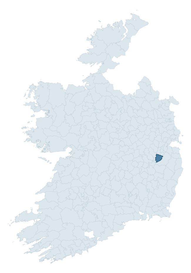
Where this barony sits in the Republic of Ireland
Geology and preservation
Bedrock geology shapes the landscape long before any settlement begins — controlling soil drainage, agricultural potential, the survival of upstanding monuments, and the preservation of buried archaeology. The figures below come from the Geological Survey Ireland 1:100,000 bedrock map.
The bedrock underlying Naas South is predominantly calcareous greywacke (65% of the barony by area), laid down during the Silurian period (95% by area, around 444 to 419 million years ago). A substantial secondary geology of greywacke and shale (15%) and chlorite, feldspathic greywacke (14%) adds further variety to the underlying landscape. The single largest mapped unit is the Carrighill Formation (65% of the barony's bedrock).
Rock type composition
Largest mapped unit: Carrighill Formation (65% of the barony)
Placename evidence
The Logainm record for Naas South contains only 2 heritage-diagnostic placenames — 1 tobar-name and 1 carn-name. With this few records, the count should be read as indicative rather than as a firm characterisation of the linguistic heritage layers; a larger sample would be needed to reliably distinguish defensive, ecclesiastical, or other stratigraphic signals from chance occurrence.
Early Christian Ecclesiastical
| Root | Count | Meaning |
|---|---|---|
| tobar- | 1 | holy well |
Burial, Ritual, and Norse-Contact
| Root | Count | Meaning |
|---|---|---|
| carn- | 1 | cairn |
Other baronies in Kildare
About this profile
Click any section below to expand.
What is a barony?
A barony is a historic administrative unit in Ireland, broadly equivalent to an English hundred. The 280 baronies used here are from the OSi 2019 National Statutory Boundaries (generalised 20m), covering the 26 counties of the Republic of Ireland. Baronies derive from the Norman period, were formalised in the 17th century, and have not been redrawn for statistical purposes. They vary enormously in area, from compact urban baronies in Dublin to vast upland baronies in Connacht, and should not be compared by raw site count without accounting for area differences.
What counts as a site?
This profile combines three distinct heritage registers, each with its own definition of what constitutes a recordable site:
- Archaeological sites (NMS). The National Monuments Service Sites and Monuments Record (SMR) catalogues every known archaeological monument or site of archaeological interest in the Republic, from prehistoric burial mounds and ringforts to medieval churches and post-medieval defensive works. Inclusion does not require legal protection — only that the site has been identified, surveyed, and assessed as having archaeological value. A separate subset of these sites lies within a recorded protection zone, which gives them statutory protection under the National Monuments Acts.
- Listed buildings (NIAH). The National Inventory of Architectural Heritage records buildings of architectural, historical, archaeological, artistic, cultural, scientific, social, or technical interest. Each surveyed structure is appraised on a five-tier scale: International, National, Regional, Local, and Record-Only. The NIAH appraisal is informational rather than strictly statutory, but it underpins local-authority Record of Protected Structures (RPS) listings.
- Heritage placenames (Logainm). Logainm is the authoritative database of Irish placenames maintained by the Placenames Branch. This profile applies a heritage-diagnostic classifier to the Irish-language form of each townland name, flagging roots that signal defensive sites (ráth-, lios-, dún-, caiseal-, cathair-), ecclesiastical foundations (cill-, teampall-, domhnach-, mainistir-), prehistoric burial-ritual features (tuaim-, carn-, leaba-), or Norse-contact settlement (gall-). Townlands without one of these diagnostic roots are not flagged here — they may still carry historical significance, but that significance is not encoded in the name itself.
Editorial principles
The narrative sections of this profile follow several explicit principles:
- Evidential. Every claim about this barony’s heritage character is anchored in the underlying register data. Where a site count, a placename count, or a percentile rank is cited, it is computed from the source datasets at export time, not estimated.
- Comparative. Counts and metrics are reported alongside their percentile rank against the other 279 ROI baronies. A barony with 50 ringforts in absolute terms could be unusually high or unusually low depending on its size and regional context; percentile ranking removes that ambiguity.
- Transparent on limits. Where a register has known coverage gaps, survey biases, or data-quality issues that affect this barony’s figures, the profile flags them rather than presenting the numbers as definitive.
- No interpretation beyond what the data supports. The narrative does not speculate about historical events, social dynamics, or cultural meaning beyond what the recorded heritage and placename evidence directly attests.
Data caveats and limits
- NMS Sites and Monuments Record is the product of survey campaigns conducted at different intensities across different counties and decades. Some baronies have been surveyed more thoroughly than others, and absolute counts should be read in that light. Sites destroyed by development before survey are typically not represented; sites in heavily forested or upland terrain are sometimes under-recorded.
- NIAH coverage is broadly complete for the Republic of Ireland but the survey was conducted on a rolling county-by-county basis, and the most recent appraisal date varies. Buildings demolished or substantially altered after their original survey may still appear in the register; conversely, recent buildings of merit may not yet have been appraised.
- Logainm classification applies a deliberately conservative pattern-matching approach to the Irish-language townland forms. The classifier prioritises true positives over recall: a townland may carry a heritage signal that the classifier doesn’t recognise, particularly where the diagnostic root has been heavily anglicised or where the townland name draws on a less common term. The 60,000+ townland records and ~9,800 classified placenames give a substantial signal at barony scale, but individual townland names should be checked against Logainm directly for definitive interpretation.
- Period attribution. The chronological distribution reflects only those NMS sites that carry a recognised period attribution in the source data. Sites listed as “Unknown” period are excluded from the dated subset.
- Boundary changes. Some baronies have undergone minor boundary adjustments since their 19th-century definition; the OSi 2019 generalised boundaries used here are the current statutory definition and may differ slightly from historical maps in border areas.
- Bedrock geology is mapped at 1:100,000 scale, which means local variation within a barony — small pockets of different rock type, mineral veins, alluvium overlying bedrock — is generalised. The dominant-system and rocktype figures are area-weighted, so a barony reading “70% Carboniferous limestone” may still contain small but archaeologically important pockets of older or younger rock. Around 3% of GSI polygons do not match the lexicon and contribute no rocktype or system attribution.
Data sources
- National Monuments Service — Sites and Monuments Record (SMR) https://data.gov.ie/dataset/national-monuments-service-archaeological-survey-of-ireland
- National Inventory of Architectural Heritage (NIAH) https://data.gov.ie/dataset/national-inventory-of-architectural-heritage-niah-national-dataset
- Logainm — Placenames Database of Ireland https://www.logainm.ie/
- Ordnance Survey Ireland — National Statutory Barony Boundaries 2019 https://data-osi.opendata.arcgis.com/
- EURODEM — European Digital Elevation Model https://www.mapsforeurope.org/datasets/euro-dem
- ESA WorldCover https://esa-worldcover.org/en
- Geological Survey Ireland — 1:100,000 Bedrock Geology https://www.gsi.ie/en-ie/data-and-maps/Pages/Bedrock.aspx
Explore more: Search any of the 280 ROI baronies, browse by historical province, or read the methodology and data sources for the full Republic of Ireland Heritage Tool.