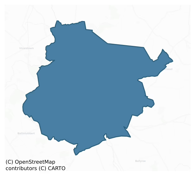
Narragh And Reban West is a barony of County Kildare, in the historical province of Leinster (Irish: An Fhorrach agus an Réabán Thiar), covering 90 km² of land. The barony records 173 NMS archaeological sites and 195 NIAH listed buildings, placing it at around the 52nd percentile among 280 ROI baronies for sites per km². This means it is in the upper half of all baronies for sites per km². Dated archaeological evidence runs from the Early Bronze Age through to the Modern, spanning 7 of 9 archaeological periods, placing the barony in the 25th percentile among 280 ROI baronies for chronological depth. This means it is in the bottom third of all baronies for chronological depth. The largest dated subset of recorded sites dates to the Iron Age.

Heritage at a glance
Percentile rankings throughout this profile compare each barony only against the other 279 Republic of Ireland baronies.
The recorded heritage of Narragh And Reban West
The National Monuments Service Sites and Monuments Record (SMR) is the statutory inventory of archaeological sites for the Republic of Ireland, maintained by the Department of Tourism, Culture, Arts, Gaeltacht, Sport and Media. Sites recorded here include earthworks, ringforts, megalithic tombs, ecclesiastical remains, and post-medieval features; not every record is legally protected, but each is registered as a monument of archaeological interest.
The National Monuments Service records 173 archaeological sites in Narragh And Reban West, putting it at the 52nd percentile among 280 ROI baronies for sites per km². This means it is in the upper half of all baronies for sites per km². Protection coverage is near-universal — 172 sites (99%) fall within a recorded monument protection zone, indicating an extensively surveyed landscape. The dominant category is defensive sites — ringforts, enclosures, hillforts, and stone forts (91 sites, 53% of the record). The most diagnostically specific type is Ring-ditch (16 records, 9% of the barony's NMS total) — compared to an ROI average of 6% across all baronies where this type occurs. Ring-ditch is a circular ditch under 20m across, often the ploughed-out remains of a barrow, ring-barrow or roundhouse. The broader 'Enclosure' classification — which catches unclassified ringforts and field enclosures — accounts for a further 69 records (40%) and reflects the difficulty of sub-classifying degraded earthworks from surface evidence alone. Across the barony's 90 km², this gives a recorded density of 1.93 sites per km².
Most common monument types
Hover or tap a monument type to see its definition.
| Type | Count |
|---|---|
| Enclosure a banked or ditched feature of uncertain type, used as a catch-all where the original function cannot be determined from surface evidence | 69 |
| Ring-ditch a circular ditch under 20m across, often the ploughed-out remains of a barrow, ring-barrow or roundhouse | 16 |
| Church a building used for public Christian worship, of any date from c. 500 AD onwards | 8 |
| Graveyard a burial area associated with a church, in use from the medieval period onwards | 8 |
| Moated site | 8 |
| Ringfort – rath an earthen ringfort enclosed by a bank and external ditch — the most common Early Medieval farmstead, broadly dated 500–1000 AD | 5 |
| Field boundary a continuous bank, wall or drain marking the limit of a field, of any date from the Neolithic onwards | 5 |
| Burial an isolated interment of human or animal remains, not associated with a formal burial ground | 4 |
Chronological distribution
The dated archaeological record for Narragh And Reban West spans from the Early Bronze Age through to the Modern, with activity attested across 7 of 9 archaeological periods. Every period from earliest to latest is represented in the record — an unbroken sequence of dated activity across the full chronological span. Activity concentrates most heavily in the Iron Age (75 sites, 55% of dated material), with the Early Bronze Age forming a secondary peak (27 sites, 20%). A further 37 recorded sites (21% of the overall NMS register for the barony) carry no period attribution — appearing as 'Unknown' in the bar chart below. This typically reflects either records that pre-date the standardised period vocabulary or sites awaiting specialist dating review, rather than a genuine absence of chronological evidence.
Sample of recorded monuments
Show 25 sample monuments (of 173 total)
A representative sample of 25 recorded monuments drawn from the barony’s 173 total NMS entries. Sites within a recorded monument protection zone and rarer site types are prioritised so the list shows a meaningful cross-section rather than only the most common type. Each entry shows the official Sites and Monuments Record reference number and the description published by the National Monuments Service.
Religious house – Knights Hospitallers
In level mixed tillage and pasture at the W edge of a farmyard some 700m E of the S-flowing River Barrow. A church (KD030-006—-) and graveyard (KD030-006001-) lie c. 40m to the NE and a ruined gatehouse…
In level mixed tillage and pasture at the W edge of a farmyard some 700m E of the S-flowing River Barrow. A church (KD030-006—-) and graveyard (KD030-006001-) lie c. 40m to the NE and a ruined gatehouse (KD030-007001-) and possible bawn (KD030-007002-) stand c. 50m to the ESE. In 1837, according to O’Conor who co-compiled the OSL for County Kildare (Herity 2002, 70 [206]), ‘There was formerly a Nunnery in Kilberry, four portions of the walls of which still remain. The site of the wall (& fosse) that ‘fenced’ (enclosed) this nunnery is as yet pointed out in the field where its ruins are, and in a grave yard [KD030-006001-] adjacent, within the same field, stand the ruined walls of the “Cathedral” (church) [KD030-006—-] of the nunnery.’ However, Gwynn and Hadcock (1970, 365-6) maintain that, ‘… the site seems unsuitable for nuns, as other towers and castles in the vicinity suggest that it was on a main defensive line. … one of the military orders, possibly hospitallers, seems more probable, in which case sisters may have been attached, explaining the tradition of nuns being there.’ A very poorly preserved rectangular structure (traceable L 22m NW-SE; traceable Wth 9.1m) is defined by the ivy-clad remains of a SE gable wall and gapped SW sidewall (av. T 1.2m) built of rubble masonry. A robbed out, apparently flat-headed window survives near the N end of the gable wall, and the central portion of the sidewall contains two adjoining robbed out loops.
Compiled by: Gearóid…
Gatehouse
In level mixed tillage and pasture, forming the E side of a possible bawn (KD030-007001-), at the E edge of a farmyard some 800m E of the S-flowing River Barrow. A ruined Religious House (KD030-005—-), possibly…
In level mixed tillage and pasture, forming the E side of a possible bawn (KD030-007001-), at the E edge of a farmyard some 800m E of the S-flowing River Barrow. A ruined Religious House (KD030-005—-), possibly belonging to the Knights Hospitallers, stands c. 40m to the WNW and a church (KD030-006—-) and graveyard (KD030-006001-) stand c. 40m to the NNW. A very poorly preserved totally overgrown, rectangular structure (traceable L 14m N-S; Wth 5.8m E-W) is defined by a N gable wall and an E sidewall (av. T 0.95m) built of rubble limestone masonry. A short portion of thick cross-wall (L 2.3m E-W; T 1.9m) sub-divides the structure into a N guard house or chamber, which only survives to one storey in height and which has a blocked loop in its E wall, and a S barrel-vaulted passage way, blocked on E wall face, above which portion of a second storey survives. Traces of an intramural stairs are visible in the internal dividing wall at first floor level, carried on an internal squinch. (Carroll 1892, 111)
Compiled by: Gearóid Conroy
Date of upload: 30 September 2013
Castle – Anglo-Norman masonry castle
On a low rise some 90m W bank of the S-flowing River Barrow, in open lowlying arable land. According to Fitzgerald (1897, 170), in the reign of King John (1199-1216) Richard de St Michael, created Baron of Rheban, built…
On a low rise some 90m W bank of the S-flowing River Barrow, in open lowlying arable land. According to Fitzgerald (1897, 170), in the reign of King John (1199-1216) Richard de St Michael, created Baron of Rheban, built the two castles of Woodstock (KD035-021—-) and Rheban, both of which were for the defence of the fords at those places. In 1288, John de Sandford, archbishop of Dublin and justiciar of Ireland (who governed for the king) visited Rheban (Otway-Ruthven 1993, 207). The site comprises the poorly preserved and heavily overgrown remains of a possible 13th-century masonry castle, subsequently altered, and later incorporated into a 17th-century fortified house. The original structure consists of a long, two storied, rectangular building (int.dims. L 13.9m NNW-SSE; Wth 8.2m ENE-WSW; wall T 1.8-2m) of rubble masonry with a very low, chamfered base-batter (H 1.1m; Wth 0.4m). Remains of a third story at the S end are 17th-century in date The ground-floor is entered through a broken doorway with the end of a barring-hole on its W side at the E end of the N wall, and contains two parallel, wicker-centered, barrel-vaults (Wth 3.2m; H 3.6m) orientated on a NNE-SSW axis which may be a later insertion into the structure. Two loops survive in the E wall and a third, near the N end, is broken out for a modern entrance. Each vault has a loop at either end of the S wall but the E loop is broken out for a modern entrance as is a loop at the centre of the W wall. Access between…
Brickworks
In level pasture. An unenclosed but roughly rectangular area (c. 110m NE-SW; c. 70m NW-SE) containing a series of low irregular earthworks forming no particular pattern were believed locally to be the remains of a brick…
In level pasture. An unenclosed but roughly rectangular area (c. 110m NE-SW; c. 70m NW-SE) containing a series of low irregular earthworks forming no particular pattern were believed locally to be the remains of a brick works or factory. (A possibly associated ‘Brick Field’ is shown some 550m to the SSE in Courttown West townland on the latest ed. (1910) of the OS 6-inch map, but is not recorded on the 1st ed. (1839) of the map.) Archaeological test trenching (Mullins, 1999. Excavation Licence No. 99E0192:http://www.excavations.ie/Pages/Details.php?Year=&County=Kildare&id=364 last accessed 26 November 2013) in advance of a proposed development at the S end of the site uncovered pockets of naturally occurring red clay, some of which showed signs of modern disturbance, particularly in the form of deeply buried layers of red brick. No other features or artefacts of archaeological interest were identified, and the surface irregularities in the field were interpreted as probably resulting from the former existence of a brick works/factory in this area.
Compiled by: Gearóid Conroy
Date of upload: 26 November
Ritual site – holy well
In a graveyard (KD035-003003-) c. 14m S of a ruined church (KD035-003001-). According to the OSL (Herity 2002, 70) '… there was formerly a pattern held (at the well) on the 24th of June, St John's Day …'. A natural…
In a graveyard (KD035-003003-) c. 14m S of a ruined church (KD035-003001-). According to the OSL (Herity 2002, 70) '… there was formerly a pattern held (at the well) on the 24th of June, St John's Day …'. A natural spring lies in a hollow (diam. 10m; D 1.6m) which is defined by a loosely built dry stone wall. A holy tree (KD035-003004-) stands at the SW edge of the well. (Jackson 1979-80, 156)
Compiled by: Gearóid Conroy
Date of upload: 27 November 2013
Castle – hall-house
On W edge of flat low-lying poorly drained land which forms part of the flood-plain of the River Barrow which flows 80m to the NE. The religious house (KD035-022006-) of the Crutched Friars founded by Richard de St.…
On W edge of flat low-lying poorly drained land which forms part of the flood-plain of the River Barrow which flows 80m to the NE. The religious house (KD035-022006-) of the Crutched Friars founded by Richard de St. Michael in the thirteenth century is 520m to the SSE, also located on the W bank of the River Barrow. A 13th century hall house built by Richard de St. Michael stands on dry ground overlooking the River Barrow to SE and possibly a fording point over the river. The main entrance to the castle faces the River Barrow and it possible that there may have a quay or harbour located on the W bank of the Barrow opposite the castle entrance. A series of linear earthworks forming rectangular features in the poorly drained field to SE may represent the remains of medieval fish-ponds (KD035-021002-). The land to the NW is higher dry ground and does not appear to have formed part of the floodplain. There are archaeological earthworks in the field to the N and S of the castle. Some of the earthworks in the field to the N of the castle may form part of the bawn wall (KD035-021001-) and two storey house (KD035-022003-) depicted on a drawing of the castle dating from 1795 (Costello 1992-3, 87; TCD MS 942/2:51, 56, 58,68). The 1656 Down Survey map of Kildare depicts a settlement (KD035-021003-) in the form a cluster of buildings standing on the W bank of the River Barrow between Woodstock Castle and the religious house (KD035-022006-) of the Crutched Friars (downsurvey….
Historic town
At a strategically important crossing point of the River Barrow. According to Bradley et al. (1986a vol. 1, 35), The placename ‘Athy’ is derived from ‘Ath I’, “the ford of Aei”, a warrior killed here in legendary…
At a strategically important crossing point of the River Barrow. According to Bradley et al. (1986a vol. 1, 35), The placename ‘Athy’ is derived from ‘Ath I’, “the ford of Aei”, a warrior killed here in legendary combat. The Anglo-Norman settlement at Athy appears to date from at least the mid 13th-century when two priories (Dominican: KD035-022004- and Fratres Cruciferi: KD035-022006-) and a church (St. Michael’s: KD035-022014-) are known to have been in existence. The Michael family, lords of the barony of Reban since the conquest, were also the Lords of Athy. An early castle (KD035-022001-) was also likely to have existed – the sergeant of the ‘ward of Athy’ is mentioned in 1297 (ibid.) – although its precise location is not recorded. The nascent Anglo-Norman settlement must also have enjoyed a level of protection from Woodstock Castle (KD035-021—-), a 13th-century structure near the W-bank of the Barrow. Athy also developed as an inland port; the passage of boats from New Ross to Athy is first referred to in the 13th-century. Although a borough is likely to have been established at an early date, (Athy was burnt in 1308), the earliest recorded evidence for its existence is not until 1326 when Geoffrey de Hereford is referred to as ‘burgess of Athy’ (op. cit 36). Although well outside the Pale, Athy was an important outpost on the route between Dublin and the Anglo-Irish territories of the south-east. Greater exposure to attack by the Irish in the later medieval perio…
Town defences
The Anglo-Norman settlement at Athy appears to date from at least the mid 13th-century when two priories (Dominican: KD035-022004- and Fratres Cruciferi: KD035-022006-) and a church (St. Michael’s: KD035-022014-) are…
The Anglo-Norman settlement at Athy appears to date from at least the mid 13th-century when two priories (Dominican: KD035-022004- and Fratres Cruciferi: KD035-022006-) and a church (St. Michael’s: KD035-022014-) are known to have been in existence. The Michael family, lords of the barony of Reban since the conquest, were also the Lords of Athy. An early castle (KD035-022001-) was also likely to have existed – the sergeant of the ‘ward of Athy’ is mentioned in 1297 – although its precise location is not recorded. While the town is likely to have been enclosed earlier, the first reference to town defences does not occur until 1515, when Athy belonged to the earl of Kildare. Athy and Kildare were granted charters by Henry VIII giving inhabitants the right to elect a provost and hold a weekly market, and authorising them to fortify the town with ditches and walls of stone and lime. Customs and other income were granted to pay for the construction and upkeep of the defences (Bradley et al. 1986a, vol. 1, 37). No structural evidence of town walls survives, but a 19th-century manuscript account (NLI Ms. 16172) indicates some of their former course. A D-shaped area (est. c. 290m N-S; c. 200m E-W) on the E bank of River Barrow was enclosed and had three gates: Tubber Muilland Gate to the N on Stanhope St., St. Michael's Gate to the E on Leinster St. and Preston's (or Postern) Gate) to the S on Offaly St. This latter gate was probably named after the family which occupied it. A Du…
Religious house – Dominican friars
Formerly stood near the E bank of the River Barrow inside the town defences (KD035-022002-), to the S of the later Town Hall. A Dominican Priory founded either in 1253 or 1257 by the Boisles or Ouganos (Wogans),…
Formerly stood near the E bank of the River Barrow inside the town defences (KD035-022002-), to the S of the later Town Hall. A Dominican Priory founded either in 1253 or 1257 by the Boisles or Ouganos (Wogans), although a de St. Michael is also a suggested founder. Suppressed in 1539 and in 1540, jurors found that the buildings had been burnt in the previous June by Donald McCare Kavanagh. An inquisition of 1542 described the friary as a church and belfry, a chapterhouse, dormitory, hall, three chambers, a kitchen, a cemetery, and a garden and orchard. It was garrisoned during the Confederate Wars and destroyed in 1650. Athy was one of the friaries re-established by Fr. Ross Mageoghegan, who became Provincial in 1622, and there were Dominicans in Athy until the mid 19th-century. (Gwynn and Hadcock 1970, 222; Bradley et al. 1986a, vol. 1, 54-5) No visible surface trace survives.
Compiled by: Gearóid Conroy
Date of upload: 11 December 2013
Religious house – Fratres Cruciferi
The Priory of St. Thomas and Hospital of St. John (Fratres Cruciferi) stood near the W bank of the River Barrow, possibly on, or just inside, the line of Athy’s town defences (KD035-022002-). Built by Richard de St…
The Priory of St. Thomas and Hospital of St. John (Fratres Cruciferi) stood near the W bank of the River Barrow, possibly on, or just inside, the line of Athy’s town defences (KD035-022002-). Built by Richard de St Michael, Lord of Rheban, either in the reign of King John (1199-1216) or later, in 1253, and described in a document of c. 1270-80 as 'The Priory of St. Thomas the Martyr with its hospital containing brothers, sisters and sick'. The priory was dissolved by 1540, but no extent of its possessions is known. However, a deed of 1603 noted that in 1568, James Foster had been granted the Priory of St. John with a church, a hall, a garden, a stable, five cottages and a ruinous tower. Today the site is occupied by a modern monastery, a private house and a disused graveyard, the N wall of which includes a portion of wall (L 12m E-W; T 0.9m; int. H 1.8m; ext. H 3.8m) of uncoursed limestone, with the splays of a blocked window, possibly the remains of the original priory. Some dressed limestone and granite pieces in the graveyard together with an architectural feature (KD035-022019-) – a window – incorporated into an adjoining garden wall, all probably came from the levelled priory. (Bradley et al. 1986a, vol. 1, 56-8; Gwynn and Hadcock 1970, 210-11)
Compiled by: Gearóid Conroy
Date of upload: 11 December 2013
Bridge
Spanning the broad S-flowing River Barrow, and a strategically important crossing point. While the first bridge was probably constructed by the Anglo-Normans during the 13th-century, linking the settlements on both…
Spanning the broad S-flowing River Barrow, and a strategically important crossing point. While the first bridge was probably constructed by the Anglo-Normans during the 13th-century, linking the settlements on both sides of the river, the first direct reference to a bridge is not until 1423. The bridge, defended by the adjacent White Castle (KD035-022010-) on the E bank of the Barrow, was damaged and repaired on several occasions in the late medieval period and later, in 1650, during the Confederate Wars. The present bridge was built in 1794 (Bradley et al. 1986a, vol. 1, 43).
Compiled by: Gearóid Conroy
Date of upload: 11 December 2013
Castle – tower house
On the E bank of the River Barrow, beside Cromaboo Bridge (KD035-022008-). In 2006 and 2008, Mr. Ben Murtagh was engaged by the owner to conduct a historic building study of the structure and identified at least four…
On the E bank of the River Barrow, beside Cromaboo Bridge (KD035-022008-). In 2006 and 2008, Mr. Ben Murtagh was engaged by the owner to conduct a historic building study of the structure and identified at least four construction phases (Murtagh 2011, 145-81). In the primary phase, in the first-half of the 16th-century, a four-storied rectangular (ext. 11.75m N-S; 9.35m E-W) ‘urban tower house’ with battlements and roof was constructed, and now forms the S-half of the present building on the site. Built of quarried roughly dressed grey limestone blocks laid in irregular courses with lime mortar, the walls have a base batter and well-dressed quoins on each corner. Although a modern render obscures many original features, and a later building obscures the N gable-wall face, some fine punch-dressed stones are visible on surviving original windows. On the W sidewall, an original cross-loop has a direct line of fire onto the adjoining bridge and two further blocked loops were identified in this wall. On the S gable wall, there are two single light windows; a round-headed one on the first floor and, directly above, an ogee-headed one. There is an angle loop in the SE corner, and a second possible blocked angle loop in the NE corner. The E sidewall contains two blocked single-light windows, one above the other. A pointed-arched doorway, with an external rebate for an iron grate, in the S gable wall – off the street – gave to a lobby with a guard room to the W and a staircase to t…
Cross-slab
Formerly in St. Michael’s parish church (KD035-022-014-) but now housed in the Athy Heritage Centre and Museum in Emily Square. The upper half of a tapering slab (L 1.30m; Wth 0.52-0.60m; T 0.14m) is decorated with an…
Formerly in St. Michael’s parish church (KD035-022-014-) but now housed in the Athy Heritage Centre and Museum in Emily Square. The upper half of a tapering slab (L 1.30m; Wth 0.52-0.60m; T 0.14m) is decorated with an incised fleur-de-lys cross, enclosing a lozenge shape in the cross-head. Probably 13th-century in date. (Bradley et al. 1986, vol. 1, 53).
Compiled by: Gearóid Conroy
Date of upload: 11 December 2013
Crucifixion plaque
The slab was used as a gravemarker in the graveyard (KD035-022015-) at St. Michael’s parish church (KD035-022-014-) but is now housed in the Athy Heritage Centre and Museum in Emily Square. A small rectangular piece of…
The slab was used as a gravemarker in the graveyard (KD035-022015-) at St. Michael’s parish church (KD035-022-014-) but is now housed in the Athy Heritage Centre and Museum in Emily Square. A small rectangular piece of limestone (L 0.28m; Wth 0.22m; T 0.055m) carries the crucifixion in false relief; the figure nailed to a Latin cross with splayed arms. The head is bent on to the right shoulder, the arms are stretched upwards and the figure is wearing an elaborate perizonium. Dates to the 16th/17th-century. (Bradley et al. 1986, vol. 1, 53).
Compiled by: Gearóid Conroy
Date of upload: 11 December 2013
Architectural feature
Inserted in a wall over the garden gate at St. John's House. According to Bradley et al. (1986a, vol. 1, 57-8, Fig. 19), the twin light round-headed limestone window with diamond shaped openings in a central spandrel,…
Inserted in a wall over the garden gate at St. John's House. According to Bradley et al. (1986a, vol. 1, 57-8, Fig. 19), the twin light round-headed limestone window with diamond shaped openings in a central spandrel, with jambs having glazing bar slots and grooved recesses, was probably associated with the levelled Priory of St. Thomas and Hospital of St. John – Fratres Cruciferi (KD035-022006-). A carved limestone head (probably of recent date) is placed above the window.
Compiled by: Gearóid Conroy
Date of upload: 11 December 2013
Memorial stone
Affixed to the S wall, and to the E of the original doorway of The White Castle (KD035-022010-). An almost square stone (H 0.43m; Wth 0.48m) bearing a Latin inscription in Roman lettering in false relief. It translates…
Affixed to the S wall, and to the E of the original doorway of The White Castle (KD035-022010-). An almost square stone (H 0.43m; Wth 0.48m) bearing a Latin inscription in Roman lettering in false relief. It translates as follows:
‘Richard Cossen, provost of the town of Athy, placed this stone the twenty seventh of the month of June A.D. 1575, and in the seventeenth year of Queen Elizabeth’s reign. Molhen O’Kelly’.
A manuscript presented to the Duke of Leinster in 1857 states that this stone was found c. 1770-80 in the old mill attached to the castle. There is an armorial stone (KD035-022024-) on the other side of the doorway. (Bradley et al. 1986a, vol. 1, 47).
Compiled by: Gearóid Conroy
Date of upload: 11 December 2013
Armorial plaque
Affixed to the S wall, and to the W of the original doorway of The White Castle (KD035-022010-). A rectangular stone (H 0.50m; Wth 0.90m) bearing the arms of the Fitzgeralds, carved in relief. Its original location is…
Affixed to the S wall, and to the W of the original doorway of The White Castle (KD035-022010-). A rectangular stone (H 0.50m; Wth 0.90m) bearing the arms of the Fitzgeralds, carved in relief. Its original location is unknown. There is a memorial stone (KD035-022023-) on the other side of the doorway. (Bradley et al. 1986a, vol. 1, 47-8)
Compiled by: Gearóid Conroy
Date of upload: 11 December 2013
Ritual site – holy tree/bush
In a graveyard (KD035-003003-), beside a holy well (KD035-003002-) c. 14m S of a church (KD035-003001-). A half-dozen, multicoloured rags are tied to an ash tree, and are associated with an annual pattern held at the…
In a graveyard (KD035-003003-), beside a holy well (KD035-003002-) c. 14m S of a church (KD035-003001-). A half-dozen, multicoloured rags are tied to an ash tree, and are associated with an annual pattern held at the well on June 24th. (Jackson 1979-80, 156)
Compiled by: Gearóid Conroy
Date of upload: 27 November 2013
House – indeterminate date
Aerial photograph (GB89.AI.26) shows the cropmark of a narrow curved fosse in the W sector of a sub-circular enclosure (KD034-018—-). Possibly a house site.
Compiled by: Gillian Barrett
Date of upload: 12…
Aerial photograph (GB89.AI.26) shows the cropmark of a narrow curved fosse in the W sector of a sub-circular enclosure (KD034-018—-). Possibly a house site.
Compiled by: Gillian Barrett
Date of upload: 12 December 2011
Architectural fragment
In a modern farmyard. On the site identified by the Athy Cemeteries Committee (athycemeteriescommittee@hotmail.com) as being that of Russellstown church (KD035-100—-) and graveyard (KD035-100001-). A font…
In a modern farmyard. On the site identified by the Athy Cemeteries Committee (athycemeteriescommittee@hotmail.com) as being that of Russellstown church (KD035-100—-) and graveyard (KD035-100001-). A font (KD035-100003-) also survives at the site. Two matching limestone arch stones with chamfered edges (each: L 1.4m; Wth 0.21m; T 0.16m) presumably came from the levelled church.
Compiled by: Gearóid Conroy
Date of upload: 19 December 2012
Excavation – miscellaneous
Archaeological monitoring (Fegan 2002. Excavation Licence No. 02E0300) of groundworks necessitated by the Fortbarrington Sewerage Scheme, S of Athy town and to the W of and in the flood-plain of the River Barrow,…
Archaeological monitoring (Fegan 2002. Excavation Licence No. 02E0300) of groundworks necessitated by the Fortbarrington Sewerage Scheme, S of Athy town and to the W of and in the flood-plain of the River Barrow, revealed three, squared, oak timbers lying in river sediments. The timbers lie 21m N of a small E-flowing tributary of the Barrow, which flows S c. 150m to the E. Two timbers were excavated; ‘Timber 1’ (L 1.97m; Wth 0.3m; T 0.25m) and ‘Timber 2’ (L 0.42m; Wth 0.3m; T 0.25m), while ‘Timber 3’ was recorded and preserved in situ (traceable L 3.57m E-W; Wth 0.21m; T 0.18m). The excavator suggests that the timbers may be revetments that were originally set into the bank of a stream, the course of which was subsequently diverted.
Compiled by: Gearóid Conroy
Date of upload: 09 January 2013
House – fortified house
Incorporated into an earlier castle (KD030-008—-), the ivy-clad S end (S and W walls) of a 17th-fortified house project W from the SW angle of the earlier structure. The S wall (L 5.8m E-W) survives to three stories…
Incorporated into an earlier castle (KD030-008—-), the ivy-clad S end (S and W walls) of a 17th-fortified house project W from the SW angle of the earlier structure. The S wall (L 5.8m E-W) survives to three stories (and extends E over the S wall of the castle) with large hood-moulded, mullioned and transommed windows on each floor, while the three-storied W wall (L 5.2m N-S) is reduced to one story at its present N end where a modern N wall is inserted to make a lean-to shed, with a large double-door at the S end of the W wall, which is inaccessible. A later (18th/19th-century?), single-storied, rectangular building (ext. dims. L 14.2m E-W; Wth 6.2m N-S; wall T 1m) abuts the S end of the castle and has a doorway in the S wall and a modern double-doorway in the W wall, above which is a carved stone bearing a jolly-looking, wigged creature. Traces of a fosse c. 40m to WSW noted in 1987 (SMR file) are no longer visible at ground-level.
Compiled by: Gearóid Conroy
Date of upload: 30 September 2013
Concentric enclosure
In tillage. Visible on Bing Maps Aerial view (pers. comm. P. Reid) as a circular area (est. diam. c. 65m) enclosed in a larger almost square area (est. L c.120m; Wth c. 120m) both defined by the cropmarks of …
In tillage. Visible on Bing Maps Aerial view (pers. comm. P. Reid) as a circular area (est. diam. c. 65m) enclosed in a larger almost square area (est. L c.120m; Wth c. 120m) both defined by the cropmarks of back-filled fosses. Cropmark visible on Google Earth aerial imagery dating 28/06/2018
See attached image taken from Google Earth based on details kindly provided by Anthony Murphy
Compiled by: Gearóid Conroy
Revised by: Caimin O'Brien
Date of revised upload: 18 February 2019
Fish-pond
On W edge of flat low-lying poorly drained land which forms part of the flood-plain of the River Barrow which flows 80m to the NE. The religious house (KD035-022006-) of the Crutched Friars founded by Richard de St.…
On W edge of flat low-lying poorly drained land which forms part of the flood-plain of the River Barrow which flows 80m to the NE. The religious house (KD035-022006-) of the Crutched Friars founded by Richard de St. Michael in the thirteenth century is 520m to the SSE, also located on the W bank of the River Barrow. A 13th century hall house known as Woodstock Castle (KD035-021—-) built by Richard de St. Michael stands on dry ground overlooking the River Barrow to SE and possibly a fording point over the river. A series of linear earthworks forming rectangular features in the poorly drained field to SE on the floodplain of the River Barrow may represent the remains of medieval fish-ponds associated with the adjoining hall house. Alternatively these rectilinear features which are visible on the ground and on aerial photographs may be the remains of post-medieval drainage channels. The 1656 Down Survey map of Kildare depicts a settlement (KD035-021003-) in the form a cluster of buildings standing on the W bank of the River Barrow between Woodstock Castle and the religious house (KD035-022006-) of the Crutched Friars (downsurvey.tcd.ie/down-survey-maps.php#c=Kildare).
Compiled by: Caimin O'Brien
Date of upload: 27 April 2016
Enclosure
In level improved tillage – local mapped field boundaries and woodland have been removed. Although not recorded on the 1st ed. (1839) of the OS 6-inch map, the monument is shown on the latest ed. (1909) as a raised oval…
In level improved tillage – local mapped field boundaries and woodland have been removed. Although not recorded on the 1st ed. (1839) of the OS 6-inch map, the monument is shown on the latest ed. (1909) as a raised oval area (est. max. diams. c. 50m NE-SW; c. 45m NW-SE) defined by a scarp. No visible surface trace survives, but a 1968 aerial photograph (CUCAP AVM020) shows the cropmark of a fosse enclosing a roughly circular area, and the same cropmark is also visible on a 1990 aerial photograph by Dr. Gillian Barrett (GB90.BC.06).
Cropmark of levelled enclosure visible on Digital Globe aerial photograph and on Google Earth imagery taken 28/06/2018.
See attached image of Google Earth photographs taken 28/06/2018 which shows cropmark of the two circular enclosures based on information supplied by Anthony Murphy
Compiled by: Gearóid Conroy
Revised by: Caimin O'Brien
Date of revised upload: 19 February 2019
Listed buildings
The National Inventory of Architectural Heritage (NIAH) is a state survey appraising buildings of architectural, historical, archaeological, artistic, cultural, scientific, social, or technical interest. Each surveyed structure receives a rating from International (the highest, for buildings of European importance) through National, Regional, Local, and Record-Only.
The NIAH records 195 listed buildings in Narragh And Reban West, the 78th percentile across ROI baronies for listed-building density. Among these, 5 are graded National — buildings of interest to the whole of Ireland rather than only its region. The Republic holds 937 National-graded buildings in total, so this barony accounts for around 1% of the national total. Construction dates concentrate most heavily in the Victorian (1830-1900) period. The most-recorded building type is house (84 examples, 43% of the listed stock).
Terrain and environment
Mean elevation across the barony is 64m — the 25th percentile among 280 ROI baronies for elevation. This means it is in the bottom third of all baronies for elevation. This is a relatively low-lying landscape by ROI standards. Elevation matters for heritage because higher-altitude baronies typically favour defensive monuments — ringforts and hilltop forts placed on prominent ground — while lowland baronies are more likely to carry the dense settlement and church networks of intensive agricultural landscapes. Mean slope is 1.5° — the 0th percentile among 280 ROI baronies for slope. This means it is in the bottom tenth of all baronies for slope. This is broadly flat terrain, the kind of landscape best suited to intensive agriculture. Slope is a key control on both land use and archaeological preservation: steep ground resists ploughing and tends to preserve earthworks intact, while gentle slopes favour intensive cultivation that damages or destroys surface archaeology over time. The Topographic Wetness Index averages 12.4, the 100th percentile among 280 ROI baronies for wetness. This means it is in the top tenth of all baronies for wetness. This is wet, slow-draining ground by ROI standards — the kind of landscape that may carry waterlogged archaeological sites of unusual preservation value. Drainage matters for heritage because poorly-drained ground preserves organic archaeology (wooden trackways, leather, textiles, and on rare occasions human remains) far better than free-draining soil; well-drained ground favours arable use but destroys organic material rapidly. The land-cover mosaic combines arable farmland (49%), improved grassland (37%), and woodland (10%), giving a mixed agricultural and semi-natural landscape. In overall character, this is low-lying, gently-sloping terrain — characteristic of Ireland's central plain and coastal lowlands, with land use dominated by arable farmland.
Terrain measurements
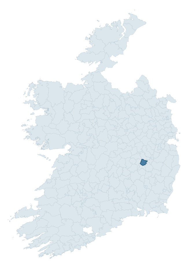
Where this barony sits in the Republic of Ireland
Geology and preservation
Bedrock geology shapes the landscape long before any settlement begins — controlling soil drainage, agricultural potential, the survival of upstanding monuments, and the preservation of buried archaeology. The figures below come from the Geological Survey Ireland 1:100,000 bedrock map.
The bedrock underlying Narragh And Reban West is predominantly limestone (100% of the barony by area), laid down during the Carboniferous period (100% by area, around 359 to 299 million years ago). Limestone is the most heritage-rich bedrock in Ireland. It supports fertile, well-drained soils that favoured dense Early Medieval settlement and Norman manorial agriculture, and it weathers into karst features — sinkholes, caves, swallow holes, and souterrains — that frequently carry archaeology. Where peat overlies limestone, organic preservation can be exceptional. The single largest mapped unit is the Ballysteen Formation (35% of the barony's bedrock). With only 1 distinct rock type mapped, the barony is geologically uniform compared to the rest of the Republic (0th percentile for diversity) — a single coherent bedrock landscape.
Largest mapped unit: Ballysteen Formation (35% of the barony)
Placename evidence
Logainm records 10 heritage-diagnostic placenames for Narragh And Reban West, a modest sample drawn predominantly from the townland record. The dominant stratum is pre-christian defensive. The most frequent diagnostic roots are ráth- (4) and cill- (4). With a sample of this size the count should be treated as indicative rather than definitive.
Pre-Christian / Early Medieval Defensive
| Root | Count | Meaning |
|---|---|---|
| ráth- | 4 | earthen ringfort |
Early Christian Ecclesiastical
| Root | Count | Meaning |
|---|---|---|
| cill- | 4 | church (early) |
Burial, Ritual, and Norse-Contact
| Root | Count | Meaning |
|---|---|---|
| sián- | 2 | fairy mound |
| gall- | 1 | foreigner — Norse settlement marker |
Other baronies in Kildare
About this profile
Click any section below to expand.
What is a barony?
A barony is a historic administrative unit in Ireland, broadly equivalent to an English hundred. The 280 baronies used here are from the OSi 2019 National Statutory Boundaries (generalised 20m), covering the 26 counties of the Republic of Ireland. Baronies derive from the Norman period, were formalised in the 17th century, and have not been redrawn for statistical purposes. They vary enormously in area, from compact urban baronies in Dublin to vast upland baronies in Connacht, and should not be compared by raw site count without accounting for area differences.
What counts as a site?
This profile combines three distinct heritage registers, each with its own definition of what constitutes a recordable site:
- Archaeological sites (NMS). The National Monuments Service Sites and Monuments Record (SMR) catalogues every known archaeological monument or site of archaeological interest in the Republic, from prehistoric burial mounds and ringforts to medieval churches and post-medieval defensive works. Inclusion does not require legal protection — only that the site has been identified, surveyed, and assessed as having archaeological value. A separate subset of these sites lies within a recorded protection zone, which gives them statutory protection under the National Monuments Acts.
- Listed buildings (NIAH). The National Inventory of Architectural Heritage records buildings of architectural, historical, archaeological, artistic, cultural, scientific, social, or technical interest. Each surveyed structure is appraised on a five-tier scale: International, National, Regional, Local, and Record-Only. The NIAH appraisal is informational rather than strictly statutory, but it underpins local-authority Record of Protected Structures (RPS) listings.
- Heritage placenames (Logainm). Logainm is the authoritative database of Irish placenames maintained by the Placenames Branch. This profile applies a heritage-diagnostic classifier to the Irish-language form of each townland name, flagging roots that signal defensive sites (ráth-, lios-, dún-, caiseal-, cathair-), ecclesiastical foundations (cill-, teampall-, domhnach-, mainistir-), prehistoric burial-ritual features (tuaim-, carn-, leaba-), or Norse-contact settlement (gall-). Townlands without one of these diagnostic roots are not flagged here — they may still carry historical significance, but that significance is not encoded in the name itself.
Editorial principles
The narrative sections of this profile follow several explicit principles:
- Evidential. Every claim about this barony’s heritage character is anchored in the underlying register data. Where a site count, a placename count, or a percentile rank is cited, it is computed from the source datasets at export time, not estimated.
- Comparative. Counts and metrics are reported alongside their percentile rank against the other 279 ROI baronies. A barony with 50 ringforts in absolute terms could be unusually high or unusually low depending on its size and regional context; percentile ranking removes that ambiguity.
- Transparent on limits. Where a register has known coverage gaps, survey biases, or data-quality issues that affect this barony’s figures, the profile flags them rather than presenting the numbers as definitive.
- No interpretation beyond what the data supports. The narrative does not speculate about historical events, social dynamics, or cultural meaning beyond what the recorded heritage and placename evidence directly attests.
Data caveats and limits
- NMS Sites and Monuments Record is the product of survey campaigns conducted at different intensities across different counties and decades. Some baronies have been surveyed more thoroughly than others, and absolute counts should be read in that light. Sites destroyed by development before survey are typically not represented; sites in heavily forested or upland terrain are sometimes under-recorded.
- NIAH coverage is broadly complete for the Republic of Ireland but the survey was conducted on a rolling county-by-county basis, and the most recent appraisal date varies. Buildings demolished or substantially altered after their original survey may still appear in the register; conversely, recent buildings of merit may not yet have been appraised.
- Logainm classification applies a deliberately conservative pattern-matching approach to the Irish-language townland forms. The classifier prioritises true positives over recall: a townland may carry a heritage signal that the classifier doesn’t recognise, particularly where the diagnostic root has been heavily anglicised or where the townland name draws on a less common term. The 60,000+ townland records and ~9,800 classified placenames give a substantial signal at barony scale, but individual townland names should be checked against Logainm directly for definitive interpretation.
- Period attribution. The chronological distribution reflects only those NMS sites that carry a recognised period attribution in the source data. Sites listed as “Unknown” period are excluded from the dated subset.
- Boundary changes. Some baronies have undergone minor boundary adjustments since their 19th-century definition; the OSi 2019 generalised boundaries used here are the current statutory definition and may differ slightly from historical maps in border areas.
- Bedrock geology is mapped at 1:100,000 scale, which means local variation within a barony — small pockets of different rock type, mineral veins, alluvium overlying bedrock — is generalised. The dominant-system and rocktype figures are area-weighted, so a barony reading “70% Carboniferous limestone” may still contain small but archaeologically important pockets of older or younger rock. Around 3% of GSI polygons do not match the lexicon and contribute no rocktype or system attribution.
Data sources
- National Monuments Service — Sites and Monuments Record (SMR) https://data.gov.ie/dataset/national-monuments-service-archaeological-survey-of-ireland
- National Inventory of Architectural Heritage (NIAH) https://data.gov.ie/dataset/national-inventory-of-architectural-heritage-niah-national-dataset
- Logainm — Placenames Database of Ireland https://www.logainm.ie/
- Ordnance Survey Ireland — National Statutory Barony Boundaries 2019 https://data-osi.opendata.arcgis.com/
- EURODEM — European Digital Elevation Model https://www.mapsforeurope.org/datasets/euro-dem
- ESA WorldCover https://esa-worldcover.org/en
- Geological Survey Ireland — 1:100,000 Bedrock Geology https://www.gsi.ie/en-ie/data-and-maps/Pages/Bedrock.aspx
Explore more: Search any of the 280 ROI baronies, browse by historical province, or read the methodology and data sources for the full Republic of Ireland Heritage Tool.