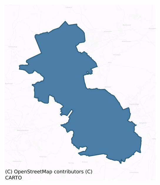
Offaly East is a barony of County Kildare, in the historical province of Leinster (Irish: Uíbh Fhailí Thoir), covering 190 km² of land. The barony records 422 NMS archaeological sites and 183 NIAH listed buildings, placing it at around the 62nd percentile among 280 ROI baronies for sites per km². This means it is in the upper half of all baronies for sites per km². Dated archaeological evidence runs from the Early Bronze Age through to the Modern, spanning 6 of 9 archaeological periods, placing the barony in the 9th percentile among 280 ROI baronies for chronological depth. This means it is in the bottom tenth of all baronies for chronological depth. The largest dated subset of recorded sites dates to the Early Bronze Age.

Heritage at a glance
Percentile rankings throughout this profile compare each barony only against the other 279 Republic of Ireland baronies.
The recorded heritage of Offaly East
The National Monuments Service Sites and Monuments Record (SMR) is the statutory inventory of archaeological sites for the Republic of Ireland, maintained by the Department of Tourism, Culture, Arts, Gaeltacht, Sport and Media. Sites recorded here include earthworks, ringforts, megalithic tombs, ecclesiastical remains, and post-medieval features; not every record is legally protected, but each is registered as a monument of archaeological interest.
The National Monuments Service records 422 archaeological sites in Offaly East, putting it at the 62nd percentile among 280 ROI baronies for sites per km². This means it is in the upper half of all baronies for sites per km². Protection coverage is near-universal — 403 sites (96%) fall within a recorded monument protection zone, indicating an extensively surveyed landscape. The record is dominated by burial and ritual monuments — barrows, cairns, and megalithic tombs (122 sites, 29% of the total), with defensive sites forming a substantial secondary presence (88 sites, 21%). Barrow – ring-barrow is the most prevalent type, making up 15% of the barony's recorded sites (65 records) — well above the ROI average of 3% across all baronies where this type occurs. Barrow – ring-barrow is a Bronze/Iron Age burial monument: a low circular area enclosed by ditch and outer bank. Other significant types include Enclosure (56) and Mound (24). Enclosure is a banked or ditched feature of uncertain type, used as a catch-all where the original function cannot be determined from surface evidence; Mound is an artificial earthen elevation of unknown date and function that cannot be classified as another known monument type. Across the barony's 190 km², this gives a recorded density of 2.22 sites per km².
Most common monument types
Hover or tap a monument type to see its definition.
| Type | Count |
|---|---|
| Barrow – ring-barrow a Bronze/Iron Age burial monument: a low circular area enclosed by ditch and outer bank | 65 |
| Enclosure a banked or ditched feature of uncertain type, used as a catch-all where the original function cannot be determined from surface evidence | 56 |
| Mound an artificial earthen elevation of unknown date and function that cannot be classified as another known monument type | 24 |
| Ringfort – rath an earthen ringfort enclosed by a bank and external ditch — the most common Early Medieval farmstead, broadly dated 500–1000 AD | 20 |
| Church a building used for public Christian worship, of any date from c. 500 AD onwards | 13 |
| Burial an isolated interment of human or animal remains, not associated with a formal burial ground | 13 |
| Graveyard a burial area associated with a church, in use from the medieval period onwards | 12 |
Chronological distribution
The dated archaeological record for Offaly East spans from the Early Bronze Age through to the Modern, with activity attested across 6 of 9 archaeological periods. This is the 9th percentile across ROI baronies — a relatively narrow chronological band, with much of Irish prehistory not represented in the dated record. The record is near-continuous, with only the Post Medieval period falling inside the span without any recorded sites. Activity concentrates most heavily in the Early Bronze Age (113 sites, 37% of dated material), with the Early Medieval forming a secondary peak (77 sites, 25%). A further 114 recorded sites (27% of the overall NMS register for the barony) carry no period attribution — appearing as 'Unknown' in the bar chart below. This typically reflects either records that pre-date the standardised period vocabulary or sites awaiting specialist dating review, rather than a genuine absence of chronological evidence.
Sample of recorded monuments
Show 25 sample monuments (of 422 total)
A representative sample of 25 recorded monuments drawn from the barony’s 422 total NMS entries. Sites within a recorded monument protection zone and rarer site types are prioritised so the list shows a meaningful cross-section rather than only the most common type. Each entry shows the official Sites and Monuments Record reference number and the description published by the National Monuments Service.
Hillfort
Outline of hillfort clearly visible on oblique aerial photograph (CUCAP AHL092) taken 26/06/1963. The upper portion of Dunmurry Hill (OD 769 feet) is girdled by a very poorly preserved, low, broad, grassed-over stoney…
Outline of hillfort clearly visible on oblique aerial photograph (CUCAP AHL092) taken 26/06/1963. The upper portion of Dunmurry Hill (OD 769 feet) is girdled by a very poorly preserved, low, broad, grassed-over stoney bank (av. Wth 6m; int H 0.2-0.5m; ext. H 0.5-1.4m), augmented and reused as a townland boundary wall with Guidenstown South from NNW-NE, and reduced to a low scarp (H0.6m) at SE. (At NE the former townland boundary wall indicated on the OS 6-inch mapping has been levelled.) A large oval area is enclosed (diams. c. 370m NW-SE; c. 200m NE-SW) and contains a small enclosure (KD022-001002-) on the summit of the hill, with a small mound or possible cairn just to its E (KD022-001003-) and two possible hut sites downslope to the SSE (KD022-001004- and KD022-001005-). A large telecommunications compound has been built in the NW sector and a service road overlies the older enclosing element along the SW.
The hillfort was recently described in the Atlas of Hillforts of Britain and Ireland as following; 'Oval fort situated surrounding the summit and SE facing slopes of Dunmurry Hill. The summit offers panoramic views in all directions. The univallate hillfort has a total site footprint of 6.3ha and comprises a poorly preserved, grass covered stoney bank up to 6m wide and 0.5m high, with no obvious ditch feature. A mound (probably prehistoric), two possible hut structures and a small enclosure are apparent within the interior of the hillfort. Interior under pasture with…
Historic town
On a low ridge at the W-edge of the Curragh. According to Bradley et al. (1986 vol. 3, 196-265), the name Kildare is derived from Cill Dara, ‘the church of the oak’, a tree which, according to the 7th century writer…
On a low ridge at the W-edge of the Curragh. According to Bradley et al. (1986 vol. 3, 196-265), the name Kildare is derived from Cill Dara, ‘the church of the oak’, a tree which, according to the 7th century writer Cogitosus, stood beside St. Brigid’s early-6th century monastery (KD022-029002-). The Annals of Clonmacnoise record that in 1012, ‘all the Towen of Kildare was burnt by a thunderbolt but one house’, suggesting a secular, urban-type settlement had developed in association with the monastery. A borough was established at Kildare before 1176, and became the principal manor of Strongbow's Lordship in north Leinster, and the earliest fortification may have been a motte (KD022-029025-). By the end of the 13th century, Kildare contained a castle (KD022-029004-), a cathedral (KD022-029005-), and both Franciscan (KD022-029006-) and Carmelite friaries (KD022-029007-). A parliament was held there in 1309-10. In 1316, John Fitzthomas, newly created earl of Kildare, was granted the town and castle. Bradley et al (op. cit., 199) suggest a population of about 1,000 in the town in the early-14th century. In 1515, the town received a new charter, and a weekly market and burgesses were licensed to enclose the town with walls and a fosse (KD022-029009-). It was the scene of an engagement in 1598, during the Nine Years War, when it was so badly damaged that it was described by Fynes Moryson (1907, ii, 351) as, ‘altogether disinhabited’. The cathedral was ruined and roofless in 160…
Castle – Anglo-Norman masonry castle
Stands between Nugent St. to the W and Cox’s Lane to the E. Gatehouse on E side of Anglo-Norman poygonal shaped enclosure castle was converted into a tower house in the 15th century which now stands in the car park of…
Stands between Nugent St. to the W and Cox’s Lane to the E. Gatehouse on E side of Anglo-Norman poygonal shaped enclosure castle was converted into a tower house in the 15th century which now stands in the car park of the Silken Tomas hotel in Kildare town. According to Bradley et al. (1986 vol. 3, 207-13), the Anglo-Norman castle originally consisted of a curtain-walled, polygonal enclosure (area c. 0.43 hectares) with four towers, and a possible motte (KD022-029025-) at its S-angle. Today only three sides of the polygonal walled enclosure or curtain wall (NW, NE and SE), a gatehouse converted into a tower house and the lower courses of two mural towers (at SW and N) survive above ground. Kildare town was used frequently by Strongbow as a base during the early 1170s, and the castle, which was in existence before 1185 (Curtis 1933-43, i, 4), may have been built by Strongbow himself, rather than the generally accepted builder, William Marshall. Between 1297 and 1299 repairs were carried out to the houses, towers and gates, and a new bakehouse, kitchen and well were constructed (38th PRI rep. DK, 47-48, 102). The castle was sufficiently strong to withstand a three-day assault by Edmund Bruce in 1316. In 1331, it was described as having four towers, a chapel and a kitchen.
The Anglo-Norman gatehouse was converted into a tower house of 15th century date, with the curtain wall of the polygonal castle acting as the bawn wall for the 15th century tower house. Access to the A…
Cathedral
Near the centre of a graveyard (KD022-029003-), just NW of the Market Sq. According to Bradley et al. (1986 Vol. 3, 217-21), St. Brigid's Cathedral is the successor to the pre-Norman church of Kildare. It consists of a…
Near the centre of a graveyard (KD022-029003-), just NW of the Market Sq. According to Bradley et al. (1986 Vol. 3, 217-21), St. Brigid's Cathedral is the successor to the pre-Norman church of Kildare. It consists of a nave and chancel church, with an almost square crossing tower and transepts, built of roughly coursed limestone with ashlar quoins (int dims: nave L c. 23.4m; Wth c. 9.3m; chancel L c. 12.5m; Wth c. 6.8m; tower L c. 6.8m; Wth c. 6.8m; N and S transepts L c. 8.1m; Wth c. 7.5m). The N transept, the greater part of the chancel, the W windows of the nave, and the N, E and W walls of the tower were entirely rebuilt during the restoration begun in1896, when external buttressing was also added to both nave and chancel. Earlier restorations had also occurred: the cathedral was in ruinous condition in 1223, when it was rebuilt by the first English bishop, Ralph of Bristol (Gwynn and Hadcock 1970, 83). The roof was pulled down in 1588 and the tower, chancel and north transept collapsed, possibly due to a failure of the foundations. The choir was rebuilt in 1686 and served as a cathedral until the late-19th century restoration of the entire structure. The chancel is lit by three graded lancets above a blank arcade of trefoil-headed arches with pointed canopies, and the restored N and S walls contain two, opposing lancets. The restored crossing tower rises from square piers with centrally attached shafts, and high pointed arches open into the nave, chancel and transept…
Religious house – Franciscan friars
In a graveyard (KD022-029067-) on low-lying ground to the SW of Kildare town (KD022-029001-). A possible holy well (KD022-030—-) lies outside the graveyard’s W wall. A Franciscan friary, the precise foundation date of…
In a graveyard (KD022-029067-) on low-lying ground to the SW of Kildare town (KD022-029001-). A possible holy well (KD022-030—-) lies outside the graveyard’s W wall. A Franciscan friary, the precise foundation date of which is uncertain: Gwynn and Hadcock (1970, 252) quote sources suggesting a founding c. 1254 by the ancestors of the earls of Kildare, or a founding c.1260, either by Gerald Fitz Maurice alone, or jointly with William de Vesci. The friars received a royal grant in 1276-8. John Fitz Thomas, 1st earl of Kildare was buried in the church in 1316, Thomas Fitz John, 2nd earl was buried in the Lady Chapel in 1328, followed by his son, Richard, in 1329. When surrendered in 1539, the friary included a church and belfry, dormitory, hall, three chambers, kitchen, cemetery and two gardens, while in November 1540, the jurors reported that all the buildings except the church and most of the cloister had been burnt in the previous May by O’Conor. The friary was re-established in 1621 (op. cit). According to Bradley et al. (1986 vol. 3, 246-51), the surviving remains comprise a ruined and overgrown nave and chancel church (est. int. L c. 20m E-W; Wth c. 5m) built of roughly coursed limestone blocks with no visible quoins or jambs surviving, which originally had a side chapel at the N. To the S, the remains of a claustral building survive as the collapsed, grass-covered walls (H 0.75m) of a rectangular area (est. L c. 15.5 N-S; Wth c. 4.4 m). The upstanding structure is ma…
Religious house – Carmelite friars
Located to the WNW of St. Brigid’s Cathedral (KD022-029005-) in a graveyard (KD022-029061-). The Carmelite Priory of St Mary, founded by William de Vesci in 1290. In 1539 it consisted of a church, belfry, dormitory,…
Located to the WNW of St. Brigid’s Cathedral (KD022-029005-) in a graveyard (KD022-029061-). The Carmelite Priory of St Mary, founded by William de Vesci in 1290. In 1539 it consisted of a church, belfry, dormitory, hall, and two chambers. All the buildings except the church and messuage were burned in 1540 (Gwynn and Hadcock 1970, 290). According to Bradley et al. (1986 vol. 3, 243-6), a late-18th century drawing by Cooper shows a roofless, single-aisled church, with two small traceried roundels above in the E wall, six pointed lancets and a flat lintelled doorway towards the W in the S wall (JKAS 1971-6, 436, 490). There are no visible remains of the priory, but it is indicated on Rocque’s 1757 map immediately S of the modern Carmelite church. Late medieval limestone panels (KD022-029062-, KD022-029063-, KD022-029064-, KD022-029065- and KD022-029066-) set in the N transept wall of the modern church may have originated in the earlier church.
Compiled by: Gearóid Conroy
Date of upload: 23 January 2012
Town defences
According to Bradley et al. (1986 vol. 3, 213), a charter of 1515 authorised the burgesses of Kildare to enclose the town with a stone wall and a fosse, for which a murage grant was provided. Thomas (1992, 125) suggests…
According to Bradley et al. (1986 vol. 3, 213), a charter of 1515 authorised the burgesses of Kildare to enclose the town with a stone wall and a fosse, for which a murage grant was provided. Thomas (1992, 125) suggests that that grant, ‘… made a few years after the death of the “great earl” of Kildare but during the lord deputy-ship of his son, may therefore have been to restore an existing but decayed wall, or else to upgrade a simple earthen enclosure.’ While the existence of a murage grant is not proof positive that defences were either constructed or repaired at that date, Kildare’s frontier location strongly suggests that town defences were a necessity, unless the strong Anglo Norman castle (KD022-029004-) was deemed sufficient to meet any threat. No visible physical evidence for the morphology of the town defences survives, and any description is based on, mainly later, historical sources, and any suggested town wall course is conjectural. The earliest reference to town gates only occurs in the later-17th century, when, in 1674, three gates are mentioned; Clare Gate, Ellis Gate and White Gate, and a Fire Castle, which may also have formed part of the defences. The Clare Gate was situated on Claregate Street on the W side of the town (PRONI D 30378/2/3/5), and is indicated on Roque's 1757 map. Bradley et al’s mapping (op. cit. 213, Fig. 85) suggests a location at c. ITM E 672649 N 712438. Ellis Gate was probably located on Station Road, on the highest point of the ri…
Round tower
In the NW sector of a graveyard (KD022-029003-), c. 30m NW of St. Brigid's Cathedral (KD022-029020-). According to Bradley et al. (1986 Vol 3, 222), the base and lower courses of the tower are built of evenly coursed…
In the NW sector of a graveyard (KD022-029003-), c. 30m NW of St. Brigid's Cathedral (KD022-029020-). According to Bradley et al. (1986 Vol 3, 222), the base and lower courses of the tower are built of evenly coursed granite blocks, with roughly coursed limestone blocks above (H. 32.6m; diam. 5.3m). There are seven floors; five supported on corbels, with the third and sixth on offsets. The red sandstone Romanesque doorway faces SE (H. above ground level 4.6m), and is of four orders (the outermost order is modern) with a gable above. The ornament includes chevrons, rosettes and foliation. There are narrow pointed splayed windows on the second, third, fourth and fifth floors, and five windows, each partially blocked at the base, on the top floor. Battlements were added in the 18th century. (Fitzgerald 1891-5, 76, 86-91; De Paor 1967, 137; Barrow 1979, 118-122)
Compiled by: Gearóid Conroy
Date of upload: 24 January 2012
Cross – High cross
In the SW sector of a graveyard (KD022-029003-), to the SW of St. Brigid’s Cathedral (KD022-029005-). According to Bradley et al. (1986 Vol 3, 224-5), a damaged undecorated, ringed, granite cross-head, the upper portion…
In the SW sector of a graveyard (KD022-029003-), to the SW of St. Brigid’s Cathedral (KD022-029005-). According to Bradley et al. (1986 Vol 3, 224-5), a damaged undecorated, ringed, granite cross-head, the upper portion of which is missing, is carried on a tall, plain, gently tapering granite shaft (H 3m; Wth 0.56m; T 0.31m) on a large, almost square base (H 1.2m; L 1.36m; Wth c.1.33m).
Compiled by: Gearóid Conroy
date o fupload: 24 January 2012
Castle – motte
Acording to Bradley et al. (1986 Vol. 3, 211-12), Rocque's map of Kildare town (1757) shows a mound to the SW of the Anglo Norman masonry castle (KD022-029004-). This may have been a motte which was subsequently…
Acording to Bradley et al. (1986 Vol. 3, 211-12), Rocque's map of Kildare town (1757) shows a mound to the SW of the Anglo Norman masonry castle (KD022-029004-). This may have been a motte which was subsequently incorporated into the defences of the later castle. No visible surface traces survive.
Compiled by: Gearóid Conroy
Date of upload: 30 January 2012
Religious house – Knights Hospitallers
In a graveyard (KD022-034001-) near the top of a short, gentle, E-facing pasture slope, Tully House located 170m to E. According to Gwynn and Hadcock (1970, 338-9), the church 'de Tuly' was confirmed to the Knights…
In a graveyard (KD022-034001-) near the top of a short, gentle, E-facing pasture slope, Tully House located 170m to E. According to Gwynn and Hadcock (1970, 338-9), the church 'de Tuly' was confirmed to the Knights Hospitallers by Pope Innocent III in 1212, probably on the site of Tulach-Fobhair, an early dependency of Fore. The Order of the Hospital of St John of Jerusalem originated in a hospice founded in Jerusalem around 1070 to care for pilgrims and was dedicated to St John the Baptist. The order of St. John of Jerusalem is also known today as the Knights Hospitaller and the Knights of Malta. The Order of the Hospital of St John of Jerusalem in Ireland consisted of a central Priory founded at Kilmainham (DU018-020286-), Co. Dublin in 1174 with subordinate houses known as preceptories located through the country. Tully church is one of these preceptories and is sometimes referred to in historical documents as the manor of Tully. The preceptory is one of three in Co. Kildare mentioned in the register of Chapter Acts of the Hospital of Kilmainham for 1326-39: see also Killybegs (KD013-019001-) and Kilteel (KD020-007003-) (DHR 1985, 108-9). The foundation date of the preceptory is not known and was established some time between 1174 and 1212. A carved sandstone fragment with roll moulding of 12th century appearance may suggest that there was an earlier Romanesque church here prior to the foundation of the Preceptory. This fragment has a sheela-na-gig (KD022-037…
Cross – Wayside cross
A limestone block (dims L 1.04m; Wth 0.9m; 0.48m) with a shallow rectangular mortice, now lying beside a small heap of limestone rubble on which it appears to have stood originally; possibly the 'very small mound' noted…
A limestone block (dims L 1.04m; Wth 0.9m; 0.48m) with a shallow rectangular mortice, now lying beside a small heap of limestone rubble on which it appears to have stood originally; possibly the 'very small mound' noted in the OSL (Herity 2002 157 (2)). It is possibly 'Richard Fitzgerald's cross' mentioned in 1591 as marking the mearing of lands at Rathbride (JKAS 1899-1902, 396-7).
Compiled by: Gearóid Conroy
Date of upload: 10 June 2011
Religious house – unclassified
On a stud farm in gently undulating pasture, sloping generally downwards towards the NE. According to local information (SMR file, 1987), the friary of the Black Friars stood here formerly, and ploughing turned up large…
On a stud farm in gently undulating pasture, sloping generally downwards towards the NE. According to local information (SMR file, 1987), the friary of the Black Friars stood here formerly, and ploughing turned up large quantities of stone, some of which was cut. Apparently, stone was removed from the site and used in the construction of some local houses. The townland name Friarstown suggests the townland was a farm belonging to the Preceptory of the Knights Hospitallers at Tully (KD022-034—-). It may therefore have been the site of a monastic grange, with a residence and farm buildings, and the stone found at this location could be the remains of such a settlement. In the Extents of Monastic Possessions (White 1943) two messuages (ie house, offices, yards etc) are mentioned in the 1540 extent, which were likely to have been the residences and farm buildings of the two tenants – Mawen OGwyn and Cormack McKylmerton. A cottage was also mentioned at Friarstown (pers. comm. Mr. Con Manning). No visible surface traces survive.
Compiled by: Gearóid Conroy
Date of upload: 3 October 2012
House – indeterminate date
The foundations of a two-roomed house (dims. L 12m; Wth 5m) are visible as low, earthen banks. Possibly the remains of a traditional, clay-walled house of uncertain date. (An Foras Forbartha report 1984, 2: SMR…
The foundations of a two-roomed house (dims. L 12m; Wth 5m) are visible as low, earthen banks. Possibly the remains of a traditional, clay-walled house of uncertain date. (An Foras Forbartha report 1984, 2: SMR file)
Compiled by: Gearóid Conroy
Date of upload: 10 June 2011
Earthwork
Earthworks which comprises the Archaeological Complex of the Curragh which was a focus of burials in the prehistoric period. This zone was listed as an Archaeological Complex in the Record of Monuments and Places for…
Earthworks which comprises the Archaeological Complex of the Curragh which was a focus of burials in the prehistoric period. This zone was listed as an Archaeological Complex in the Record of Monuments and Places for Co. Kildare published in 1995. This record was listed to cover the archaeological landscape including all the monuments on The Curragh of Kildare. Every individual monument has been assigned an individual monument number.
Compiled by: Gearóid Conroy
Revised by: Caimin O'Brien
Date of revised upload: 4 March 2021
Ringfort – unclassified
On a very gentle NW-facing pasture slope. Shown on the 1st ed. (1838) of the OS 6-inch map as a circular area (est. max. diam. c. 35m) enclosed by a bank. Only a very slightly curving arc of bank (int. H 0.7m; Wth 2.6m;…
On a very gentle NW-facing pasture slope. Shown on the 1st ed. (1838) of the OS 6-inch map as a circular area (est. max. diam. c. 35m) enclosed by a bank. Only a very slightly curving arc of bank (int. H 0.7m; Wth 2.6m; ext H 0.6m) at NE survives, and has been planted with a hedge and reused as a field boundary. A farmyard and paddock occupy the N limits.
Compiled by: Gearóid Conroy
Date of upload: 30 August 2012
Bullaun stone
In a graveyard (KD012-006005-) which forms part of the early ecclesiastical site at Lullymore (KD012-006—-). A roughly hexagonal-shaped stone (dims. L c. 1m; Wth c. 1m; T c. 0.2m) contains a shallow, circular hollow…
In a graveyard (KD012-006005-) which forms part of the early ecclesiastical site at Lullymore (KD012-006—-). A roughly hexagonal-shaped stone (dims. L c. 1m; Wth c. 1m; T c. 0.2m) contains a shallow, circular hollow (diam. c. 0.5m; D c. 0.12m).
Compiled by: Gearóid Conroy
Date of upload: 10 June 2011
Cairn – unclassified
Near the centre of a rectangular enclosure (KD017-018002-) located at the S end of a possible medieval field system (KD017-018001-) which is abutted at W by a possible early ecclesiastical enclosure (KD017-018003-). A…
Near the centre of a rectangular enclosure (KD017-018002-) located at the S end of a possible medieval field system (KD017-018001-) which is abutted at W by a possible early ecclesiastical enclosure (KD017-018003-). A low, circular, grass-covered cairn (diam. c. 8m; H c. 0.6m) composed of small angular stones and glacial boulders was levelled in a 1957 land reclamation project. (SMR File) It contained a possible burial (KD017-018006-).
Compiled by: Gearóid Conroy
Date of upload: 10 June 2011
Standing stone
At the E end of a low, narrow pasture ridge overlooking the narrow flood-plain of the Slate River which flows SW c. 100m to the N, and overlooked by the embankment of the Grand Canal (Athy Branch) c. 30m to the S. A…
At the E end of a low, narrow pasture ridge overlooking the narrow flood-plain of the Slate River which flows SW c. 100m to the N, and overlooked by the embankment of the Grand Canal (Athy Branch) c. 30m to the S. A thin granite stone with a square base (dims. L 0.25m; Wth 0.25m) tapers gently to a semi-rounded top (H 1.4m). The N and S faces are worked smooth while the E and W faces are rough. Smoothing on the SW and SE angles is caused by scratching livestock, which have worn a shallow circular depression in the ground surface around the bass of the stone (diam. 2.5m; D 0.4m). The stone has been erected on a low, oval, grass-covered mound (diams. 20m E-W; 12m N-S; H 0.2-0.7m).
Compiled by: Gearóid Conroy
Date of upload: 10 June 2011
Inauguration site
A mound (KD017-028001-) and unclassified castle (KD017-028002-), where, according to Fitzgerald (1891-95, 148), 'a town of Kildare jarvey gave … a garbled story about how in former times the Earls of Kildare used to…
A mound (KD017-028001-) and unclassified castle (KD017-028002-), where, according to Fitzgerald (1891-95, 148), 'a town of Kildare jarvey gave … a garbled story about how in former times the Earls of Kildare used to crown the Kings of Leinster on this rock …' . An editorial interjection in a later Fitzgerald article (1912-14, 424) records, ' "The Tryal and Conviction of Alexander Graydon, Esq.," a pamphlet preserved in the Library of Trinity College, Dublin, gives an account of the ceremony of electing a sovereign here in 1730'. Anglo-Norman families are not normally associated with inauguration sites and it would be unusual if the monuments here had been used in such ceremonies, however the name of the site 'Chair of Kildare' does suggest a possible ceremonial function.
Compiled by: Gearóid Conroy
Date of upload: 10 June 2011
Children's burial ground
Located 4m S of the SW corner of a church (KD017-008—-). Two small, plain, rectangular, unworked, earthfast flags (dims. H 0.5m; L 0.4m N-S; T 0.10m) stand in line a short distance apart, their long axes in line with…
Located 4m S of the SW corner of a church (KD017-008—-). Two small, plain, rectangular, unworked, earthfast flags (dims. H 0.5m; L 0.4m N-S; T 0.10m) stand in line a short distance apart, their long axes in line with the W gable wall of the church, and appear to be burial markers, possibly the graves of children.
Compiled by: Gearóid Conroy
Date of upload: 10 June 2011
Barrow – pond barrow
In open level wet rough pasture. An oval, wet, pond-like area (int. diams. 23.3m NNW-SSE; 18m NNW-SSE) is defined by a low, very broad, denuded earthen bank (Wth 3.3 – 10m; int. H 0.3m; ext. H 0.1 – 0.5m) densely…
In open level wet rough pasture. An oval, wet, pond-like area (int. diams. 23.3m NNW-SSE; 18m NNW-SSE) is defined by a low, very broad, denuded earthen bank (Wth 3.3 – 10m; int. H 0.3m; ext. H 0.1 – 0.5m) densely overgrown with whins WNW-N. Two possible ring-barrows lie nearby; KD027-043—- c. 50m to the ENE and KD027-044—- c. 65m to the ESE.
Compiled by: Gearóid Conroy
Date of upload: 26 October 2012
Tomb – effigial (present location)
A large collection of cross slabs, grave slabs, decorated stones and three effigies (See KD022-029023- and KD022-029027- to KD022-029057-), dating from the 10th to the 17th centuries have been placed in St. Brigid’s…
A large collection of cross slabs, grave slabs, decorated stones and three effigies (See KD022-029023- and KD022-029027- to KD022-029057-), dating from the 10th to the 17th centuries have been placed in St. Brigid’s Cathedral (KD022-029005-).
KD022-029034-: The County Kildare Archaeological Society were responsible for removing the Walter Wellesley Tomb from Great Connell Abbey (KD023-016—) to Kildare Cathedral for safekeeping in 1971. The tomb was re-erected in S transept of Kildare Cathedral on 17 July 1971. Prior to this move the effigial tomb had been broken up into several fragments that had been inserted into the S face of the W wall of the graveyard either side of the entrance gate. Photographs taken by Edwin Rae show the fragments incorporated into the W wall of the abbey graveyard (KD023-016001-) (http://hdl.handle.net/2262/34868).
The Urban Survey of Kildare (Bradley et. al. 1986 vol. 3, 228-9 Fig. 104) described the effigial tomb as following; 'Of limestone, the end panels are complete but the side panels only survive in fragmentary sections (L 1.9m; Wth 0.98m; H 0.94m). The Bishop is depicted under a pinnacled and crocketed canopy which is supported by two angels carrying shields emblazoned with crosses, the arms of Wellesley. He wears an amice or neck-scarf, a chasuble decorated with a central panel of fine embroidery, a fringed dalmatic, an alb and a girdle. His manipled left hand holds a foliated, in-turned crozier and the gloved right hand is rai…
Tomb – table tomb
A large collection of cross slabs, grave slabs, decorated stones and three effigies (See KD022-029023- and KD022-029027- to KD022-029057-), dating from the 10th to the 17th centuries have been placed in St. Brigid’s…
A large collection of cross slabs, grave slabs, decorated stones and three effigies (See KD022-029023- and KD022-029027- to KD022-029057-), dating from the 10th to the 17th centuries have been placed in St. Brigid’s Cathedral (KD022-029005-).
KD022-029038-: Four decorated limestone fragments; three in the S transept and a fourth laid against the outer face of the chancel’s E gable wall. According to Bradley et al. (1986 vol. 3, 232-33 Fig. 109), the fragments form part of an elaborate table tomb (surviving max. Wth 2.71m; H 0.62m) decorated with Christ crucified on a Latin cross, bead and reel mouldings, pillastered niches with foliated stems, ivy, grapes and animals including a sheep, a winged animal with talons, a fox-and goose and three human heads.
Compiled by: Gearóid Conroy
Date of upload: 2 February 2012
Barrow – ring-barrow
On a short, gentle, S-facing slope, overgrown with whins. Described by O'Riordáin (1950, 277: Site E1; scaled section at W Plate XXVII) as an irregular area, 'enclosed by a bank, outside which a slight ditch and low…
On a short, gentle, S-facing slope, overgrown with whins. Described by O'Riordáin (1950, 277: Site E1; scaled section at W Plate XXVII) as an irregular area, 'enclosed by a bank, outside which a slight ditch and low bank are discernible. Interior is sub-divided by banks, the plan of which is not clear as much of the area is overgrown'. A rectangular area (int. dims. L 51.5m E-W; Wth 41m) is defined by a low earthen bank (Wth 4.5m; int H 0.5m; ext H 0.7m) with very faint traces of an outer fosse (Wth 0.9m; D 0.1m) at E. There is an entrance gap (Wth 2.4m) at S. The interior falls 1.5m N-S and a possible ringbarrow lies in the SW sector, where a small circular area (diam. 5.3m) is defined by a broad, shallow fosse (Wth 3.1m at N; D 0.3m) and a low outer earthen bank (Wth 4m; H 0.3-0.8m), N-S. The W-half of the monument has been disturbed and three short lengths of later field banks run from the larger enclosure's bank to converge on the barrow at SE, SW and NW. The larger enclosure may be a later feature and a second ringbarrow (KD022-065001-) lies 10m to the S. The monument is visible on a 1970 aerial photograph (CUCAP BDU 21) which also shows up to 13 small circular enclosures (est. av. diam. 6-10m) in its immediate vicinity; some may be ringbarrows/ringditches, but some are almost certainly lunging rings. The group has been designated KD022-065—-.
Compiled by: Gearóid Conroy
Date of upload: 10 June 2011
Listed buildings
The National Inventory of Architectural Heritage (NIAH) is a state survey appraising buildings of architectural, historical, archaeological, artistic, cultural, scientific, social, or technical interest. Each surveyed structure receives a rating from International (the highest, for buildings of European importance) through National, Regional, Local, and Record-Only.
The NIAH records 183 listed buildings in Offaly East, the 74th percentile across ROI baronies for listed-building density. The highest-graded structures include 2 of National significance. The Republic holds 937 National-graded buildings in total, so this barony accounts for around 0% of the national total. Construction dates concentrate most heavily in the Victorian (1830-1900) period. The most-recorded building type is house (76 examples, 42% of the listed stock).
Terrain and environment
Mean elevation across the barony is 92m — the 52nd percentile among 280 ROI baronies for elevation. This means it is in the upper half of all baronies for elevation. Elevation matters for heritage because higher-altitude baronies typically favour defensive monuments — ringforts and hilltop forts placed on prominent ground — while lowland baronies are more likely to carry the dense settlement and church networks of intensive agricultural landscapes. A maximum elevation of 228m gives the barony meaningful vertical relief. Mean slope is 2.4° — the 21st percentile among 280 ROI baronies for slope. This means it is in the bottom third of all baronies for slope. This is broadly flat terrain, the kind of landscape best suited to intensive agriculture. Slope is a key control on both land use and archaeological preservation: steep ground resists ploughing and tends to preserve earthworks intact, while gentle slopes favour intensive cultivation that damages or destroys surface archaeology over time. The Topographic Wetness Index averages 11.6, the 78th percentile among 280 ROI baronies for wetness. This means it is in the top third of all baronies for wetness. This is wet, slow-draining ground by ROI standards — the kind of landscape that may carry waterlogged archaeological sites of unusual preservation value. Drainage matters for heritage because poorly-drained ground preserves organic archaeology (wooden trackways, leather, textiles, and on rare occasions human remains) far better than free-draining soil; well-drained ground favours arable use but destroys organic material rapidly. The land-cover mosaic combines improved grassland (69%), woodland (16%), and arable farmland (12%), giving a mixed agricultural and semi-natural landscape.
Terrain measurements
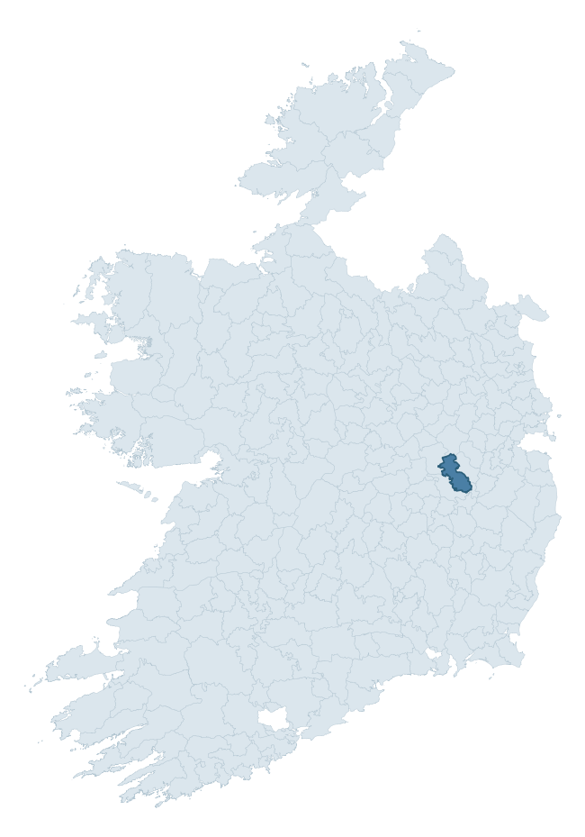
Where this barony sits in the Republic of Ireland
Geology and preservation
Bedrock geology shapes the landscape long before any settlement begins — controlling soil drainage, agricultural potential, the survival of upstanding monuments, and the preservation of buried archaeology. The figures below come from the Geological Survey Ireland 1:100,000 bedrock map.
The bedrock underlying Offaly East is predominantly limestone (94% of the barony by area), laid down during the Carboniferous period (96% by area, around 359 to 299 million years ago). Limestone is the most heritage-rich bedrock in Ireland. It supports fertile, well-drained soils that favoured dense Early Medieval settlement and Norman manorial agriculture, and it weathers into karst features — sinkholes, caves, swallow holes, and souterrains — that frequently carry archaeology. Where peat overlies limestone, organic preservation can be exceptional.
Rock type composition
Largest mapped unit: Boston Hill Formation (22% of the barony)
Placename evidence
Logainm records 5 heritage-diagnostic placenames for Offaly East, a modest sample drawn predominantly from the townland record. The dominant stratum is pre-christian defensive. The most frequent diagnostic roots are ráth- (1) and dún- (1). With a sample of this size the count should be treated as indicative rather than definitive.
Pre-Christian / Early Medieval Defensive
| Root | Count | Meaning |
|---|---|---|
| ráth- | 1 | earthen ringfort |
| dún- | 1 | hilltop or promontory fort |
Early Christian Ecclesiastical
| Root | Count | Meaning |
|---|---|---|
| cill- | 1 | church (early) |
| gráinseach- | 1 | monastic farm / grange |
Burial, Ritual, and Norse-Contact
| Root | Count | Meaning |
|---|---|---|
| carn- | 1 | cairn |
Other baronies in Kildare
- Carbury
- Narragh And Reban West
- Narragh And Reban East
- Clane
- Kilkea And Moone
- Ikeathy And Oughterany
- Kilcullen
- Morgallion — Meath
- Duleek Lower — Meath
- Kells Upper — Meath
See all 280 baronies in the Republic of Ireland Heritage Tool.

Explore further
Grounding History: 10 Maps of Northern Ireland’s Past
If you’re interested in Irish heritage more widely, the companion report for Northern Ireland brings together the analysis of all 462 NI wards into one place through 10 high-quality maps — covering monument density, archaeological periods, placename heritage, terrain, wetland, and the historic landscape at first survey. Take a look.
About this profile
Click any section below to expand.
What is a barony?
A barony is a historic administrative unit in Ireland, broadly equivalent to an English hundred. The 280 baronies used here are from the OSi 2019 National Statutory Boundaries (generalised 20m), covering the 26 counties of the Republic of Ireland. Baronies derive from the Norman period, were formalised in the 17th century, and have not been redrawn for statistical purposes. They vary enormously in area, from compact urban baronies in Dublin to vast upland baronies in Connacht, and should not be compared by raw site count without accounting for area differences.
What counts as a site?
This profile combines three distinct heritage registers, each with its own definition of what constitutes a recordable site:
- Archaeological sites (NMS). The National Monuments Service Sites and Monuments Record (SMR) catalogues every known archaeological monument or site of archaeological interest in the Republic, from prehistoric burial mounds and ringforts to medieval churches and post-medieval defensive works. Inclusion does not require legal protection — only that the site has been identified, surveyed, and assessed as having archaeological value. A separate subset of these sites lies within a recorded protection zone, which gives them statutory protection under the National Monuments Acts.
- Listed buildings (NIAH). The National Inventory of Architectural Heritage records buildings of architectural, historical, archaeological, artistic, cultural, scientific, social, or technical interest. Each surveyed structure is appraised on a five-tier scale: International, National, Regional, Local, and Record-Only. The NIAH appraisal is informational rather than strictly statutory, but it underpins local-authority Record of Protected Structures (RPS) listings.
- Heritage placenames (Logainm). Logainm is the authoritative database of Irish placenames maintained by the Placenames Branch. This profile applies a heritage-diagnostic classifier to the Irish-language form of each townland name, flagging roots that signal defensive sites (ráth-, lios-, dún-, caiseal-, cathair-), ecclesiastical foundations (cill-, teampall-, domhnach-, mainistir-), prehistoric burial-ritual features (tuaim-, carn-, leaba-), or Norse-contact settlement (gall-). Townlands without one of these diagnostic roots are not flagged here — they may still carry historical significance, but that significance is not encoded in the name itself.
Editorial principles
The narrative sections of this profile follow several explicit principles:
- Evidential. Every claim about this barony’s heritage character is anchored in the underlying register data. Where a site count, a placename count, or a percentile rank is cited, it is computed from the source datasets at export time, not estimated.
- Comparative. Counts and metrics are reported alongside their percentile rank against the other 279 ROI baronies. A barony with 50 ringforts in absolute terms could be unusually high or unusually low depending on its size and regional context; percentile ranking removes that ambiguity.
- Transparent on limits. Where a register has known coverage gaps, survey biases, or data-quality issues that affect this barony’s figures, the profile flags them rather than presenting the numbers as definitive.
- No interpretation beyond what the data supports. The narrative does not speculate about historical events, social dynamics, or cultural meaning beyond what the recorded heritage and placename evidence directly attests.
Data caveats and limits
- NMS Sites and Monuments Record is the product of survey campaigns conducted at different intensities across different counties and decades. Some baronies have been surveyed more thoroughly than others, and absolute counts should be read in that light. Sites destroyed by development before survey are typically not represented; sites in heavily forested or upland terrain are sometimes under-recorded.
- NIAH coverage is broadly complete for the Republic of Ireland but the survey was conducted on a rolling county-by-county basis, and the most recent appraisal date varies. Buildings demolished or substantially altered after their original survey may still appear in the register; conversely, recent buildings of merit may not yet have been appraised.
- Logainm classification applies a deliberately conservative pattern-matching approach to the Irish-language townland forms. The classifier prioritises true positives over recall: a townland may carry a heritage signal that the classifier doesn’t recognise, particularly where the diagnostic root has been heavily anglicised or where the townland name draws on a less common term. The 60,000+ townland records and ~9,800 classified placenames give a substantial signal at barony scale, but individual townland names should be checked against Logainm directly for definitive interpretation.
- Period attribution. The chronological distribution reflects only those NMS sites that carry a recognised period attribution in the source data. Sites listed as “Unknown” period are excluded from the dated subset.
- Boundary changes. Some baronies have undergone minor boundary adjustments since their 19th-century definition; the OSi 2019 generalised boundaries used here are the current statutory definition and may differ slightly from historical maps in border areas.
- Bedrock geology is mapped at 1:100,000 scale, which means local variation within a barony — small pockets of different rock type, mineral veins, alluvium overlying bedrock — is generalised. The dominant-system and rocktype figures are area-weighted, so a barony reading “70% Carboniferous limestone” may still contain small but archaeologically important pockets of older or younger rock. Around 3% of GSI polygons do not match the lexicon and contribute no rocktype or system attribution.
Data sources
- National Monuments Service — Sites and Monuments Record (SMR) https://data.gov.ie/dataset/national-monuments-service-archaeological-survey-of-ireland
- National Inventory of Architectural Heritage (NIAH) https://data.gov.ie/dataset/national-inventory-of-architectural-heritage-niah-national-dataset
- Logainm — Placenames Database of Ireland https://www.logainm.ie/
- Ordnance Survey Ireland — National Statutory Barony Boundaries 2019 https://data-osi.opendata.arcgis.com/
- EURODEM — European Digital Elevation Model https://www.mapsforeurope.org/datasets/euro-dem
- ESA WorldCover https://esa-worldcover.org/en
- Geological Survey Ireland — 1:100,000 Bedrock Geology https://www.gsi.ie/en-ie/data-and-maps/Pages/Bedrock.aspx
Explore more: Search any of the 280 ROI baronies, browse by historical province, or read the methodology and data sources for the full Republic of Ireland Heritage Tool.