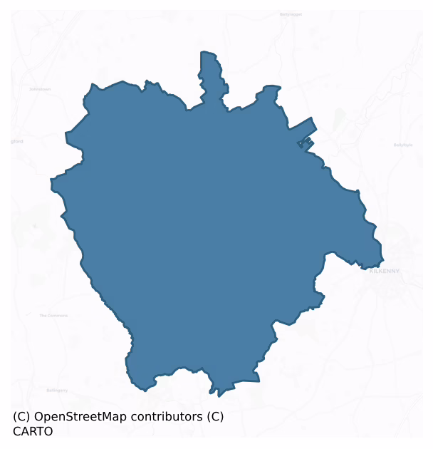
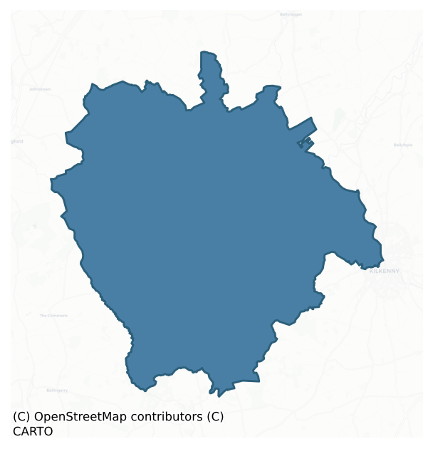
Crannagh is a barony of County Kilkenny, in the historical province of Leinster (Irish: Crannach), covering 236 km² of land. The barony records 571 NMS archaeological sites and 189 NIAH listed buildings, placing it at around the 69th percentile among 280 ROI baronies for sites per km². This means it is in the top third of all baronies for sites per km². Dated archaeological evidence runs from the Neolithic through to the Modern, spanning 8 of 9 archaeological periods, placing the barony in the 81st percentile among 280 ROI baronies for chronological depth. This means it is in the top fifth of all baronies for chronological depth. The largest dated subset of recorded sites dates to the Iron Age. Logainm flags 36 placenames in the barony as carrying a recognised heritage root; the largest share — around 56% — are names associated with early Christian church and monastic foundations.
Heritage at a glance
Percentile rankings throughout this profile compare each barony only against the other 279 Republic of Ireland baronies.
The recorded heritage of Crannagh
The National Monuments Service Sites and Monuments Record (SMR) is the statutory inventory of archaeological sites for the Republic of Ireland, maintained by the Department of Tourism, Culture, Arts, Gaeltacht, Sport and Media. Sites recorded here include earthworks, ringforts, megalithic tombs, ecclesiastical remains, and post-medieval features; not every record is legally protected, but each is registered as a monument of archaeological interest.
The National Monuments Service records 571 archaeological sites in Crannagh, putting it at the 69th percentile among 280 ROI baronies for sites per km². This means it is in the top third of all baronies for sites per km². Protection coverage is near-universal — 561 sites (98%) fall within a recorded monument protection zone, indicating an extensively surveyed landscape. The dominant category is defensive sites — ringforts, enclosures, hillforts, and stone forts (274 sites, 48% of the record). The most diagnostically specific type is Ringfort – rath (65 records, 11% of the barony's NMS total) — compared to an ROI average of 20% across all baronies where this type occurs. Ringfort – rath is an earthen ringfort enclosed by a bank and external ditch — the most common Early Medieval farmstead, broadly dated 500–1000 AD. The broader 'Enclosure' classification — which catches unclassified ringforts and field enclosures — accounts for a further 140 records (25%) and reflects the difficulty of sub-classifying degraded earthworks from surface evidence alone. Across the barony's 236 km², this gives a recorded density of 2.42 sites per km².
Most common monument types
Hover or tap a monument type to see its definition.
| Type | Count |
|---|---|
| Enclosure a banked or ditched feature of uncertain type, used as a catch-all where the original function cannot be determined from surface evidence | 140 |
| Ringfort – rath an earthen ringfort enclosed by a bank and external ditch — the most common Early Medieval farmstead, broadly dated 500–1000 AD | 65 |
| Church a building used for public Christian worship, of any date from c. 500 AD onwards | 29 |
| Ring-ditch a circular ditch under 20m across, often the ploughed-out remains of a barrow, ring-barrow or roundhouse | 26 |
| Graveyard a burial area associated with a church, in use from the medieval period onwards | 25 |
| Graveslab a recumbent grave-marking slab, dated 1200–1700 AD | 20 |
| Castle – unclassified a castle whose form cannot be precisely classified, dating somewhere between the late 12th and 16th centuries | 19 |
| Ritual site – holy well a well or spring traditionally associated with a saint, often credited with healing properties; many trace earlier ritual origins but devotion is documented from the medieval period onwards | 14 |
Chronological distribution
The dated archaeological record for Crannagh spans from the Neolithic through to the Modern, with activity attested across 8 of 9 archaeological periods. This is the 81st percentile across ROI baronies for chronological depth — an above-average span. Every period from earliest to latest is represented in the record — an unbroken sequence of dated activity across the full chronological span. Activity concentrates most heavily in the Iron Age (210 sites, 48% of dated material), with the Early Medieval forming a secondary peak (107 sites, 25%). A further 138 recorded sites (24% of the overall NMS register for the barony) carry no period attribution — appearing as 'Unknown' in the bar chart below. This typically reflects either records that pre-date the standardised period vocabulary or sites awaiting specialist dating review, rather than a genuine absence of chronological evidence.
Sample of recorded monuments
Show 25 sample monuments (of 571 total)
A representative sample of 25 recorded monuments drawn from the barony’s 571 total NMS entries. Sites within a recorded monument protection zone and rarer site types are prioritised so the list shows a meaningful cross-section rather than only the most common type. Each entry shows the official Sites and Monuments Record reference number and the description published by the National Monuments Service.
Megalithic tomb – passage tomb
On the summit of Mount Garret hill (349m), at the centre of a hillfort (KK008-124001-). It consists of a ruined cairn (diam. c. 25m; H 1-2m). Six kerb-stones are exposed along the W side. The monument was investigated…
On the summit of Mount Garret hill (349m), at the centre of a hillfort (KK008-124001-). It consists of a ruined cairn (diam. c. 25m; H 1-2m). Six kerb-stones are exposed along the W side. The monument was investigated by Graves in 1851 and was found to contain a central chamber (L c. 2m; Wth 1.35m; D 1m) (Graves 1849-51, vol. 1, 289-92). Its E side was formed of four 'immense stones, averaging six feet long [1.83m], and from two feet six to three feet wide [0.76-0.91m], piled one on the other'. The W side was of similar construction and was formed of five slabs. The S end was closed by a large slab set on edge. The N extremity was built up with smaller stones 'without any order or regularity'. It appears to have been roofed by two flags 'each about five feet long [1.52m], and between three and four feet wide [0.9m-1.22m]' which were displaced and lay in the chamber. The fill of the chamber contained two adult human skeletons, apparently extended; their heads lay to the S. Some 2m S of this chamber and on a much higher level in the cairn was a small cist. In it were found cremated bone and sherds of pottery with 'indented herring-bone or zig-zag pattern', probably from an urn or food vessel (ibid.). Both the cist and S end stone of the central chamber are still visible. Ryan (1981, 144) has suggested that this monument may be a probable Linkardstown-type burial. The occurrence of a central megalithic chamber in a kerbed, round cairn together with the hilltop siting of the m…
Hillfort
In commanding position surrounding the flat summit of Mount Garret. Circular level terrain fort has panoramic views in all directions, however, the shape of the hill prevents views of the N base of the mountain. The…
In commanding position surrounding the flat summit of Mount Garret. Circular level terrain fort has panoramic views in all directions, however, the shape of the hill prevents views of the N base of the mountain. The mountain overlooks an E-W running gap in the Slieveardagh Hills http://hillforts.arch.ox.ac.uk/records/IR0676).
The circular hillfort (diam. 205m) encompasses the higher S end of the ridge and has a large cairn, possibly a passage-tomb (KK008-124001-) at its centre. The hillfort is enclosed by a grass-covered stoney bank (Basal Wth 4-5m; Wth at crest 2.5-3m; H c. 0.3-0.5m) which is clearly visible except in the NW quadrant where it is more denuded. In the E-SE quadrant upright facing stones are visible and for a short length low stone slabs survive both internally and externally, indicating that the grass-covered bank was originally a wall (Wth 2.8m). The interior of the hillfort is undulating and the enclosing element does not follow the contours of the hill but largely ignores them in order to maintain circularity (Pers. Comm. Barry Raftery, 7 October 1986). There is no evidence of an entrance. A substantial field boundary runs NE-SW across the northern half of the hillfort, from NE-W. Another field boundary runs NW-SE through the SW quadrant.
See attached Google Earth satellite image taken 8 March 2010
Compiled by: Jean Farrelly
Date of upload: 4 February 2020
Ecclesiastical site
On a terrace on a hillside, on fairly wet land in rolling grassland. There are good views in all directions. Carrigan (1905, vol. 2, 258) equates the civil parish of Garranamanagh with the parish of Cloran and Garran…
On a terrace on a hillside, on fairly wet land in rolling grassland. There are good views in all directions. Carrigan (1905, vol. 2, 258) equates the civil parish of Garranamanagh with the parish of Cloran and Garran which is mentioned in documents relating to Jerpoint Abbey, 'to which it belonged almost from the time of the Abbey's foundation till its suppression'. He states that, 'The "monastery" of Garranamanagh stood to the west of the late Mr. Nicholas Healy's house, within an enclosure [KK009-058002–] half an acre in extent and surrounded by a fosse 10 ft. [c. 3m] wide and 8 ft. [c. 2.4m] deep. The enclosure, which was covered over with foundations and debris of fallen walls, was levelled and tilled, and the fosse partially filled up, about forty or fifty years ago. Pieces of cut-stone were unearthed at the time, among them being an inscribed flag [KK009-058003-], 8 in. [0.21m] square, whose whereabouts cannot now be traced' (ibid.). This may have been a grange associated with Jerpoint Abbey (KK028-062005-). It is not visible at ground level.
Compiled by: Jean Farrelly
Date of upload: 7 February 2018
Cist
In a low sand and gravel hillock. A single pit burial, aligned NE-SW, protected by a series of slabs was discovered during gravel-digging in 1986. (Cahill and Sikora 2011, vol. 2, 485)
Compiled by: Mary…
In a low sand and gravel hillock. A single pit burial, aligned NE-SW, protected by a series of slabs was discovered during gravel-digging in 1986. (Cahill and Sikora 2011, vol. 2, 485)
Compiled by: Mary Tunney
Date of upload: 11 February 2013
Historic town
On the S bank of the Nuenna River and naturally terminated to the E by the Arigna River, which flows northward to join the Nuenna. There is a suggestion of an early ecclesiastical enclosure in the two concentric curving…
On the S bank of the Nuenna River and naturally terminated to the E by the Arigna River, which flows northward to join the Nuenna. There is a suggestion of an early ecclesiastical enclosure in the two concentric curving boundaries (c. 60m apart) which form the SE quadrant of the town. On the 1st (1839) ed. OS 6-inch map the area between these boundaries is indicated as ‘Glebe’ or church land. It seems likely that the Nuenna would have formed the northern boundary of the ecclesiastical enclosure, however, there are two concentric earthworks (c. 30m apart), curving southward, in the field immediately N of the Nuenna and E of New Bridge Street. These earthworks may indicate that the river, rather than forming a boundary, was actually incorporated into the monastic enclosure. The town is roughly quartered by the main crossroads. The church (KK013-023001-) with its Romanesque porch is roughly centrally placed within the town, at the junction of Kilkenny Street to the S and New Bridge Street to the W. In the N portion of the town long burgess plots run from Kilkenny Street to the Nuenna River. In the SE quarter the plots run southward from Kilkenny Street to the inner or outer line of the Glebe boundary. The SW quarter is dominated by a large and relatively late market square (c. 130m N-S x c. 80m E-W), possibly laid out in the late 17th/18th century, with the base of a cross (KK013-023004-) on its N side.
Freshford owes it origins to a monastic foundation here by St Lachtain (…
Standing stone
On floor of small NW-SE valley. According to Carrigan (1905, vol. 3, 497) this standing stone was known as the ''Sthooic-Rawhaeola' [stook of Rathealy] or pointed rock of Rathealy', 'a pillar stone, 7 feet [2.1m] high,…
On floor of small NW-SE valley. According to Carrigan (1905, vol. 3, 497) this standing stone was known as the ''Sthooic-Rawhaeola' [stook of Rathealy] or pointed rock of Rathealy', 'a pillar stone, 7 feet [2.1m] high, a few hundred yards east of the church [KK013-060001-]. It is said to have been thrown here all the way from Slievenamon by one of the old Irish giants'.
The standing stone (L 2.7m; 0.5m by 0.3m) originally stood in a field c. 230m SW of its present location (KK013-145—-). At some stage it was moved up near the farmyard, then moved again to facilitate the construction of a silage dump (OPW files). It had been leaning against a tree in the farmyard before being placed upright in its present location.
Compiled by: Jean Farrelly
Date of revised upload: 20 July 2015
Barrow – stepped barrow
On a slight natural N-S hillock, a little below the crest of a hillside on gently sloping very wet grassland, on the W slopes of small N-S river valley. There is a stream running immediately outside the SE quadrant and…
On a slight natural N-S hillock, a little below the crest of a hillside on gently sloping very wet grassland, on the W slopes of small N-S river valley. There is a stream running immediately outside the SE quadrant and another stream c. 40m to the N-NW, both indicated on the 1st (1839) ed. OS 6-inch map. There are fair views to N-E-S, but limited by rising ground to W.
A flat, waterlogged oval platform (dims. 30m N-S; 25m E-W) defined by scarp (H 0.9-1.5m) and external berm (Wth c. 7m E and W side; 10-15m N and S side) of lower oval mound (H c. 0.5-1m above external ground level), possibly a modified natural hillock.
Compiled by: Jean Farrelly
Date of upload: 24 March 2020
Concentric enclosure
On a gently sloping bluff in a valley, in reclaimed grassland. There are very fine views in all directions.
Monument identified on an aerial photograph (GSI 1:30,000). The enclosure was not visible at ground level when…
On a gently sloping bluff in a valley, in reclaimed grassland. There are very fine views in all directions.
Monument identified on an aerial photograph (GSI 1:30,000). The enclosure was not visible at ground level when visited in 1987. However, it is visible on satellite imagery (Google Earth imagery date 8 March 2010 and 28 June 2018). It consists of an internal roughly circular enclosure (diam. c. 31m N-S; c. 28m E-W) visible as the cropmark of a fosse, a gap of c. 16m and an outer enclosure (diam. c. 60m) visible as a low bank.
See attached:
KK013-063—-_01 Google Earth image (imagery date 8 March 2010)
KK013-063—-_02 Google Earth image (imagery date 28 June 2018)
Compiled by: Jean Farrelly
Date of upload: 24 March 2020
Ogham stone
Moore (1874-9, 45) records that a farmer, 'unsettled from the flooring of a modern out-office adjoining [Killahy Church KK013-067003-], a five [1.5m] or six feet [c. 1.8m] slab, on which were numerous incised strokes'.…
Moore (1874-9, 45) records that a farmer, 'unsettled from the flooring of a modern out-office adjoining [Killahy Church KK013-067003-], a five [1.5m] or six feet [c. 1.8m] slab, on which were numerous incised strokes'. Unfortunately the slab was subsequently broken up when the graveyard wall was being built, but Moore (ibid.) goes on to say that he, 'discovered a small fragment of it inserted as [a] coigne [quoin] in the north angle of the enclosure; and though much effaced I have no doubt but that the incised characters thereon were Ogham'. None of the ogham fragments were visible when the graveyard was visited in 1987, though it is likely that some, including the piece mentioned by Moore, are incorporated in the graveyard wall.
Compiled by: Jean Farrelly
Date of upload: 24 March 2020
Fish-pond
On the floor of a valley, in mostly reclaimed grassland. Carrigan (1905, vol. 2, 376), describes the 'extensive ruins of a fine mansion of about the year 1700, with fish-pond and lake, both dried up'. A rectangular…
On the floor of a valley, in mostly reclaimed grassland. Carrigan (1905, vol. 2, 376), describes the 'extensive ruins of a fine mansion of about the year 1700, with fish-pond and lake, both dried up'. A rectangular feature (dims. c. 23m x c. 4m), possibly the fish-pond, is located c. 15m SE of the Killahy Castle (KK013-069001-) on the 1st (1839) ed. 6-inch OS map. The fish-pond is not indicated on the subsequent 1900 edition. It is not visible at ground level.
Compiled by: Jean Farrelly
Date of upload: 21 December 2016
Mill – unclassified
The terrier accompanying the Down Survey (1655-6) parish of ‘Freshford and parte of Coolerahin’ (Hibernia Regnum, courtesy of Trinity College Dublin), notes that there is 'at Balliroe=Shortall a Castle & a Church and…
The terrier accompanying the Down Survey (1655-6) parish of ‘Freshford and parte of Coolerahin’ (Hibernia Regnum, courtesy of Trinity College Dublin), notes that there is 'at Balliroe=Shortall a Castle & a Church and Cabbin with a Mill' and the proprietor in 1640 listed as Thomas Shortall Irish Papist. The castle (KK013-096001-) and cabins (KK013-096004-) are indicated on the map but not the mill or the church (KK013-096002-). The castle and houses are indicated within a triangular area at the very S point of Ballyroe townland and this corresponds well to the triangular southern tip of the townland that survives to this day. At this location there is a rectangular platform (dims. 25m N-S; 21m E-W; H 1m) with a berm (Wth 7m) along the E and S sides and a waterlogged fosse (Wth 3m; D 0.5m) along the W and N sides, the N fosse being fed by a diverted stream. A road runs N-S immediately E of the enclosure and a stream, indicated as a ford on the 1st (1839) ed. OS 6-inch map where it meets the road, runs E-W along the S side. It is likely that the buildings depicted on the Down Survey map are located in this field, with one at least, possibly the castle or mill, being located on this platform. A lime kiln is depicted on the 1900 revision and 25-inch OS map roughly centrally placed in the field and there is extensive outcrop and small quarry holes in the field which no doubt relate to that.
KK013-096003-_01 View of platform from NE (from road), Google Earth street view, viewe…
Ford
There was a fording point over the River Nore, according to Carrigan (1905, vol. 2, 55) it was, 'a little to the north of Three Castles Bridge'. The presence of a fording point would have made this a strategic location…
There was a fording point over the River Nore, according to Carrigan (1905, vol. 2, 55) it was, 'a little to the north of Three Castles Bridge'. The presence of a fording point would have made this a strategic location for the motte (KK014-025005-) which is located on the prominent ridge immediately S of the river, c. 200m SE of the ford.
Compiled by: Jean Farrelly
Date of upload: 20 May 2020
Cairn – unclassified
On the crest of a hill with panoramic views. Identified on an aerial photograph (GSI S 476, 1973-7). It is indicated as a trig. station on the 1900 revision of the OS 6-inch map. As it is the highest point for miles…
On the crest of a hill with panoramic views. Identified on an aerial photograph (GSI S 476, 1973-7). It is indicated as a trig. station on the 1900 revision of the OS 6-inch map. As it is the highest point for miles around it has also been utilised for locating television masts. It consists of a roughly raised circular area (diam. c. 15m; H 0.2m) composed of rock with several large boulders around its edge. A bank (H 0.7m; Wth 3m) runs for 10m NW-SE along the NE edge, possibly all that remains of a former field boundary. This may be the remains of a much denuded cairn.
Compiled by: Jean Farrelly
Date of upload: 7 May 2020
Water mill – horizontal-wheeled
The remains of a structure, interpreted as a horizontal water mill, were investigated by the NMI in 1964 (pers. comm. Victor Buckley 1970).
Compiled by: Jean Farrelly
Date of upload: 6 July 2020
Children's burial ground
On the S bank of a stream with trees and scrub growing along both banks of the stream. Indicated on the 1900 revision of the OS 6-inch map as, 'Infants' Burial Ground' and described by Carrigan (1905, 497-8) as a…
On the S bank of a stream with trees and scrub growing along both banks of the stream. Indicated on the 1900 revision of the OS 6-inch map as, 'Infants' Burial Ground' and described by Carrigan (1905, 497-8) as a graveyard, 'now used only for the burial of unbaptized children. Its name is Kyle-na-geawrlach (Cill na n-Geárlach) that is, the Churchyard (literally the Church,) of the Children'.
Compiled by: Jean Farrelly
Date of upload: 6 July 2020
Cross – Wayside cross (present location)
An early 17th-century wayside cross originally located (see KK013-024—-) c. 600m WSW of its current location, near the W end of Freshford, at the back entrance to Uppercourt demesne (Tighe 1802, 426; Prim 1850-51,…
An early 17th-century wayside cross originally located (see KK013-024—-) c. 600m WSW of its current location, near the W end of Freshford, at the back entrance to Uppercourt demesne (Tighe 1802, 426; Prim 1850-51, 170). It was moved from there to its present location on the N edge of the village green by Sir William Morres of Uppercourt c. 1800 (ibid.).
According to Prim (ibid. 171) the cross was erected by Ellen Butler, daughter of Edmond, second Viscount Mountgarret for her husband Lucas Shee who died in 1622. He describes how the monument had been much vandalized and the inscription and armorial bearing defaced. However, he gives portion of the inscription which was decipherable up to c. 1835, as, ‘LUCAE SHEE ARMIGERI NOBILIS UXOR…BTLER…MONUMNETUM. E… T UTRIUSQUE AN…. ERNUM PRECA….. TE…….’ the translation of which, in essence, invokes passers-by to pray for the repose of the souls of Lucas Shee and his wife, the Hon. Ellen Butler (ibid.). The armorial bearing consisted of 'the O’Shee arms, impaling those of the lordly house of Mountgarret, and some elaborate sculptures representing the emblems of the Passion', all of which had been defaced by vandalization (ibid.).
Carrigan (1905, vol. 2, 256) describes the cross as consisting of, ‘a solid graduated base of limestone, supported a square pedestal in which the cross was placed. The cross itself was removed or broken a great many years ago, leaving only the graduated base and socket’. The stepped square-plan pedesta…
Town defences
The Archaeological Survey of Ireland (ASI) is in the process of providing information on all monuments on The Historic Environment Viewer (HEV). Currently the information for this record has not been uploaded. To…
The Archaeological Survey of Ireland (ASI) is in the process of providing information on all monuments on The Historic Environment Viewer (HEV). Currently the information for this record has not been uploaded. To access available information for research purposes please make an appointment in advance with the Archive Unit (open Fridays 10.00 am – 5.00 pm), Department of Culture, Heritage and the Gaeltacht, The Custom House, Dublin 1 D01W6XO or email nmarchive@chg.gov.ie.
See attached photographs:
KK019-026001-_01 Talbot's Tower
KK019-026001-_02 A 15th/16th-century stretch of the town wall of the Hightown was recorded by Cóilín Ó Drisceoil (07E0366) on the S bank of the river Breagagh at No. 6 Watergate Street
KK019-026001-_03 A 15th/16th-century stretch of the town wall of the Hightown was recorded by Cóilín Ó Drisceoil (07E0366) on the S bank of the river Breagagh at No. 6 Watergate Street
KK019-026001-_04 Profile of town wall on Abbey Street, E-facing section (E38330)
Religious house – Dominican friars
The Dominican Priory of the Holy Trinity, known as 'the Black Abbey', was founded by the younger William Marshal (d. 1231) in 1225 (Carrigan 1905, Vol. 3, 176-190; Gwynn and Hadcock 1970, 226; Farrelly et.al. 1993, 16).…
The Dominican Priory of the Holy Trinity, known as 'the Black Abbey', was founded by the younger William Marshal (d. 1231) in 1225 (Carrigan 1905, Vol. 3, 176-190; Gwynn and Hadcock 1970, 226; Farrelly et.al. 1993, 16). The medieval church was a large T-plan structure with an aisled nave; its surviving remains include the nave with a S aisle, the S transept, crossing tower (1527) and the 15th-century W tower. An impressive Decorated-style five-light window, the largest of its kind in Ireland, fills almost the entire S gable of the S transept. The chancel was demolished in 1775 and it, along with the overall plan of the church and its cloisters, is depicted as ruinous on the 1758 John Rocque map of Kilkenny. The E end of the chancel and a section of its tiled floor were recorded in excavations by Frank Ryan in 2000 (Ryan 2000, unpublished; 2002) and parts of its N and S walls and a mortared floor level were unearthed in 1976 in excavations by Raghnall O Floinn (Cahill and Sikora 2011, vol. 2, 345–7). The claustral buildings, situated to the N of the church, were described in 1540 as including a church, belfry, dormitory, chapter house, ‘castle’ over gate, granary, king’s chamber, prior’s chamber, ‘small castle’, toft and Will Dowlaghe’s chamber (Gwynn and Hadcock 1970, 226). Geophysical survey in the prior’s garden (between the River Breagagh and the N side of the church) identified parts of the cloister and N range as well as other structures (Leigh 2004). An upstanding se…
Bullring
The Archaeological Survey of Ireland (ASI) is in the process of providing information on all monuments on The Historic Environment Viewer (HEV). Currently the information for this record has not been uploaded. To…
The Archaeological Survey of Ireland (ASI) is in the process of providing information on all monuments on The Historic Environment Viewer (HEV). Currently the information for this record has not been uploaded. To access available information for research purposes please make an appointment in advance with the Archive Unit (open Fridays 10.00 am – 5.00 pm), Department of Culture, Heritage and the Gaeltacht, The Custom House, Dublin 1 D01W6XO or email nmarchive@chg.gov.ie.
Cathedral
The Archaeological Survey of Ireland (ASI) is in the process of providing information on all monuments on The Historic Environment Viewer (HEV). Currently the information for this record has not been uploaded. To…
The Archaeological Survey of Ireland (ASI) is in the process of providing information on all monuments on The Historic Environment Viewer (HEV). Currently the information for this record has not been uploaded. To access available information for research purposes please make an appointment in advance with the Archive Unit (open Fridays 10.00 am – 5.00 pm), Department of Culture, Heritage and the Gaeltacht, The Custom House, Dublin 1 D01W6XO or email nmarchive@chg.gov.ie.
Almshouse
The Archaeological Survey of Ireland (ASI) is in the process of providing information on all monuments on The Historic Environment Viewer (HEV). Currently the information for this record has not been uploaded. To…
The Archaeological Survey of Ireland (ASI) is in the process of providing information on all monuments on The Historic Environment Viewer (HEV). Currently the information for this record has not been uploaded. To access available information for research purposes please make an appointment in advance with the Archive Unit (open Fridays 10.00 am – 5.00 pm), Department of Culture, Heritage and the Gaeltacht, The Custom House, Dublin 1 D01W6XO or email nmarchive@chg.gov.ie.
Gateway
The Archaeological Survey of Ireland (ASI) is in the process of providing information on all monuments on The Historic Environment Viewer (HEV). Currently the information for this record has not been uploaded. To…
The Archaeological Survey of Ireland (ASI) is in the process of providing information on all monuments on The Historic Environment Viewer (HEV). Currently the information for this record has not been uploaded. To access available information for research purposes please make an appointment in advance with the Archive Unit (open Fridays 10.00 am – 5.00 pm), Department of Culture, Heritage and the Gaeltacht, The Custom House, Dublin 1 D01W6XO or email nmarchive@chg.gov.ie.
See attached photograph:
KK019-026103—-_01
Inn
On the S side of St. Canice's Place (formerly Bull Alley) This was a three- storey gable-fronted building (dims. c. 17m N-S; c. 6.5m E-W), the apex of which was surmounted by a stone chimney. An illustration by Graves,…
On the S side of St. Canice's Place (formerly Bull Alley) This was a three- storey gable-fronted building (dims. c. 17m N-S; c. 6.5m E-W), the apex of which was surmounted by a stone chimney. An illustration by Graves, drawn in 1841, shows a blocked up central opening with a flat-headed three-light window to the E surmounted by a hood-moulding (Prim 1862-3, 152-80). There is a similar hood-moulding to the W of the blocked up opening which suggests there was another three-light window W of the doorway. This window appears to have been broken out and a later doorway inserted with a single light immediately to the W, probably the westernmost light of the original window. Prim also states that there was an original central doorway, later blocked up (ibid., 177). At first-floor level there were two two-light flat-headed windows to the E and W with two plaques between them. One plaque bore the date 1602 with the inscription ‘Insingnia Roberti Jose’, while the other bore the inscription ‘Bulles Inne: Nomen huius faedi dicitur’ which Prim suggests translates as ‘Bull Inn – the name of the house is called' (ibid., 177-8). There are two single-light windows at attic level. All the windows have hood-mouldings. By the end of the 17th century the inn had fallen into a ruinous state (ibid., 180). When Bull Alley was being widened in 1862 the inn was taken down to second-storey level, as it was considered to be in a dangerous condition (ibid.). At present the E wall (H c. 4.5m; L c. 15m)…
Stone sculpture (present location)
Currently in the yard of the Christian Brother’s school at the W end of Evan’s Lane. It had been dug up in the Christian Brother’s monastery garden before 1978, probably in the 1970s (Bradley 1983, 542).
A rectangular…
Currently in the yard of the Christian Brother’s school at the W end of Evan’s Lane. It had been dug up in the Christian Brother’s monastery garden before 1978, probably in the 1970s (Bradley 1983, 542).
A rectangular limestone block (H 0.72m; Wth 0.21m; T 0.205) with the figure carved in relief on one side. The top of the block has been cut off, including the head of the figure and portion of the upper left side and arm of the figure have been damaged and broken off. The figure is described by Bradley (ibid. 542-4) as being that of a man, ‘wearing a pleated skirt and has a cloak coming under his right arm, across the chest, and falling in folds from the left. It is not clear whether the cloak was clutched in the left hand or merely thrown over the arm because this part of the figure is missing. The right hand holds a banded staff and just below the fingers is an object resembling a buckle but which may be a purse. The feet, his right shoulder and chest are base. Underneath the figure is a small recessed panel ornamented with three rosettes’. The figure was originally set into a wall and Bradley (ibid. 545) suggests that as it is too large to be part of a chest tomb it may have been incorporated into a cloister arcade, perhaps at the nearby Dominican friary, the ‘Black Abbey’ (KK019-026021-). He also suggests, among other options, that the figure may be that of St James of Compostella and could have on display in the wall of St James’ Gate at the W end of James’ Street…
Enclosure
On a terrace on a hillside, on fairly wet land in rolling grassland. There are good views in all directions. Carrigan (1905, vol. 2, 258) equates the civil parish of Garranamanagh with the parish of Cloran and Garran…
On a terrace on a hillside, on fairly wet land in rolling grassland. There are good views in all directions. Carrigan (1905, vol. 2, 258) equates the civil parish of Garranamanagh with the parish of Cloran and Garran which is mentioned in documents relating to Jerpoint Abbey, 'to which it belonged almost from the time of the Abbey's foundation till its suppression'. He states that, 'The "monastery" [KK009-058001-] of Garranamanagh stood to the west of the late Mr. Nicholas Healy's house, within an enclosure half an acre in extent and surrounded by a fosse 10 ft. [c. 3m] wide and 8 ft. [c. 2.4m] deep. The enclosure, which was covered over with foundations and debris of fallen walls, was levelled and tilled, and the fosse partially filled up, about forty or fifty years ago. Pieces of cut-stone were unearthed at the time, among them being an inscribed flag [KK009-058003-], 8 in. [0.21m] square, whose whereabouts cannot now be traced' (ibid.). This may have been a grange associated with Jerpoint Abbey (KK028-062005-). It is not visible at ground level.
Compiled by: Jean Farrelly
Date of upload: 7 February 2018
Listed buildings
The National Inventory of Architectural Heritage (NIAH) is a state survey appraising buildings of architectural, historical, archaeological, artistic, cultural, scientific, social, or technical interest. Each surveyed structure receives a rating from International (the highest, for buildings of European importance) through National, Regional, Local, and Record-Only.
The NIAH records 189 listed buildings in Crannagh, the 76th percentile across ROI baronies for listed-building density. Among these, 10 are graded National — buildings of interest to the whole of Ireland rather than only its region. The Republic holds 937 National-graded buildings in total, so this barony accounts for around 1% of the national total. Construction dates concentrate most heavily in the Victorian (1830-1900) period. The most-recorded building type is house (76 examples, 40% of the listed stock).
Terrain and environment
Mean elevation across the barony is 149m — the 85th percentile among 280 ROI baronies for elevation. This means it is in the top fifth of all baronies for elevation. This is a relatively elevated landscape by ROI standards. Elevation matters for heritage because higher-altitude baronies typically favour defensive monuments — ringforts and hilltop forts placed on prominent ground — while lowland baronies are more likely to carry the dense settlement and church networks of intensive agricultural landscapes. A maximum elevation of 347m gives the barony meaningful vertical relief. Mean slope is 3.9° — the 56th percentile among 280 ROI baronies for slope. This means it is in the upper half of all baronies for slope. Slope is a key control on both land use and archaeological preservation: steep ground resists ploughing and tends to preserve earthworks intact, while gentle slopes favour intensive cultivation that damages or destroys surface archaeology over time. The Topographic Wetness Index averages 10.6, the 42nd percentile among 280 ROI baronies for wetness. This means it is in the lower half of all baronies for wetness. Drainage matters for heritage because poorly-drained ground preserves organic archaeology (wooden trackways, leather, textiles, and on rare occasions human remains) far better than free-draining soil; well-drained ground favours arable use but destroys organic material rapidly. The land-cover mosaic combines improved grassland (81%), woodland (11%), and arable farmland (6%), giving a mixed agricultural and semi-natural landscape. In overall character, this is elevated but relatively gentle terrain — typical of plateau country, with land use dominated by improved grassland.
Terrain measurements
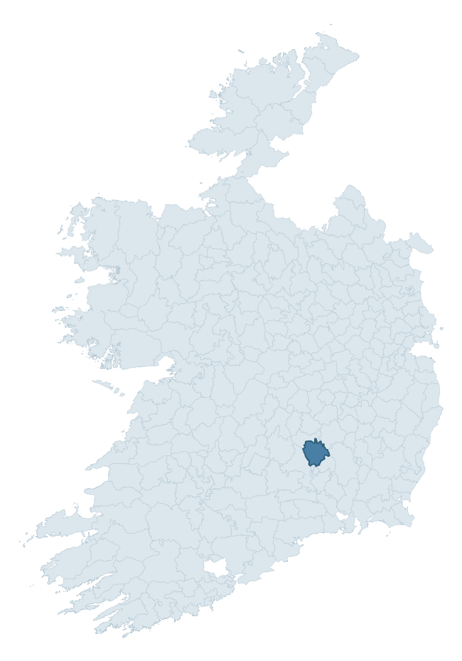
Where this barony sits in the Republic of Ireland
Geology and preservation
Bedrock geology shapes the landscape long before any settlement begins — controlling soil drainage, agricultural potential, the survival of upstanding monuments, and the preservation of buried archaeology. The figures below come from the Geological Survey Ireland 1:100,000 bedrock map.
The bedrock underlying Crannagh is predominantly siltstone (44% of the barony by area), laid down during the Carboniferous period (100% by area, around 359 to 299 million years ago). Siltstone weathers to fertile, moderately heavy soils that supported Early Medieval ringfort agriculture, often interbedded with mudstone in lowland landscapes. A substantial secondary geology of limestone (44%) adds further variety to the underlying landscape. The single largest mapped unit is the Killeshin Siltstone Formation (44% of the barony's bedrock).
Rock type composition
Largest mapped unit: Killeshin Siltstone Formation (45% of the barony)
Placename evidence
Logainm records 36 heritage-diagnostic placenames for Crannagh, drawn from townland and civil-parish names across the barony. The dominant stratum is Early Christian ecclesiastical — cill-, teampall-, and domhnach-prefixed names that record the dense network of early church foundations established between the fifth and tenth centuries. The leading diagnostic roots are cill- (14 — church), ráth- (11 — earthen ringfort), and lios- (2 — ringfort or enclosure). This is broadly in line with the ROI average of 30.7 heritage placenames per barony. The presence of multiple heritage strata side by side indicates layered occupation of the landscape across successive prehistoric and historic periods. Logainm records 226 placenames for Crannagh (predominantly townland names). Of these, 36 (16%) carry one of the diagnostic Gaelic roots tracked above; the remainder draw on more generic landscape vocabulary that does not encode a heritage period.
Pre-Christian / Early Medieval Defensive
| Root | Count | Meaning |
|---|---|---|
| ráth- | 11 | earthen ringfort |
| lios- | 2 | ringfort or enclosure |
| dún- | 2 | hilltop or promontory fort |
| cathair- | 1 | stone fort |
Early Christian Ecclesiastical
| Root | Count | Meaning |
|---|---|---|
| cill- | 14 | church (early) |
| teampall- | 2 | church (later medieval) |
| tobar- | 2 | holy well |
| cillín- | 1 | unconsecrated burial ground |
| gráinseach- | 1 | monastic farm / grange |
Burial, Ritual, and Norse-Contact
| Root | Count | Meaning |
|---|---|---|
| gall- | 2 | foreigner — Norse settlement marker |
Other baronies in Kilkenny
About this profile
Click any section below to expand.
What is a barony?
A barony is a historic administrative unit in Ireland, broadly equivalent to an English hundred. The 280 baronies used here are from the OSi 2019 National Statutory Boundaries (generalised 20m), covering the 26 counties of the Republic of Ireland. Baronies derive from the Norman period, were formalised in the 17th century, and have not been redrawn for statistical purposes. They vary enormously in area, from compact urban baronies in Dublin to vast upland baronies in Connacht, and should not be compared by raw site count without accounting for area differences.
What counts as a site?
This profile combines three distinct heritage registers, each with its own definition of what constitutes a recordable site:
- Archaeological sites (NMS). The National Monuments Service Sites and Monuments Record (SMR) catalogues every known archaeological monument or site of archaeological interest in the Republic, from prehistoric burial mounds and ringforts to medieval churches and post-medieval defensive works. Inclusion does not require legal protection — only that the site has been identified, surveyed, and assessed as having archaeological value. A separate subset of these sites lies within a recorded protection zone, which gives them statutory protection under the National Monuments Acts.
- Listed buildings (NIAH). The National Inventory of Architectural Heritage records buildings of architectural, historical, archaeological, artistic, cultural, scientific, social, or technical interest. Each surveyed structure is appraised on a five-tier scale: International, National, Regional, Local, and Record-Only. The NIAH appraisal is informational rather than strictly statutory, but it underpins local-authority Record of Protected Structures (RPS) listings.
- Heritage placenames (Logainm). Logainm is the authoritative database of Irish placenames maintained by the Placenames Branch. This profile applies a heritage-diagnostic classifier to the Irish-language form of each townland name, flagging roots that signal defensive sites (ráth-, lios-, dún-, caiseal-, cathair-), ecclesiastical foundations (cill-, teampall-, domhnach-, mainistir-), prehistoric burial-ritual features (tuaim-, carn-, leaba-), or Norse-contact settlement (gall-). Townlands without one of these diagnostic roots are not flagged here — they may still carry historical significance, but that significance is not encoded in the name itself.
Editorial principles
The narrative sections of this profile follow several explicit principles:
- Evidential. Every claim about this barony’s heritage character is anchored in the underlying register data. Where a site count, a placename count, or a percentile rank is cited, it is computed from the source datasets at export time, not estimated.
- Comparative. Counts and metrics are reported alongside their percentile rank against the other 279 ROI baronies. A barony with 50 ringforts in absolute terms could be unusually high or unusually low depending on its size and regional context; percentile ranking removes that ambiguity.
- Transparent on limits. Where a register has known coverage gaps, survey biases, or data-quality issues that affect this barony’s figures, the profile flags them rather than presenting the numbers as definitive.
- No interpretation beyond what the data supports. The narrative does not speculate about historical events, social dynamics, or cultural meaning beyond what the recorded heritage and placename evidence directly attests.
Data caveats and limits
- NMS Sites and Monuments Record is the product of survey campaigns conducted at different intensities across different counties and decades. Some baronies have been surveyed more thoroughly than others, and absolute counts should be read in that light. Sites destroyed by development before survey are typically not represented; sites in heavily forested or upland terrain are sometimes under-recorded.
- NIAH coverage is broadly complete for the Republic of Ireland but the survey was conducted on a rolling county-by-county basis, and the most recent appraisal date varies. Buildings demolished or substantially altered after their original survey may still appear in the register; conversely, recent buildings of merit may not yet have been appraised.
- Logainm classification applies a deliberately conservative pattern-matching approach to the Irish-language townland forms. The classifier prioritises true positives over recall: a townland may carry a heritage signal that the classifier doesn’t recognise, particularly where the diagnostic root has been heavily anglicised or where the townland name draws on a less common term. The 60,000+ townland records and ~9,800 classified placenames give a substantial signal at barony scale, but individual townland names should be checked against Logainm directly for definitive interpretation.
- Period attribution. The chronological distribution reflects only those NMS sites that carry a recognised period attribution in the source data. Sites listed as “Unknown” period are excluded from the dated subset.
- Boundary changes. Some baronies have undergone minor boundary adjustments since their 19th-century definition; the OSi 2019 generalised boundaries used here are the current statutory definition and may differ slightly from historical maps in border areas.
- Bedrock geology is mapped at 1:100,000 scale, which means local variation within a barony — small pockets of different rock type, mineral veins, alluvium overlying bedrock — is generalised. The dominant-system and rocktype figures are area-weighted, so a barony reading “70% Carboniferous limestone” may still contain small but archaeologically important pockets of older or younger rock. Around 3% of GSI polygons do not match the lexicon and contribute no rocktype or system attribution.
Data sources
- National Monuments Service — Sites and Monuments Record (SMR) https://data.gov.ie/dataset/national-monuments-service-archaeological-survey-of-ireland
- National Inventory of Architectural Heritage (NIAH) https://data.gov.ie/dataset/national-inventory-of-architectural-heritage-niah-national-dataset
- Logainm — Placenames Database of Ireland https://www.logainm.ie/
- Ordnance Survey Ireland — National Statutory Barony Boundaries 2019 https://data-osi.opendata.arcgis.com/
- EURODEM — European Digital Elevation Model https://www.mapsforeurope.org/datasets/euro-dem
- ESA WorldCover https://esa-worldcover.org/en
- Geological Survey Ireland — 1:100,000 Bedrock Geology https://www.gsi.ie/en-ie/data-and-maps/Pages/Bedrock.aspx
Explore more: Search any of the 280 ROI baronies, browse by historical province, or read the methodology and data sources for the full Republic of Ireland Heritage Tool.