Kells is a barony of County Kilkenny, in the historical province of Leinster (Irish: Ceanannas), covering 155 km² of land. The barony records 297 NMS archaeological sites and 70 NIAH listed buildings, placing it at around the 50th percentile among 280 ROI baronies for sites per km². This means it is in the upper half of all baronies for sites per km². Dated archaeological evidence runs from the Neolithic through to the Post Medieval, spanning 7 of 9 archaeological periods, placing the barony in the 46th percentile among 280 ROI baronies for chronological depth. This means it is in the lower half of all baronies for chronological depth. The largest dated subset of recorded sites dates to the Early Medieval. Logainm flags 29 placenames in the barony as carrying a recognised heritage root; the largest share — around 52% — are names associated with early Christian church and monastic foundations.
Heritage at a glance
Percentile rankings throughout this profile compare each barony only against the other 279 Republic of Ireland baronies.
The recorded heritage of Kells
The National Monuments Service Sites and Monuments Record (SMR) is the statutory inventory of archaeological sites for the Republic of Ireland, maintained by the Department of Tourism, Culture, Arts, Gaeltacht, Sport and Media. Sites recorded here include earthworks, ringforts, megalithic tombs, ecclesiastical remains, and post-medieval features; not every record is legally protected, but each is registered as a monument of archaeological interest.
The National Monuments Service records 297 archaeological sites in Kells, putting it at the 50th percentile among 280 ROI baronies for sites per km². This means it is in the upper half of all baronies for sites per km². Protection coverage is near-universal — 287 sites (97%) fall within a recorded monument protection zone, indicating an extensively surveyed landscape. The record is dominated by defensive sites — ringforts, enclosures, hillforts, and stone forts (107 sites, 36% of the total), with ecclesiastical sites forming a substantial secondary presence (95 sites, 32%). Graveslab is the most prevalent type, making up 13% of the barony's recorded sites (38 records) — well above the ROI average of 4% across all baronies where this type occurs. Graveslab is a recumbent grave-marking slab, dated 1200–1700 AD. Other significant types include Enclosure (32) and Ringfort – rath (23). Enclosure is a banked or ditched feature of uncertain type, used as a catch-all where the original function cannot be determined from surface evidence; Ringfort – rath is an earthen ringfort enclosed by a bank and external ditch — the most common Early Medieval farmstead, broadly dated 500–1000 AD. Across the barony's 155 km², this gives a recorded density of 1.91 sites per km².
Most common monument types
Hover or tap a monument type to see its definition.
| Type | Count |
|---|---|
| Graveslab a recumbent grave-marking slab, dated 1200–1700 AD | 38 |
| Enclosure a banked or ditched feature of uncertain type, used as a catch-all where the original function cannot be determined from surface evidence | 32 |
| Ringfort – rath an earthen ringfort enclosed by a bank and external ditch — the most common Early Medieval farmstead, broadly dated 500–1000 AD | 23 |
| Fulacht fia a horseshoe-shaped Bronze Age burnt mound built around a sunken trough beside a water source, traditionally interpreted as a cooking site | 23 |
| Church a building used for public Christian worship, of any date from c. 500 AD onwards | 16 |
| Graveyard a burial area associated with a church, in use from the medieval period onwards | 15 |
| Ringfort – unclassified a circular Early Medieval settlement enclosure where surviving evidence does not allow distinction between earthen and stone forms | 15 |
| Ritual site – holy well a well or spring traditionally associated with a saint, often credited with healing properties; many trace earlier ritual origins but devotion is documented from the medieval period onwards | 14 |
Chronological distribution
The dated archaeological record for Kells spans from the Neolithic through to the Post Medieval, with activity attested across 7 of 9 archaeological periods. Every period from earliest to latest is represented in the record — an unbroken sequence of dated activity across the full chronological span. Activity concentrates most heavily in the Early Medieval (76 sites, 33% of dated material), with the Medieval forming a secondary peak (69 sites, 30%). A further 64 recorded sites (22% of the overall NMS register for the barony) carry no period attribution — appearing as 'Unknown' in the bar chart below. This typically reflects either records that pre-date the standardised period vocabulary or sites awaiting specialist dating review, rather than a genuine absence of chronological evidence.
Sample of recorded monuments
Show 25 sample monuments (of 297 total)
A representative sample of 25 recorded monuments drawn from the barony’s 297 total NMS entries. Sites within a recorded monument protection zone and rarer site types are prioritised so the list shows a meaningful cross-section rather than only the most common type. Each entry shows the official Sites and Monuments Record reference number and the description published by the National Monuments Service.
Barrow – unclassified
In pasture. Indicated on the 1st (1839) ed. OS 6-inch map and on the 1948 revision as a small circular enclosure (diam. c. 17m), with a stream running N-S along the W side and a field boundary running roughly E-W…
In pasture. Indicated on the 1st (1839) ed. OS 6-inch map and on the 1948 revision as a small circular enclosure (diam. c. 17m), with a stream running N-S along the W side and a field boundary running roughly E-W immediately to the N.
Compiled by: Jean Farrelly
Date of upload: 10 May 2022
Boundary stone
A roughly rectangular limestone boulder incorporated in a field boundary. The stone was recorded in 1867 (Graves 1867, 5-7). According to Carrigan (1905, vol. 3, 382-3) a, ‘memorial of the ownership of Killiny by the…
A roughly rectangular limestone boulder incorporated in a field boundary. The stone was recorded in 1867 (Graves 1867, 5-7). According to Carrigan (1905, vol. 3, 382-3) a, ‘memorial of the ownership of Killiny by the religious community of Kells has been handed down. This is a large stone, evidently a land-mark, at present built into a stile on the boundary fence separating Killiny from Newtown, but which formerly must have stood on a pier or base of masonry. It is smooth on one side, where it has the two following raised Old English inscriptions, of about the year 1500, arranged back to back, so that both must be read from opposite directions: prediu de kelles barron of erly. As the stone was originally set up, the former inscription, viz. Farm of Kelles [Priory], looked towards Killiny, the latter, viz. [Land of Sweetman], Barron of Erly, looked towards the adjoining townland of Newtown, in former times the property of the Sweetman family’. The somewhat worn inscription in Latin, in raised Black Letter script, is visible within slightly recessed rectangular panel set diagonally across one face of the boulder.
See attached photograph:
KK027-015—-_01
Compiled by: Jean Farrelly
Date of upload: 2 December 2019
House – 16th/17th century
On the summit of a low hill with good views to the N and W. The Down Survey (1655-6) barony map of Kells, Co. Kilkenny, depicts a substantial castle in 'Rathculbyne' with an adjacent gabled house with a chimney at one…
On the summit of a low hill with good views to the N and W. The Down Survey (1655-6) barony map of Kells, Co. Kilkenny, depicts a substantial castle in 'Rathculbyne' with an adjacent gabled house with a chimney at one end (Hibernia Regnum, courtesy of Trinity College Dublin). It is shown on the 1st (1839) ed. OS 6-inch map and the 1948 revision as, 'Castle (in ruins)' and the 25-inch OS map indicates the N gable. Only the N gable (wall T 0.83m; surviving L 5.5m – E end is missing) and a short length of the W wall (L 1.55m) at the NW angle survives of a rectangular three-storey house, composed of roughly coursed limestone rubble. It has a externally projecting chimney (Wth 3.4m; D 0.35m) roughly centrally placed in the gable, which is heavily ivy clad both internally and externally.
Internally at first-floor level there are the remains of a small fireplace flanked to the E by a rectangular wall-cupboard. At second-floor features there are two poorly preserved windows (now collapsed) one on either side of the chimney breast and the fragmentary remains of a fireplace.
According to local information the greater part of the E side of the house had collapsed in 1954 and the rubble subsequently removed. Also there had been a small archway adjoining the E side of the N gable and the area around the house was formerly cobbled (local information).
The depiction on the Down Survey map would suggest that there is also a castle at this location which is no longer visible at groun…
Historic town
The town of Kells and the Augustinian Priory were founded in 1193 by Geoffry fitz Robert de Monte Marisco (Killanin and Duignan 1967, 314). The town was granted a borough charter in 1211-16 but there are appear to be no…
The town of Kells and the Augustinian Priory were founded in 1193 by Geoffry fitz Robert de Monte Marisco (Killanin and Duignan 1967, 314). The town was granted a borough charter in 1211-16 but there are appear to be no murage grants (Thomas 1992, vol. 2, 243-4). The privileges granted to the burgesses of Kells by his foundation charter were further augmented by subsequent charters granted by his sons and successors to Kells, William and John de Monte Mauriso (Carrigan 1905, vol. 4, 53-4). The town suffered numerous assaults from the late 13th into 14th century. In 1252 the town was burned by William de Bermingham, in 1316 it was taken by Edward Bruce and in 1327 it was again burned by the de Berminghams, this time with the Geraldines (Carrigan 1905, vol. 4, 54; Killanin and Duignan 1967, 314). In 1346 the town, formerly the property of Eustace le Poer, was granted to Walter de Bermingham when the former was hanged for treason (Carrigan 1905, vol. 4, 54). The town may originally have been centred on the motte (KK027-029001-). On the Down Survey map (1655-8) and area called ‘Common Green’ is depicted between the present RC church and the Augustinian Priory. Recent aerial photographs (Simon Dowling, 14 December 2013; http://aerialarchaeology.blogspot.ie/2013/09/kells-priory-co-kilkenny.html) have shown earthworks which appear to indicate the remains of a borough S of the priory, in the fields immediately S and SW of the medieval parish church (KK027-029009-) which was incorp…
Castle – motte and bailey
On top of a glacial deposit on a flat island with Kings River c. 80m to N-NE and a steam which flows from Kings River to the W and runs 20m S of the motte and bailey before rejoining Kings River to the SE. The bailey is…
On top of a glacial deposit on a flat island with Kings River c. 80m to N-NE and a steam which flows from Kings River to the W and runs 20m S of the motte and bailey before rejoining Kings River to the SE. The bailey is raised above the island, which is probably liable to flood. The ground around the base of the bailey was formerly marshy but has been reclaimed (Ó Drisceoil 2006, 262). There are good views E and W along valley floor, but otherwise the view is impeded by rising ground to N and S of the rivers.
The motte was probably built by Geoffrey FitzRoberts in 1192-3 when he founded the town of Kells and would have been well positioned to control the river crossing (Empey 1984, 36). Defence does not appear to be the primary concern for this motte, though it is constructed on an island and is surrounded by marshland, rather it was to form the caput or focus for FitzRobert’s settlement. As Empey (ibid.) points out, ‘the availability of suitable sufficient arable land for demesne lands, the proximity of a river for the manorial mill, seigniorial fishing rights, and communications’ would all have been important considerations which were fulfilled by this siting. The motte is mentioned in two early 13th-century charters, where it is referred to as a ‘castelli’. In the charter c. 1204-06 to the Augustinian Priory (TS027-029004-), which lies c. 500m to the SE, FitzRobert grants the canons all the fisheries between his mill and the gate of the castle or motte. In the town ch…
Religious house – Augustinian canons
In low-lying terrain on what was formerly an island, with the Kings River flowing along the N side and a channel forming the S side. The later walled and turreted extension lies S of the channel. The foundation lies…
In low-lying terrain on what was formerly an island, with the Kings River flowing along the N side and a channel forming the S side. The later walled and turreted extension lies S of the channel. The foundation lies immediately N of an early medieval church (KK027-009—-) dedicated to St Kieran of Sighir with the possible remains of an ecclesiastical enclosure (Clyne 2007, 19). The medieval town of Kells (KK027-029—-) is located c. 400m to the E. According to Gwynn and Hadcock (1988, 181), in 1183 Geoffry fitz Robert founded a small collegiate establishment in the church of St. Keran of Kenlis, in honour of St. Mary, for four secular priests before bringing over four Augustinian canons from Bodmin Priory, Cornwall at a later date. However, Empey (2007, 1-3) argues that a foundation date of 1193 seems more likely as the land was granted to Geoffrey fitz Robert by William Marshal, who had only gained possession of Leinster in 1192. One of the four canons from Bodmin, Hugh de Rous, became the prior and also became the first Anglo-Norman bishop of Ossory in 1202 (ibid. 4). Over the next three centuries the priory’s fortunes where entwined with those of the neighbouring town. Kells was burnt by William de Bermingham in 1252, the area was devastated by the Bruce invasion in 1317 and Kells sacked by the Fitzgeralds of Desmond ten years later in 1327 (Gwynn and Hadcock 1988, 181; Empey 2007, 5).
It would appear that local families were heavily invested in the fortunes of the…
Water mill – unclassified
At the SE angle of the monastic precinct of Kells Priory (KK027-029004-). Indicated on the 1st (1839) ed. OS 6-inch map as a ‘Mill (in ruins)’ and also appears to be indicated on the Down Survey (1655-6) barony map of…
At the SE angle of the monastic precinct of Kells Priory (KK027-029004-). Indicated on the 1st (1839) ed. OS 6-inch map as a ‘Mill (in ruins)’ and also appears to be indicated on the Down Survey (1655-6) barony map of Kells, Co. Kilkenny (Hibernia Regnum, courtesy of Trinity College Dublin). A mill associated with the Augustinian Priory is mentioned in the foundation charter in the Ormond Deeds, which dates to c. 1204-06, whereby Geoffrey FitzRobert grants that the Priory, 'may enclose and make the said fisheries and their mill ponds in my land beneath my mill towards the north wheresoever they wish or are able, and their mills wherever they are beneath the church of St. Mary I grant and confirm to them. And whoever of my men shall wish to do so shall fully and freely grind in their mills, nor shall it be lawful to any of my men to bring to law those who wish to grind there' (Curtis 1932, vol. 1, 15, deed 30). Several water mills are listed in 1541 as part of the former property of the Priory following the dissolution of the monastery, one possibly within the precinct and it also mentions that it is the duty of the tenants to, 'find a man for cleaning the water-mill when necessary' (White 1943, 188-9).
Clyne (2007, 35) suggests that there was a watermill at this location since the 13th century, with the stream which ran along the outside the S wall of the precinct doubling as both a moat and a millrace. In the 15th century the mill became incorporated in the southern wall…
Cross – Market cross
According to Carrigan (1905, vol. 4, 55-6), the market cross at Kells, ‘stood originally on the roadside, opposite the gateway leading to Bosheen na gcorp, that is, the bosheen [local word for boreen] that formerly led…
According to Carrigan (1905, vol. 4, 55-6), the market cross at Kells, ‘stood originally on the roadside, opposite the gateway leading to Bosheen na gcorp, that is, the bosheen [local word for boreen] that formerly led from the public road down to the Priory [KK027-029004-] and Priory graveyard. It was removed thence to the south corner of the field in which its pedestal now lies. Later on it was again removed to its present position, which is only a few yards distant from the spot on which it was first set up many centuries ago. The cross itself is missing, and the time and manner of its disappearance are unknown. What is now called “the Cross,” merely consists of a great circular stone, wide and thick, in the centre of which is fixed an ornamental cut-stone pedestal, with a socket cut into the top surface for the reception of the cross’.
The circular base (diam. c. 1.5m; H 0.22m), which may be a reused millstone, has a circular socket in the centre into which a circular limestone pedestal (diam. c. 0.66m; H above base 0.31m) has been fitted. The lower portion of this pedestal (H 0.12m) is slightly wider than the upper portion by c. 0.06m. Heather King noted faint traces of arcading on the upper portion, which would be suggestive of a 13th-century date (pers. comm. 1993) (Farrelly et al. 1993, 174).
See attached photograph:
KK027-029012-_01 Urban Archaeological Survey, 25 September 1992
KK027-029012-_02 Google Street View, imagery date September 2019
Compiled by:…
Bridge
Crossing the Kings River N of the village of Kells and c. 60m N of the motte and bailey (KK027-029001-). A bridge is depicted at this location on the Down Survey (1655-6) barony map of Kells, Co. Kilkenny (Hibernia…
Crossing the Kings River N of the village of Kells and c. 60m N of the motte and bailey (KK027-029001-). A bridge is depicted at this location on the Down Survey (1655-6) barony map of Kells, Co. Kilkenny (Hibernia Regnum, courtesy of Trinity College Dublin). The roughly coursed limestone bridge (L c. 60m) runs NNE-SSW, with the upstream side to the W. The present bridge is clearly a two-phase construction. This earlier phase is to the W and consists of 8 round-headed arches with a further flood arch to the S. The bridge was widened in the 18th century, with three large elliptical-headed arches overlapping the central arches of the earlier bridge, while the two outer arches are flush with the original arches. The voussoirs of the earlier bridge are roughly cut but are all similar in size while those on the later upstream side are well cut and have a projecting keystone. There are cut waters between each of the upstream arches, up to springing level of the arches. The S end of this side of the bridge, within the field, is supported by three large buttresses. There are less substantial pyramidal buttresses on the downstream piers. The early phase has been dated to c. 1725 and the rebuild to c. 1775 (National Inventory of Architectural Heritage; http://www.buildingsofireland.ie/niah/search.jsp?type=record&county=KK®no=12315002; viewed 16 November 2017). The present earlier phase of the bridge may incorporate masonry from the bridge depicted here in the 17th century.
See…
Water mill – vertical-wheeled
Carrigan (1905, vol. 4, 54) refers to a grant of 1346 of the, ‘Barony and Lordship of Kenlis, which belonged to Eustace le Poer, are granted by the King to [Lord] Walter de Bermingham’, which includes the manor of…
Carrigan (1905, vol. 4, 54) refers to a grant of 1346 of the, ‘Barony and Lordship of Kenlis, which belonged to Eustace le Poer, are granted by the King to [Lord] Walter de Bermingham’, which includes the manor of Kells, including one water mill. Empey (1984, 37) suggests that, ‘There can be little doubt that the castle mill occupied the site of the present mill about 100 meters north-east of the motte’. This mill could be the water mill, or a least at the location, depicted in a late 18th-century sketch by Vallancy, copied by Beranger (Harbison 1991, 86 and opposite). It is shown as a simple single-storey thatched building, viewed from the W, with a large off-centre door, a small window at eaves level at the mill-wheel end to the S and a possible second window at the opposite end, though this is obscured by a hill (ibid.). A flour mill is shown at this location on the 1st (1839) ed. OS 6-inch map and it is annotated as a ‘Corn Mill’ on the 1948 revision. The present mill occupying the site is that shown on the OS maps and consists of a three-storey four-bay limestone rubble building with a slated roof and mill-wheel on the S gable. Across the mill race, to the S, is a two-story two-bay miller’s house, also of limestone rubble and slated roof.
See attached:
KK027-029014-_01 From Harbison 1991, opposite 86 – a late 18th-century sketch by Vallancy, copied by Beranger
Compiled by: Jean Farrelly
Date of upload: 12 June 2023
Round tower
On a flat-topped hill, surrounded by pasture. There round tower is located on the W edge of the graveyard (KK027-044002-) of Kilree church (KK027-044001-). According to Carrigan (1905, vol. 4, 45), the name Kilree is…
On a flat-topped hill, surrounded by pasture. There round tower is located on the W edge of the graveyard (KK027-044002-) of Kilree church (KK027-044001-). According to Carrigan (1905, vol. 4, 45), the name Kilree is derived from Cill Ruidhche, after St Ruidhche, a female saint who is commemorated on the 8th of February. Kilree church and a high cross (KK027-004404-) are located 7m to the SE and 55m to the W respectively. This round tower (H 29.3m; diam. at base 4.86m) is composed of limestone rubble, roughly coursed. An unusual feature, noted by Lalor (1999 (Reprint 2016), 173), are two offsets, visible on the portion of the wall in the field immediately W of the graveyard, which stand on a monolithic rectangular pad-foundation. The only other known example of this is at the round tower (KK031-030003-) at Aghaviller, c. 6km to the S (ibid.). It was entered via a round-headed sandstone doorway with plain relief architrave in the S face. There are three flat-topped windows, with sandstone surrounds, in the tower, facing N, E and W at various levels and four windows at the top of the tower, facing the four cardinal points. When O’Donovan visited in 1839 (OS Letters) a ladder of ropes had been placed in the tower, ‘by which one can easily climb to the top, where a wooden floor is firmly fixed’ (O’Flanagan 1930, vol. 2, 63-4). He describes the tower as being, ‘fifty feet [15.2m] in circumference at the base and nine feet [2.7m] in diameter on the inside. Its doorway sees the…
Structure
Named 'Hermit's Cave' on the 1st ed. OS 6-inch map (surveyed 1839) where it is represented as a rectangular structure (dims. c. 26m E-W; c. 12m N-S). It has been destroyed by the time of the OS 1:2500 survey in 1899 as…
Named 'Hermit's Cave' on the 1st ed. OS 6-inch map (surveyed 1839) where it is represented as a rectangular structure (dims. c. 26m E-W; c. 12m N-S). It has been destroyed by the time of the OS 1:2500 survey in 1899 as it is there named 'Hermit's Cave (Site of)'. Satellite imagery (DigitalGlobe imagery date 2011-13) shows a reclaimed field with no visible structure at the location of the 'Hermit's Cave'. The precise nature of this feature is unknown.
Compiled by: Jean Farrelly
Date of upload: 5 April 2023
Sheela-na-gig
Sheela-na-gig currently in Rothe House, Kilkenny. Discovered during clearance work in Coolaghmore graveyard (KK030-004003-) containing medieval church (KK030-004001-), and said to have been buried there in early 19th…
Sheela-na-gig currently in Rothe House, Kilkenny. Discovered during clearance work in Coolaghmore graveyard (KK030-004003-) containing medieval church (KK030-004001-), and said to have been buried there in early 19th century, after having been discovered in a local holy well (KK030-004006-) (Freitag 2004, 130). Described by Freitag as a figure, ‘carved in the round. Earless, inverted pear-shaped head; facial expression calm, ovoid eyes, wedge nose and slit-mouth. Thin neck, round shoulders; no breasts, but slightly incised ribs. Fingers of right hand just touching vulva, indicated as vertical line and ending in very noticeable deep hole. Left hand (much larger than the other) may hold an object resting on thigh. Peculiar leg position reminiscent of Egremont; left leg almost straight with foot turned inwards, while right leg tightly flexed at knee with heel of foot pointing at pudenda’ (Freitag 2004, 130). Cross-referenced with KK019-026170-.
See attached:
KK030-004006-_01 https://en.wikipedia.org/wiki/Coolaghmore_Sheela-na-gig
Compiled by: Caimin O'Brien
Date of upload: 6 June 2012
Stoup (present location)
On a SW-NE ridge. Associated with a medieval church (KK030-010001-) in Garryrickin townland, the remaining wall of which was demolished in 1973. According to local information there was a 'holy water font' in the…
On a SW-NE ridge. Associated with a medieval church (KK030-010001-) in Garryrickin townland, the remaining wall of which was demolished in 1973. According to local information there was a 'holy water font' in the church, however, as stoups are commonly described as holy water fonts it is likely that this refers to a stoup and not a font. It is currently unlocated, though it possibly remains in the vicinity of the church.
Compiled by: Jean Farrelly
Date of upload: 25 July 2023
Megalithic structure
The Archaeological Survey of Ireland (ASI) is in the process of providing information on all monuments on The Historic Environment Viewer (HEV). Currently the information for this record has not been uploaded. To…
The Archaeological Survey of Ireland (ASI) is in the process of providing information on all monuments on The Historic Environment Viewer (HEV). Currently the information for this record has not been uploaded. To access available information for research purposes please make an appointment in advance with the Archive Unit (open Fridays 10.00 am – 5.00 pm), Department of Culture, Heritage and the Gaeltacht, The Custom House, Dublin 1 D01W6XO or email nmarchive@chg.gov.ie.
House – early medieval
The Archaeological Survey of Ireland (ASI) is in the process of providing information on all monuments on The Historic Environment Viewer (HEV). Currently the information for this record has not been uploaded. To…
The Archaeological Survey of Ireland (ASI) is in the process of providing information on all monuments on The Historic Environment Viewer (HEV). Currently the information for this record has not been uploaded. To access available information for research purposes please make an appointment in advance with the Archive Unit (open Fridays 10.00 am – 5.00 pm), Department of Culture, Heritage and the Gaeltacht, The Custom House, Dublin 1 D01W6XO or email nmarchive@chg.gov.ie.
Cross – Wayside cross
The Archaeological Survey of Ireland (ASI) is in the process of providing information on all monuments on The Historic Environment Viewer (HEV). Currently the information for this record has not been uploaded. To…
The Archaeological Survey of Ireland (ASI) is in the process of providing information on all monuments on The Historic Environment Viewer (HEV). Currently the information for this record has not been uploaded. To access available information for research purposes please make an appointment in advance with the Archive Unit (open Fridays 10.00 am – 5.00 pm), Department of Culture, Heritage and the Gaeltacht, The Custom House, Dublin 1 D01W6XO or email nmarchive@chg.gov.ie.
Barrow – ring-barrow
On top of a flat ridge with good views to the E and SE, in pasture. Indicated on the 1st (1839) ed. OS 6-inch map as a circular enclosure (diam. c. 16m) but not shown on the 1901 revision. A ring-barrow (overall diam.…
On top of a flat ridge with good views to the E and SE, in pasture. Indicated on the 1st (1839) ed. OS 6-inch map as a circular enclosure (diam. c. 16m) but not shown on the 1901 revision. A ring-barrow (overall diam. 19.5m) consisting of a flat central area (diam. c. 6.5m), enclosed by a fosse (top Wth 3.8m; basal Wth 1.6m; D 0.5m) and outer bank (Wth 3m; int. H 0.9m; ext. H 0.5m). There is a causewayed entrance in the SE sector (Wth c. 2m over fosse; c. 3m gap in bank). There monument is heavily overgrown with furze bushes.
Compiled by: Jean Farrelly
Date of upload: 4 July 2022
Standing stone (present location)
The Archaeological Survey of Ireland (ASI) is in the process of providing information on all monuments on The Historic Environment Viewer (HEV). Currently the information for this record has not been uploaded. To…
The Archaeological Survey of Ireland (ASI) is in the process of providing information on all monuments on The Historic Environment Viewer (HEV). Currently the information for this record has not been uploaded. To access available information for research purposes please make an appointment in advance with the Archive Unit (open Fridays 10.00 am – 5.00 pm), Department of Culture, Heritage and the Gaeltacht, The Custom House, Dublin 1 D01W6XO or email nmarchive@chg.gov.ie.
House – medieval
Excavated in 2006-7 in advance of the N9/N10 Kilcullen to Waterford Road Improvement Scheme. Excavation licence no. 2517, AR054, Area E. One of a cluster of monuments found in close proximity to each other in an area c.…
Excavated in 2006-7 in advance of the N9/N10 Kilcullen to Waterford Road Improvement Scheme. Excavation licence no. 2517, AR054, Area E. One of a cluster of monuments found in close proximity to each other in an area c. 1.8ha with dates ranging from the Late Neolithic to the early medieval period. A circular ring-slot trench (diam. c. 5m), wider and deeper than other similar monuments in the area (KK031-077—-, KK031-078—-). These structures are interpreted as medieval and would appear to be contemporary with a ringfort (KK031-082—-) that truncates the palisaded enclosure. Radiocarbon dated to 899-1028 AD (UBA 10698). (Channing 2009, 255-6, no. 1003; 2010a, 234, no. 881; 2010b)
Compiled by: Mary Tunney
Date of upload: 25 September 2013
Flat cemetery
Excavated in 2006-7 in advance of the N9/N10 Kilcullen to Waterford Road Improvement Scheme. Excavation licence no. 2517, AR 053, Area B. One of a cluster of monuments found in close proximity to each other in an area…
Excavated in 2006-7 in advance of the N9/N10 Kilcullen to Waterford Road Improvement Scheme. Excavation licence no. 2517, AR 053, Area B. One of a cluster of monuments found in close proximity to each other in an area c. 1.8ha with dates ranging from the Late Neolithic to the early medieval period. 9 individual subcircular shallow pits (av. D 0.13m; av. L 0.4m; av. Wth 0.4m), 4 inside and 4 outside an Iron Age palisaded enclosure (KK031-076—-) and occupying an area of 10m x 12m but without any obvious pattern. The pits were set into subsoil directly beneath topsoil and contained the remains of adult and child cremations and charcoal. The cemetery was radiocarbon dated to 1260—1056 Cal BC (UB 10680) and 1312—1048 Cal BC (UB 10682). (Channing 2009, 255-6, no. 1003; 2010a, 234, no. 881; 2010b)
Compiled by: Mary Tunney
Date of upload: 25 September 2013
Ring-ditch
On a S-facing slope in pasture. Excavated in 2006-7 in advance of the N9/N10 Kilcullen to Waterford Road Improvement Scheme. Excavation licence no. 2517, AR054, Area F. One of a cluster of monuments found in close…
On a S-facing slope in pasture. Excavated in 2006-7 in advance of the N9/N10 Kilcullen to Waterford Road Improvement Scheme. Excavation licence no. 2517, AR054, Area F. One of a cluster of monuments found in close proximity to each other in an area c. 1.8ha with dates ranging from the Late Neolithic to the early medieval period. A ring-ditch (ext. diam 16.8m; int. diam 13.3m) with two narrow gaps to the NE and SE. Two main phases of activity were found in the ditch fill. A miniature ring-ditch (ext. diam. 3m; max. D 0.27m) was located in the N half enclosing a small oval cremation pit. A discrete inhumation lay 3m to the SE of the miniature ring-ditch. It was orientated E-W and the grave cut was partially lined with stones. It may have been associated with a cemetery of linear graves (KK031-085—-) immediately outside the ring-ditches at NE that had an earliest date of Cal AD 427-561 (UB14016). A figure-of-eight kiln was located 2.5m W of the inhumation. This was possibly an intrusive feature and is similar in date (Cal AD 349-537 (UB10688)) to the adjacent cemetery. The ring-ditches returned dates of Cal BC 170-45 (UB10679), Cal BC 168-2 (UB10704) and Cal AD 28-127 (UB10681) while the central pit was radiocarbon dated to Cal BC 1374-1130 (UB10678). (Channing 2009, 255-6, no. 1003; 2010a, 234, no. 881; 2010b)
Compiled by: Mary Tunney
Date of upload: 25 September 2013
Burial ground
On a S-facing slope in pasture. Excavated in 2006-7 in advance of the N9/N10 Kilcullen to Waterford Road Improvement Scheme. Excavation licence no. 2517, AR054, Area F. One of a cluster of monuments found in close…
On a S-facing slope in pasture. Excavated in 2006-7 in advance of the N9/N10 Kilcullen to Waterford Road Improvement Scheme. Excavation licence no. 2517, AR054, Area F. One of a cluster of monuments found in close proximity to each other in an area c. 1.8ha with dates ranging from the Late Neolithic to the early medieval period. A linear inhumation cemetery aligned with the north-east curve of an Iron Age ring-ditch complex (KK031-081—-). It consisted of three rows of 67 graves containing the poorly preserved remains of 43 individuals, both adults and children. The inhumations were in shallow, unlined graves oriented NE-SW. The distribution and orientation of the graves indicates that the linear cemetery respected not only the ring-ditch but also the gap in its NE quadrant. The cemetery may have been in use at a time of transition between a Pagan and Christian Ireland. The earliest radiocarbon date was Cal AD 427-561 (UB14016). This is also contemporary with kilns (KK031-088—-) and metalworking furnaces (KK031-087—-) in the area. Some burials remain outside the excavated area. (Channing 2009, 255-6, no. 1003; 2010a, 234, no. 881; 2010b)
Compiled by: Mary Tunney
Date of upload: 25 September 2013
Metalworking site
On a S-facing slope in pasture. Excavated in 2006-7 in advance of the N9/N10 Kilcullen to Waterford Road Improvement Scheme. Excavation licence no. 2517, AR053 Area B. Evidence for ferrous metalworking was located SE of…
On a S-facing slope in pasture. Excavated in 2006-7 in advance of the N9/N10 Kilcullen to Waterford Road Improvement Scheme. Excavation licence no. 2517, AR053 Area B. Evidence for ferrous metalworking was located SE of an Iron Age palisaded enclosure (KK031-076—-) and consisted of three clusters of furnaces with associated pits, and two isolated bowl type furnaces. In addition to this, a number of stake-holes, post-holes and scattered pits were excavated in the immediate vicinity. A clear pattern was displayed by all bowl furnaces. They presented a circular shape in plan and contained large quantities of iron slag, charcoal and oxidised clay. Specialist analysis of the metallurgical remains indicated that iron smelting was conducted and that there is evidence for iron smithing. Three radiocarbon dates were obtained ranging from 352-295 BC (UB 10695) to 42 BC – AD 62 (UB 10693). (Channing 2009, 255-6, no. 1003; 2010a, 234, no. 881; 2010b)
Compiled by: Mary Tunney
Date of upload: 25 September 2013
Graveslab
One of a large number of graveslabs (KK027-029005-; KK027-029015-, KK027-029016-, KK027-029021- to KK027-029051-) found at Kells Priory for Augustinian canons (KK027-029004-) which have been described and catalogued by…
One of a large number of graveslabs (KK027-029005-; KK027-029015-, KK027-029016-, KK027-029021- to KK027-029051-) found at Kells Priory for Augustinian canons (KK027-029004-) which have been described and catalogued by Higgins (2007, 453-67).
An unusually small undecorated tapering slab (L c. 0.85m; Wth at top c. 0.3m; Wth at base c. 0.25m) with no visible decoration. The surface is dressed with carefully executed pock tooling which Higgins suggests could have provided a key for gesso and paint. Stylistically the graveslab dates to the 13th/14th century. The underside of the slab was subsequently hollowed out when the slab was reused as a slop-stone in the priory kitchens. The slab, intact when drawn in 1980, was subsequently broken into numerous pieces as a result of vandalisation. (Higgins 2007, cat. no. 1, 459, fig. 7.1:1).
Ref.:
Higgins, J. 2007 The medieval funerary monuments. In M. Clyne, (ed.), Kells Priory, Co. Kilkenny: archaeological excavations by T. Fanning & M. Clyne, 453-67. Department of Environment, Heritage and Local Government. Dublin.
See attached:
KK027-029005-_01 Illustration in Higgins, J. 2007 The medieval funerary monuments. In M. Clyne, (ed.), Kells Priory, Co. Kilkenny: archaeological excavations by T. Fanning & M. Clyne, 453-67.
Compiled by: Jean Farrelly
Date of upload: 24 May 2023
Listed buildings
The National Inventory of Architectural Heritage (NIAH) is a state survey appraising buildings of architectural, historical, archaeological, artistic, cultural, scientific, social, or technical interest. Each surveyed structure receives a rating from International (the highest, for buildings of European importance) through National, Regional, Local, and Record-Only.
The NIAH records 70 listed buildings in Kells (38th percentile across ROI baronies). The highest-graded structure include 1 of National significance. The Republic holds 937 National-graded buildings in total, so this barony accounts for around 0% of the national total. Construction dates concentrate most heavily in the Late Georgian (1800-1830) period. The most-recorded building type is house (15 examples, 21% of the listed stock).
Terrain and environment
Mean elevation across the barony is 106m — the 63rd percentile among 280 ROI baronies for elevation. This means it is in the upper half of all baronies for elevation. Elevation matters for heritage because higher-altitude baronies typically favour defensive monuments — ringforts and hilltop forts placed on prominent ground — while lowland baronies are more likely to carry the dense settlement and church networks of intensive agricultural landscapes. The barony reaches 308m at its highest point — a vertical span of more than 201m within its boundary, indicating significant topographic diversity. Mean slope is 3.3° — the 44th percentile among 280 ROI baronies for slope. This means it is in the lower half of all baronies for slope. Slope is a key control on both land use and archaeological preservation: steep ground resists ploughing and tends to preserve earthworks intact, while gentle slopes favour intensive cultivation that damages or destroys surface archaeology over time. The Topographic Wetness Index averages 11.0, the 57th percentile among 280 ROI baronies for wetness. This means it is in the upper half of all baronies for wetness. Drainage matters for heritage because poorly-drained ground preserves organic archaeology (wooden trackways, leather, textiles, and on rare occasions human remains) far better than free-draining soil; well-drained ground favours arable use but destroys organic material rapidly. The land-cover mosaic combines improved grassland (78%), woodland (13%), and arable farmland (8%), giving a mixed agricultural and semi-natural landscape.
Terrain measurements
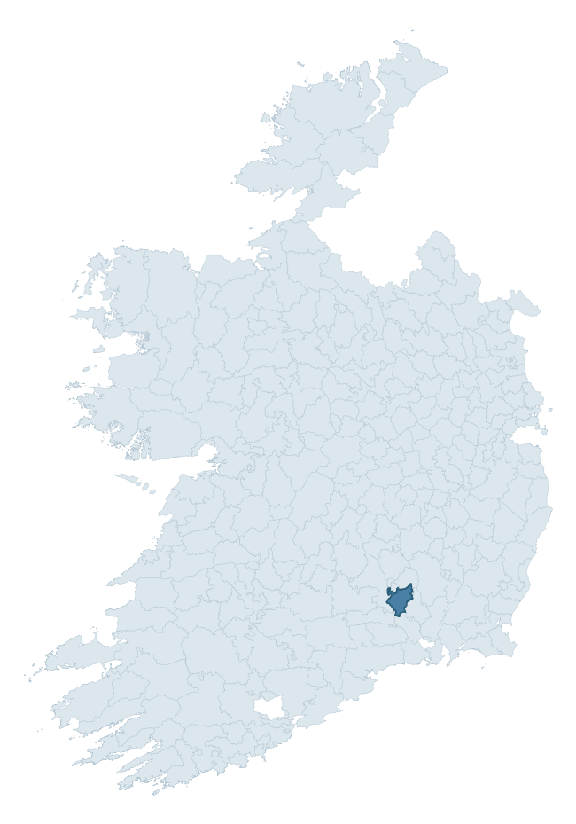
Where this barony sits in the Republic of Ireland
Geology and preservation
Bedrock geology shapes the landscape long before any settlement begins — controlling soil drainage, agricultural potential, the survival of upstanding monuments, and the preservation of buried archaeology. The figures below come from the Geological Survey Ireland 1:100,000 bedrock map.
The bedrock underlying Kells is predominantly limestone (40% of the barony by area), laid down during the Carboniferous period (58% by area, around 359 to 299 million years ago). Limestone is the most heritage-rich bedrock in Ireland. It supports fertile, well-drained soils that favoured dense Early Medieval settlement and Norman manorial agriculture, and it weathers into karst features — sinkholes, caves, swallow holes, and souterrains — that frequently carry archaeology. Where peat overlies limestone, organic preservation can be exceptional. A substantial secondary geology of sandstone (25%) and slate (15%) adds further variety to the underlying landscape. The single largest mapped unit is the Ballysteen Formation (31% of the barony's bedrock). With 8 distinct rock types mapped, the barony sits in the top third of ROI baronies for geological diversity (84th percentile) — typically a sign of complex tectonic history or coastal mosaics of differing rock units.
Rock type composition
Largest mapped unit: Ballysteen Formation (31% of the barony)
Placename evidence
Logainm records 29 heritage-diagnostic placenames for Kells, drawn from townland and civil-parish names across the barony. The dominant stratum is Early Christian ecclesiastical — cill-, teampall-, and domhnach-prefixed names that record the dense network of early church foundations established between the fifth and tenth centuries. The leading diagnostic roots are cill- (13 — church), ráth- (8 — earthen ringfort), and dún- (2 — hilltop fort or promontory fort). This is broadly in line with the ROI average of 30.7 heritage placenames per barony. The presence of multiple heritage strata side by side indicates layered occupation of the landscape across successive prehistoric and historic periods. Logainm records 174 placenames for Kells (predominantly townland names). Of these, 29 (17%) carry one of the diagnostic Gaelic roots tracked above; the remainder draw on more generic landscape vocabulary that does not encode a heritage period.
Pre-Christian / Early Medieval Defensive
| Root | Count | Meaning |
|---|---|---|
| ráth- | 8 | earthen ringfort |
| dún- | 2 | hilltop or promontory fort |
| cathair- | 1 | stone fort |
Early Christian Ecclesiastical
| Root | Count | Meaning |
|---|---|---|
| cill- | 13 | church (early) |
| teampall- | 1 | church (later medieval) |
| gráinseach- | 1 | monastic farm / grange |
Burial, Ritual, and Norse-Contact
| Root | Count | Meaning |
|---|---|---|
| leacht- | 1 | grave monument |
Other baronies in Kilkenny
About this profile
Click any section below to expand.
What is a barony?
A barony is a historic administrative unit in Ireland, broadly equivalent to an English hundred. The 280 baronies used here are from the OSi 2019 National Statutory Boundaries (generalised 20m), covering the 26 counties of the Republic of Ireland. Baronies derive from the Norman period, were formalised in the 17th century, and have not been redrawn for statistical purposes. They vary enormously in area, from compact urban baronies in Dublin to vast upland baronies in Connacht, and should not be compared by raw site count without accounting for area differences.
What counts as a site?
This profile combines three distinct heritage registers, each with its own definition of what constitutes a recordable site:
- Archaeological sites (NMS). The National Monuments Service Sites and Monuments Record (SMR) catalogues every known archaeological monument or site of archaeological interest in the Republic, from prehistoric burial mounds and ringforts to medieval churches and post-medieval defensive works. Inclusion does not require legal protection — only that the site has been identified, surveyed, and assessed as having archaeological value. A separate subset of these sites lies within a recorded protection zone, which gives them statutory protection under the National Monuments Acts.
- Listed buildings (NIAH). The National Inventory of Architectural Heritage records buildings of architectural, historical, archaeological, artistic, cultural, scientific, social, or technical interest. Each surveyed structure is appraised on a five-tier scale: International, National, Regional, Local, and Record-Only. The NIAH appraisal is informational rather than strictly statutory, but it underpins local-authority Record of Protected Structures (RPS) listings.
- Heritage placenames (Logainm). Logainm is the authoritative database of Irish placenames maintained by the Placenames Branch. This profile applies a heritage-diagnostic classifier to the Irish-language form of each townland name, flagging roots that signal defensive sites (ráth-, lios-, dún-, caiseal-, cathair-), ecclesiastical foundations (cill-, teampall-, domhnach-, mainistir-), prehistoric burial-ritual features (tuaim-, carn-, leaba-), or Norse-contact settlement (gall-). Townlands without one of these diagnostic roots are not flagged here — they may still carry historical significance, but that significance is not encoded in the name itself.
Editorial principles
The narrative sections of this profile follow several explicit principles:
- Evidential. Every claim about this barony’s heritage character is anchored in the underlying register data. Where a site count, a placename count, or a percentile rank is cited, it is computed from the source datasets at export time, not estimated.
- Comparative. Counts and metrics are reported alongside their percentile rank against the other 279 ROI baronies. A barony with 50 ringforts in absolute terms could be unusually high or unusually low depending on its size and regional context; percentile ranking removes that ambiguity.
- Transparent on limits. Where a register has known coverage gaps, survey biases, or data-quality issues that affect this barony’s figures, the profile flags them rather than presenting the numbers as definitive.
- No interpretation beyond what the data supports. The narrative does not speculate about historical events, social dynamics, or cultural meaning beyond what the recorded heritage and placename evidence directly attests.
Data caveats and limits
- NMS Sites and Monuments Record is the product of survey campaigns conducted at different intensities across different counties and decades. Some baronies have been surveyed more thoroughly than others, and absolute counts should be read in that light. Sites destroyed by development before survey are typically not represented; sites in heavily forested or upland terrain are sometimes under-recorded.
- NIAH coverage is broadly complete for the Republic of Ireland but the survey was conducted on a rolling county-by-county basis, and the most recent appraisal date varies. Buildings demolished or substantially altered after their original survey may still appear in the register; conversely, recent buildings of merit may not yet have been appraised.
- Logainm classification applies a deliberately conservative pattern-matching approach to the Irish-language townland forms. The classifier prioritises true positives over recall: a townland may carry a heritage signal that the classifier doesn’t recognise, particularly where the diagnostic root has been heavily anglicised or where the townland name draws on a less common term. The 60,000+ townland records and ~9,800 classified placenames give a substantial signal at barony scale, but individual townland names should be checked against Logainm directly for definitive interpretation.
- Period attribution. The chronological distribution reflects only those NMS sites that carry a recognised period attribution in the source data. Sites listed as “Unknown” period are excluded from the dated subset.
- Boundary changes. Some baronies have undergone minor boundary adjustments since their 19th-century definition; the OSi 2019 generalised boundaries used here are the current statutory definition and may differ slightly from historical maps in border areas.
- Bedrock geology is mapped at 1:100,000 scale, which means local variation within a barony — small pockets of different rock type, mineral veins, alluvium overlying bedrock — is generalised. The dominant-system and rocktype figures are area-weighted, so a barony reading “70% Carboniferous limestone” may still contain small but archaeologically important pockets of older or younger rock. Around 3% of GSI polygons do not match the lexicon and contribute no rocktype or system attribution.
Data sources
- National Monuments Service — Sites and Monuments Record (SMR) https://data.gov.ie/dataset/national-monuments-service-archaeological-survey-of-ireland
- National Inventory of Architectural Heritage (NIAH) https://data.gov.ie/dataset/national-inventory-of-architectural-heritage-niah-national-dataset
- Logainm — Placenames Database of Ireland https://www.logainm.ie/
- Ordnance Survey Ireland — National Statutory Barony Boundaries 2019 https://data-osi.opendata.arcgis.com/
- EURODEM — European Digital Elevation Model https://www.mapsforeurope.org/datasets/euro-dem
- ESA WorldCover https://esa-worldcover.org/en
- Geological Survey Ireland — 1:100,000 Bedrock Geology https://www.gsi.ie/en-ie/data-and-maps/Pages/Bedrock.aspx
Explore more: Search any of the 280 ROI baronies, browse by historical province, or read the methodology and data sources for the full Republic of Ireland Heritage Tool.