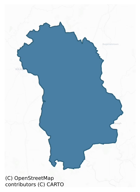
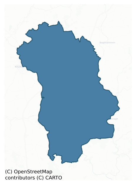
Gowran is a barony of County Kilkenny, in the historical province of Leinster (Irish: Gabhrán), covering 454 km² of land. The barony records 1,059 NMS archaeological sites and 614 NIAH listed buildings, placing it at around the 67th percentile among 280 ROI baronies for sites per km². This means it is in the top third of all baronies for sites per km². Dated archaeological evidence runs from the Neolithic through to the Modern, spanning 8 of 9 archaeological periods, placing the barony in the 53rd percentile among 280 ROI baronies for chronological depth. This means it is in the upper half of all baronies for chronological depth. The largest dated subset of recorded sites dates to the Iron Age. Logainm flags 85 placenames in the barony as carrying a recognised heritage root; the largest share — around 65% — are names associated with early Christian church and monastic foundations.
Heritage at a glance
Percentile rankings throughout this profile compare each barony only against the other 279 Republic of Ireland baronies.
The recorded heritage of Gowran
The National Monuments Service Sites and Monuments Record (SMR) is the statutory inventory of archaeological sites for the Republic of Ireland, maintained by the Department of Tourism, Culture, Arts, Gaeltacht, Sport and Media. Sites recorded here include earthworks, ringforts, megalithic tombs, ecclesiastical remains, and post-medieval features; not every record is legally protected, but each is registered as a monument of archaeological interest.
The National Monuments Service records 1,059 archaeological sites in Gowran, putting it at the 67th percentile among 280 ROI baronies for sites per km². This means it is in the top third of all baronies for sites per km². Protection coverage is near-universal — 1,006 sites (95%) fall within a recorded monument protection zone, indicating an extensively surveyed landscape. The record is dominated by defensive sites — ringforts, enclosures, hillforts, and stone forts (389 sites, 37% of the total), with ecclesiastical sites forming a substantial secondary presence (211 sites, 20%). The most diagnostically specific type is Church (57 records, 5% of the barony's NMS total) — compared to an ROI average of 4% across all baronies where this type occurs. Church is a building used for public Christian worship, of any date from c. 500 AD onwards. The broader 'Enclosure' classification — which catches unclassified ringforts and field enclosures — accounts for a further 263 records (25%) and reflects the difficulty of sub-classifying degraded earthworks from surface evidence alone. Other significant types include Graveslab (53) — a recumbent grave-marking slab, dated 1200–1700 AD. Across the barony's 454 km², this gives a recorded density of 2.33 sites per km².
Most common monument types
Hover or tap a monument type to see its definition.
| Type | Count |
|---|---|
| Enclosure a banked or ditched feature of uncertain type, used as a catch-all where the original function cannot be determined from surface evidence | 263 |
| Church a building used for public Christian worship, of any date from c. 500 AD onwards | 57 |
| Graveslab a recumbent grave-marking slab, dated 1200–1700 AD | 53 |
| Graveyard a burial area associated with a church, in use from the medieval period onwards | 51 |
| Fulacht fia a horseshoe-shaped Bronze Age burnt mound built around a sunken trough beside a water source, traditionally interpreted as a cooking site | 42 |
| Ring-ditch a circular ditch under 20m across, often the ploughed-out remains of a barrow, ring-barrow or roundhouse | 36 |
| Ringfort – rath an earthen ringfort enclosed by a bank and external ditch — the most common Early Medieval farmstead, broadly dated 500–1000 AD | 29 |
Chronological distribution
The dated archaeological record for Gowran spans from the Neolithic through to the Modern, with activity attested across 8 of 9 archaeological periods. Every period from earliest to latest is represented in the record — an unbroken sequence of dated activity across the full chronological span. Activity concentrates most heavily in the Iron Age (351 sites, 47% of dated material), with the Medieval forming a secondary peak (138 sites, 19%). A further 314 recorded sites (30% of the overall NMS register for the barony) carry no period attribution — appearing as 'Unknown' in the bar chart below. This typically reflects either records that pre-date the standardised period vocabulary or sites awaiting specialist dating review, rather than a genuine absence of chronological evidence.
Sample of recorded monuments
Show 25 sample monuments (of 1,059 total)
A representative sample of 25 recorded monuments drawn from the barony’s 1,059 total NMS entries. Sites within a recorded monument protection zone and rarer site types are prioritised so the list shows a meaningful cross-section rather than only the most common type. Each entry shows the official Sites and Monuments Record reference number and the description published by the National Monuments Service.
Crannog
In very boggy terrain, formerly a small lough and c. 60-80m from dryland to the S and E. Identified as a circular feature (diam. c. 25m) on an aerial photograph (GSI S448, 1973-7). It consists of a low man-made platform…
In very boggy terrain, formerly a small lough and c. 60-80m from dryland to the S and E. Identified as a circular feature (diam. c. 25m) on an aerial photograph (GSI S448, 1973-7). It consists of a low man-made platform (H c. 1m). The crannog is also visible on satellite imagery (Google earth).
See attached Google Earth images (imagery date 21 April 2011 and 14 September 2019)
Compiled by: Jean Farrelly
Date of upload: 9 June 2020
Tunnel
An underground structure was uncovered in the front garden of Kellymount House (KK016-009002-) in August 1961. The structure was examined by the NMI (Prendergast 1962 OPW Topographical files) and described as follows,…
An underground structure was uncovered in the front garden of Kellymount House (KK016-009002-) in August 1961. The structure was examined by the NMI (Prendergast 1962 OPW Topographical files) and described as follows, ‘a large flagstone about 6 inches under the surface was prised out of position revealing the stone tunnel underneath. From this entrance it was possible to trace the tunnel in both directions, East-West. It proved to be quite extensive and in no place could one turn around or stand upright until a compartment at one end was reached; it was quite dry and built of local limestone or freestone. The tunnel bent almost at right angles three times and there were two other passages leading off it. It was not of uniform size throughout. The floor was flagged for the greater part of its length, otherwise it was a compacted clay. The walls were vertical, of dry stone carefully built to give an even surface, occasionally a brick was incorporated in it and for the greater part of its length it was plastered with mortar. It was lintelled carefully with regular flat lintels resting on top of the walls; the lintels averaged 60cm in width, i.e. measured along the length of the passage.
The narrowest portion of the tunnel was just in front of the house; it was too narrow to be reached except by an extended steel tape. It seemed to be choked with soil. About 5 metres in from this end the size of the tunnel was 45cm. wide at the floor and 48cm. at the roof, it was 48cm high; t…
Designed landscape – tree-ring
On a S-facing slope, c. 90m SW of the Kilkenny to Waterford railway line and c. 300m W of a tributary of the River Nore. Indicated as a wooded circular area (diam. c. 42m) on the 1st (1839-40) ed. OS 6-inch map with a…
On a S-facing slope, c. 90m SW of the Kilkenny to Waterford railway line and c. 300m W of a tributary of the River Nore. Indicated as a wooded circular area (diam. c. 42m) on the 1st (1839-40) ed. OS 6-inch map with a 'Turret' and on the 1945-6 revision with a 'Turret (in Ruins)'. It was located c. 170m to the rear of the 18th-century Inch House and was probably a tree-ring, a designed landscape feature associated with Inch House demesne. Inch House is now demolished. Both the tree-ring and turret (KK019-035002-) were removed during the construction of Purcellsinch industrial estate and a large factory now occupies the site.
Compiled by: Jean Farrelly
Date of upload: 6 October 2020
Designed landscape – folly
On a S-facing slope, c. 90m SW of the Kilkenny to Waterford railway line and c. 300m W of a tributary of the River Nore. Indicated as a 'Turret' within a tree-ring (KK019-035001-) on the 1st (1839-40) ed. OS 6-inch map…
On a S-facing slope, c. 90m SW of the Kilkenny to Waterford railway line and c. 300m W of a tributary of the River Nore. Indicated as a 'Turret' within a tree-ring (KK019-035001-) on the 1st (1839-40) ed. OS 6-inch map and as a 'Turret (in Ruins)' on the 1945-6 revision. It was located c. 170m to the rear of the 18th-century Inch House and is described by Craig (1973, 106) as, 'a two-storey turret, with gothick features, possibly dating from the mid-18th century'. This turret would have been a folly on the Inch House demesne. Inch House is now demolished. Both the tree-ring and turret (KK019-035002-) were removed during the construction of Purcellsinch industrial estate and a large factory now occupies the site.
Compiled by: Jean Farrelly
Date of upload: 6 October 2020
Cairn – burial cairn
At the highest point of Freestone Hill, immediately NW of centre of the enclosing hillfort (KK020-018002-). A circular cairn (diam. c. 23m) bounded by a kerb of medium sized vertical set stones and concentric to this,…
At the highest point of Freestone Hill, immediately NW of centre of the enclosing hillfort (KK020-018002-). A circular cairn (diam. c. 23m) bounded by a kerb of medium sized vertical set stones and concentric to this, at a distance of 3m, an inner kerb formed by somewhat smaller stones (Bersu 1951, 5-10). It was excavated by Bersu in 1951 and the excavation published by Raftery in 1969 (Raftery 1969, 1-108). There were at least 16 burials within the cairn, some of which were in the 2 pits or 4 cists (Waddell 1990, 101). In all the remains of at least 18 individuals were found, including three inhumations and the remainder cremations (ibid.). The burials were concentrated in the E half of the mound and one lay 1.5m E of the cairn (ibid.). Associated finds included two small bone pins, several vases and a perforated bone plaque provided an Early Bronze Age date for the cairn (ibid.; Raftery 1994, 41).
During the Iron Age the cairn was truncated by a circular wall (diam. 18m) and a larger oval enclosure (dims. 37m x 30m), the cairn being robbed to provide material for the wall (Raftery 1969, 6; 1994, 41). Also during this later phase of occupation of the hillfort a cist in the cairn was emptied and reused as a hearth (Raftery 1994, 41).
Compiled by: Jean Farrelly
Date of upload: 23 November 2020
Settlement cluster
In gently undulating low-lying terrain, in mixed tillage and pasture. Identified during the construction of the Cork-Dublin gas pipeline in 1983 (Lehane 1983, 266-7). Described as 'a deserted village of possible…
In gently undulating low-lying terrain, in mixed tillage and pasture. Identified during the construction of the Cork-Dublin gas pipeline in 1983 (Lehane 1983, 266-7). Described as 'a deserted village of possible medieval date. The village is well preserved and several rectangular and circular structures with interconnecting trackways are visible on the ground' (ibid.). A number of excavation trenches were opened but no archaeological material was uncovered (ibid). The date of this settlement is unknown. A satellite image (Google Earth) taken in November 2005 shows the settlement earthworks with a tillage field immediately to the W and an irregular tillage field to the N. Another satellite image (Google Earth) taken in April 2011 shows that the field has been reclaimed and the earthworks levelled.
See attached satellite imagery:
KK020-041—-_01 satellite image Google Earth, 20 November 2005
KK020-041—-_02 satellite image, OS ortho
Compiled by: Jean Farrelly
Date of upload: 8 December 2020
Cross – Market cross (present location)
A 1710/11 map the town showing a cross towards the E end of the main street, suggests that the original market place was located in this area, S of the main street and probably infilled with a 'Malt House'…
A 1710/11 map the town showing a cross towards the E end of the main street, suggests that the original market place was located in this area, S of the main street and probably infilled with a 'Malt House' (KK020-060018-) (White 1710/11). There is a triangular fair green at the W end of the town which Thomas (1992, vol. 2, 115) suggests may have originally been outside the town but which was incorporated as a result of an expansion westward. The cross indicated on the White map was probably the market cross and this appears to have subsequently moved to the fair green which effectively became the market place. Local tradition relates that, ‘the Cromwellians broke the cross down and that the pieces were scattered on the green’ (Drennan 1965, 58). Only the base of the cross survives. It has been placed on a circular concrete plinth on the SW grassy island within the green. It consists of a straight-sided plain block of limestone, square in plan (dims. 0.6m x 0.6m), which tapers towards the top. The top of the base has a rectangular socket (dims. 0.18m x 0.2m; D 0.18m).
Compiled by: Jean Farrelly
Date of upload: 22 March 2021
College
In the SE angle of St Mary’s graveyard (KK020-060024-), c. 30m from the church (KK020-060006-).
In 1312 a college was established to compensate Edmund Butler, Earl of Carrick for the loss of any financial entitlement…
In the SE angle of St Mary’s graveyard (KK020-060024-), c. 30m from the church (KK020-060006-).
In 1312 a college was established to compensate Edmund Butler, Earl of Carrick for the loss of any financial entitlement (advowson) from St Mary’s church, which were due to the patron, and which was now being given to the Dean and Chapter of St Canice’s, Kilkenny. The Dean and Chapter agreed to, ‘find, and support at our own expense, four priests to celebrate Masses in the said Church of the Blessed Mary for the said Edmund and Joan, his wife, and sons and daughters; and for all his ancestors and successors, living and dead’ (Carrigan 1905, vol. 3, 409). The college appears to have continued post-Reformation under Protestant chaplains and it is mentioned in the Regal Visitation Book of 1615 (ibid, 409-10).
The priests, or chaplains, lived collegiately, in community and their residence is indicated as, ‘Colledge’ on White’s 1710/11 map of Gowran. In the early 20th century the foundations of the college are described as being ‘still traceable’ (Carrigan 1905, vol. 3, 409). Drennan (1965, 58-9) noted that, ‘Traces of this college can still be seen and its back wall was probably strengthened to make the wall of the present Protestant cemetery’. There was no trace of the building when inspected in 1992.
See attached copy of White map 1710/11
Compiled by: Jean Farrelly
Date of upload: 24 March 2021
Maltings
At the E end of Gowran, on the S side of Main Street. A building annotated, ‘Malt House’ is indicated at this location on White’s map of Gowran, 1710/11. Though the map is early 18th century in date, it is likely that…
At the E end of Gowran, on the S side of Main Street. A building annotated, ‘Malt House’ is indicated at this location on White’s map of Gowran, 1710/11. Though the map is early 18th century in date, it is likely that the malt house, which no longer survives above ground, dated to, at least, the 17th century. The malt house appears to have been situated roughly where the 19th-century gate lodge at the main entrance to Gowran Castle is located.
See attached:
KK020-060022-_01 White's map of Gowran 1710/11 with malt house highlighted.
Compiled by: Jean Farrelly
Date of upload: 26 March 2021
Forge
Towards the E end of Gowran, on the N side of Main Street. A building annotated, ‘The Forge’ is indicated at this location on White’s map of Gowran, 1710/11. Though the map is early 18th century in date, it is likely…
Towards the E end of Gowran, on the N side of Main Street. A building annotated, ‘The Forge’ is indicated at this location on White’s map of Gowran, 1710/11. Though the map is early 18th century in date, it is likely that the forge dated to, at least, the 17th century. A two-storey four-bay house with three chimneys appears to occupy the location of the forge.
Megalithic tomb – unclassified
At the foot of a steep slope 100m W of the River Barrow. Much of the monument is concealed beneath field debris that has been dumped there in modern times. The tomb (H 2.5m), aligned N-S, is very ruined and only one…
At the foot of a steep slope 100m W of the River Barrow. Much of the monument is concealed beneath field debris that has been dumped there in modern times. The tomb (H 2.5m), aligned N-S, is very ruined and only one upright is now visible. A photo of the monument in the Bord Fáile archives shows a stone standing at the N end of gallery which has a gable-shaped backstone at its S end. The monument cannot be classified with certainty but appears to be related to the court/portal tomb traditions. (Prendergast 1967, 91; O'Kelly 1969, 77)
Compiled by: Paul Walsh
Date of upload: 10 May 2021
Henge
Indicated as a circular enclosure on the 1st (1839) ed. OS 6-inch map and as a circular depression with trees in the interior on the revision. Subsequently levelled, the monument is visible as a well-defined cropmark on…
Indicated as a circular enclosure on the 1st (1839) ed. OS 6-inch map and as a circular depression with trees in the interior on the revision. Subsequently levelled, the monument is visible as a well-defined cropmark on an aerial photographs (CUCAP AVL081, 15 July 1968; AYK074, 9 July 1969; BGH004 and 005, 16 July 1971). The circular enclosure (diam. c. 50m) is defined by a wide deep inner fosse and broad outer bank which is further enclosed by a slot trench (Gibbons 1990, 7). There is a possible single entrance in the E.
See attached:
KK024-024—-_01 aerial photograph (CUCAP BGH004, 16 July 1971)
KK024-024—-_02 aerial photograph (CUCAP AYK074, 9 July 1969)
Compiled by: Geraldine Stout
Date of upload: 2 February 2012
Round tower
On the brow of a gentle S-facing slope commanding excellent views of the surrounding countryside except directly W where ground level rises. Situated in the NW corner of a roughly rectangular graveyard (KK024-062002-),…
On the brow of a gentle S-facing slope commanding excellent views of the surrounding countryside except directly W where ground level rises. Situated in the NW corner of a roughly rectangular graveyard (KK024-062002-), with the SW angle of the medieval church (KK024-062001-) 2.4m to the NE. The origins of Tullaherin are unclear as the name has changed over the centuries, however, Manning (1998, 19-21) argues that Tullaherin equates with Telach nInmainne which is mentioned in the annals in 1026 when it was raided and again in 1121 when the round tower was struck by lightning and stone from it fell, killing a student. As the patron saint of the church of Tullaherin is St. Ciarán, Manning (ibid.) suggests that Tullaherin may have been part of an amalgamation of churches connected with St. Ciarán of Seir at the time of the establishment of the diocese of Ossory in the 12th century (ibid.).
Lalor (1999 (Reprint 2016), 175), suggests that the round tower was probably rebuilt after the damage in 1121, with the addition of more windows (ibid.). A six-storey round tower (H 22.5m; ext. diam. at base 4.92m; ext. diam. at top 4.26m; wall T at door level 1.07m; wall T at top 0.94m) constructed of well coursed rough blocks of sandstone, gradually tapering towards the top. The upper courses (H 3m) are constructed of roughly coursed rubble, containing four rectangular windows with a string course above, and are a later addition, though they appear to have been there in 1892. The wind…
Burial mound
Not indicated on the 1st (1893) ed. OS 6-inch map or the 1899-1902 revision. A mound which when partially excavated in c. 1960 revealed bones, presumed to be human, and a decorated bone spindle whorl. The mound appears…
Not indicated on the 1st (1893) ed. OS 6-inch map or the 1899-1902 revision. A mound which when partially excavated in c. 1960 revealed bones, presumed to be human, and a decorated bone spindle whorl. The mound appears to have been completely levelled subsequently as it is not visible on satellite imagery. An enclosure (KK024-047—-) is located c. 160m to the SW.
Compiled by: Jean Farrelly
Date of upload: 19 October 2021
Sweathouse
At the junction of four field boundaries, two of which, to the NW and N, are also townland and parish boundaries. A roughly circular structure (ext. diam. c. 2.75m; wall T c. 0.6m; int. wall H 1.3m; overall int. H c.…
At the junction of four field boundaries, two of which, to the NW and N, are also townland and parish boundaries. A roughly circular structure (ext. diam. c. 2.75m; wall T c. 0.6m; int. wall H 1.3m; overall int. H c. 1.6m), the roof of which corbels inwards towards a circular opening (c. 0.44m x 0.6m) at the apex of the roof (Cronin, Hunt and Prendergast 1991, 874-5). It is built of dry-stone construction (ibid. 875). The interior is sub-rectangular (dims. c. 1.3m x 1.5m) in plan and has a clay floor (ibid. 875-6). It was entered via a low flat-headed opening (H c. 0.5m; Wth 0.45m), the lintel being supported on the side walls (ibid. 875). It is known locally as a sweathouse (ibid. 878-9).
Compiled by: Jean Farrelly
Date of upload: 19 October 2021
Ritual site – holy/saint's stone
A large boulder, named on the 1st (1839) ed. OS 6-inch map and on the 1900 revision in Gothic script as, 'Cloghvickree' which is an anglised version of the Irish 'Cloch mhic rí' which means the 'stone of the king's…
A large boulder, named on the 1st (1839) ed. OS 6-inch map and on the 1900 revision in Gothic script as, 'Cloghvickree' which is an anglised version of the Irish 'Cloch mhic rí' which means the 'stone of the king's son'.
Compiled by: Jean Farrelly
Date of upload: 1 March 2022
Children's burial ground
According to O'Kelly (1969, 88) the Templeboy Church (KK025-027001-), 'is known locally as Teámpall beag and the site is in the Cillín field'. The term 'Cillín field' suggests a possible children's burial ground in the…
According to O'Kelly (1969, 88) the Templeboy Church (KK025-027001-), 'is known locally as Teámpall beag and the site is in the Cillín field'. The term 'Cillín field' suggests a possible children's burial ground in the vicinity of the church. The precise location of this church is unclear. On the 1st (1839) ed. OS 6-inch map to the left/W of the words, 'Site of Templeboy Church', a rectangular area (dims. c. 50m E-W; c. 15m N-S) is indicated. The lower/S and E portion of which is shown by a dotted line, indicating a general area, rather than a specific location, immediately S and E of a field boundary. A holy well, 'Toberboy' is indicated 10m to the N, in the adjoining field. On the 1900 revision and 25-inch OS map the church site is indicated with a cross in a small field (dims. c. 22m NW-SE; c. 13m NE-SW) to the W of Gothic script on the 1st ed. map. This is shown as a slightly bigger field, or haggard, on the 1st ed. map, immediately S of a farmyard.
The small field indicated as the church site on the 1900 revision has been removed, though the SW field boundary and the S portion of the NW boundary have been retained. There is no trace of the church at ground level at either location.
Until more precise information is available, the possible children's burial ground has been located to the rectangular area indicated on the 1st ed. OS 6-inch map, which is currently an unenclosed area in the NW angle of a reclaimed field.
Compiled by: Jean Farrelly
Date of upload:…
Armorial plaque (present location)
Described by Farrelly et al. (1993, vol. 1, 194) as 'Located in the Bank of Ireland on the west side of Market Street. This stone plaque originally formed the keystone of an arched gateway in Marsh's Street…
Described by Farrelly et al. (1993, vol. 1, 194) as 'Located in the Bank of Ireland on the west side of Market Street. This stone plaque originally formed the keystone of an arched gateway in Marsh's Street [KK028-040022-]. It bears the armorial plaques of the Walsh and Brenan families on either side with the initials "J.W." and "C.B." inscribed in an elaborate central frame and a human head carved above this. The date "1645" is carved below with the names of "John Wailsh" and "Catrin Brenan". At some stage, the date "1794" was also incised onto the stone.'
Compiled by: Mary Tunney
Date of upload: 21 December 2011
Castle – Anglo-Norman masonry castle
The Archaeological Survey of Ireland (ASI) is in the process of providing information on all monuments on The Historic Environment Viewer (HEV). Currently the information for this record has not been uploaded. To…
The Archaeological Survey of Ireland (ASI) is in the process of providing information on all monuments on The Historic Environment Viewer (HEV). Currently the information for this record has not been uploaded. To access available information for research purposes please make an appointment in advance with the Archive Unit (open Fridays 10.00 am – 5.00 pm), Department of Culture, Heritage and the Gaeltacht, The Custom House, Dublin 1 D01W6XO or email nmarchive@chg.gov.ie.
Megalithic structure
Moore (1849, 26-7) described this structure as consisting of a large slab approximately 3.65m square resting above a number of other smaller slabs. Based on this description it was included in Borlase's work, 'The…
Moore (1849, 26-7) described this structure as consisting of a large slab approximately 3.65m square resting above a number of other smaller slabs. Based on this description it was included in Borlase's work, 'The Dolmens of Ireland' (1897, 403). A report by J. Delaney to the National Museum of Ireland in 1958 concluded that this was not likely to be the remains of a megalithic tomb (SMR files). The structure was destroyed c. 1970, with no visible remains at ground level.
Compiled by: Paul Walsh
Date of upload: 12 May 2021
Linkardstown burial
The Archaeological Survey of Ireland (ASI) is in the process of providing information on all monuments on The Historic Environment Viewer (HEV). Currently the information for this record has not been uploaded. To…
The Archaeological Survey of Ireland (ASI) is in the process of providing information on all monuments on The Historic Environment Viewer (HEV). Currently the information for this record has not been uploaded. To access available information for research purposes please make an appointment in advance with the Archive Unit (open Fridays 10.00 am – 5.00 pm), Department of Culture, Heritage and the Gaeltacht, The Custom House, Dublin 1 D01W6XO or email nmarchive@chg.gov.ie.
Mill – unclassified
The Archaeological Survey of Ireland (ASI) is in the process of providing information on all monuments on The Historic Environment Viewer (HEV). Currently the information for this record has not been uploaded. To…
The Archaeological Survey of Ireland (ASI) is in the process of providing information on all monuments on The Historic Environment Viewer (HEV). Currently the information for this record has not been uploaded. To access available information for research purposes please make an appointment in advance with the Archive Unit (open Fridays 10.00 am – 5.00 pm), Department of Culture, Heritage and the Gaeltacht, The Custom House, Dublin 1 D01W6XO or email nmarchive@chg.gov.ie.
Stoup (present location)
Located c. 50m NW of the Sruhnasilloge river which flows southwestward. A stoup from the medieval church of St Kieran (KK029-027001-) is located in an adjacent garden.
Compiled by: Jean Farrelly
Date of upload: 9…
Located c. 50m NW of the Sruhnasilloge river which flows southwestward. A stoup from the medieval church of St Kieran (KK029-027001-) is located in an adjacent garden.
Compiled by: Jean Farrelly
Date of upload: 9 March 2022
Pillar stone
Located c. 50m NW of the Sruhnasilloge river which flows southwestward. A possible pillar stone (L 1.2m; Wth 0.3m), lying horizontal, is located within the graveyard (KK029-027002-) associated with the medieval church…
Located c. 50m NW of the Sruhnasilloge river which flows southwestward. A possible pillar stone (L 1.2m; Wth 0.3m), lying horizontal, is located within the graveyard (KK029-027002-) associated with the medieval church of St Kieran (KK029-027001-). There are several vertical incised marks on the stone, possibly indicating its use as a sharpening stone. It is possible that the stone formed part of the fabric of the church. The graveyard is heavily overgrown with scrub and trees.
See attached photograph:
KK029-027006-_01
Compiled by: Jean Farrelly
Date of upload: 9 March 2022
Enclosure
On quite a steep E-facing slope at the SE end of a small N-S ridge, rising from a broad expanse of rolling and mostly reclaimed grassland. Very good views in all directions. A large and roughly circular area (diam. 56m…
On quite a steep E-facing slope at the SE end of a small N-S ridge, rising from a broad expanse of rolling and mostly reclaimed grassland. Very good views in all directions. A large and roughly circular area (diam. 56m N-S; 58m E-W) defined by a wide flat-topped bank (Wth at crest 2m; overall Wth 7.5m; int. H 0.6m; ext. H 2.4m), a wide steep-sided flat-bottomed fosse (Wth 3.5m) and a much denuded outer bank (Wth 2m; int. H 1.6m; ext. H 0.4m). There is a gap (Wth 4m) in the bank in the E quadrant, but no causeway, which suggests this is modern. An entrance (Wth 3m) in the S quadrant is probably original, it has a steep, ramped causeway. The interior slopes to the E. The western portion of the interior is 0.45m higher than the eastern half. The division, which bisects the monument from N-S, is marked by a step. In the W quadrant there are three small mounds (KK015-018002-; KK015-018003-; KK015-018004-). The date and function of these mounds is unknown. If the enclosing element is a ringfort then it is unlikely that the mounds are archaeological. However, if the enclosure is prehistoric in date, then it is possible that the mounds may be barrows.
Compiled by: Jean Farrelly
Date of upload: 29 February 2016
This monument is subject to a preservation order made under the National Monuments Acts 1930 to 2014 (PO no. 5/1956).
Listed buildings
The National Inventory of Architectural Heritage (NIAH) is a state survey appraising buildings of architectural, historical, archaeological, artistic, cultural, scientific, social, or technical interest. Each surveyed structure receives a rating from International (the highest, for buildings of European importance) through National, Regional, Local, and Record-Only.
The National Inventory of Architectural Heritage records 614 listed buildings in Gowran, placing it in the top 3% of ROI baronies for listed-building density. Among these, 19 are graded National — buildings of interest to the whole of Ireland rather than only its region. The Republic holds 937 National-graded buildings in total, so this barony accounts for around 2% of the national total. Construction dates concentrate most heavily in the Victorian (1830-1900) period. The most-recorded building type is house (275 examples, 45% of the listed stock).
Terrain and environment
Mean elevation across the barony is 109m — the 66th percentile among 280 ROI baronies for elevation. This means it is in the upper half of all baronies for elevation. Elevation matters for heritage because higher-altitude baronies typically favour defensive monuments — ringforts and hilltop forts placed on prominent ground — while lowland baronies are more likely to carry the dense settlement and church networks of intensive agricultural landscapes. The barony reaches 512m at its highest point — a vertical span of more than 402m within its boundary, indicating significant topographic diversity. Mean slope is 4.3° — the 64th percentile among 280 ROI baronies for slope. This means it is in the upper half of all baronies for slope. Slope is a key control on both land use and archaeological preservation: steep ground resists ploughing and tends to preserve earthworks intact, while gentle slopes favour intensive cultivation that damages or destroys surface archaeology over time. The Topographic Wetness Index averages 10.5, the 34th percentile among 280 ROI baronies for wetness. This means it is in the lower half of all baronies for wetness. Drainage matters for heritage because poorly-drained ground preserves organic archaeology (wooden trackways, leather, textiles, and on rare occasions human remains) far better than free-draining soil; well-drained ground favours arable use but destroys organic material rapidly. The land-cover mosaic combines improved grassland (70%), woodland (17%), and arable farmland (10%), giving a mixed agricultural and semi-natural landscape.
Terrain measurements
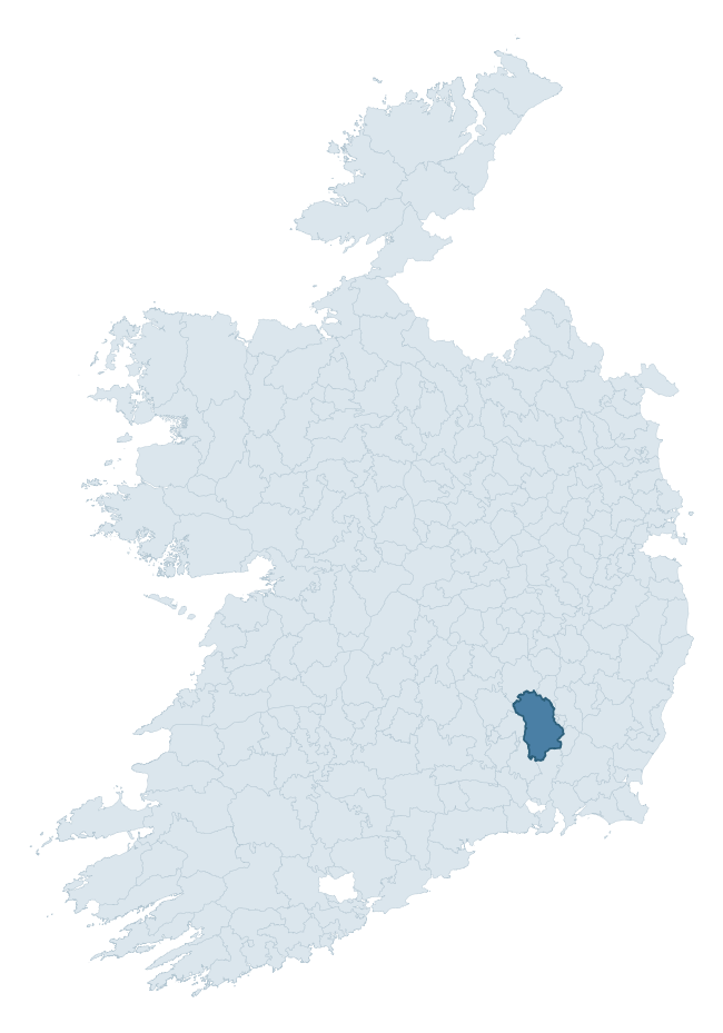
Where this barony sits in the Republic of Ireland
Geology and preservation
Bedrock geology shapes the landscape long before any settlement begins — controlling soil drainage, agricultural potential, the survival of upstanding monuments, and the preservation of buried archaeology. The figures below come from the Geological Survey Ireland 1:100,000 bedrock map.
The bedrock underlying Gowran is predominantly limestone (31% of the barony by area), laid down during the Carboniferous period (62% by area, around 359 to 299 million years ago). Limestone is the most heritage-rich bedrock in Ireland. It supports fertile, well-drained soils that favoured dense Early Medieval settlement and Norman manorial agriculture, and it weathers into karst features — sinkholes, caves, swallow holes, and souterrains — that frequently carry archaeology. Where peat overlies limestone, organic preservation can be exceptional. A substantial secondary geology of sandstone (16%) and schist (12%) adds further variety to the underlying landscape. With 12 distinct rock types mapped, the barony sits in the top third of ROI baronies for geological diversity (95th percentile) — typically a sign of complex tectonic history or coastal mosaics of differing rock units.
Rock type composition
Largest mapped unit: Brownsford Member (Maulin Formation) (12% of the barony)
Placename evidence
Logainm records 85 heritage-diagnostic placenames for Gowran, drawn from townland and civil-parish names across the barony. The dominant stratum is Early Christian ecclesiastical — cill-, teampall-, and domhnach-prefixed names that record the dense network of early church foundations established between the fifth and tenth centuries. The leading diagnostic roots are cill- (32 — church), ráth- (21 — earthen ringfort), and gráinseach- (8 — grange). This is well above the ROI average of 30.7 heritage placenames per barony — around 2.8× the typical figure. The presence of multiple heritage strata side by side indicates layered occupation of the landscape across successive prehistoric and historic periods. Logainm records 356 placenames for Gowran (predominantly townland names). Of these, 85 (24%) carry one of the diagnostic Gaelic roots tracked above; the remainder draw on more generic landscape vocabulary that does not encode a heritage period.
Pre-Christian / Early Medieval Defensive
| Root | Count | Meaning |
|---|---|---|
| ráth- | 21 | earthen ringfort |
| dún- | 7 | hilltop or promontory fort |
| lios- | 1 | ringfort or enclosure |
Early Christian Ecclesiastical
| Root | Count | Meaning |
|---|---|---|
| cill- | 32 | church (early) |
| gráinseach- | 8 | monastic farm / grange |
| teampall- | 4 | church (later medieval) |
| cillín- | 3 | unconsecrated burial ground |
| bile- | 3 | sacred tree / boundary marker |
| mainistir- | 2 | monastery |
| tobar- | 2 | holy well |
| díseart- | 1 | hermitage |
Burial, Ritual, and Norse-Contact
| Root | Count | Meaning |
|---|---|---|
| gall- | 2 | foreigner — Norse settlement marker |
Other baronies in Kilkenny
About this profile
Click any section below to expand.
What is a barony?
A barony is a historic administrative unit in Ireland, broadly equivalent to an English hundred. The 280 baronies used here are from the OSi 2019 National Statutory Boundaries (generalised 20m), covering the 26 counties of the Republic of Ireland. Baronies derive from the Norman period, were formalised in the 17th century, and have not been redrawn for statistical purposes. They vary enormously in area, from compact urban baronies in Dublin to vast upland baronies in Connacht, and should not be compared by raw site count without accounting for area differences.
What counts as a site?
This profile combines three distinct heritage registers, each with its own definition of what constitutes a recordable site:
- Archaeological sites (NMS). The National Monuments Service Sites and Monuments Record (SMR) catalogues every known archaeological monument or site of archaeological interest in the Republic, from prehistoric burial mounds and ringforts to medieval churches and post-medieval defensive works. Inclusion does not require legal protection — only that the site has been identified, surveyed, and assessed as having archaeological value. A separate subset of these sites lies within a recorded protection zone, which gives them statutory protection under the National Monuments Acts.
- Listed buildings (NIAH). The National Inventory of Architectural Heritage records buildings of architectural, historical, archaeological, artistic, cultural, scientific, social, or technical interest. Each surveyed structure is appraised on a five-tier scale: International, National, Regional, Local, and Record-Only. The NIAH appraisal is informational rather than strictly statutory, but it underpins local-authority Record of Protected Structures (RPS) listings.
- Heritage placenames (Logainm). Logainm is the authoritative database of Irish placenames maintained by the Placenames Branch. This profile applies a heritage-diagnostic classifier to the Irish-language form of each townland name, flagging roots that signal defensive sites (ráth-, lios-, dún-, caiseal-, cathair-), ecclesiastical foundations (cill-, teampall-, domhnach-, mainistir-), prehistoric burial-ritual features (tuaim-, carn-, leaba-), or Norse-contact settlement (gall-). Townlands without one of these diagnostic roots are not flagged here — they may still carry historical significance, but that significance is not encoded in the name itself.
Editorial principles
The narrative sections of this profile follow several explicit principles:
- Evidential. Every claim about this barony’s heritage character is anchored in the underlying register data. Where a site count, a placename count, or a percentile rank is cited, it is computed from the source datasets at export time, not estimated.
- Comparative. Counts and metrics are reported alongside their percentile rank against the other 279 ROI baronies. A barony with 50 ringforts in absolute terms could be unusually high or unusually low depending on its size and regional context; percentile ranking removes that ambiguity.
- Transparent on limits. Where a register has known coverage gaps, survey biases, or data-quality issues that affect this barony’s figures, the profile flags them rather than presenting the numbers as definitive.
- No interpretation beyond what the data supports. The narrative does not speculate about historical events, social dynamics, or cultural meaning beyond what the recorded heritage and placename evidence directly attests.
Data caveats and limits
- NMS Sites and Monuments Record is the product of survey campaigns conducted at different intensities across different counties and decades. Some baronies have been surveyed more thoroughly than others, and absolute counts should be read in that light. Sites destroyed by development before survey are typically not represented; sites in heavily forested or upland terrain are sometimes under-recorded.
- NIAH coverage is broadly complete for the Republic of Ireland but the survey was conducted on a rolling county-by-county basis, and the most recent appraisal date varies. Buildings demolished or substantially altered after their original survey may still appear in the register; conversely, recent buildings of merit may not yet have been appraised.
- Logainm classification applies a deliberately conservative pattern-matching approach to the Irish-language townland forms. The classifier prioritises true positives over recall: a townland may carry a heritage signal that the classifier doesn’t recognise, particularly where the diagnostic root has been heavily anglicised or where the townland name draws on a less common term. The 60,000+ townland records and ~9,800 classified placenames give a substantial signal at barony scale, but individual townland names should be checked against Logainm directly for definitive interpretation.
- Period attribution. The chronological distribution reflects only those NMS sites that carry a recognised period attribution in the source data. Sites listed as “Unknown” period are excluded from the dated subset.
- Boundary changes. Some baronies have undergone minor boundary adjustments since their 19th-century definition; the OSi 2019 generalised boundaries used here are the current statutory definition and may differ slightly from historical maps in border areas.
- Bedrock geology is mapped at 1:100,000 scale, which means local variation within a barony — small pockets of different rock type, mineral veins, alluvium overlying bedrock — is generalised. The dominant-system and rocktype figures are area-weighted, so a barony reading “70% Carboniferous limestone” may still contain small but archaeologically important pockets of older or younger rock. Around 3% of GSI polygons do not match the lexicon and contribute no rocktype or system attribution.
Data sources
- National Monuments Service — Sites and Monuments Record (SMR) https://data.gov.ie/dataset/national-monuments-service-archaeological-survey-of-ireland
- National Inventory of Architectural Heritage (NIAH) https://data.gov.ie/dataset/national-inventory-of-architectural-heritage-niah-national-dataset
- Logainm — Placenames Database of Ireland https://www.logainm.ie/
- Ordnance Survey Ireland — National Statutory Barony Boundaries 2019 https://data-osi.opendata.arcgis.com/
- EURODEM — European Digital Elevation Model https://www.mapsforeurope.org/datasets/euro-dem
- ESA WorldCover https://esa-worldcover.org/en
- Geological Survey Ireland — 1:100,000 Bedrock Geology https://www.gsi.ie/en-ie/data-and-maps/Pages/Bedrock.aspx
Explore more: Search any of the 280 ROI baronies, browse by historical province, or read the methodology and data sources for the full Republic of Ireland Heritage Tool.