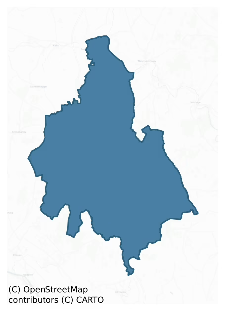
Knocktopher is a barony of County Kilkenny, in the historical province of Leinster (Irish: Cnoc an Tóchair), covering 189 km² of land. The barony records 306 NMS archaeological sites and 79 NIAH listed buildings, placing it at around the 40th percentile among 280 ROI baronies for sites per km². This means it is in the lower half of all baronies for sites per km². Dated archaeological evidence runs from the Neolithic through to the Modern, spanning 8 of 9 archaeological periods, placing the barony in the 53rd percentile among 280 ROI baronies for chronological depth. This means it is in the upper half of all baronies for chronological depth. The largest dated subset of recorded sites dates to the Early Medieval. Logainm flags 27 placenames in the barony as carrying a recognised heritage root; the largest share — around 67% — are names associated with early Christian church and monastic foundations.
Heritage at a glance
Percentile rankings throughout this profile compare each barony only against the other 279 Republic of Ireland baronies.
The recorded heritage of Knocktopher
The National Monuments Service Sites and Monuments Record (SMR) is the statutory inventory of archaeological sites for the Republic of Ireland, maintained by the Department of Tourism, Culture, Arts, Gaeltacht, Sport and Media. Sites recorded here include earthworks, ringforts, megalithic tombs, ecclesiastical remains, and post-medieval features; not every record is legally protected, but each is registered as a monument of archaeological interest.
The National Monuments Service records 306 archaeological sites in Knocktopher, putting it at the 40th percentile among 280 ROI baronies for sites per km². This means it is in the lower half of all baronies for sites per km². Of these, 275 (90%) fall within a recorded monument protection zone. The record is dominated by defensive sites — ringforts, enclosures, hillforts, and stone forts (132 sites, 43% of the total), with ecclesiastical sites forming a substantial secondary presence (54 sites, 18%). Ringfort – rath is the most prevalent type, making up 15% of the barony's recorded sites (46 records), broadly in line with the ROI average of 20% across all baronies where this type occurs. Ringfort – rath is an earthen ringfort enclosed by a bank and external ditch — the most common Early Medieval farmstead, broadly dated 500–1000 AD. Other significant types include Enclosure (28) and Fulacht fia (21). Enclosure is a banked or ditched feature of uncertain type, used as a catch-all where the original function cannot be determined from surface evidence; Fulacht fia is a horseshoe-shaped Bronze Age burnt mound built around a sunken trough beside a water source, traditionally interpreted as a cooking site. Across the barony's 189 km², this gives a recorded density of 1.62 sites per km².
Most common monument types
Hover or tap a monument type to see its definition.
| Type | Count |
|---|---|
| Ringfort – rath an earthen ringfort enclosed by a bank and external ditch — the most common Early Medieval farmstead, broadly dated 500–1000 AD | 46 |
| Enclosure a banked or ditched feature of uncertain type, used as a catch-all where the original function cannot be determined from surface evidence | 28 |
| Fulacht fia a horseshoe-shaped Bronze Age burnt mound built around a sunken trough beside a water source, traditionally interpreted as a cooking site | 21 |
| Church a building used for public Christian worship, of any date from c. 500 AD onwards | 19 |
| Ringfort – unclassified a circular Early Medieval settlement enclosure where surviving evidence does not allow distinction between earthen and stone forms | 19 |
| Graveyard a burial area associated with a church, in use from the medieval period onwards | 17 |
| Castle – unclassified a castle whose form cannot be precisely classified, dating somewhere between the late 12th and 16th centuries | 16 |
| Standing stone a deliberately set upright stone, used variously as a Bronze/Iron Age burial marker, route marker or commemorative monument | 12 |
Chronological distribution
The dated archaeological record for Knocktopher spans from the Neolithic through to the Modern, with activity attested across 8 of 9 archaeological periods. Every period from earliest to latest is represented in the record — an unbroken sequence of dated activity across the full chronological span. Activity concentrates most heavily in the Early Medieval (85 sites, 43% of dated material), with the Iron Age forming a secondary peak (37 sites, 19%). A further 107 recorded sites (35% of the overall NMS register for the barony) carry no period attribution — appearing as 'Unknown' in the bar chart below. This typically reflects either records that pre-date the standardised period vocabulary or sites awaiting specialist dating review, rather than a genuine absence of chronological evidence.
Sample of recorded monuments
Show 25 sample monuments (of 306 total)
A representative sample of 25 recorded monuments drawn from the barony’s 306 total NMS entries. Sites within a recorded monument protection zone and rarer site types are prioritised so the list shows a meaningful cross-section rather than only the most common type. Each entry shows the official Sites and Monuments Record reference number and the description published by the National Monuments Service.
Barrow – unclassified
Indicated as an irregular curvilinear enclosure on the 1st (1839) ed. OS 6-inch map, with a field boundary running along the N-NNW perimeter of the enclosure. On the 1948 it is shown as a circular enclosure (diam. c.…
Indicated as an irregular curvilinear enclosure on the 1st (1839) ed. OS 6-inch map, with a field boundary running along the N-NNW perimeter of the enclosure. On the 1948 it is shown as a circular enclosure (diam. c. 25m), with the field boundary tot he N-NNW kinking around it and another field boundary running S and E-W immediately outside the S and W quadrants of the enclosure. On satellite imagery (Digitalglobe 2005-2012) the monument appears to have been levelled and the field boundaries to the S and W have been removed.
Compiled by: Jean Farrelly
Date of upload: 3 April 2023
Barrow – ring-barrow
Indicated as an sub-rectangular enclosure on the 1st (1839) ed. OS 6-inch map and as a relatively small enclosure on the 1948 revision. The monument was levelled c. 2000. On satellite imagery (Digitalglobe 2005-2012)…
Indicated as an sub-rectangular enclosure on the 1st (1839) ed. OS 6-inch map and as a relatively small enclosure on the 1948 revision. The monument was levelled c. 2000. On satellite imagery (Digitalglobe 2005-2012) the fosse of the enclosure (internal diam. c. 24m; overall diam. c. 30m) is visible.
Compiled by: Jean Farrelly
Date of upload: 3 April 2023
Linkardstown burial
The Archaeological Survey of Ireland (ASI) is in the process of providing information on all monuments on The Historic Environment Viewer (HEV). Currently the information for this record has not been uploaded. To…
The Archaeological Survey of Ireland (ASI) is in the process of providing information on all monuments on The Historic Environment Viewer (HEV). Currently the information for this record has not been uploaded. To access available information for research purposes please make an appointment in advance with the Archive Unit (open Fridays 10.00 am – 5.00 pm), Department of Culture, Heritage and the Gaeltacht, The Custom House, Dublin 1 D01W6XO or email nmarchive@chg.gov.ie.
Historic town
The Archaeological Survey of Ireland (ASI) is in the process of providing information on all monuments on The Historic Environment Viewer (HEV). Currently the information for this record has not been uploaded. To…
The Archaeological Survey of Ireland (ASI) is in the process of providing information on all monuments on The Historic Environment Viewer (HEV). Currently the information for this record has not been uploaded. To access available information for research purposes please make an appointment in advance with the Archive Unit (open Fridays 10.00 am – 5.00 pm), Department of Culture, Heritage and the Gaeltacht, The Custom House, Dublin 1 D01W6XO or email nmarchive@chg.gov.ie.
Religious house – Carmelite friars
The Archaeological Survey of Ireland (ASI) is in the process of providing information on all monuments on The Historic Environment Viewer (HEV). Currently the information for this record has not been uploaded. To…
The Archaeological Survey of Ireland (ASI) is in the process of providing information on all monuments on The Historic Environment Viewer (HEV). Currently the information for this record has not been uploaded. To access available information for research purposes please make an appointment in advance with the Archive Unit (open Fridays 10.00 am – 5.00 pm), Department of Culture, Heritage and the Gaeltacht, The Custom House, Dublin 1 D01W6XO or email nmarchive@chg.gov.ie.
Road – road/trackway
The Archaeological Survey of Ireland (ASI) is in the process of providing information on all monuments on The Historic Environment Viewer (HEV). Currently the information for this record has not been uploaded. To…
The Archaeological Survey of Ireland (ASI) is in the process of providing information on all monuments on The Historic Environment Viewer (HEV). Currently the information for this record has not been uploaded. To access available information for research purposes please make an appointment in advance with the Archive Unit (open Fridays 10.00 am – 5.00 pm), Department of Culture, Heritage and the Gaeltacht, The Custom House, Dublin 1 D01W6XO or email nmarchive@chg.gov.ie.
Ford
The Archaeological Survey of Ireland (ASI) is in the process of providing information on all monuments on The Historic Environment Viewer (HEV). Currently the information for this record has not been uploaded. To…
The Archaeological Survey of Ireland (ASI) is in the process of providing information on all monuments on The Historic Environment Viewer (HEV). Currently the information for this record has not been uploaded. To access available information for research purposes please make an appointment in advance with the Archive Unit (open Fridays 10.00 am – 5.00 pm), Department of Culture, Heritage and the Gaeltacht, The Custom House, Dublin 1 D01W6XO or email nmarchive@chg.gov.ie.
Water mill – horizontal-wheeled
The Archaeological Survey of Ireland (ASI) is in the process of providing information on all monuments on The Historic Environment Viewer (HEV). Currently the information for this record has not been uploaded. To…
The Archaeological Survey of Ireland (ASI) is in the process of providing information on all monuments on The Historic Environment Viewer (HEV). Currently the information for this record has not been uploaded. To access available information for research purposes please make an appointment in advance with the Archive Unit (open Fridays 10.00 am – 5.00 pm), Department of Culture, Heritage and the Gaeltacht, The Custom House, Dublin 1 D01W6XO or email nmarchive@chg.gov.ie.
Round tower
At the W end of Aghaviller graveyard (KK031-030002-), adjacent to the W boundary wall with forestry on the W side. A modified 12th/13th-century church (KK031-030003-) with later residential tower (KK031-030004-) lies…
At the W end of Aghaviller graveyard (KK031-030002-), adjacent to the W boundary wall with forestry on the W side. A modified 12th/13th-century church (KK031-030003-) with later residential tower (KK031-030004-) lies along the N wall of the graveyard c. 25m to the NE. According to Carrigan (1905, vol. 4, 6) St Brendan of Birr was the patron of the church and the holy well (Kk031-029—) c. 200m to the NW is dedicated to him. The lower portion of this round tower survives (H 9.6m), constructed of sandstone ashlar masonry, with large courses both at the base and above the doorway and smaller courses in between (ext. diam. 4.85m; int. diam. 2.65m; wall T at doorway 1.1m). The round tower is built on a square plinth (dims. 5.2m N-S; 5.35m E-W) with some stones missing at the angles. The base of the tower rests on a projecting basal course (H 0.3m. Wth 0.2m). The tower was accessed at first-floor level via a round-headed doorway, c. 4m above ground level, in the NE face. The doorway, though worn, has an architrave surround which does not continue on the keystone. The keystone is higher than the surrounding voussoirs and, like them, continues through the thickness of the wall. The wooden floors were supported on internal offsets and each floor reached internally by a ladder. There is a SW-facing triangular-shaped window at second-floor level. A modern flat-headed doorway has been inserted at ground level facing E. Lalor (2016, 169) suggests an 11th-century date for this tower ho…
Chapel
The Archaeological Survey of Ireland (ASI) is in the process of providing information on all monuments on The Historic Environment Viewer (HEV). Currently the information for this record has not been uploaded. To…
The Archaeological Survey of Ireland (ASI) is in the process of providing information on all monuments on The Historic Environment Viewer (HEV). Currently the information for this record has not been uploaded. To access available information for research purposes please make an appointment in advance with the Archive Unit (open Fridays 10.00 am – 5.00 pm), Department of Culture, Heritage and the Gaeltacht, The Custom House, Dublin 1 D01W6XO or email nmarchive@chg.gov.ie.
Ogham stone
A large rectangular fallen slab of close-grained slate (dims. L 2.87m; Wth at W end 1.78m tapering to Wth at E end of 1.55m; max. T 0.45m tapering to 0.28m at the E end), in its own enclosure in a corner of a field by…
A large rectangular fallen slab of close-grained slate (dims. L 2.87m; Wth at W end 1.78m tapering to Wth at E end of 1.55m; max. T 0.45m tapering to 0.28m at the E end), in its own enclosure in a corner of a field by the side of the road. On the N edge of the upper face, along the eastern portion for a length of c. 1.15m from the E edge, is an ogham inscription read by Macalister (1945, 42-4, no. 38) as: CORBI KOI MAQI LABRID. According to Macalister (ibid.) the stone was originally standing upright in the field in which it is now recumbent.
(National Monument no. 599)
This stone has been studied as part of the ‘Ogham in 3D’ project undertaken by the School of Celtic Studies, Dublin Institute for Advanced Studies. To access details go to the following website: http://ogham.celt.dias.ie/search.php?ciic=38
Compiled by: Nora White
Date of revised upload: 11 January 2017
Megalithic tomb – passage tomb
The Archaeological Survey of Ireland (ASI) is in the process of providing information on all monuments on The Historic Environment Viewer (HEV). Currently the information for this record has not been uploaded. To…
The Archaeological Survey of Ireland (ASI) is in the process of providing information on all monuments on The Historic Environment Viewer (HEV). Currently the information for this record has not been uploaded. To access available information for research purposes please make an appointment in advance with the Archive Unit (open Fridays 10.00 am – 5.00 pm), Department of Culture, Heritage and the Gaeltacht, The Custom House, Dublin 1 D01W6XO or email nmarchive@chg.gov.ie.
Mound
The Archaeological Survey of Ireland (ASI) is in the process of providing information on all monuments on The Historic Environment Viewer (HEV). Currently the information for this record has not been uploaded. To…
The Archaeological Survey of Ireland (ASI) is in the process of providing information on all monuments on The Historic Environment Viewer (HEV). Currently the information for this record has not been uploaded. To access available information for research purposes please make an appointment in advance with the Archive Unit (open Fridays 10.00 am – 5.00 pm), Department of Culture, Heritage and the Gaeltacht, The Custom House, Dublin 1 D01W6XO or email nmarchive@chg.gov.ie.
Ritual site – holy tree/bush
The Archaeological Survey of Ireland (ASI) is in the process of providing information on all monuments on The Historic Environment Viewer (HEV). Currently the information for this record has not been uploaded. To…
The Archaeological Survey of Ireland (ASI) is in the process of providing information on all monuments on The Historic Environment Viewer (HEV). Currently the information for this record has not been uploaded. To access available information for research purposes please make an appointment in advance with the Archive Unit (open Fridays 10.00 am – 5.00 pm), Department of Culture, Heritage and the Gaeltacht, The Custom House, Dublin 1 D01W6XO or email nmarchive@chg.gov.ie.
Stone row
Three granite stones, aligned N – S and set 1.2 – 1.7m apart. The stones decrease in height from S to N. The S stone measures 1.35m high is 0.85m W and 0.4m T. The middle stone is 1.25m high, 0.7m wide and 0.5m T. The N…
Three granite stones, aligned N – S and set 1.2 – 1.7m apart. The stones decrease in height from S to N. The S stone measures 1.35m high is 0.85m W and 0.4m T. The middle stone is 1.25m high, 0.7m wide and 0.5m T. The N stone is 1.1m high, 0.6m wide and 0.5m T. This stone fell in 2012 and was re-erected in 2015 when the stones were painted white (Munster Expresss, 24 February 2015, page. 10). In 1849 the Rev. P. Moore recorded they were 'vulgarly termed "the three friars" a name derived, so far as he could conjecture, from no connection with the burial of friars, or from any such having suffered death there, but from these stones having been grouped together in mute and fraternal companionship.' (Moore 1849, 28). This story has been developed further in local lore and they are now considered to mark the place where three monks were murdered by the Cromwellians in 1651.
Compiled by: Paul Walsh
Date of upload: 27 February 2015
Bullaun stone
The Archaeological Survey of Ireland (ASI) is in the process of providing information on all monuments on The Historic Environment Viewer (HEV). Currently the information for this record has not been uploaded. To…
The Archaeological Survey of Ireland (ASI) is in the process of providing information on all monuments on The Historic Environment Viewer (HEV). Currently the information for this record has not been uploaded. To access available information for research purposes please make an appointment in advance with the Archive Unit (open Fridays 10.00 am – 5.00 pm), Department of Culture, Heritage and the Gaeltacht, The Custom House, Dublin 1 D01W6XO or email nmarchive@chg.gov.ie.
Tomb – unclassified
The Archaeological Survey of Ireland (ASI) is in the process of providing information on all monuments on The Historic Environment Viewer (HEV). Currently the information for this record has not been uploaded. To…
The Archaeological Survey of Ireland (ASI) is in the process of providing information on all monuments on The Historic Environment Viewer (HEV). Currently the information for this record has not been uploaded. To access available information for research purposes please make an appointment in advance with the Archive Unit (open Fridays 10.00 am – 5.00 pm), Department of Culture, Heritage and the Gaeltacht, The Custom House, Dublin 1 D01W6XO or email nmarchive@chg.gov.ie.
House – 17th century
The Archaeological Survey of Ireland (ASI) is in the process of providing information on all monuments on The Historic Environment Viewer (HEV). Currently the information for this record has not been uploaded. To…
The Archaeological Survey of Ireland (ASI) is in the process of providing information on all monuments on The Historic Environment Viewer (HEV). Currently the information for this record has not been uploaded. To access available information for research purposes please make an appointment in advance with the Archive Unit (open Fridays 10.00 am – 5.00 pm), Department of Culture, Heritage and the Gaeltacht, The Custom House, Dublin 1 D01W6XO or email nmarchive@chg.gov.ie.
House – indeterminate date
Situated within an enclosure (KK035-048001-) visible on the 1st ed OS 6-inch map, dated to cal AD 1050-1217 and partially excavated in 2006 in advance of the N9/N10 Kilcullen to Waterford road improvement scheme…
Situated within an enclosure (KK035-048001-) visible on the 1st ed OS 6-inch map, dated to cal AD 1050-1217 and partially excavated in 2006 in advance of the N9/N10 Kilcullen to Waterford road improvement scheme (Excavation licence no. E2513). A circular area (diam. 6m), identified following topsoil stripping during an archaeological assessment, defined by a slot-trench filled with charcoal, burnt clay and possible packing stones. The interior contained four possible post-holes and a central feature. A likely doorway was represented by a gap in the wall slot. Although portion of the enclosure was excavated in 2006 the house remained outside the limits of the excavation. (Channing 2009, 268, no. 1047; Channing and O’Neill 2010)
Compiled by: Mary Tunney
Date of upload: 15 October 2013
Burnt mound
A burnt mound was revealed during test-trenching in advance of a proposed residential construction (Excavation licence no. 07E0524). The mound (c. 16.2m x 13.4m) comprised frequent to abundant small to medium pieces of…
A burnt mound was revealed during test-trenching in advance of a proposed residential construction (Excavation licence no. 07E0524). The mound (c. 16.2m x 13.4m) comprised frequent to abundant small to medium pieces of rounded sandstone and large quantities of angular burnt stone and some charcoal flecks. Plough furrows had spread the material N and S (the dimensions cited include this spreading). A souterrain (KK031-070—) lies c. 145m to the N. (Henry 2007; Henry 2010, 232, no. 874)
Compiled by: Mary Tunney
Date of upload: 5 November 2013
Concentric enclosure
In tillage. A curvilinear concentric enclosure (inner enclosure diam. c. 45m N-S; c. 50m E-W; outer enclosure 105m N-S; 110m E-W) which is visible as a cropmark on satellite imagery (Apple Maps satellite imagery; OSI…
In tillage. A curvilinear concentric enclosure (inner enclosure diam. c. 45m N-S; c. 50m E-W; outer enclosure 105m N-S; 110m E-W) which is visible as a cropmark on satellite imagery (Apple Maps satellite imagery; OSI ortho satellite imagery, 2004-2006), identified and reported by Jean-Charles Caillère. The outer enclosure kinks inward slightly in the S sector. A townland boundary runs NW-SE along the W perimeter of the outer enclosure and the N sector of the outer enclosure is transected by a field boundary running ENE-WSW. There is another enclosure (KK031-105—-), also visible as a cropmark, c. 180m to the NE.
See attached imagery:
KK031-104—-_01 Apple maps satellite imagery
KK031-104—-_02 OSI ortho satellite imagery, 2004-2006
Compiled by: Jean Farrelly
Date of upload: 14 June 2023
Settlement deserted – medieval
The Archaeological Survey of Ireland (ASI) is in the process of providing information on all monuments on The Historic Environment Viewer (HEV). Currently the information for this record has not been uploaded. To…
The Archaeological Survey of Ireland (ASI) is in the process of providing information on all monuments on The Historic Environment Viewer (HEV). Currently the information for this record has not been uploaded. To access available information for research purposes please make an appointment in advance with the Archive Unit (open Fridays 10.00 am – 5.00 pm), Department of Culture, Heritage and the Gaeltacht, The Custom House, Dublin 1 D01W6XO or email nmarchive@chg.gov.ie.
Mill – unclassified
The Archaeological Survey of Ireland (ASI) is in the process of providing information on all monuments on The Historic Environment Viewer (HEV). Currently the information for this record has not been uploaded. To…
The Archaeological Survey of Ireland (ASI) is in the process of providing information on all monuments on The Historic Environment Viewer (HEV). Currently the information for this record has not been uploaded. To access available information for research purposes please make an appointment in advance with the Archive Unit (open Fridays 10.00 am – 5.00 pm), Department of Culture, Heritage and the Gaeltacht, The Custom House, Dublin 1 D01W6XO or email nmarchive@chg.gov.ie.
Ringfort – rath
Indicated on the 1st ed. OS 6-inch map and 1948 revision as a roughly circular enclosure (overall diam. c. 57m). On the 1948 revision a field boundary is indicated running NW-SE through the SW sector of the enclosure.…
Indicated on the 1st ed. OS 6-inch map and 1948 revision as a roughly circular enclosure (overall diam. c. 57m). On the 1948 revision a field boundary is indicated running NW-SE through the SW sector of the enclosure. This monument was visited in January 1953 and described as follows, ‘No local name on the fort. The site is completely overgrown with hazel and briars and many tree stumps…It is small, circular surrounded by low bank and ditch, the central area is depressed to about the level of the surrounding fields’ (OPW Correspondence Files, 1953). A very basic accompanying sketch shows a circular area (diam. c. 35yds = c. 32m) enclosed by a wide bank, fosse (D c. 6’ = 1.8m) and low outer bank (overall Wth from top of inner bank to top of outer bank c. 10yds = c. 9m) (ibid.). The monument was subsequently levelled as part of Land Project works (ibid.). A field boundary, as indicated on the 1948 revision, remains.
Compiled by: Jean Farrelly
Date of upload: 5 April 2023
Listed buildings
The National Inventory of Architectural Heritage (NIAH) is a state survey appraising buildings of architectural, historical, archaeological, artistic, cultural, scientific, social, or technical interest. Each surveyed structure receives a rating from International (the highest, for buildings of European importance) through National, Regional, Local, and Record-Only.
The NIAH records 79 listed buildings in Knocktopher (42nd percentile across ROI baronies). The highest-graded structures include 2 of National significance. The Republic holds 937 National-graded buildings in total, so this barony accounts for around 0% of the national total. Construction dates concentrate most heavily in the Late Georgian (1800-1830) period.
Terrain and environment
Mean elevation across the barony is 131m — the 80th percentile among 280 ROI baronies for elevation. This means it is in the top fifth of all baronies for elevation. This is a relatively elevated landscape by ROI standards. Elevation matters for heritage because higher-altitude baronies typically favour defensive monuments — ringforts and hilltop forts placed on prominent ground — while lowland baronies are more likely to carry the dense settlement and church networks of intensive agricultural landscapes. A maximum elevation of 307m gives the barony meaningful vertical relief. Mean slope is 3.9° — the 54th percentile among 280 ROI baronies for slope. This means it is in the upper half of all baronies for slope. Slope is a key control on both land use and archaeological preservation: steep ground resists ploughing and tends to preserve earthworks intact, while gentle slopes favour intensive cultivation that damages or destroys surface archaeology over time. The Topographic Wetness Index averages 10.6, the 39th percentile among 280 ROI baronies for wetness. This means it is in the lower half of all baronies for wetness. Drainage matters for heritage because poorly-drained ground preserves organic archaeology (wooden trackways, leather, textiles, and on rare occasions human remains) far better than free-draining soil; well-drained ground favours arable use but destroys organic material rapidly. The land cover is dominated by improved grassland (72%) and woodland (22%). In overall character, this is elevated but relatively gentle terrain — typical of plateau country, with land use dominated by improved grassland.
Terrain measurements
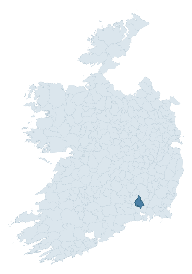
Where this barony sits in the Republic of Ireland
Geology and preservation
Bedrock geology shapes the landscape long before any settlement begins — controlling soil drainage, agricultural potential, the survival of upstanding monuments, and the preservation of buried archaeology. The figures below come from the Geological Survey Ireland 1:100,000 bedrock map.
The bedrock underlying Knocktopher is predominantly sandstone (66% of the barony by area), laid down during the Devonian period (63% by area, around 419 to 359 million years ago). Sandstone weathers to free-draining, moderately fertile soils that supported Early Medieval ringfort agriculture and later manorial estates. The rock itself is a major source of building stone — visible in churches, tower houses, and farm buildings across the barony's historic landscape. The single largest mapped unit is the Carrigmaclea Formation (39% of the barony's bedrock).
Rock type composition
Largest mapped unit: Carrigmaclea Formation (39% of the barony)
Placename evidence
Logainm records 27 heritage-diagnostic placenames for Knocktopher, drawn from townland and civil-parish names across the barony. The dominant stratum is Early Christian ecclesiastical — cill-, teampall-, and domhnach-prefixed names that record the dense network of early church foundations established between the fifth and tenth centuries. The leading diagnostic roots are cill- (14 — church), ráth- (5 — earthen ringfort), and lios- (2 — ringfort or enclosure). This is broadly in line with the ROI average of 30.7 heritage placenames per barony. Logainm records 137 placenames for Knocktopher (predominantly townland names). Of these, 27 (20%) carry one of the diagnostic Gaelic roots tracked above; the remainder draw on more generic landscape vocabulary that does not encode a heritage period.
Pre-Christian / Early Medieval Defensive
| Root | Count | Meaning |
|---|---|---|
| ráth- | 5 | earthen ringfort |
| lios- | 2 | ringfort or enclosure |
| dún- | 2 | hilltop or promontory fort |
Early Christian Ecclesiastical
| Root | Count | Meaning |
|---|---|---|
| cill- | 14 | church (early) |
| teampall- | 2 | church (later medieval) |
| mainistir- | 1 | monastery |
| cillín- | 1 | unconsecrated burial ground |
Other baronies in Kilkenny
About this profile
Click any section below to expand.
What is a barony?
A barony is a historic administrative unit in Ireland, broadly equivalent to an English hundred. The 280 baronies used here are from the OSi 2019 National Statutory Boundaries (generalised 20m), covering the 26 counties of the Republic of Ireland. Baronies derive from the Norman period, were formalised in the 17th century, and have not been redrawn for statistical purposes. They vary enormously in area, from compact urban baronies in Dublin to vast upland baronies in Connacht, and should not be compared by raw site count without accounting for area differences.
What counts as a site?
This profile combines three distinct heritage registers, each with its own definition of what constitutes a recordable site:
- Archaeological sites (NMS). The National Monuments Service Sites and Monuments Record (SMR) catalogues every known archaeological monument or site of archaeological interest in the Republic, from prehistoric burial mounds and ringforts to medieval churches and post-medieval defensive works. Inclusion does not require legal protection — only that the site has been identified, surveyed, and assessed as having archaeological value. A separate subset of these sites lies within a recorded protection zone, which gives them statutory protection under the National Monuments Acts.
- Listed buildings (NIAH). The National Inventory of Architectural Heritage records buildings of architectural, historical, archaeological, artistic, cultural, scientific, social, or technical interest. Each surveyed structure is appraised on a five-tier scale: International, National, Regional, Local, and Record-Only. The NIAH appraisal is informational rather than strictly statutory, but it underpins local-authority Record of Protected Structures (RPS) listings.
- Heritage placenames (Logainm). Logainm is the authoritative database of Irish placenames maintained by the Placenames Branch. This profile applies a heritage-diagnostic classifier to the Irish-language form of each townland name, flagging roots that signal defensive sites (ráth-, lios-, dún-, caiseal-, cathair-), ecclesiastical foundations (cill-, teampall-, domhnach-, mainistir-), prehistoric burial-ritual features (tuaim-, carn-, leaba-), or Norse-contact settlement (gall-). Townlands without one of these diagnostic roots are not flagged here — they may still carry historical significance, but that significance is not encoded in the name itself.
Editorial principles
The narrative sections of this profile follow several explicit principles:
- Evidential. Every claim about this barony’s heritage character is anchored in the underlying register data. Where a site count, a placename count, or a percentile rank is cited, it is computed from the source datasets at export time, not estimated.
- Comparative. Counts and metrics are reported alongside their percentile rank against the other 279 ROI baronies. A barony with 50 ringforts in absolute terms could be unusually high or unusually low depending on its size and regional context; percentile ranking removes that ambiguity.
- Transparent on limits. Where a register has known coverage gaps, survey biases, or data-quality issues that affect this barony’s figures, the profile flags them rather than presenting the numbers as definitive.
- No interpretation beyond what the data supports. The narrative does not speculate about historical events, social dynamics, or cultural meaning beyond what the recorded heritage and placename evidence directly attests.
Data caveats and limits
- NMS Sites and Monuments Record is the product of survey campaigns conducted at different intensities across different counties and decades. Some baronies have been surveyed more thoroughly than others, and absolute counts should be read in that light. Sites destroyed by development before survey are typically not represented; sites in heavily forested or upland terrain are sometimes under-recorded.
- NIAH coverage is broadly complete for the Republic of Ireland but the survey was conducted on a rolling county-by-county basis, and the most recent appraisal date varies. Buildings demolished or substantially altered after their original survey may still appear in the register; conversely, recent buildings of merit may not yet have been appraised.
- Logainm classification applies a deliberately conservative pattern-matching approach to the Irish-language townland forms. The classifier prioritises true positives over recall: a townland may carry a heritage signal that the classifier doesn’t recognise, particularly where the diagnostic root has been heavily anglicised or where the townland name draws on a less common term. The 60,000+ townland records and ~9,800 classified placenames give a substantial signal at barony scale, but individual townland names should be checked against Logainm directly for definitive interpretation.
- Period attribution. The chronological distribution reflects only those NMS sites that carry a recognised period attribution in the source data. Sites listed as “Unknown” period are excluded from the dated subset.
- Boundary changes. Some baronies have undergone minor boundary adjustments since their 19th-century definition; the OSi 2019 generalised boundaries used here are the current statutory definition and may differ slightly from historical maps in border areas.
- Bedrock geology is mapped at 1:100,000 scale, which means local variation within a barony — small pockets of different rock type, mineral veins, alluvium overlying bedrock — is generalised. The dominant-system and rocktype figures are area-weighted, so a barony reading “70% Carboniferous limestone” may still contain small but archaeologically important pockets of older or younger rock. Around 3% of GSI polygons do not match the lexicon and contribute no rocktype or system attribution.
Data sources
- National Monuments Service — Sites and Monuments Record (SMR) https://data.gov.ie/dataset/national-monuments-service-archaeological-survey-of-ireland
- National Inventory of Architectural Heritage (NIAH) https://data.gov.ie/dataset/national-inventory-of-architectural-heritage-niah-national-dataset
- Logainm — Placenames Database of Ireland https://www.logainm.ie/
- Ordnance Survey Ireland — National Statutory Barony Boundaries 2019 https://data-osi.opendata.arcgis.com/
- EURODEM — European Digital Elevation Model https://www.mapsforeurope.org/datasets/euro-dem
- ESA WorldCover https://esa-worldcover.org/en
- Geological Survey Ireland — 1:100,000 Bedrock Geology https://www.gsi.ie/en-ie/data-and-maps/Pages/Bedrock.aspx
Explore more: Search any of the 280 ROI baronies, browse by historical province, or read the methodology and data sources for the full Republic of Ireland Heritage Tool.