
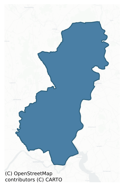
Ida is a barony of County Kilkenny, in the historical province of Leinster (Irish: Uí Dheá), covering 249 km² of land. The barony records 296 NMS archaeological sites and 63 NIAH listed buildings, placing it at around the 18th percentile among 280 ROI baronies for sites per km². This means it is in the bottom fifth of all baronies for sites per km². Dated archaeological evidence runs from the Early Bronze Age through to the Medieval, spanning 3 of 9 archaeological periods, placing the barony in the 1st percentile among 280 ROI baronies for chronological depth. This means it is in the bottom tenth of all baronies for chronological depth. The largest dated subset of recorded sites dates to the Medieval. Logainm flags 41 placenames in the barony as carrying a recognised heritage root; the largest share — around 56% — are names associated with early Christian church and monastic foundations.
Heritage at a glance
Percentile rankings throughout this profile compare each barony only against the other 279 Republic of Ireland baronies.
The recorded heritage of Ida
The National Monuments Service Sites and Monuments Record (SMR) is the statutory inventory of archaeological sites for the Republic of Ireland, maintained by the Department of Tourism, Culture, Arts, Gaeltacht, Sport and Media. Sites recorded here include earthworks, ringforts, megalithic tombs, ecclesiastical remains, and post-medieval features; not every record is legally protected, but each is registered as a monument of archaeological interest.
The National Monuments Service records 296 archaeological sites in Ida, putting it at the 18th percentile among 280 ROI baronies for sites per km². This means it is in the bottom fifth of all baronies for sites per km². Of these, 266 (90%) fall within a recorded monument protection zone. The record is dominated by defensive sites — ringforts, enclosures, hillforts, and stone forts (115 sites, 39% of the total), with ecclesiastical sites forming a substantial secondary presence (68 sites, 23%). Ringfort – rath is the most prevalent type, making up 13% of the barony's recorded sites (39 records) — below the ROI average of 20% across all baronies where this type occurs. Ringfort – rath is an earthen ringfort enclosed by a bank and external ditch — the most common Early Medieval farmstead, broadly dated 500–1000 AD. Other significant types include Fulacht fia (32) and Enclosure (29). Fulacht fia is a horseshoe-shaped Bronze Age burnt mound built around a sunken trough beside a water source, traditionally interpreted as a cooking site; Enclosure is a banked or ditched feature of uncertain type, used as a catch-all where the original function cannot be determined from surface evidence. Across the barony's 249 km², this gives a recorded density of 1.19 sites per km².
Most common monument types
Hover or tap a monument type to see its definition.
| Type | Count |
|---|---|
| Ringfort – rath an earthen ringfort enclosed by a bank and external ditch — the most common Early Medieval farmstead, broadly dated 500–1000 AD | 39 |
| Fulacht fia a horseshoe-shaped Bronze Age burnt mound built around a sunken trough beside a water source, traditionally interpreted as a cooking site | 32 |
| Enclosure a banked or ditched feature of uncertain type, used as a catch-all where the original function cannot be determined from surface evidence | 29 |
| Church a building used for public Christian worship, of any date from c. 500 AD onwards | 26 |
| Graveyard a burial area associated with a church, in use from the medieval period onwards | 20 |
| Castle – unclassified a castle whose form cannot be precisely classified, dating somewhere between the late 12th and 16th centuries | 14 |
| Ringfort – unclassified a circular Early Medieval settlement enclosure where surviving evidence does not allow distinction between earthen and stone forms | 12 |
| Standing stone a deliberately set upright stone, used variously as a Bronze/Iron Age burial marker, route marker or commemorative monument | 9 |
Chronological distribution
The dated archaeological record for Ida spans from the Early Bronze Age through to the Medieval, with activity attested across 3 of 9 archaeological periods. This is the 1st percentile across ROI baronies — a relatively narrow chronological band, with much of Irish prehistory not represented in the dated record. The record is periodic rather than continuous: the Middle Late Bronze Age, and Iron Age periods fall inside the chronological span but record no dated sites — likely reflecting either genuine settlement discontinuity or limits of survey attribution. A further 1 recorded sites (20% of the overall NMS register for the barony) carry no period attribution — appearing as 'Unknown' in the bar chart below. This typically reflects either records that pre-date the standardised period vocabulary or sites awaiting specialist dating review, rather than a genuine absence of chronological evidence.
Sample of recorded monuments
Show 25 sample monuments (of 296 total)
A representative sample of 25 recorded monuments drawn from the barony’s 296 total NMS entries. Sites within a recorded monument protection zone and rarer site types are prioritised so the list shows a meaningful cross-section rather than only the most common type. Each entry shows the official Sites and Monuments Record reference number and the description published by the National Monuments Service.
Building
On a steep SW-facing slope above River Nore. A roughly circular area (diam. c. 25m) is indicated by a dashed line as the ‘Site of Old Court’ on the 1st (1839-40) ed. OS 6-inch map. The dashed line suggests the general…
On a steep SW-facing slope above River Nore. A roughly circular area (diam. c. 25m) is indicated by a dashed line as the ‘Site of Old Court’ on the 1st (1839-40) ed. OS 6-inch map. The dashed line suggests the general area where the building is located, and that it was not visible above ground in 1839-40. However, according to Carrigan (1905, vol. 4, 123), ‘Oldcourt derives its name from an ancient building that formerly stood here, within a few perches of the hill-road from Inistioge to New Ross. The site is marked on the Ordnance Map. Only the grey, strong enclosing walls now remain. Tradition states that a court stood here, and that, ages ago, it was the residence of “Griffin McCroo,” brother of “Ross McCroo,” the foundress of New Ross’. The building is not visible at ground level.
Compiled by: Jean Farrelly
Date of upload: 4 October 2016
Architectural feature
This was classified in the SMR (1987) and the RMP (1996) as an 'Font', however, this is actually a stoup which is a receptacle for holy water, originally positioned immediately inside the entrance doorway on one or…
This was classified in the SMR (1987) and the RMP (1996) as an 'Font', however, this is actually a stoup which is a receptacle for holy water, originally positioned immediately inside the entrance doorway on one or other side. Described by Carrigan (1905, vol. 4, 120) as, 'a granite holy water font, with rectangular cavity 9 in. by 8 in. and 2½ in. deep'. Associated with Clonamery church (KK033-021001-), it is not incorporated in the walling of the church. It is currently located 0.3m outside the church, close to the N jamb of the W doorway. It consists of a roughly dressed sub-rectangular granite boulder (dims. 0.39m x 0.37m; H 0.28m) with a carved rectangular basin (dims. 0.23m x 0.2m; D 0.07m) which splays in towards the base (dims. 0.13m x 0.12m).
Compiled by: Jean Farrelly
Date of upload: 19 October 2016
Wall monument
The Archaeological Survey of Ireland (ASI) is in the process of providing information on all monuments on The Historic Environment Viewer (HEV). Currently the information for this record has not been uploaded. To…
The Archaeological Survey of Ireland (ASI) is in the process of providing information on all monuments on The Historic Environment Viewer (HEV). Currently the information for this record has not been uploaded. To access available information for research purposes please make an appointment in advance with the Archive Unit (open Fridays 10.00 am – 5.00 pm), Department of Culture, Heritage and the Gaeltacht, The Custom House, Dublin 1 D01W6XO or email nmarchive@chg.gov.ie.
Cross (present location)
This is described by Carrigan (1905, iv, 186-7) as follows: ‘In the graveyard [KK037-003002-], beside the south wall of the chancel is the sculptured base of a wayside cross, which formerly stood on a graduated base a…
This is described by Carrigan (1905, iv, 186-7) as follows: ‘In the graveyard [KK037-003002-], beside the south wall of the chancel is the sculptured base of a wayside cross, which formerly stood on a graduated base a little to the south of the church, and which having been thrown into the neighbouring mill-stream, was carried thence, for safety, to its present position, by the late Canon Moore, P.P., Johnstown. One side of the stone has a shield with the arms of De Frayne impaling those of Fitzgerald, and at the base the initials R.F., E.G., from which it must be concluded that the cross of which this stone formed a part, was erected by the same lady who set up the De Frayne tomb in the parish church. Of the inscription nothing is now legible but the first word, Orate.’
Compiled by: Paul Walsh
Date of upload: 5 August 2015
Megalithic tomb – portal tomb
The Archaeological Survey of Ireland (ASI) is in the process of providing information on all monuments on The Historic Environment Viewer (HEV). Currently the information for this record has not been uploaded. To…
The Archaeological Survey of Ireland (ASI) is in the process of providing information on all monuments on The Historic Environment Viewer (HEV). Currently the information for this record has not been uploaded. To access available information for research purposes please make an appointment in advance with the Archive Unit (open Fridays 10.00 am – 5.00 pm), Department of Culture, Heritage and the Gaeltacht, The Custom House, Dublin 1 D01W6XO or email nmarchive@chg.gov.ie.
Megalithic tomb – court tomb
On the NE flank of Tory Hill on the W side of a shallow valley, within an overgrown triangular area (Wth 22m at SW) of uncultivated land. Consisting of two very ruined back-to-back galleries (L c. 15m), aligned NE – SW.…
On the NE flank of Tory Hill on the W side of a shallow valley, within an overgrown triangular area (Wth 22m at SW) of uncultivated land. Consisting of two very ruined back-to-back galleries (L c. 15m), aligned NE – SW. Each gallery appears to have been divided into two chambers. The SW gallery is 5m long and its front portion is destroyed. The rear chamber is represented by a gable-shaped backstone, two sidestones and two opposing, inset jamb-stones. There is a single surviving N sidestone of the second chamber to the SW. Beyond this a field bank crosses the monument. The NE gallery (L 6m) is more disturbed but was of similar construction to the other. The rear chamber is represented by the backstone, a single N sidestone and two opposing, inset jambs-stones. Only two stones of the N side of the chamber to the NE survive. The outermost may be a longitudinally-set entrance jamb or portal. A distance of 1.7m separates the backstones of the galleries. Though no evidence of a court survives the general design is clearly indicative of the monument being the remains of a dual court tomb. (de Valéra and Ó Nualláin 1962, 117-23)
Compiled by: Paul Walsh
Date of upload: 12 May 2021
Barrow – ring-barrow
The Archaeological Survey of Ireland (ASI) is in the process of providing information on all monuments on The Historic Environment Viewer (HEV). Currently the information for this record has not been uploaded. To…
The Archaeological Survey of Ireland (ASI) is in the process of providing information on all monuments on The Historic Environment Viewer (HEV). Currently the information for this record has not been uploaded. To access available information for research purposes please make an appointment in advance with the Archive Unit (open Fridays 10.00 am – 5.00 pm), Department of Culture, Heritage and the Gaeltacht, The Custom House, Dublin 1 D01W6XO or email nmarchive@chg.gov.ie.
Cist
The Archaeological Survey of Ireland (ASI) is in the process of providing information on all monuments on The Historic Environment Viewer (HEV). Currently the information for this record has not been uploaded. To…
The Archaeological Survey of Ireland (ASI) is in the process of providing information on all monuments on The Historic Environment Viewer (HEV). Currently the information for this record has not been uploaded. To access available information for research purposes please make an appointment in advance with the Archive Unit (open Fridays 10.00 am – 5.00 pm), Department of Culture, Heritage and the Gaeltacht, The Custom House, Dublin 1 D01W6XO or email nmarchive@chg.gov.ie.
Headstone
A headstone in Rathpatrick graveyard (KK044-014002-) with an English inscription in Roman capitals commemorating Derby O’Bryen. The headstone is dated 1690. (Cockerham 2009, 362)
Compiled by: Mary Tunney
Date of…
A headstone in Rathpatrick graveyard (KK044-014002-) with an English inscription in Roman capitals commemorating Derby O’Bryen. The headstone is dated 1690. (Cockerham 2009, 362)
Compiled by: Mary Tunney
Date of upload: 2 July 2013
Cross – Wayside cross
The Archaeological Survey of Ireland (ASI) is in the process of providing information on all monuments on The Historic Environment Viewer (HEV). Currently the information for this record has not been uploaded. To…
The Archaeological Survey of Ireland (ASI) is in the process of providing information on all monuments on The Historic Environment Viewer (HEV). Currently the information for this record has not been uploaded. To access available information for research purposes please make an appointment in advance with the Archive Unit (open Fridays 10.00 am – 5.00 pm), Department of Culture, Heritage and the Gaeltacht, The Custom House, Dublin 1 D01W6XO or email nmarchive@chg.gov.ie.
Chapel
The Archaeological Survey of Ireland (ASI) is in the process of providing information on all monuments on The Historic Environment Viewer (HEV). Currently the information for this record has not been uploaded. To…
The Archaeological Survey of Ireland (ASI) is in the process of providing information on all monuments on The Historic Environment Viewer (HEV). Currently the information for this record has not been uploaded. To access available information for research purposes please make an appointment in advance with the Archive Unit (open Fridays 10.00 am – 5.00 pm), Department of Culture, Heritage and the Gaeltacht, The Custom House, Dublin 1 D01W6XO or email nmarchive@chg.gov.ie.
Burnt mound
On an E-facing slope in pasture. Excavated in 2006 in advance of the N9/N10 Waterford to Kilcullen Road Improvement Scheme (Excavation licence no. E2498). A spread of loosely packed heat-shattered stone and charcoal…
On an E-facing slope in pasture. Excavated in 2006 in advance of the N9/N10 Waterford to Kilcullen Road Improvement Scheme (Excavation licence no. E2498). A spread of loosely packed heat-shattered stone and charcoal (6.3m N-S; 5m E-W, T 0.11m) extending W beyond the limits of the excavation. The spread lay above a deposit of charcoal 0.4m in depth. A sherd of prehistoric pottery and some waste flint were recovered from the spread and a flint core was found in the topsoil above it. A sample of charcoal from the spread was radiocarbon dated to 1120-910 cal BC (Poz-26963). An early medieval kiln (KK043-095—-) lay 9m to the SE. (Wren 2009, 259, no. 1017; 2010)
Compiled by: Mary Tunney
Date of upload: 7 October 2013
Clochan
At the NW end of a NW-SE ridge, c. 73m W of the W gable of Clonamery church (KK033-021001-), in rough pasture. According to Carrigan (1905, vol. 4, 121), outside the graveyard wall of the medieval church of Clonamery…
At the NW end of a NW-SE ridge, c. 73m W of the W gable of Clonamery church (KK033-021001-), in rough pasture. According to Carrigan (1905, vol. 4, 121), outside the graveyard wall of the medieval church of Clonamery (KK033-021001-), 'to the W, 'at a distance of five [25m] or six perches [30m] from the church, and occupying the highest point of the elevated ridge on which the sacred edifice stands, may be noticed the foundations of two of those circular clochawns, or bee-hive shaped stone houses of which we read in connection with our ancient Celtic monasteries. One is 14½ ft. [4.42m] in diameter, the other 11ft. [3.35m]'. Only one of these structures is visible at ground level. It is a roughly circular cairn (overall diam. 0.71m N-S; 7.4m E-W; diam. at top 2.2m N-S; 1.5m E-W; H 0.35m to upslope; H 1.4m above downslope), possibly with internal kerbing, though there is only one stone evident with its flat-face towards the interior. The base of the cairn to W and NW is defined by kerbing.
Visited by: Jean Farrelly
Date of upload: 23 January 2017
Clochan
At the NW end of a NW-SE ridge, W of the W gable of Clonamery church (KK033-021001-), in rough pasture. According to Carrigan (1905, vol. 4, 121), outside the graveyard wall of the medieval church of Clonamery…
At the NW end of a NW-SE ridge, W of the W gable of Clonamery church (KK033-021001-), in rough pasture. According to Carrigan (1905, vol. 4, 121), outside the graveyard wall of the medieval church of Clonamery (KK033-021001-), 'to the W, 'at a distance of five [25m] or six perches [30m] from the church, and occupying the highest point of the elevated ridge on which the sacred edifice stands, may be noticed the foundations of two of those circular clochawns, or bee-hive shaped stone houses of which we read in connection with our ancient Celtic monasteries. One is 14½ ft. [4.42m] in diameter, the other 11ft. [3.35m]'. Only one of these structures (KK033-021005-) is visible at ground level. There are several areas on top of the ridge where stones are protruding but these seem to be bedrock. The second possible clochan is not visible at ground level, though Carrigan's description suggests it is quite close to the upstanding one.
Compiled by: Jean Farrelly
Date of upload: 23 January 2017
Castle – motte
The Archaeological Survey of Ireland (ASI) is in the process of providing information on all monuments on The Historic Environment Viewer (HEV). Currently the information for this record has not been uploaded. To…
The Archaeological Survey of Ireland (ASI) is in the process of providing information on all monuments on The Historic Environment Viewer (HEV). Currently the information for this record has not been uploaded. To access available information for research purposes please make an appointment in advance with the Archive Unit (open Fridays 10.00 am – 5.00 pm), Department of Culture, Heritage and the Gaeltacht, The Custom House, Dublin 1 D01W6XO or email nmarchive@chg.gov.ie.
House – 16th/17th century
The Archaeological Survey of Ireland (ASI) is in the process of providing information on all monuments on The Historic Environment Viewer (HEV). Currently the information for this record has not been uploaded. To…
The Archaeological Survey of Ireland (ASI) is in the process of providing information on all monuments on The Historic Environment Viewer (HEV). Currently the information for this record has not been uploaded. To access available information for research purposes please make an appointment in advance with the Archive Unit (open Fridays 10.00 am – 5.00 pm), Department of Culture, Heritage and the Gaeltacht, The Custom House, Dublin 1 D01W6XO or email nmarchive@chg.gov.ie.
Souterrain
The Archaeological Survey of Ireland (ASI) is in the process of providing information on all monuments on The Historic Environment Viewer (HEV). Currently the information for this record has not been uploaded. To…
The Archaeological Survey of Ireland (ASI) is in the process of providing information on all monuments on The Historic Environment Viewer (HEV). Currently the information for this record has not been uploaded. To access available information for research purposes please make an appointment in advance with the Archive Unit (open Fridays 10.00 am – 5.00 pm), Department of Culture, Heritage and the Gaeltacht, The Custom House, Dublin 1 D01W6XO or email nmarchive@chg.gov.ie.
Castle – motte
The Archaeological Survey of Ireland (ASI) is in the process of providing information on all monuments on The Historic Environment Viewer (HEV). Currently the information for this record has not been uploaded. To…
The Archaeological Survey of Ireland (ASI) is in the process of providing information on all monuments on The Historic Environment Viewer (HEV). Currently the information for this record has not been uploaded. To access available information for research purposes please make an appointment in advance with the Archive Unit (open Fridays 10.00 am – 5.00 pm), Department of Culture, Heritage and the Gaeltacht, The Custom House, Dublin 1 D01W6XO or email nmarchive@chg.gov.ie.
Souterrain
The Archaeological Survey of Ireland (ASI) is in the process of providing information on all monuments on The Historic Environment Viewer (HEV). Currently the information for this record has not been uploaded. To…
The Archaeological Survey of Ireland (ASI) is in the process of providing information on all monuments on The Historic Environment Viewer (HEV). Currently the information for this record has not been uploaded. To access available information for research purposes please make an appointment in advance with the Archive Unit (open Fridays 10.00 am – 5.00 pm), Department of Culture, Heritage and the Gaeltacht, The Custom House, Dublin 1 D01W6XO or email nmarchive@chg.gov.ie.
Cross-inscribed stone
The Archaeological Survey of Ireland (ASI) is in the process of providing information on all monuments on The Historic Environment Viewer (HEV). Currently the information for this record has not been uploaded. To…
The Archaeological Survey of Ireland (ASI) is in the process of providing information on all monuments on The Historic Environment Viewer (HEV). Currently the information for this record has not been uploaded. To access available information for research purposes please make an appointment in advance with the Archive Unit (open Fridays 10.00 am – 5.00 pm), Department of Culture, Heritage and the Gaeltacht, The Custom House, Dublin 1 D01W6XO or email nmarchive@chg.gov.ie.
House – 16th/17th century
The Archaeological Survey of Ireland (ASI) is in the process of providing information on all monuments on The Historic Environment Viewer (HEV). Currently the information for this record has not been uploaded. To…
The Archaeological Survey of Ireland (ASI) is in the process of providing information on all monuments on The Historic Environment Viewer (HEV). Currently the information for this record has not been uploaded. To access available information for research purposes please make an appointment in advance with the Archive Unit (open Fridays 10.00 am – 5.00 pm), Department of Culture, Heritage and the Gaeltacht, The Custom House, Dublin 1 D01W6XO or email nmarchive@chg.gov.ie.
Kiln
The Archaeological Survey of Ireland (ASI) is in the process of providing information on all monuments on The Historic Environment Viewer (HEV). Currently the information for this record has not been uploaded. To…
The Archaeological Survey of Ireland (ASI) is in the process of providing information on all monuments on The Historic Environment Viewer (HEV). Currently the information for this record has not been uploaded. To access available information for research purposes please make an appointment in advance with the Archive Unit (open Fridays 10.00 am – 5.00 pm), Department of Culture, Heritage and the Gaeltacht, The Custom House, Dublin 1 D01W6XO or email nmarchive@chg.gov.ie.
House – 17th century
The Archaeological Survey of Ireland (ASI) is in the process of providing information on all monuments on The Historic Environment Viewer (HEV). Currently the information for this record has not been uploaded. To…
The Archaeological Survey of Ireland (ASI) is in the process of providing information on all monuments on The Historic Environment Viewer (HEV). Currently the information for this record has not been uploaded. To access available information for research purposes please make an appointment in advance with the Archive Unit (open Fridays 10.00 am – 5.00 pm), Department of Culture, Heritage and the Gaeltacht, The Custom House, Dublin 1 D01W6XO or email nmarchive@chg.gov.ie.
Ringfort – rath
The Archaeological Survey of Ireland (ASI) is in the process of providing information on all monuments on The Historic Environment Viewer (HEV). Currently the information for this record has not been uploaded. To…
The Archaeological Survey of Ireland (ASI) is in the process of providing information on all monuments on The Historic Environment Viewer (HEV). Currently the information for this record has not been uploaded. To access available information for research purposes please make an appointment in advance with the Archive Unit (open Fridays 10.00 am – 5.00 pm), Department of Culture, Heritage and the Gaeltacht, The Custom House, Dublin 1 D01W6XO or email nmarchive@chg.gov.ie.
Listed buildings
The National Inventory of Architectural Heritage (NIAH) is a state survey appraising buildings of architectural, historical, archaeological, artistic, cultural, scientific, social, or technical interest. Each surveyed structure receives a rating from International (the highest, for buildings of European importance) through National, Regional, Local, and Record-Only.
The NIAH records 63 listed buildings in Ida (32nd percentile across ROI baronies). The highest-graded structure include 1 of National significance. The Republic holds 937 National-graded buildings in total, so this barony accounts for around 0% of the national total. Construction dates concentrate most heavily in the Late Georgian (1800-1830) period.
Terrain and environment
Mean elevation across the barony is 10m — the 1st percentile among 280 ROI baronies for elevation. This means it is in the bottom tenth of all baronies for elevation. This is a relatively low-lying landscape by ROI standards. Elevation matters for heritage because higher-altitude baronies typically favour defensive monuments — ringforts and hilltop forts placed on prominent ground — while lowland baronies are more likely to carry the dense settlement and church networks of intensive agricultural landscapes. Mean slope is 3.9° — the 54th percentile among 280 ROI baronies for slope. This means it is in the upper half of all baronies for slope. Slope is a key control on both land use and archaeological preservation: steep ground resists ploughing and tends to preserve earthworks intact, while gentle slopes favour intensive cultivation that damages or destroys surface archaeology over time. The Topographic Wetness Index averages 10.8, the 49th percentile among 280 ROI baronies for wetness. This means it is in the lower half of all baronies for wetness. Drainage matters for heritage because poorly-drained ground preserves organic archaeology (wooden trackways, leather, textiles, and on rare occasions human remains) far better than free-draining soil; well-drained ground favours arable use but destroys organic material rapidly. Urban land covers 19% of the barony (the 96th percentile among 280 ROI baronies for urban cover. This means it is in the top tenth of all baronies for urban cover). Heavy urban coverage compresses heritage analysis: many archaeological features have been buried or destroyed by development, but the surviving record is concentrated in protected city-centre cores, and the NIAH listed-buildings count is typically high. The land-cover mosaic combines improved grassland (35%), open water (24%), and woodland (22%), giving a mixed agricultural and semi-natural landscape.
Terrain measurements
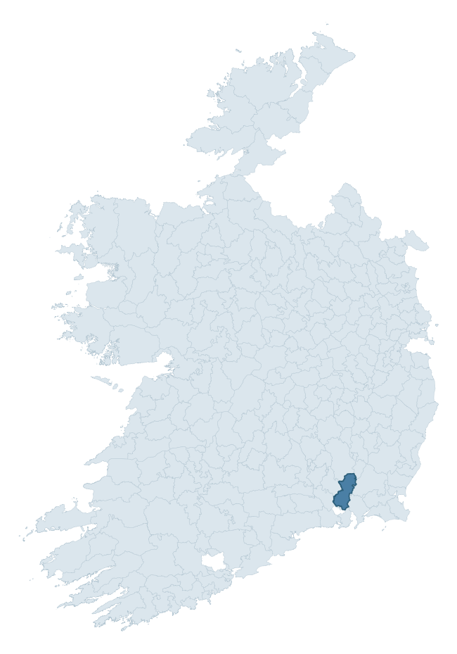
Where this barony sits in the Republic of Ireland
Geology and preservation
Bedrock geology shapes the landscape long before any settlement begins — controlling soil drainage, agricultural potential, the survival of upstanding monuments, and the preservation of buried archaeology. The figures below come from the Geological Survey Ireland 1:100,000 bedrock map.
The bedrock underlying Ida is predominantly slate (36% of the barony by area), laid down during the Ordovician period (73% by area, around 485 to 444 million years ago). Slate weathers to thin upland soils but provides high-value building and roofing stone, which often shows in surviving 19th-century rural and ecclesiastical architecture. A substantial secondary geology of schist (18%) and slates (14%) adds further variety to the underlying landscape. The single largest mapped unit is the Ballylane Shale Formation (27% of the barony's bedrock). With 8 distinct rock types mapped, the barony sits in the top third of ROI baronies for geological diversity (78th percentile) — typically a sign of complex tectonic history or coastal mosaics of differing rock units.
Rock type composition
Largest mapped unit: Ballylane Shale Formation (27% of the barony)
Placename evidence
Logainm records 41 heritage-diagnostic placenames for Ida, drawn from townland and civil-parish names across the barony. The dominant stratum is Early Christian ecclesiastical — cill-, teampall-, and domhnach-prefixed names that record the dense network of early church foundations established between the fifth and tenth centuries. The leading diagnostic roots are cill- (19 — church), ráth- (13 — earthen ringfort), and lios- (2 — ringfort or enclosure). This is above the ROI average of 30.7 heritage placenames per barony. The presence of multiple heritage strata side by side indicates layered occupation of the landscape across successive prehistoric and historic periods. Logainm records 207 placenames for Ida (predominantly townland names). Of these, 41 (20%) carry one of the diagnostic Gaelic roots tracked above; the remainder draw on more generic landscape vocabulary that does not encode a heritage period.
Pre-Christian / Early Medieval Defensive
| Root | Count | Meaning |
|---|---|---|
| ráth- | 13 | earthen ringfort |
| lios- | 2 | ringfort or enclosure |
| dún- | 2 | hilltop or promontory fort |
Early Christian Ecclesiastical
| Root | Count | Meaning |
|---|---|---|
| cill- | 19 | church (early) |
| teampall- | 1 | church (later medieval) |
| díseart- | 1 | hermitage |
| cillín- | 1 | unconsecrated burial ground |
| gráinseach- | 1 | monastic farm / grange |
Burial, Ritual, and Norse-Contact
| Root | Count | Meaning |
|---|---|---|
| uaimh- | 1 | cave / souterrain |
| gall- | 1 | foreigner — Norse settlement marker |
Other baronies in Kilkenny
About this profile
Click any section below to expand.
What is a barony?
A barony is a historic administrative unit in Ireland, broadly equivalent to an English hundred. The 280 baronies used here are from the OSi 2019 National Statutory Boundaries (generalised 20m), covering the 26 counties of the Republic of Ireland. Baronies derive from the Norman period, were formalised in the 17th century, and have not been redrawn for statistical purposes. They vary enormously in area, from compact urban baronies in Dublin to vast upland baronies in Connacht, and should not be compared by raw site count without accounting for area differences.
What counts as a site?
This profile combines three distinct heritage registers, each with its own definition of what constitutes a recordable site:
- Archaeological sites (NMS). The National Monuments Service Sites and Monuments Record (SMR) catalogues every known archaeological monument or site of archaeological interest in the Republic, from prehistoric burial mounds and ringforts to medieval churches and post-medieval defensive works. Inclusion does not require legal protection — only that the site has been identified, surveyed, and assessed as having archaeological value. A separate subset of these sites lies within a recorded protection zone, which gives them statutory protection under the National Monuments Acts.
- Listed buildings (NIAH). The National Inventory of Architectural Heritage records buildings of architectural, historical, archaeological, artistic, cultural, scientific, social, or technical interest. Each surveyed structure is appraised on a five-tier scale: International, National, Regional, Local, and Record-Only. The NIAH appraisal is informational rather than strictly statutory, but it underpins local-authority Record of Protected Structures (RPS) listings.
- Heritage placenames (Logainm). Logainm is the authoritative database of Irish placenames maintained by the Placenames Branch. This profile applies a heritage-diagnostic classifier to the Irish-language form of each townland name, flagging roots that signal defensive sites (ráth-, lios-, dún-, caiseal-, cathair-), ecclesiastical foundations (cill-, teampall-, domhnach-, mainistir-), prehistoric burial-ritual features (tuaim-, carn-, leaba-), or Norse-contact settlement (gall-). Townlands without one of these diagnostic roots are not flagged here — they may still carry historical significance, but that significance is not encoded in the name itself.
Editorial principles
The narrative sections of this profile follow several explicit principles:
- Evidential. Every claim about this barony’s heritage character is anchored in the underlying register data. Where a site count, a placename count, or a percentile rank is cited, it is computed from the source datasets at export time, not estimated.
- Comparative. Counts and metrics are reported alongside their percentile rank against the other 279 ROI baronies. A barony with 50 ringforts in absolute terms could be unusually high or unusually low depending on its size and regional context; percentile ranking removes that ambiguity.
- Transparent on limits. Where a register has known coverage gaps, survey biases, or data-quality issues that affect this barony’s figures, the profile flags them rather than presenting the numbers as definitive.
- No interpretation beyond what the data supports. The narrative does not speculate about historical events, social dynamics, or cultural meaning beyond what the recorded heritage and placename evidence directly attests.
Data caveats and limits
- NMS Sites and Monuments Record is the product of survey campaigns conducted at different intensities across different counties and decades. Some baronies have been surveyed more thoroughly than others, and absolute counts should be read in that light. Sites destroyed by development before survey are typically not represented; sites in heavily forested or upland terrain are sometimes under-recorded.
- NIAH coverage is broadly complete for the Republic of Ireland but the survey was conducted on a rolling county-by-county basis, and the most recent appraisal date varies. Buildings demolished or substantially altered after their original survey may still appear in the register; conversely, recent buildings of merit may not yet have been appraised.
- Logainm classification applies a deliberately conservative pattern-matching approach to the Irish-language townland forms. The classifier prioritises true positives over recall: a townland may carry a heritage signal that the classifier doesn’t recognise, particularly where the diagnostic root has been heavily anglicised or where the townland name draws on a less common term. The 60,000+ townland records and ~9,800 classified placenames give a substantial signal at barony scale, but individual townland names should be checked against Logainm directly for definitive interpretation.
- Period attribution. The chronological distribution reflects only those NMS sites that carry a recognised period attribution in the source data. Sites listed as “Unknown” period are excluded from the dated subset.
- Boundary changes. Some baronies have undergone minor boundary adjustments since their 19th-century definition; the OSi 2019 generalised boundaries used here are the current statutory definition and may differ slightly from historical maps in border areas.
- Bedrock geology is mapped at 1:100,000 scale, which means local variation within a barony — small pockets of different rock type, mineral veins, alluvium overlying bedrock — is generalised. The dominant-system and rocktype figures are area-weighted, so a barony reading “70% Carboniferous limestone” may still contain small but archaeologically important pockets of older or younger rock. Around 3% of GSI polygons do not match the lexicon and contribute no rocktype or system attribution.
Data sources
- National Monuments Service — Sites and Monuments Record (SMR) https://data.gov.ie/dataset/national-monuments-service-archaeological-survey-of-ireland
- National Inventory of Architectural Heritage (NIAH) https://data.gov.ie/dataset/national-inventory-of-architectural-heritage-niah-national-dataset
- Logainm — Placenames Database of Ireland https://www.logainm.ie/
- Ordnance Survey Ireland — National Statutory Barony Boundaries 2019 https://data-osi.opendata.arcgis.com/
- EURODEM — European Digital Elevation Model https://www.mapsforeurope.org/datasets/euro-dem
- ESA WorldCover https://esa-worldcover.org/en
- Geological Survey Ireland — 1:100,000 Bedrock Geology https://www.gsi.ie/en-ie/data-and-maps/Pages/Bedrock.aspx
Explore more: Search any of the 280 ROI baronies, browse by historical province, or read the methodology and data sources for the full Republic of Ireland Heritage Tool.