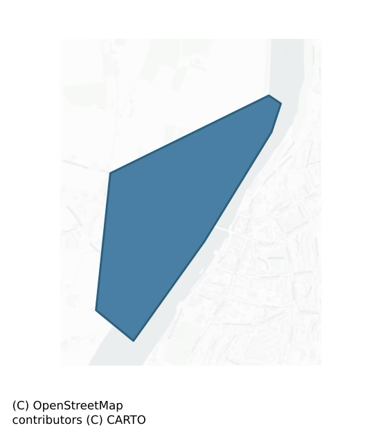
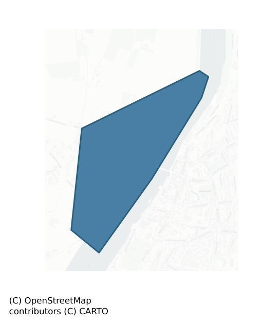
Ida is a barony of County Wexford, in the historical province of Leinster (Irish: Uí Dheá), a small barony covering less than 5 km² of land. The barony records 5 NMS archaeological sites and 21 NIAH listed buildings, placing it at around the 99th percentile among 280 ROI baronies for sites per km². This means it is in the top tenth of all baronies for sites per km². Dated archaeological evidence runs from the Early Bronze Age through to the Medieval, spanning 3 of 9 archaeological periods, placing the barony in the 2nd percentile among 280 ROI baronies for chronological depth. This means it is in the bottom tenth of all baronies for chronological depth. The largest dated subset of recorded sites dates to the Medieval.
Heritage at a glance
Percentile rankings throughout this profile compare each barony only against the other 279 Republic of Ireland baronies.
The recorded heritage of Ida
The National Monuments Service Sites and Monuments Record (SMR) is the statutory inventory of archaeological sites for the Republic of Ireland, maintained by the Department of Tourism, Culture, Arts, Gaeltacht, Sport and Media. Sites recorded here include earthworks, ringforts, megalithic tombs, ecclesiastical remains, and post-medieval features; not every record is legally protected, but each is registered as a monument of archaeological interest.
The National Monuments Service records 5 archaeological sites in Ida, putting it at the 99th percentile among 280 ROI baronies for sites per km². This means it is in the top tenth of all baronies for sites per km². Protection coverage is near-universal — 5 sites (100%) fall within a recorded monument protection zone, indicating an extensively surveyed landscape. The dominant category is ecclesiastical sites — churches, graveyards, and holy wells (4 sites, 80% of the record). Church is the most prevalent type, making up 20% of the barony's recorded sites (1 records) — well above the ROI average of 4% across all baronies where this type occurs. Church is a building used for public Christian worship, of any date from c. 500 AD onwards. Other significant types include Graveyard (1) and Graveslab (1). Graveyard is a burial area associated with a church, in use from the medieval period onwards; Graveslab is a recumbent grave-marking slab, dated 1200–1700 AD.
Most common monument types
Hover or tap a monument type to see its definition.
| Type | Count |
|---|---|
| Church a building used for public Christian worship, of any date from c. 500 AD onwards | 1 |
| Graveyard a burial area associated with a church, in use from the medieval period onwards | 1 |
| Graveslab a recumbent grave-marking slab, dated 1200–1700 AD | 1 |
| Bullaun stone a boulder or rock outcrop with hemispherical hollows ('bulláin'), commonly associated with ecclesiastical sites and holy wells | 1 |
Chronological distribution
The dated archaeological record for Ida spans from the Early Bronze Age through to the Medieval, with activity attested across 3 of 9 archaeological periods. This is the 2nd percentile across ROI baronies — a relatively narrow chronological band, with much of Irish prehistory not represented in the dated record. The record is periodic rather than continuous: the Middle Late Bronze Age, and Iron Age periods fall inside the chronological span but record no dated sites — likely reflecting either genuine settlement discontinuity or limits of survey attribution. A further 1 recorded sites (20% of the overall NMS register for the barony) carry no period attribution — appearing as 'Unknown' in the bar chart below. This typically reflects either records that pre-date the standardised period vocabulary or sites awaiting specialist dating review, rather than a genuine absence of chronological evidence.
Sample of recorded monuments
Show all 5 recorded monuments
All 5 recorded monuments in the barony. Each entry shows the official Sites and Monuments Record reference number and the description published by the National Monuments Service.
Church
Described as the 'Convent of Dominicans (Site of)' only on the 1940 ed. of the OS 6-inch map, and situated on a steep E-facing slope. This is the site of parish church of Rosbercon. The church is depicted as a…
Described as the 'Convent of Dominicans (Site of)' only on the 1940 ed. of the OS 6-inch map, and situated on a steep E-facing slope. This is the site of parish church of Rosbercon. The church is depicted as a rectangular roofed structure (dims. c. 20m E-W; c. 10m N-S) on the 1839 ed. of the OS 6-inch map, and it is described as in good repair (Lewis 1837, vol. 2, 533-4). There are no visible remains of a church at ground level, apart from the N wall with two brick-lined window embrasures incorporated into the N wall of the wedge-shaped graveyard (dims. c. 55m E-W; c. 25-45m N-S) defined by masonry walls. There is a fragment of a medieval graveslab (Wth 0.5-55m; visible H 1.1m; T 0.2m) in a green stone with a fleur-de-lis terminals serving as a grave-marker in the graveyard. An oval bullaun stone (dims 0.5m x 0.35m; H 0.25m plus) of granite with a single basin (dims 0.27m x 0.25m; D 0.1m) is in a flowerbed c. 40m N of the graveyard.
The above description is derived from the published 'Archaeological Inventory of County Wexford' (Dublin: Stationery Office, 1996). In certain instances the entries have been revised and updated in the light of recent research.
Compiled by: Michael Moore
Date of revision: 29 May, 2019
Religious house – Dominican friars
Described as the site of the Dominican abbey only on the 1839 ed. of the OS 6-inch map, and situated on the flood-plain of the N-S River Barrow/Nore with the stream c. 50m to the E. A Dominican friary known as St.…
Described as the site of the Dominican abbey only on the 1839 ed. of the OS 6-inch map, and situated on the flood-plain of the N-S River Barrow/Nore with the stream c. 50m to the E. A Dominican friary known as St. Mary’s was reputedly founded in 1267 by the Graces or Walshes. It was dissolved in 1539 when it was described as a church with a belfry, a dormitory, a cemetery and four chambers, together with St. Saviour’s chapel (WX029-013011-) (Gwynn and Hadcock 1970, 229), but this last is not proven and the chapel was a possession of Dunbrody abbey (WX039-030001-) at the Suppression. A late 18th century print (Flynn 1981, Pl. 2) shows a nave and chancel with a tower, destroyed aisles and a N transept, and Lewis (1837, vol. 2, 553) describes a crossing tower and a wall with five arches and ten windows, but doubt must be cast on the validity of both (Manning 1998a, 125).
There are no visible remains of it at ground level, but archaeological monitoring of a drainage pipe (95E0086) identified a wall from the friary and burials associated with it (McCutcheon 1996). Further excavation (00E0828) to secure the site for pile-supported development did not disturb any medieval deposits (McCarthy, M. 2002).
The above description is derived from the published 'Archaeological Inventory of County Wexford' (Dublin: Stationery Office, 1996). In certain instances the entries have been revised and updated in the light of recent research.
Compiled by: Michael Moore
Date of upload/r…
Graveyard
This site of the parish church of Rosbercon (WX029-013001-) is within a wedge-shaped graveyard (dims. c. 55m E-W; c. 25-45m N-S) defined by masonry walls. There is a medieval graveslab (WX029-013021-) serving as a…
This site of the parish church of Rosbercon (WX029-013001-) is within a wedge-shaped graveyard (dims. c. 55m E-W; c. 25-45m N-S) defined by masonry walls. There is a medieval graveslab (WX029-013021-) serving as a grave-marker in the graveyard.
Compiled by: Michael Moore
Date of upload: 7 August, 2012
Graveslab
There is a medieval graveslab (Wth 50-55m; visible H 1.1m; T 0.2m) in a green stone with fleur-de-lis terminals serving as a grave-marker in the graveyard (WX029-013020-) of Rosbercon parish church…
There is a medieval graveslab (Wth 50-55m; visible H 1.1m; T 0.2m) in a green stone with fleur-de-lis terminals serving as a grave-marker in the graveyard (WX029-013020-) of Rosbercon parish church (WX029-013001-).
Compiled by: Michael Moore
Date of upload: 7 August, 2012
Bullaun stone
An oval bullaun stone of granite (dims 0.5m; x 0.35m; H 0.25m plus) with a single basin (dims 0.27m x 0.25m; D 0.1m) is c.45m N of the graveyard of the parish church of Rosbercon (WX029-013001-).
Compiled by:…
An oval bullaun stone of granite (dims 0.5m; x 0.35m; H 0.25m plus) with a single basin (dims 0.27m x 0.25m; D 0.1m) is c.45m N of the graveyard of the parish church of Rosbercon (WX029-013001-).
Compiled by: Michael Moore
Date of upload: 29 May 2019
Listed buildings
The National Inventory of Architectural Heritage (NIAH) is a state survey appraising buildings of architectural, historical, archaeological, artistic, cultural, scientific, social, or technical interest. Each surveyed structure receives a rating from International (the highest, for buildings of European importance) through National, Regional, Local, and Record-Only.
The NIAH records only 21 listed buildings in Ida, the 8th percentile across ROI baronies — a relatively thin architectural record. All recorded buildings carry Regional or lower grading; the barony does not contain any structures appraised as being of National or International architectural importance. Construction dates concentrate most heavily in the Modern (post-1900) period. The most-recorded building type is house (13 examples, 62% of the listed stock).
Terrain and environment
Mean elevation across the barony is 10m — the 1st percentile among 280 ROI baronies for elevation. This means it is in the bottom tenth of all baronies for elevation. This is a relatively low-lying landscape by ROI standards. Elevation matters for heritage because higher-altitude baronies typically favour defensive monuments — ringforts and hilltop forts placed on prominent ground — while lowland baronies are more likely to carry the dense settlement and church networks of intensive agricultural landscapes. Mean slope is 3.9° — the 56th percentile among 280 ROI baronies for slope. This means it is in the upper half of all baronies for slope. Slope is a key control on both land use and archaeological preservation: steep ground resists ploughing and tends to preserve earthworks intact, while gentle slopes favour intensive cultivation that damages or destroys surface archaeology over time. The Topographic Wetness Index averages 10.8, the 50th percentile among 280 ROI baronies for wetness. This means it is in the upper half of all baronies for wetness. Drainage matters for heritage because poorly-drained ground preserves organic archaeology (wooden trackways, leather, textiles, and on rare occasions human remains) far better than free-draining soil; well-drained ground favours arable use but destroys organic material rapidly. Urban land covers 19% of the barony (the 97th percentile among 280 ROI baronies for urban cover. This means it is in the top tenth of all baronies for urban cover). Heavy urban coverage compresses heritage analysis: many archaeological features have been buried or destroyed by development, but the surviving record is concentrated in protected city-centre cores, and the NIAH listed-buildings count is typically high. The land-cover mosaic combines improved grassland (35%), open water (24%), and woodland (22%), giving a mixed agricultural and semi-natural landscape.
Terrain measurements
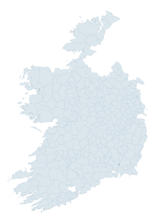
Where this barony sits in the Republic of Ireland
Geology and preservation
Bedrock geology shapes the landscape long before any settlement begins — controlling soil drainage, agricultural potential, the survival of upstanding monuments, and the preservation of buried archaeology. The figures below come from the Geological Survey Ireland 1:100,000 bedrock map.
The bedrock underlying Ida is predominantly slate (88% of the barony by area), laid down during the Ordovician period (100% by area, around 485 to 444 million years ago). Slate weathers to thin upland soils but provides high-value building and roofing stone, which often shows in surviving 19th-century rural and ecclesiastical architecture. The single largest mapped unit is the Ballylane Shale Formation (88% of the barony's bedrock). With only 2 distinct rock types mapped, the barony is geologically uniform compared to the rest of the Republic (16th percentile for diversity) — a single coherent bedrock landscape.
Rock type composition
Largest mapped unit: Ballylane Shale Formation (88% of the barony)
Placename evidence
Logainm records 5 placenames for Ida, but none carry the diagnostic Gaelic roots tracked by the heritage classifier — defensive (ráth-, lios-, dún-, caiseal-), ecclesiastical (cill-, teampall-, domhnach-), burial-ritual, or Norse-contact terms. The barony's townland names appear to draw on the more generic Gaelic landscape vocabulary (baile-, cnoc-, gleann-, droim-) which is common throughout Ireland and carries no specific heritage-period signal.
Other baronies in Wexford

Explore further
Grounding History: 10 Maps of Northern Ireland’s Past
If you’re interested in Irish heritage more widely, the companion report for Northern Ireland brings together the analysis of all 462 NI wards into one place through 10 high-quality maps — covering monument density, archaeological periods, placename heritage, terrain, wetland, and the historic landscape at first survey. Take a look.
About this profile
Click any section below to expand.
What is a barony?
A barony is a historic administrative unit in Ireland, broadly equivalent to an English hundred. The 280 baronies used here are from the OSi 2019 National Statutory Boundaries (generalised 20m), covering the 26 counties of the Republic of Ireland. Baronies derive from the Norman period, were formalised in the 17th century, and have not been redrawn for statistical purposes. They vary enormously in area, from compact urban baronies in Dublin to vast upland baronies in Connacht, and should not be compared by raw site count without accounting for area differences.
What counts as a site?
This profile combines three distinct heritage registers, each with its own definition of what constitutes a recordable site:
- Archaeological sites (NMS). The National Monuments Service Sites and Monuments Record (SMR) catalogues every known archaeological monument or site of archaeological interest in the Republic, from prehistoric burial mounds and ringforts to medieval churches and post-medieval defensive works. Inclusion does not require legal protection — only that the site has been identified, surveyed, and assessed as having archaeological value. A separate subset of these sites lies within a recorded protection zone, which gives them statutory protection under the National Monuments Acts.
- Listed buildings (NIAH). The National Inventory of Architectural Heritage records buildings of architectural, historical, archaeological, artistic, cultural, scientific, social, or technical interest. Each surveyed structure is appraised on a five-tier scale: International, National, Regional, Local, and Record-Only. The NIAH appraisal is informational rather than strictly statutory, but it underpins local-authority Record of Protected Structures (RPS) listings.
- Heritage placenames (Logainm). Logainm is the authoritative database of Irish placenames maintained by the Placenames Branch. This profile applies a heritage-diagnostic classifier to the Irish-language form of each townland name, flagging roots that signal defensive sites (ráth-, lios-, dún-, caiseal-, cathair-), ecclesiastical foundations (cill-, teampall-, domhnach-, mainistir-), prehistoric burial-ritual features (tuaim-, carn-, leaba-), or Norse-contact settlement (gall-). Townlands without one of these diagnostic roots are not flagged here — they may still carry historical significance, but that significance is not encoded in the name itself.
Editorial principles
The narrative sections of this profile follow several explicit principles:
- Evidential. Every claim about this barony’s heritage character is anchored in the underlying register data. Where a site count, a placename count, or a percentile rank is cited, it is computed from the source datasets at export time, not estimated.
- Comparative. Counts and metrics are reported alongside their percentile rank against the other 279 ROI baronies. A barony with 50 ringforts in absolute terms could be unusually high or unusually low depending on its size and regional context; percentile ranking removes that ambiguity.
- Transparent on limits. Where a register has known coverage gaps, survey biases, or data-quality issues that affect this barony’s figures, the profile flags them rather than presenting the numbers as definitive.
- No interpretation beyond what the data supports. The narrative does not speculate about historical events, social dynamics, or cultural meaning beyond what the recorded heritage and placename evidence directly attests.
Data caveats and limits
- NMS Sites and Monuments Record is the product of survey campaigns conducted at different intensities across different counties and decades. Some baronies have been surveyed more thoroughly than others, and absolute counts should be read in that light. Sites destroyed by development before survey are typically not represented; sites in heavily forested or upland terrain are sometimes under-recorded.
- NIAH coverage is broadly complete for the Republic of Ireland but the survey was conducted on a rolling county-by-county basis, and the most recent appraisal date varies. Buildings demolished or substantially altered after their original survey may still appear in the register; conversely, recent buildings of merit may not yet have been appraised.
- Logainm classification applies a deliberately conservative pattern-matching approach to the Irish-language townland forms. The classifier prioritises true positives over recall: a townland may carry a heritage signal that the classifier doesn’t recognise, particularly where the diagnostic root has been heavily anglicised or where the townland name draws on a less common term. The 60,000+ townland records and ~9,800 classified placenames give a substantial signal at barony scale, but individual townland names should be checked against Logainm directly for definitive interpretation.
- Period attribution. The chronological distribution reflects only those NMS sites that carry a recognised period attribution in the source data. Sites listed as “Unknown” period are excluded from the dated subset.
- Boundary changes. Some baronies have undergone minor boundary adjustments since their 19th-century definition; the OSi 2019 generalised boundaries used here are the current statutory definition and may differ slightly from historical maps in border areas.
- Bedrock geology is mapped at 1:100,000 scale, which means local variation within a barony — small pockets of different rock type, mineral veins, alluvium overlying bedrock — is generalised. The dominant-system and rocktype figures are area-weighted, so a barony reading “70% Carboniferous limestone” may still contain small but archaeologically important pockets of older or younger rock. Around 3% of GSI polygons do not match the lexicon and contribute no rocktype or system attribution.
Data sources
- National Monuments Service — Sites and Monuments Record (SMR) https://data.gov.ie/dataset/national-monuments-service-archaeological-survey-of-ireland
- National Inventory of Architectural Heritage (NIAH) https://data.gov.ie/dataset/national-inventory-of-architectural-heritage-niah-national-dataset
- Logainm — Placenames Database of Ireland https://www.logainm.ie/
- Ordnance Survey Ireland — National Statutory Barony Boundaries 2019 https://data-osi.opendata.arcgis.com/
- EURODEM — European Digital Elevation Model https://www.mapsforeurope.org/datasets/euro-dem
- ESA WorldCover https://esa-worldcover.org/en
- Geological Survey Ireland — 1:100,000 Bedrock Geology https://www.gsi.ie/en-ie/data-and-maps/Pages/Bedrock.aspx
Explore more: Search any of the 280 ROI baronies, browse by historical province, or read the methodology and data sources for the full Republic of Ireland Heritage Tool.