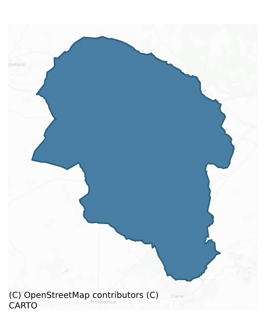
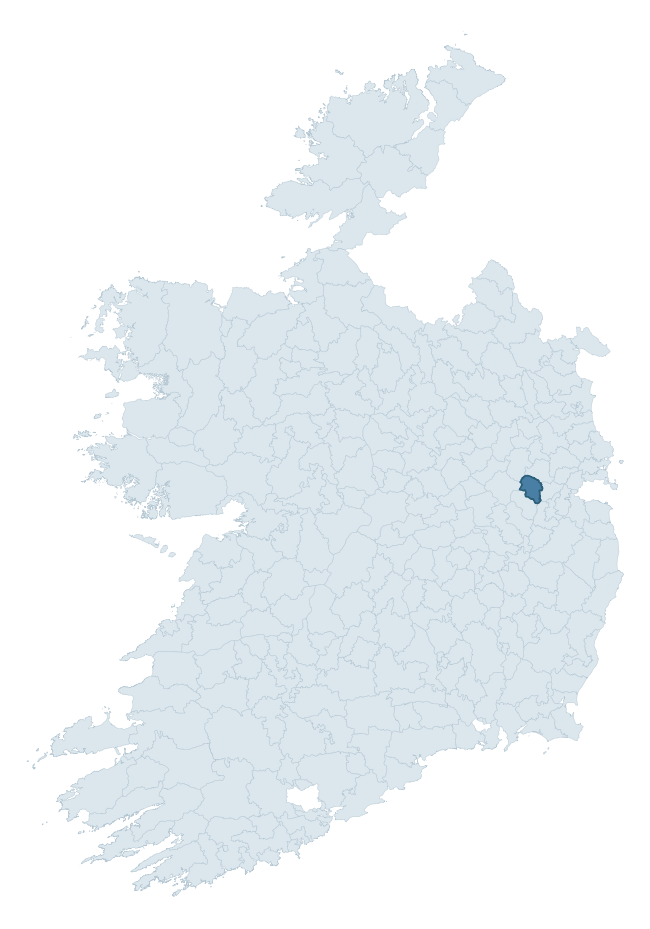
Ikeathy And Oughterany is a barony of County Kildare, in the historical province of Leinster (Irish: Uí Chéithigh agus Uachtar Fhine), covering 104 km² of land. The barony records 175 NMS archaeological sites and 59 NIAH listed buildings, placing it at around the 42nd percentile among 280 ROI baronies for sites per km². This means it is in the lower half of all baronies for sites per km². Dated archaeological evidence runs from the Early Bronze Age through to the Post Medieval, spanning 6 of 9 archaeological periods, placing the barony in the 10th percentile among 280 ROI baronies for chronological depth. This means it is in the bottom fifth of all baronies for chronological depth. The largest dated subset of recorded sites dates to the Iron Age.

Heritage at a glance
Percentile rankings throughout this profile compare each barony only against the other 279 Republic of Ireland baronies.
The recorded heritage of Ikeathy And Oughterany
The National Monuments Service Sites and Monuments Record (SMR) is the statutory inventory of archaeological sites for the Republic of Ireland, maintained by the Department of Tourism, Culture, Arts, Gaeltacht, Sport and Media. Sites recorded here include earthworks, ringforts, megalithic tombs, ecclesiastical remains, and post-medieval features; not every record is legally protected, but each is registered as a monument of archaeological interest.
The National Monuments Service records 175 archaeological sites in Ikeathy And Oughterany, putting it at the 42nd percentile among 280 ROI baronies for sites per km². This means it is in the lower half of all baronies for sites per km². Protection coverage is near-universal — 158 sites (90%) fall within a recorded monument protection zone, indicating an extensively surveyed landscape. The record is dominated by defensive sites — ringforts, enclosures, hillforts, and stone forts (67 sites, 38% of the total), with ecclesiastical sites forming a substantial secondary presence (33 sites, 19%). The most diagnostically specific type is Church (11 records, 6% of the barony's NMS total) — compared to an ROI average of 4% across all baronies where this type occurs. Church is a building used for public Christian worship, of any date from c. 500 AD onwards. The broader 'Enclosure' classification — which catches unclassified ringforts and field enclosures — accounts for a further 39 records (22%) and reflects the difficulty of sub-classifying degraded earthworks from surface evidence alone. Across the barony's 104 km², this gives a recorded density of 1.68 sites per km².
Most common monument types
Hover or tap a monument type to see its definition.
| Type | Count |
|---|---|
| Enclosure a banked or ditched feature of uncertain type, used as a catch-all where the original function cannot be determined from surface evidence | 39 |
| Church a building used for public Christian worship, of any date from c. 500 AD onwards | 11 |
| Ringfort – rath an earthen ringfort enclosed by a bank and external ditch — the most common Early Medieval farmstead, broadly dated 500–1000 AD | 10 |
| Graveyard a burial area associated with a church, in use from the medieval period onwards | 10 |
| Barrow – unclassified a prehistoric burial mound where the specific barrow type cannot be determined from surface evidence | 10 |
| Ecclesiastical enclosure a large enclosure surrounding an Early Medieval church or monastery and its associated activity areas | 4 |
| Ritual site – holy well a well or spring traditionally associated with a saint, often credited with healing properties; many trace earlier ritual origins but devotion is documented from the medieval period onwards | 4 |
Chronological distribution
The dated archaeological record for Ikeathy And Oughterany spans from the Early Bronze Age through to the Post Medieval, with activity attested across 6 of 9 archaeological periods. This is the 10th percentile across ROI baronies — a relatively narrow chronological band, with much of Irish prehistory not represented in the dated record. Every period from earliest to latest is represented in the record — an unbroken sequence of dated activity across the full chronological span. Activity concentrates most heavily in the Iron Age (65 sites, 46% of dated material), with the Early Medieval forming a secondary peak (31 sites, 22%). A further 35 recorded sites (20% of the overall NMS register for the barony) carry no period attribution — appearing as 'Unknown' in the bar chart below. This typically reflects either records that pre-date the standardised period vocabulary or sites awaiting specialist dating review, rather than a genuine absence of chronological evidence.
Sample of recorded monuments
Show 25 sample monuments (of 175 total)
A representative sample of 25 recorded monuments drawn from the barony’s 175 total NMS entries. Sites within a recorded monument protection zone and rarer site types are prioritised so the list shows a meaningful cross-section rather than only the most common type. Each entry shows the official Sites and Monuments Record reference number and the description published by the National Monuments Service.
Cross
Lies c. 650m to the S of a medieval church (KD004-021005-). A square cross-base (dims. 0.59m; 0.59m; H. 0.38m) contains a rectangular mortice (dims. L 0.24m; Wth 0.20m; D. 0.19m) and has chamfered upper edges upon which…
Lies c. 650m to the S of a medieval church (KD004-021005-). A square cross-base (dims. 0.59m; 0.59m; H. 0.38m) contains a rectangular mortice (dims. L 0.24m; Wth 0.20m; D. 0.19m) and has chamfered upper edges upon which the word AMEN is carved in false relief. According to local tradition, a Carmelite Friary (KD004-021006-) once stood in the same field as the cross. (Bradley et al. 1986, vol. 2, 163).
Compiled by: Gearóid Conroy
Date of upload: 10 June 2011
Road – hollow-way
Recorded on Netterville's 1752 map of Michael Aylmer's estate (NLI Map 21 f. 50(4)) and suggested as the possible location of the medieval borough of Cloncurry (KD004-021001-) by Bradley et al. (1986 vol. 2, 155-67). In…
Recorded on Netterville's 1752 map of Michael Aylmer's estate (NLI Map 21 f. 50(4)) and suggested as the possible location of the medieval borough of Cloncurry (KD004-021001-) by Bradley et al. (1986 vol. 2, 155-67). In level pasture. Visible as a broad sunken trackway (Wth. 7- 8m; D 1.5m) running approximately NE – SW (traceable L c. 600m) before forking at its SW end; one section running NW (L c. 80m) and the other SW (L c. 80m).
Compiled by: Gearóid Conroy
Date of upload: 10 June 2011
Architectural fragment
By the roadside on a hilltop in gently undulating mixed pasture and tillage. A well-dressed limestone pillar with a rectangular section (dims. H c. 1.3m; L 0.25m; Wth 0.2m) has been white-washed. Hammer-dressing is…
By the roadside on a hilltop in gently undulating mixed pasture and tillage. A well-dressed limestone pillar with a rectangular section (dims. H c. 1.3m; L 0.25m; Wth 0.2m) has been white-washed. Hammer-dressing is visible on the top and the corners, while the faces are smooth. There is no visible inscription, but according to local tradition the stone is associated with St Patrick.
Compiled by: Gearóid Conroy
Date of upload: 10 June 2011
Mound
On level improved pasture c. 50m S of a holy well (KD004-024—-). A low, grass covered, sub-circular, earthen mound (diams. 8.3m N-S; 8m E-W; H 0.4m) is heavily poached by livestock and has no visible stone in its…
On level improved pasture c. 50m S of a holy well (KD004-024—-). A low, grass covered, sub-circular, earthen mound (diams. 8.3m N-S; 8m E-W; H 0.4m) is heavily poached by livestock and has no visible stone in its composition. It is visible on an aerial photograph (Holton 1985, Fig. 39; SMR file).
Compiled by: Gearóid Conroy
Date of upload: 10 June 2011
Ecclesiastical site
According to Gwynn and Hadcock (1970, 389), 'Cell-choca, the monastery of the 6thC virgin Cocha (Chuaca)' was located at Kilcock. No visible surface trace of the monument survives, but a later, medieval church…
According to Gwynn and Hadcock (1970, 389), 'Cell-choca, the monastery of the 6thC virgin Cocha (Chuaca)' was located at Kilcock. No visible surface trace of the monument survives, but a later, medieval church (KD005-002001-) and graveyard (KD005-002002-) may occupy its site.
Compiled by: Gearóid Conroy
Date of upload: 10 June 2011
Standing stone
On a slight pasture hillock. Described by the landowner as, 'a low standing stone' which was removed by his father who thought it was a scratching post (SMR file). The stone was not located.
Compiled by: Gearóid…
On a slight pasture hillock. Described by the landowner as, 'a low standing stone' which was removed by his father who thought it was a scratching post (SMR file). The stone was not located.
Compiled by: Gearóid Conroy
Date of upload: 10 June 2011
Burnt mound
On wet ground at the W foot of a gentle pasture slope. According to the landowner, a low rise was revealed to be composed of burnt stone and dark soil during drainage operations in the early 1980's (SMR file). No…
On wet ground at the W foot of a gentle pasture slope. According to the landowner, a low rise was revealed to be composed of burnt stone and dark soil during drainage operations in the early 1980's (SMR file). No visible surface traces survive.
Compiled by: Gearóid Conroy
Date of upload: 10 June 2011
Castle – Anglo-Norman masonry castle
National Monument No. 404. According to Leask, lands in the area were granted to the de Wogan's in 1317 and the castle was probably built shortly afterwards (SMR File). The castle was attacked in 1454, fortified in 1641…
National Monument No. 404. According to Leask, lands in the area were granted to the de Wogan's in 1317 and the castle was probably built shortly afterwards (SMR File). The castle was attacked in 1454, fortified in 1641 (Harbison 1975, 126), and the mansion was built post-c.1785 (Bence-Jones 1978, 239). Prominently sited on the SE shoulder of a hill in arable land, with a panoramic view from N clockwise to WSW and overlooking an enclosure (KD010-016—-) c. 500m to NE. A gatehouse (KD010-018002-) stands slightly upslope to NW and low earthworks (KD010-018003-), visible on an aerial photograph (CUCAP BDU 36), to the N and E may mark late-18th/19th century garden features. Sections of the Pale Boundary Ditch survive some two miles away to NNW (KD010-001—-) and c. 1300m away to SSW (KD010-021—-). The site comprises the poorly preserved remains of a 14th century castle subsequently incorporated (above and to W) into a 17th century fortified house (KD010-018004-) which in turn forms part of a late 18th century mansion (KD010-018005-). Render and plaster obscure the detail, especially of the 17th century phase, but the earliest remains, in the NE angle, are of a rectangular structure (int. dims. L 15.5m E-W; Wth 6.18m N-S; wall T 1.9m) built of unbattered rubble masonry with a wicker-centred, barrel-vaulted ceiling (H 3.1m) orientated on an E-W axis over the ground floor. Two loops in the S wall (at E end, and W of centre) are original. Two external doorways, in the N and E…
Gatehouse
National Monument No. 404. Prominently sited on the SE shoulder of a hill in arable land, slightly upslope, c. 50m to the NW, of a 14th century, de Wogan castle (KD010-018001-) which was later incorporated into a 17th…
National Monument No. 404. Prominently sited on the SE shoulder of a hill in arable land, slightly upslope, c. 50m to the NW, of a 14th century, de Wogan castle (KD010-018001-) which was later incorporated into a 17th century fortified house (KD010-018004-) and 18th century mansion (KD010-018005-). Low earthworks (KD010-018003-) to N and E may mark late 18th/19th century landscaped gardens associated with an extant walled-garden to the S, and are visible on an aerial photograph (CUCAP, BDU036) Two sections of the Pale Boundary Ditch survive nearby; c. 2 miles to NNW (KD010-001—-) and c. 1300m to SSW (KD010-021—-). A three-storied rectangular structure with caphouse (ext. dims. L 10.5m N-S; max. Wth 7.1m E-W; av. wall T 1.1m) built of unbattered, coursed masonry with roughly dressed quoins, comprises the E wall of a tall and otherwise robbed-out, central round-arched passageway (Wth 3.2m) orientated on an E-W axis with a loop above at second-floor level, and flanked at S by a small, poorly preserved, roofless rectangular guardroom (int. dims. L 3.06m E-W; Wth 1m N-S) and at N by a larger, fairly well-preserved rectangular tower (int. dims. L 4.7m E-W; Wth 2.5m N-S). The guardroom is entered from the central passageway through a narrow, round-headed doorway at the E end of its N wall. The E wall survives to three stories in height and contains a narrow round-headed doorway at first-floor level. The S and W walls are almost levelled, but traces of a window-jamb in the S w…
Designed landscape – formal garden
Recorded on the 1st ed. of the OS 6-inch map (1838) as two, formally laid out, rectangular gardens with internal pathways and divisions, the larger (est. dims. L c. 90m E-W; Wth c. 80m N-S) lying immediately NE of…
Recorded on the 1st ed. of the OS 6-inch map (1838) as two, formally laid out, rectangular gardens with internal pathways and divisions, the larger (est. dims. L c. 90m E-W; Wth c. 80m N-S) lying immediately NE of Rathcoffey House (KD010-018005-) is mirrored by a slightly smaller garden (est. dims. L c. 70m E-W; Wth c. 60m N-S) immediately to the SW of the house. Visible on a 1970's aerial photograph (CUCAP BDU036) as low earthworks, but extensive ploughing has removed obvious visible surface traces. An elongated pond or lake (est. dims. L c. 180m; Wth c. 30m), possibly marking the end of a vista, is also recorded on the OS 1st ed., on lower ground c. 450m S of the house. Now dry, it is known locally as the 'decoy', and in the 1890's and 1950's, produced several skulls and antlers of giant Irish deer. (JKAS 1945, 420-24)
Compiled by: Gearóid Conroy
Date of upload: 10 June 2011
Castle – motte and bailey
The monument is 'a relic of the castle of the first Anglo-Norman proprietor, John de Hereford' (Killanin and Duignan 1967, 162) and may have had an associated village (KD014-007002-). On a gentle slope which forms the S…
The monument is 'a relic of the castle of the first Anglo-Norman proprietor, John de Hereford' (Killanin and Duignan 1967, 162) and may have had an associated village (KD014-007002-). On a gentle slope which forms the S end of a low, narrow, N-S pasture ridge which carries medieval ecclesiastical remains (KD014-006001- to KD014-006004-) c. 100m upslope to the N. A fairly well-preserved, high, steep-sided, circular earthen mound (base diams. 43.7m N-S; 42.4m E-W; surface diams. 15.4m N-S; 11.5m E-W; av.H 7.5m) has traces of a low, earthen bank (Wth 1.8-2.2m; int. H 0.2-0.5m) on its upper surface S-W-NE, and is girdled at the base by a fosse (Wth 1.4-1.8m: D 1.6-2.2m) SE-W-NE. A badger sett occupies most of the upper surface and burrowing has resulted in a lot of gravel being exposed and spilled down the sides of the mound, especially along the E. A concrete pipe (diam. 0.3m) has been inserted into the mound just W of centre and marks a Trig. Point. The sides of the mound are covered in tree stumps and the fosse contains mature oak and beech trees. Contiguous to the S a large, sub rectangular bailey (dims. max. L 60.5m E-W; Wth 46m N-S) is defined by a scarp (H 1.6m at E-2.2m at W). At its N end, closest to the motte, it carries a slightly raised, rectangular area (dims. L 37.5m E-W; Wth 15.5m N-S) which is defined by a low scarp (H 0.8m). A very small enclosure (KD014-007003-) abuts the bailey at SE.
Compiled by: Gearóid Conroy
Date of upload: 10 June 2011
Ritual site – holy tree/bush
Located immediately to the S of a Holy Well (KD004-031004-) at the N end of a graveyard (KD004-031003-). A mature ash tree has numerous votive offerings attached – rosary beads, holy medals, scapulars, St Patrick's Day…
Located immediately to the S of a Holy Well (KD004-031004-) at the N end of a graveyard (KD004-031003-). A mature ash tree has numerous votive offerings attached – rosary beads, holy medals, scapulars, St Patrick's Day badges and small crosses made from twigs.
Compiled by: Gearóid Conroy
Date of upload: 10 June 2011
Bawn
On a low pasture rise surrounded by lower, poor, wet ground to W, N and E. A very large and fairly well-preserved trapezoidal area (dims. L c. 330m NW-SE; Wth c. 260m along NW side; Wth c. 320m along SE side) is defined…
On a low pasture rise surrounded by lower, poor, wet ground to W, N and E. A very large and fairly well-preserved trapezoidal area (dims. L c. 330m NW-SE; Wth c. 260m along NW side; Wth c. 320m along SE side) is defined by an intermittent, low, inner earthen bank (Wth 1-3m; int H 0.2-0.4m; ext H 1.5-2m), and an outer fosse which is recut as a drain (Wth 2-3m; av. D 1m). The enclosure was defended by D-shaped corner bastions, the straight sides of which back onto the interior (int. diams. 7-10m; straight side L 12-16.5m), three of which survive. The fourth, at the S corner, is shown on the 1st. ed. (1838) of the OS 6-inch map as being partially destroyed by a road, and by the date of the current OS 6-inch map (1939) it was overlain by a driveway. The interior is sub-divided roughly equally into four fields by hedged earthen banks, and the NW-SE bank follows the line of a tree-lined avenue which is indicated on Taylor's 1783 map of County Kildare and which also shows the site as a tree-lined sub-rectangular area. The avenue is still traceable as two parallel field banks to the NW of the site. May have been a plantation bawn. (Cullen and O'Keefe 1996, 215-7).
Compiled by: Gearóid Conroy
Date of upload: 10 June 2011
Tomb – effigial
Set into a wall alcove on the S side of the chancel of a 19th century Church of Ireland church dedicated to St. Peter which is standing in the N quadrant of a graveyard (KD009-014004-) c. 10m N of a ruined post-medieval…
Set into a wall alcove on the S side of the chancel of a 19th century Church of Ireland church dedicated to St. Peter which is standing in the N quadrant of a graveyard (KD009-014004-) c. 10m N of a ruined post-medieval church (KD009-014001-) possibly built on the site of an Early Christian church (KD009-014002-). A fine Renaissance canopied-tomb of limestone with the kneeling effigies of Sir Gerald Aylmer (d. 1634) and his wife, Dame Julia Nugent (d. 1617), and panels carrying their coats of arms. A plaque also records, 'This monument was moved from the old church, November, 1812, by Sir Fenton Aylmer Bart.' (Fitzgerald 1891-5, 207; Aylmer 1895, 301, 305-7; Aylmer 1935, 383-5; Killanin and Duignan 1967, 372).
Compiled by: Gearóid Conroy
Revised by: Caimin O'Brien
Date of revised upload: 27 November 2015
Mausoleum
Built 1743. Fitzgerald (1899-1902, 260-64) has recorded it in some detail.
Compiled by: Gearóid Conroy
Date of upload: 10 June 2011
Cross-inscribed stone
In a graveyard (KD014-006002-). A broad, thin and gently tapering limestone slab (H 1.17m; Wth at top 0.73m; Wth at base 0.61m; T 0.008-0.10m) has a simple ringed Latin cross incised on its E face (H 0.97m; Wth 0.41m;…
In a graveyard (KD014-006002-). A broad, thin and gently tapering limestone slab (H 1.17m; Wth at top 0.73m; Wth at base 0.61m; T 0.008-0.10m) has a simple ringed Latin cross incised on its E face (H 0.97m; Wth 0.41m; diam. of ring 0.11m).
Compiled by: Gearóid Conroy
Date of upload: 10 June 2011
Coffin-resting stone
According to Simms (1999, 183-4), local tradition relates that in the past, Catholic funerals had to remain outside the gates of the graveyard (KD005-002002-) until the burial fees were paid and the coffin was rested on…
According to Simms (1999, 183-4), local tradition relates that in the past, Catholic funerals had to remain outside the gates of the graveyard (KD005-002002-) until the burial fees were paid and the coffin was rested on a stone in the interim. A small roughly dressed block of stone beside the E pier of the entrance gates is pointed to as having been the coffin-resting stone. However, Rochfort (1999, 74) states that a cross base (KD005-030—-), once located at the edge of the Fair Green, served that function.
Compiled by: Gearóid Conroy
Date of upload: 10 June 2011
Cross – Market cross
At the W end of the 'Fair Green' to the S of Kilcock village. Rochfort (1999, 74) provides a photograph and brief details on what is regarded locally as being the Kilcock market cross. The photograph shows a small,…
At the W end of the 'Fair Green' to the S of Kilcock village. Rochfort (1999, 74) provides a photograph and brief details on what is regarded locally as being the Kilcock market cross. The photograph shows a small, rectangular, granite (?) cross base with a broad mortice in its upper surface. Traditionally used as a coffin-resting stone.
Compiled by: Gearóid Conroy
Date of upload: 10 June 2011
Armorial plaque
Armorial plaque inserted into E wall of Donadea Castle (KD009-015001-), located just inside bowed entrance front of the castellated housee. A carved stone plaque of 17th century date set into a brick surround of 19th…
Armorial plaque inserted into E wall of Donadea Castle (KD009-015001-), located just inside bowed entrance front of the castellated housee. A carved stone plaque of 17th century date set into a brick surround of 19th century date which bears the Aylmer and Nugent coats of arms and the inscription, 'Sir Gerald Aylmer, Knight and Barronet and Dame Julia Nugent built this house, 1624', commemorating the building of the fortified house (KD009-015002-) which incorporated an earlier tower house (KD009-015001-). Underneath the armorial plaque there is a 19th century limestone tablet which bears the following inscription; 'Destroyed by fire in the war of 1641 Rebuilt by Sr Fitzgerald Aylmer Baronet 1773 Repaired by Sir Gerald George Aylmer Baronet 1827'.
Compiled by: Gearóid Conroy
Revised by:Caimin O'Brien
Date of revised upload: 27 November 2015
Field boundary
In 2001, archaeological testing (Licence no. 01E0156: www.excavations.ie) in advance of the construction of four houses exposed a natural hollow containing two field ditches, one apparently of medieval date. Modern…
In 2001, archaeological testing (Licence no. 01E0156: www.excavations.ie) in advance of the construction of four houses exposed a natural hollow containing two field ditches, one apparently of medieval date. Modern field consolidation had filled the hollow to the level of the present ground surface, and covered the features in a layer of topsoil. The first ditch was 1.4m wide and c. 0.5m deep, and was filled with a friable loam containing a single sherd of late medieval pottery, the second ditch shared its orientation with post-medieval furrows.
Compiled by: Gearóid Conroy
Date of upload: 10 June 2011
Designed landscape – tree-ring
Situated on the demesne lands of Rathcoffey House located 225m to NNE. Cropmark of small enclosure visible on Digital Globe aerial photograph. Appears to be the remains of a tree-ring of post 1700 date as it is…
Situated on the demesne lands of Rathcoffey House located 225m to NNE. Cropmark of small enclosure visible on Digital Globe aerial photograph. Appears to be the remains of a tree-ring of post 1700 date as it is located on the demesne lands of Rathcoffey House. A small grove of trees is depicted at this location on the 1838 ed. OS 6-inch map. Outlined as a small enclosure on the current edition of the OS 6-inch map.
Compiled by: Caimin O'Brien based on details provided by Colin Flynn
Date of upload: 2 August 2018
Dovecote
Dovectote situated on the demesne lands of Rathcoffey Castle (KD010-018001-) and House (KD010-018004-/005-)standing 260m to ESE. Annotated on the 1838 ed. OS 6-inch map as 'Old Pigeon Ho.' but not depicted on…
Dovectote situated on the demesne lands of Rathcoffey Castle (KD010-018001-) and House (KD010-018004-/005-)standing 260m to ESE. Annotated on the 1838 ed. OS 6-inch map as 'Old Pigeon Ho.' but not depicted on subsequent editions of the OS maps. No surface remains visible of dovecote on Digital Globe aerial photograph.
Compiled by: Caimin O'Brien
Date of upload: 2 August 2018
Water mill – unclassified
Mill building depicted on 1838 ed. OS 6-inch map as 'Old Mill' with 'Old Mill Race' indicated to NE of Mill building. Not depicted on subsequent editions of the OS six-inch maps. No surface remains visible of building…
Mill building depicted on 1838 ed. OS 6-inch map as 'Old Mill' with 'Old Mill Race' indicated to NE of Mill building. Not depicted on subsequent editions of the OS six-inch maps. No surface remains visible of building on Digital Globe aerial photograph. Old Mill Race to NE survives as townland boundary with Raheen Old. Rathcoffey Castle (KD010-018001-) located 1.3km to SE.
Compiled by: Caimin O'Brien
Date of upload: 5 November 2018
Windmill
'Old Windmill' depicted on the 1838 ed. OS 6-inch map, annotated as 'Windmill (in Ruins)' on current edition. No surface remains visible of windmill on Digital Globe aerial photograph. The annotation of the windmill…
'Old Windmill' depicted on the 1838 ed. OS 6-inch map, annotated as 'Windmill (in Ruins)' on current edition. No surface remains visible of windmill on Digital Globe aerial photograph. The annotation of the windmill as an 'Old' structure in 1838 suggests that this mill may have been built prior to the 18th century.
Compiled by: Caimin O'Brien
Date of upload: 6 November 2018
Enclosure
At the W end of a pasture ridge with commanding views to N, S and W. A large, approximately circular area (diams. 99m E-W; 92m N-S) is defined by a faint inner earthen bank N-E which is reduced to a scarp elsewhere (H…
At the W end of a pasture ridge with commanding views to N, S and W. A large, approximately circular area (diams. 99m E-W; 92m N-S) is defined by a faint inner earthen bank N-E which is reduced to a scarp elsewhere (H 2m), and by a broad, U-shaped, outer fosse (Wth 6.3-7.9m; D 0.3-1.6m). There are two possible entrances; at the NE and E, each marked more by the shallow nature of the fosse there rather than by causeways proper. The interior rises slightly towards the centre. Visible on a 2005 aerial photograph (OSi Orthophoto) which shows the perimeter and the S-half of the interior as being overgrown.
Compiled by: Gearóid Conroy
Date of upload: 10 June 2011
Listed buildings
The National Inventory of Architectural Heritage (NIAH) is a state survey appraising buildings of architectural, historical, archaeological, artistic, cultural, scientific, social, or technical interest. Each surveyed structure receives a rating from International (the highest, for buildings of European importance) through National, Regional, Local, and Record-Only.
The NIAH records 59 listed buildings in Ikeathy And Oughterany (29th percentile across ROI baronies). All recorded buildings carry Regional or lower grading; the barony does not contain any structures appraised as being of National or International architectural importance. Construction dates concentrate most heavily in the Victorian (1830-1900) period. The most-recorded building type is house (31 examples, 53% of the listed stock).
Terrain and environment
Mean elevation across the barony is 82m — the 44th percentile among 280 ROI baronies for elevation. This means it is in the lower half of all baronies for elevation. Elevation matters for heritage because higher-altitude baronies typically favour defensive monuments — ringforts and hilltop forts placed on prominent ground — while lowland baronies are more likely to carry the dense settlement and church networks of intensive agricultural landscapes. Mean slope is 2.3° — the 16th percentile among 280 ROI baronies for slope. This means it is in the bottom fifth of all baronies for slope. This is broadly flat terrain, the kind of landscape best suited to intensive agriculture. Slope is a key control on both land use and archaeological preservation: steep ground resists ploughing and tends to preserve earthworks intact, while gentle slopes favour intensive cultivation that damages or destroys surface archaeology over time. The Topographic Wetness Index averages 11.6, the 79th percentile among 280 ROI baronies for wetness. This means it is in the top third of all baronies for wetness. This is wet, slow-draining ground by ROI standards — the kind of landscape that may carry waterlogged archaeological sites of unusual preservation value. Drainage matters for heritage because poorly-drained ground preserves organic archaeology (wooden trackways, leather, textiles, and on rare occasions human remains) far better than free-draining soil; well-drained ground favours arable use but destroys organic material rapidly. The land-cover mosaic combines improved grassland (72%), arable farmland (14%), and woodland (12%), giving a mixed agricultural and semi-natural landscape.
Terrain measurements
Where this barony sits in the Republic of Ireland
Geology and preservation
Bedrock geology shapes the landscape long before any settlement begins — controlling soil drainage, agricultural potential, the survival of upstanding monuments, and the preservation of buried archaeology. The figures below come from the Geological Survey Ireland 1:100,000 bedrock map.
The bedrock underlying Ikeathy And Oughterany is predominantly limestone (82% of the barony by area), laid down during the Carboniferous period (100% by area, around 359 to 299 million years ago). Limestone is the most heritage-rich bedrock in Ireland. It supports fertile, well-drained soils that favoured dense Early Medieval settlement and Norman manorial agriculture, and it weathers into karst features — sinkholes, caves, swallow holes, and souterrains — that frequently carry archaeology. Where peat overlies limestone, organic preservation can be exceptional. The single largest mapped unit is the Lucan Formation (56% of the barony's bedrock).
Rock type composition
Largest mapped unit: Lucan Formation (56% of the barony)
Placename evidence
The Logainm record for Ikeathy And Oughterany contains only 3 heritage-diagnostic placenames — 1 dún-name and 1 cill-name. With this few records, the count should be read as indicative rather than as a firm characterisation of the linguistic heritage layers; a larger sample would be needed to reliably distinguish defensive, ecclesiastical, or other stratigraphic signals from chance occurrence.
Pre-Christian / Early Medieval Defensive
| Root | Count | Meaning |
|---|---|---|
| dún- | 1 | hilltop or promontory fort |
Early Christian Ecclesiastical
| Root | Count | Meaning |
|---|---|---|
| cill- | 1 | church (early) |
| domhnach- | 1 | pre-Patrician or earliest Patrician church |
Other baronies in Kildare
About this profile
Click any section below to expand.
What is a barony?
A barony is a historic administrative unit in Ireland, broadly equivalent to an English hundred. The 280 baronies used here are from the OSi 2019 National Statutory Boundaries (generalised 20m), covering the 26 counties of the Republic of Ireland. Baronies derive from the Norman period, were formalised in the 17th century, and have not been redrawn for statistical purposes. They vary enormously in area, from compact urban baronies in Dublin to vast upland baronies in Connacht, and should not be compared by raw site count without accounting for area differences.
What counts as a site?
This profile combines three distinct heritage registers, each with its own definition of what constitutes a recordable site:
- Archaeological sites (NMS). The National Monuments Service Sites and Monuments Record (SMR) catalogues every known archaeological monument or site of archaeological interest in the Republic, from prehistoric burial mounds and ringforts to medieval churches and post-medieval defensive works. Inclusion does not require legal protection — only that the site has been identified, surveyed, and assessed as having archaeological value. A separate subset of these sites lies within a recorded protection zone, which gives them statutory protection under the National Monuments Acts.
- Listed buildings (NIAH). The National Inventory of Architectural Heritage records buildings of architectural, historical, archaeological, artistic, cultural, scientific, social, or technical interest. Each surveyed structure is appraised on a five-tier scale: International, National, Regional, Local, and Record-Only. The NIAH appraisal is informational rather than strictly statutory, but it underpins local-authority Record of Protected Structures (RPS) listings.
- Heritage placenames (Logainm). Logainm is the authoritative database of Irish placenames maintained by the Placenames Branch. This profile applies a heritage-diagnostic classifier to the Irish-language form of each townland name, flagging roots that signal defensive sites (ráth-, lios-, dún-, caiseal-, cathair-), ecclesiastical foundations (cill-, teampall-, domhnach-, mainistir-), prehistoric burial-ritual features (tuaim-, carn-, leaba-), or Norse-contact settlement (gall-). Townlands without one of these diagnostic roots are not flagged here — they may still carry historical significance, but that significance is not encoded in the name itself.
Editorial principles
The narrative sections of this profile follow several explicit principles:
- Evidential. Every claim about this barony’s heritage character is anchored in the underlying register data. Where a site count, a placename count, or a percentile rank is cited, it is computed from the source datasets at export time, not estimated.
- Comparative. Counts and metrics are reported alongside their percentile rank against the other 279 ROI baronies. A barony with 50 ringforts in absolute terms could be unusually high or unusually low depending on its size and regional context; percentile ranking removes that ambiguity.
- Transparent on limits. Where a register has known coverage gaps, survey biases, or data-quality issues that affect this barony’s figures, the profile flags them rather than presenting the numbers as definitive.
- No interpretation beyond what the data supports. The narrative does not speculate about historical events, social dynamics, or cultural meaning beyond what the recorded heritage and placename evidence directly attests.
Data caveats and limits
- NMS Sites and Monuments Record is the product of survey campaigns conducted at different intensities across different counties and decades. Some baronies have been surveyed more thoroughly than others, and absolute counts should be read in that light. Sites destroyed by development before survey are typically not represented; sites in heavily forested or upland terrain are sometimes under-recorded.
- NIAH coverage is broadly complete for the Republic of Ireland but the survey was conducted on a rolling county-by-county basis, and the most recent appraisal date varies. Buildings demolished or substantially altered after their original survey may still appear in the register; conversely, recent buildings of merit may not yet have been appraised.
- Logainm classification applies a deliberately conservative pattern-matching approach to the Irish-language townland forms. The classifier prioritises true positives over recall: a townland may carry a heritage signal that the classifier doesn’t recognise, particularly where the diagnostic root has been heavily anglicised or where the townland name draws on a less common term. The 60,000+ townland records and ~9,800 classified placenames give a substantial signal at barony scale, but individual townland names should be checked against Logainm directly for definitive interpretation.
- Period attribution. The chronological distribution reflects only those NMS sites that carry a recognised period attribution in the source data. Sites listed as “Unknown” period are excluded from the dated subset.
- Boundary changes. Some baronies have undergone minor boundary adjustments since their 19th-century definition; the OSi 2019 generalised boundaries used here are the current statutory definition and may differ slightly from historical maps in border areas.
- Bedrock geology is mapped at 1:100,000 scale, which means local variation within a barony — small pockets of different rock type, mineral veins, alluvium overlying bedrock — is generalised. The dominant-system and rocktype figures are area-weighted, so a barony reading “70% Carboniferous limestone” may still contain small but archaeologically important pockets of older or younger rock. Around 3% of GSI polygons do not match the lexicon and contribute no rocktype or system attribution.
Data sources
- National Monuments Service — Sites and Monuments Record (SMR) https://data.gov.ie/dataset/national-monuments-service-archaeological-survey-of-ireland
- National Inventory of Architectural Heritage (NIAH) https://data.gov.ie/dataset/national-inventory-of-architectural-heritage-niah-national-dataset
- Logainm — Placenames Database of Ireland https://www.logainm.ie/
- Ordnance Survey Ireland — National Statutory Barony Boundaries 2019 https://data-osi.opendata.arcgis.com/
- EURODEM — European Digital Elevation Model https://www.mapsforeurope.org/datasets/euro-dem
- ESA WorldCover https://esa-worldcover.org/en
- Geological Survey Ireland — 1:100,000 Bedrock Geology https://www.gsi.ie/en-ie/data-and-maps/Pages/Bedrock.aspx
Explore more: Search any of the 280 ROI baronies, browse by historical province, or read the methodology and data sources for the full Republic of Ireland Heritage Tool.