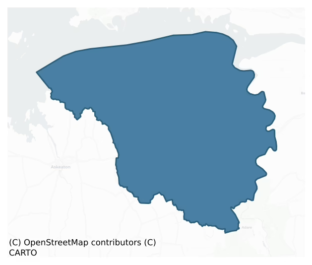
Kenry is a barony of County Limerick, in the historical province of Munster (Irish: Caonraí), covering 125 km² of land. The barony records 258 NMS archaeological sites and 51 NIAH listed buildings, placing it at around the 57th percentile among 280 ROI baronies for sites per km². This means it is in the upper half of all baronies for sites per km². Dated archaeological evidence runs from the Neolithic through to the Post Medieval, spanning 7 of 9 archaeological periods, placing the barony in the 38th percentile among 280 ROI baronies for chronological depth. This means it is in the lower half of all baronies for chronological depth. The largest dated subset of recorded sites dates to the Early Medieval.

Heritage at a glance
Percentile rankings throughout this profile compare each barony only against the other 279 Republic of Ireland baronies.
The recorded heritage of Kenry
The National Monuments Service Sites and Monuments Record (SMR) is the statutory inventory of archaeological sites for the Republic of Ireland, maintained by the Department of Tourism, Culture, Arts, Gaeltacht, Sport and Media. Sites recorded here include earthworks, ringforts, megalithic tombs, ecclesiastical remains, and post-medieval features; not every record is legally protected, but each is registered as a monument of archaeological interest.
The National Monuments Service records 258 archaeological sites in Kenry, putting it at the 57th percentile among 280 ROI baronies for sites per km². This means it is in the upper half of all baronies for sites per km². Protection coverage is near-universal — 253 sites (98%) fall within a recorded monument protection zone, indicating an extensively surveyed landscape. The dominant category is defensive sites — ringforts, enclosures, hillforts, and stone forts (178 sites, 69% of the record). Ringfort – rath is the most prevalent type, making up 46% of the barony's recorded sites (119 records) — well above the ROI average of 20% across all baronies where this type occurs. Ringfort – rath is an earthen ringfort enclosed by a bank and external ditch — the most common Early Medieval farmstead, broadly dated 500–1000 AD. Other significant types include Enclosure (22) and Ringfort – cashel (15). Enclosure is a banked or ditched feature of uncertain type, used as a catch-all where the original function cannot be determined from surface evidence; Ringfort – cashel is the stone-walled equivalent of the rath, found mainly in upland or western areas, broadly dated 500–1000 AD. Across the barony's 125 km², this gives a recorded density of 2.06 sites per km².
Most common monument types
Hover or tap a monument type to see its definition.
| Type | Count |
|---|---|
| Ringfort – rath an earthen ringfort enclosed by a bank and external ditch — the most common Early Medieval farmstead, broadly dated 500–1000 AD | 119 |
| Enclosure a banked or ditched feature of uncertain type, used as a catch-all where the original function cannot be determined from surface evidence | 22 |
| Ringfort – cashel the stone-walled equivalent of the rath, found mainly in upland or western areas, broadly dated 500–1000 AD | 15 |
| Castle – tower house a fortified residential tower of four or five storeys, mostly built by lords in the 15th and 16th centuries and often within a defended bawn | 8 |
| Church a building used for public Christian worship, of any date from c. 500 AD onwards | 8 |
| Graveyard a burial area associated with a church, in use from the medieval period onwards | 7 |
| Ritual site – holy well a well or spring traditionally associated with a saint, often credited with healing properties; many trace earlier ritual origins but devotion is documented from the medieval period onwards | 5 |
Chronological distribution
The dated archaeological record for Kenry spans from the Neolithic through to the Post Medieval, with activity attested across 7 of 9 archaeological periods. Every period from earliest to latest is represented in the record — an unbroken sequence of dated activity across the full chronological span. Activity concentrates most heavily in the Early Medieval (108 sites, 49% of dated material), with the Iron Age forming a secondary peak (69 sites, 32%). A further 39 recorded sites (15% of the overall NMS register for the barony) carry no period attribution — appearing as 'Unknown' in the bar chart below. This typically reflects either records that pre-date the standardised period vocabulary or sites awaiting specialist dating review, rather than a genuine absence of chronological evidence.
Sample of recorded monuments
Show 25 sample monuments (of 258 total)
A representative sample of 25 recorded monuments drawn from the barony’s 258 total NMS entries. Sites within a recorded monument protection zone and rarer site types are prioritised so the list shows a meaningful cross-section rather than only the most common type. Each entry shows the official Sites and Monuments Record reference number and the description published by the National Monuments Service.
Windmill
"Freestanding circular-plan two-stage former windmill, built in 1735. Rubble stone walls having remains of render. Concrete support to west elevation. Segmental-arched opening with roughly dressed limestone voussoirs to…
"Freestanding circular-plan two-stage former windmill, built in 1735. Rubble stone walls having remains of render. Concrete support to west elevation. Segmental-arched opening with roughly dressed limestone voussoirs to south elevation. Segmental-arched opening having roughly dressed limestone voussoir to west elevation. This windmill was built by William Bury to grind wheat for the charter school, which he had established at the gates of Shannongrove in 1735, is an example of a small-scale enterprise for specific consumers. Although now derelict, this former windmill retains much of its original form and is a strong focal point and unusual feature within the surrounding landscape."
This description by the National Inventory of Architectural Heritage (NIAH) is posted on the web at the following internet address (accessed 3 August 2012): http://www.buildingsofireland.ie/
Anomalous stone group
In rough pasture, on a sharp E-facing slope, with good views across the River Shannon estuary to N and the surrounding landscape from N-E-S. Not depicted on OS historic mapping. Identified in 1987 as a small, roughly…
In rough pasture, on a sharp E-facing slope, with good views across the River Shannon estuary to N and the surrounding landscape from N-E-S. Not depicted on OS historic mapping. Identified in 1987 as a small, roughly circular-shaped stone setting (diam. 1.5m) of unknown date (Rose Cleary, UCC). There are no surface remains visible of this potential monument. The area of the monument has been incorporated into the rear garden of a modern house as seen on Digital Globe (2011-13) and Google Earth aerial photography taken 2018.
See attached Google Earth orthophoto taken 28/06/2018
Compiled by: Alison McQueen and Vera Rahilly
Date of Upload: 19 June 2020
Kiln – lime
In rough pasture, on steep E-facing slope. Irregular earthen mound (17.3m N-S; 7.2m E-W; H 1.55m) protruding away from slope to E. Mound, heavily masked by vegetation cover, has mortared stone wall (H 2m) built against…
In rough pasture, on steep E-facing slope. Irregular earthen mound (17.3m N-S; 7.2m E-W; H 1.55m) protruding away from slope to E. Mound, heavily masked by vegetation cover, has mortared stone wall (H 2m) built against N tip; possibly the remains of a lime kiln.
Compiled by: Denis Power
Date of upload: 26 August 2011
Dovecote
The 1654-56 Civil Survey of Limerick there was on the lands of Islandmore [Castletown] belonging to Major General Sir Hardress Waller ‘a ruinous Castle [LI003-008001-], sixteene cottages a pigeon house, one orchard and…
The 1654-56 Civil Survey of Limerick there was on the lands of Islandmore [Castletown] belonging to Major General Sir Hardress Waller ‘a ruinous Castle [LI003-008001-], sixteene cottages a pigeon house, one orchard and one weare seate on the River of Shanen’ (Simington 1938, 353). The precise location of this dovecote within the townland of Castletown has not been identified, it was presumably located in close proximity to the medieval castle. The castle of Castletown Waller, which was besieged in 1642, was located, according to Westropp (1906-7, 157), in the immediate vicinity of Castletown Manor. This house was demolished in 1935 (Spellissy 1989, 241). There is now no standing remains at the site of either the castle or the house.
Compiled by: Denis Power
Revised by: Caimin O'Brien
Date of revised upload: 12 May 2020
Cist
In scrubland, on an elevated limestone outcrop overlooking a marshy area to the N. The area had recently been burnt to clear the scrub. No visible surface trace of the 'cist' is now evident. This cist was discovered in…
In scrubland, on an elevated limestone outcrop overlooking a marshy area to the N. The area had recently been burnt to clear the scrub. No visible surface trace of the 'cist' is now evident. This cist was discovered in the 1920s and consisted of 'a cist and urn' (NMI) which were destroyed at the time.
Compiled by: Denis Power
Date of upload: 26 August 2011
Cairn – unclassified
On top of a low hill, in a deciduous forest. Roughly circular cairn of stones (H 3.2m; 15m N-S; 16m E-W). The sides are roughly-stepped with the steps decreasing in height from the base upwards. At the top is a flat…
On top of a low hill, in a deciduous forest. Roughly circular cairn of stones (H 3.2m; 15m N-S; 16m E-W). The sides are roughly-stepped with the steps decreasing in height from the base upwards. At the top is a flat roughly circular summit (3m N-S; 3.8m E-W). The cairn is best preserved N->E but has suffered a partial collapse along its S arc.
Compiled by: Denis Power
Date of upload: 26 August 2011
Barrow – ring-barrow
In pasture, on an elevated ridge. A circular area (diam. 16m) enclosed by a fosse (Wth 0.65m; D 0.3m) with an external earthen bank (int. H 0.7m; ext. H 0.4m). The bank is best preserved E->NW, there is no apparent gap…
In pasture, on an elevated ridge. A circular area (diam. 16m) enclosed by a fosse (Wth 0.65m; D 0.3m) with an external earthen bank (int. H 0.7m; ext. H 0.4m). The bank is best preserved E->NW, there is no apparent gap in the bank but there is a slight dip at E. The interior, which is flat and c. 0.3m above the level of the top of the bank, is covered with briar and furze bushes.
Compiled by: Denis Power
Date of upload: 26 August 2011
Designed landscape – tree-ring
On a knoll, in mixed woodland, on the grounds of Currah Chase House located 590m to WSW. Depicted as a circular-shaped tree plantation and not as an antiquity on the OS 25-inch map where it is shown as a suboval-shaped…
On a knoll, in mixed woodland, on the grounds of Currah Chase House located 590m to WSW. Depicted as a circular-shaped tree plantation and not as an antiquity on the OS 25-inch map where it is shown as a suboval-shaped enclosure (approx. diam. 34m), with a subrectangular-shaped annexe (approx. dims. 27m N-S x 30m E-W) partially conjoined to E. Obscured by woodland on Digital Globe orthophotos taken 2011-13 and Google Earth orthoimage taken 28/06/2018.
See attached Google Earth orthoimage
Compiled by: Alison McQueen and Vera Rahilly
Date of upload: 8 July 2020
Megalithic tomb – wedge tomb
Wedge-tomb described by the Megalithic Survey of Ireland as follows; 'This monument lies about 3 km to the north of Adare, in the broad basin of the River Maigue. It stands on rich, gently undulating grassland broken in…
Wedge-tomb described by the Megalithic Survey of Ireland as follows; 'This monument lies about 3 km to the north of Adare, in the broad basin of the River Maigue. It stands on rich, gently undulating grassland broken in places by limestone outcrops. The outlook from the site is rather restricted though part of the Slievebernagh Mountains are visible towards the north-east and the north Kerry hills appear to the south-west.
The monument is in a ruinous condition and is heavily overgrown. The southern side of a chamber is represented by two orthostats and, outside the western stone, is another orthostat representing an outer-wall. The opposite side of the chamber is represented by a fallen sidestone. A roofstone lies in a tilted position above the chamber. Two displaced stones stand at its eastern end. There are no traces of a surrounding mound.
The western sidestone, at the south, leans outwards. It is 1.9m long, 0.3m thick and 0.9m high. The second sidestone here is erect. It measures 1.6m long, 0.35m thick and 1.05m high. The tops of both stones slope downwards from west to east. The fallen sidestone at the north is 1.8m long and 0.4m thick. If erect it would be about 0.7m high. The single outer-wall stone is erect. It is 0.9m long, 0.45m thick and 1.1m high. The roofstone measures 2.1m by 1.9m and is 0.5m thick. It rests on the two sidestones at the south and the fallen sidestone at the north. One of the two displaced stones at the eastern end of the roofstone is large…
Chapel
On natural high shelf of ground, terrain dips immediately to the S. No surface remains visible today of medieval chapel of Kilcurly in the parish of Adare which was a chapel of ease belonging to the parish of Adare. …
On natural high shelf of ground, terrain dips immediately to the S. No surface remains visible today of medieval chapel of Kilcurly in the parish of Adare which was a chapel of ease belonging to the parish of Adare. Described as a building in repair in 1590 and depicted as a roofed building on mid-17th century map (Westropp 1904-5, 379-80), shown as a ruined rectangular structure (c. 15m E-W; c. 5m N-S) on 1840 ed. OS 6-inch map; Westropp (ibid.) noted 'its foundations remained recently'. Area now occupied by courtyard and garden of Kilcurly House which stands immediately W of church site.
Westropp recorded the following details about Kilcurly; 'It lies to the west of the Maigue. Kylcharli, 1201; Kylkyrely, 1291. The Hospitallers served it in 1302. Cap. de Kylkyrille, 1400. It is mentioned with Adare in several grants and fiants, e.g. 1595 (Fiant 5964), "kilcrile, Kilcoile, or Killcryll, Kilkerely, alias Kilcoyle, or Kilbride,"belonged to the Franciscan Convent of Adare. Kilkerlle Church is given as in repair in Jobson's map, 1590 (1209, MSS., T.C.D., No. 56). Kilkerill is shown as roofed (on Petty's map, No. 70, and D.S.(B.), p. 18) in 1657. Site – Its foundations remained recently near Kilcurly house, and west from the graveyard [children's burial ground (LI012-069—-) ], in the position shown on the maps of 1657' (Westropp 1904-5, 379-80).
Medieval chapel of 'Kilkerill' [Cill Choireallaigh/Kilcurley] shown standing to NE of a substantial dwelling with a second buil…
Road – road/trackway
In lowlying pasture, possible enclosure (LI012-119001—-) 90m to E, enclosure (LI012-020—-) 127m to SSE. Identified by Celie O’Rahilly during field survey in 1991 and described as following; ‘Situated on low grazing…
In lowlying pasture, possible enclosure (LI012-119001—-) 90m to E, enclosure (LI012-020—-) 127m to SSE. Identified by Celie O’Rahilly during field survey in 1991 and described as following; ‘Situated on low grazing ground. Located at the northern extremity of the area, close to the Limerick-Foynes road. A series of low stone and earthen banks. One of these appears to be an old trackway running parallel to the road just inside the boundary wall. A small lake to the west of these has been divided by a causeway and may be a continuation of the track’. This possible trackway is visible on Google Earth orthoimage taken 29/03/2012.
See attached Google Earth aerial photograph taken 29/03/2012
Compiled by: Fiona Rooney
Date of upload: 23 June 2020
Hut site
In pasture, on S-facing slope of spur. Recorded by Celie O’Rahilly during field survey in 1991 and described as following; 'Situated in a grazing field on the south-facing slopes of the spur. Located just north-east of…
In pasture, on S-facing slope of spur. Recorded by Celie O’Rahilly during field survey in 1991 and described as following; 'Situated in a grazing field on the south-facing slopes of the spur. Located just north-east of enclosure [LI012-023—]. Consists of a small circular shaped depression (diam. 5m) defined by a low clay bank with some stones. Could be a hut site'. Not marked on the OS maps. Possible hut site or circular depression visible on Google Earth orthoimage taken 17/09/2008.
See attached Google Earth orthoimage.
Compiled by: Fiona Rooney
Date of Upload: 23 June 2020
Designed landscape feature
In woodland on high ground overlooking a lake to NW, on the demesne lands of Currah Chase House and castle (LI020-119—-) standing 337m to NW. Annotated 'Pillar Hill' on the 1840 ed. OS 6-inch map indicating the…
In woodland on high ground overlooking a lake to NW, on the demesne lands of Currah Chase House and castle (LI020-119—-) standing 337m to NW. Annotated 'Pillar Hill' on the 1840 ed. OS 6-inch map indicating the presence of a pillar stone from which the hill was named. Annotated 'Pillar' on the 1897 OSi 25-inch map. The monument is not visible on Google Earth orthoimage taken 14/02/2020 as the area is covered with trees. An architectural column rather than a standing stone which formed part of the designed landscape feature of the demesne of Curraghchase House. In 1829 Aubrey de Vere of Curragh Chase House recollected how upon the passing of the Catholic Emancipation Bill he ‘remembered climbing to the top of a high pillar on the summit of a hill opposite our house, though how the seat was achieved I cannot conceive, and standing upon it for many minutes, waving a lighted torch round my head in the gathering darkness’ (De Vere 1894, 760-8).
See attached photograph courtesy of Stephen Murphy
Compiled by: Fiona Rooney
Revised by: Caimin O'Brien
Date of revised upload: 11 April 2022
Mill – unclassified
There are now evident standing remains of mill which is depicted on 1840 OS map as "Tough Mill (in ruins)".
Compiled by: Denis Power
Date of Upload: 9 August 2012
Burnt mound
Archaeological testing by Brian Halpin (06E0811) revealed 'an enclosure is within the site boundary and a tower-house is adjacent to the development. A total of eighteen trenches of various lengths were enacted…
Archaeological testing by Brian Halpin (06E0811) revealed 'an enclosure is within the site boundary and a tower-house is adjacent to the development. A total of eighteen trenches of various lengths were enacted throughout the site from the topsoil down to the subsoil, one of which partially uncovered the remains of a small burnt mound; the other trenches proved to be negative.' This description is posted on the web at the following internet address (accessed 3 August 2012): http://www.excavations.ie/
Compiled by: Denis Power
Date of Upload: 3 August 2012
Pier/Jetty
Beagh Castle (LI003-002—-) stands directly atop short cliff which forms part of S shore of Shannon estuary, a short distance W of Beagh Quay. The S shoreline of Rineanna South in Co. Clare lies 2.9km to the N across…
Beagh Castle (LI003-002—-) stands directly atop short cliff which forms part of S shore of Shannon estuary, a short distance W of Beagh Quay. The S shoreline of Rineanna South in Co. Clare lies 2.9km to the N across the River Shannon. The precise location of a pier/jetty associated with a 17th century ferry crossing on the River Shannon which was located in Beagh has not been identified. The 19th century stone quay may have replaced or have been built on the site of an earlier quay associated with the 17th century ferry crossing.
In 1605 a ferry crossing over the River Shannon was established between Beagh and Rineanna in Co. Clare. In this year King James I granted James Sculles of Lislaughtie, Co. Kerry, 'full power and authority to appoint, settle and establish two ferries on the banks of the said river, between the city of Limerick and the sea, viz. one between a place called Begh in Limerick co. on the S. of the river, and a place called Ringannon in Clare and Thomond co. on the N' (Cal. pat. rolls Ire., 3 Jas I, 83-4). The conditions of the 21 year lease stated that James was 'to take from every passenger, ferried over in the former 2d., every horse, cow or Garran 4d., every 2 hogs 1d., 2 sheep or goats the same' (ibid.). In 1619 the lease of the 'chief Ferry from Beagh to Ringannon [Rineanna] in Clare, [was] granted to James Ware and William Plunkett' (Westropp 1906-7, 155).
Compiled by: Caimin O'Brien
Date of upload: 15 November 2018
Battery
Beagh Castle (LI003-002—) stands directly atop short cliff which forms part of S shore of Shannon estuary, a short distance W of Beagh Quay. Rectangular four-storey high tower house with 18th/19th century stone…
Beagh Castle (LI003-002—) stands directly atop short cliff which forms part of S shore of Shannon estuary, a short distance W of Beagh Quay. Rectangular four-storey high tower house with 18th/19th century stone vaulted blockhouse on west side stands in N quadrant of a poorly preserved 19th century courtyard (LI003-002007-). Built onto W wall of tower house is a single storey structure divided into three vaulted apartments; at foot of N wall is level platform built over creviced cliff face. This stone vaulted blockhouse is the remains of an artillery battery covering the Shannon estuary during the Napoleonic Wars (Spellissy 1989, 242; Donnelly 1994, vol. 2, 49). The rectangular-shaped stone vaulted blockhouse or bombproof barrack acted as a defensible guardhouse with accommodation on the ground floor and with artillery guns overlooking the Shannon estuary on top of the vaulted roof. The S side of the courtyard wall has been replaced by a row of cottages and outbuildings possibly ranging in date from the 17th to 19th centuries (LI003-002001-/002-) (Ní Cheallacháin 2008, 1).
Beagh Castle was probably built by the Knight of Glin (Fitzgerald family) who held this land in the 16th century until 'confiscated and granted in 1578 to Sir W. Drury' (Westropp 1906-7, 155). The Civil Survey of 1654-56 recorded that Major General Sir Hardress Waller was in possession in the two townlands of 'Beahy and Ballynehagulshy' of a 'ruinous Castle, two good tenements, or dwelling hous…
Courtyard
Beagh Castle (LI003-002—) stands directly atop short cliff which forms part of S shore of Shannon estuary, a short distance W of Beagh Quay. Rectangular four-storey high tower house standing in N quadrant of courtyard…
Beagh Castle (LI003-002—) stands directly atop short cliff which forms part of S shore of Shannon estuary, a short distance W of Beagh Quay. Rectangular four-storey high tower house standing in N quadrant of courtyard (approx. dims. 40m N-S; wall T 0.6m) partially enclosed by a poorly preserved wall of 19th century date (Ní Cheallacháin 2008, 1). Only short stretches of the lower wall courses of the courtyard wall survive immediately N of castle where the wall runs along the edge of the cliff overlooking the Shannon. Along the cliff edge there is a segmental arch cross a natural cavity in the cliff face which was built to carry the courtyard wall running along the cliff edge. The courtyard wall is best preserved at W where it runs S off the SW angle of the 18th/19th century artillery blockhouse built onto the W side of the castle. It is possible that this section of courtyard wall is contemporaneous with the blockhouse of the 18th/19th century but probably dates from the 19th century (Ní Cheallacháin 2008, 1). The S side of the courtyard wall has been replaced by a row of cottages and outbuildings possibly ranging in date from the 17th and 18th centuries (ibid.). There is no evidence for the courtyard wall on the E side of the castle .
See attached site plan of phased buildings provided courtesy of Cáit Ní Cheallacháin, Conservation Architect, O'Callaghan Architects
Compiled and revised by: Caimin O'Brien
Date of revised upload: 16 April 2019
Strip Lynchets
Three terraced areas running from E-W are defined by four linear or sinuous earthworks (approx. L. 170m E-W; Wth 40m) or lynchets of possible medieval date although this dating is uncertain. The curving nature of the…
Three terraced areas running from E-W are defined by four linear or sinuous earthworks (approx. L. 170m E-W; Wth 40m) or lynchets of possible medieval date although this dating is uncertain. The curving nature of the lynchets along with the curving or sinuous form of the field boundary to N may indicate that these earthworks represent the remains of medieval cultivation. Situated in field immediately E of two enclosures (LI012-153–/152-) and one ringfort (LI012-130—-) which are visible on Google earth aerial photograph taken 05/02/2009 may be the remains of a medieval settlement. A children's burial ground (LI012-069—-) lies 240m to S, with the site of a medieval chapel (LI012-068—-) 480m to SW. Earthworks (LI012-151—-) 730m to SW may be the remains of a substantial dwelling depicted on the 1657 Down Survey map.
The lynchets possibly represents the remains of medieval cultivation associated with the medieval chapel (I012-068—) of 'Kilkerill' [Cill Choireallaigh/Kilcurley] which is shown standing beside a substantial dwelling with a second building to S that are depicted on the 1657 Down Survey map of Kenry Barony (NLI, MS 718). The ridge and furrow ridges visible on Google earth aerial photographs may represent the remains of post-1700 field systems. The lands of Kilcurly were described in a land grant of 1587 when they were described as containing 'In Kilcoill, alias Kill Kryle, 3 Messuages, 2 Cottages, 24a. arable, 6a. pasture, & underwood, and the f…
House – 16th/17th century
The precise location of a medieval house in the townland of Kilcurly has not been identified. Medieval chapel (LI012-068—) of 'Kilkerill' [Cill Choireallaigh/Kilcurley] shown standing to NE of a substantial dwelling…
The precise location of a medieval house in the townland of Kilcurly has not been identified. Medieval chapel (LI012-068—) of 'Kilkerill' [Cill Choireallaigh/Kilcurley] shown standing to NE of a substantial dwelling with a second building to S on the 1657 Down Survey map of Kenry Barony (NLI, MS 718). The buildings depicted on the 1657 Down Survey map of Kenry Barony may be the same structure described in the 1654-56 Civil Survey of Limerick which recorded that on the lands of John Lissaght of Kilcurly there was 'one good dwelling house, ten Cottages, and one Salmon weare [LI012-155—-] seate upon it' (Simington 1938, 362). It is not clear if the 10 cottages were located throughout the townland or clustered around the 'good dwelling' described in the Civil Survey. Earthworks (LI012-151—-) visible on Google Earth photographs to the SW of the chapel may be the remains of these two dwellings depicted on the 1657 Down Survey map. Alternatively earthworks in the field to the N of Kilcurly chapel could be associated with the 'good dwelling house' described in the 1654-56 survey. A rectangular-shaped earthwork in the field to the N of a children's burial ground may represent the remains of a possible house site and it is tempting to identify this earthwork with the dwelling house described in the Civil Survey.
See attached 1657 Down Survey map of Kenry Barony showing dwellings to SW of Kilcurly chapel
Compiled by: Caimin O'Brien based on details provided by Dr….
Enclosure – large enclosure
Situated in rough grassland immediately E of Clorane House. Outline of large roughly square-shaped enclosure (approx. dims. 120m N-S x 150m E-W) visible on Google Earth photographs taken 05/02/2009. The irregularity or…
Situated in rough grassland immediately E of Clorane House. Outline of large roughly square-shaped enclosure (approx. dims. 120m N-S x 150m E-W) visible on Google Earth photographs taken 05/02/2009. The irregularity or imprecise nature of the defining feature casts some doubt about the antiquity of this feature although the cultivation ridges contained within this enclosure appear to respect the enclosing element.
See attached Google earth aerial photograph showing outline of enclosure.
Compiled by: Caimin O'Brien based on details provided by Dr. Rob O'Hara
Date of upload: 18 February 2020
Ringfort – unclassified
In pasture, on gentle N-facing slope. Depicted on 1923 OS 6-inch map as hachured circular area (diam. c. 20m) within wooded area. Levelled; no visible surface trace evident. Wooded area has been cleared.
Compiled by:…
In pasture, on gentle N-facing slope. Depicted on 1923 OS 6-inch map as hachured circular area (diam. c. 20m) within wooded area. Levelled; no visible surface trace evident. Wooded area has been cleared.
Compiled by: Denis Power
Date of upload: 26 August 2011
Moated site
In pasture, on gently-undulating terrain. Rectangular slightly raised area (39.5m N-S; 60.8m E-W) enclosed by inner earthen bank, outer earthen bank and intervening fosse. Inner bank (int. H 0.65m) survives NNW-> N;…
In pasture, on gently-undulating terrain. Rectangular slightly raised area (39.5m N-S; 60.8m E-W) enclosed by inner earthen bank, outer earthen bank and intervening fosse. Inner bank (int. H 0.65m) survives NNW-> N; elsewhere defined by scarped edge (H 1.65m). Outer bank (int. H 1m; ext. H 0.52m) best preserved along SE->SW, does not survive along W side where clipped by field wall running along base of fosse; field wall merges with inner scarp edge at NW where it forms gap (Wth 3.2m). Outer bank replaced by earth and stone field bank along N and E sides, gap (Wth 4.2m) at NW corner. Interior, used as small pasture field, slightly higher S half due to outcropping limestone. Listed as a moated site by Barry (Barry 1981, 84; site no. 29).
Compiled by: Denis Power
Date of upload: 26 August 2011
Ecclesiastical enclosure
The National Museum of Ireland topographical files for Killeen Church (LI011-065001-) recorded that traces of a circle or enclosure are visible on OS sheet in close proximity to Killeen Church. The curving arc of an…
The National Museum of Ireland topographical files for Killeen Church (LI011-065001-) recorded that traces of a circle or enclosure are visible on OS sheet in close proximity to Killeen Church. The curving arc of an earthen bank 27m to the NW of the church is visible from WNW-NW on Digital Globe aerial photograph. This curving bank is depicted as a contour line on the current ed. OS 6-inch map and may have formed part of an ecclesiastical enclosure surrounding Killeen Church. No surface remains visible of any enclosure. An old quarry is now located in the area to the NW of the church which is visible as an area of scrub vegetation on Digital Globe aerial photograph.
Compiled by: Caimin O'Brien
Date of upload: 19 April 2018
See attached ASI aerial photograph ASIAP – taken on 04/03/2006.
Ringfort – rath
In pasture, on break in N-facing slope immediately below brow of low hill. Roughly circular area (31m N-S; 34m E-W) enclosed by earthen bank (int. H 0.6m; ext. H 0.75m), best preserved ESE->SW. Bank is much denuded by…
In pasture, on break in N-facing slope immediately below brow of low hill. Roughly circular area (31m N-S; 34m E-W) enclosed by earthen bank (int. H 0.6m; ext. H 0.75m), best preserved ESE->SW. Bank is much denuded by cattle along N arc (ext. H c. 0.25m), and is clear of overgrowth but has some mature deciduous trees growing on it. Level interior is under pasture.
Compiled by: Denis Power
Date of upload: 26 August 2011
See attached ASI aerial photograph ASIAP – taken on 04/03/2006.
Listed buildings
The National Inventory of Architectural Heritage (NIAH) is a state survey appraising buildings of architectural, historical, archaeological, artistic, cultural, scientific, social, or technical interest. Each surveyed structure receives a rating from International (the highest, for buildings of European importance) through National, Regional, Local, and Record-Only.
The NIAH records 51 listed buildings in Kenry (25th percentile across ROI baronies). The highest-graded structures include 2 of National significance. The Republic holds 937 National-graded buildings in total, so this barony accounts for around 0% of the national total. Construction dates concentrate most heavily in the Late Georgian (1800-1830) period. The most-recorded building type is house (18 examples, 35% of the listed stock).
Terrain and environment
Mean elevation across the barony is 15m — the 1st percentile among 280 ROI baronies for elevation. This means it is in the bottom tenth of all baronies for elevation. This is a relatively low-lying landscape by ROI standards. Elevation matters for heritage because higher-altitude baronies typically favour defensive monuments — ringforts and hilltop forts placed on prominent ground — while lowland baronies are more likely to carry the dense settlement and church networks of intensive agricultural landscapes. Mean slope is 2.7° — the 32nd percentile among 280 ROI baronies for slope. This means it is in the bottom third of all baronies for slope. Slope is a key control on both land use and archaeological preservation: steep ground resists ploughing and tends to preserve earthworks intact, while gentle slopes favour intensive cultivation that damages or destroys surface archaeology over time. The Topographic Wetness Index averages 11.5, the 76th percentile among 280 ROI baronies for wetness. This means it is in the top third of all baronies for wetness. This is wet, slow-draining ground by ROI standards — the kind of landscape that may carry waterlogged archaeological sites of unusual preservation value. Drainage matters for heritage because poorly-drained ground preserves organic archaeology (wooden trackways, leather, textiles, and on rare occasions human remains) far better than free-draining soil; well-drained ground favours arable use but destroys organic material rapidly. The land-cover mosaic combines improved grassland (71%), open water (14%), and woodland (13%), giving a mixed agricultural and semi-natural landscape.
Terrain measurements
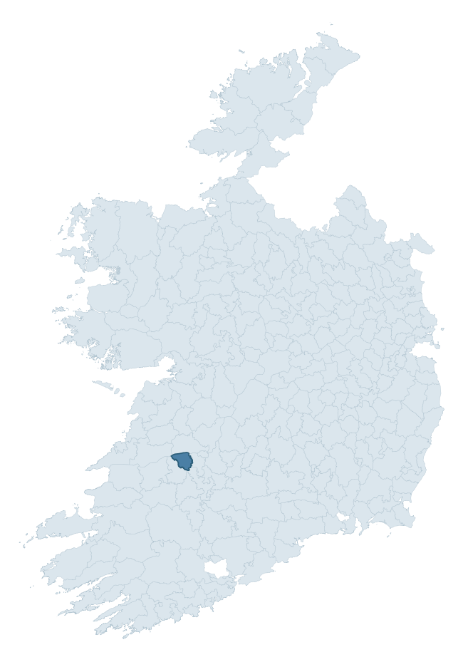
Where this barony sits in the Republic of Ireland
Geology and preservation
Bedrock geology shapes the landscape long before any settlement begins — controlling soil drainage, agricultural potential, the survival of upstanding monuments, and the preservation of buried archaeology. The figures below come from the Geological Survey Ireland 1:100,000 bedrock map.
The bedrock underlying Kenry is predominantly limestone (84% of the barony by area), laid down during the Carboniferous period (96% by area, around 359 to 299 million years ago). Limestone is the most heritage-rich bedrock in Ireland. It supports fertile, well-drained soils that favoured dense Early Medieval settlement and Norman manorial agriculture, and it weathers into karst features — sinkholes, caves, swallow holes, and souterrains — that frequently carry archaeology. Where peat overlies limestone, organic preservation can be exceptional. The single largest mapped unit is the Waulsortian Limestones (56% of the barony's bedrock).
Rock type composition
Largest mapped unit: Waulsortian Limestones (56% of the barony)
Placename evidence
Logainm records 13 heritage-diagnostic placenames for Kenry, a modest sample drawn predominantly from the townland record. The dominant stratum is early christian ecclesiastical. The most frequent diagnostic roots are cill- (11) and domhnach- (1). With a sample of this size the count should be treated as indicative rather than definitive.
Early Christian Ecclesiastical
| Root | Count | Meaning |
|---|---|---|
| cill- | 11 | church (early) |
| domhnach- | 1 | pre-Patrician or earliest Patrician church |
| cillín- | 1 | unconsecrated burial ground |
Burial, Ritual, and Norse-Contact
| Root | Count | Meaning |
|---|---|---|
| gall- | 1 | foreigner — Norse settlement marker |
Other baronies in Limerick
- Coonagh
- Connello Lower
- Coshma
- Glenquin
- Kilmallock
- Pubblebrien
- Connello Upper
- Corkaguiny — Kerry
- Connello Upper
- Bunratty Upper — Clare
See all 280 baronies in the Republic of Ireland Heritage Tool.

Explore further
Grounding History: 10 Maps of Northern Ireland’s Past
If you’re interested in Irish heritage more widely, the companion report for Northern Ireland brings together the analysis of all 462 NI wards into one place through 10 high-quality maps — covering monument density, archaeological periods, placename heritage, terrain, wetland, and the historic landscape at first survey. Take a look.
About this profile
Click any section below to expand.
What is a barony?
A barony is a historic administrative unit in Ireland, broadly equivalent to an English hundred. The 280 baronies used here are from the OSi 2019 National Statutory Boundaries (generalised 20m), covering the 26 counties of the Republic of Ireland. Baronies derive from the Norman period, were formalised in the 17th century, and have not been redrawn for statistical purposes. They vary enormously in area, from compact urban baronies in Dublin to vast upland baronies in Connacht, and should not be compared by raw site count without accounting for area differences.
What counts as a site?
This profile combines three distinct heritage registers, each with its own definition of what constitutes a recordable site:
- Archaeological sites (NMS). The National Monuments Service Sites and Monuments Record (SMR) catalogues every known archaeological monument or site of archaeological interest in the Republic, from prehistoric burial mounds and ringforts to medieval churches and post-medieval defensive works. Inclusion does not require legal protection — only that the site has been identified, surveyed, and assessed as having archaeological value. A separate subset of these sites lies within a recorded protection zone, which gives them statutory protection under the National Monuments Acts.
- Listed buildings (NIAH). The National Inventory of Architectural Heritage records buildings of architectural, historical, archaeological, artistic, cultural, scientific, social, or technical interest. Each surveyed structure is appraised on a five-tier scale: International, National, Regional, Local, and Record-Only. The NIAH appraisal is informational rather than strictly statutory, but it underpins local-authority Record of Protected Structures (RPS) listings.
- Heritage placenames (Logainm). Logainm is the authoritative database of Irish placenames maintained by the Placenames Branch. This profile applies a heritage-diagnostic classifier to the Irish-language form of each townland name, flagging roots that signal defensive sites (ráth-, lios-, dún-, caiseal-, cathair-), ecclesiastical foundations (cill-, teampall-, domhnach-, mainistir-), prehistoric burial-ritual features (tuaim-, carn-, leaba-), or Norse-contact settlement (gall-). Townlands without one of these diagnostic roots are not flagged here — they may still carry historical significance, but that significance is not encoded in the name itself.
Editorial principles
The narrative sections of this profile follow several explicit principles:
- Evidential. Every claim about this barony’s heritage character is anchored in the underlying register data. Where a site count, a placename count, or a percentile rank is cited, it is computed from the source datasets at export time, not estimated.
- Comparative. Counts and metrics are reported alongside their percentile rank against the other 279 ROI baronies. A barony with 50 ringforts in absolute terms could be unusually high or unusually low depending on its size and regional context; percentile ranking removes that ambiguity.
- Transparent on limits. Where a register has known coverage gaps, survey biases, or data-quality issues that affect this barony’s figures, the profile flags them rather than presenting the numbers as definitive.
- No interpretation beyond what the data supports. The narrative does not speculate about historical events, social dynamics, or cultural meaning beyond what the recorded heritage and placename evidence directly attests.
Data caveats and limits
- NMS Sites and Monuments Record is the product of survey campaigns conducted at different intensities across different counties and decades. Some baronies have been surveyed more thoroughly than others, and absolute counts should be read in that light. Sites destroyed by development before survey are typically not represented; sites in heavily forested or upland terrain are sometimes under-recorded.
- NIAH coverage is broadly complete for the Republic of Ireland but the survey was conducted on a rolling county-by-county basis, and the most recent appraisal date varies. Buildings demolished or substantially altered after their original survey may still appear in the register; conversely, recent buildings of merit may not yet have been appraised.
- Logainm classification applies a deliberately conservative pattern-matching approach to the Irish-language townland forms. The classifier prioritises true positives over recall: a townland may carry a heritage signal that the classifier doesn’t recognise, particularly where the diagnostic root has been heavily anglicised or where the townland name draws on a less common term. The 60,000+ townland records and ~9,800 classified placenames give a substantial signal at barony scale, but individual townland names should be checked against Logainm directly for definitive interpretation.
- Period attribution. The chronological distribution reflects only those NMS sites that carry a recognised period attribution in the source data. Sites listed as “Unknown” period are excluded from the dated subset.
- Boundary changes. Some baronies have undergone minor boundary adjustments since their 19th-century definition; the OSi 2019 generalised boundaries used here are the current statutory definition and may differ slightly from historical maps in border areas.
- Bedrock geology is mapped at 1:100,000 scale, which means local variation within a barony — small pockets of different rock type, mineral veins, alluvium overlying bedrock — is generalised. The dominant-system and rocktype figures are area-weighted, so a barony reading “70% Carboniferous limestone” may still contain small but archaeologically important pockets of older or younger rock. Around 3% of GSI polygons do not match the lexicon and contribute no rocktype or system attribution.
Data sources
- National Monuments Service — Sites and Monuments Record (SMR) https://data.gov.ie/dataset/national-monuments-service-archaeological-survey-of-ireland
- National Inventory of Architectural Heritage (NIAH) https://data.gov.ie/dataset/national-inventory-of-architectural-heritage-niah-national-dataset
- Logainm — Placenames Database of Ireland https://www.logainm.ie/
- Ordnance Survey Ireland — National Statutory Barony Boundaries 2019 https://data-osi.opendata.arcgis.com/
- EURODEM — European Digital Elevation Model https://www.mapsforeurope.org/datasets/euro-dem
- ESA WorldCover https://esa-worldcover.org/en
- Geological Survey Ireland — 1:100,000 Bedrock Geology https://www.gsi.ie/en-ie/data-and-maps/Pages/Bedrock.aspx
Explore more: Search any of the 280 ROI baronies, browse by historical province, or read the methodology and data sources for the full Republic of Ireland Heritage Tool.