
Kerrycurrihy is a barony of County Cork, in the historical province of Munster (Irish: Ciarraí Cuirche), covering 96 km² of land. The barony records 267 NMS archaeological sites and 438 NIAH listed buildings, placing it at around the 76th percentile among 280 ROI baronies for sites per km². This means it is in the top third of all baronies for sites per km². Dated archaeological evidence runs from the Mesolithic through to the Modern, spanning 8 of 9 archaeological periods, placing the barony in the 50th percentile among 280 ROI baronies for chronological depth. This means it is in the upper half of all baronies for chronological depth. The largest dated subset of recorded sites dates to the Early Medieval. Logainm flags 18 placenames in the barony as carrying a recognised heritage root; the largest share — around 72% — are names associated with early Christian church and monastic foundations.
Heritage at a glance
Percentile rankings throughout this profile compare each barony only against the other 279 Republic of Ireland baronies.
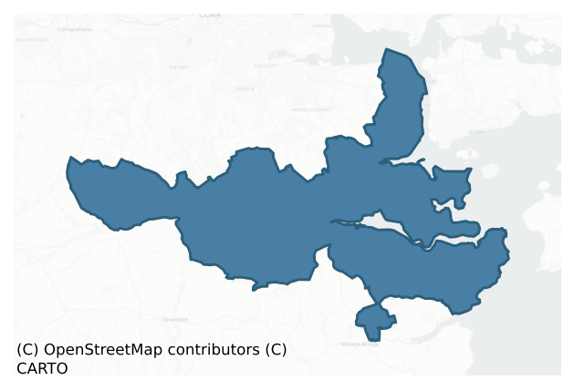
The recorded heritage of Kerrycurrihy
The National Monuments Service Sites and Monuments Record (SMR) is the statutory inventory of archaeological sites for the Republic of Ireland, maintained by the Department of Tourism, Culture, Arts, Gaeltacht, Sport and Media. Sites recorded here include earthworks, ringforts, megalithic tombs, ecclesiastical remains, and post-medieval features; not every record is legally protected, but each is registered as a monument of archaeological interest.
The National Monuments Service records 267 archaeological sites in Kerrycurrihy, putting it at the 76th percentile among 280 ROI baronies for sites per km². This means it is in the top third of all baronies for sites per km². Protection coverage is near-universal — 258 sites (97%) fall within a recorded monument protection zone, indicating an extensively surveyed landscape. The dominant category is defensive sites — ringforts, enclosures, hillforts, and stone forts (110 sites, 41% of the record). Ringfort – rath is the most prevalent type, making up 21% of the barony's recorded sites (57 records), broadly in line with the ROI average of 20% across all baronies where this type occurs. Ringfort – rath is an earthen ringfort enclosed by a bank and external ditch — the most common Early Medieval farmstead, broadly dated 500–1000 AD. Other significant types include Fulacht fia (29) and Enclosure (22). Fulacht fia is a horseshoe-shaped Bronze Age burnt mound built around a sunken trough beside a water source, traditionally interpreted as a cooking site; Enclosure is a banked or ditched feature of uncertain type, used as a catch-all where the original function cannot be determined from surface evidence. Across the barony's 96 km², this gives a recorded density of 2.77 sites per km².
Most common monument types
Hover or tap a monument type to see its definition.
| Type | Count |
|---|---|
| Ringfort – rath an earthen ringfort enclosed by a bank and external ditch — the most common Early Medieval farmstead, broadly dated 500–1000 AD | 57 |
| Fulacht fia a horseshoe-shaped Bronze Age burnt mound built around a sunken trough beside a water source, traditionally interpreted as a cooking site | 29 |
| Enclosure a banked or ditched feature of uncertain type, used as a catch-all where the original function cannot be determined from surface evidence | 22 |
| Souterrain an underground stone-built passage and chamber, generally Early Medieval and often associated with ringforts as a defensive or storage feature | 22 |
| Standing stone a deliberately set upright stone, used variously as a Bronze/Iron Age burial marker, route marker or commemorative monument | 22 |
| Church a building used for public Christian worship, of any date from c. 500 AD onwards | 14 |
| Excavation – miscellaneous | 10 |
| Ritual site – holy well a well or spring traditionally associated with a saint, often credited with healing properties; many trace earlier ritual origins but devotion is documented from the medieval period onwards | 9 |
Chronological distribution
The dated archaeological record for Kerrycurrihy spans from the Mesolithic through to the Modern, with activity attested across 8 of 9 archaeological periods. The record is near-continuous, with only the Neolithic period falling inside the span without any recorded sites. Activity concentrates most heavily in the Early Medieval (85 sites, 42% of dated material), with the Iron Age forming a secondary peak (46 sites, 23%). A further 64 recorded sites (24% of the overall NMS register for the barony) carry no period attribution — appearing as 'Unknown' in the bar chart below. This typically reflects either records that pre-date the standardised period vocabulary or sites awaiting specialist dating review, rather than a genuine absence of chronological evidence.
Sample of recorded monuments
Show 25 sample monuments (of 267 total)
A representative sample of 25 recorded monuments drawn from the barony’s 267 total NMS entries. Sites within a recorded monument protection zone and rarer site types are prioritised so the list shows a meaningful cross-section rather than only the most common type. Each entry shows the official Sites and Monuments Record reference number and the description published by the National Monuments Service.
House – 16th/17th century
The 1842 OS 6-inch map marks the 'site of Old Court' on the S side of a public road. This location is now occupied by domestic buildings none of which appear to predate the 19th century. According to Healy (1988, 85),…
The 1842 OS 6-inch map marks the 'site of Old Court' on the S side of a public road. This location is now occupied by domestic buildings none of which appear to predate the 19th century. According to Healy (1988, 85), 'Old Court' refers to Shannon Court, a house built by the Earl of Shannon in the 17th century, which was described in the middle of the 18th century as 'a neat house, and fine park, both entirely gone to ruin' (Smith 1750, vol. 2, 209). This house probably stood on the site of the Cogan castle of Ballinrea (pers. comm. D. Ó Murchadha).
The above description is derived from 'The Archaeological Inventory of County Cork. Volume 5' (Dublin: Stationery Office, 2009).
Date of upload: 22 December 2009
Religious house – Benedictine monks
Though marked with broken circle (diam. c. 20m) and named 'Legan Abbey and Tower' on 1842 OS 6-inch map, exact location of this Benedictine abbey is in doubt (see Hurst 1925, 15-20). According to Gwynn and Hadcock…
Though marked with broken circle (diam. c. 20m) and named 'Legan Abbey and Tower' on 1842 OS 6-inch map, exact location of this Benedictine abbey is in doubt (see Hurst 1925, 15-20). According to Gwynn and Hadcock (1988, 107), 'a small non-conventual priory….its date must be 1204 or later'. No visible surface trace.
The above description is derived from the published 'Archaeological Inventory of County Cork. Volume 2: East and South Cork' (Dublin: Stationery Office, 1994). In certain instances the entries have been revised and updated in the light of recent research.
Date of upload/revision: 14 January 2009
House – fortified house
On shoulder of rising ground, overlooking S entrance into West Passage of Cork Harbour to E; steep-sided glen close-by to N. Three storey rectangular block (int. 11.5m E-W; 6.3m N-S) with square towers (ext. L c. 7.5m;…
On shoulder of rising ground, overlooking S entrance into West Passage of Cork Harbour to E; steep-sided glen close-by to N. Three storey rectangular block (int. 11.5m E-W; 6.3m N-S) with square towers (ext. L c. 7.5m; int. L c. 5m) at each corner; towers four storey with attic. Walls stand to full height but floors and roofs collapsed and in dangerous condition. Gables atop each elevation of main block and towers; string courses on all elevations between floor levels. Each tower has square chimney stack atop both inward-facing gables, also stack atop main W wall. Bartizan atop outside corner on each tower; each supported by five elegantly tapering corbels (central one set on corner); traces of stepped crenellations atop walls of bartizans. Numerous gun loops at ground level (see plan, Craig 1982, 127), most now blocked up. Most windows now blocked or closed withg alvanised sheets; originally all had square or rectangular lights, somewith mullion and transom divisions; largest intact light in E wall at 1st floor level divided by two mullions and a transom; most covered externally by hood mouldings with stepped terminals. Wide door in N wall of mainblock; cut-stone surround in two plain orders with elliptical arch, hood moulding overhead; now blocked up. Similar surround to smaller door at E end of S wall in NW tower; opposite blocked door in SW tower; these face each other under wide segmental arch (Wth 2m) which carrys forward upper part of W wall of main block. Against N…
Castle – Anglo-Norman masonry castle
On N shore of Owenboy estuary, on rocky limestone eminence; area around castle overgrown and quarried in parts. Remains consist of two structures: fragmentary remains of rectangular tower (int.: 5.5m E-W; 3.6m N-S) and,…
On N shore of Owenboy estuary, on rocky limestone eminence; area around castle overgrown and quarried in parts. Remains consist of two structures: fragmentary remains of rectangular tower (int.: 5.5m E-W; 3.6m N-S) and, at slightly lower level to S, ivy-clad ruins of later building. Tower missing most of E and W walls at ground level; two arched recesses built into S wall obscure blocked slit window. Entrance to stairwell (doorway destroyed) at E end of N wall; stairs rises straight up through N wall to NW corner. At base of stairs is small much-ruined chamber which may have contained garderobe. First floor covered by pointed wicker-centered vault (axis E-W) in poor structural condition; entered through doorway in N wall from stairs; window ope in S and W wall. Only lower courses of S and W walls survive at 2nd floor level, traces of window ope in both walls.
Second structure c. 20m to S: E wall stands to full height (3 storeys with attic); fireplace with flat masonry arch at 2nd floor level feeds stack atop gable. Wall almost completely obscured by ivy. Other walls largely fallen.
Site of early 13th century castle, probably built by Philip de Prendergast who was granted these lands in 1207; Cogans later succeeded Prendergasts through marriage (Ó Murchadha 1985, 78); by late 14th century castle and lands held by Fitzgeralds (ibid, 141). None of present remains can be confidently dated to 13th century though the core of tower could be of that date; tower has appearance…
Gate lodge
The Archaeological Survey of Ireland (ASI) is in the process of providing information on all monuments on The Historic Environment Viewer (HEV). Currently the information for this record has not been uploaded. To…
The Archaeological Survey of Ireland (ASI) is in the process of providing information on all monuments on The Historic Environment Viewer (HEV). Currently the information for this record has not been uploaded. To access available information for research purposes please make an appointment in advance with the Archive Unit (open Fridays 10.00 am – 5.00 pm), Department of Culture, Heritage and the Gaeltacht, The Custom House, Dublin 1 D01W6XO or email nmarchive@chg.gov.ie.
Ecclesiastical site
O Murchadha (1960, 19-20) records Rosbeg as a parish from c. 1100 AD until the end of the 18th century, sometimes called Teampall Breacáin (modern townland of Ballybricken). The site of Rosbeg church (CO087-049—-) was…
O Murchadha (1960, 19-20) records Rosbeg as a parish from c. 1100 AD until the end of the 18th century, sometimes called Teampall Breacáin (modern townland of Ballybricken). The site of Rosbeg church (CO087-049—-) was noted by Bishop Dive Downes in October 1700 as 'a heap of rubbish in Mr. Abraham Dicksons orchard at Ballbricken' (Lunham 1909, 176). The 1842 OS 6-inch map shows a walled garden NW of Ballybricken House, but in Ballintaggart townland which may be the location referred to above. This is also likely to be the site of the 'early Irish church and graveyard which O'Leary (1918, 159) describes as being in Ballintaggart townland 'on the lawn before Mr. Birds house'. Listed by Hurley (1982, 302-3) as one of the 'principal sites' of the early church in the south-west of Ireland. Area now occupied by industrial complex; no visible surface trace.
The above description is derived from the published 'Archaeological Inventory of County Cork. Volume 2: East and South Cork' (Dublin: Stationery Office, 1994). In certain instances the entries have been revised and updated in the light of recent research.
Date of upload/revision: 14 January 2009
Kiln – brick
Late 19th century brickworks known as the Cork Brick Manufacturing Company on site of earlier unmechanized brickworks (The Irish Builder, March 27,1902); closed down in 1913 (Cork Examiner, 1977). Grass-covered…
Late 19th century brickworks known as the Cork Brick Manufacturing Company on site of earlier unmechanized brickworks (The Irish Builder, March 27,1902); closed down in 1913 (Cork Examiner, 1977). Grass-covered foundations of building is all that survives of complex indicated on 1902 OS 6-inch map, except for one range of brick built buildings on W side. These consist of a single-storey structure (long axis N-S) with low brick arch in N wall ofinterior flanked by doors which lead to lean-to (L 2.75m; Wth 2.4m). According to local information, this lean-to was 'drying house'. Also noted were brick entrance piers, several ornate ceramic tiles and a hand bellows. In 1901 aerial ropeway constructed to transport bricks cross-country to Ballinhassig railway station 3 miles to NW; some of the support piers survive.
The above description is derived from the published 'Archaeological Inventory of County Cork. Volume 2: East and South Cork' (Dublin: Stationery Office, 1994). In certain instances the entries have been revised and updated in the light of recent research.
Date of upload/revision: 14 January 2009
Religious house – Augustinian canons
S of Carrigaline, in area cordoned-off from pasture field, on grounds of Kilmoney Abbey House (CO098-016—-); ivyclad W gable of church. Point of gable fallen. Surviving wall (L 6.5m; Wth 1m) broken off to N whereas to…
S of Carrigaline, in area cordoned-off from pasture field, on grounds of Kilmoney Abbey House (CO098-016—-); ivyclad W gable of church. Point of gable fallen. Surviving wall (L 6.5m; Wth 1m) broken off to N whereas to S short return (L 0.35m) of S wall survives, though exterior SW corner fallen. Set high on gable lintelled opening (H 1.15m; Wth 0.7m) with straight sides, may be remains of window ope. According to Gwynn and Hadcock (1988, 183) 'a small cell' of the Gill Abbey (CO074-036—) in Cork, 'probably merely a vicarage after the mid-fourteenth century'; foundation date not known.
The above description is derived from the published 'Archaeological Inventory of County Cork. Volume 2: East and South Cork' (Dublin: Stationery Office, 1994). In certain instances the entries have been revised and updated in the light of recent research.
Date of upload/revision: 14 January 2009
Slab-lined burial
In tillage, on N-facing slope. Excavated by O'Kelly (1955) who found stone-lined grave (L 2.1m; max. Wth 0.56m; max. H 0.54m) containing bones of 'tall strongly-built adult male'. He suggests an Early Christian date…
In tillage, on N-facing slope. Excavated by O'Kelly (1955) who found stone-lined grave (L 2.1m; max. Wth 0.56m; max. H 0.54m) containing bones of 'tall strongly-built adult male'. He suggests an Early Christian date based on E-W orientation of cist and absence of accompanying objects.
The above description is derived from the published 'Archaeological Inventory of County Cork. Volume 2: East and South Cork' (Dublin: Stationery Office, 1994). In certain instances the entries have been revised and updated in the light of recent research.
Date of upload/revision: 14 January 2009
Cairn – unclassified
On top of a hill in Curraghbinny wood at E tip of E-W ridge, overlooking Cork Harbour to E and N and Owenboy river valley to W. Excavated in 1932 by O Ríordáin (1933, 80-4) who found a cairn of stone enclosed by rough…
On top of a hill in Curraghbinny wood at E tip of E-W ridge, overlooking Cork Harbour to E and N and Owenboy river valley to W. Excavated in 1932 by O Ríordáin (1933, 80-4) who found a cairn of stone enclosed by rough dry-stone wall, an inner arc of stones running from E to W and a platform of clay with embedded stones (c. 9ft x 4ft; H 41/2in) in the centre where he suggested inhumation took place. He also noted a circle of loose stones (diam. 3 ft) outside of, and adjoining outer circle on E side; very fragmentary cremated human bone and charcoal between stones of circle on SE side; post hole near centre. The remains had never been backfilled at the end of the excavation. In the ensuing years the boulder kerb and inner arc of stones together with the spoil heaps had become overgrown with scrub and brambles. The monument was taken into State Care in 1984 and the cairn was reinstated in July 1998 (see attached images). A reappraisal of the evidence would suggest that the circle of boulders and the drystone 'revetment' wall, traces of which were found on the boulders, was probably an internal feature and that the cairn originally extended beyond it.
The above description is derived from the published 'Archaeological Inventory of County Cork. Volume 2: East and South Cork' (Dublin: Stationery Office, 1994). In this instance the entry has been revised and updated.
CO099-023—-_01.jpg. View of cairn prior to reinstatement (1998).
CO099-023—-_02.jpg. View of cairn prio…
Fortification
Occupying high ground and steeply-sloping W side of outer entrance to Cork harbour; directly opposite is Carlisle Fort (CO087-058—). Phillips's map of 1685 (Gowen 1979, 231) shows no fortification on this headland but…
Occupying high ground and steeply-sloping W side of outer entrance to Cork harbour; directly opposite is Carlisle Fort (CO087-058—). Phillips's map of 1685 (Gowen 1979, 231) shows no fortification on this headland but depicts small shoreline blockhouse/battery further south in vicinity of Weaver's point; Goubet's map of c. 1690 (ibid., 250; Kerrigan 1980, 14; O Murchadha 1990, 4) shows two lines of walls or revetments apparently pierced by gun embrasures along shoreline and square bastioned fort in approximate position of later fort, these probably constituted 'James's Battery' erected by forces of James II and which engaged Williamite navy in 1690. Unclear if any of these features incorporated into Camden Fort which was built c. 1798. Plan on 1842 OS 6-inch map shows roughly rectangular area enclosed on landward sides by zig-zag ditch with 'irregular tenaille trace' on its inside (Kerrigan 1978, 147); plan also shows ranges of barrack buildings and shoreline gun emplacements. 1804 report lists 26 pieces of ordnance here (Kerrigan ibid.) but by 1837 'had but a token force of a master-gunner and five men' (O Murchadha 1967, 67). About 1870 (Kerrigan ibid.) landward defences remodelled when wide, deep ditch constructed on irregular zig-zag plan, with caponier. Also about this time shoreline works built including two piers and Brennan torpedo emplacement (O Murchadha 1967, 69) and 'new gun emplacements towards the harbour entrance' (Kerrigan ibid). Fort area honeycombed wit…
Earthwork
In pasture, on S-facing slope. Shown on 1936 OS 6-inch map as arc of hachures in corner of field. Overgrown; no visible surface trace.
The above description is derived from the published 'Archaeological Inventory of…
In pasture, on S-facing slope. Shown on 1936 OS 6-inch map as arc of hachures in corner of field. Overgrown; no visible surface trace.
The above description is derived from the published 'Archaeological Inventory of County Cork. Volume 2: East and South Cork' (Dublin: Stationery Office, 1994). In certain instances the entries have been revised and updated in the light of recent research.
Date of upload/revision: 14 January 2009
Boundary stone
According to O Murchadha (1967, 36) the inscription reads: 'The Road West here of leading from Carrigaline to Cross Haven is part of the lands of Kilcrow Belonging to Captain William Hodder which being left out of his…
According to O Murchadha (1967, 36) the inscription reads: 'The Road West here of leading from Carrigaline to Cross Haven is part of the lands of Kilcrow Belonging to Captain William Hodder which being left out of his paddock he has sett up this stone as a perpetuall monument of his right to the inheritance thereof this 1st day of January 1715.'
The above description is derived from the published 'Archaeological Inventory of County Cork. Volume 2: East and South Cork' (Dublin: Stationery Office, 1994). In certain instances the entries have been revised and updated in the light of recent research.
Date of upload/revision: 14 January 2009
Dovecote
Roofless 2-storey stone built structure, pentagonal in plan, in NE corner of farmbuildings of Crosshaven Ho.(CO099-021—). Five sides of similar dims. (L 5.6m); lintelled door in SW wall; small lintelled perforations…
Roofless 2-storey stone built structure, pentagonal in plan, in NE corner of farmbuildings of Crosshaven Ho.(CO099-021—). Five sides of similar dims. (L 5.6m); lintelled door in SW wall; small lintelled perforations on either side (c. 1.35m off ground) of door, similar opes in N and E wall. Brick vault over ground floor. Nine tiers of nesting boxes at 1st floor, brick sides with stone lintels. Narrow ope in 1st floor of S wall gave access to attic level of farmbuildings attached to S. Access to interior not gained.
The above description is derived from the published 'Archaeological Inventory of County Cork. Volume 2: East and South Cork' (Dublin: Stationery Office, 1994). In certain instances the entries have been revised and updated in the light of recent research.
Date of upload/revision: 14 January 2009
Standing stone – pair
Pair of stones once stood in field known as "Pairc na Leacach" and were c. 3m H (pers. comm. S. O'Mahony). Perhaps these are the same stones referred to by O'Leary (1918, 123), mistakenly, as being in the adjoining…
Pair of stones once stood in field known as "Pairc na Leacach" and were c. 3m H (pers. comm. S. O'Mahony). Perhaps these are the same stones referred to by O'Leary (1918, 123), mistakenly, as being in the adjoining townland of Commeen. Both references to stones locate them, on a hilltop with 'a magnificent view'. O'Leary gives stones measurements as 10ft x 3ft x 3ft and 9ft x 6ft x 3ft.
The above description is derived from the published 'Archaeological Inventory of County Cork. Volume 2: East and South Cork' (Dublin: Stationery Office, 1994). In certain instances the entries have been revised and updated in the light of recent research.
Date of upload/revision: 14 January 2009
Bawn
At break in SE-facing slope, overlooking Lough Beg and Cork Harbour. Complex of ruined buildings around courtyard which still functions as farmyard. At S and SW sides ruins of Barnahely castle; on E side remains of…
At break in SE-facing slope, overlooking Lough Beg and Cork Harbour. Complex of ruined buildings around courtyard which still functions as farmyard. At S and SW sides ruins of Barnahely castle; on E side remains of Castle Warren house, built in 1796 (Lewis 1837, vol. 1, 187) with associated farm buildings on NW and N sides. Complex now owned by IDA in area zoned for industrial use. Oldest structure near SW corner where 2-storey rectangular building (10.5m N-S; 6.6m E-W) appears to be remains tower house, showing much evidence of rebuilding; later converted to stable/barn. Wicker-centred barrel vault over ground floor; much altered window opes in E and S wall. Running S from SE corner of tower is fragment of wall, with splayed embrasure for blocked light at 1st floor level. This abuts, at right angle, wall (axis E-W) forming S side of complex; W section(L c. 15m) part of bawn wall, one gun-loop evident; W end wall broken and probably extended further to W.
E section (L 20m) forms S wall of two-storey gable-ended structure (int.:17.65m E-W; 6.6m N-S) of late 16th/early 17th century appearance. Interior overgrown and strewn with rubbish; adapted as domestic quarters/kitchen when 18th century house built on N side, from which it was accessed by inserted doors. Original doors near W end of N wall, with elliptical-headed arch, and near E end of S wall, with pointed arch. Latter now partially buried internally and must have been approached from inside down flight of steps, grou…
Font
In the transept on the N side of St Mary's C of I church (vol. 2, 5698), in Carrigaline. A stone baptismal font (H 1.05m) comprising an octagonal basin with a circular hollow, supported by an octagonal shaft and…
In the transept on the N side of St Mary's C of I church (vol. 2, 5698), in Carrigaline. A stone baptismal font (H 1.05m) comprising an octagonal basin with a circular hollow, supported by an octagonal shaft and pedestal. The circumference of the basin is c. 0.6m. The basin contains a drainage hole and on one of the eight sides there is a smooth depression, probably for resting the arm of the person holding the infant being baptised. The basin bears an inscription 'ANO DOM WD:WG: CHURWA 1637 R/N' (see Pl. ?). The M of ANO DOM is damaged. WD and WG are the initials of two church wardens and the letters of the third line of the inscription, which have been incorrectly blackened, and those of the fourth line represent the words church warden (pers. comm. Conleth Manning). The present church was built in 1823 on the site of a church built in 1723 which itself was built on the site of an earlier church demolished 'during the early months of 1723' (O'Mahony 1993, 69). The commemoration stone of the 1723 church survives in the present church. It bears the names Philip Gillman and Richard Dorman who are described as 'Church Wardens'; these may be descendants of the church wardens whose initials were WG and WD as the post of church warden was often hereditary.
The above description is derived from 'The Archaeological Inventory of County Cork. Volume 5' (Dublin: Stationery Office, 2009).
Date of upload: 22 December 2009
Sheela-na-gig
Possible sheela-na-gig found at castle (CO087-052001-) in early 19th century but disappeared shortly afterwards (Coleman 1915, 6; Guest 1936, 112; Cherry 1992, no. 73). Guest recorded in 1935 that, ‘Windele calls this…
Possible sheela-na-gig found at castle (CO087-052001-) in early 19th century but disappeared shortly afterwards (Coleman 1915, 6; Guest 1936, 112; Cherry 1992, no. 73). Guest recorded in 1935 that, ‘Windele calls this Castle Warren (CO087-052001-), near Monkstown, and speaks of "a brown gritty stone figure," which is stated in the J.R.S.A.I List to be "erect." It is not now to be found’ (Guest 1936, 112).
Compiled by: Caimin O’Brien
Date of upload: 29 May 2012
Moated site
In pasture, on S-facing slope. Roughly square area (36m E-W; 34m N-S) enclosed by earthen bank (int. H 1.8m), stone-faced in parts; shallow external fosse (max. D 0.5m) to S and W. Interior raised on S side to…
In pasture, on S-facing slope. Roughly square area (36m E-W; 34m N-S) enclosed by earthen bank (int. H 1.8m), stone-faced in parts; shallow external fosse (max. D 0.5m) to S and W. Interior raised on S side to compensate for hillslope. Trackway running E-W crosses N half of interior.
The above description is derived from the published 'Archaeological Inventory of County Cork. Volume 2: East and South Cork' (Dublin: Stationery Office, 1994). In certain instances the entries have been revised and updated in the light of recent research.
Date of upload/revision: 14 January 2009
Bridge
Tall single-arch railway bridge over stream, on Cork-Baltimore line; cut stone voussoirs.
The above description is derived from the published 'Archaeological Inventory of County Cork. Volume 2: East and South Cork'…
Tall single-arch railway bridge over stream, on Cork-Baltimore line; cut stone voussoirs.
The above description is derived from the published 'Archaeological Inventory of County Cork. Volume 2: East and South Cork' (Dublin: Stationery Office, 1994). In certain instances the entries have been revised and updated in the light of recent research.
Date of upload/revision: 14 January 2009
Bridge
Road bridge (Wth c. 8.8m) spanning ravine in which tributary of Owenboy River flows. Three tall, slim, deeply recessed blind semicircular arches (H c. 14m); cut-stone voussoirs; string course overhead. Tall pointed…
Road bridge (Wth c. 8.8m) spanning ravine in which tributary of Owenboy River flows. Three tall, slim, deeply recessed blind semicircular arches (H c. 14m); cut-stone voussoirs; string course overhead. Tall pointed breakwaters on piers. Three small semicircular arches (H c. 3m) at base of blind arches; cut-stone voussoirs; stream flows through SW arch only.
The above description is derived from the published 'Archaeological Inventory of County Cork. Volume 3: Mid Cork' (Dublin: Stationery Office, 1997). In certain instances the entries have been revised and updated in the light of recent research.
Date of upload/revision: 14 January 2009
Moated site
On S-facing slope, on E-W ridge overlooking Owenboy river valley to S. Rectangular area (33.5m E-W; 51.7m N-S) enclosed by two banks (max. int. H1.65m; max. ext. H 1.5m); separated by intervening fosse; heavily…
On S-facing slope, on E-W ridge overlooking Owenboy river valley to S. Rectangular area (33.5m E-W; 51.7m N-S) enclosed by two banks (max. int. H1.65m; max. ext. H 1.5m); separated by intervening fosse; heavily overgrown. Outer bank incorporated into field fence to N and W; forms edge of laneway to E and garden wall of house to S.
The above description is derived from the published 'Archaeological Inventory of County Cork. Volume 2: East and South Cork' (Dublin: Stationery Office, 1994). In certain instances the entries have been revised and updated in the light of recent research.
Date of upload/revision: 14 January 2009
Icehouse
The Archaeological Survey of Ireland (ASI) is in the process of providing information on all monuments on The Historic Environment Viewer (HEV). Currently the information for this record has not been uploaded. To…
The Archaeological Survey of Ireland (ASI) is in the process of providing information on all monuments on The Historic Environment Viewer (HEV). Currently the information for this record has not been uploaded. To access available information for research purposes please make an appointment in advance with the Archive Unit (open Fridays 10.00 am – 5.00 pm), Department of Culture, Heritage and the Gaeltacht, The Custom House, Dublin 1 D01W6XO or email nmarchive@chg.gov.ie.
Mill – unclassified
Late 18th/early 19th century flour mill in Carrigaline town. Shown as L-shaped structure on 1842 OS 6-inch map. Rectangular 4-storey mill (long axis N-S), now used as a store. Roof double-half-hipped. Wooden floor…
Late 18th/early 19th century flour mill in Carrigaline town. Shown as L-shaped structure on 1842 OS 6-inch map. Rectangular 4-storey mill (long axis N-S), now used as a store. Roof double-half-hipped. Wooden floor intact; also remains of hoist system and winnower. Courtyard to N enclosed on three sides by additional buildings.
The above description is derived from the published 'Archaeological Inventory of County Cork. Volume 2: East and South Cork' (Dublin: Stationery Office, 1994). In certain instances the entries have been revised and updated in the light of recent research.
Date of upload/revision: 14 January 2009
Ringfort – rath
In pasture, N of Owenboy river, on S-facing slope some 25m SW of a rectangular enclosure (CO086-047—-). It is depicted as roughly circular enclosure on 1842 OS 6-inch map. In 1985 the remains consisted of an arc…
In pasture, N of Owenboy river, on S-facing slope some 25m SW of a rectangular enclosure (CO086-047—-). It is depicted as roughly circular enclosure on 1842 OS 6-inch map. In 1985 the remains consisted of an arc formed by a slight rise (H 0.3m) running from NNE to the E with a shallow external depression (D 0.3m); there was a slight rise to W for c. 2m. Interior surface (diam. 36m E-W) uneven. The monument was excavated (License No. 92E0104) in advance of quarrying. A summary report of the excavations by Mount (1993) describes the results as follows:
'The ringfort and souterrain. This was a flattened oval area 25m north-south by 36m east- west in internal diameter enclosed by a low internal bank and shallow, rather narrow external ditch. A linear hollow, running generally east-west, was noted on the surface before excavation and on examination was found to be a rock-cut, stone-built souterrain. The ditch consisted of a single concave V-shaped cut 1.95m in width and l.05m in depth with a steep inner and mote gentle outer slope. This contained 2 fills and a small amount of animal bone, representing bank material which had eroded back into the ditch.
The bank was about 1.55m in width and survived to 0.35m in height above the natural and consisted of a single layer of material with some animal bone. There was no indication of a reverting, although several large stones found in the top of the ditch fill could have formed part of a revetment. The entrance was situated on…
Listed buildings
The National Inventory of Architectural Heritage (NIAH) is a state survey appraising buildings of architectural, historical, archaeological, artistic, cultural, scientific, social, or technical interest. Each surveyed structure receives a rating from International (the highest, for buildings of European importance) through National, Regional, Local, and Record-Only.
The National Inventory of Architectural Heritage records 438 listed buildings in Kerrycurrihy, placing it in the top 6% of ROI baronies for listed-building density. Among these, 7 are graded National — buildings of interest to the whole of Ireland rather than only its region. The Republic holds 937 National-graded buildings in total, so this barony accounts for around 1% of the national total. Construction dates concentrate most heavily in the Victorian (1830-1900) period. The most-recorded building type is house (284 examples, 65% of the listed stock).
Terrain and environment
Mean elevation across the barony is 66m — the 28th percentile among 280 ROI baronies for elevation. This means it is in the bottom third of all baronies for elevation. This is a relatively low-lying landscape by ROI standards. Elevation matters for heritage because higher-altitude baronies typically favour defensive monuments — ringforts and hilltop forts placed on prominent ground — while lowland baronies are more likely to carry the dense settlement and church networks of intensive agricultural landscapes. A maximum elevation of 188m gives the barony meaningful vertical relief. Mean slope is 5.2° — the 75th percentile among 280 ROI baronies for slope. This means it is in the top third of all baronies for slope. This is consistently steep terrain by ROI standards, the kind of landscape that tends to preserve upstanding archaeological features well. Slope is a key control on both land use and archaeological preservation: steep ground resists ploughing and tends to preserve earthworks intact, while gentle slopes favour intensive cultivation that damages or destroys surface archaeology over time. The Topographic Wetness Index averages 10.0, the 23rd percentile among 280 ROI baronies for wetness. This means it is in the bottom third of all baronies for wetness. This is well-drained ground by ROI standards — typical of upland or steeply-sloping country that sheds water rapidly. Drainage matters for heritage because poorly-drained ground preserves organic archaeology (wooden trackways, leather, textiles, and on rare occasions human remains) far better than free-draining soil; well-drained ground favours arable use but destroys organic material rapidly. Urban land covers 6% of the barony (the 91st percentile among 280 ROI baronies for urban cover. This means it is in the top tenth of all baronies for urban cover). Heavy urban coverage compresses heritage analysis: many archaeological features have been buried or destroyed by development, but the surviving record is concentrated in protected city-centre cores, and the NIAH listed-buildings count is typically high. The land-cover mosaic combines improved grassland (58%), woodland (21%), and arable farmland (13%), giving a mixed agricultural and semi-natural landscape. In overall character, this is steeply-sloping terrain at modest elevation, with land use dominated by improved grassland.
Terrain measurements
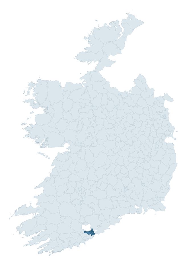
Where this barony sits in the Republic of Ireland
Geology and preservation
Bedrock geology shapes the landscape long before any settlement begins — controlling soil drainage, agricultural potential, the survival of upstanding monuments, and the preservation of buried archaeology. The figures below come from the Geological Survey Ireland 1:100,000 bedrock map.
The bedrock underlying Kerrycurrihy is predominantly sandstone (49% of the barony by area), laid down during the Carboniferous period (53% by area, around 359 to 299 million years ago). Sandstone weathers to free-draining, moderately fertile soils that supported Early Medieval ringfort agriculture and later manorial estates. The rock itself is a major source of building stone — visible in churches, tower houses, and farm buildings across the barony's historic landscape. A substantial secondary geology of mudstone (26%) and limestone (14%) adds further variety to the underlying landscape.
Rock type composition
Largest mapped unit: Cuskinny Member (Kinsale Formation) (24% of the barony)
Placename evidence
Logainm records 18 heritage-diagnostic placenames for Kerrycurrihy, drawn from townland and civil-parish names across the barony. The dominant stratum is Early Christian ecclesiastical — cill-, teampall-, and domhnach-prefixed names that record the dense network of early church foundations established between the fifth and tenth centuries. The leading diagnostic roots are cill- (10 — church), ráth- (3 — earthen ringfort), and lios- (2 — ringfort or enclosure). This is below the ROI average of 30.7 heritage placenames per barony, suggesting either lighter survey coverage or a townland-naming tradition that draws more on generic landscape vocabulary. Logainm records 87 placenames for Kerrycurrihy (predominantly townland names). Of these, 18 (21%) carry one of the diagnostic Gaelic roots tracked above; the remainder draw on more generic landscape vocabulary that does not encode a heritage period.
Pre-Christian / Early Medieval Defensive
| Root | Count | Meaning |
|---|---|---|
| ráth- | 3 | earthen ringfort |
| lios- | 2 | ringfort or enclosure |
Early Christian Ecclesiastical
| Root | Count | Meaning |
|---|---|---|
| cill- | 10 | church (early) |
| cillín- | 2 | unconsecrated burial ground |
| teampall- | 1 | church (later medieval) |
Other baronies in Cork
- Kinalmeaky
- Condons And Clangibbon
- Orrery And Kilmore
- Duhallow
- Bear
- Carbery East (east Division)
- Carbery West (west Division)
- North Liberties — Limerick
- Decies Without Drum — Waterford
- Glanarought — Kerry
See all 280 baronies in the Republic of Ireland Heritage Tool.

Explore further
Grounding History: 10 Maps of Northern Ireland’s Past
If you’re interested in Irish heritage more widely, the companion report for Northern Ireland brings together the analysis of all 462 NI wards into one place through 10 high-quality maps — covering monument density, archaeological periods, placename heritage, terrain, wetland, and the historic landscape at first survey. Take a look.
About this profile
Click any section below to expand.
What is a barony?
A barony is a historic administrative unit in Ireland, broadly equivalent to an English hundred. The 280 baronies used here are from the OSi 2019 National Statutory Boundaries (generalised 20m), covering the 26 counties of the Republic of Ireland. Baronies derive from the Norman period, were formalised in the 17th century, and have not been redrawn for statistical purposes. They vary enormously in area, from compact urban baronies in Dublin to vast upland baronies in Connacht, and should not be compared by raw site count without accounting for area differences.
What counts as a site?
This profile combines three distinct heritage registers, each with its own definition of what constitutes a recordable site:
- Archaeological sites (NMS). The National Monuments Service Sites and Monuments Record (SMR) catalogues every known archaeological monument or site of archaeological interest in the Republic, from prehistoric burial mounds and ringforts to medieval churches and post-medieval defensive works. Inclusion does not require legal protection — only that the site has been identified, surveyed, and assessed as having archaeological value. A separate subset of these sites lies within a recorded protection zone, which gives them statutory protection under the National Monuments Acts.
- Listed buildings (NIAH). The National Inventory of Architectural Heritage records buildings of architectural, historical, archaeological, artistic, cultural, scientific, social, or technical interest. Each surveyed structure is appraised on a five-tier scale: International, National, Regional, Local, and Record-Only. The NIAH appraisal is informational rather than strictly statutory, but it underpins local-authority Record of Protected Structures (RPS) listings.
- Heritage placenames (Logainm). Logainm is the authoritative database of Irish placenames maintained by the Placenames Branch. This profile applies a heritage-diagnostic classifier to the Irish-language form of each townland name, flagging roots that signal defensive sites (ráth-, lios-, dún-, caiseal-, cathair-), ecclesiastical foundations (cill-, teampall-, domhnach-, mainistir-), prehistoric burial-ritual features (tuaim-, carn-, leaba-), or Norse-contact settlement (gall-). Townlands without one of these diagnostic roots are not flagged here — they may still carry historical significance, but that significance is not encoded in the name itself.
Editorial principles
The narrative sections of this profile follow several explicit principles:
- Evidential. Every claim about this barony’s heritage character is anchored in the underlying register data. Where a site count, a placename count, or a percentile rank is cited, it is computed from the source datasets at export time, not estimated.
- Comparative. Counts and metrics are reported alongside their percentile rank against the other 279 ROI baronies. A barony with 50 ringforts in absolute terms could be unusually high or unusually low depending on its size and regional context; percentile ranking removes that ambiguity.
- Transparent on limits. Where a register has known coverage gaps, survey biases, or data-quality issues that affect this barony’s figures, the profile flags them rather than presenting the numbers as definitive.
- No interpretation beyond what the data supports. The narrative does not speculate about historical events, social dynamics, or cultural meaning beyond what the recorded heritage and placename evidence directly attests.
Data caveats and limits
- NMS Sites and Monuments Record is the product of survey campaigns conducted at different intensities across different counties and decades. Some baronies have been surveyed more thoroughly than others, and absolute counts should be read in that light. Sites destroyed by development before survey are typically not represented; sites in heavily forested or upland terrain are sometimes under-recorded.
- NIAH coverage is broadly complete for the Republic of Ireland but the survey was conducted on a rolling county-by-county basis, and the most recent appraisal date varies. Buildings demolished or substantially altered after their original survey may still appear in the register; conversely, recent buildings of merit may not yet have been appraised.
- Logainm classification applies a deliberately conservative pattern-matching approach to the Irish-language townland forms. The classifier prioritises true positives over recall: a townland may carry a heritage signal that the classifier doesn’t recognise, particularly where the diagnostic root has been heavily anglicised or where the townland name draws on a less common term. The 60,000+ townland records and ~9,800 classified placenames give a substantial signal at barony scale, but individual townland names should be checked against Logainm directly for definitive interpretation.
- Period attribution. The chronological distribution reflects only those NMS sites that carry a recognised period attribution in the source data. Sites listed as “Unknown” period are excluded from the dated subset.
- Boundary changes. Some baronies have undergone minor boundary adjustments since their 19th-century definition; the OSi 2019 generalised boundaries used here are the current statutory definition and may differ slightly from historical maps in border areas.
- Bedrock geology is mapped at 1:100,000 scale, which means local variation within a barony — small pockets of different rock type, mineral veins, alluvium overlying bedrock — is generalised. The dominant-system and rocktype figures are area-weighted, so a barony reading “70% Carboniferous limestone” may still contain small but archaeologically important pockets of older or younger rock. Around 3% of GSI polygons do not match the lexicon and contribute no rocktype or system attribution.
Data sources
- National Monuments Service — Sites and Monuments Record (SMR) https://data.gov.ie/dataset/national-monuments-service-archaeological-survey-of-ireland
- National Inventory of Architectural Heritage (NIAH) https://data.gov.ie/dataset/national-inventory-of-architectural-heritage-niah-national-dataset
- Logainm — Placenames Database of Ireland https://www.logainm.ie/
- Ordnance Survey Ireland — National Statutory Barony Boundaries 2019 https://data-osi.opendata.arcgis.com/
- EURODEM — European Digital Elevation Model https://www.mapsforeurope.org/datasets/euro-dem
- ESA WorldCover https://esa-worldcover.org/en
- Geological Survey Ireland — 1:100,000 Bedrock Geology https://www.gsi.ie/en-ie/data-and-maps/Pages/Bedrock.aspx
Explore more: Search any of the 280 ROI baronies, browse by historical province, or read the methodology and data sources for the full Republic of Ireland Heritage Tool.