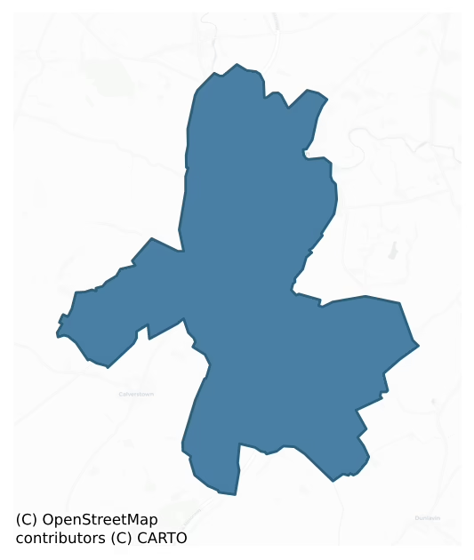
Kilcullen is a barony of County Kildare, in the historical province of Leinster (Irish: Cill Chuillinn), covering 34.5 km² of land. The barony records 77 NMS archaeological sites and 28 NIAH listed buildings, placing it at around the 63rd percentile among 280 ROI baronies for sites per km². This means it is in the upper half of all baronies for sites per km². Dated archaeological evidence runs from the Neolithic through to the Modern, spanning 7 of 9 archaeological periods, placing the barony in the 30th percentile among 280 ROI baronies for chronological depth. This means it is in the bottom third of all baronies for chronological depth. The largest dated subset of recorded sites dates to the Iron Age.
Heritage at a glance
Percentile rankings throughout this profile compare each barony only against the other 279 Republic of Ireland baronies.
The recorded heritage of Kilcullen
The National Monuments Service Sites and Monuments Record (SMR) is the statutory inventory of archaeological sites for the Republic of Ireland, maintained by the Department of Tourism, Culture, Arts, Gaeltacht, Sport and Media. Sites recorded here include earthworks, ringforts, megalithic tombs, ecclesiastical remains, and post-medieval features; not every record is legally protected, but each is registered as a monument of archaeological interest.
The National Monuments Service records 77 archaeological sites in Kilcullen, putting it at the 63rd percentile among 280 ROI baronies for sites per km². This means it is in the upper half of all baronies for sites per km². Protection coverage is near-universal — 72 sites (94%) fall within a recorded monument protection zone, indicating an extensively surveyed landscape. The record is dominated by defensive sites — ringforts, enclosures, hillforts, and stone forts (30 sites, 39% of the total), with ecclesiastical sites forming a substantial secondary presence (12 sites, 16%). The most diagnostically specific type is Graveyard (4 records, 5% of the barony's NMS total) — compared to an ROI average of 4% across all baronies where this type occurs. Graveyard is a burial area associated with a church, in use from the medieval period onwards. The broader 'Enclosure' classification — which catches unclassified ringforts and field enclosures — accounts for a further 22 records (29%) and reflects the difficulty of sub-classifying degraded earthworks from surface evidence alone. Across the barony's 34.5 km², this gives a recorded density of 2.23 sites per km².
Most common monument types
Hover or tap a monument type to see its definition.
| Type | Count |
|---|---|
| Enclosure a banked or ditched feature of uncertain type, used as a catch-all where the original function cannot be determined from surface evidence | 22 |
| Graveyard a burial area associated with a church, in use from the medieval period onwards | 4 |
| Ring-ditch a circular ditch under 20m across, often the ploughed-out remains of a barrow, ring-barrow or roundhouse | 4 |
| Church a building used for public Christian worship, of any date from c. 500 AD onwards | 3 |
| Burial an isolated interment of human or animal remains, not associated with a formal burial ground | 3 |
| Castle – tower house a fortified residential tower of four or five storeys, mostly built by lords in the 15th and 16th centuries and often within a defended bawn | 2 |
Chronological distribution
The dated archaeological record for Kilcullen spans from the Neolithic through to the Modern, with activity attested across 7 of 9 archaeological periods. The record is near-continuous, with only the Post Medieval period falling inside the span without any recorded sites. Activity concentrates most heavily in the Iron Age (24 sites, 39% of dated material), with the Early Bronze Age forming a secondary peak (11 sites, 18%). A further 16 recorded sites (21% of the overall NMS register for the barony) carry no period attribution — appearing as 'Unknown' in the bar chart below. This typically reflects either records that pre-date the standardised period vocabulary or sites awaiting specialist dating review, rather than a genuine absence of chronological evidence.
Sample of recorded monuments
Show 25 sample monuments (of 77 total)
A representative sample of 25 recorded monuments drawn from the barony’s 77 total NMS entries. Sites within a recorded monument protection zone and rarer site types are prioritised so the list shows a meaningful cross-section rather than only the most common type. Each entry shows the official Sites and Monuments Record reference number and the description published by the National Monuments Service.
Barrow – stepped barrow
On a short E-facing pasture slope at the N foot of Knockaillinne and overlooked by Dun Aillinne (KD028-038—-) c. 630m to the S. A low, partially dug-out, circular area (diam. 18m; H above external ground level…
On a short E-facing pasture slope at the N foot of Knockaillinne and overlooked by Dun Aillinne (KD028-038—-) c. 630m to the S. A low, partially dug-out, circular area (diam. 18m; H above external ground level 0.6-1.6m) is girdled by a broad berm (Wth 2.9-3.1m) SW-N-SE, which is heavily poached at W, and by a wide outer fosse (Wth at base 1.5m at S-2.4m at N; Wth at ground surface 7.8m at E-8.6m at S; overall diam. of monument 44.4m).
Compiled by: Gearóid Conroy
Date of upload: 18 February 2013
Ceremonial enclosure
On Knockaulin, a moderately steep-sided, round-topped hill (OD c. 183m), in improved pasture overlooking the Curragh to the NW, and traditionally, the ‘Dún Ailinne’ of early Irish literature – seat of the kings of…
On Knockaulin, a moderately steep-sided, round-topped hill (OD c. 183m), in improved pasture overlooking the Curragh to the NW, and traditionally, the ‘Dún Ailinne’ of early Irish literature – seat of the kings of Leinster. O’Donovan, jointly compiling the OSL for Co. Kildare in 1837, noted that the name ‘Ailinne’ was said to derive from an ‘ail’ or stone on the site (KD028-038004-). He also noted that in the literature, Dún Ailinne is referred to as, ‘a place of assemblies, a Rath with royal roads, … a Grianan [palace] and a Royal Dún’ (Herity 2002, 102-3 [46-7]).
A substantial earth and stone bank (H 5m) and deep internal fosse encloses a very large oval area (c. 470m N-S; c. 385m E-W; c. 13 hectares) The enclosing elements hug the 150m contour SW-W-NW, and serve as a townland boundary SE-S-W-NW. A causewayed entrance (unexcavated bedrock) at E is approached externally by a revetted/kerbed roadway (L c. 40m; Wth c. 8m) which continues internally (L c. 70m) towards the summit of the monument. In the interior, O’Donovan (op. cit.) recorded a ‘Rath on the apex of the hill’ (KD028-038006-) and it is indicated on the 1st ed. (1838) of the OS 6-inch map which also records ‘St John’s Well’ (KD028-038002-) in the NW sector. From 1968 to 1975, seasonal archaeological excavation and geophysical prospection was undertaken at the monument (Wailes 1970 (a), 79-90; 1970 (b), 507-17; 1971, 5-11; 1973, 234-41; 1974 (a), 13-14; 1974 (b), 345-58; 1976, 319-38; 1982, 1-29; 1990, 10-21; J…
Habitation site
Sherds of Western Neolithic pottery, a scatter of arrow and javelin heads and several polished stone axes – indicative of possible settlement debris – were found during the archaeological excavations of Dun Ailinne, a…
Sherds of Western Neolithic pottery, a scatter of arrow and javelin heads and several polished stone axes – indicative of possible settlement debris – were found during the archaeological excavations of Dun Ailinne, a ceremonial enclosure (KD028-038001-). A pit burial (KD028-038005-) was also excavated. (Johnson 1990, 26-31; Waddell 1998, 343-7)
Compiled by: Gearóid Conroy
Date of revised upload: 12 December 2017
This monument is subject to a preservation order made under the National Monuments Acts 1930 to 2014 (PO no. 200/1954).
Pit-burial
Discovered during archaeological excavations at Dún Ailinne (KD028-038001-). A pit contained sherds of a decorated Neolithic pot and a slate disc or pendant. The vessel is similar to pottery from Neolithic Linkardstown…
Discovered during archaeological excavations at Dún Ailinne (KD028-038001-). A pit contained sherds of a decorated Neolithic pot and a slate disc or pendant. The vessel is similar to pottery from Neolithic Linkardstown type burials, and is possibly associated with a fragment of skull bone. Possible prehistoric settlement evidence (KD028-038003-) was found nearby. (Wailes 1990, 12; Waddell 1998, 344)
Compiled by: Gearóid Conroy
Date of upload: 15 July 2013
This monument is subject to a preservation order made under the National Monuments Acts 1930 to 2014 (PO no. 200/1954).
Religious house – Franciscan friars
In a graveyard (KD028-040001-) near the S bank of the River Liffey. According to Gwynn and Hadcock (1970, 251-2), ‘New Abbey’ was founded in 1486 for the Observant Franciscans by Roland FitzEustace, who was burial here…
In a graveyard (KD028-040001-) near the S bank of the River Liffey. According to Gwynn and Hadcock (1970, 251-2), ‘New Abbey’ was founded in 1486 for the Observant Franciscans by Roland FitzEustace, who was burial here in 1496 [Effigial tomb: KD028-040002-]. It was suppressed in 1539 when it comprised, 'a church and belfry, dormitory hall, two chambers, kitchen, cemetery and orchard garden with a small close of 8 acres’. In 1540, ‘the church and house [were] in good repair’ (ibid). The ruins were sketched and briefly described in 1782 by Austin Cooper, who commented, ‘At present the choir, refectory and confessional chapel only remain entire. In the centre formerly stood a beautiful steeple, which fell down about eighteen years ago.’ (Fitzgerald 1901, 307-9) Cooper’s sketch shows a long nave and chancel with a large transept, large traceried windows in the gable walls, and double ogee headed windows with square hoods in the S wall of the chancel (ibid. 307). According to Fenton (1935-45, 219), the walls were demolished very soon after [1782] to furnish materials for a new chapel erected on the site, which itself was demolished in 1872 when the present Catholic church building was completed.
Compiled by: Gearóid Conroy
Date of upload: 18 February 2013
Barrow – bowl-barrow
On a hilltop, in pasture, with panoramic views in all directions. A low, sub-circular mound (H. 1m at W-1.5m at N and E; base diams. 10.5m E-W; 9.9m N-S; summit diam. 4.3m E-W; 3.3m N-S) is composed of earth and stone.…
On a hilltop, in pasture, with panoramic views in all directions. A low, sub-circular mound (H. 1m at W-1.5m at N and E; base diams. 10.5m E-W; 9.9m N-S; summit diam. 4.3m E-W; 3.3m N-S) is composed of earth and stone. An iron Trigonometrical Station, revetted by earthfast stones, is embedded on the surface, and the height (OD 594 feet) is recorded on the 1st ed. (1838) of the OS 6-inch map. The monument may have been a pre-existing mound modified for that purpose. Traces of a fosse and possible external bank are visible on Digital Globe aerial photography suggesting that this mound may be the remains of a bowl-barrow. This burial mound or barrow is annotated 'Moat' on Longfield's 1809 map of part of Oldkilcullen (NLI MS. 21 F. 34(28)). On this map it is depicted as a small mound standing immediately south of a road annotated 'Green Road called Drawwell Lane'.
Compiled by: Gearóid Conroy
Revised by: Caimin O'Brien based on details kindly provided by Edward O'Riordan
Date of revised upload: 18 January 2019
Settlement deserted – medieval
On a moderately steep-sided hilltop (OD c. 150m) upon which several roads converge. According to Bradley et al. (1986 vol. 4, 384-99), Kilcullen is a deserted medieval borough established on the site of an Early…
On a moderately steep-sided hilltop (OD c. 150m) upon which several roads converge. According to Bradley et al. (1986 vol. 4, 384-99), Kilcullen is a deserted medieval borough established on the site of an Early Christian monastery (KD028-049001-). The earliest reference to the borough occurs in 1403 when the provost and burgesses received a royal charter for a weekly market – the borough is described in that charter as having been recently burned. In 1456, it was again “burned, laid waste and destroyed” by the native Irish and parliament authorised a levy of £10 on the county of Kildare to enable Roland FitzEustace to build a fortified tower or towerhouse there. In 1478, FitzEustace obtained a murage grant for the town’s defences (KD028-049008-). The scarcity of references to Kilcullen in the 16th and 17th-centuries suggests the borough declined at this time. An inquisition in 1581 (ibid 386) refers to the ‘old walls and close within the walls called the old manor house of Kilcullen’, while in 1588 the manor and town of Kilcullen were leased to Brian FitzWilliams. The Civil Survey of 1654 records ‘severall ruined Castles and Stone houses’ and the census of Ireland in 1659 recorded a population of 115. No visible surface trace of the borough, town walls, castles or stone houses survive, but the borough probably ocupied the area at the intersection of the several roads, immediately W of the surviving church (KD028-049005-) round tower (KD028-049006-) and graveyard (KD028-04…
Ecclesiastical site
On a moderately steep-sided hilltop (OD c. 150m) upon which several roads converge. According to Bradley et al. (1986 vol. 4, 384-5, 391-599), the placename Kilcullen derives from Cill Chuilinn, ‘church of the steep…
On a moderately steep-sided hilltop (OD c. 150m) upon which several roads converge. According to Bradley et al. (1986 vol. 4, 384-5, 391-599), the placename Kilcullen derives from Cill Chuilinn, ‘church of the steep slope’. This was an Early Christian foundation traditionally associated with Isernius (d. 468) and MacTail (d. 548). The deaths of its abbots are recorded from the later 8th-century, and a number of bishops are noted in the 10th and 11th-centuries. Its plundering by Amhlaibh and the foreigners (Norse) of Dublin is recorded in 937-8 and another raid is recorded in 944. A stone church is mentioned in 1037 and the monastery was burned in 1114. Little physical evidence of the early monastery survives, but some curving field boundaries may reflect the line of an early monastic enclosure (KD028-049014-). The site’s importance is reflected in the later, High crosses (KD028-049002-, KD028-049003- and KD028-049004-), round tower (KD028-0490006-) and church ruins KD028-049005-) which do survive. (Gwynn and Hadcock 1979, 42-3)
Compiled by: Gearóid Conroy
Date of upload: 17 May 2013
Round tower
To SW of centre in a graveyard (KD028-049011-) on an early monastic site (KD028-049001-). Part of a National Monument (No. 71) in state ownership. According to Bradley et al. (1986 vol. 4, 393), this is a circular tower…
To SW of centre in a graveyard (KD028-049011-) on an early monastic site (KD028-049001-). Part of a National Monument (No. 71) in state ownership. According to Bradley et al. (1986 vol. 4, 393), this is a circular tower (diam. 4.5m; H. 10m), the upper portion of which is missing, built of roughly coursed limestone blocks. There is a slightly battered, round headed door at the N side (H. above ground 1.8m). There is a rectangular flat-lintelled window facing S at second floor-level, with granite jambs and a limestone sill. (Barrow 1979, 116-7)
Compiled by: Gearóid Conroy
Date of upload: 17 May 2013
Town defences
According to Bradley et al. (1986 vol. 4, 389-90), in 1478, parliament imposed a levy for the walling of Kilcullen, a medieval borough (KD028-049—-), and also released the townspeople from all levies in order to…
According to Bradley et al. (1986 vol. 4, 389-90), in 1478, parliament imposed a levy for the walling of Kilcullen, a medieval borough (KD028-049—-), and also released the townspeople from all levies in order to enable them to strengthen their town. An inquisition in 1581 refers to the ‘old walls and close within the walls called the old manor house of Kilcullen.’ Archdall, visiting Kilcullen in 1781, recorded a tradition that it had been ‘a large walled town with seven gates’, one of which was apparently still standing which he described as ‘about 10 feet wide (c. 3m), with a handsome Roman arch, under which the present turnpike road runs’, and he added that traces of a second gate were to be seen to the SW. In 1795, Seward noted that Kilcullen was entered by ‘an arch at the turnpike’. By 1837, according to the OSL (Herity 2002, 67 (197)), ‘This gate does not now remain; it was, tradition says, pulled down when Coaches began to run by that town, as it stood an obstacle …; it being at where a small slated house is now near the turnpike gate on that road.’ No visible surface traces of any of the gates survive, nor is the circuit of the town walls identifiable.
Compiled by: Gearóid Conroy
Date of upload: 17 May 2013
Architectural fragment
In a graveyard (KD028-049011-). Bradley et al. (1986 vol. 4, 395) mentions a possible graveslab, described in the Dublin Penny Journal (iv, no. 185, Jan. 1836, 229) as a tapering slab with a hole at either end, and…
In a graveyard (KD028-049011-). Bradley et al. (1986 vol. 4, 395) mentions a possible graveslab, described in the Dublin Penny Journal (iv, no. 185, Jan. 1836, 229) as a tapering slab with a hole at either end, and measuring 6’ (c. 1.83m) by 2’ 2” (c. 0.66m), that was not located. This may, however, be the slab subsequently noted by O’Carragáin in 2000 (pers. comm.) as a possible threshold stone at the medieval church (KD028-049005-).
Compiled by: Gearóid Conroy
Date of upload: 17 May 2013
Cist
In 1938, a short rectangular cist (L c. 0.6m; Wth c. 0.38m; H 0.46m) was found in a sand pit. It contained the cremated remains of an adult female, a foetus and three teeth of a year-old child. (Price 1938, 293-4;…
In 1938, a short rectangular cist (L c. 0.6m; Wth c. 0.38m; H 0.46m) was found in a sand pit. It contained the cremated remains of an adult female, a foetus and three teeth of a year-old child. (Price 1938, 293-4; Waddell 1970, 119)
Compiled by: Gearóid Conroy
Date of upload: 14 May 2013
Burial ground
In pasture. A sub-rectangular area (c. 38m NE-SW; c. 26m NW-SE) is enclosed by a modern stone wall. The interior is very uneven and rises towards the centre. The headstones date from the 18th – 20th century.
Compiled…
In pasture. A sub-rectangular area (c. 38m NE-SW; c. 26m NW-SE) is enclosed by a modern stone wall. The interior is very uneven and rises towards the centre. The headstones date from the 18th – 20th century.
Compiled by: Gearóid Conroy
Date of upload: 14 May 2013
Standing stone
Towards the N end on a low partially quarried away esker. A tall (H. 2.3m) thin tapering granite stone (base L 0.61m; Wth 0.46m; top L 0.46m; Wth 0.3m) has a later cross incised on its SW face. While the cross may be…
Towards the N end on a low partially quarried away esker. A tall (H. 2.3m) thin tapering granite stone (base L 0.61m; Wth 0.46m; top L 0.46m; Wth 0.3m) has a later cross incised on its SW face. While the cross may be associated with burials (KD032-012002-) discovered immediately to the N in 1987, Meagher (1936, 192) records that, ‘… 100 years ago or more, Father Lawlor and Father Cummins lived in a garden at Kilgowan cross-roads …; and it was one of these men that cut the cross on the Long Stone’. (Walshe 1931, 134)
Compiled by: Gearóid Conroy
Date of upload: 15 October 2013
This monument is subject to a preservation order made under the National Monuments Acts 1930 to 2014 (PO no. 7/1973).
Rock art
Found, in 1984, ex situ in spoil from an adjacent road widening scheme. An irregularly shaped boulder fragment (L 0.61m; Wth 0.52m; max. T 0.18m) is decorated on one face with a cupmark surrounded by four incised…
Found, in 1984, ex situ in spoil from an adjacent road widening scheme. An irregularly shaped boulder fragment (L 0.61m; Wth 0.52m; max. T 0.18m) is decorated on one face with a cupmark surrounded by four incised circles with a gap or channel on one side. The lower part of this motif is missing because of damage to the stone. A double circle is attached to the main motif. It is probably a fragment of a larger decorated stone and was recovered from spoil beside the road in the course of road widening. It is now in the NMI (see DU018-174—-: NMI 1984:145).
Compiled by: Gearóid Conroy
Date of upload: 12 November 2013
Barrow – unclassified
On a gentle W-facing slope in improved pasture: field boundaries shown abutting the monument NW-N-E on the current ed. (1910) of the OS 6-inch map have been levelled, whins removed from the monument are piled to the SW…
On a gentle W-facing slope in improved pasture: field boundaries shown abutting the monument NW-N-E on the current ed. (1910) of the OS 6-inch map have been levelled, whins removed from the monument are piled to the SW and the monument is freshly grass-seeded. A slightly raised (H 0.5m) subcircular area (diam. 20.6m E-W; 17.5m N-S) is defined by a wide shallow fosse (Wth 3.2m at E-5.7m at N; D 0.2m). there is no obvious trace of an outer bank, but the local land improvement works may have resulted in its levelling?
Compiled by: Gearóid Conroy
Date of upload: 25 November 2013
Hearth
A hearth was uncovered during archaeological testing in advance of the laying of the Cork-Dublin Natural Gas Pipeline (O’Donnell 1983, 361).
Compiled by: Gearóid Conroy
Date of upload: 25 November 2013
Graveslab
According to Bradley et al. (1986 vol. 4, 395), a graveslab bearing a 16th-century knightly effigy was moved from the medieval church in Old Kilcullen (KD028-049005-) to the modern R.C. church in Ballymore Eustace…
According to Bradley et al. (1986 vol. 4, 395), a graveslab bearing a 16th-century knightly effigy was moved from the medieval church in Old Kilcullen (KD028-049005-) to the modern R.C. church in Ballymore Eustace graveyard (KD029-011004-). See KD029-011011- for its present location.
Compiled by: Gearóid Conroy
Date of upload: 17 May 2013
Ecclesiastical enclosure
On a moderately steep-sided hilltop (OD c. 150m), on the site of an Early Christian monastery (KD028-049001-) and later, medieval borough (KD028-049—-). According to Bradley et al. (1986 vol. 4, 389), the possible…
On a moderately steep-sided hilltop (OD c. 150m), on the site of an Early Christian monastery (KD028-049001-) and later, medieval borough (KD028-049—-). According to Bradley et al. (1986 vol. 4, 389), the possible line of an ecclesiastical enclosure may be preserved in a curving, but now levelled field boundary (visible on aerial photographs), to the E of a church (KD028-049005-) and graveyard (KD028-049011-), and also in the slightly curving line of the laneway to the N of the green. (CUCAP ATA072, BDU030, BDR033)
Compiled by: Gearóid Conroy
Date of upload: 17 May 2013
Battlefield
The 1798 United Irishmen rebellion broke out in the east midlands of Ireland on the night of 23-24 May. Here the counties of Dublin, Meath and Kildare were to see the most significant military action. Events in Dublin…
The 1798 United Irishmen rebellion broke out in the east midlands of Ireland on the night of 23-24 May. Here the counties of Dublin, Meath and Kildare were to see the most significant military action. Events in Dublin on the night of 23 May were significant for what did not happen, as the rebellion was crushed by Crown forces here almost as spoon as it began. Meath and Kildare were to see greater, and longer-lasting, military action, however, as the rebellion took hold much more firmly in those two counties. The battle of Kilcullen, fought on 24 May, has the distinction of being one of the first of the major military clashes in the east midlands. In Kildare, during the night of 23-24 May, United Irish insurgents carried out attacks in the towns of Ballymore-Eustace, Naas, and Prosperous, but these all failed. Subsequent to this, that same night, insurgents began to mobilise at the old churchyard in old Kilcullen, which was on the southern outskirts of that town. By daybreak on 24 May (c. 5 am) c. 300 insurgents had gathered there. This seditious congregation was soon brought to the attention of the commander of the local Crown forces, Lieutenant General Sir Ralph Dundas, however. He almost immediately gathered some forces together and set out to defeat the insurgent forces. The scene was thus set for the subsequent battle.
After the outbreak of rebellion in Kildare county on the night of 23 May, 300 insurgents gathered at the churchyard at Old Kilcullen on 24 M…
Tomb – effigial
In a church (KD028-022—-). A reconstructed tomb with a knightly effigy, probably that of Richard FitzEustace who died between 1491 and 1496. The side panels are composed of figures within ogee headed arcading, resting…
In a church (KD028-022—-). A reconstructed tomb with a knightly effigy, probably that of Richard FitzEustace who died between 1491 and 1496. The side panels are composed of figures within ogee headed arcading, resting on a plinth with hollow mouldings of animals and gothic foliage (Hunt 1974, 154-5).
Compiled by: Gearóid Conroy
Date of upload: 26 November 2012
Castle – tower house
On a former demesne, c. 100m W of the N-Flowing River Liffey. A medieval church (KD028-022—-) stands c. 275m to the NE. The castle was the property of Arnold Fitz Eustace le Poer by 1317, and in 1448 it was…
On a former demesne, c. 100m W of the N-Flowing River Liffey. A medieval church (KD028-022—-) stands c. 275m to the NE. The castle was the property of Arnold Fitz Eustace le Poer by 1317, and in 1448 it was unsuccessfully attacked by Cathal O'Connor Faly. It was subsequently burnt in 1647 before being recaptured and destroyed by Colonel Hewson (Tickell 1955, 271-2; 1958, 308, 316-7). Partial remains are incorporated into the basement an early 18th-century house, and comprise a rectangular structure (int. L 10.7m; Wth 5.2m) of uncoursed limestone rubble, into which a later partition wall has been inserted. The present doorway is probably original and there are at least two, blocked, loops with deep splays. A barrel vaulted ceiling bears traces of wicker centring. (Bence-Jones 1978, 72; Meagher 1979-80, 86).
Compiled by: Gearóid Conroy
Date of upload: 26 November 2012
Mound
A Registered Historic Monument. On a hilltop with panoramic views in all directions. A well-defined, possibly landscaped, low (2m at S-3m at W) circular (base diam. 35m), flat-topped (diam 16m) steep-sided earthen…
A Registered Historic Monument. On a hilltop with panoramic views in all directions. A well-defined, possibly landscaped, low (2m at S-3m at W) circular (base diam. 35m), flat-topped (diam 16m) steep-sided earthen mound. A modern farm road bordered by wooden post-and-rail fencing skirts the base NE-S-WSW. There is no trace of the two low earthen banks on the S limits of the summit, noted in 1972 (SMR file). A small concrete Trigonometrical Station is built into the upper surface.
Compiled by: Gearóid Conroy
Date of upload: 26 November 2012
Ritual site – holy well
The well is a feature in a narrow, landscaped public park along the S bank of the River Liffey. According to Fitzgerald (1899-1902, 317) the well, ‘ … [went] by the name of Tubber-molin … or St. Moling’s Well’, while…
The well is a feature in a narrow, landscaped public park along the S bank of the River Liffey. According to Fitzgerald (1899-1902, 317) the well, ‘ … [went] by the name of Tubber-molin … or St. Moling’s Well’, while Jackson (1979-80, 151) attributes it to St. Brigid and says a pattern was formerly held there on February 1st. A small spring well issues from beneath a modern limestone sculpture by Fr. Henry Flanagan OP. An adjoining plaque commemorates the reconstruction of the well and the unveiling of the sculpture in 1977.
Compiled by: Gearóid Conroy
Date of upload: 28 January 2013
Enclosure
Shown as a ‘Rath’ on Taylor's 1783 Map of County Kildare but not recorded on any edition of the subsequent OS mapping. The area was archaeologically trail-trenched in advance of a motorway scheme, but no archaeological…
Shown as a ‘Rath’ on Taylor's 1783 Map of County Kildare but not recorded on any edition of the subsequent OS mapping. The area was archaeologically trail-trenched in advance of a motorway scheme, but no archaeological material was revealed. Quarrying is known to have taken place previously in this area, and may have resulted in the destruction of the monument? (Keeley 1991, 170)
Compiled by: Gearóid Conroy
Date of upload: 18 February 2013
Listed buildings
The National Inventory of Architectural Heritage (NIAH) is a state survey appraising buildings of architectural, historical, archaeological, artistic, cultural, scientific, social, or technical interest. Each surveyed structure receives a rating from International (the highest, for buildings of European importance) through National, Regional, Local, and Record-Only.
The NIAH records only 28 listed buildings in Kilcullen, the 12th percentile across ROI baronies — a relatively thin architectural record. The highest-graded structures include 3 of National significance. The Republic holds 937 National-graded buildings in total, so this barony accounts for around 0% of the national total. Construction dates concentrate most heavily in the Victorian (1830-1900) period. The most-recorded building type is house (8 examples, 29% of the listed stock).
Terrain and environment
Mean elevation across the barony is 124m — the 75th percentile among 280 ROI baronies for elevation. This means it is in the top third of all baronies for elevation. This is a relatively elevated landscape by ROI standards. Elevation matters for heritage because higher-altitude baronies typically favour defensive monuments — ringforts and hilltop forts placed on prominent ground — while lowland baronies are more likely to carry the dense settlement and church networks of intensive agricultural landscapes. Mean slope is 3.1° — the 38th percentile among 280 ROI baronies for slope. This means it is in the lower half of all baronies for slope. Slope is a key control on both land use and archaeological preservation: steep ground resists ploughing and tends to preserve earthworks intact, while gentle slopes favour intensive cultivation that damages or destroys surface archaeology over time. The Topographic Wetness Index averages 11.0, the 57th percentile among 280 ROI baronies for wetness. This means it is in the upper half of all baronies for wetness. Drainage matters for heritage because poorly-drained ground preserves organic archaeology (wooden trackways, leather, textiles, and on rare occasions human remains) far better than free-draining soil; well-drained ground favours arable use but destroys organic material rapidly. The land-cover mosaic combines improved grassland (70%), arable farmland (19%), and woodland (8%), giving a mixed agricultural and semi-natural landscape.
Terrain measurements
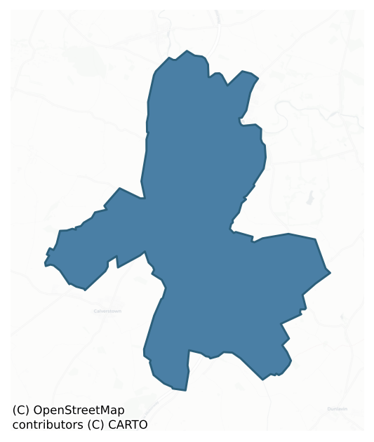
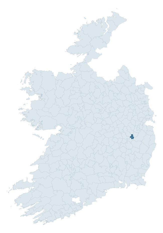
Where this barony sits in the Republic of Ireland
Geology and preservation
Bedrock geology shapes the landscape long before any settlement begins — controlling soil drainage, agricultural potential, the survival of upstanding monuments, and the preservation of buried archaeology. The figures below come from the Geological Survey Ireland 1:100,000 bedrock map.
The bedrock underlying Kilcullen is predominantly calcareous greywacke (76% of the barony by area), laid down during the Silurian period (79% by area, around 444 to 419 million years ago). The single largest mapped unit is the Carrighill Formation (76% of the barony's bedrock).
Rock type composition
Largest mapped unit: Carrighill Formation (76% of the barony)
Placename evidence
The Logainm record for Kilcullen contains only 3 heritage-diagnostic placenames — 3 cill-names. With this few records, the count should be read as indicative rather than as a firm characterisation of the linguistic heritage layers; a larger sample would be needed to reliably distinguish defensive, ecclesiastical, or other stratigraphic signals from chance occurrence.
Early Christian Ecclesiastical
| Root | Count | Meaning |
|---|---|---|
| cill- | 3 | church (early) |
Other baronies in Kildare
About this profile
Click any section below to expand.
What is a barony?
A barony is a historic administrative unit in Ireland, broadly equivalent to an English hundred. The 280 baronies used here are from the OSi 2019 National Statutory Boundaries (generalised 20m), covering the 26 counties of the Republic of Ireland. Baronies derive from the Norman period, were formalised in the 17th century, and have not been redrawn for statistical purposes. They vary enormously in area, from compact urban baronies in Dublin to vast upland baronies in Connacht, and should not be compared by raw site count without accounting for area differences.
What counts as a site?
This profile combines three distinct heritage registers, each with its own definition of what constitutes a recordable site:
- Archaeological sites (NMS). The National Monuments Service Sites and Monuments Record (SMR) catalogues every known archaeological monument or site of archaeological interest in the Republic, from prehistoric burial mounds and ringforts to medieval churches and post-medieval defensive works. Inclusion does not require legal protection — only that the site has been identified, surveyed, and assessed as having archaeological value. A separate subset of these sites lies within a recorded protection zone, which gives them statutory protection under the National Monuments Acts.
- Listed buildings (NIAH). The National Inventory of Architectural Heritage records buildings of architectural, historical, archaeological, artistic, cultural, scientific, social, or technical interest. Each surveyed structure is appraised on a five-tier scale: International, National, Regional, Local, and Record-Only. The NIAH appraisal is informational rather than strictly statutory, but it underpins local-authority Record of Protected Structures (RPS) listings.
- Heritage placenames (Logainm). Logainm is the authoritative database of Irish placenames maintained by the Placenames Branch. This profile applies a heritage-diagnostic classifier to the Irish-language form of each townland name, flagging roots that signal defensive sites (ráth-, lios-, dún-, caiseal-, cathair-), ecclesiastical foundations (cill-, teampall-, domhnach-, mainistir-), prehistoric burial-ritual features (tuaim-, carn-, leaba-), or Norse-contact settlement (gall-). Townlands without one of these diagnostic roots are not flagged here — they may still carry historical significance, but that significance is not encoded in the name itself.
Editorial principles
The narrative sections of this profile follow several explicit principles:
- Evidential. Every claim about this barony’s heritage character is anchored in the underlying register data. Where a site count, a placename count, or a percentile rank is cited, it is computed from the source datasets at export time, not estimated.
- Comparative. Counts and metrics are reported alongside their percentile rank against the other 279 ROI baronies. A barony with 50 ringforts in absolute terms could be unusually high or unusually low depending on its size and regional context; percentile ranking removes that ambiguity.
- Transparent on limits. Where a register has known coverage gaps, survey biases, or data-quality issues that affect this barony’s figures, the profile flags them rather than presenting the numbers as definitive.
- No interpretation beyond what the data supports. The narrative does not speculate about historical events, social dynamics, or cultural meaning beyond what the recorded heritage and placename evidence directly attests.
Data caveats and limits
- NMS Sites and Monuments Record is the product of survey campaigns conducted at different intensities across different counties and decades. Some baronies have been surveyed more thoroughly than others, and absolute counts should be read in that light. Sites destroyed by development before survey are typically not represented; sites in heavily forested or upland terrain are sometimes under-recorded.
- NIAH coverage is broadly complete for the Republic of Ireland but the survey was conducted on a rolling county-by-county basis, and the most recent appraisal date varies. Buildings demolished or substantially altered after their original survey may still appear in the register; conversely, recent buildings of merit may not yet have been appraised.
- Logainm classification applies a deliberately conservative pattern-matching approach to the Irish-language townland forms. The classifier prioritises true positives over recall: a townland may carry a heritage signal that the classifier doesn’t recognise, particularly where the diagnostic root has been heavily anglicised or where the townland name draws on a less common term. The 60,000+ townland records and ~9,800 classified placenames give a substantial signal at barony scale, but individual townland names should be checked against Logainm directly for definitive interpretation.
- Period attribution. The chronological distribution reflects only those NMS sites that carry a recognised period attribution in the source data. Sites listed as “Unknown” period are excluded from the dated subset.
- Boundary changes. Some baronies have undergone minor boundary adjustments since their 19th-century definition; the OSi 2019 generalised boundaries used here are the current statutory definition and may differ slightly from historical maps in border areas.
- Bedrock geology is mapped at 1:100,000 scale, which means local variation within a barony — small pockets of different rock type, mineral veins, alluvium overlying bedrock — is generalised. The dominant-system and rocktype figures are area-weighted, so a barony reading “70% Carboniferous limestone” may still contain small but archaeologically important pockets of older or younger rock. Around 3% of GSI polygons do not match the lexicon and contribute no rocktype or system attribution.
Data sources
- National Monuments Service — Sites and Monuments Record (SMR) https://data.gov.ie/dataset/national-monuments-service-archaeological-survey-of-ireland
- National Inventory of Architectural Heritage (NIAH) https://data.gov.ie/dataset/national-inventory-of-architectural-heritage-niah-national-dataset
- Logainm — Placenames Database of Ireland https://www.logainm.ie/
- Ordnance Survey Ireland — National Statutory Barony Boundaries 2019 https://data-osi.opendata.arcgis.com/
- EURODEM — European Digital Elevation Model https://www.mapsforeurope.org/datasets/euro-dem
- ESA WorldCover https://esa-worldcover.org/en
- Geological Survey Ireland — 1:100,000 Bedrock Geology https://www.gsi.ie/en-ie/data-and-maps/Pages/Bedrock.aspx
Explore more: Search any of the 280 ROI baronies, browse by historical province, or read the methodology and data sources for the full Republic of Ireland Heritage Tool.