
Kilmallock is a barony of County Limerick, in the historical province of Munster (Irish: Cill Mocheallóg), covering 16.5 km² of land. The barony records 94 NMS archaeological sites and 57 NIAH listed buildings, placing it at around the 97th percentile among 280 ROI baronies for sites per km². This means it is in the top tenth of all baronies for sites per km². Dated archaeological evidence runs from the Neolithic through to the Post Medieval, spanning 7 of 9 archaeological periods, placing the barony in the 26th percentile among 280 ROI baronies for chronological depth. This means it is in the bottom third of all baronies for chronological depth. The largest dated subset of recorded sites dates to the Early Medieval.

Heritage at a glance
Percentile rankings throughout this profile compare each barony only against the other 279 Republic of Ireland baronies.
The recorded heritage of Kilmallock
The National Monuments Service Sites and Monuments Record (SMR) is the statutory inventory of archaeological sites for the Republic of Ireland, maintained by the Department of Tourism, Culture, Arts, Gaeltacht, Sport and Media. Sites recorded here include earthworks, ringforts, megalithic tombs, ecclesiastical remains, and post-medieval features; not every record is legally protected, but each is registered as a monument of archaeological interest.
The National Monuments Service records 94 archaeological sites in Kilmallock, putting it at the 97th percentile among 280 ROI baronies for sites per km². This means it is in the top tenth of all baronies for sites per km². Protection coverage is near-universal — 93 sites (99%) fall within a recorded monument protection zone, indicating an extensively surveyed landscape. The dominant category is domestic structures — house sites and settlement remains (29 sites, 31% of the record). Excavation – miscellaneous is the most prevalent type, making up 31% of the barony's recorded sites (29 records) — well above the ROI average of 4% across all baronies where this type occurs. Other significant types include Bridge (4) and Church (3). Bridge is a built structure spanning a river or ravine to allow crossing, dated medieval onwards; Church is a building used for public Christian worship, of any date from c. 500 AD onwards. Across the barony's 16.5 km², this gives a recorded density of 5.70 sites per km².
Most common monument types
Hover or tap a monument type to see its definition.
| Type | Count |
|---|---|
| Excavation – miscellaneous | 29 |
| Bridge a built structure spanning a river or ravine to allow crossing, dated medieval onwards | 4 |
| Church a building used for public Christian worship, of any date from c. 500 AD onwards | 3 |
| Graveyard a burial area associated with a church, in use from the medieval period onwards | 3 |
Chronological distribution
The dated archaeological record for Kilmallock spans from the Neolithic through to the Post Medieval, with activity attested across 7 of 9 archaeological periods. Every period from earliest to latest is represented in the record — an unbroken sequence of dated activity across the full chronological span. Activity concentrates most heavily in the Early Medieval (20 sites, 33% of dated material), with the Medieval forming a secondary peak (19 sites, 32%). A further 34 recorded sites (36% of the overall NMS register for the barony) carry no period attribution — appearing as 'Unknown' in the bar chart below. This typically reflects either records that pre-date the standardised period vocabulary or sites awaiting specialist dating review, rather than a genuine absence of chronological evidence.
Sample of recorded monuments
Show 25 sample monuments (of 94 total)
A representative sample of 25 recorded monuments drawn from the barony’s 94 total NMS entries. Sites within a recorded monument protection zone and rarer site types are prioritised so the list shows a meaningful cross-section rather than only the most common type. Each entry shows the official Sites and Monuments Record reference number and the description published by the National Monuments Service.
Quarry
In pasture 60m E of enclosure (LI039-111—-). Not depicted on the 1840 ed. OSi 6-inch map. Shown on the 1897 ed. OSi 25-inch map as an irregular-shaped area (dims. 58m NW-SE; 47m NE-SW) possibly indicating a small…
In pasture 60m E of enclosure (LI039-111—-). Not depicted on the 1840 ed. OSi 6-inch map. Shown on the 1897 ed. OSi 25-inch map as an irregular-shaped area (dims. 58m NW-SE; 47m NE-SW) possibly indicating a small pond. Truncated at S by field wall running NW-SE. Depicted on Cassini ed. OSi 6-inch map as sub-circular-shaped depression or possibly a quarry or pond(diam. c. 48m) with second depression (36m E-W; 12m N-S) to immediate S. Visible as irregular shaped field enclosure delimited by scrub on OSi orthophoto taken between 2005-12. Outline of earthwork visible as a circular-shaped area delimited by scrub on Google Earth orthoimage dated 14/09/2019. Probably the remains of a post-1700 quarry which has become a pond feature, not the remains of an archaeological monument.
See attached Google Earth orthoimages.
Compiled by: Martin Fitzpatrick
Date of upload: 6 May 2021
See attached ASI aerial photographs ASIAP – 308/18 taken on 05/10/2002.
Mound
In pasture on the designed landscape of Ash Hill Towers, that lies 70m to SE. Walled garden of Ash Hill Towers lies immediately to S as shown on 1840 ed. OSi 6-inch map. Not depicted on historic OSi 6-inch maps. A…
In pasture on the designed landscape of Ash Hill Towers, that lies 70m to SE. Walled garden of Ash Hill Towers lies immediately to S as shown on 1840 ed. OSi 6-inch map. Not depicted on historic OSi 6-inch maps. A trace of a late 18th century estate map of Ash Hill, Kilmallock, Co. Limerick by Aideen Ireland (1983, 39-40), shows a sub-circular shaped area defined by a scarp annotated 'Mote'. Location of monument now covered with trees on Digital Globe orthoimage taken 2011-13 and on Google Earth orthoimages.
See attached Google Earth orthoimages and section of estate map taken from Ireland 1983.
Compiled by: Fiona Rooney
Date of upload: 8 September 2021
Bawn
To the W of Charleville Road , within the former demesne lands of Ash Hill Towers, that lies 300m to the WSW. Site of Castle Coote (LI047-021002-) indicated in centre of earthwork. Depicted on the 1840 ed. OSi 6-inch…
To the W of Charleville Road , within the former demesne lands of Ash Hill Towers, that lies 300m to the WSW. Site of Castle Coote (LI047-021002-) indicated in centre of earthwork. Depicted on the 1840 ed. OSi 6-inch map as a rectangular shaped field or walled area with small rectangular shaped building in NW corner. On the 1897 ed. OSi 25-inch map the rectangular shaped field has been partially levelled and only a section of the N and E sides of survive as an L-shaped earthwork (dims. c. 39m NE-SW; 37m NW-SE ). May be the remains of a levelled bawn wall that enclosed the 'Site of Castle Coote' (LI047-021002-). No surface remains visible on Digital Globe orthoimage taken between 2011-13 or on Google Earth orthoimages.
See attached Google Earth orthoimages.
Compiled by: Martin Fitzpatrick
Date of upload: 30 August 2021
House – 17th/18th century
Site of Castle Coote depicted on the demesne lands of Ash Hill [Knockash] Towers located 255m to SW. On this map the castle site is depicted as a rectangular shaped field or walled area with small rectangular shaped…
Site of Castle Coote depicted on the demesne lands of Ash Hill [Knockash] Towers located 255m to SW. On this map the castle site is depicted as a rectangular shaped field or walled area with small rectangular shaped building in NW corner. On the 1897 ed. OSi 25-inch map the rectangular shaped field has been partially levelled and only the a section of the N and E sides of this are survive as an L-shaped earthwork. On this map a 'Draw Well' is depicted standing inside the earthwork c. 40m to NW of castle site.
Westropp (1906/7, 191) recorded the following details about the site of Castle Coote; 'Castle Coote. Site marked near Ashill Towers'. According to Ireland (1983, 40), 'the square foundations marked site of Castle Coote is clearly the remnants of Chidley Coote's 18th century house'. Nearby Ash Hill Towers was described by the National Inventory of Architectural Heritage [NIAH] as a 'Detached six-bay three-storey country house, built in 1781, with substantial additions dating to the 1830s. An impressive country house originally built for Eyre Evans (the entrance carries the Evans family motto), and extensively Gothicised to the rear to the designs prepared by Charles Frederick Anderson. Part of this scheme was the addition of Gothic Revival towers which were added in 1831 and were subsequently removed' (www.buildingsofireland.ie); NIAH Reg. No. 2183051). According to the present owners of Ash Hill, Castle Coote was the birthplace of Lieutenant General Sir…
Historic town
Historic town of Kilmallock described in the Urban Survey of County Limerick as following (Bradley et. al. 1989, 146-51); 'Kilmallock is a small town located in south Limerick on the river Loobagh. The town derives its…
Historic town of Kilmallock described in the Urban Survey of County Limerick as following (Bradley et. al. 1989, 146-51); 'Kilmallock is a small town located in south Limerick on the river Loobagh. The town derives its name from a monastery founded by St. Mocheallog in the early seventh century (Gwynn and Hadcock 1970, 39). It was/plundered in 1015 (Ann. Inisf.) and it is recorded that Flaithnia O Tigernain, lector of Cell Mo-Chelloc died in 1027 (Ann. Inisf.). The early church site (LI047-019001-) has been identified with the remains on Kilmallock Hill about 1 mile NW of the town but the presence of the base of a round tower (LI047-022022-) within the fabric of the medieval parish church (LI047-022009-) of SS Peter & Paul suggests that by the tenth or eleventh century the monastery had moved down onto the low-lying ground occupied by the town today.
It is puzzling, however, that from the thirteenth century the main church of Kilmallock was dedicated, not to St Mocheallog, but to the apostles Peter and Paul. At the time of the arrival of the Anglo-Normans Kilmallock appears to have belonged to the church and to have formed part of the estates of the bishop of Limerick. It is the bishops then who were most likely the founders of the medieval town. This was not an unusual phenomenon. Cashel was founded by the archbishops of Cashel while Swords was established by the archbishops of Dublin.
There are few documentary references of a secular nature, however, to give us an ins…
Ritual site – holy well
Ó Danachair (1955, 213) recorded the following details about this holy well; 'Toberreendoney on 1840 map. A circular stone-lined well, on the roadside. Over it is a small statue of Our Lady in a small wooden niche, and…
Ó Danachair (1955, 213) recorded the following details about this holy well; 'Toberreendoney on 1840 map. A circular stone-lined well, on the roadside. Over it is a small statue of Our Lady in a small wooden niche, and a rough wooden cross. Devotions are still made, but not as often as formerly. The water cures sore eyes. Usually said to be dedicated to Our Lady. Legends: A trout is seen in well by those cured of eye ailments. A black dog appeared here, hence the local name "The Black Dog'.
Compiled by: Caimin O'Brien
Date of upload: 03 July 2019
Standing stone
In pasture, 370m S of Ahatrishnaun Stream, 125m E of a road annotated 'Bohereennaderrymore' on OSi historic maps. Site of standing stone annotated 'Cloghaleagaun' on OSi maps which was removed c. 1998 (SMR File;…
In pasture, 370m S of Ahatrishnaun Stream, 125m E of a road annotated 'Bohereennaderrymore' on OSi historic maps. Site of standing stone annotated 'Cloghaleagaun' on OSi maps which was removed c. 1998 (SMR File; Grogan 1989, Vol. 2, 267). No surface remains visible on Google Earth orthoimages. Described in the Ordnance Survey Field Name Books as 'Cloch a Liagáin, the standing or pillar stone. The name of a large stone or rock' (OSNB Parish of St Peter & Paul, 1579).
See attached Google Earth orthoimage.
Compiled by: Martin Fitzpatrick
Date of upload: 12 August 2021
Moated site
In reclaimed pasture, immediately N of watercourse that forms townland boundary with Tobernea East. Pouladragoon Bridge 119m to E. Depicted on the 1840 ed. OSi 6-inch map as a large circular-shaped earthwork,…
In reclaimed pasture, immediately N of watercourse that forms townland boundary with Tobernea East. Pouladragoon Bridge 119m to E. Depicted on the 1840 ed. OSi 6-inch map as a large circular-shaped earthwork, intersected at N by a post-1700 field boundary running E-W. Shown on the 1897 ed. OSi 25-inch map as a large sub-circular shaped area (dims. c. 93m N-S x 83m E-W) enclosed by a bank, fosse and external bank with gap in outer bank at W. External bank and fosse transected at S by stream running E-W. Described by H. A. Wheeler in 1974 as follows; ‘This appears to be the side of a medieval moated house and to be of considerable archaeological interest’ (SMR file). Monument visible as a large sub-circular area enclosed by a single tree-lined bank with fosse on Digital Globe orthoimage taken between 2011-13 and on Google Earth orthoimages. Traces of cropmark of levelled inner enclosing bank visible on Digital Globe orthoimage taken 2011-13.
See attached Google Earth orthoimages.
Compiled by: Fiona Rooney
Date of upload: 8 September 2021
Town defences
Town defences of Kilmallock (LI047-022—-) described in the Urban Survey of County Limerick as following (Bradley et. al. 1989, 155-8); 'The earliest reference to the presence of defences at Kilmallock occurs in a…
Town defences of Kilmallock (LI047-022—-) described in the Urban Survey of County Limerick as following (Bradley et. al. 1989, 155-8); 'The earliest reference to the presence of defences at Kilmallock occurs in a deed, dated by Westropp to the 1280s, which refers to the "communal fosse" as a boundary marker (MacCaffrey 1907, 74). The pipe roll of 1301-2 mentions that the Kilmallock then owed a £14 fine for their account of the murage which suggests that a grant had been made prior to 1300 (38 RDKPRI, 76). In 1375 the town recieved a grant the right of collect murage for ten years in order to enclose the town with a stone wall (Tresham 1828, 98: no. 257) and this was followed by another grant in 1409 (ibid., p. 190: no.55). It is clear from these grants that the walls were being constructed and repaired from the late thirteenth until the early fifteenth centuries. The surviving remains, however, show no distinctive sign of thirteenth century work and appear to belong largely to the late fourteenth and fifteenth centuries.
The course of the town wall can be accurately reconstructed from surviving remains and the outline shown on Jones" Elizabethan map of the town (Andrews 1968; TCD, MS 1209/62). The wall is still substantially intact along the west side of the town, particularly from Blossoms Gate to the rear of the modern R.C. church of St. Peter and Paul, where a stretch some 575m long survives. Regrettably, the wall has been taken down in two areas close to Blossom’s G…
Gatehouse
The following description of this monument is taken from 'The Urban Archaeological Survey of County Limerick' compiled by John Bradley, Andrew Halpin and Heather A. King (Office of Public Works, 1985).
"Blossom's…
The following description of this monument is taken from 'The Urban Archaeological Survey of County Limerick' compiled by John Bradley, Andrew Halpin and Heather A. King (Office of Public Works, 1985).
"Blossom's Gate
This consists of a three-floored tower with a round arch (partly modernised) spanning the road on the west side of the town. It is built of coursed limestone with long and short quoins. A pointed door on the north west side of the arch provides access to a stairs which is lit by narrow flat lintelled windows. The first floor is lit from the west by a large pointed light with modern surrounds. There is also a small pointed single light with a similar one in the east wall. The second floor or roof level is missing.
Compiled by: Matt Kelleher
Date of upload/revision: 5 March 2015
Castle – tower house
National monument No. 173. Annotated 'The Queen's Castle' on a map of Kilmallock town dating from c. 1600 (TCD, MS 1209/62). Later renamed 'King's Castle' and annotated 'King John's Castle' on the latest OSI 5k map. …
National monument No. 173. Annotated 'The Queen's Castle' on a map of Kilmallock town dating from c. 1600 (TCD, MS 1209/62). Later renamed 'King's Castle' and annotated 'King John's Castle' on the latest OSI 5k map. Described in the Urban Survey (Bradley et. al. 1989, 158-9) as following; 'The remains, which spanned St John' St., consist of a three-floored structure with base batter and protruding rectangular stair turret, lit by small rectangular slits, on the north-east. It is built of coursed limestone with long and short quoins and a pointed arch over the street. The modern street is diverted around the tower. There is a chamber to the west of the arch at ground floor level which was lit from north and south by rectangular windows with rectangular hoodmoulds (possibly inserted and now blocked) while the first floor was lit from the north by a small single light pointed window and from the south by two wide pointed openings. A similar arrangement occurs on the floor above although there is a large rectangular opening in the south wall. A drainage course occurs above this floor and the tower had stepped merlons'.
This castle was described by Thomas (1992, 135) as following; 'The Queen's Castle (now King's) is one of the features named on the 1600 map and survives astride the middle of the main street rather as a gate; it has been dated to the 15th—16th century (Bradley 1985, 452); it may be the 'main guard' of the Elizabethan period, a successor to the original castl…
Tomb – unclassified
16th century altar-tomb at Kilmallock described in the Urban Survey of County Limerick as following (Bradley et. al. 1989, 160); 'Altar tomb. 16th cent. Fragments lying on the ground. One panel has a crucifixion with…
16th century altar-tomb at Kilmallock described in the Urban Survey of County Limerick as following (Bradley et. al. 1989, 160); 'Altar tomb. 16th cent. Fragments lying on the ground. One panel has a crucifixion with INRI, the date 1594 and the letters ..ENXERE BEATE +…. Mems Dead v (1901-3), 232.
Compiled by: Caimin O’Brien
Date of upload: 27 September 2019
Religious house – Dominican friars
National monument No. 212. Kilmallock Friary described in the Urban Survey (Bradley et. al. 1989, 162-4) as following: 'This friary was established in 1291 on land purchased from John Bluet, a burgess of Kilmallock. It…
National monument No. 212. Kilmallock Friary described in the Urban Survey (Bradley et. al. 1989, 162-4) as following: 'This friary was established in 1291 on land purchased from John Bluet, a burgess of Kilmallock. It was founded, however, with the consent of the bishop of Limerick who had the friars ejected and their house levelled (Sweetman 1875-86, iii, no. 967). After an inquiry was held into the affair the Dominicans were permitted to re-establish themselves on land across the river from the town. The friary was suppressed in 1541 when the jurors found that the 2-acre site contained a church cemetery, cloister, dormitory and other buildings (Gwynn and Hadcock 1970, 226). The remains consist of a thirteenth century nave and chancel church with an inserted fourteenth/fifteenth century crossing tower. The nave has a south aisle and there is a south transept with a western aisle which was added in the fourteenth century. To the north there is a sacristy and a north and east range around a cloister arcade. The masonry consists of coursed limestone. The chancel is lit from the east by a large graduated five-light pointed window with banded shafts and from the south by a row of six twin-light windows with switch-line tracery. There is a six-bay sedilia on the south wall and a cusped ogee-headed tomb niche with nail-head and carved heads on the north wall. The north wall of the nave had three windows (probably twin-light) and the west wall has a three-light window with swit…
Kiln – lime
In disused quarry, 24m E of townland boundary with Proonts. Indicated on the 1840 ed. OSi 6-inch map. Annotated 'Lime Kiln' on the 1897 ed. OSi 25-inch map. Seoighe (1987, 376) recorded the following about this…
In disused quarry, 24m E of townland boundary with Proonts. Indicated on the 1840 ed. OSi 6-inch map. Annotated 'Lime Kiln' on the 1897 ed. OSi 25-inch map. Seoighe (1987, 376) recorded the following about this post-1700 lime-kiln known locally as Hannon's limekiln; ‘Up to the late 1930’s people came from far and near to Hannon’s limekiln at Quarry Hill to buy lime for the whitewashing of their houses, outhouses, piers and walls’. Overgrown limekiln visible on Digital Globe orthoimage taken between 2011-13 and on Google Earth orthoimages.
Compiled by: Fiona Rooney
Date of upload: 8 September 2021
Megalithic structure
In grassland on the demesne lands of Ash Hill Towers located 700m to SSW. Ash Hill Lough now covered in forestry located 45m to S and town wall (LI047-022006-) of Kilmallock historic town (LI047-022001-) 95m to E. Not…
In grassland on the demesne lands of Ash Hill Towers located 700m to SSW. Ash Hill Lough now covered in forestry located 45m to S and town wall (LI047-022006-) of Kilmallock historic town (LI047-022001-) 95m to E. Not indicated on 1840 ed. OSi 6-inch map. Annotated 'Cromlech' on Cassini ed. OSi 6-inch map. Small cluster of three stones visible on Digital Globe orthoimages and Google earth orthophotos. It was suggested by Aideen Ireland (1984, 40) that these three stones are the same site as the 'Kilmallock Cromlech' recorded in 1904 by P. J. Lynch (1904, 284) who described the remains of a cromlech located behind the R.C. Church in Kilmallock. The field in which the stones stand was recorded as the 'Kiln-Field' on an 18th century map of Ash Hill demesne (Ireland 1984, 42). Unlikely to be the remains of a megalithic structure.
These stones were described by Lynch (1904, 284) as follows; 'Only three stones remain of the Kilmallock cromlech. The centre stone would appear to have fallen in and the covering stone slipped off to the left, as it now appears in photograph. This stone is 12 feet 6 inches [3.8m] long, 2 feet 9 inches [0.83m] thick and 7 feet 6 inches [2.28m] wide. The centre stone is 7 feet [2.13m] long, 3 feet [0.91m] wide and 2 feet [0.6m] thick. The upright stone to the right is 7 feet 6 inches [2.28m] long, 4 feet 6 inches [1.37m] wide or high, and about 1 foot 3 inches [0.38m] thick, all of limestone'.
See attached photographs of 'Cromlech' t…
Round tower
Partial remains of Early Christian round tower (H of original surviving fabric c. 3m; base diam. 5.2m) that has been heightened when incorporated into the W end of the 13th century Collegiate Church of Kilmallock…
Partial remains of Early Christian round tower (H of original surviving fabric c. 3m; base diam. 5.2m) that has been heightened when incorporated into the W end of the 13th century Collegiate Church of Kilmallock dedicated to SS Peter and Paul (LI047-022009-). Round tower associated with Early Christian monastery of Kilmallock founded by St Mocheallóg (Ceall Mocheallóg), son of Tolodhrán, whose feastday fell on the 26th of March (Gwynn and Hadcock 1970, 39; Ó Riain 2011, 462). Present remains of round tower described by Lalor (1999, 181-3) as follows; ‘Its identity is so completely subsumed into the fabric of the later buildings that, without examples from elsewhere, it would probably be passed without comment. Only the bottom dozen courses can be said to represent the masonry of the tower; what stands above it is late medieval, although it is possible that some of the upper masonry conceals the core of the earlier wall. The masonry of the tower's superstructure, like the adjacent walls of the church, has putlock holes (absent in the original portion of the Round Tower), and the general aspect of the rebuilding, in a number of periods, is extremely dramatic in its profile and roofline’.
Compiled by: Caimin O’Brien
Date of upload: 3 December 2021
Well
A well within the walled town of Kilmallock (LI047-022—) was excavated by John O'Connor under licence No. 99E0215 on the 'Sarsfield Street' part of the Urban Renewal Scheme's monitoring work; all other features in…
A well within the walled town of Kilmallock (LI047-022—) was excavated by John O'Connor under licence No. 99E0215 on the 'Sarsfield Street' part of the Urban Renewal Scheme's monitoring work; all other features in this section are covered by LI047-022044-. The well was described by O'Connor as following; 'On 31st August and 1st September the footpath was removed on the south-west side of Sarsfield Street between CH32 and CH168. At Ch155 the top of a circular limestone and mortar well (F208) was exposed. It was found 0.89m from the shop front and was c. 1.38m in diameter. It was constructed of roughly hewn limestone blocks c.0.18m by 0.15m by 0.12-0.2m. The well still contained water and initially only the top seven courses were visible. The water was pumped out and eight more courses were revealed. There were three possible building phases visible in the well. the most recent phase was represented by the addition of the four upper courses, which were regularly coursed and mortar bonded. The middle phase consisted of the fifth and sixth courses, which were also regularly coursed but showed no evidence of having been mortar bonded. The remaining courses were of the earliest phase of works and were randomly coursed with no obvious evidence of bonding material. The well was measured at 7.6m deep but may have been deeper. When the well was recorded it was covered with a wooden board and then concrete poured over this' (O'Connor 1999).
Compiled by: Caimin O'…
House – 16th century
Testing was carried out by Linda G. Lynch under licence No. 06E0266 in advance of the proposed renovation and extension of a building. This development is to be extended into the backyard of the existing house, the…
Testing was carried out by Linda G. Lynch under licence No. 06E0266 in advance of the proposed renovation and extension of a building. This development is to be extended into the backyard of the existing house, the northern boundary of which is formed by the extant wall of an earlier medieval building (and also forms part of the extant structure on site). The site lies to the south-east of King’s Castle, the building which now projects into the main street of Kilmallock.
Three trenches were excavated by machine and cleaned by hand across the site in order to ascertain if there were archaeological deposits remaining on the site and, if so, at what depth. Several layers were identified on the site that may be archaeological in nature.
In Trenches 1 and 3 an archaeologically sealed layer was identified at a depth of c. 0.6m below the existing ground level. Pottery of a late medieval or post-medieval date was found at this depth and it is likely that there is material of an earlier date beneath this. Nothing of an archaeological nature was identified in Trench 2. Material in this trench appeared to have been disturbed, possibly during the construction of later drains (www.excavations.ie).
Barrow – unclassified
In pasture, immediately to N (c. 4m) of the avenue leading to Ash Hill Towers country house. A grass-covered oblong mound (14.6m N-S; 22.8m E-W) with the traces of a possible shallow fosse (Wth 1.8m; D 0.15m) NNW-ENE.…
In pasture, immediately to N (c. 4m) of the avenue leading to Ash Hill Towers country house. A grass-covered oblong mound (14.6m N-S; 22.8m E-W) with the traces of a possible shallow fosse (Wth 1.8m; D 0.15m) NNW-ENE. The mound is highest (H 1.2m) at its centre point and is abutted by a farm trackway at NW. It would appear that when trees were planted along the N side of the avenue about 200 years ago, they were planted in an arc around the mound as if to respect its presence. In a letter to her American fiancé dated 15 March 1908, Eileen (Weldon) notes "close to the avenue, as they call it, although there are trees on only one side of the road, is a large green mound which is supposed to mark the burial place of one of the Irish chieftains and a number of his followers. It was the custom in those days to bury a dozen or so of his slaves with every chieftain. Father says he would like to explore the spot, but not a man could be found who would put a spade into the sacred earth".
Compiled by: Matt Kelleher
Date of upload: 30 April 2015
Cross – Market cross
The market cross or the "cross of John FitzRichard" in the historic town of Kilmallock has not been identified. It was located along the High St (now Sarsfield St.) at the junction with Orr St as shown on a map of…
The market cross or the "cross of John FitzRichard" in the historic town of Kilmallock has not been identified. It was located along the High St (now Sarsfield St.) at the junction with Orr St as shown on a map of Kilmallock town dating from c. 1600 (TCD, MS 1209/62).
Described in the Urban Survey of County Limerick as following (Bradley et. al. 1989, 149-50); 'The first reference to a cross at Kilmallock is to the "cross of John FitzRichard" which is mentioned in a deed in the Black Book of Limerick which Westropp (1904-5, 420) has dated to the 1280s (MacCaffrey 1907, 77). It is not clear, however, if this was the market cross or not. From the context it is evident that it stood in what was then called Flemyngystret. It is possible that it is the cross shown on the Elizabethan map of Kilmallock immediately outside King’s castle (Andrews 1968). The Civil Survey records Church Lane as running "from the cross to the churchyard" and the cross itself is shown in the middle of modern Sarsfield St. (High St.) at its junction with Orr St. on the Elizabethan map (Andrews 1968, 35). The market place was evidently located in High Street and probably concentrated around the intersection with Church Lane. A Fair Green is located outside the walls on the south side of the town. No trace of the market cross survives'.
Compiled by: Caimin O’Brien
Date of upload: 27 September 2019
Outwork
Triangular-shaped earthwork of 17th century built onto external face of Kilmallock town wall (LI047-022006-) at NW corner described by Thomas (1992, 132) as following; 'Other Fortifications—triangular earthen ditch and…
Triangular-shaped earthwork of 17th century built onto external face of Kilmallock town wall (LI047-022006-) at NW corner described by Thomas (1992, 132) as following; 'Other Fortifications—triangular earthen ditch and platform beyond fosse near NW corner, possibly remains of 17th century earthworks'.
Compiled by: Caimin O’Brien
Date of upload: 30 September 2019
Field system
Situated on poorly drained partially reclaimed pasture in fields to N and S of the Ahaleagaun Stream which forms townland boundary with Fairyfield Glebe. Outline of two rectangular-shaped enclosures in field to N and S…
Situated on poorly drained partially reclaimed pasture in fields to N and S of the Ahaleagaun Stream which forms townland boundary with Fairyfield Glebe. Outline of two rectangular-shaped enclosures in field to N and S of Ahaleagaun Stream with linear cropmarks of possible watercourses or drainage channels intersecting earthworks clearly visible on Google Earth orthoimage taken 19/03/2015.
See attached Google Earth orthophotos
Compiled by: Caimin O'Brien based on details provided by Jean-Charles Caillère
Date of upload: 5 August 2020
Barrow – ditch barrow
Situated on reclaimed poorly drained pasture. Cropmark of possible ditch-barrow consisting of a circular-shaped area (approx. diam. 14m) defined by a fosse that is visible on Google Earth orthoimage taken 19/03/2015…
Situated on reclaimed poorly drained pasture. Cropmark of possible ditch-barrow consisting of a circular-shaped area (approx. diam. 14m) defined by a fosse that is visible on Google Earth orthoimage taken 19/03/2015 and clearly visible on OSi orthophoto taken 2005-12.
See attached Google Earth orthophotos
Compiled by: Caimin O'Brien based
Date of upload: 5 August 2020
Barrow – ring-barrow
In reclaimed pasture 140m W the townland boundary with Ballygubba North. Depicted on the 1840 ed. OSi 6-inch map as a circular-shaped earthwork. Shown on the 1897 ed. OSi 25-inch map as a roughly circular-shaped area…
In reclaimed pasture 140m W the townland boundary with Ballygubba North. Depicted on the 1840 ed. OSi 6-inch map as a circular-shaped earthwork. Shown on the 1897 ed. OSi 25-inch map as a roughly circular-shaped area (diam. c. 16m) defined by a scarp with fosse and outer bank truncated at S by drainage ditch running E-W. Levelled monument visible as a circular-shaped cropmark on OSi orthophoto taken between 2005-12. Outline of levelled ring-barrow (overall diam. c. 32m) visible on Google Earth orthoimages visible to the immediate N of a drainage ditch running E-W.
See attached Google Earth orthoimages.
Compiled by: Martin Fitzpatrick
Date of upload: 6 May 2021
Excavation – miscellaneous
To the W of Emmet Street and within the former demesne lands of Ash Hill Towers, located 350m to SW. On the S outskirts of Kilmallock historic town (LI047-022001-), site of Castle Coote (LI047-021002-) and enclosure…
To the W of Emmet Street and within the former demesne lands of Ash Hill Towers, located 350m to SW. On the S outskirts of Kilmallock historic town (LI047-022001-), site of Castle Coote (LI047-021002-) and enclosure (LI047-021001-) 240m to S, gatehouse (Blossom Gate)(LI047-022007-) of Kilmallock town walls 170m to NE. Medieval ditch identified by Rory Sherlock during archaeological pre-development testing (Licence No. 03E1609) associated with a housing development project, the results were summarised as following; ‘A large number of features were investigated in the low-lying area between the town and the hill upon which the castle site is situated and, though most of these appeared to derive from early modern agricultural activity, one shallow ditch was found, when sectioned, to contain three pieces of medieval pottery. No other finds or features of archaeological interest were noted’ (www.excavations.ie 2003; No. 1164, Sherlock 2003).
Compiled by: Martin Fitzpatrick
Date upload: 20 August 2021
Listed buildings
The National Inventory of Architectural Heritage (NIAH) is a state survey appraising buildings of architectural, historical, archaeological, artistic, cultural, scientific, social, or technical interest. Each surveyed structure receives a rating from International (the highest, for buildings of European importance) through National, Regional, Local, and Record-Only.
The NIAH records 57 listed buildings in Kilmallock (27th percentile across ROI baronies). The highest-graded structures include 3 of National significance. The Republic holds 937 National-graded buildings in total, so this barony accounts for around 0% of the national total. Construction dates concentrate most heavily in the Victorian (1830-1900) period. The most-recorded building type is house (39 examples, 68% of the listed stock).
Terrain and environment
Mean elevation across the barony is 87m — the 48th percentile among 280 ROI baronies for elevation. This means it is in the lower half of all baronies for elevation. Elevation matters for heritage because higher-altitude baronies typically favour defensive monuments — ringforts and hilltop forts placed on prominent ground — while lowland baronies are more likely to carry the dense settlement and church networks of intensive agricultural landscapes. Mean slope is 1.9° — the 2nd percentile among 280 ROI baronies for slope. This means it is in the bottom tenth of all baronies for slope. This is broadly flat terrain, the kind of landscape best suited to intensive agriculture. Slope is a key control on both land use and archaeological preservation: steep ground resists ploughing and tends to preserve earthworks intact, while gentle slopes favour intensive cultivation that damages or destroys surface archaeology over time. The Topographic Wetness Index averages 11.8, the 93rd percentile among 280 ROI baronies for wetness. This means it is in the top tenth of all baronies for wetness. This is wet, slow-draining ground by ROI standards — the kind of landscape that may carry waterlogged archaeological sites of unusual preservation value. Drainage matters for heritage because poorly-drained ground preserves organic archaeology (wooden trackways, leather, textiles, and on rare occasions human remains) far better than free-draining soil; well-drained ground favours arable use but destroys organic material rapidly. The land cover is dominated by improved grassland (91%) and woodland (6%).
Terrain measurements
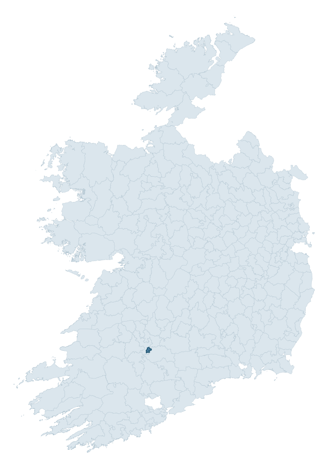
Where this barony sits in the Republic of Ireland
Geology and preservation
Bedrock geology shapes the landscape long before any settlement begins — controlling soil drainage, agricultural potential, the survival of upstanding monuments, and the preservation of buried archaeology. The figures below come from the Geological Survey Ireland 1:100,000 bedrock map.
The bedrock underlying Kilmallock is predominantly limestones (67% of the barony by area), laid down during the Carboniferous period (100% by area, around 359 to 299 million years ago). Limestone is the most heritage-rich bedrock in Ireland. It supports fertile, well-drained soils that favoured dense Early Medieval settlement and Norman manorial agriculture, and it weathers into karst features — sinkholes, caves, swallow holes, and souterrains — that frequently carry archaeology. Where peat overlies limestone, organic preservation can be exceptional. A substantial secondary geology of limestone (33%) adds further variety to the underlying landscape. The single largest mapped unit is the Visean Limestones (undifferentiated) (67% of the barony's bedrock). With only 2 distinct rock types mapped, the barony is geologically uniform compared to the rest of the Republic (7th percentile for diversity) — a single coherent bedrock landscape.
Rock type composition
Largest mapped unit: Visean Limestones (undifferentiated) (67% of the barony)
Placename evidence
The Logainm record for Kilmallock contains only 3 heritage-diagnostic placenames — 3 cill-names. With this few records, the count should be read as indicative rather than as a firm characterisation of the linguistic heritage layers; a larger sample would be needed to reliably distinguish defensive, ecclesiastical, or other stratigraphic signals from chance occurrence.
Early Christian Ecclesiastical
| Root | Count | Meaning |
|---|---|---|
| cill- | 3 | church (early) |
Other baronies in Limerick
- North Liberties
- Coonagh
- Smallcounty
- Glenquin
- Connello Lower
- Pubblebrien
- Kenry
- Coonagh
- Orrery And Kilmore — Cork
- Connello Upper
See all 280 baronies in the Republic of Ireland Heritage Tool.

Explore further
Grounding History: 10 Maps of Northern Ireland’s Past
If you’re interested in Irish heritage more widely, the companion report for Northern Ireland brings together the analysis of all 462 NI wards into one place through 10 high-quality maps — covering monument density, archaeological periods, placename heritage, terrain, wetland, and the historic landscape at first survey. Take a look.
About this profile
Click any section below to expand.
What is a barony?
A barony is a historic administrative unit in Ireland, broadly equivalent to an English hundred. The 280 baronies used here are from the OSi 2019 National Statutory Boundaries (generalised 20m), covering the 26 counties of the Republic of Ireland. Baronies derive from the Norman period, were formalised in the 17th century, and have not been redrawn for statistical purposes. They vary enormously in area, from compact urban baronies in Dublin to vast upland baronies in Connacht, and should not be compared by raw site count without accounting for area differences.
What counts as a site?
This profile combines three distinct heritage registers, each with its own definition of what constitutes a recordable site:
- Archaeological sites (NMS). The National Monuments Service Sites and Monuments Record (SMR) catalogues every known archaeological monument or site of archaeological interest in the Republic, from prehistoric burial mounds and ringforts to medieval churches and post-medieval defensive works. Inclusion does not require legal protection — only that the site has been identified, surveyed, and assessed as having archaeological value. A separate subset of these sites lies within a recorded protection zone, which gives them statutory protection under the National Monuments Acts.
- Listed buildings (NIAH). The National Inventory of Architectural Heritage records buildings of architectural, historical, archaeological, artistic, cultural, scientific, social, or technical interest. Each surveyed structure is appraised on a five-tier scale: International, National, Regional, Local, and Record-Only. The NIAH appraisal is informational rather than strictly statutory, but it underpins local-authority Record of Protected Structures (RPS) listings.
- Heritage placenames (Logainm). Logainm is the authoritative database of Irish placenames maintained by the Placenames Branch. This profile applies a heritage-diagnostic classifier to the Irish-language form of each townland name, flagging roots that signal defensive sites (ráth-, lios-, dún-, caiseal-, cathair-), ecclesiastical foundations (cill-, teampall-, domhnach-, mainistir-), prehistoric burial-ritual features (tuaim-, carn-, leaba-), or Norse-contact settlement (gall-). Townlands without one of these diagnostic roots are not flagged here — they may still carry historical significance, but that significance is not encoded in the name itself.
Editorial principles
The narrative sections of this profile follow several explicit principles:
- Evidential. Every claim about this barony’s heritage character is anchored in the underlying register data. Where a site count, a placename count, or a percentile rank is cited, it is computed from the source datasets at export time, not estimated.
- Comparative. Counts and metrics are reported alongside their percentile rank against the other 279 ROI baronies. A barony with 50 ringforts in absolute terms could be unusually high or unusually low depending on its size and regional context; percentile ranking removes that ambiguity.
- Transparent on limits. Where a register has known coverage gaps, survey biases, or data-quality issues that affect this barony’s figures, the profile flags them rather than presenting the numbers as definitive.
- No interpretation beyond what the data supports. The narrative does not speculate about historical events, social dynamics, or cultural meaning beyond what the recorded heritage and placename evidence directly attests.
Data caveats and limits
- NMS Sites and Monuments Record is the product of survey campaigns conducted at different intensities across different counties and decades. Some baronies have been surveyed more thoroughly than others, and absolute counts should be read in that light. Sites destroyed by development before survey are typically not represented; sites in heavily forested or upland terrain are sometimes under-recorded.
- NIAH coverage is broadly complete for the Republic of Ireland but the survey was conducted on a rolling county-by-county basis, and the most recent appraisal date varies. Buildings demolished or substantially altered after their original survey may still appear in the register; conversely, recent buildings of merit may not yet have been appraised.
- Logainm classification applies a deliberately conservative pattern-matching approach to the Irish-language townland forms. The classifier prioritises true positives over recall: a townland may carry a heritage signal that the classifier doesn’t recognise, particularly where the diagnostic root has been heavily anglicised or where the townland name draws on a less common term. The 60,000+ townland records and ~9,800 classified placenames give a substantial signal at barony scale, but individual townland names should be checked against Logainm directly for definitive interpretation.
- Period attribution. The chronological distribution reflects only those NMS sites that carry a recognised period attribution in the source data. Sites listed as “Unknown” period are excluded from the dated subset.
- Boundary changes. Some baronies have undergone minor boundary adjustments since their 19th-century definition; the OSi 2019 generalised boundaries used here are the current statutory definition and may differ slightly from historical maps in border areas.
- Bedrock geology is mapped at 1:100,000 scale, which means local variation within a barony — small pockets of different rock type, mineral veins, alluvium overlying bedrock — is generalised. The dominant-system and rocktype figures are area-weighted, so a barony reading “70% Carboniferous limestone” may still contain small but archaeologically important pockets of older or younger rock. Around 3% of GSI polygons do not match the lexicon and contribute no rocktype or system attribution.
Data sources
- National Monuments Service — Sites and Monuments Record (SMR) https://data.gov.ie/dataset/national-monuments-service-archaeological-survey-of-ireland
- National Inventory of Architectural Heritage (NIAH) https://data.gov.ie/dataset/national-inventory-of-architectural-heritage-niah-national-dataset
- Logainm — Placenames Database of Ireland https://www.logainm.ie/
- Ordnance Survey Ireland — National Statutory Barony Boundaries 2019 https://data-osi.opendata.arcgis.com/
- EURODEM — European Digital Elevation Model https://www.mapsforeurope.org/datasets/euro-dem
- ESA WorldCover https://esa-worldcover.org/en
- Geological Survey Ireland — 1:100,000 Bedrock Geology https://www.gsi.ie/en-ie/data-and-maps/Pages/Bedrock.aspx
Explore more: Search any of the 280 ROI baronies, browse by historical province, or read the methodology and data sources for the full Republic of Ireland Heritage Tool.