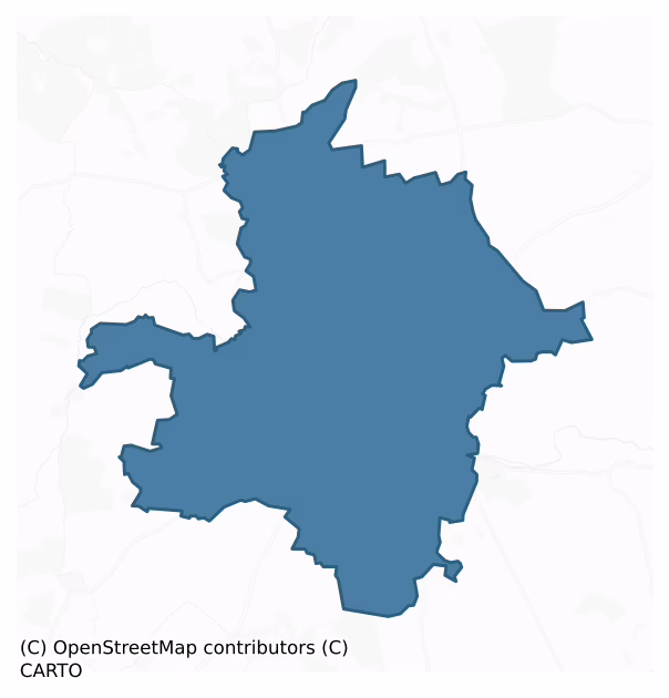
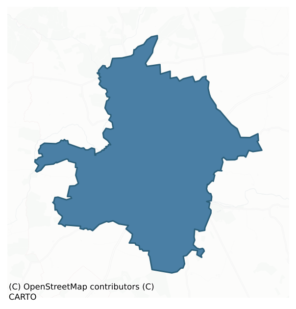
Callan is a barony of County Kilkenny, in the historical province of Leinster (Irish: Callainn), covering 22.9 km² of land. The barony records 92 NMS archaeological sites and 84 NIAH listed buildings, placing it at around the 92nd percentile among 280 ROI baronies for sites per km². This means it is in the top tenth of all baronies for sites per km². Dated archaeological evidence runs from the Middle-Late Bronze Age through to the Post Medieval, spanning 5 of 9 archaeological periods, placing the barony in the 6th percentile among 280 ROI baronies for chronological depth. This means it is in the bottom tenth of all baronies for chronological depth. The largest dated subset of recorded sites dates to the Medieval.
Heritage at a glance
Percentile rankings throughout this profile compare each barony only against the other 279 Republic of Ireland baronies.
The recorded heritage of Callan
The National Monuments Service Sites and Monuments Record (SMR) is the statutory inventory of archaeological sites for the Republic of Ireland, maintained by the Department of Tourism, Culture, Arts, Gaeltacht, Sport and Media. Sites recorded here include earthworks, ringforts, megalithic tombs, ecclesiastical remains, and post-medieval features; not every record is legally protected, but each is registered as a monument of archaeological interest.
The National Monuments Service records 92 archaeological sites in Callan, putting it at the 92nd percentile among 280 ROI baronies for sites per km². This means it is in the top tenth of all baronies for sites per km². Protection coverage is near-universal — 91 sites (99%) fall within a recorded monument protection zone, indicating an extensively surveyed landscape. The dominant category is ecclesiastical sites — churches, graveyards, and holy wells (45 sites, 49% of the record). Graveslab is the most prevalent type, making up 41% of the barony's recorded sites (38 records) — well above the ROI average of 4% across all baronies where this type occurs. Graveslab is a recumbent grave-marking slab, dated 1200–1700 AD. Other significant types include Castle – tower house (5) and Church (3). Castle – tower house is a fortified residential tower of four or five storeys, mostly built by lords in the 15th and 16th centuries and often within a defended bawn; Church is a building used for public Christian worship, of any date from c. 500 AD onwards. Across the barony's 22.9 km², this gives a recorded density of 4.03 sites per km².
Most common monument types
Hover or tap a monument type to see its definition.
| Type | Count |
|---|---|
| Graveslab a recumbent grave-marking slab, dated 1200–1700 AD | 38 |
| Castle – tower house a fortified residential tower of four or five storeys, mostly built by lords in the 15th and 16th centuries and often within a defended bawn | 5 |
| Church a building used for public Christian worship, of any date from c. 500 AD onwards | 3 |
| Bridge a built structure spanning a river or ravine to allow crossing, dated medieval onwards | 3 |
| Graveyard a burial area associated with a church, in use from the medieval period onwards | 2 |
| Ritual site – holy well a well or spring traditionally associated with a saint, often credited with healing properties; many trace earlier ritual origins but devotion is documented from the medieval period onwards | 2 |
Chronological distribution
The dated archaeological record for Callan spans from the Middle-Late Bronze Age through to the Post Medieval, with activity attested across 5 of 9 archaeological periods. This is the 6th percentile across ROI baronies — a relatively narrow chronological band, with much of Irish prehistory not represented in the dated record. Activity concentrates most heavily in the Medieval (38 sites, 78% of dated material), with the Early Medieval forming a secondary peak (6 sites, 12%). A further 43 recorded sites (47% of the overall NMS register for the barony) carry no period attribution — appearing as 'Unknown' in the bar chart below. This typically reflects either records that pre-date the standardised period vocabulary or sites awaiting specialist dating review, rather than a genuine absence of chronological evidence.
Sample of recorded monuments
Show 25 sample monuments (of 92 total)
A representative sample of 25 recorded monuments drawn from the barony’s 92 total NMS entries. Sites within a recorded monument protection zone and rarer site types are prioritised so the list shows a meaningful cross-section rather than only the most common type. Each entry shows the official Sites and Monuments Record reference number and the description published by the National Monuments Service.
Enclosure
In flat pasture. Identified as the circular cropmark of an enclosure (diam. c. 40m) on an aerial photograph (CUCAP AVO096; 17 July 1968). There is no visible trace of the enclosure at ground level.
See…
In flat pasture. Identified as the circular cropmark of an enclosure (diam. c. 40m) on an aerial photograph (CUCAP AVO096; 17 July 1968). There is no visible trace of the enclosure at ground level.
See attached:
KK022-022—-_01 CUCAP (AVO096, 17 July 1968)
Compiled by: Jean Farrelly
Date of upload: 24 May 2021
Castle – unclassified
It is likely that there was a castle (KK026-002—-), perhaps a tower house and bawn, at Westcourt Demesne. According to Carrigan (1905, vol. 3, 317), ‘Westcourt Castle, of which some traces remain at Westcourt Ho., was…
It is likely that there was a castle (KK026-002—-), perhaps a tower house and bawn, at Westcourt Demesne. According to Carrigan (1905, vol. 3, 317), ‘Westcourt Castle, of which some traces remain at Westcourt Ho., was the old manor house of Callan. It passed from the descendants of Earl Marshall to the Earl of Ormond in 1391; from the Ormond family to Lord Desart, about 1700; and from Lord Desart to George Agar, Lord Callan, during the second half of the 18th century. Mr. Thomas Shelly believes that this castle of Westcourt was the strong Butler castle of Callan, mentioned in connection with the siege of Callan by the Cromwellians in 1650’.
A large house (KK026-023—-), which appears to be Westcourt House, is indicated on the Down Survey (1655-6) parish map of ‘A Survey of the Liberties of Callan by George Marshall an exact copy by Dan[ie]l O Brien Surv[eyo]r’ within the 17th-century townland of ‘Whitescourte’ (Hibernia Regnum, courtesy of Trinity College Dublin). This house possibly incorporated the earlier castle.
Carrigan notes that, ‘Following the death of the owner, John Galwey, in 1793, ‘Lord Callan threw down the old Westcourt manor Ho. Or Castle, and replaced it by the present handsome mansion known as Westcourt Ho.’ (1905, vol. 3, 318).
In c. 1940 there was a catastrophic fire at West Court house and the house was abandoned and later knocked (Ó Drisceoil 2014, 6). Ó Drisceoil noted that the, ‘rubble heap to the west of the walled garden marks the location o…
Castle – ringwork
On an E-facing slope. A roughly square enclosure (dims. c. 50m N-S; c. 53m E-W) with rounded corners, defined by a bank and broad deep U-shaped fosse (D c. 2m; Wth 4m). A townland boundary ran roughly N-S along the E…
On an E-facing slope. A roughly square enclosure (dims. c. 50m N-S; c. 53m E-W) with rounded corners, defined by a bank and broad deep U-shaped fosse (D c. 2m; Wth 4m). A townland boundary ran roughly N-S along the E side and another ran along the public road which formerly skirted the S edge of the monument. In 1974 a new Callan-Kilkenny road was constructed across the centre of the monument from NE-SW, by which time the enclosure had been levelled by ploughing (Sutton 1974, 18). Archaeological investigations were carried out which revealed that an extensive area of the interior had been cobbled (ibid.). There was a well (D 3m) built of dry-stone walling in the SE quadrant and the base of a stone and mortar tower (int. dims. < 2m) were found in the fosse in the NE quadrant (ibid.). The excavator noted two phases of habitation, the earliest dating to the 13th-century based on pottery finds, while, ‘structural and material finds suggest that secondary habitation of the site occurred in late or post medieval times’ (ibid.). The 13th-century date for the primary occupation suggests that this is an Anglo-Norman earthwork, possibly a ringwork.
Compiled by: Jean Farrelly
Date of upload: 9 May 2022
Coffin-resting stone
This area is known as 'heaven', a place where coffins are rested (pers. comm. Joe Kennedy 1986). The resting place is at a junction of several field boundaries and is associated with a Mass path.
Compiled by: Jean…
This area is known as 'heaven', a place where coffins are rested (pers. comm. Joe Kennedy 1986). The resting place is at a junction of several field boundaries and is associated with a Mass path.
Compiled by: Jean Farrelly
Date of upload: 9 May 2022
Historic town
The medieval town of Callan, located 15km SW of Kilkenny, was situated primarily on the S bank of the NW-SE flowing Kings River (formerly the River Rye), with a northern suburb across the river, between the manorial…
The medieval town of Callan, located 15km SW of Kilkenny, was situated primarily on the S bank of the NW-SE flowing Kings River (formerly the River Rye), with a northern suburb across the river, between the manorial demesne to the W, with its motte and bailey (KK026-010009-), and the Augustinian Friary (KK026-010016-) to the E. Thomas (1992, vol. 2, 31) suggests that the town began life as a castle settlement which then spread to the less restricted space S of the river.
The town owes it origins to William Marshal, earl of Pembroke and lord of Leinster between 1190 and 1219, who granted the town a charter in 1217 (Carrigan 1905, vol. 3, 292). The town was burned in 1286 and again in 1317, during the Bruce invasion, at which time the town charter was also burnt (ibid.; Curtis 1934, 362-3). By the 14th century the town must have been of significant stature as in 1344, ‘a Parliament was summoned to meet at Callan, to which came Maurice fitz Thomas Fitzgerald, Earl of Desmond, bringing with him several thousand men; but the King, fearing that evil instead of good would result therefrom, issued an edict prohibiting the magnates of the country from attending the said Parliament’ (Carrigan 1905, vol. 3, 292).
In 1388, letters patent of Richard II grant to Lord Thomas de Ferrars and Lady Anne la Despenser, ‘thirty-three librates [land worth £1 a year], fifteen solidates [gold coins] and three denariates [silver coins] of rents from Callan and the advowson of the church there’ (…
Battery
Indicated on Thomas Stuish's map of 1681 as, 'Cromels Battery' (Manning 1998, 69, fig. 13). According to Carrigan (1905, vol. 3, 317), following a description of the motte at Callan (KK026-010009-), ‘At the opposite end…
Indicated on Thomas Stuish's map of 1681 as, 'Cromels Battery' (Manning 1998, 69, fig. 13). According to Carrigan (1905, vol. 3, 317), following a description of the motte at Callan (KK026-010009-), ‘At the opposite end of the town, there was a smaller Moat about 10 ft. [c. 3m] high, and known as Cromwell’s Moat; it stood partly within the Fair Green, and partly on the track of the present road to Cooliagh; it was levelled about 1850’. According to Kennedy (1984, 49), the battery was levelled, 'early in the nin[e]teenth-century by the then Callan corporation during the enclosing of the fair green area by a wall'. Walsh (1952, 17) mentions that this mound was so named, ‘because it was used by him [Cromwell] to cover his attack by cannon on the East wall and gate of the town. Human bones, horses’ bones, horses’ shoes, pistols and other accoutrements of war were dug up near this town wall in the beginning of the 19th century. This smaller moat was built on the south side of the Fair Green and was demolished a century ago. Nothing of importance was found in its construction. Some sixty years ago a well-known Callan archaeologist, the late Mr. Thomas Shelly, had excavations carried out on this moat. There is still evidence of this on the north side. He found traces of masonry and stone wall construction’. Though not indicated on the 1st (1839) ed. OS 6-inch map, there is a trigonometrical station '280 ft.' marked in the likely position of the battery, and it may have been locat…
Cross – Market cross
At the intersection of Green Street and Upper Bridge Street, running N-S, with West Street and Mill Street, running E-W. Kennedy (1990, 294) notes that there were two market days per week in Callan, on Wednesdays and…
At the intersection of Green Street and Upper Bridge Street, running N-S, with West Street and Mill Street, running E-W. Kennedy (1990, 294) notes that there were two market days per week in Callan, on Wednesdays and Saturdays, which were authorised by a royal charter granted in the year 1568 by Queen Elizabeth I. The cross is indicated on an estate map by Thomas Stuish dating to 1681 (Farrelly et al. 1993, 62; National Archives M2841). According to Carrigan (1905, vol. 3, 296), the market cross was still standing towards the end of the 18th century. He quotes the author of a 'Tour in Ireland in 1779', who described the cross as having, 'a square glass lanthorn that gives light in the night to travellers that come from the four cardinal points of the compass' (ibid.). The date of its removal and its present location are unknown.
Compiled by: Jean Farrelly
Date of upload: 17 May 2022
Town defences
The medieval town of Callan, located 15km SW of Kilkenny, was situated primarily on the S bank of the NW-SE flowing Kings River (formerly the River Rye), with a northern suburb across the river, between the manorial…
The medieval town of Callan, located 15km SW of Kilkenny, was situated primarily on the S bank of the NW-SE flowing Kings River (formerly the River Rye), with a northern suburb across the river, between the manorial demesne to the W, with its motte and bailey (KK026-010009-), and the Augustinian Friary (KK026-010016-) to the E.
There is no surviving evidence of a town wall, however, there are references and cartographic evidence of town gates to the E, S and W gate, the locations of which would suggest that Callan was a very large town of c. 34 hectares, as well as an inner or ‘midle’ gate, possibly ‘Skerry’s Castle’ (KK026-010008-), on West Street which hints at a possible inner town defence (Thomas 1992, vol. 2, 30-31). Cartographic evidence shows that the S town boundary ran along Lower Green Lane (previous called Fair Green Lane and Cuddy’s Lane) to the SE and Chapel Lane to the SW (Manning 1998, 63). Archaeological excavations (licence no. 01E0014) on Lower Green (Fair Green) Lane revealed two fosses which appear to be part southern town defences (Elliott 2002).
According to Carrigan (1905, vol. 3, 292), Callan’s town walls were constructed in the 15th century but, ‘of the enclosing wall (with its cleemoore, or fosse) only a small fragment remains, at the east end of Mill-Street (formerly East St.)’. There are numerous references to castles in Callan, some were probably urban tower houses while others may be associated with town gates (Carrigan 1905, vol. 3, 296)….
Castle – motte and bailey
On the flat flood plain c. 50m N of Kings River and N of the town of Callan (KK026-010—) which lies immediately S of the river, in pasture. The sides and much of the top of the motte are overgrown with trees, scrub…
On the flat flood plain c. 50m N of Kings River and N of the town of Callan (KK026-010—) which lies immediately S of the river, in pasture. The sides and much of the top of the motte are overgrown with trees, scrub and brambles. There are good views in all directions. The motte was probably built by William Marshall (died 1219), who is credited with founding the town, probably utilising a natural ridge which was augmented. The construction is likely to have been built under the supervision of one of Marshall’s stewards, possibly Geoffry Fitz Robert, who built the motte at Kells (Clutterbuck et al. 2006, 9). Orpen (1909, 319-20) relates that in 1247, ‘the castle and vill, with appurtenances, went with Kilkenny as part of Isabella Marshal’s share, and were granted to her son Richard de Clare, earl of Gloucester and Hertford’. In an extent of the manor of Callan, taken in 1307, ‘upon the death of Joan, Countess of Gloucester and Hertford, when the jurors found that “there was there a castle in which there was a hall constructed of wood, with wooden shingles, a stone chamber, a kitchen, and other wooden chambers”’ (ibid.).
The area around the motte appears to have been utilised for gardening by the 16th century, as illustrated in a 1539 lease in the Ormond Deeds, where the Earl of Ormond grants to ‘Rose Hedyn, widow, and Piers Herforde’s children…two messuages [a house with outbuildings and a parcel of land/yard] …said messuages and a garden by the ‘mothe’ [motte] with 17…
Font
In the SW corner of the chancel of St Mary's medieval parish church (KK026-010012-), Callan. A square limestone font (total H including supports and pedestal 1m; font H 0.37m; Wth 0.84m) with a circular basin and…
In the SW corner of the chancel of St Mary's medieval parish church (KK026-010012-), Callan. A square limestone font (total H including supports and pedestal 1m; font H 0.37m; Wth 0.84m) with a circular basin and central drain hole. There are nine Gothic flutes on each side and one bevelling at each angle (Pike 1989, 576-7). The font rests on a wide central column, with four slender columns under each angle, all on a square pedestal with chamfered angles.
This font is one of a series of similarly decorated fonts, described by Pike as the Ossory Fonts (ibid. 572-82). According to Pike the fonts decorated with rounded flutes are the earliest examples, probably dating from the 12th century, while those decorated with pointed (Gothic) flutes, such as that at Callan, are about a century later in date (ibid. 572-3).
See attached photograph:
KK026-010013-_01 From E (Urban Archaeological Survey, October 1992)
Compiled by: Jean Farrelly
Date of upload: 29 June 2022
Religious house – Augustinian friars
On the flat flood plain on the N bank of the Kings River, immediately N of Callan town (KK026-010—-) and c. 200m E of the motte and bailey (KK026-010009-). The petition for the foundation of an Augustinian monastery…
On the flat flood plain on the N bank of the Kings River, immediately N of Callan town (KK026-010—-) and c. 200m E of the motte and bailey (KK026-010009-). The petition for the foundation of an Augustinian monastery at Callan was instigated by Edmund Butler, and granted by Pope Pius II in 1461. However, following Edmund’s defeat in a battle in 1462 it appears that James, his eldest son, became the founder instead and, as such, was buried in the friary in 1487 (Gwynn and Hadcock 1988, 297). The foundation was probably built in the late 1460s. Carrigan (ibid. 312) notes that James had been living in concubinage with his relative Syve Kavanagh, and that having received a Papal dispensation which enabled him to marry her in 1467, he went on to found this religious house in reparation for his sinful past, in c. 1468-69. Also in 1472 the Observant reform was introduced, the friary being placed directly under the prior general and declared independent of the English provincial, so it must have been in existence for at least a few years prior to this date (Carrigan 1905, vol. 3, 311; Gwynn and Hadcock 1988, 297). In 1479 Callan became the centre of the Irish Observant Congregation (Gwynn and Hadcock 1988, 297). Until the Dissolution of the Monasteries in 1540, the friary was noted, ‘for its learned community; its library rich in manuscripts and possessing duplicates of all the rare books in the library of the Abbey of Jerpoint; for the richness of its church utensils; but above…
House – 17th century
It is likely that there was a castle (KK026-002—-), perhaps a tower house and bawn, at Westcourt Demesne. According to Carrigan (1905, vol. 3, 317), ‘Westcourt Castle, of which some traces remain at Westcourt Ho., was…
It is likely that there was a castle (KK026-002—-), perhaps a tower house and bawn, at Westcourt Demesne. According to Carrigan (1905, vol. 3, 317), ‘Westcourt Castle, of which some traces remain at Westcourt Ho., was the old manor house of Callan. It passed from the descendants of Earl Marshall to the Earl of Ormond in 1391; from the Ormond family to Lord Desart, about 1700; and from Lord Desart to George Agar, Lord Callan, during the second half of the 18th century. Mr. Thomas Shelly believes that this castle of Westcourt was the strong Butler castle of Callan, mentioned in connection with the siege of Callan by the Cromwellians in 1650’.
A large house (KK026-023—-), which appears to be Westcourt House, is indicated on the Down Survey (1655-6) parish map of ‘A Survey of the Liberties of Callan by George Marshall an exact copy by Dan[ie]l O Brien Surv[eyo]r’ within the 17th-century townland of ‘Whitescourte’ (Hibernia Regnum, courtesy of Trinity College Dublin). This house possibly incorporated the earlier castle.
Carrigan notes that, ‘Following the death of the owner, John Galwey, in 1793, ‘Lord Callan threw down the old Westcourt manor Ho. Or Castle, and replaced it by the present handsome mansion known as Westcourt Ho.’ (1905, vol. 3, 318).
In c. 1940 there was a catastrophic fire at West Court house and the house was abandoned and later knocked (Ó Drisceoil 2014, 6). Ó Drisceoil noted that the, ‘rubble heap to the west of the walled garden marks the location o…
Well
On the S bank of the Kilbride River, at the base of the scarp which drops to flood-plain of the river, in rough pasture. The river runs roughly E-W c. 25m to the N. Carrigan (1905, vol. 3, 321) describes this as, 'a…
On the S bank of the Kilbride River, at the base of the scarp which drops to flood-plain of the river, in rough pasture. The river runs roughly E-W c. 25m to the N. Carrigan (1905, vol. 3, 321) describes this as, 'a fine well, not accounted holy, and known as Tobarnaskeha or Well of the White-thorn tree'. According to local information the well is now gone.
Kiln
In Callan, c. 30m N of the bailey which lies E of the motte (KK026-010009-). A millrace associated with a watermill (KK026-010021-) runs E-W c. 12m to the N.
A geophysical and topographical survey of the motte and…
In Callan, c. 30m N of the bailey which lies E of the motte (KK026-010009-). A millrace associated with a watermill (KK026-010021-) runs E-W c. 12m to the N.
A geophysical and topographical survey of the motte and bailey and surrounding area was carried out in 2002 (Clutterbuck et al. 2006, 7-28). This revealed several anomalies including a possible kiln (Wth c. 7m) and a possible forge (furnace) (KK026-010086-) c. 20m to the NW (ibid. 12-21, 24).
See attached illustration:
KK026-010085-_01 Interpretative reconstruction plan of geophysical results and historical sources (Clutterbuck, Elliot and Shanahan 2006, 21, fig. 10)
Compiled by: Jean Farrelly
Date of upload: 29 June 2022
Forge
In Callan, c. 40m N of the bailey which lies E of the motte (KK026-010009-). A millrace associated with a watermill (KK026-010021-) runs E-W c. 9m to the N.
A geophysical and topographical survey of the motte and…
In Callan, c. 40m N of the bailey which lies E of the motte (KK026-010009-). A millrace associated with a watermill (KK026-010021-) runs E-W c. 9m to the N.
A geophysical and topographical survey of the motte and bailey and surrounding area was carried out in 2002 (Clutterbuck et al. 2006, 7-28). This revealed several anomalies including a possible furnace (Wth c. 5m), interpreted as a forge, and a possible kiln (KK026-010085-) c. 20m to the SE (ibid. 12-21, 24).
See attached illustration:
KK026-010086-_01 Interpretative reconstruction plan of geophysical results and historical sources (Clutterbuck, Elliot and Shanahan 2006, 21, fig. 10)
Compiled by: Jean Farrelly
Date of upload: 29 June 2022
Fulacht fia
On a SE-facing slope, in boggy terrain, now reclaimed pasture. A slight mound (diam. c. 10m) comprised of burnt stone and charcoal.
Compiled by: Jean Farrelly
Date of upload: 12 July 1989
Architectural fragment
Lying loose in the chancel of St Mary’s parish church (KK026-010012-), Callan. There are a number of architectural fragments. Some of the fragments may be from wall monuments or funerary monuments, including a…
Lying loose in the chancel of St Mary’s parish church (KK026-010012-), Callan. There are a number of architectural fragments. Some of the fragments may be from wall monuments or funerary monuments, including a rectangular limestone block (H 0.57m; Wth 0.48m; T 0.19m) possibly portion of a wall monument decorated in false relief with an interlace monogram IHC; a rectangular limestone block (H 0.22m; Wth 0.24m; D 0.18m) possibly portion of a entablature from a wall monument, decorated with a raised lozenge on each of the three decorated sides; a small fragment (L 0.28m; H 0.18m; D 0.11m) possibly portion of a chest tomb panel decorated with the lower part of a flowing robe and to the left of it a column; a moulded plinth (L 0.85m; D 0.55m; H 0.2m); an engaged corbel with punch tooling (L 0.14m; Wth 0.15m; H 0.44m) projecting from a rectangular block of stone (D 0.44m; Wth 0.26m; H 0.44m); a fragment of tracery (H 0.22m; Wth 0.24m) and a pyramidal limestone piece (H 0.4m; Wth 0.3m) with punch tooling within plain margins.
Compiled by: Jean Farrelly
Date of upload: 11 December 2019
Ritual site – holy well
On the flat flood plain of the Kings River which flows c. 35m S of the well. The Augustinian friary (KK026-010016-) of Callan is located c. 60m to the N. Indicated on the 6-inch OS map as 'St. Augustine's Well'. It is a…
On the flat flood plain of the Kings River which flows c. 35m S of the well. The Augustinian friary (KK026-010016-) of Callan is located c. 60m to the N. Indicated on the 6-inch OS map as 'St. Augustine's Well'. It is a clear spring well surrounded by a stone wall (dims. 3m x 4.63m), with an entrance on the S side. At the entrance the water flows over a limestone gutter-spout (KK026-010019-) which may have come from the friary. There is no evidence of veneration. The well water flows southward into the Kings River.
See attached photographs:
KK026-010018-_01 From S (Urban Archaeological Survey, October 1992)
KK026-010018-_01 From SW (Urban Archaeological Survey, October 1992)
Compiled by: Jean Farrelly
Date of upload: 21 October 2019
Architectural fragment
Incorporated into the entrance of 'St. Augustine's Well' (KK026-010018-) which is c. 60m S of the Augustinian friary (KK026-010016-) of Callan and c. 35m N of the Kings River. At the entrance to the holy well the water…
Incorporated into the entrance of 'St. Augustine's Well' (KK026-010018-) which is c. 60m S of the Augustinian friary (KK026-010016-) of Callan and c. 35m N of the Kings River. At the entrance to the holy well the water flows over a limestone gutter-spout (dims. 0.58m x 0.35m; T 0.12m) which may have come from the friary.
Compiled by: Jean Farrelly
Date of upload: 21 October 2019
Water mill – vertical-wheeled
Indicated as a 'Mill' on the 1st (1839) ed. OS 6-inch map on a long mill race which runs NE and E from the Kings River, c. 1.1km to the W and rejoins the river c. 80m S of the mill. The mill is c. 100m NW of the…
Indicated as a 'Mill' on the 1st (1839) ed. OS 6-inch map on a long mill race which runs NE and E from the Kings River, c. 1.1km to the W and rejoins the river c. 80m S of the mill. The mill is c. 100m NW of the Augustinian Friary (KK026-010016-).
A Down Survey (1655-6) map, ‘A Survey of the Liberties of Callan by George Marshall an exact copy by Dan[ie]l O Brien Surv[eyo]r’ (Hibernia Regnum, courtesy of Trinity College Dublin) indicates two watermills associated with Callan, one (KK026-010021-) N of the Kings River and the other (KK026-010022-) S of the river just outside the E end of the town. A century earlier, in 1556, Thomas, Earl of Ormond, grants to Sir William Wheelane, priest, ‘two water mills at Callan, one within the town and one without’ (Curtis 1941, vol. 5, 84, deed 48).
It would seem that the mill S of the river originally belonged to the Augustinians and was known in the 16th century as the ‘new mill’ (Curtis 1941, vol. 5, 293, deed 305; Moran 1876, 302-03).
The mill on the N side of the river therefore must be the mill referred to in the Ormond Deeds as the ‘old mill’. A transaction in 1539 refers to two properties in the town, one lying, ‘by the Earl’s mill called the Old Mill’ (Curtis 1937, vol. 4, 181, deed 225). The ‘old mill’ is also mentioned in a lease of 1562 (Curtis 1941, vol. 5, deed 116). It is possible that this mill formerly served the monastery but it is also just as likely to have been a manorial mill, with the mill race running only c….
Water mill – vertical-wheeled
Indicated as a ‘Flour Mill’ on the 1st (1839) ed. OS 6-inch map and a ‘Saw Mill’ on the 1948 revision, on the S bank of the Kings River, c. 60-80m E of the medieval town of Callan.
A Down Survey (1655-6) map, ‘A Survey…
Indicated as a ‘Flour Mill’ on the 1st (1839) ed. OS 6-inch map and a ‘Saw Mill’ on the 1948 revision, on the S bank of the Kings River, c. 60-80m E of the medieval town of Callan.
A Down Survey (1655-6) map, ‘A Survey of the Liberties of Callan by George Marshall an exact copy by Dan[ie]l O Brien Surv[eyo]r’ (Hibernia Regnum, courtesy of Trinity College Dublin) indicates two watermills associated with Callan, one (KK026-010021-) N of the Kings River and the other (KK026-010022-) S of the river just outside the E end of the town. A century earlier, in 1556, Thomas, Earl of Ormond, grants to Sir William Wheelane, priest, ‘two water mills at Callan, one within the town and one without’ (Curtis 1941, vol. 5, 84, deed 48).
Immediately N of the mill, there is a thin island (L c. 90m; max. Wth c. 10m) in the river which seems to be that referred to in a deed of 1578, whereby Thomas, Earl of Ormond, grants to Edmund Butler fitz Theobald, ‘the Inche or Iland on the east side of the mill called the new mill in the borough of Callan, lying between the course of the water running from the new mill and the old course of the river or water of the Rye, said inch being now sown with corn’ (Curtis 1941, vol. 5, 293, deed 305). This mill appears to have belonged to the Augustinian friary (KK026-010016-) as when the monastery was surrendered in 1540 it included, ‘a water-mill, then in ruins, and called the New Mill, and a small parcel of pasture ground adjacent, called the Inch, being hal…
Graveyard
The Kilbride River flows roughly E-W c. 40m S of the graveyard and the holy well, 'Toberbride' is located c. 30m to the SSE. A roughly rectangular graveyard (dims. c. 60m N-S and c. 53m E-W at N, narrowing to c. 38m at…
The Kilbride River flows roughly E-W c. 40m S of the graveyard and the holy well, 'Toberbride' is located c. 30m to the SSE. A roughly rectangular graveyard (dims. c. 60m N-S and c. 53m E-W at N, narrowing to c. 38m at S), on raised ground, defined by a stone wall, with a townland boundary running c. 7m S of and parallel to the S side. The Callan-Clonmel road formerly ran along the E side but has been bypassed. The modern graveyard extends to the N and W.
According to Hogan (1860-61, 361), ‘The chapel of Cill-Bhrighde was an ancient church, the site of which is still a place of great sepulture, known as Kilbride’ and was ‘the ancient parochial church of the district’. When the parish church was established in Callan, the church at Kilbride became ‘a chapel of ease’ (ibid.). The church (KK026-013001-) is not visible at ground level. Carrigan (1905, vol. 3, 319) notes that there are no pre-1700 funerary monuments in the associated graveyard.
Carrigan (ibid. 320-21) describes a pattern which was held at Kilbride graveyard on St Bridget’s feast day, the 1st of February, till the beginning of the 19th century: ‘It was attended by all the people for miles around, in holiday attire, the richer portion bringing basketfuls of bread and butter (called manchaine, or bread of lamentation), for distribution among the poor, who in return, were expected to pray for the donor’s deceased friends. Other features of this celebration were the dressing of the graves with box and laurel and…
Ritual site – holy well
The Kilbride River flows roughly E-W c. 15m S of the holy well and the medieval church (KK026-013001-) and graveyard (KK026-013002-) of St Bridget are located c. 16m to the N.
Carrigan (ibid. 320-21) describes a…
The Kilbride River flows roughly E-W c. 15m S of the holy well and the medieval church (KK026-013001-) and graveyard (KK026-013002-) of St Bridget are located c. 16m to the N.
Carrigan (ibid. 320-21) describes a pattern which was held at Kilbride graveyard on St Bridget’s feast day, the 1st of February, till the beginning of the 19th century and which included, 'the pilgrimage and prayers at St. Bridget’s holy well’.
Compiled by: Jean Farrelly
Date of upload: 10 May 2022
Graveyard
Centrally placed within the walled town of Callan (KK026-010—-), at the junction of Green Street (formerly South Street) and Mill Street (formerly East Street). A roughly square graveyard (dims. c. 70m NNE-SSW; c. 78m…
Centrally placed within the walled town of Callan (KK026-010—-), at the junction of Green Street (formerly South Street) and Mill Street (formerly East Street). A roughly square graveyard (dims. c. 70m NNE-SSW; c. 78m WNW-ESE) associated with the medieval parish church of St Mary’s (KK026-010012-) occupying the SE angle of the main crossroads in the town. The parish church was founded in the 13th century by William Marshall (died 1219), (Carrigan 1905, vol. 3, 297).
Compiled by: Jean Farrelly
Date of upload: 27 June 2022
Graveslab
In the chancel of the Augustinian friary (KK026-010016-) in Callan, lying face down near the E gable. A central portion of a limestone slab (L 1.05m; Wth at top 0.78m; Wth towards base Wth 0.73m; T 0.14m) which appears…
In the chancel of the Augustinian friary (KK026-010016-) in Callan, lying face down near the E gable. A central portion of a limestone slab (L 1.05m; Wth at top 0.78m; Wth towards base Wth 0.73m; T 0.14m) which appears to be tapering slightly towards the base. The sides of the slab are straight and roughly dressed. This is likely to be the described by Carrigan (1905, vol. 3, 313) as, 'a fragment of a floor-slab, with raised cross. The inscription, which is raised Old English and perfectly legible, runs round the edge, beginning in the middle, at the right side of the cross, and being continued on the top, now missing, and thence down the left side. What remains of now is: Hic i………….[mcccc]lxxxxix & frater Ricard O'Knavy. A small fragment of this same tomb, with the words "cu ani," may be seen at the present Augustinian Convent. Translation:- Here lie ………1499, and Brother Richard O'Knavyn….. On whose soul……….. . The Irish name O'Knavyn, is now sometimes anglicised Bowen, cnamh [cnámh] being the Irish for a bone'.
Compiled by: Jean Farrelly
Date of upload: 21 October 2019
Listed buildings
The National Inventory of Architectural Heritage (NIAH) is a state survey appraising buildings of architectural, historical, archaeological, artistic, cultural, scientific, social, or technical interest. Each surveyed structure receives a rating from International (the highest, for buildings of European importance) through National, Regional, Local, and Record-Only.
The NIAH records 84 listed buildings in Callan (44th percentile across ROI baronies). The highest-graded structures include 2 of National significance. The Republic holds 937 National-graded buildings in total, so this barony accounts for around 0% of the national total. Construction dates concentrate most heavily in the Victorian (1830-1900) period. The most-recorded building type is house (42 examples, 50% of the listed stock).
Terrain and environment
Mean elevation across the barony is 73m — the 34th percentile among 280 ROI baronies for elevation. This means it is in the lower half of all baronies for elevation. Elevation matters for heritage because higher-altitude baronies typically favour defensive monuments — ringforts and hilltop forts placed on prominent ground — while lowland baronies are more likely to carry the dense settlement and church networks of intensive agricultural landscapes. Mean slope is 1.7° — the 0th percentile among 280 ROI baronies for slope. This means it is in the bottom tenth of all baronies for slope. This is broadly flat terrain, the kind of landscape best suited to intensive agriculture. Slope is a key control on both land use and archaeological preservation: steep ground resists ploughing and tends to preserve earthworks intact, while gentle slopes favour intensive cultivation that damages or destroys surface archaeology over time. The Topographic Wetness Index averages 12.0, the 99th percentile among 280 ROI baronies for wetness. This means it is in the top tenth of all baronies for wetness. This is wet, slow-draining ground by ROI standards — the kind of landscape that may carry waterlogged archaeological sites of unusual preservation value. Drainage matters for heritage because poorly-drained ground preserves organic archaeology (wooden trackways, leather, textiles, and on rare occasions human remains) far better than free-draining soil; well-drained ground favours arable use but destroys organic material rapidly. The land-cover mosaic combines improved grassland (85%), woodland (6%), and arable farmland (6%), giving a mixed agricultural and semi-natural landscape.
Terrain measurements
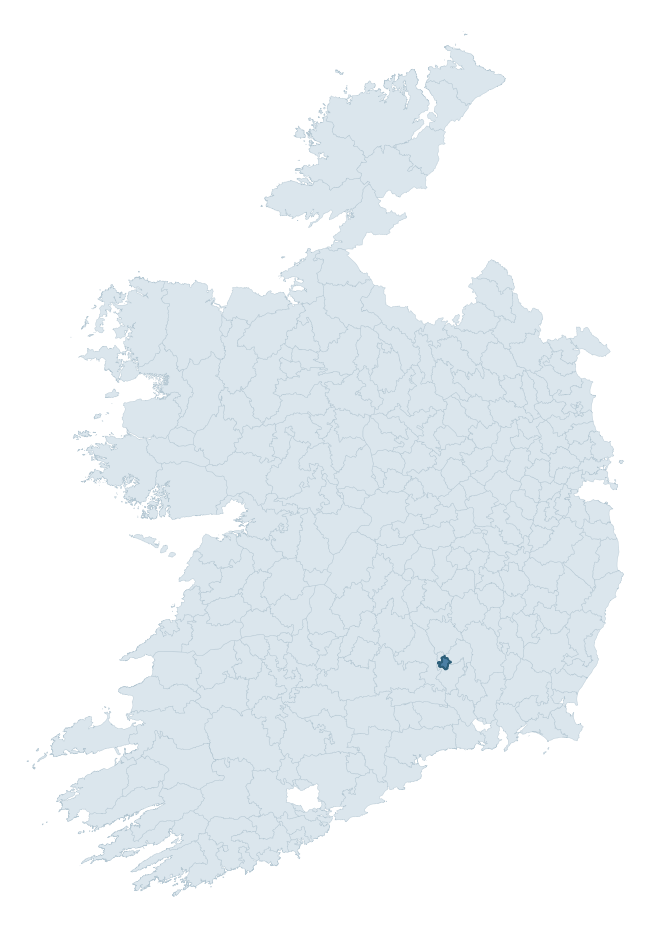
Where this barony sits in the Republic of Ireland
Geology and preservation
Bedrock geology shapes the landscape long before any settlement begins — controlling soil drainage, agricultural potential, the survival of upstanding monuments, and the preservation of buried archaeology. The figures below come from the Geological Survey Ireland 1:100,000 bedrock map.
The bedrock underlying Callan is predominantly dark shaly micrite, peloidal limestone (46% of the barony by area), laid down during the Carboniferous period (100% by area, around 359 to 299 million years ago). A substantial secondary geology of limestone (44%) and dolomitisd limestones (10%) adds further variety to the underlying landscape. The single largest mapped unit is the Aghmacart Formation (46% of the barony's bedrock).
Rock type composition
Largest mapped unit: Aghmacart Formation (46% of the barony)
Placename evidence
Logainm records 5 heritage-diagnostic placenames for Callan, a modest sample drawn predominantly from the townland record. The dominant stratum is early christian ecclesiastical. The most frequent diagnostic roots are cill- (4) and ráth- (1). With a sample of this size the count should be treated as indicative rather than definitive.
Pre-Christian / Early Medieval Defensive
| Root | Count | Meaning |
|---|---|---|
| ráth- | 1 | earthen ringfort |
Early Christian Ecclesiastical
| Root | Count | Meaning |
|---|---|---|
| cill- | 4 | church (early) |
Other baronies in Kilkenny

Explore further
Grounding History: 10 Maps of Northern Ireland’s Past
If you’re interested in Irish heritage more widely, the companion report for Northern Ireland brings together the analysis of all 462 NI wards into one place through 10 high-quality maps — covering monument density, archaeological periods, placename heritage, terrain, wetland, and the historic landscape at first survey. Take a look.
About this profile
Click any section below to expand.
What is a barony?
A barony is a historic administrative unit in Ireland, broadly equivalent to an English hundred. The 280 baronies used here are from the OSi 2019 National Statutory Boundaries (generalised 20m), covering the 26 counties of the Republic of Ireland. Baronies derive from the Norman period, were formalised in the 17th century, and have not been redrawn for statistical purposes. They vary enormously in area, from compact urban baronies in Dublin to vast upland baronies in Connacht, and should not be compared by raw site count without accounting for area differences.
What counts as a site?
This profile combines three distinct heritage registers, each with its own definition of what constitutes a recordable site:
- Archaeological sites (NMS). The National Monuments Service Sites and Monuments Record (SMR) catalogues every known archaeological monument or site of archaeological interest in the Republic, from prehistoric burial mounds and ringforts to medieval churches and post-medieval defensive works. Inclusion does not require legal protection — only that the site has been identified, surveyed, and assessed as having archaeological value. A separate subset of these sites lies within a recorded protection zone, which gives them statutory protection under the National Monuments Acts.
- Listed buildings (NIAH). The National Inventory of Architectural Heritage records buildings of architectural, historical, archaeological, artistic, cultural, scientific, social, or technical interest. Each surveyed structure is appraised on a five-tier scale: International, National, Regional, Local, and Record-Only. The NIAH appraisal is informational rather than strictly statutory, but it underpins local-authority Record of Protected Structures (RPS) listings.
- Heritage placenames (Logainm). Logainm is the authoritative database of Irish placenames maintained by the Placenames Branch. This profile applies a heritage-diagnostic classifier to the Irish-language form of each townland name, flagging roots that signal defensive sites (ráth-, lios-, dún-, caiseal-, cathair-), ecclesiastical foundations (cill-, teampall-, domhnach-, mainistir-), prehistoric burial-ritual features (tuaim-, carn-, leaba-), or Norse-contact settlement (gall-). Townlands without one of these diagnostic roots are not flagged here — they may still carry historical significance, but that significance is not encoded in the name itself.
Editorial principles
The narrative sections of this profile follow several explicit principles:
- Evidential. Every claim about this barony’s heritage character is anchored in the underlying register data. Where a site count, a placename count, or a percentile rank is cited, it is computed from the source datasets at export time, not estimated.
- Comparative. Counts and metrics are reported alongside their percentile rank against the other 279 ROI baronies. A barony with 50 ringforts in absolute terms could be unusually high or unusually low depending on its size and regional context; percentile ranking removes that ambiguity.
- Transparent on limits. Where a register has known coverage gaps, survey biases, or data-quality issues that affect this barony’s figures, the profile flags them rather than presenting the numbers as definitive.
- No interpretation beyond what the data supports. The narrative does not speculate about historical events, social dynamics, or cultural meaning beyond what the recorded heritage and placename evidence directly attests.
Data caveats and limits
- NMS Sites and Monuments Record is the product of survey campaigns conducted at different intensities across different counties and decades. Some baronies have been surveyed more thoroughly than others, and absolute counts should be read in that light. Sites destroyed by development before survey are typically not represented; sites in heavily forested or upland terrain are sometimes under-recorded.
- NIAH coverage is broadly complete for the Republic of Ireland but the survey was conducted on a rolling county-by-county basis, and the most recent appraisal date varies. Buildings demolished or substantially altered after their original survey may still appear in the register; conversely, recent buildings of merit may not yet have been appraised.
- Logainm classification applies a deliberately conservative pattern-matching approach to the Irish-language townland forms. The classifier prioritises true positives over recall: a townland may carry a heritage signal that the classifier doesn’t recognise, particularly where the diagnostic root has been heavily anglicised or where the townland name draws on a less common term. The 60,000+ townland records and ~9,800 classified placenames give a substantial signal at barony scale, but individual townland names should be checked against Logainm directly for definitive interpretation.
- Period attribution. The chronological distribution reflects only those NMS sites that carry a recognised period attribution in the source data. Sites listed as “Unknown” period are excluded from the dated subset.
- Boundary changes. Some baronies have undergone minor boundary adjustments since their 19th-century definition; the OSi 2019 generalised boundaries used here are the current statutory definition and may differ slightly from historical maps in border areas.
- Bedrock geology is mapped at 1:100,000 scale, which means local variation within a barony — small pockets of different rock type, mineral veins, alluvium overlying bedrock — is generalised. The dominant-system and rocktype figures are area-weighted, so a barony reading “70% Carboniferous limestone” may still contain small but archaeologically important pockets of older or younger rock. Around 3% of GSI polygons do not match the lexicon and contribute no rocktype or system attribution.
Data sources
- National Monuments Service — Sites and Monuments Record (SMR) https://data.gov.ie/dataset/national-monuments-service-archaeological-survey-of-ireland
- National Inventory of Architectural Heritage (NIAH) https://data.gov.ie/dataset/national-inventory-of-architectural-heritage-niah-national-dataset
- Logainm — Placenames Database of Ireland https://www.logainm.ie/
- Ordnance Survey Ireland — National Statutory Barony Boundaries 2019 https://data-osi.opendata.arcgis.com/
- EURODEM — European Digital Elevation Model https://www.mapsforeurope.org/datasets/euro-dem
- ESA WorldCover https://esa-worldcover.org/en
- Geological Survey Ireland — 1:100,000 Bedrock Geology https://www.gsi.ie/en-ie/data-and-maps/Pages/Bedrock.aspx
Explore more: Search any of the 280 ROI baronies, browse by historical province, or read the methodology and data sources for the full Republic of Ireland Heritage Tool.