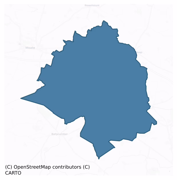
Kilcoursey is a barony of County Offaly, in the historical province of Leinster (Irish: Cill Chuairsí), covering 78 km² of land. The barony records 113 NMS archaeological sites and 61 NIAH listed buildings, placing it at around the 31st percentile among 280 ROI baronies for sites per km². This means it is in the bottom third of all baronies for sites per km². Dated archaeological evidence runs from the Early Bronze Age through to the Modern, spanning 7 of 9 archaeological periods, placing the barony in the 44th percentile among 280 ROI baronies for chronological depth. This means it is in the lower half of all baronies for chronological depth. The largest dated subset of recorded sites dates to the Iron Age. Logainm flags 23 placenames in the barony as carrying a recognised heritage root; the largest share — around 91% — are names associated with early Christian church and monastic foundations.
Heritage at a glance
Percentile rankings throughout this profile compare each barony only against the other 279 Republic of Ireland baronies.
The recorded heritage of Kilcoursey
The National Monuments Service Sites and Monuments Record (SMR) is the statutory inventory of archaeological sites for the Republic of Ireland, maintained by the Department of Tourism, Culture, Arts, Gaeltacht, Sport and Media. Sites recorded here include earthworks, ringforts, megalithic tombs, ecclesiastical remains, and post-medieval features; not every record is legally protected, but each is registered as a monument of archaeological interest.
The National Monuments Service records 113 archaeological sites in Kilcoursey, putting it at the 31st percentile among 280 ROI baronies for sites per km². This means it is in the bottom third of all baronies for sites per km². Of these, 94 (83%) fall within a recorded monument protection zone. The dominant category is defensive sites — ringforts, enclosures, hillforts, and stone forts (58 sites, 51% of the record). The most diagnostically specific type is Ringfort – rath (12 records, 11% of the barony's NMS total) — compared to an ROI average of 20% across all baronies where this type occurs. Ringfort – rath is an earthen ringfort enclosed by a bank and external ditch — the most common Early Medieval farmstead, broadly dated 500–1000 AD. The broader 'Enclosure' classification — which catches unclassified ringforts and field enclosures — accounts for a further 26 records (23%) and reflects the difficulty of sub-classifying degraded earthworks from surface evidence alone. Across the barony's 78 km², this gives a recorded density of 1.45 sites per km².
Most common monument types
Hover or tap a monument type to see its definition.
| Type | Count |
|---|---|
| Enclosure a banked or ditched feature of uncertain type, used as a catch-all where the original function cannot be determined from surface evidence | 26 |
| Ringfort – rath an earthen ringfort enclosed by a bank and external ditch — the most common Early Medieval farmstead, broadly dated 500–1000 AD | 12 |
| Castle – unclassified a castle whose form cannot be precisely classified, dating somewhere between the late 12th and 16th centuries | 4 |
| Church a building used for public Christian worship, of any date from c. 500 AD onwards | 4 |
| Earthwork an unclassified earthen structure with no diagnostic features that allow a more specific classification | 4 |
| Bawn the defended courtyard of a medieval house, tower house or fortified house | 4 |
| Fulacht fia a horseshoe-shaped Bronze Age burnt mound built around a sunken trough beside a water source, traditionally interpreted as a cooking site | 4 |
| Mound an artificial earthen elevation of unknown date and function that cannot be classified as another known monument type | 3 |
Chronological distribution
The dated archaeological record for Kilcoursey spans from the Early Bronze Age through to the Modern, with activity attested across 7 of 9 archaeological periods. Every period from earliest to latest is represented in the record — an unbroken sequence of dated activity across the full chronological span. Activity concentrates most heavily in the Iron Age (31 sites, 38% of dated material), with the Early Medieval forming a secondary peak (23 sites, 28%). A further 32 recorded sites (28% of the overall NMS register for the barony) carry no period attribution — appearing as 'Unknown' in the bar chart below. This typically reflects either records that pre-date the standardised period vocabulary or sites awaiting specialist dating review, rather than a genuine absence of chronological evidence.
Sample of recorded monuments
Show 25 sample monuments (of 113 total)
A representative sample of 25 recorded monuments drawn from the barony’s 113 total NMS entries. Sites within a recorded monument protection zone and rarer site types are prioritised so the list shows a meaningful cross-section rather than only the most common type. Each entry shows the official Sites and Monuments Record reference number and the description published by the National Monuments Service.
Barrow – bowl-barrow
Situated on top of a hillock in undulating countryside. Small conical shaped earthen mound (top diam. 2.5m N-S; base diam. 5.2m N-S; H 1.2m) with several large rock protruding from the surface of the mound.
The above…
Situated on top of a hillock in undulating countryside. Small conical shaped earthen mound (top diam. 2.5m N-S; base diam. 5.2m N-S; H 1.2m) with several large rock protruding from the surface of the mound.
The above description is derived from the published 'Archaeological Inventory of County Offaly' (Dublin: Stationery Office, 1997). In certain instances the entries have been revised and updated in the light of recent research.
Date of upload: 23 May 2011
Water mill – horizontal-wheeled
No surface tace visible of watermill which was excavated by A.T. Lucas in 1955. Dated dendrochonologically to c. AD. 636 +/- 9 (pers. comm. M. Baillie).
The above description is derived from the published…
No surface tace visible of watermill which was excavated by A.T. Lucas in 1955. Dated dendrochonologically to c. AD. 636 +/- 9 (pers. comm. M. Baillie).
The above description is derived from the published 'Archaeological Inventory of County Offaly' (Dublin: Stationery Office, 1997). In certain instances the entries have been revised and updated in the light of recent research.
Date of upload: 23 May 2011
Castle – ringwork
On a slight rise in undulating countryside. Subcircular raised platform (dims. 50m N-S; 43m E-W; H 1.7m) enclosed by a poorly preserved earth and stone bank which has been reduced to a scarp in most places, intervening…
On a slight rise in undulating countryside. Subcircular raised platform (dims. 50m N-S; 43m E-W; H 1.7m) enclosed by a poorly preserved earth and stone bank which has been reduced to a scarp in most places, intervening fosse (Wth 4.6m, int. D 1.7m) with outer bank which is only visible from N to E.
Site-specific test-trenching was carried out by Tim Coughlan of Irish Archaeological Consultancy Ltd., under licence No. E2653 as part of an archaeological mitigation programme associated with the N6 Kilbeggan to Athlone dual carriageway in addition to the main centre-line testing programme. This site was identified during site-specific testing undertaken by the writer in August 2005 (A016/025). The site was excavated between October 2005 and April 2006.
The area of excavation measured c. 60m north–south by 80m. The main feature of the site was a probable medieval enclosure, previously documented as a ringfort; it measured c. 50m east–west by c. 50m. Excavation results suggest that activity took place here during a number of periods and that the medieval enclosure is actually located on the site of an earlier monument.
Within the internal flat platform of the large medieval enclosure were: the remains of a possible Bronze Age ring-barrow (OF002-021001-), possible associated post-holes and a stone-lined cist; possible medieval industrial pits with an associated rectangular structure; and numerous post-medieval cultivation furrows and isolated pits. The site phasing has been…
Ringfort – cashel
On a natural rise of ground with good views in all directions. Natural hill which is scarped at its base with dry stone wall facing visible from NE through E to SW. The interior of the ringfort (57m N-S; 53m E-W)…
On a natural rise of ground with good views in all directions. Natural hill which is scarped at its base with dry stone wall facing visible from NE through E to SW. The interior of the ringfort (57m N-S; 53m E-W) follows the natural rise of the hill rising to a low rounded summit (ext. H 2m) in the centre.
The above description is derived from the published 'Archaeological Inventory of County Offaly' (Dublin: Stationery Office, 1997). In certain instances the entries have been revised and updated in the light of recent research.
Date of upload: 23 May 2011
Moated site
No visible surface remains, depicted as a sub-rectangular enclosure or earthwork on the 1838 ed. of the OS 6-inch map and not indicated on the 1908 ed. of the OS 6-inch map. The shape of the monument on the 1838 OS…
No visible surface remains, depicted as a sub-rectangular enclosure or earthwork on the 1838 ed. of the OS 6-inch map and not indicated on the 1908 ed. of the OS 6-inch map. The shape of the monument on the 1838 OS 6-inch map suggests that this earthwork may have been a moated site. Gorteen Castle (OF002-026001-) is located 430m to the SE. Described in 1977 as an earthwork that has 'been completely levelled. The earthwork appears to have encircled the end of a low rise or ridge. This was probably a ringfort. The surrounding area is fairly well drained pasture land' (SMR File 1977).
The above description is derived from the published 'Archaeological Inventory of County Offaly' (Dublin: Stationery Office, 1997). In certain instances the entries have been revised and updated in the light of recent research.
Compiled by Caimin O'Brien
Date of upload/revision: 19 December 2011
Ecclesiastical enclosure
Located on high ground with extensive views of undulating countryside. Depicted as a rectangular church (OF002-030001-) standing in the centre of an oval-shaped shaped graveyard (OF002-030002-) on the 1838 ed. OS 6-inch…
Located on high ground with extensive views of undulating countryside. Depicted as a rectangular church (OF002-030001-) standing in the centre of an oval-shaped shaped graveyard (OF002-030002-) on the 1838 ed. OS 6-inch map. On this map the curve of the public road immediately to the E and S of the graveyard probably follows the line of a possible Early Christian enclosure. The graveyard is enclosed by a post-medieval stone wall from S through E to NE only and elsewhere by a low earth and stone bank mainly reduced to a scarp with remains of an external fosse best visible on W side. This curving bank and external fosse visible at W may be the remains of an Early Christian ecclesiastical enclosure. The townland and parish name of Kilmanaghan [Cill Mhancháin] meaning church of Manchán, may be a reference to a possible monastic foundation associated with Saint Manchán of Lemanaghan (OF015-004003-) whose feastday is celebrated on 24th January (Ó Riain 2011, 429). Early Christian cross-inscribed slab (OF002-030003-) along with possible bullaun stone (OF002-030004-) found here during a clean up of the graveyard in 1971 (Fanning and Ó hÉailidhe 1980, 13).
The above description is derived from the published 'Archaeological Inventory of County Offaly' (Dublin: Stationery Office, 1997). In certain instances the entries have been revised and updated in the light of recent research.
Compiled and revised by: Caimin O'Brien
Date of revision: 26 September 2014
Cross-inscribed stone
Located on high ground with extensive views of undulating countryside. Well preserved church ruins (OF002-030001-) standing in centre of an oval-shaped graveyard (OF002-030002-) which may follow the line of an Early…
Located on high ground with extensive views of undulating countryside. Well preserved church ruins (OF002-030001-) standing in centre of an oval-shaped graveyard (OF002-030002-) which may follow the line of an Early Christian enclosure (OF002-030—-). The townland and parish name of Kilmanaghan [Cill Mhancháin] meaning church of Manchán, may be a reference to a possible monastic foundation at this location which is associated with Saint Manchán of Lemanaghan (OF015-004003-). Ivy-covered Early Christian cross-inscribed slab (dims. 0.5m x 0.26m) consisting of an incised cross of arcs enclosed by an incised double line circle found during a clean up of the graveyard in 1971 and subsequently built into external face of S wall of church ruins (Fanning and Ó hÉailidhe 1980, 13). This carved slab is located 0.75m W of window located at E end of S wall of church.
The above description is derived from the published 'Archaeological Inventory of County Offaly' (Dublin: Stationery Office, 1997). In certain instances the entries have been revised and updated in the light of recent research.
See attached line drawing of cross-inscribed slab taken from Fanning and Ó hÉailidhe 1980.
Compiled and revised by: Caimin O'Brien
Date of revision: 30 September 2014
Hut site
Rectangular shaped stone hut situated on the W bank of Cloghtanny river about 100m north of Bolart Corn mill. Only the grass covered wall footings survive of a small rectangular building orientated (int. dims. 12.4m…
Rectangular shaped stone hut situated on the W bank of Cloghtanny river about 100m north of Bolart Corn mill. Only the grass covered wall footings survive of a small rectangular building orientated (int. dims. 12.4m E-W; 4.4m N-S; wall T 1.5m approx.). Possibly associated with the nearby 19th-century corn mill.
The above description is derived from the published 'Archaeological Inventory of County Offaly' (Dublin: Stationery Office, 1997). In certain instances the entries have been revised and updated in the light of recent research.
Date of upload: 23 May 2011
Religious house nunnery – unclassified
The medieval ruins of the church (OF008-009001-) of Kilbride [Cill Bhríde], known locally as ‘St. Bridget’s Abbey’ forms the N boundary of Kilbride graveyard (OF008-009003-) with the site of a possible convent or church…
The medieval ruins of the church (OF008-009001-) of Kilbride [Cill Bhríde], known locally as ‘St. Bridget’s Abbey’ forms the N boundary of Kilbride graveyard (OF008-009003-) with the site of a possible convent or church standing along W boundary of graveyard 60m S of the parish church ruins (OSL 1840, 134). Wall footings of a second medieval church (OF008-009004-) formed N boundary of earlier graveyard to the S of St. Bridget's abbey. Cogan (1867, 496) recorded that a 'church and convent were founded here by St. Bridget, and there is a tradition amongst the people that this was the first church erected by her after her religious profession, on the hill of Usny [Uisneach]'. The ruins of two ecclesiastical buildings are shown at this location in the townland of ‘Kilbride & Killocollni/Killecolline’ on the 1654-57 Down Survey map of Kilcoursey Barony (NLI MS 716). The terrier of the Down Survey map of Kilbride parish recorded that there were ‘the Ruines of two Churches’ (ibid.). In the 19th century the stones from both ecclesiastical buildings were used to construct the Sisters of Mercy Convent (Saint Brigid’s, Kilcoursey) located 1km S of the graveyard. This event was described as following; ‘There are still some remains of an old monastery (OF008-009002-) and chapel; and the fragments of a church (OF008-009001-) in the cemetery, quite contiguous, measure fifty-two [15.85m] in length by twenty-four [7.3m]. Some years back, with the permission of the church-warden of t…
Cross – Termon cross
No evidence of any cross in the area marked on the 6 inch OS 6-inch map. This cross has long since dissappeared as Davies recalls in the ITA survey
of 1942.
Described in 1942 as 'Ths site of the cross, which has…
No evidence of any cross in the area marked on the 6 inch OS 6-inch map. This cross has long since dissappeared as Davies recalls in the ITA survey
of 1942.
Described in 1942 as 'Ths site of the cross, which has disappeared was at or close to the boundary of Kilbride Td. The road from Clara to Kilbride was sunk deep through the hill at the famine time, and the cross may then have disappeared. A small mound (OF008-057) on the S side of road has some superstitions attached, but the site was probably on N side, as shown on OS The tradition of the cross is preserved in that funerals to Kilbride stop at this point on the road' (ITA Survey 1942).
The above description is derived from the published 'Archaeological Inventory of County Offaly' (Dublin: Stationery Office, 1997). In certain instances the entries have been revised and updated in the light of recent research.
Date of upload: 23 May 2011
Castle – tower house
Located on top of a hill with good extensive views in all directions. The hill is steeply sloped at S which may have acted as a natural form of defence for the castle. The tower house is built of roughly coursed…
Located on top of a hill with good extensive views in all directions. The hill is steeply sloped at S which may have acted as a natural form of defence for the castle. The tower house is built of roughly coursed limestone rubble and was originally three storeys high however the second floor is now destroyed with evidence of a wall walk surviving at NE corner. The bawn wall (OF008-016001-) runs from the SW corner in a W direction and rejoins the Tower house on its NE corner thus defending the original doorway which is now destroyed but was located at the centre of the N wall. This destroyed doorway gave access to the ground floor (int. dims. 5.5m N-S by 4m E-W, wall T 1.15m) with attic which had a barrel vaulted roof. The wooden floor of this attic measured 1.95m above ground floor level. First floor accessed by mural stairs in the N wall (Wth 0.6m). This stairways leads up to the NE corner of the first floor (int. dims. 5m by 5m) which was well lit by a large destroyed window at the E end of the S wall. There are several musket loops present on the S and W walls. Access to the stairs is through a destroyed door on the NW corner of the first floor which leads to the destroyed second floor which had a door in its NE corner. The ground floor with attic above was probably the storage area with the first and second floors being the main living area. The first floor had a wooden roof with evidence of stone corbels on the W wall located 2m above floor level. The musket loops at g…
Children's burial ground
Located on flat land in area of undulating countryside. Rectangular shaped earthen platform (dims. N-S 19m; E-W 30m and varies in ext. height from 0.5m to 1m defined by a scarp). The platform slopes from E to W and…
Located on flat land in area of undulating countryside. Rectangular shaped earthen platform (dims. N-S 19m; E-W 30m and varies in ext. height from 0.5m to 1m defined by a scarp). The platform slopes from E to W and there are some small protruding stones in the E sector of the platform which could be possible grave-markers. According to the ITA Survey (1942) the site was used a burial ground for still-born infants.
The following folklore was recorded from Clara School in 1935-9 about this burial ground; 'Old Peter calls Kilcromeen Kilcuitin. I have seen it. It is not fenced off from the field in which it is situated but as it has never been cultivated it is easily seen. It is in John Sheridan's land. Sheridan told me on one had been buried in it since he bought the land years ago. Old Peter said a child from Clashawaun was buried in it 5 years ago. The graveyard space is square, the surface rought and bumpy, with smallish rough stones here and there. I have also heard the same place referred to as Cillalugán. The is a place in the monastery graveyard now for unbaptised babies. There was a graveyard in Tommy Flattery's garden. It "stopped" when Monastery opened. Old Peter "met" a couple of tombstones when working in Tommy's garden' ( The Schools’ Collection, Volume 0807, Page 446)
The above description is derived from the published 'Archaeological Inventory of County Offaly' (Dublin: Stationery Office, 1997). In certain instances the entries have been revised and upda…
Barrow – ring-barrow
Site-specific test-trenching was carried out by Tim Coughlan of Irish Archaeological Consultancy Ltd., under licence No. E2653 as part of an archaeological mitigation programme associated with the N6 Kilbeggan to…
Site-specific test-trenching was carried out by Tim Coughlan of Irish Archaeological Consultancy Ltd., under licence No. E2653 as part of an archaeological mitigation programme associated with the N6 Kilbeggan to Athlone dual carriageway in addition to the main centre-line testing programme. This site was identified during site-specific testing undertaken by the writer in August 2005 (A016/025). The site was excavated between October 2005 and April 2006.
The area of excavation measured c. 60m north–south by 80m. The main feature of the site was a probable medieval enclosure (OF002-021—-), previously documented as a ringfort; it measured c. 50m east–west by c. 50m. Excavation results suggest that activity took place here during a number of periods and that the medieval enclosure is actually located on the site of an earlier monument.
Within the internal flat platform of the large medieval enclosure were: the remains of a possible Bronze Age ring-barrow (OF002-021001-), possible associated post-holes and a stone-lined cist; possible medieval industrial pits with an associated rectangular structure; and numerous post-medieval cultivation furrows and isolated pits. The site phasing has been divided as follows.
Prehistory
A circular enclosure c. 14m in diameter was identified at the top of a natural gradual slope. This consisted of an enclosing ditch c. 2m wide and 1m deep. Within this was a smaller enclosing ditch c. 7m in diameter, 0.4m wide and 0.2m deep. It is felt th…
Burial
Site-specific test-trenching was carried out by Tim Coughlan of Irish Archaeological Consultancy Ltd., under licence No. E2653 as part of an archaeological mitigation programme associated with the N6 Kilbeggan to…
Site-specific test-trenching was carried out by Tim Coughlan of Irish Archaeological Consultancy Ltd., under licence No. E2653 as part of an archaeological mitigation programme associated with the N6 Kilbeggan to Athlone dual carriageway in addition to the main centre-line testing programme. This site was identified during site-specific testing undertaken by the writer in August 2005 (A016/025). The site was excavated between October 2005 and April 2006.
The area of excavation measured c. 60m north–south by 80m. The main feature of the site was a probable medieval enclosure (OF002-021—-), previously documented as a ringfort; it measured c. 50m east–west by c. 50m. Excavation results suggest that activity took place here during a number of periods and that the medieval enclosure is actually located on the site of an earlier monument.
Within the internal flat platform of the large medieval enclosure were: the remains of a possible Bronze Age ring-barrow (OF002-021001-), possible associated post-holes and a stone-lined cist; possible medieval industrial pits with an associated rectangular structure; and numerous post-medieval cultivation furrows and isolated pits. The site phasing has been divided as follows. e barrow was subsequently partially recut during medieval times to accommodate a large industrial furnace (OF002-021002-) with an associated area of stone metalling. Part of a human skull was found with the lower fills of the barrow. This bone may have been disturbe…
Mass-rock
Located on high ground with good views in all directions. Large natural rock outcrop marked on OS 25-inch map as 'Ballinough Big Rock' which was used during penal times as a mass rock.
Compiled by: Caimin…
Located on high ground with good views in all directions. Large natural rock outcrop marked on OS 25-inch map as 'Ballinough Big Rock' which was used during penal times as a mass rock.
Compiled by: Caimin O'Brien
Date of upload: 09 June 2014
Habitation site
A Bronze Age house (OF002-053001-) with associated settlement features was excavated under licence No. E2677 in the townland of Tober, by Irish Archaeological Consultancy Ltd (I.A.C.) as part of an archaeological…
A Bronze Age house (OF002-053001-) with associated settlement features was excavated under licence No. E2677 in the townland of Tober, by Irish Archaeological Consultancy Ltd (I.A.C.) as part of an archaeological mitigation programme associated with the N6 phase 2: Kilbeggan to Athlone dual carriageway scheme. The excavation took place on the W edge of a thin way-leave of a side road connected to the motorway between 7 December 2005 and 2 February 2006. The site was first identified in 2005 by I.A.C. Ltd when archaeological testing was undertaken in this field. The site is located 1.1km N of the village of Tober on gently undulating land with good views in all directions. Ballynahinch crannog (OF001-001—-) is located 1.6km to the NNE.
The site at Tober 1 consisted of a Bronze Age house (OF002-053001-) defined by two concentric rings of posts with associated ancillary structures, all of which was enclosed by a fence. To the N of the house was uncovered a curving line of postholes (1006-832 B.C.) which may be the remains of a stake and wattle fence enclosing the Bronze Age house. This feature was not fully excavated as part of the enclosing feature ran into the unexcavated area to the W of the house. To the S of the house a series of postholes were excavated and identified as structure D which appears to have been the remains of straight fence orientated in a WNW-ESE alignment. Other postholes identified to the S of the house consisted of two four-post structure…
Enclosure – large enclosure
Outline of circular shaped area (approx. diam. 65m) defined by a fosse and intersected at W by a field boundary running N-S which curves around the enclosing element of the monument. This field boundary marks the…
Outline of circular shaped area (approx. diam. 65m) defined by a fosse and intersected at W by a field boundary running N-S which curves around the enclosing element of the monument. This field boundary marks the townland boundary with Tinamuck South. Outline of monument is clearly visible on Digital Globe aerial photograph taken 20/03/2018.
See attached image of Google Earth photograph taken 20/03/2018
Compiled by: Caimin O'Brien based on details provided by Ed O'Donovan
Date of upload: 09 April 2019
Crannog
A small island in Ballinderry Lough excavated by Hencken in 1942. The site consisted of two superimposed occupation layers, the lower layer dating to the Late Bronze Age and the upper one to the Early Christian period.…
A small island in Ballinderry Lough excavated by Hencken in 1942. The site consisted of two superimposed occupation layers, the lower layer dating to the Late Bronze Age and the upper one to the Early Christian period. The Late Bronze Age evidence comprised of a number of small wicker huts (diam. 1-2.5m) and the oak plank foundations of a square shaped building (dims. 11.5m x 11.5m). This particular settlement was abandoned following a rise in the level of the lake. The Early Christian period habitation consisted of a palisade of stout posts (diam. 0.3m) reinforced by an inner row of smaller posts delimiting a circular area (diam. 35m) with a timber floor and hearth. A dugout canoe was found just inside the inner row of posts at the S edge of the timber floor. A later brushwood road was located to the SE of the crannog. (Hencken 1942, 1-84)
The above description is derived from the published 'Archaeological Inventory of County Offaly' (Dublin: Stationery Office, 1997). In certain instances the entries have been revised and updated in the light of recent research.
Date of upload: 23 May 2011
This monument is subject to a preservation order made under the National Monuments Acts 1930 to 2014 (PO no. 8/1932).
Bullaun stone
Not visible at ground level. Unable to locate this bullaun stone. Identified during fieldwork on March 25th 1988 by staff in the SMR office. Described in 1988 as a small bullaun which was covered in moss and was located…
Not visible at ground level. Unable to locate this bullaun stone. Identified during fieldwork on March 25th 1988 by staff in the SMR office. Described in 1988 as a small bullaun which was covered in moss and was located on the side of the road. Traditionally the bullaun was believed to be the mark of the cow belonging to St Ciaran of Clonmacnoise. Pointed out by Mrs Mary Moran of Gorteen on the Tober Road.
The above description is derived from the published 'Archaeological Inventory of County Offaly' (Dublin: Stationery Office, 1997). In certain instances the entries have been revised and updated in the light of recent research.
Date of upload: 23 May 2011
Crannog
Not visible at ground level. Possible Crannog site identified by Victor Buckley in 1980 and which may have been destroyed during drainage operations carried out in the area during the 1980's.
The above description is…
Not visible at ground level. Possible Crannog site identified by Victor Buckley in 1980 and which may have been destroyed during drainage operations carried out in the area during the 1980's.
The above description is derived from the published 'Archaeological Inventory of County Offaly' (Dublin: Stationery Office, 1997). In certain instances the entries have been revised and updated in the light of recent research.
Date of upload: 23 May 2011
Graveyard
Located on rise of ground with extensive views of undulating countryside. Depicted as a rectangular church (OF002-030001-) standing in the centre of an oval-shaped shaped graveyard (dims. 45m N-S; 56m E-W) on the 1838…
Located on rise of ground with extensive views of undulating countryside. Depicted as a rectangular church (OF002-030001-) standing in the centre of an oval-shaped shaped graveyard (dims. 45m N-S; 56m E-W) on the 1838 ed. OS 6-inch map. On this map the curve of the public road immediately to the E and S of the graveyard probably follows the line of a possible Early Christian enclosure (OF002-030—-) associated with Saint Manchan of Lemanaghan. The graveyard is enclosed by a stone wall (H 1.2m; T 0.4m) of post medieval date from S through W to NW only and elsewhere by a low earth and stone bank reduced to a scarp with remains of an external fosse at W. The graveyard is entered through an iron gateway located off centre to W in S wall of graveyard with remains of a stone stile visible in S wall located off centre to E. The graveyard contains memorials dating from the post-medieval period onwards. Early Christian cross-inscribed slab (OF002-03003-) two architectural fragments of a late medieval window, a quernstone, and a possible bullaun stone (OF002-030004-) found during a clean up of the graveyard in 1971 (Fanning and Ó hÉailidhe 1980, 13) have been built into SE angle and S wall of church.
The above description is derived from the published 'Archaeological Inventory of County Offaly' (Dublin: Stationery Office, 1997). In certain instances the entries have been revised and updated in the light of recent research.
Compiled and revised by: Caimin O'Brien
D…
Graveyard
The medieval ruins of the church (OF008-009001-) of Kilbride [Cill Bhríde], known locally as ‘St. Bridget’s Abbey’ forms the N boundary of Kilbride graveyard with the site of a possible convent / nunnery…
The medieval ruins of the church (OF008-009001-) of Kilbride [Cill Bhríde], known locally as ‘St. Bridget’s Abbey’ forms the N boundary of Kilbride graveyard with the site of a possible convent / nunnery (OF008-009002-) forming W boundary of graveyard (OSL 1840, 134). According to local tradition this parish was founded by St. Brigid before she founded Kildare (The Schools’ Collection, Volume 0807, Page 203; Cogan 1867, 496). The graveyard was described in 1938 as following 'The graveyard (about 15 perches [75m] x 8 perches [40m] roughly triangular) is certainly very ancient. There is no gateway into it. There are two stiles (to cross the wall) and between them a large flat stone which was set there to take the coffin while the bearers climbed the stiles. At the farthest corner from the road towards the east there is an old ruin [OF008-009001– which local tradition states to be the authentic ruin of St. Brigid's church (or kitchen). It is about 15 feet [5m] by 9 feet [3m] inside and the inside of the roof is rounded. The outside is so much covered with ivy that it is impossible to say what it is like. The graveyard is still used. One local family claims to have 18 generations buried there. A great improvement has been made in the keeping of this graveyard, cutting nettles etc., since my first visit to it in 1927. Legend say that when St. Brigid asked for land for her convent she was told she could have what her cloak would cover, and she got Kilbride' (The Schools’…
Burial ground
No surface trace visible of any archaeological feature in the area excavated in 1978 by the National Museum. The National Museum of Ireland recorded that 'in March 1978 three human skeletons and a bowl were discovered…
No surface trace visible of any archaeological feature in the area excavated in 1978 by the National Museum. The National Museum of Ireland recorded that 'in March 1978 three human skeletons and a bowl were discovered during gravel-digging operations at Lehinch, near Clara, Co. Offaly. The site was a low natural hillock composed almost entirely of sand and gravel, and an oval pit measuring 8m by 7m by 3m deep had been dug into the centre of it for the purposes of obtaining sand. According to the landowner, Mr David Connor, the human remains—one apparently an extended inhumation—and bowl sherds were found towards the eastern side of the hillock. The site was first reported by Brother Angelo Holmes, a member of the Franciscan community at Clara, to Mr Etienne Rynne, who informed the NMI. A three-week excavation was undertaken by Raghnall Ó Floinn in July 1978, when six burials were excavated (Cahill and Sikora Vol. 2, 139-66, for the report on these burials, graves 1-5). A second season in 1979 comprised the excavation of a ring-ditch (OF008-012001-), which had been partially exposed the previous summer. A single extended skeleton had been discovered also in the same townland by Mr Connor in 1977. This was investigated by Mr Michael Ryan of the NMI. This report describes the early Bronze Age burial, grave 6, and the bowl found in 1978 (grave 7). This was probably associated with one of the three skeletons also found at that time. Two of these individuals are likely to r…
Ring-ditch
No surface trace visible of any archaeological feature in the area excavated in 1979 by the National Museum. A small pennanular ditch (diam. 4m) was discovered to the S of the burials (Waddell 1990, 129). The…
No surface trace visible of any archaeological feature in the area excavated in 1979 by the National Museum. A small pennanular ditch (diam. 4m) was discovered to the S of the burials (Waddell 1990, 129). The National Museum of Ireland recorded that 'in March 1978 three human skeletons (OF008-012—-) and a bowl were discovered during gravel-digging operations at Lehinch, near Clara, Co. Offaly. The site was a low natural hillock composed almost entirely of sand and gravel, and an oval pit measuring 8m by 7m by 3m deep had been dug into the centre of it for the purposes of obtaining sand. According to the landowner, Mr David Connor, the human remains—one apparently an extended inhumation—and bowl sherds were found towards the eastern side of the hillock. The site was first reported by Brother Angelo Holmes, a member of the Franciscan community at Clara, to Mr Etienne Rynne, who informed the NMI. A three-week excavation was undertaken by Raghnall Ó Floinn in July 1978, when six burials were excavated (Cahill and Sikora Vol. 2, 139-66, for the report on these burials, graves 1-5). A second season in 1979 comprised the excavation of a ring-ditch, which had been partially exposed the previous summer. A single extended skeleton had been discovered also in the same townland by Mr Connor in 1977. This was investigated by Mr Michael Ryan of the NMI' (Cahill and Sikora 2011, vol. 1, 386).
See attached location map taken from Cahill and Sikora 2011.
The above description…
Enclosure
No evidence of any archaeological site in the area marked on the aerial photograph taken in 1973 (GSI N 577/8).
The above description is derived from the published 'Archaeological Inventory of County Offaly' (Dublin:…
No evidence of any archaeological site in the area marked on the aerial photograph taken in 1973 (GSI N 577/8).
The above description is derived from the published 'Archaeological Inventory of County Offaly' (Dublin: Stationery Office, 1997). In certain instances the entries have been revised and updated in the light of recent research.
Date of upload: 23 May 2011
Listed buildings
The National Inventory of Architectural Heritage (NIAH) is a state survey appraising buildings of architectural, historical, archaeological, artistic, cultural, scientific, social, or technical interest. Each surveyed structure receives a rating from International (the highest, for buildings of European importance) through National, Regional, Local, and Record-Only.
The NIAH records 61 listed buildings in Kilcoursey (30th percentile across ROI baronies). All recorded buildings carry Regional or lower grading; the barony does not contain any structures appraised as being of National or International architectural importance. Construction dates concentrate most heavily in the Victorian (1830-1900) period. The most-recorded building type is house (26 examples, 43% of the listed stock).
Terrain and environment
Mean elevation across the barony is 62m — the 24th percentile among 280 ROI baronies for elevation. This means it is in the bottom third of all baronies for elevation. This is a relatively low-lying landscape by ROI standards. Elevation matters for heritage because higher-altitude baronies typically favour defensive monuments — ringforts and hilltop forts placed on prominent ground — while lowland baronies are more likely to carry the dense settlement and church networks of intensive agricultural landscapes. Mean slope is 2.5° — the 28th percentile among 280 ROI baronies for slope. This means it is in the bottom third of all baronies for slope. Slope is a key control on both land use and archaeological preservation: steep ground resists ploughing and tends to preserve earthworks intact, while gentle slopes favour intensive cultivation that damages or destroys surface archaeology over time. The Topographic Wetness Index averages 11.5, the 74th percentile among 280 ROI baronies for wetness. This means it is in the top third of all baronies for wetness. Drainage matters for heritage because poorly-drained ground preserves organic archaeology (wooden trackways, leather, textiles, and on rare occasions human remains) far better than free-draining soil; well-drained ground favours arable use but destroys organic material rapidly. The land cover is dominated by improved grassland (81%) and woodland (15%). In overall character, this is low-lying, gently-sloping terrain — characteristic of Ireland's central plain and coastal lowlands, with land use dominated by improved grassland.
Terrain measurements
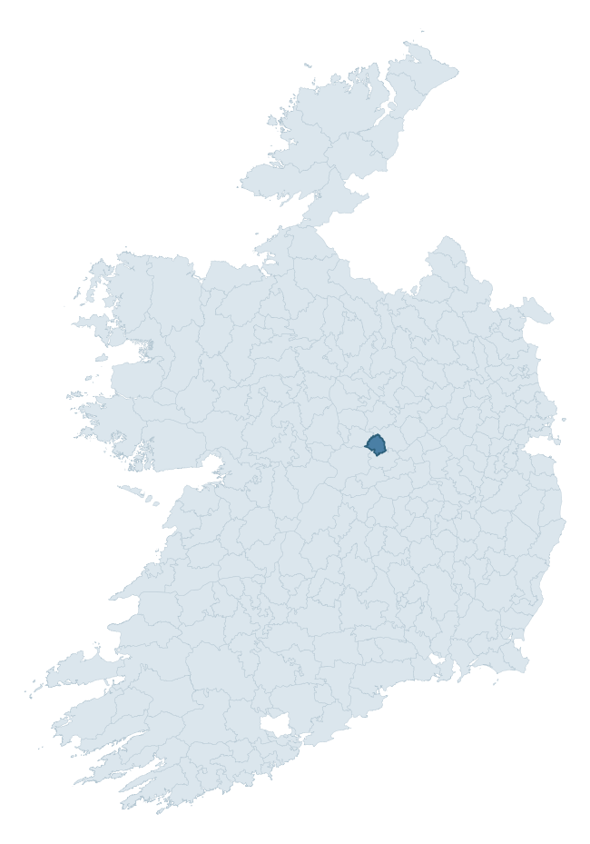
Where this barony sits in the Republic of Ireland
Geology and preservation
Bedrock geology shapes the landscape long before any settlement begins — controlling soil drainage, agricultural potential, the survival of upstanding monuments, and the preservation of buried archaeology. The figures below come from the Geological Survey Ireland 1:100,000 bedrock map.
The bedrock underlying Kilcoursey is predominantly limestone (100% of the barony by area), laid down during the Carboniferous period (100% by area, around 359 to 299 million years ago). Limestone is the most heritage-rich bedrock in Ireland. It supports fertile, well-drained soils that favoured dense Early Medieval settlement and Norman manorial agriculture, and it weathers into karst features — sinkholes, caves, swallow holes, and souterrains — that frequently carry archaeology. Where peat overlies limestone, organic preservation can be exceptional. The single largest mapped unit is the Waulsortian Limestones (80% of the barony's bedrock). With only 1 distinct rock type mapped, the barony is geologically uniform compared to the rest of the Republic (4th percentile for diversity) — a single coherent bedrock landscape.
Largest mapped unit: Waulsortian Limestones (80% of the barony)
Placename evidence
Logainm records 23 heritage-diagnostic placenames for Kilcoursey, drawn from townland and civil-parish names across the barony. The dominant stratum is Early Christian ecclesiastical — cill-, teampall-, and domhnach-prefixed names that record the dense network of early church foundations established between the fifth and tenth centuries. The leading diagnostic roots are cill- (19 — church), lios- (1 — ringfort or enclosure), and dún- (1 — hilltop fort or promontory fort). This is below the ROI average of 30.7 heritage placenames per barony, suggesting either lighter survey coverage or a townland-naming tradition that draws more on generic landscape vocabulary. Logainm records 71 placenames for Kilcoursey (predominantly townland names). Of these, 23 (32%) carry one of the diagnostic Gaelic roots tracked above; the remainder draw on more generic landscape vocabulary that does not encode a heritage period.
Pre-Christian / Early Medieval Defensive
| Root | Count | Meaning |
|---|---|---|
| lios- | 1 | ringfort or enclosure |
| dún- | 1 | hilltop or promontory fort |
Early Christian Ecclesiastical
| Root | Count | Meaning |
|---|---|---|
| cill- | 19 | church (early) |
| tobar- | 1 | holy well |
| cillín- | 1 | unconsecrated burial ground |
Other baronies in Offaly

Explore further
Grounding History: 10 Maps of Northern Ireland’s Past
If you’re interested in Irish heritage more widely, the companion report for Northern Ireland brings together the analysis of all 462 NI wards into one place through 10 high-quality maps — covering monument density, archaeological periods, placename heritage, terrain, wetland, and the historic landscape at first survey. Take a look.
About this profile
Click any section below to expand.
What is a barony?
A barony is a historic administrative unit in Ireland, broadly equivalent to an English hundred. The 280 baronies used here are from the OSi 2019 National Statutory Boundaries (generalised 20m), covering the 26 counties of the Republic of Ireland. Baronies derive from the Norman period, were formalised in the 17th century, and have not been redrawn for statistical purposes. They vary enormously in area, from compact urban baronies in Dublin to vast upland baronies in Connacht, and should not be compared by raw site count without accounting for area differences.
What counts as a site?
This profile combines three distinct heritage registers, each with its own definition of what constitutes a recordable site:
- Archaeological sites (NMS). The National Monuments Service Sites and Monuments Record (SMR) catalogues every known archaeological monument or site of archaeological interest in the Republic, from prehistoric burial mounds and ringforts to medieval churches and post-medieval defensive works. Inclusion does not require legal protection — only that the site has been identified, surveyed, and assessed as having archaeological value. A separate subset of these sites lies within a recorded protection zone, which gives them statutory protection under the National Monuments Acts.
- Listed buildings (NIAH). The National Inventory of Architectural Heritage records buildings of architectural, historical, archaeological, artistic, cultural, scientific, social, or technical interest. Each surveyed structure is appraised on a five-tier scale: International, National, Regional, Local, and Record-Only. The NIAH appraisal is informational rather than strictly statutory, but it underpins local-authority Record of Protected Structures (RPS) listings.
- Heritage placenames (Logainm). Logainm is the authoritative database of Irish placenames maintained by the Placenames Branch. This profile applies a heritage-diagnostic classifier to the Irish-language form of each townland name, flagging roots that signal defensive sites (ráth-, lios-, dún-, caiseal-, cathair-), ecclesiastical foundations (cill-, teampall-, domhnach-, mainistir-), prehistoric burial-ritual features (tuaim-, carn-, leaba-), or Norse-contact settlement (gall-). Townlands without one of these diagnostic roots are not flagged here — they may still carry historical significance, but that significance is not encoded in the name itself.
Editorial principles
The narrative sections of this profile follow several explicit principles:
- Evidential. Every claim about this barony’s heritage character is anchored in the underlying register data. Where a site count, a placename count, or a percentile rank is cited, it is computed from the source datasets at export time, not estimated.
- Comparative. Counts and metrics are reported alongside their percentile rank against the other 279 ROI baronies. A barony with 50 ringforts in absolute terms could be unusually high or unusually low depending on its size and regional context; percentile ranking removes that ambiguity.
- Transparent on limits. Where a register has known coverage gaps, survey biases, or data-quality issues that affect this barony’s figures, the profile flags them rather than presenting the numbers as definitive.
- No interpretation beyond what the data supports. The narrative does not speculate about historical events, social dynamics, or cultural meaning beyond what the recorded heritage and placename evidence directly attests.
Data caveats and limits
- NMS Sites and Monuments Record is the product of survey campaigns conducted at different intensities across different counties and decades. Some baronies have been surveyed more thoroughly than others, and absolute counts should be read in that light. Sites destroyed by development before survey are typically not represented; sites in heavily forested or upland terrain are sometimes under-recorded.
- NIAH coverage is broadly complete for the Republic of Ireland but the survey was conducted on a rolling county-by-county basis, and the most recent appraisal date varies. Buildings demolished or substantially altered after their original survey may still appear in the register; conversely, recent buildings of merit may not yet have been appraised.
- Logainm classification applies a deliberately conservative pattern-matching approach to the Irish-language townland forms. The classifier prioritises true positives over recall: a townland may carry a heritage signal that the classifier doesn’t recognise, particularly where the diagnostic root has been heavily anglicised or where the townland name draws on a less common term. The 60,000+ townland records and ~9,800 classified placenames give a substantial signal at barony scale, but individual townland names should be checked against Logainm directly for definitive interpretation.
- Period attribution. The chronological distribution reflects only those NMS sites that carry a recognised period attribution in the source data. Sites listed as “Unknown” period are excluded from the dated subset.
- Boundary changes. Some baronies have undergone minor boundary adjustments since their 19th-century definition; the OSi 2019 generalised boundaries used here are the current statutory definition and may differ slightly from historical maps in border areas.
- Bedrock geology is mapped at 1:100,000 scale, which means local variation within a barony — small pockets of different rock type, mineral veins, alluvium overlying bedrock — is generalised. The dominant-system and rocktype figures are area-weighted, so a barony reading “70% Carboniferous limestone” may still contain small but archaeologically important pockets of older or younger rock. Around 3% of GSI polygons do not match the lexicon and contribute no rocktype or system attribution.
Data sources
- National Monuments Service — Sites and Monuments Record (SMR) https://data.gov.ie/dataset/national-monuments-service-archaeological-survey-of-ireland
- National Inventory of Architectural Heritage (NIAH) https://data.gov.ie/dataset/national-inventory-of-architectural-heritage-niah-national-dataset
- Logainm — Placenames Database of Ireland https://www.logainm.ie/
- Ordnance Survey Ireland — National Statutory Barony Boundaries 2019 https://data-osi.opendata.arcgis.com/
- EURODEM — European Digital Elevation Model https://www.mapsforeurope.org/datasets/euro-dem
- ESA WorldCover https://esa-worldcover.org/en
- Geological Survey Ireland — 1:100,000 Bedrock Geology https://www.gsi.ie/en-ie/data-and-maps/Pages/Bedrock.aspx
Explore more: Search any of the 280 ROI baronies, browse by historical province, or read the methodology and data sources for the full Republic of Ireland Heritage Tool.