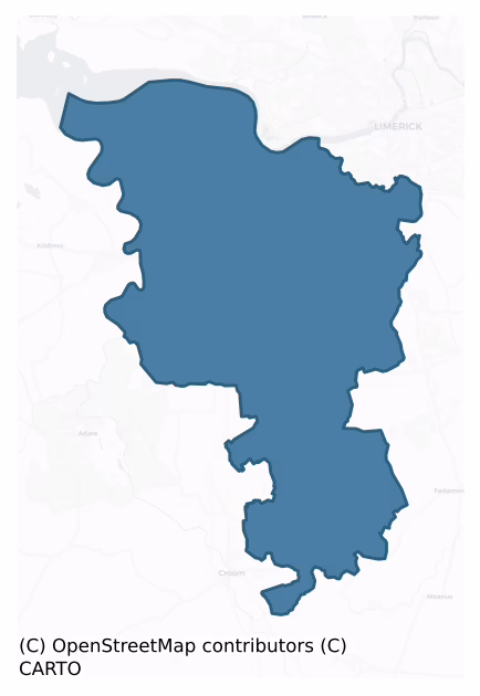
Pubblebrien is a barony of County Limerick, in the historical province of Munster (Irish: Pobal Bhriain), covering 124 km² of land. The barony records 391 NMS archaeological sites and 65 NIAH listed buildings, placing it at around the 84th percentile among 280 ROI baronies for sites per km². This means it is in the top fifth of all baronies for sites per km². Dated archaeological evidence runs from the Neolithic through to the Modern, spanning 8 of 9 archaeological periods, placing the barony in the 72nd percentile among 280 ROI baronies for chronological depth. This means it is in the top third of all baronies for chronological depth. The largest dated subset of recorded sites dates to the Iron Age. Logainm flags 23 placenames in the barony as carrying a recognised heritage root; the largest share — around 48% — are names associated with pre-christian defensive.

Heritage at a glance
Percentile rankings throughout this profile compare each barony only against the other 279 Republic of Ireland baronies.
The recorded heritage of Pubblebrien
The National Monuments Service Sites and Monuments Record (SMR) is the statutory inventory of archaeological sites for the Republic of Ireland, maintained by the Department of Tourism, Culture, Arts, Gaeltacht, Sport and Media. Sites recorded here include earthworks, ringforts, megalithic tombs, ecclesiastical remains, and post-medieval features; not every record is legally protected, but each is registered as a monument of archaeological interest.
The National Monuments Service records 391 archaeological sites in Pubblebrien, putting it at the 84th percentile among 280 ROI baronies for sites per km². This means it is in the top fifth of all baronies for sites per km². Of these, 351 (90%) fall within a recorded monument protection zone. The dominant category is defensive sites — ringforts, enclosures, hillforts, and stone forts (209 sites, 53% of the record). Ringfort – rath is the most prevalent type, making up 25% of the barony's recorded sites (97 records) — well above the ROI average of 20% across all baronies where this type occurs. Ringfort – rath is an earthen ringfort enclosed by a bank and external ditch — the most common Early Medieval farmstead, broadly dated 500–1000 AD. Other significant types include Enclosure (71) and Fulacht fia (40). Enclosure is a banked or ditched feature of uncertain type, used as a catch-all where the original function cannot be determined from surface evidence; Fulacht fia is a horseshoe-shaped Bronze Age burnt mound built around a sunken trough beside a water source, traditionally interpreted as a cooking site. Across the barony's 124 km², this gives a recorded density of 3.15 sites per km².
Most common monument types
Hover or tap a monument type to see its definition.
| Type | Count |
|---|---|
| Ringfort – rath an earthen ringfort enclosed by a bank and external ditch — the most common Early Medieval farmstead, broadly dated 500–1000 AD | 97 |
| Enclosure a banked or ditched feature of uncertain type, used as a catch-all where the original function cannot be determined from surface evidence | 71 |
| Fulacht fia a horseshoe-shaped Bronze Age burnt mound built around a sunken trough beside a water source, traditionally interpreted as a cooking site | 40 |
| Church a building used for public Christian worship, of any date from c. 500 AD onwards | 14 |
| Graveyard a burial area associated with a church, in use from the medieval period onwards | 11 |
| Moated site | 10 |
| Ringfort – cashel the stone-walled equivalent of the rath, found mainly in upland or western areas, broadly dated 500–1000 AD | 9 |
| Excavation – miscellaneous | 9 |
Chronological distribution
The dated archaeological record for Pubblebrien spans from the Neolithic through to the Modern, with activity attested across 8 of 9 archaeological periods. This is the 72nd percentile across ROI baronies for chronological depth — an above-average span. Every period from earliest to latest is represented in the record — an unbroken sequence of dated activity across the full chronological span. Activity concentrates most heavily in the Iron Age (120 sites, 36% of dated material), with the Early Medieval forming a secondary peak (93 sites, 28%). A further 55 recorded sites (14% of the overall NMS register for the barony) carry no period attribution — appearing as 'Unknown' in the bar chart below. This typically reflects either records that pre-date the standardised period vocabulary or sites awaiting specialist dating review, rather than a genuine absence of chronological evidence.
Sample of recorded monuments
Show 25 sample monuments (of 391 total)
A representative sample of 25 recorded monuments drawn from the barony’s 391 total NMS entries. Sites within a recorded monument protection zone and rarer site types are prioritised so the list shows a meaningful cross-section rather than only the most common type. Each entry shows the official Sites and Monuments Record reference number and the description published by the National Monuments Service.
Castle – Anglo-Norman masonry castle
Westropp recorded the following details about Carrigogunnel (Carraig Ó gCoinneall/rock of Uí Choinneall) Castle ; 'Granted by Charter to Donchad Cairbreach O'Brien, Prince of Thomond (Ann. Inisf.). The C[astle]. is said…
Westropp recorded the following details about Carrigogunnel (Carraig Ó gCoinneall/rock of Uí Choinneall) Castle ; 'Granted by Charter to Donchad Cairbreach O'Brien, Prince of Thomond (Ann. Inisf.). The C[astle]. is said to have been occupied by the O'Briens in 1336 (Inq. Exchequer, 1, 1536). It has been supposed to be the C[astle]. of Esclon, but is nowhere identified as such. 1426 Teige O'Brien, "na glenore," ancestor of the O'Briens of Carrigogunnell, died (A.F.M.). 1502 Donough O'Brien, Lord of Pubblebrian and Aherloe, died (A.F.M.). This "strong Rock and House of Defence" of the O'Briens only appears in history in 1536. "When the Parliament adjourned that year to Limerick, Edward Lord Grey, the Deputy marched to a very strong C[astle]. called "Carekogunyel," "in English, Candell Rock," which was surrendered next day by Mat. (Mahon) O'Bryne, on condition that the Government should hold it themselves. "It stands on a high rock, and … is the key of all the County," with the manor, " which belongs to the King as part of Lord Clerres lands." Grey, despite his pledge, was about to entrust it to Donoth O'Brien, but "by crafty policy and a former letter of my Lord" it was given back to Matthew. On August 22 the Lord Deputy besieged it. The ordnance was "bent" on the gate of the base court, which was soon taken. The guns were then "bent on the dungeon of the great Castle." That night a tower in the upper ward was taken, and at dawn the keep surrendered. As the Deputy had firs…
Enclosure – large enclosure
In level pasture on slight rise, 170m NE of the townland boundary with Elmpark Demesne. Present remains consist of a raised roughly oval-shaped area (dims. 42m NNW-SSE x 56m WSW-ENE) enclosed by an earth and stone bank…
In level pasture on slight rise, 170m NE of the townland boundary with Elmpark Demesne. Present remains consist of a raised roughly oval-shaped area (dims. 42m NNW-SSE x 56m WSW-ENE) enclosed by an earth and stone bank (H 0.4m; base Wth 3.2m) from NE through to SE and a scarp (H 0.4m; base Wth 2.4m) from SE through to N. The interior is slightly undulating. The outline of the monument is visible on Google Earth orthoimage taken 2019.
See attached Google Earth orthoimage taken 19/11/2019 and 25/03/2017
Compiled by: Fiona Rooney
Date of upload: 19 June 2020
House – fortified house
In farmyard of Meelick House, with excellent views from NE-E-S-W-NW and restricted elsewhere. Not depicted or named on the 1840 ed. OS 6-inch map. Westropp (1906-7, 147) recorded the following details about Meelick…
In farmyard of Meelick House, with excellent views from NE-E-S-W-NW and restricted elsewhere. Not depicted or named on the 1840 ed. OS 6-inch map. Westropp (1906-7, 147) recorded the following details about Meelick Castle; '1583 Myellig C[astle]. 1655 Meelick and Balytragh (D.S.B., 26), Millicke and Bally Ightragh, held by W. Roche and Marg. Bryne, with one Chimnie House and orchard. It paid chiefry, four shillings and four white groats, to the Earl of Kildare (C.S., pp. 27, 28). The C[astle]. was probably at Meelick House, the old "Meelick Upper". Westropp appears to have identified the wrong owner in 1665 as the 1654-56 Civil Survey of Limerick recorded that William Roche of Limerick was in possession of lands in Meelick which were mortgaged from Connor Mc Dermodie Mc Mahonye containing, 'one head fishinge Weare, one Chymnie house with some few tatched Cabbins and an Orchard' (Simington 1938, 389).
Described by the ASI in 2001 as no surface remains visible of castle. The description of the building as a 'Chymnie house' may suggest that this was a 17th century fortified house rather than a tower house. Area now occupied by a farmyard and a modern shed visible on Digital Globe aerial photographs taken 2011-2013 and Google Earth orthoimage taken 28/06/2018.
See attached Google Earth orthoimage.
Compiled by: Alison McQueen, Vera Rahilly and Caimin O’Brien
Date of upload: 8 July 2020
Historic town
The following description of this monument is taken from 'The Urban Archaeological Survey of County Limerick' compiled by John Bradley, Andrew Halpin and Heather A. King (1989a), unpublished report commissioned by the…
The following description of this monument is taken from 'The Urban Archaeological Survey of County Limerick' compiled by John Bradley, Andrew Halpin and Heather A. King (1989a), unpublished report commissioned by the Office of Public Works, Dublin.
"Mungret is located three miles west of Limerick city on the Foynes road. The name appears to mean 'bog or sedgy morass of the sloping hill'. Mungret was one of the most important Early Christian monasteries in north Munster. Founded, apparently in the sixth century, by St Nessan its abbots are recorded from the middle of the eighth century and this provides a clear indication of its significance by this time (Gwynn and Hadcock 1970, 42). The monastery was raided on a number of occasions between the tenth and twelfth centuries. In 1152, at the Synod of Kells, it claimed to be recognised as an episcopal seat. This claim was presumably based on its historic role as the principal church of the diocese of Limerick. Its proximity to the town of Limerick, however, meant that it was unable to make good its claim (Gwynn and Hadcock 1970, 94). It has been suggested that the Augustinian Canons may have established a house here during the twelfth century but documentary evidence is lacking (ibid., 42: Westropp 1904-5, 367-8). At the close of the twelfth century the land of Mungret was granted to St Mary's, Limerick, by Domhnall Mor 0 Briain and subsequently it was to be part of the estates of the bishop of Limerick (MacCaffrey 1907, 34…
Castle – ringwork
This monument was excavated in 1997 and 1998 by Audrey Gahan, ADS (97E0285), in advance of the N20/N21 Adare-Anacotty road scheme. She described the monument as c. 30m diam, with a still extant bank measuring in places…
This monument was excavated in 1997 and 1998 by Audrey Gahan, ADS (97E0285), in advance of the N20/N21 Adare-Anacotty road scheme. She described the monument as c. 30m diam, with a still extant bank measuring in places 1m above present ground level. Sections excavated through the ditch showed it to be roughly U-shaped and on average 4.2m wide and 1.5m deep. It was filled to a large extent by slippage from the bank and no organic remains were recovered. A sherd of medieval pottery was recovered from the fill.
The bank was composed of redeposited subsoil, almost certainly upcast from the ditch construction. Within the bank, two whetstones and part of a rotary quern were recovered. Internal features consisted of a scatter of post-holes, which indicated no apparent structure. She suggests the site may be a ringwork rather than a ringfort and therefore date to the 12th century. (http://www.excavations.ie/Pages/Details.php?Year=&County=Limerick&id=1304)
Compiled by: Denis Power
Date of upload: 24 April 2013
Mill – unclassified
Situated in an estate of newly built apartments. The mill, depicted on the 1924 OS 6-inch map as a rectangular structure (15m NE-SW by 10m NW-SE) and named on the 1840 OS 6-inch map as 'Shanwillen Old Mill' has been…
Situated in an estate of newly built apartments. The mill, depicted on the 1924 OS 6-inch map as a rectangular structure (15m NE-SW by 10m NW-SE) and named on the 1840 OS 6-inch map as 'Shanwillen Old Mill' has been demolished and there is now no evident trace of the structure.
Compiled by: Denis Power
Date of upload: 31 May 2013
Settlement deserted – medieval
In pasture on slight W-facing slope, immediately W of the townland boundary with Attyflin, to immediate N, E and W of Killasragh children’s burial ground (LI021-025002-) and a trackway (LI021-025003—-). Excavations…
In pasture on slight W-facing slope, immediately W of the townland boundary with Attyflin, to immediate N, E and W of Killasragh children’s burial ground (LI021-025002-) and a trackway (LI021-025003—-). Excavations on the N20, 50m to the E, revealed an enclosure, a trackway and field system (LI021-025003; LI021-025—-). Site visited by Celie O’Rahilly in 1990, during field work for the proposed N20, and described as ‘a complex of earthen and stone linear mounds some of which appear to be boundaries and some of which may be structural’ located to the N and W of the children’s burial ground (LI021-025002-) and ‘extending over the greater part of the field’.
Present remains consists of a large area with a series of low undulations and low profile linear earthen banks (H 0.3-0.6m) forming several rectangular shaped paddocks or enclosures with a possible medieval road to W which appear to form the remains of a deserted medieval settlement site. This complex series of earthworks are visible on OSi orthoimages taken 2005-12. Three of the most prominent features of this complex were surveyed in 2000 and described as following; Feature 1 which was described as an enclosure with annex, located 7.5m W of the children's burial ground (LI021-025002-) consisted of a slightly raised rectangular shaped area (dims. 36.5m N-S x 22m E-W) defined by an earthen bank (Wth 6.3m; H int. 0.3m; ext. 0.4m). The interior is level and clear of overgrowth. Immediately N of this enclosure there…
Castle – tower house
Castle described in 1840 by Curry (OSL Crecora Parish, 389) as following; ‘It is placed on high ground and is of an oblong form, measuring twenty six and a half feet [8m] by fourteen feet [4.26m] outside. It is four…
Castle described in 1840 by Curry (OSL Crecora Parish, 389) as following; ‘It is placed on high ground and is of an oblong form, measuring twenty six and a half feet [8m] by fourteen feet [4.26m] outside. It is four stories high and the walls are fifty feet [15.25m] in height and four feet [1.2m] thick. Joined to this at the west side stood a building, which was commonly called a Court, the quoin stones of which are seen projecting out of the walls of the tower on both sides being the only remnant belonging to it that is now visible’. The 1654-56 Civil Survey of Limerick recorded that Barnaby Earl of Thomond was the owner of Ballinveala which included 'a stump of a Castle and a smale Orcharde'(Simington 1938, 377).
Westropp (1906-7, 153-4) recorded the following details about Ballinveala Castle; ‘Brien Duff held Ballymeilly or Ballynveylie C[astle]. (Fi. 4486; and Des. R., 7), which was granted to Edm. Manering, but recovered by Teige O'Brien (Inq. Exch., 25). 1622 Leased by Donat Earl of Thomond to Marg. mac Canna (Inq. Chan., Car. I., No. 62). 1657 Ballinvealla, the stumpe of a C[astle]. and a small orchard, Earl of Thomond (B.D., p. 57; and Act of Sett.). 1669 Confirmed to Arthur Upton (B.D., 57 ; and Act Sett.).
Fabric – The eastern wing of a larger peel tower stands; it is 26 feet by 14 feet, and 51 feet high, with four stories, a perfect spiral stair, porch, and vaulted rooms under a stone roof. Bond stones of the levelled "Court" project from the west wall (O…
Castle – hall-house
Ballycahane Castle described in 1840 as following; 'This building is a complete ruin. There was a part of it pulled down in 1838, and a stone found on which was inscribed 1149. The walls, where standing, are 4 feet…
Ballycahane Castle described in 1840 as following; 'This building is a complete ruin. There was a part of it pulled down in 1838, and a stone found on which was inscribed 1149. The walls, where standing, are 4 feet [1.2m] thick' (OSNB, 219). The castle ruins were described in the Ordnance Survey letters as measuring 'twenty seven feet [8m] by eighteen feet [5.5m]. It was three stories high. The floor next over the ground one is arched beneath. A square tower on the north west corner rises to a height of twelve feet above the side wall, which is forty feet high. The walls are four feet [1.2m] thick' (OSL 110). The adjoining Ballycahane House was described in 1840 as 'the residence of the Revd. E. Connery; a plain house situated near the castle ruins. it is two stories high, is slated and underwent repairs about 1838' (ibid. 218).
Westropp (1906-7, 152) recorded the following details on Ballycahane; ‘1281 Henry de Berkeley (Mem. R. Exch.). 1295 Pardon at instance of H. Berkeley to Edm. de Berkley for death of T. f. Ralph (Justic. R. Cal., p. 70). 1321 Suit of Anastas, widow of H. de Berkeley, and Roger, her son, as to dower on same and Dromassill (Ib., 133, m. 8). 1336 H. Berkeley held it. The family continued in possession. Their ancestors held it from And. Le Yngles. Brian duff or Barnaby O'Brien had ravaged their land (Inq. Exch., 28). Among the mayors and sheriffs of Limerick we find several members of this family. 1378 Thomas Barkly was bailiff. 1402 Laur…
Hillfort
The hillfort was recently described in the Atlas of Hillforts of Britain and Ireland as following; 'Possible contour fort identified by Grogan (2005, 113). Positioned surrounding the summit of Tory Hill, an isolated…
The hillfort was recently described in the Atlas of Hillforts of Britain and Ireland as following; 'Possible contour fort identified by Grogan (2005, 113). Positioned surrounding the summit of Tory Hill, an isolated hilltop situated in low-lying terrain, with extensive views from the summit. Possible hillfort overlooks river to E. There is no information regarding the enclosing elements available. No obvious entrance features recorded. No evidence for any internal features on the surface (Grogan 2005, 113). There has been no archaeological investigations of this hillfort and further information is not available. First identified by Grogan (2005, 113).The hillfort is not depicted in any historic mapping.' (http://hillforts.arch.ox.ac.uk/records/IR0687.html)
Compiled by: Caimin O’Brien
Date of upload: 30 January 2020
Inscribed stone
An altar stone from Croom with a post medieval ogham inscription. It is now in the National Museum of Ireland (Ref. 1941:117).
Compiled by: Nora White
Date of upload: 15/12/2016
Water mill – horizontal-wheeled
In reclaimed pasture, 48m S of a stream, 112m E of townland boundary with Garrane. Toberlaghteen holy well (LI022-116—-) lies 116m to NE. Originally identified in 1942, the site was reported to the National Museum…
In reclaimed pasture, 48m S of a stream, 112m E of townland boundary with Garrane. Toberlaghteen holy well (LI022-116—-) lies 116m to NE. Originally identified in 1942, the site was reported to the National Museum of Ireland in 1954 and excavated in 1955 by A. T. Lucas. The report describes the site as, 'located in a boggy field which sloped gently westwards to a boggy rush-grown bottom. It consisted of a low, roughly pear-shaped mound with an irregularly hummocked surface, which measured about 15.3m east-west and 6.35m in maximum width north-south. Lying on the long axis of the mound at its broadest part was an oak chute, wider at one end than at the other. The narrow end, which lay to the west, rested on a large oak beam set on edge which ran north-south under it'. (Lucas 1969, 13). A cutting (L 8m; Wth 1m; D 1m) orientated N-S revealed two parallel banks of yellow clay (H 0.5m), 4m apart which defined the millpond. A third cutting (L 2m; Wth 1m; D 1.15m) revealed no evidence of a bank. Excavations also revealed that the wheelhouse and superstructure had been erected on a foundation layer of clay and stones laid down on the peat. Three fragments of wooden boards were uncovered in the area of the former wheelhouse. Two were the remains of a wooden floor which formerly extended across the wheelhouse while the third was a board that ran transversely across the west end of the wheel house. The chute (L 2.08m), tapered from 0.36m-0.7m in width, had been uncovere…
Quarry
In pasture on slight SE-facing slope, 122m N of townland boundary with Ballycahane Lower, enclosure (LI022-007—-) lies 170m to NW. Identified from an examination of 1:5000 aerial photographs (BGE No. 3224; Site No.…
In pasture on slight SE-facing slope, 122m N of townland boundary with Ballycahane Lower, enclosure (LI022-007—-) lies 170m to NW. Identified from an examination of 1:5000 aerial photographs (BGE No. 3224; Site No. 022198) taken 03/11/1984 associated with the Bord Gáis Éireann Cork-Dublin gas pipeline. Site visited by ASI in 2000 and described as a square-shaped hollow (4m x 4m x ; D 0.2m) in the area of the site which appears to be modern. Cropmark of hollow visible on the Google Earth orthoimage taken 2006.
See attached Bord Gáis Éireann aerial photo (BGE No. 3224) with site labelled 022198 and Google Earth orthoimage
Compiled by: Fiona Rooney
Date of upload: 14 August 2020
Water mill – unclassified
Standing on the N bank of the Camoge River 650m NW of Monasteranenagh Cistercian Abbey (LI031-050004-). Two eel-weirs (LI031-125001/002-) are located 70m to SW and 45m to S respectively. Depicted as a rectangular…
Standing on the N bank of the Camoge River 650m NW of Monasteranenagh Cistercian Abbey (LI031-050004-). Two eel-weirs (LI031-125001/002-) are located 70m to SW and 45m to S respectively. Depicted as a rectangular structure on the 1840 ed. OSi 6-inch map where it is annotated ‘Mill (in Ruins)’. Annotated ‘Creamery’ on the 1897 ed. OSi 25-inch map. According to Westropp (1889, 238) this mill may have stood on the site of the original medieval Abbey Mill. The 1654-56 Civil Survey of Limerick recorded that Lady Anne Southwell was the owner in Monasteranenagh of, ‘half a plow[lan]d w[i]th a mill seate and an Eele weare [LI035-125002-]’ (Simington 1938, 371).
The watermill depicted standing parallel to the Camoge River on the 1840 ed. OSi 6-inch map was converted into a creamery in the second half of the 19th century. The creamery was surveyed by the ASI in 2007 and described as a detached seven-bay four-storey structure constructed of roughly dressed limestone with dressed quoins. Extensions have been added to the north and south. The square headed openings at 4th floor level are blocked-up while elsewhere some have red brick voussoirs and limestone sills. The building has a pitched corrugated-iron roof. The mill race has been filled-in and the mill wheel removed to Croom village. Creamery described by the National Inventory of Architectural Heritage (NIAH) as a; ‘Detached seven-bay four-storey creamery, built c. 1880, with recent extensions to front (north) elevati…
Habitation site
On intertidal zone of River Shannon estuary, c. 75m to N of flood relief embankment. Togher (LI004-032012-) is c. 32m to ESE. Not depicted on OS historic mapping. Listed as ‘Carrigadirty Rock 5' by O’ Sullivan (2001,…
On intertidal zone of River Shannon estuary, c. 75m to N of flood relief embankment. Togher (LI004-032012-) is c. 32m to ESE. Not depicted on OS historic mapping. Listed as ‘Carrigadirty Rock 5' by O’ Sullivan (2001, 307) who described the site as following; 'Possible Neolithic wetland occupation site represented by a scatter of both stratified and unstratified finds on the lower foreshore. The finds are emerging from organicrich, reedy, grey estuarine clays over an area 30m (E—W) by 2m (N-S). They include worked and charred roundwood, charcoal, fragments of basketry, a portion of human skull and clavicle, cattle and swan bone, a stone axe, chert flakes, a possible hammerstone and a few fragments of charred bone and hazelnuts. The human skull has been radiocarbon-dated to 4710 ± 60 BP (3634-3370 cal. BC; Beta-102086). The basket has provided two similar radiocarbon dates of 4820 ± 50 BP (3702—3386 cal. BC; GrA-6520) and 4820 ± 50 BP (3702-3386 cal. BC; Beta-102087). September 1998.'.
See attached Google Earth orthoimage
Compiled by: Alison McQueen and Vera Rahilly
Date of upload: 19 June 2020
House – Bronze Age
On intertidal zone of River Shannon estuary, c. 105m to N of flood relief embankment. A post row (LI004-032009-) lies c. 48m to W. Not depicted on OS historic mapping. Listed as ‘Carrigadirty Rock 1' by O’ Sullivan…
On intertidal zone of River Shannon estuary, c. 105m to N of flood relief embankment. A post row (LI004-032009-) lies c. 48m to W. Not depicted on OS historic mapping. Listed as ‘Carrigadirty Rock 1' by O’ Sullivan (2001, 306) who described the site as following; 'Wooden oval structure, 4.8m (E—W) by 4.6m (N-S), defined by inner ring of posts with possible ring of smaller stakes outside, c. 6m in diameter. There are at least 23 sharpened vertical roundwood posts and stakes, 4—12cm in diameter, driven into a reedy, woody fen peat. A few stone slabs lie on the peat to the NE of the structure. A single calf mandible was recovered at the S side. A vertical post was radiocarbon-dated to 3330 ± 25 BP (1681-1529 cal. BC; GrN-20976). July 1994.'.
See attached Google Earth orthoimage
Compiled by: Alison McQueen and Vera Rahilly
Date of upload: 19 June 2020
Road – unclassified togher
On intertidal zone of River Shannon estuary, c. 60m to N of flood relief embankment. Enclosure (LI004-032007-) is c. 32m to WNW. Not depicted on OS historic mapping. Listed as ‘Carrigadirty Rock 20 and 21' by O’…
On intertidal zone of River Shannon estuary, c. 60m to N of flood relief embankment. Enclosure (LI004-032007-) is c. 32m to WNW. Not depicted on OS historic mapping. Listed as ‘Carrigadirty Rock 20 and 21' by O’ Sullivan (2001, 309) who described the site as following; 'Large, tangentially cleft oak plank, oriented N—S, 3.4m long, 46—54cm wide, in peats on mid-foreshore. Edges of plank irregular, with notches and protrusions. Large, cleft oak plank, oriented E—W, 5.6m long, 76cm wide, 5.5cm thick. Set in fen peats, 2m S of the edge of the intertidal peat shelf. Tangentially cleft from a massive, knotty oak trunk. The plank was worked to a blunt oblique point at its W end, cut directly across at its E end. Side edges quite thin and 'feather-edged', owing to splitting of trunk.'
See attached Google Earth orthoimage
Compiled by: Alison McQueen and Vera Rahilly
Date of upload: 19 June 2020
Cairn – clearance cairn
Situated on a gentle SE-facing slope in rolling, well-drained pasture, overlooking the new N20 to the E. The monument is partially obscured by scrub vegetation. Sub-oval concentration of stones (4.5m E-W; 3.2m N-S; H…
Situated on a gentle SE-facing slope in rolling, well-drained pasture, overlooking the new N20 to the E. The monument is partially obscured by scrub vegetation. Sub-oval concentration of stones (4.5m E-W; 3.2m N-S; H 0.4 – 0.8m) in a gentle sub oval depression (c. 9.1m NE-SW; 7.8m NW-SE; D 0.1m). A concentration of smaller stones (c. 0.2 x 0.3 x 0.2m) forms a base with three larger rocks (c. 0.4 x 0.4 x 0.7) roughly placed on top, interspersed with smaller stones. The stones are sub-angular limestone blocks with the larger rocks being heavily fissured. Some marks on them may have been made by the toothed bucket of an excavator. They are partially covered with a recent growth of ivy, and to the S the site is becoming obscured by brambles. The hawthorns which ring the concentration of stones are mature. There are some rounded field stones scattered in the depression. The concentration is covered with a layer of hay to the E. Probably a clearance cairn, associated with land reclamation.
Linear earthwork
In level pasture, on the S-facing edge of a terrace, on the N-bank of the Camoge River. A ringfort (LI031-001—-) is located 190m to WNW. The location is not recorded as an antiquity on historic OSi maps, although a…
In level pasture, on the S-facing edge of a terrace, on the N-bank of the Camoge River. A ringfort (LI031-001—-) is located 190m to WNW. The location is not recorded as an antiquity on historic OSi maps, although a field boundary (orientated E-W) is depicted along the terrace that runs parallel and above the N bank of the river. The field boundary is located parallel with the earthworks and is visible on both the OSi orthoimages taken 2005-12 and on Digital Globe orthophotos taken 2011-2013.
Inspected by the ASI in 2005 and recorded as numerous low-lying undulations and low raised areas located on level ground on the N-bank of Camoge River and on the scarp that form a terrace along the river. A linear bank (L59m; Wth 4.0m; int. H 0.45m; ext. H 0.7m at river side) orientated E-W flanks the base of a natural high scarp. There is a gap (Wth c. 5m) in this bank roughly midway, and there are two linear mounds splayed outward toward river. A field boundary (orientated N-S) depicted on the 1840 ed. OSi 6-inch map has been removed. A level area of ground (Wth 2.2m) lies immediately behind the bank to the N. The bank and level area appear to be the remainder of the ‘battle trench’. The natural scarp (Wth 5.3m; H 2.65m) has a level area of ground (Wth 1.5-2m) on top, and the ground rises again to the N where a field boundary marks the S edge of a field in pasture. The earthworks are visible on Google Earth orthoimages taken 05/04/2006; 16/03/2016; 25/03/2017 and 14/02/2020. Rece…
Metalworking site
In well-drained, gently undulating pasture. Carrigogunnel Castle (LI004-015—-) is perched on a volcanic rock outcrop c. 30m to SW. Not depicted on OS historic mapping. Identified as a dense area of archaeological…
In well-drained, gently undulating pasture. Carrigogunnel Castle (LI004-015—-) is perched on a volcanic rock outcrop c. 30m to SW. Not depicted on OS historic mapping. Identified as a dense area of archaeological features discovered during archaeological testing (Licence No. 04E1476) (Collins 2004, 15-25). Six trenches (L 10-20m; Wth 1.5m) were excavated across the site which exposed a series of archaeological cuts and deposits including linear features, post-holes, areas of burning, as well as three possible ironworking kilns (ibid). Finds included iron slag, charcoal and animal bone (ibid). The concentrations of burning, along with slag, and the furnace bottom suggests that metalworking was taking place on the site. Some of the larger linear features may represent ditches of subsurface enclosures on the level land at the base of the Castle rock. Given the density of features identified, it is likely that at least some of them are contemporary with the period of occupation of the castle (i.e. medieval) (ibid).
See attached Google Earth orthoimage 19/11/2019.
Compiled by: Alison McQueen and Vera Rahilly
Date of upload: 22 June 2020
Riverine revetment
Identified in 2005 as Site 1 by Rex Bangerter in a Riverine Archaeological Assessment undertaken on behalf of Irish Archaeological Consultancy as part of the proposed Limerick Southern Ring Road (Phase II), Southern…
Identified in 2005 as Site 1 by Rex Bangerter in a Riverine Archaeological Assessment undertaken on behalf of Irish Archaeological Consultancy as part of the proposed Limerick Southern Ring Road (Phase II), Southern Contract (Minsiterial Direction Order A005; Road Scheme sub-number A005/1008). The site lies 75m SW of Ballinacurra Bridge (LI013-012—-). A pre-disturbance assessment of a 300m stretch of Ballynaclogh River (Area UA2) was undertaken and an archaeological assessment of Ballinacurra Bridge was made. A series of timber pilings were located 75m downstream of the bridge (www.excavations.ie 2005, No. 957).
Compiled by: Martin Fitzpatrick
Date upload: 2 July 2020
House – 17th century
Annotated 'Skehacreggaun Ho. (in ruins)' on 1840 ed. OSi 6-inch map which may indicate that this is the site of an early house.
Compiled by: Caimin O'Brien
Date of upload: 26 November 2021
Ecclesiastical site
The following description of this monument is taken from 'The Urban Archaeological Survey of County Limerick' compiled by John Bradley, Andrew Halpin and Heather A. King (1989a), unpublished report commissioned by the…
The following description of this monument is taken from 'The Urban Archaeological Survey of County Limerick' compiled by John Bradley, Andrew Halpin and Heather A. King (1989a), unpublished report commissioned by the Office of Public Works, Dublin.
"Mungret is located three miles west of Limerick city on the Foynes road. The name appears to mean 'bog or sedgy morass of the sloping hill'. Mungret was one of the most important Early Christian monasteries in north Munster. Founded, apparently in the sixth century, by St Nessan its abbots are recorded from the middle of the eighth century and this provides a clear indication of its significance by this time (Gwynn and Hadcock 1970, 42). The monastery was raided on a number of occasions between the tenth and twelfth centuries. In 1152, at the Synod of Kells, it claimed to be recognised as an episcopal seat. This claim was presumably based on its historic role as the principal church of the diocese of Limerick. Its proximity to the town of Limerick, however, meant that it was unable to make good its claim (Gwynn and Hadcock 1970, 94). It has been suggested that the Augustinian Canons may have established a house here during the twelfth century but documentary evidence is lacking (ibid., 42: Westropp 1904-5, 367-8). At the close of the twelfth century the land of Mungret was granted to St Mary's, Limerick, by Domhnall Mor 0 Briain and subsequently it was to be part of the estates of the bishop of Limerick (MacCaffrey 1907, 34…
Bullaun stone
In Mungret graveyard (LI013-009004-) immediately S of S wall of church (LI013-009005-) close to SW angle are the remains of an irregular shaped stone (dims. 0.56m x 0.83m x 0.2m) with deep circular-shaped hollow (top…
In Mungret graveyard (LI013-009004-) immediately S of S wall of church (LI013-009005-) close to SW angle are the remains of an irregular shaped stone (dims. 0.56m x 0.83m x 0.2m) with deep circular-shaped hollow (top diam. 0.22m; base diam. 5m; D 0.15-0.2m) on the edge of the stone.
Compiled by: Caimin O'Brien
Date of upload: 30 October 2018
Ringfort – rath
In pasture, on a gentle W-facing slope, with good views across the River Shannon estuary to N and the surrounding landscape from N-E-S. Enclosure (LI004-024—-) is c. 155m to NE. Recorded as an enclosure by Westropp…
In pasture, on a gentle W-facing slope, with good views across the River Shannon estuary to N and the surrounding landscape from N-E-S. Enclosure (LI004-024—-) is c. 155m to NE. Recorded as an enclosure by Westropp (1907, 381). Depicted on the revised 1924 ed. OS 25-inch map as an oval-shaped enclosure (approx. 38m E-W; 32m N-S). Visible as a tree-lined monument on Digital Globe orthophotos taken 2011-13 and Google Earth orthoimage taken 19/11/2019.
See attached Google Earth orthoimage taken 19/11/2019
Compiled by: Alison McQueen and Vera Rahilly
Date of upload: 19 June 2020
Listed buildings
The National Inventory of Architectural Heritage (NIAH) is a state survey appraising buildings of architectural, historical, archaeological, artistic, cultural, scientific, social, or technical interest. Each surveyed structure receives a rating from International (the highest, for buildings of European importance) through National, Regional, Local, and Record-Only.
The NIAH records 65 listed buildings in Pubblebrien (34th percentile across ROI baronies). All recorded buildings carry Regional or lower grading; the barony does not contain any structures appraised as being of National or International architectural importance. Construction dates concentrate most heavily in the Victorian (1830-1900) period. The most-recorded building type is house (26 examples, 40% of the listed stock).
Terrain and environment
Mean elevation across the barony is 20m — the 2nd percentile among 280 ROI baronies for elevation. This means it is in the bottom tenth of all baronies for elevation. This is a relatively low-lying landscape by ROI standards. Elevation matters for heritage because higher-altitude baronies typically favour defensive monuments — ringforts and hilltop forts placed on prominent ground — while lowland baronies are more likely to carry the dense settlement and church networks of intensive agricultural landscapes. Mean slope is 2.4° — the 24th percentile among 280 ROI baronies for slope. This means it is in the bottom third of all baronies for slope. This is broadly flat terrain, the kind of landscape best suited to intensive agriculture. Slope is a key control on both land use and archaeological preservation: steep ground resists ploughing and tends to preserve earthworks intact, while gentle slopes favour intensive cultivation that damages or destroys surface archaeology over time. The Topographic Wetness Index averages 11.6, the 77th percentile among 280 ROI baronies for wetness. This means it is in the top third of all baronies for wetness. This is wet, slow-draining ground by ROI standards — the kind of landscape that may carry waterlogged archaeological sites of unusual preservation value. Drainage matters for heritage because poorly-drained ground preserves organic archaeology (wooden trackways, leather, textiles, and on rare occasions human remains) far better than free-draining soil; well-drained ground favours arable use but destroys organic material rapidly. The land cover is dominated by improved grassland (79%) and woodland (11%). In overall character, this is low-lying, gently-sloping terrain — characteristic of Ireland's central plain and coastal lowlands, with land use dominated by improved grassland.
Terrain measurements
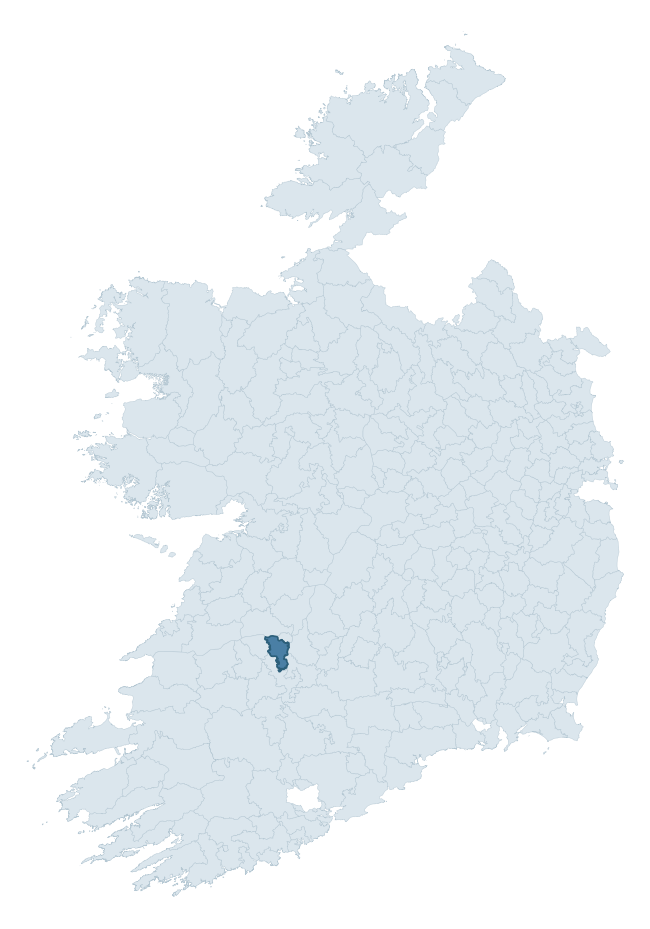
Where this barony sits in the Republic of Ireland
Geology and preservation
Bedrock geology shapes the landscape long before any settlement begins — controlling soil drainage, agricultural potential, the survival of upstanding monuments, and the preservation of buried archaeology. The figures below come from the Geological Survey Ireland 1:100,000 bedrock map.
The bedrock underlying Pubblebrien is predominantly limestones (56% of the barony by area), laid down during the Carboniferous period (99% by area, around 359 to 299 million years ago). Limestone is the most heritage-rich bedrock in Ireland. It supports fertile, well-drained soils that favoured dense Early Medieval settlement and Norman manorial agriculture, and it weathers into karst features — sinkholes, caves, swallow holes, and souterrains — that frequently carry archaeology. Where peat overlies limestone, organic preservation can be exceptional. A substantial secondary geology of limestone (39%) adds further variety to the underlying landscape. The single largest mapped unit is the Visean Limestones (undifferentiated) (56% of the barony's bedrock).
Rock type composition
Largest mapped unit: Visean Limestones (undifferentiated) (56% of the barony)
Placename evidence
Logainm records 23 heritage-diagnostic placenames for Pubblebrien, drawn from townland and civil-parish names across the barony. The dominant stratum is pre-Christian and Early Medieval defensive — ráth-, lios-, dún-, and caiseal-prefixed names that mark Iron Age and early historic settlement. The leading diagnostic roots are cill- (10 — church), dún- (3 — hilltop fort or promontory fort), and cathair- (3 — stone fort). This is below the ROI average of 30.7 heritage placenames per barony, suggesting either lighter survey coverage or a townland-naming tradition that draws more on generic landscape vocabulary. The presence of multiple heritage strata side by side indicates layered occupation of the landscape across successive prehistoric and historic periods. Logainm records 125 placenames for Pubblebrien (predominantly townland names). Of these, 23 (18%) carry one of the diagnostic Gaelic roots tracked above; the remainder draw on more generic landscape vocabulary that does not encode a heritage period.
Pre-Christian / Early Medieval Defensive
| Root | Count | Meaning |
|---|---|---|
| dún- | 3 | hilltop or promontory fort |
| cathair- | 3 | stone fort |
| ráth- | 2 | earthen ringfort |
| lios- | 2 | ringfort or enclosure |
| caiseal- | 1 | stone ringfort |
Early Christian Ecclesiastical
| Root | Count | Meaning |
|---|---|---|
| cill- | 10 | church (early) |
| mainistir- | 1 | monastery |
Burial, Ritual, and Norse-Contact
| Root | Count | Meaning |
|---|---|---|
| carn- | 1 | cairn |
| gall- | 1 | foreigner — Norse settlement marker |
Other baronies in Limerick
- Coonagh
- North Liberties
- Clanwilliam
- Owneybeg
- Coshma
- Glenquin
- Kilmallock
- Carbery East (east Division) — Cork
- Glenquin
- Decies Without Drum — Waterford
See all 280 baronies in the Republic of Ireland Heritage Tool.

Explore further
Grounding History: 10 Maps of Northern Ireland’s Past
If you’re interested in Irish heritage more widely, the companion report for Northern Ireland brings together the analysis of all 462 NI wards into one place through 10 high-quality maps — covering monument density, archaeological periods, placename heritage, terrain, wetland, and the historic landscape at first survey. Take a look.
About this profile
Click any section below to expand.
What is a barony?
A barony is a historic administrative unit in Ireland, broadly equivalent to an English hundred. The 280 baronies used here are from the OSi 2019 National Statutory Boundaries (generalised 20m), covering the 26 counties of the Republic of Ireland. Baronies derive from the Norman period, were formalised in the 17th century, and have not been redrawn for statistical purposes. They vary enormously in area, from compact urban baronies in Dublin to vast upland baronies in Connacht, and should not be compared by raw site count without accounting for area differences.
What counts as a site?
This profile combines three distinct heritage registers, each with its own definition of what constitutes a recordable site:
- Archaeological sites (NMS). The National Monuments Service Sites and Monuments Record (SMR) catalogues every known archaeological monument or site of archaeological interest in the Republic, from prehistoric burial mounds and ringforts to medieval churches and post-medieval defensive works. Inclusion does not require legal protection — only that the site has been identified, surveyed, and assessed as having archaeological value. A separate subset of these sites lies within a recorded protection zone, which gives them statutory protection under the National Monuments Acts.
- Listed buildings (NIAH). The National Inventory of Architectural Heritage records buildings of architectural, historical, archaeological, artistic, cultural, scientific, social, or technical interest. Each surveyed structure is appraised on a five-tier scale: International, National, Regional, Local, and Record-Only. The NIAH appraisal is informational rather than strictly statutory, but it underpins local-authority Record of Protected Structures (RPS) listings.
- Heritage placenames (Logainm). Logainm is the authoritative database of Irish placenames maintained by the Placenames Branch. This profile applies a heritage-diagnostic classifier to the Irish-language form of each townland name, flagging roots that signal defensive sites (ráth-, lios-, dún-, caiseal-, cathair-), ecclesiastical foundations (cill-, teampall-, domhnach-, mainistir-), prehistoric burial-ritual features (tuaim-, carn-, leaba-), or Norse-contact settlement (gall-). Townlands without one of these diagnostic roots are not flagged here — they may still carry historical significance, but that significance is not encoded in the name itself.
Editorial principles
The narrative sections of this profile follow several explicit principles:
- Evidential. Every claim about this barony’s heritage character is anchored in the underlying register data. Where a site count, a placename count, or a percentile rank is cited, it is computed from the source datasets at export time, not estimated.
- Comparative. Counts and metrics are reported alongside their percentile rank against the other 279 ROI baronies. A barony with 50 ringforts in absolute terms could be unusually high or unusually low depending on its size and regional context; percentile ranking removes that ambiguity.
- Transparent on limits. Where a register has known coverage gaps, survey biases, or data-quality issues that affect this barony’s figures, the profile flags them rather than presenting the numbers as definitive.
- No interpretation beyond what the data supports. The narrative does not speculate about historical events, social dynamics, or cultural meaning beyond what the recorded heritage and placename evidence directly attests.
Data caveats and limits
- NMS Sites and Monuments Record is the product of survey campaigns conducted at different intensities across different counties and decades. Some baronies have been surveyed more thoroughly than others, and absolute counts should be read in that light. Sites destroyed by development before survey are typically not represented; sites in heavily forested or upland terrain are sometimes under-recorded.
- NIAH coverage is broadly complete for the Republic of Ireland but the survey was conducted on a rolling county-by-county basis, and the most recent appraisal date varies. Buildings demolished or substantially altered after their original survey may still appear in the register; conversely, recent buildings of merit may not yet have been appraised.
- Logainm classification applies a deliberately conservative pattern-matching approach to the Irish-language townland forms. The classifier prioritises true positives over recall: a townland may carry a heritage signal that the classifier doesn’t recognise, particularly where the diagnostic root has been heavily anglicised or where the townland name draws on a less common term. The 60,000+ townland records and ~9,800 classified placenames give a substantial signal at barony scale, but individual townland names should be checked against Logainm directly for definitive interpretation.
- Period attribution. The chronological distribution reflects only those NMS sites that carry a recognised period attribution in the source data. Sites listed as “Unknown” period are excluded from the dated subset.
- Boundary changes. Some baronies have undergone minor boundary adjustments since their 19th-century definition; the OSi 2019 generalised boundaries used here are the current statutory definition and may differ slightly from historical maps in border areas.
- Bedrock geology is mapped at 1:100,000 scale, which means local variation within a barony — small pockets of different rock type, mineral veins, alluvium overlying bedrock — is generalised. The dominant-system and rocktype figures are area-weighted, so a barony reading “70% Carboniferous limestone” may still contain small but archaeologically important pockets of older or younger rock. Around 3% of GSI polygons do not match the lexicon and contribute no rocktype or system attribution.
Data sources
- National Monuments Service — Sites and Monuments Record (SMR) https://data.gov.ie/dataset/national-monuments-service-archaeological-survey-of-ireland
- National Inventory of Architectural Heritage (NIAH) https://data.gov.ie/dataset/national-inventory-of-architectural-heritage-niah-national-dataset
- Logainm — Placenames Database of Ireland https://www.logainm.ie/
- Ordnance Survey Ireland — National Statutory Barony Boundaries 2019 https://data-osi.opendata.arcgis.com/
- EURODEM — European Digital Elevation Model https://www.mapsforeurope.org/datasets/euro-dem
- ESA WorldCover https://esa-worldcover.org/en
- Geological Survey Ireland — 1:100,000 Bedrock Geology https://www.gsi.ie/en-ie/data-and-maps/Pages/Bedrock.aspx
Explore more: Search any of the 280 ROI baronies, browse by historical province, or read the methodology and data sources for the full Republic of Ireland Heritage Tool.