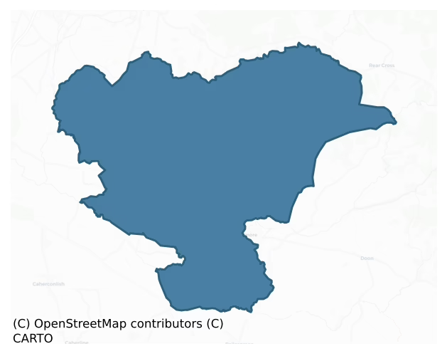
Owneybeg is a barony of County Limerick, in the historical province of Munster (Irish: Uaithne Beag), covering 110 km² of land. The barony records 173 NMS archaeological sites and 53 NIAH listed buildings, placing it at around the 37th percentile among 280 ROI baronies for sites per km². This means it is in the lower half of all baronies for sites per km². Dated archaeological evidence runs from the Neolithic through to the Modern, spanning 8 of 9 archaeological periods, placing the barony in the 77th percentile among 280 ROI baronies for chronological depth. This means it is in the top third of all baronies for chronological depth. The largest dated subset of recorded sites dates to the Iron Age.
Heritage at a glance
Percentile rankings throughout this profile compare each barony only against the other 279 Republic of Ireland baronies.
The recorded heritage of Owneybeg
The National Monuments Service Sites and Monuments Record (SMR) is the statutory inventory of archaeological sites for the Republic of Ireland, maintained by the Department of Tourism, Culture, Arts, Gaeltacht, Sport and Media. Sites recorded here include earthworks, ringforts, megalithic tombs, ecclesiastical remains, and post-medieval features; not every record is legally protected, but each is registered as a monument of archaeological interest.
The National Monuments Service records 173 archaeological sites in Owneybeg, putting it at the 37th percentile among 280 ROI baronies for sites per km². This means it is in the lower half of all baronies for sites per km². Protection coverage is near-universal — 171 sites (99%) fall within a recorded monument protection zone, indicating an extensively surveyed landscape. The dominant category is defensive sites — ringforts, enclosures, hillforts, and stone forts (73 sites, 42% of the record). Ringfort – rath is the most prevalent type, making up 20% of the barony's recorded sites (35 records), broadly in line with the ROI average of 20% across all baronies where this type occurs. Ringfort – rath is an earthen ringfort enclosed by a bank and external ditch — the most common Early Medieval farmstead, broadly dated 500–1000 AD. Other significant types include Enclosure (24) and Barrow – ring-barrow (10). Enclosure is a banked or ditched feature of uncertain type, used as a catch-all where the original function cannot be determined from surface evidence; Barrow – ring-barrow is a Bronze/Iron Age burial monument: a low circular area enclosed by ditch and outer bank. Across the barony's 110 km², this gives a recorded density of 1.57 sites per km².
Most common monument types
Hover or tap a monument type to see its definition.
| Type | Count |
|---|---|
| Ringfort – rath an earthen ringfort enclosed by a bank and external ditch — the most common Early Medieval farmstead, broadly dated 500–1000 AD | 35 |
| Enclosure a banked or ditched feature of uncertain type, used as a catch-all where the original function cannot be determined from surface evidence | 24 |
| Barrow – ring-barrow a Bronze/Iron Age burial monument: a low circular area enclosed by ditch and outer bank | 10 |
| Mound an artificial earthen elevation of unknown date and function that cannot be classified as another known monument type | 6 |
| Castle – unclassified a castle whose form cannot be precisely classified, dating somewhere between the late 12th and 16th centuries | 5 |
| Church a building used for public Christian worship, of any date from c. 500 AD onwards | 4 |
Chronological distribution
The dated archaeological record for Owneybeg spans from the Neolithic through to the Modern, with activity attested across 8 of 9 archaeological periods. This is the 77th percentile across ROI baronies for chronological depth — an above-average span. Every period from earliest to latest is represented in the record — an unbroken sequence of dated activity across the full chronological span. Activity concentrates most heavily in the Iron Age (41 sites, 28% of dated material), with the Early Medieval forming a secondary peak (38 sites, 26%). A further 26 recorded sites (15% of the overall NMS register for the barony) carry no period attribution — appearing as 'Unknown' in the bar chart below. This typically reflects either records that pre-date the standardised period vocabulary or sites awaiting specialist dating review, rather than a genuine absence of chronological evidence.
Sample of recorded monuments
Show 25 sample monuments (of 173 total)
A representative sample of 25 recorded monuments drawn from the barony’s 173 total NMS entries. Sites within a recorded monument protection zone and rarer site types are prioritised so the list shows a meaningful cross-section rather than only the most common type. Each entry shows the official Sites and Monuments Record reference number and the description published by the National Monuments Service.
Hilltop enclosure
In woodland area on the summit of a steep N-S ridge with panoramic views on all sides. Annotated 'Lisgorey' on 1840 OS 6-inch map with trig. station marking spot height 494 ft. OD in centre of monument. Moroe Fair…
In woodland area on the summit of a steep N-S ridge with panoramic views on all sides. Annotated 'Lisgorey' on 1840 OS 6-inch map with trig. station marking spot height 494 ft. OD in centre of monument. Moroe Fair Green located 140m to SSE and enclosure (LI007-003—-) 180m to S. Lynch (1932, 44) identifies the fort of Lios Ghuaire as one of the royal forts listed in the Book of Rights as the fort of Eibhliu, daughter of Guaire. The hilltop fort is situated on a prominent spur of Slieve Felim, N of the village of Murroe (ibid). According to O'Donovan this hilltop was formerly known as 'Sliabh Eibhlinne inghini Guaire' the mountain rainge of Eibhliu, daughter of Guaire (ibid., 43).
Monument described by the Ordnance Survey as following; 'This fort is about 2½ chains [50m] in diameter and 3 feet [0.9m] high, composed of earth, with a green flat surface. It is placed on an exalted hill, terminating almost at the top to the extent of the fort and commanding a fine view over a great part of the surrounding country. It has taken its name, it is said, from a man named Guaire, about whom a folk tale is current in the district' (OSNB Abington Parish, 41).
Site visited in 1999 and described as a circular-shaped area (approx. dims. 26m N-S x 28m E-W) defined by a scarp and steeply falling ground to the E and W. The E and W quadrants of the interior have been raised to form a level surface. No entrance feature visible. A field boundary is visible at N and NW side of the encl…
Barrow – bowl-barrow
On the level summit of Knockaunnamoughilly, in level pasture, c. 125m to S of the Clare River, with excellent views in all directions. Depicted on the 1840 OS 6-inch map as a circular-shaped enclosure standing in the…
On the level summit of Knockaunnamoughilly, in level pasture, c. 125m to S of the Clare River, with excellent views in all directions. Depicted on the 1840 OS 6-inch map as a circular-shaped enclosure standing in the centre of a large circular-shaped field (approx. diam. 115m). Monument surveyed by the ASI in 1999 and described as a circular-shaped flat-topped mound (diam. 9m; H 0.4m) defined by a fosse (base Wth 2.4m; overall Wth 7m; D 0.15m) from E-SE-S. Visible as a tree-covered monument within the centre of a circular-shaped large enclosure (100m E-W; 90m N-S) on Digital Globe orthophotos taken 2011-13 and Google Earth orthoimage taken 28/06/2018. Possible barrow standing in centre of large ritual hilltop enclosure (LI007-005001-) known as 'Knockaunnamoughilly'.
See attached Google Earth orthoimages
Compiled by: Alison McQueen and Vera Rahilly
Date of upload: 3 July 2020
Cairn – boundary cairn
A possible boundary cairn or megalithic tomb known locally as 'Tuaim an Fhir Mhóir', which marks the townland boundary with Glenstal on the western foothills of the Slievefelim Mountains, in the townland of Meentolla.…
A possible boundary cairn or megalithic tomb known locally as 'Tuaim an Fhir Mhóir', which marks the townland boundary with Glenstal on the western foothills of the Slievefelim Mountains, in the townland of Meentolla. Annotated 'Tuamanirvore' on the 1840 ed. OS 6-inch map. Described in the Ordnance Survey Letters as following; 'In the south west corner of the Townland of Meentulla and at the boundary of it with Glanstale, is situated a monument called Tuaim an Fhir Mhóir, locally translated the Big Man's Grave. It is a small heap of stones thrown together by passerby, it is said, over the remains of a highway man who was killed there. The same name notifies a grave [wedge tomb LI006-031—-) situated in the Townland of Cappanahannagh, within half a mile to the north to Liss Guaire [LI007-002—-]' (O'Flanagan 1929, 127). Two megalithic tombs are in the vicinity, a wedge tomb (LI007-006—-) in the nearby townland of Garranbane and a court tomb (TN038-013—-) in the neighbouring townland of Shanballyedmond, Co. Tipperary.
Compiled by: Alison McQueen, Vera Rahilly and Caimin O'Brien
Date of upload: 3 July 2020
Religious house – Cistercian monks
Situated on a slight rise of ground immediately S of a medieval parish church (LI014-014005-) and graveyard (LI014-014006-) and 70m N of the Mulkear River, corn mill (LI014-014007-) and 17th century bridge…
Situated on a slight rise of ground immediately S of a medieval parish church (LI014-014005-) and graveyard (LI014-014006-) and 70m N of the Mulkear River, corn mill (LI014-014007-) and 17th century bridge (LI014-014008-). In 1907 Seymour (1907, 180) suggested that the ‘true site of the abbey must be sought a little higher up from the river, where the ground is flat, and it may have stood, in whole or in part, on the site now occupied by the present graveyard (LI014-014006-)’. A deserted medieval settlement (LI014-014001-) appears to have been located in the fields to the SE of the abbey. Two fish weirs (LI014-014014-/-015-) possibly belonging to the abbey were located in the Mulkear River immediately S of the abbey buildings. Cistercian monastery dedicated to the Blessed Virgin Mary (Cal. papal letters, 1495-1403, 241) known as Mainistir Uaithne, Woney or Owney, the monastery of Abington or Abbey Owney founded by Theobald Walter, Butler of Ireland in 1205 for a colony of monks from Furness in Lancashire (Gwynn and Hadcock 1970, 126). In 1540 a 'Charter for the abbey of the B.V.M. of Wothonia, diocese of Emly, of the Cistercian order, with assent of James, earl of Ormond and Ossory, its founder and patron; transforming it to a secular provostry (prepositura); John Ryane, late abbot, to be provost' (Nicholls 1994, 21). In 1552 a 21 year lease was granted to Walter Ap Howell which included the 'site of the abbey of Wony, county Limerick, lands of Wony, Caslane boenagh…
Mill – corn
Owney Mill is mentioned in 1558 when the 'Earl of Sussex and his retinue came through an old abbey (LI014-014002-) and a mill called Onin O'Mollrye' (Seymour 1907, 177). The mill depicted standing on the N bank of the…
Owney Mill is mentioned in 1558 when the 'Earl of Sussex and his retinue came through an old abbey (LI014-014002-) and a mill called Onin O'Mollrye' (Seymour 1907, 177). The mill depicted standing on the N bank of the Mulkear River, 70m S of Abbey Owney (LI014-014002-) on the 1840 ed. OS 6-inch map may stand on site of or incorporate the remains of a medieval corn mill depicted on the 1656 Down Survey map of Owneybeg barony (NLI, MS 718). This map depicted a cluster of dwellings (LI014-014001-) standing either side of the Mulkear River in close proximity to the ruins of Owneybeg Abbey (LI014-014002-), a stone bridge (LI014-014008-) and the medieval corn mill (ibid.). The mill is depicted standing on the N bank of the Mulkear River in a location similar to the mill depicted on the 1840 ed. OS 6-inch map. The medieval mill is depicted with a large waterwheel on the gable of the corn mill. The terrier of the Down survey map of Abbeyowneybeg parish recorded that in this parish ‘there is an abbey p[ar]te whereof is Thatcht and about thirty Thatch Houses a good Corne Mill and a bridge on the Mannor of Abbeyowthneybegg’ (ibid.). The 1654-56 Civil Survey of Limerick recorded that in the parish of Abbeyowney there was ‘a Mannor Towne wth the priviledge of a Courte Leete and Courte barron. Ye River of Muilcherne leadinge through the said Towne and a stone bridge thereuppon one Mill two fishing weares a Demolished stone house with two Orchards and a garden upon Rath and C…
Country house
In 1681 the lands of Abbey Owney (LI014-014002-) were in the possession of Joseph Stepney, of the Middle Temple, London. He was one of the Cromwellian settlers, and was High Sheriff of Co. Limerick in 1686. Amongst the…
In 1681 the lands of Abbey Owney (LI014-014002-) were in the possession of Joseph Stepney, of the Middle Temple, London. He was one of the Cromwellian settlers, and was High Sheriff of Co. Limerick in 1686. Amongst the list of persons attainted in the reign of James II., there occurs the name of " Joseph Stepney, of Abbeyowney, in the County of Limerick, Esqr." He is credited with having pulled down the greater part of the abbey in order to build Abington House' (Seymour 1907, 179-80).
The present ruins of Abington House standing 220m S of Abbey Owney (LI014-014002-) and 50m S of Abington Bridge (LI014-014008-) and the Mulkear River were described by the National Inventory of Architectural Heritage as a 'Detached L-plan seven-bay two-storey house, built c. 1790. Hipped and pitched slate roof with rendered chimneystacks and return to rear. Rendered walls having render quoins. Square-headed opening with limestone sills, some with remains of six-over-six pane timber sliding sash windows. Square-headed door opening having render surround. Single-bay single-storey outbuilding to east with hipped slate roof. Rubble limestone and sandstone walls' (www.buidingsofireland.ie).
In 1907 Rev. Seymour recorded the presence of cut stone and other architectural fragments possibly taken from the nearby abbey (LI014-014002-) which were then present in the yard of Abington House beside Abington Bridge. He recorded the following details about these fragments, 'Mr. Fitz Gerald's yard cl…
Mausoleum
Situated on a terrace in gently undulating pasture immediately S of Abbey Owney graveyard (LI014-014006-) and abbey (LI014-014002-) c. 30m N of the Mulkear River with good views to S and W. No surface remains visible…
Situated on a terrace in gently undulating pasture immediately S of Abbey Owney graveyard (LI014-014006-) and abbey (LI014-014002-) c. 30m N of the Mulkear River with good views to S and W. No surface remains visible of any mound in field to E of the building marked as 'Convent on the 1840 ed. OS 6-inch map. According to Seymour (1907, 180 ), 'The old graveyard (LI014-014003-) is said to have been in the field between the river and the present entrance to the graveyard (LI014-014006-). Stepney, thinking it a pity that good land should be thus wasted, rooted up all the graves, gathered the coffins and remains together, and tried to burn them. They refused to burn, so he piled them on the river bank, and threw them in when a big flood came down. But the river, as if abhorring such desecration, washed them back again; so he was at last compelled to bury them at a spot in the field which is now marked by the mound'. Seymour (1907, 165) recorded that the mound was located between the E wall of the Walsh mausoleum (LI014-014004-) marked as 'Convent' on the 1840 ed. OS 6-inch map and the public road where 'there is a mound, resembling a small tumulus'. According to Seymour (1907, 363) 'two curious figures' 'were dug out of the mound outside the graveyard, and that they formed part of the Barry mausoleum (LI014-014018-). They represent nude, armless, female figures in very high relief, and appear to be copies of Sheela-na-gigs intended by the sculptor to be placed on each sid…
Concentric enclosure
Situated in undulating, poorly drained pasture with good views to N and E. A field boundary bisects the site in the WSW. The monument is evident as a roughly circular area (27m E-W; 24m N-S) defined by a scarped edge…
Situated in undulating, poorly drained pasture with good views to N and E. A field boundary bisects the site in the WSW. The monument is evident as a roughly circular area (27m E-W; 24m N-S) defined by a scarped edge (Wth 1.7-3.8m; H 0.4-0.8m) with an external fosse (Wth 2.8m). This is truncated at SW by a field boundary travelling NW-SE. Concentric with the fosse and c. 8m outside it is a low earthen bank (int. H 0.4m; Wth 2m; ext. H 0.1m). This bank is evident from S (where truncated by field boundary) clockwise to E. That area of the enclosure SW of the field boundary is partially covered by scrub overgrowth.
Compiled by: Denis Power
Date of upload: 18 June 2013
Castle – motte
Situated in a wooded area c. 50m NE of a Georgian house and garden. On a natural scarp with a sharp drop to the E, with good views in all directions. Indicated on the 1923 OS 6-inch map as a sub-circular area (diam. c.…
Situated in a wooded area c. 50m NE of a Georgian house and garden. On a natural scarp with a sharp drop to the E, with good views in all directions. Indicated on the 1923 OS 6-inch map as a sub-circular area (diam. c. 20m) defined by a scarp, near to 'Castle, site of'. The monument is covered by dense vegetation overgrowth. Survives as a sub-oval area defined by a scarp (Wth. 1.8m; H 1.3m).
Compiled by: Elizabeth Connolly
Date of upload: 9 June 2016
Designed landscape – folly
Situated on the W-facing slope of a hill in gently rolling former pasture, immediately E of a disused quarry. Structure shown on 1840 OS map and named 'Turret' is located in an area of dense scrub vegetation and it was…
Situated on the W-facing slope of a hill in gently rolling former pasture, immediately E of a disused quarry. Structure shown on 1840 OS map and named 'Turret' is located in an area of dense scrub vegetation and it was not possible to find any standing remains of the structure. It was probably an eyecatcher/folly as it is located close in a prominent position close to the entrance into the demesne of Tower Hill country house which was built in 1800 (see Spellissy 1989, 135).
Compiled by: Denis Power
Date of upload: 3 July 2013
Kiln – corn-drying
Situated in the SW edge of ringfort (LI015-013—-), on a gentle SW-facing slope in poorly-drained, undulating pasture with good views in all directions. The basal remains of a keyhole shaped kiln (L 4.05m E-W) with a…
Situated in the SW edge of ringfort (LI015-013—-), on a gentle SW-facing slope in poorly-drained, undulating pasture with good views in all directions. The basal remains of a keyhole shaped kiln (L 4.05m E-W) with a flue (2.35m E-W; 0.95m N-S) to W and a bowl (1.7m E-W; 1.65m N-S) to E. It is constructed of limestone blocks of various sizes and lengths with longer stones used in the flue's construction.
See attached photographs and sketch plan of feature identified and recorded by Elizabeth Connolly.
Compiled by: Denis Power
Revised by: Caimin O'Brien
Date of revised upload: 1 June 2021
Standing stone
On SW-facing slope, in pasture, c. 10m NE of a public road. Not depicted on OS historic mapping. Described in 1999 by the ASI as a single upright standing stone (H. 0.89m x 0.2m x 0.3m) that is square in section.…
On SW-facing slope, in pasture, c. 10m NE of a public road. Not depicted on OS historic mapping. Described in 1999 by the ASI as a single upright standing stone (H. 0.89m x 0.2m x 0.3m) that is square in section. Monument is close to the inside angle formed by the meeting of two field boundaries. Not visible on Digital Globe orthophotos taken 2011-13 or on Google Earth orthoimages taken 28/06/2018.
See attached Google Earth orthoimage taken 28/06/2018 and sketch location map
Compiled by: Alison McQueen and Vera Rahilly
Date of upload: 10 July 2020
Castle – motte and bailey
In gently undulating pasture, with good view in all directions. The monument consists of a flat topped (18m N-S; 13m W-E) conical mound (diam. 38m; H 4.7m) with a roughly rectangular platform (26m E-W; 32m N-S) defined…
In gently undulating pasture, with good view in all directions. The monument consists of a flat topped (18m N-S; 13m W-E) conical mound (diam. 38m; H 4.7m) with a roughly rectangular platform (26m E-W; 32m N-S) defined by a scarped edge (Wth 8m; H 2.5m) attached on its W side. The entire mounment is overgrown by scrub. A field boundary crosses the platform close to its junction with the mound.
Compiled by: Denis Power
Date of upload: 29 October 2013.
Inscribed stone
A stone bridge (LI014-014008-) built in 1621 is shown traversing the Mulkear River to the S of Abbey Owney (LI014-014002-) on the 1656 Down Survey map of the barony of Owneybeg (NLI, MS 718). The Down Survey map of…
A stone bridge (LI014-014008-) built in 1621 is shown traversing the Mulkear River to the S of Abbey Owney (LI014-014002-) on the 1656 Down Survey map of the barony of Owneybeg (NLI, MS 718). The Down Survey map of Owneybeg barony depicted the medieval settlement (LI014-014001-) of Abbeyowney standing either side of the Mulkear River in close proximity to the ruins of Owneybeg Abbey and the medieval corn mill (LI014-014007-) (ibid.). In 1681 Thomas Dineley visited the Abbey and made a drawing of the abbey ruins which he showed standing beside a six-arch bridge around which there were a cluster of dwellings representing the medieval settlement of Abbey Owney (Shirley et. al. 1865, 278).
The present road bridge over the Mulkear River stands 170m SSE of the Cistercian abbey (LI014-014001-) and was described by the National Inventory of Architectural Heritage as a 'Six-arch limestone road bridge over the River Mulkear, built c. 1740, with earlier fabric. Rubble limestone and sandstone walls with limestone cappings and inscribed limestone plaque to west parapet wall. Roughly dressed limestone voussoirs to round-headed arches. Rubble limestone V-cutwaters to east elevation' (wwww.buildingsoireland.ie). The inscribed plaque visible in the W parapet wall of the bridge is a 17th-century memorial plaque commemorating the death of Sir Edmund Walsh in 1618. The inscription was recorded by Dineley in 1681 as follows; 'The Armes of Sr. Edmund Walsh als Grace Knight and his wife E…
Headstone
The precise location of a possible 17th century headstone in Abbey Owney graveyard (LI014-014006-) cannot be identified. In 1907 Seymour recorded that the headstone was located close to the Barry wall monument…
The precise location of a possible 17th century headstone in Abbey Owney graveyard (LI014-014006-) cannot be identified. In 1907 Seymour recorded that the headstone was located close to the Barry wall monument (LI014-014018-) in Abbey Owney graveyard. He recorded the following details about the slab 'Following on in the same direction a curious little upright tombstone will be found. It is about 17 inches [0.43m] high by 11 [0.27m] wide, with rounded top, and represents a winged figure standing on a pedestal, blowing a trumpet, which is held in the left hand, while the right grasps a pair of scales. This is surrounded by foliage, and the whole is in low relief. Underneath is a blank space of about 5 inches, apparently intended for an inscription, which was never cut' (Seymour 1907, 363).
Compiled by: Caimin O'Brien and Matt Kelleher
Date of upload: 3 July 2017
Armorial plaque
The precise location of the armorial plaque taken from doorway of the Walsh family mausoleum and was reused as a headstone in Abbey Owney graveyard (LI014-014006-) cannot be identified. In 1907 Seymour recorded that the…
The precise location of the armorial plaque taken from doorway of the Walsh family mausoleum and was reused as a headstone in Abbey Owney graveyard (LI014-014006-) cannot be identified. In 1907 Seymour recorded that the armorial plaque was located close to the Barry wall monument (LI014-014018-) in Abbey Owney graveyard. He recorded the following details about the plaque, 'Next there is a square upright slab, now doing duty as a tombstone, with the arms of Walsh impaling Grace as in shield No. 1, and the crest a swan sejant. It has carved on it the following (taken from Dyneley, as the original is almost covered) : THE ARMES OF SIR EDMUND WALSH KNIGHT AND HYS LADYE ELLYCE GRACE. Enough, however, is exposed to show that it is written in raised Roman letters, not in old English, as Dyneley gives it. He says this stone was over the door going into the chapel (LI014-014004-) where the Walsh tomb was, and that the date 1619 was on it' (Seymour 1907, 363). Loeber suggested that the cut limestone often referred to as marble for the memorials in Abington graveyard came from quarries in the barony of Clanwilliam (Loeber 1981, 278). The marble quarry (LI023-339—-) of Caherline and Ballyhobin mentioned in the Civil Survey of 1654-56 may have supplied the stone for these memorials (Simington 1938, 74).
Compiled by: Caimin O'Brien and Matt Kelleher
Date of upload: 3 July 2017
Graveslab
The precise location of a cross-inscribed graveslab in Abbey Owney graveyard (LI014-014006-) cannot be identified. In 1907 Seymour recorded that the graveslab was located close to the Barry wall monument (LI014-014018-)…
The precise location of a cross-inscribed graveslab in Abbey Owney graveyard (LI014-014006-) cannot be identified. In 1907 Seymour recorded that the graveslab was located close to the Barry wall monument (LI014-014018-) in Abbey Owney graveyard. He recorded the following details about the graveslab, 'Beyond this are a few pieces of cut stone, and a slab on which is carved a raised four-point cross, the arms bound in a circle which is intertwined with them' (Seymour 1907, 363).
Compiled by: Caimin O'Brien and Matt Kelleher
Date of upload: 3 July 2017
Mass-rock
Mass-rock (H 0.8m x Wth 0.8m x T 0.5m) located in woodland in Cappercullen Glen beside a stream which marks the townland boundary between Garranbane and Boarmanshill with Cappercullen Castle (LI007-010001-) 465m to SW. …
Mass-rock (H 0.8m x Wth 0.8m x T 0.5m) located in woodland in Cappercullen Glen beside a stream which marks the townland boundary between Garranbane and Boarmanshill with Cappercullen Castle (LI007-010001-) 465m to SW. Mass-rock now standing beneath a modern stone roofed structure constructed by the Belgian monks of Glenstal Abbey with modern altar stone placed on top of the mass rock. Fragments of two 17th century tombs (LI007-015—-/016—-) and a sixteenth century tomb (LI007-017—-) all of which come from Abbey Owney (LI014-014002-) in Abington have been built into the mass shelter. Two square shaped stones to the E of the shelter appear to be decorated and possibly came from the 17th Walsh family mausoleum at Owney Abbey. These stones have been built into the cliff face and reused as seats beside the mass shelter. Other cut stone fragments can be seen lying scattered around the site. 13th century architectural fragment from the Cistercian Owney Abbey (LI014-014002-) consisting of a dressed stone with roll moulding on the angle has been reused as a leg to support the rear altar of the mass-shelter. Two cut stone panels (H 0.9m x Wth 0.45m) decorated with incised floral motifs and S-shaped scrolls have been incorporated into the pillars of the mass shelter on either side of the mass-rock. These two fragments probably came from the 17th century wall memorial (LI014-014017-) of Edmund Walsh of Owney Abbey (LI014-014002-) and were carved by Patrick Kerin.
C…
Walled garden
The walled garden now on the demesne of Glenstal Abbey was originally built c. 1680 by George Evans who acquired the forfeited lands and castle of Cappercullen in 1667. The walled garden was built to the W of the…
The walled garden now on the demesne of Glenstal Abbey was originally built c. 1680 by George Evans who acquired the forfeited lands and castle of Cappercullen in 1667. The walled garden was built to the W of the medieval castle of Cappercullen (LI007-010001-).
In 1604 Theobald Baron Bourgh, of Castleconnell was granted the castle and lands of Cappercullen which was formerly part of the estate of 'Conogher, mac Edmund, mac Lysagh, O'Mulrian' (Westropp 1906-07, 100). In 1641 Colonel Pierce Walsh of Abbeyowney was listed as the proprietor of the lands of 'Cappacullyn' which consisted of 261 acres of profitable land and 33 acres of bog (ibid.). In 1667 the forfeited castle and lands of Cappercullen were granted to George Evans (Westropp 1906-07, 100). Around 1680 a walled garden was built to the W of the medieval castle (Murphy 2014, 19). Cappercullen House located immediately SW of the garden was built by Lord Carbery in the early 18th century (ibid., 21). Modern tennis courts now stand on the site of the levelled 18th century brick house.
Compiled by: Caimin O'Brien
Date of upload: 10 July 2017
Deer park
The deer park garden now on the demesne of Glenstal Abbey was originally built in 1683 by George Evans who acquired the forfeited lands and castle of Cappercullen in 1667 (Murphy 2014, 20. The deer park was built to…
The deer park garden now on the demesne of Glenstal Abbey was originally built in 1683 by George Evans who acquired the forfeited lands and castle of Cappercullen in 1667 (Murphy 2014, 20. The deer park was built to the NW of the medieval castle of Cappercullen (LI007-010001-). In 1667 the forfeited castle and lands of Cappercullen were granted to George Evans (Westropp 1906-07, 100). Around 1680 a walled garden (LI007-010005-) was built to the W of the medieval castle (Murphy 2014, 19). In 1682 King Charles II granted George Evans 'the younger' a charter to establish a deer park c. 500 acres in size on his lands at Cappercullen and Murroe (ibid.). A raised walkway running from a corner of the walled garden prevented deer from encroaching on the gardens of Cappercullen House which was located immediately SW of the walled garden. This house was built by Lord Carbery in the early 18th century (ibid., 21). Modern tennis courts now stand on the site of the levelled 18th century brick house.
Compiled by: Caimin O'Brien
Date of upload: 10 July 2017
Architectural feature
Standing on a post-1700 cut stone column in Cappercullen Glen beside mass rock (LI007-014—-) and fragments of wall tombs (LI007-015/016/017—-) and architectural fragments which came from Owney Abbey (LI014-014002-)…
Standing on a post-1700 cut stone column in Cappercullen Glen beside mass rock (LI007-014—-) and fragments of wall tombs (LI007-015/016/017—-) and architectural fragments which came from Owney Abbey (LI014-014002-) in Abington. Well worked limestone bowl (diam. 0.3m) roughly faceted with shallow depression (diam. 0.17m; D 0.05m) possibly originally used as a stoup in a church, and may have come from Abington however this is not certain. The flat base of the bowl has a hole for fixing it to a column on which it stands. The stone appears to have been a freestanding stoup supported on a column possibly inside the doorway of a church. The dating of the stoup is uncertain.
Compiled by: Caimin O'Brien with details kindly provided by Colmán Ó Clabaigh of Glenstal Abbey.
Date of upload: 3 August 2017
Enclosure – large enclosure
On the level summit of Knockaunnamoughilly, in level pasture, c. 125m to S of the Clare River, with excellent views in all directions. Depicted on the 1840 OS 6-inch map as a circular-shaped enclosure (LI007-005—-)…
On the level summit of Knockaunnamoughilly, in level pasture, c. 125m to S of the Clare River, with excellent views in all directions. Depicted on the 1840 OS 6-inch map as a circular-shaped enclosure (LI007-005—-) standing in the centre of a large circular-shaped field (approx. diam. 115m). Monument surveyed by the ASI in 1999 and described as a circular-shaped flat-topped mound the base of which is enclosed by a fosse from E-SE-S. Visible as a tree-covered monument within the centre of a circular-shaped large enclosure (100m E-W; 90m N-S) on Digital Globe orthophotos taken 2011-13 and Google Earth orthoimage taken 28/06/2018. Possible barrow standing in centre of large ritual hilltop enclosure (LI007-005001-) known locally as 'Knockaunnamoughilly'.
See attached Google Earth orthoimages
Compiled by: Alison McQueen, Vera Rahilly and Caimin O'Brien
Date of upload: 3 July 2020
Cairn – burial cairn
Situated on a ridge of poorly drained land in upland area on the SE facing slope of Cullaun Mountain with commanding views of the surrounding countryside from NE-E-S-W. The summit of Cullaun Mountain with ring-barrow…
Situated on a ridge of poorly drained land in upland area on the SE facing slope of Cullaun Mountain with commanding views of the surrounding countryside from NE-E-S-W. The summit of Cullaun Mountain with ring-barrow (LI008-003—-) rises high above the monument 800m to NW. Low orthostats (H 0.3m) protruding above the surface of the heather-covered ground represents the the remains of a cist (L 3m x Wth 1m) roughly aligned N-S which was covered by a low stone cairn (approx. ext. diam. 8.8m) the revetment of which is visible as low upright stones forming a roughly circular shaped outline which is clearly visible on Digital Globe orthoimage taken 2011-13. Two prostrate stone slabs lying on the surface of the ground to the N of the upright orthostats appear to be the remains of displaced capstones. Could be the robbed-out remains of burial cairn with central cist, the presence of loose stones lying around the perimeter of the monument may be the remains of the original cairn material.
Compiled by: Caimin O’Brien based on information provided by John Carey
Date of upload: 24 September 2020
Bawn
Farmyard located on footprint of Rath Castle (LI015-012—-) which is visible on OSi orthophotos and on Digital Globe orthoimage taken between 2011-13. Outline of farmyard partially defined by fragment of the bawn wall…
Farmyard located on footprint of Rath Castle (LI015-012—-) which is visible on OSi orthophotos and on Digital Globe orthoimage taken between 2011-13. Outline of farmyard partially defined by fragment of the bawn wall of Rath Castle (Salter 2004, 98).
Compiled by: Caimin O'Brien
Date of upload: 26 November 2021
Ringfort – rath
On a moderate SE-facing slope, in pasture with good views from E-SSE and panoramic views SSE-S-W. Hilltop enclosure or royal fort of Lisgorey (LI007-002—-) 170m to N. Depicted on the OS 25-inch map as a roughly…
On a moderate SE-facing slope, in pasture with good views from E-SSE and panoramic views SSE-S-W. Hilltop enclosure or royal fort of Lisgorey (LI007-002—-) 170m to N. Depicted on the OS 25-inch map as a roughly circular-shaped enclosure. Described by Lynch (1932, 42-3) as a 'small earthen fort'. Monument levelled in the 1960s when field boundary to W was removed. Site visited by the ASI in 1999 and described as a slightly raised circular-shaped area (20m N-S; 19m E-W) defined by a scarp (Wth 2m; H 0.25m). The interior has a SE-facing slope. Irregular undulations to N of site appears to be rock outcrop. Visible as a faint cropmark on Digital Globe orthophotos taken 2011-13 and Google Earth orthoimage taken 28/06/2018.
See attached Google Earth orthoimage
Compiled by: Alison McQueen and Vera Rahilly
Date of upload: 3 July 2020
Listed buildings
The National Inventory of Architectural Heritage (NIAH) is a state survey appraising buildings of architectural, historical, archaeological, artistic, cultural, scientific, social, or technical interest. Each surveyed structure receives a rating from International (the highest, for buildings of European importance) through National, Regional, Local, and Record-Only.
The NIAH records 53 listed buildings in Owneybeg (25th percentile across ROI baronies). The highest-graded structures include 2 of National significance. The Republic holds 937 National-graded buildings in total, so this barony accounts for around 0% of the national total. Construction dates concentrate most heavily in the Victorian (1830-1900) period. The most-recorded building type is house (26 examples, 49% of the listed stock).
Terrain and environment
Mean elevation across the barony is 131m — the 79th percentile among 280 ROI baronies for elevation. This means it is in the top third of all baronies for elevation. This is a relatively elevated landscape by ROI standards. Elevation matters for heritage because higher-altitude baronies typically favour defensive monuments — ringforts and hilltop forts placed on prominent ground — while lowland baronies are more likely to carry the dense settlement and church networks of intensive agricultural landscapes. The barony reaches 460m at its highest point — a vertical span of more than 329m within its boundary, indicating significant topographic diversity. Mean slope is 4.8° — the 72nd percentile among 280 ROI baronies for slope. This means it is in the top third of all baronies for slope. Slope is a key control on both land use and archaeological preservation: steep ground resists ploughing and tends to preserve earthworks intact, while gentle slopes favour intensive cultivation that damages or destroys surface archaeology over time. The Topographic Wetness Index averages 10.3, the 31st percentile among 280 ROI baronies for wetness. This means it is in the bottom third of all baronies for wetness. Drainage matters for heritage because poorly-drained ground preserves organic archaeology (wooden trackways, leather, textiles, and on rare occasions human remains) far better than free-draining soil; well-drained ground favours arable use but destroys organic material rapidly. The land cover is dominated by improved grassland (65%) and woodland (34%). In overall character, this is elevated but relatively gentle terrain — typical of plateau country, with land use dominated by improved grassland.
Terrain measurements
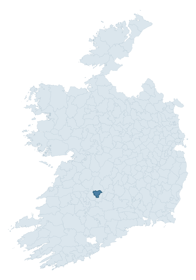
Where this barony sits in the Republic of Ireland
Geology and preservation
Bedrock geology shapes the landscape long before any settlement begins — controlling soil drainage, agricultural potential, the survival of upstanding monuments, and the preservation of buried archaeology. The figures below come from the Geological Survey Ireland 1:100,000 bedrock map.
The bedrock underlying Owneybeg is predominantly sandstone and conglomerates (41% of the barony by area), with much of the rock dating to the Devonian period. A substantial secondary geology of limestone (25%) and greywack, siltstone and grit (23%) adds further variety to the underlying landscape. The single largest mapped unit is the Keeper Hill Formation (41% of the barony's bedrock).
Rock type composition
Largest mapped unit: Keeper Hill Formation (41% of the barony)
Placename evidence
Logainm records 8 heritage-diagnostic placenames for Owneybeg, a modest sample drawn predominantly from the townland record. The dominant stratum is early christian ecclesiastical. The most frequent diagnostic roots are ráth- (2) and cill- (2). With a sample of this size the count should be treated as indicative rather than definitive.
Pre-Christian / Early Medieval Defensive
| Root | Count | Meaning |
|---|---|---|
| ráth- | 2 | earthen ringfort |
| lios- | 1 | ringfort or enclosure |
Early Christian Ecclesiastical
| Root | Count | Meaning |
|---|---|---|
| cill- | 2 | church (early) |
| mainistir- | 2 | monastery |
| tobar- | 1 | holy well |
Other baronies in Limerick
- Connello Lower
- Coonagh
- Connello Upper
- Shanid
- Kilmallock
- Glenquin
- North Liberties
- Coshmore And Coshbride — Waterford
- Kinatalloon — Cork
- Condons And Clangibbon — Cork
See all 280 baronies in the Republic of Ireland Heritage Tool.

Explore further
Grounding History: 10 Maps of Northern Ireland’s Past
If you’re interested in Irish heritage more widely, the companion report for Northern Ireland brings together the analysis of all 462 NI wards into one place through 10 high-quality maps — covering monument density, archaeological periods, placename heritage, terrain, wetland, and the historic landscape at first survey. Take a look.
About this profile
Click any section below to expand.
What is a barony?
A barony is a historic administrative unit in Ireland, broadly equivalent to an English hundred. The 280 baronies used here are from the OSi 2019 National Statutory Boundaries (generalised 20m), covering the 26 counties of the Republic of Ireland. Baronies derive from the Norman period, were formalised in the 17th century, and have not been redrawn for statistical purposes. They vary enormously in area, from compact urban baronies in Dublin to vast upland baronies in Connacht, and should not be compared by raw site count without accounting for area differences.
What counts as a site?
This profile combines three distinct heritage registers, each with its own definition of what constitutes a recordable site:
- Archaeological sites (NMS). The National Monuments Service Sites and Monuments Record (SMR) catalogues every known archaeological monument or site of archaeological interest in the Republic, from prehistoric burial mounds and ringforts to medieval churches and post-medieval defensive works. Inclusion does not require legal protection — only that the site has been identified, surveyed, and assessed as having archaeological value. A separate subset of these sites lies within a recorded protection zone, which gives them statutory protection under the National Monuments Acts.
- Listed buildings (NIAH). The National Inventory of Architectural Heritage records buildings of architectural, historical, archaeological, artistic, cultural, scientific, social, or technical interest. Each surveyed structure is appraised on a five-tier scale: International, National, Regional, Local, and Record-Only. The NIAH appraisal is informational rather than strictly statutory, but it underpins local-authority Record of Protected Structures (RPS) listings.
- Heritage placenames (Logainm). Logainm is the authoritative database of Irish placenames maintained by the Placenames Branch. This profile applies a heritage-diagnostic classifier to the Irish-language form of each townland name, flagging roots that signal defensive sites (ráth-, lios-, dún-, caiseal-, cathair-), ecclesiastical foundations (cill-, teampall-, domhnach-, mainistir-), prehistoric burial-ritual features (tuaim-, carn-, leaba-), or Norse-contact settlement (gall-). Townlands without one of these diagnostic roots are not flagged here — they may still carry historical significance, but that significance is not encoded in the name itself.
Editorial principles
The narrative sections of this profile follow several explicit principles:
- Evidential. Every claim about this barony’s heritage character is anchored in the underlying register data. Where a site count, a placename count, or a percentile rank is cited, it is computed from the source datasets at export time, not estimated.
- Comparative. Counts and metrics are reported alongside their percentile rank against the other 279 ROI baronies. A barony with 50 ringforts in absolute terms could be unusually high or unusually low depending on its size and regional context; percentile ranking removes that ambiguity.
- Transparent on limits. Where a register has known coverage gaps, survey biases, or data-quality issues that affect this barony’s figures, the profile flags them rather than presenting the numbers as definitive.
- No interpretation beyond what the data supports. The narrative does not speculate about historical events, social dynamics, or cultural meaning beyond what the recorded heritage and placename evidence directly attests.
Data caveats and limits
- NMS Sites and Monuments Record is the product of survey campaigns conducted at different intensities across different counties and decades. Some baronies have been surveyed more thoroughly than others, and absolute counts should be read in that light. Sites destroyed by development before survey are typically not represented; sites in heavily forested or upland terrain are sometimes under-recorded.
- NIAH coverage is broadly complete for the Republic of Ireland but the survey was conducted on a rolling county-by-county basis, and the most recent appraisal date varies. Buildings demolished or substantially altered after their original survey may still appear in the register; conversely, recent buildings of merit may not yet have been appraised.
- Logainm classification applies a deliberately conservative pattern-matching approach to the Irish-language townland forms. The classifier prioritises true positives over recall: a townland may carry a heritage signal that the classifier doesn’t recognise, particularly where the diagnostic root has been heavily anglicised or where the townland name draws on a less common term. The 60,000+ townland records and ~9,800 classified placenames give a substantial signal at barony scale, but individual townland names should be checked against Logainm directly for definitive interpretation.
- Period attribution. The chronological distribution reflects only those NMS sites that carry a recognised period attribution in the source data. Sites listed as “Unknown” period are excluded from the dated subset.
- Boundary changes. Some baronies have undergone minor boundary adjustments since their 19th-century definition; the OSi 2019 generalised boundaries used here are the current statutory definition and may differ slightly from historical maps in border areas.
- Bedrock geology is mapped at 1:100,000 scale, which means local variation within a barony — small pockets of different rock type, mineral veins, alluvium overlying bedrock — is generalised. The dominant-system and rocktype figures are area-weighted, so a barony reading “70% Carboniferous limestone” may still contain small but archaeologically important pockets of older or younger rock. Around 3% of GSI polygons do not match the lexicon and contribute no rocktype or system attribution.
Data sources
- National Monuments Service — Sites and Monuments Record (SMR) https://data.gov.ie/dataset/national-monuments-service-archaeological-survey-of-ireland
- National Inventory of Architectural Heritage (NIAH) https://data.gov.ie/dataset/national-inventory-of-architectural-heritage-niah-national-dataset
- Logainm — Placenames Database of Ireland https://www.logainm.ie/
- Ordnance Survey Ireland — National Statutory Barony Boundaries 2019 https://data-osi.opendata.arcgis.com/
- EURODEM — European Digital Elevation Model https://www.mapsforeurope.org/datasets/euro-dem
- ESA WorldCover https://esa-worldcover.org/en
- Geological Survey Ireland — 1:100,000 Bedrock Geology https://www.gsi.ie/en-ie/data-and-maps/Pages/Bedrock.aspx
Explore more: Search any of the 280 ROI baronies, browse by historical province, or read the methodology and data sources for the full Republic of Ireland Heritage Tool.