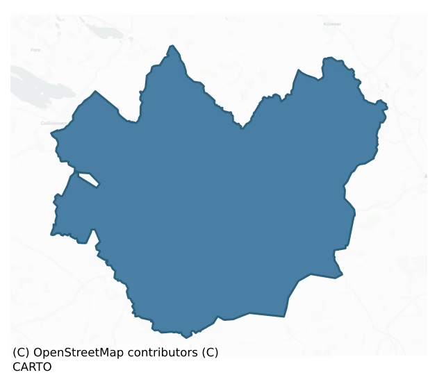
Delvin is a barony of County Westmeath, in the historical province of Leinster (Irish: Dealbhna), covering 158 km² of land. The barony records 242 NMS archaeological sites and 100 NIAH listed buildings, placing it at around the 35th percentile among 280 ROI baronies for sites per km². This means it is in the lower half of all baronies for sites per km². Dated archaeological evidence runs from the Early Bronze Age through to the Modern, spanning 7 of 9 archaeological periods, placing the barony in the 33rd percentile among 280 ROI baronies for chronological depth. This means it is in the lower half of all baronies for chronological depth. The largest dated subset of recorded sites dates to the Early Medieval. Logainm flags 21 placenames in the barony as carrying a recognised heritage root; the largest share — around 81% — are names associated with early Christian church and monastic foundations.

Heritage at a glance
Percentile rankings throughout this profile compare each barony only against the other 279 Republic of Ireland baronies.
The recorded heritage of Delvin
The National Monuments Service Sites and Monuments Record (SMR) is the statutory inventory of archaeological sites for the Republic of Ireland, maintained by the Department of Tourism, Culture, Arts, Gaeltacht, Sport and Media. Sites recorded here include earthworks, ringforts, megalithic tombs, ecclesiastical remains, and post-medieval features; not every record is legally protected, but each is registered as a monument of archaeological interest.
The National Monuments Service records 242 archaeological sites in Delvin, putting it at the 35th percentile among 280 ROI baronies for sites per km². This means it is in the lower half of all baronies for sites per km². Protection coverage is near-universal — 235 sites (97%) fall within a recorded monument protection zone, indicating an extensively surveyed landscape. The dominant category is defensive sites — ringforts, enclosures, hillforts, and stone forts (134 sites, 55% of the record). Ringfort – rath is the most prevalent type, making up 31% of the barony's recorded sites (75 records) — well above the ROI average of 20% across all baronies where this type occurs. Ringfort – rath is an earthen ringfort enclosed by a bank and external ditch — the most common Early Medieval farmstead, broadly dated 500–1000 AD. Other significant types include Ringfort – unclassified (13) and Hut site (12). Ringfort – unclassified is a circular Early Medieval settlement enclosure where surviving evidence does not allow distinction between earthen and stone forms; Hut site is a low stone or earthen foundation enclosing a small circular or oval area, generally interpreted as a former dwelling, of any date from prehistory to the medieval period. Across the barony's 158 km², this gives a recorded density of 1.53 sites per km².
Most common monument types
Hover or tap a monument type to see its definition.
| Type | Count |
|---|---|
| Ringfort – rath an earthen ringfort enclosed by a bank and external ditch — the most common Early Medieval farmstead, broadly dated 500–1000 AD | 75 |
| Ringfort – unclassified a circular Early Medieval settlement enclosure where surviving evidence does not allow distinction between earthen and stone forms | 13 |
| Hut site a low stone or earthen foundation enclosing a small circular or oval area, generally interpreted as a former dwelling, of any date from prehistory to the medieval period | 12 |
| Castle – tower house a fortified residential tower of four or five storeys, mostly built by lords in the 15th and 16th centuries and often within a defended bawn | 9 |
| Castle – unclassified a castle whose form cannot be precisely classified, dating somewhere between the late 12th and 16th centuries | 9 |
| House – indeterminate date a habitation building whose date cannot be determined from available evidence | 9 |
| Barrow – unclassified a prehistoric burial mound where the specific barrow type cannot be determined from surface evidence | 9 |
| Graveyard a burial area associated with a church, in use from the medieval period onwards | 9 |
Chronological distribution
The dated archaeological record for Delvin spans from the Early Bronze Age through to the Modern, with activity attested across 7 of 9 archaeological periods. Every period from earliest to latest is represented in the record — an unbroken sequence of dated activity across the full chronological span. Activity concentrates most heavily in the Early Medieval (115 sites, 55% of dated material), with the Medieval forming a secondary peak (28 sites, 13%). A further 34 recorded sites (14% of the overall NMS register for the barony) carry no period attribution — appearing as 'Unknown' in the bar chart below. This typically reflects either records that pre-date the standardised period vocabulary or sites awaiting specialist dating review, rather than a genuine absence of chronological evidence.
Sample of recorded monuments
Show 25 sample monuments (of 242 total)
A representative sample of 25 recorded monuments drawn from the barony’s 242 total NMS entries. Sites within a recorded monument protection zone and rarer site types are prioritised so the list shows a meaningful cross-section rather than only the most common type. Each entry shows the official Sites and Monuments Record reference number and the description published by the National Monuments Service.
Burial mound
Situated on a natural hillock in undulating grass-land, with marshy ground at S & SW side of hillock. Possible moated site (WM008-042—-) 100m to NW and possible settlement earthworks of 'Old Brownstown' 100m to W. …
Situated on a natural hillock in undulating grass-land, with marshy ground at S & SW side of hillock. Possible moated site (WM008-042—-) 100m to NW and possible settlement earthworks of 'Old Brownstown' 100m to W. Depicted as a circular shaped earthwork on the 1837 ed. OS 6-inch map. Depicted as a sub-rectangular shaped earthwork on the 1911 ed. OS 25-inch map (approx. dims. 40m NW-SE x 28m NE-SW). No surface remains visible as the earthwork has been levelled. According to an ASI field report from 1975 the landowner found ‘two human graves side by side’ when bulldozing the site three years previously (1972). Levelled site visible as a cropmark on Digital Globe aerial photograph taken November 2011.
Compiled by: Frank Coyne and Caimin O'Brien
Date of upload: 20 April 2017
Architectural feature
Situated on the E side of Clonmellon town with Killua Castle 890m to E and Knock Killua Church (WM009-043—-) 1.5km to ESE. A 19th century square-shaped tower (int. dims 1.7m x 1.76m; wall T 0.55m; approx. max. H 4m)…
Situated on the E side of Clonmellon town with Killua Castle 890m to E and Knock Killua Church (WM009-043—-) 1.5km to ESE. A 19th century square-shaped tower (int. dims 1.7m x 1.76m; wall T 0.55m; approx. max. H 4m) built of limestone rubble standing over and housing a natural spring now dried up known as Isaac's Well. In the SE wall of the tower there is a pointed doorway the arch of which has been constructed with three late medieval sparrow-pecked voussoirs the edges of which have rope moulding of possible 16th century date. The two lower jamb stones of the pointed window above the doorway in the tower also have rope moulding and probably came from the same medieval doorway. According to the NIAH the cut stone fragments reputedly came from the doorway of a medieval church. The rope or cable moulding is similar to the moulding on medieval carved doorway (WM033-040—-) at 19th century Meedin Church.
The location of this medieval church has not been identified but it could have come from Knock Killua Church (WM009-043—-) located on the demesne lands of Killua Castle the residence of Sir Benjamin Chapman who built the folly in 1860. However the medieval stonework at Killua Church is dressed differently from the punch-dressed stone incorporated into the folly. It is more likely that the cut stone fragments came from the Franciscan Friary at Multyfarnham (WM006-058—). According to local tradition the carved stone surrounds found around the openings at the f…
House – 16th/17th century
The precise location of the house and bawn (WM009-042001-) at Heathstown which belonged to Andrew Tuite that is mentioned in the terrier of the 1659 Down Survey map of Killua parish has not been identified. The terrier…
The precise location of the house and bawn (WM009-042001-) at Heathstown which belonged to Andrew Tuite that is mentioned in the terrier of the 1659 Down Survey map of Killua parish has not been identified. The terrier of the Down Survey recorded that 'There is a House with a Bawne in Heathstowne in good repaire' (NLI MS 723-4). This house and bawn are depicted standing close to the E boundary with the townland of Dervotstown. The building may have been located in close proximity to the present Heathstown House which is 440m W of the townland boundary with Dervotstown. The building is depicted on the Down Survey map as a two storey high house with gable-ended chimneystack standing in the centre of a rectangular shaped bawn. A wide low rise to the W of Heathstown House built in 1834 according to a date on a weather vane on the house, bounded by a wide marshy area on the W & SW & by a low scarp from S-E. The rise is crossed by very slight remains of low banks. Several shallow depressions can also be seen on the SE & the N ends of the rise may mark the location of the house mentioned in the Down Survey. No dressed stone of 16th/17th century appearance was identified at Heathstown House or in the yard belonging to the 19th century house. Possible plantation house and bawn of early 17th century date belonging to Andrew Tuite who is described in the terrier of the Down Survey as an 'Irish papist'.
Compiled by: Frank Coyne and Caimin O'Brien
Date of upload: 17 May 2017
Font (present location)
Ballinlough Castle (WM009-047—-) stands 3km S of Clonmellon village and the landscaped estate is now mainly used as a golf course. Medieval limestone octagonal-shaped baptismal font (H 0.31m; bowl diam. 0.64m) with…
Ballinlough Castle (WM009-047—-) stands 3km S of Clonmellon village and the landscaped estate is now mainly used as a golf course. Medieval limestone octagonal-shaped baptismal font (H 0.31m; bowl diam. 0.64m) with central drainage hole standing in the walled garden of Ballinlough Castle which stands 175m to the NNW. According to the owner of Ballinlough Castle the font was moved to this location c. 50 years ago (1930s). The owner of the castle suggested that the font had been taken from the site of a medieval church located on the estate of Ballinlough Castle. The font (WM009-043003-) was originally located in the medieval church of Knock Killua (WM009-043—-) dedicated to St. Lonán which is located 3.2km NE of Ballinlough Castle.
Compiled by: Frank Coyne and Caimin O’Brien
Date of upload: 1 November 2016
Burial
Situated on gently rising ground in a sheltered location. Human remains were discovered at this location during land reclamation works in 1992 in an area measuring 30m N-S by 70m E-W. A field report from that time…
Situated on gently rising ground in a sheltered location. Human remains were discovered at this location during land reclamation works in 1992 in an area measuring 30m N-S by 70m E-W. A field report from that time reported that ‘no articulated skeletons were noted but the remains were definitely human. The burials were close to the surface’ (ASI Field Report).
Compiled by: Frank Coyne and Caimin O'Brien
Date of upload: 16 May 2017
House – 17th century
Clonyn House and its landscaped gardens are described in the terrier of the 1654-57 Down map of Castletown parish which recorded that the in ‘Clonyn there is the ruines of a fayre house with a fewe backroomes Wherein…
Clonyn House and its landscaped gardens are described in the terrier of the 1654-57 Down map of Castletown parish which recorded that the in ‘Clonyn there is the ruines of a fayre house with a fewe backroomes Wherein the Earle of West Meath dwells with a faire orchard and a garden with a grove of trees’ (NLI, MS 723-4). Clonyn House is not depicted on the Down Survey maps. This 'fayre house' was probably built on the site of or incorporated the medieval castle (WM013-014001-) belonging to the Nugent family. In 1538 an inquisition into the estate of the recently deceased Richard Nugent Baron of Delvin listed ‘Clonyn. A castle and 160a arable; worth £8’ as part of his estate (Ainsworth 1958, 126).
Annotated on the 1838 ed. OS 6-inch map as Clonyn House and depicted as a ruinous structure on the revised 1913 ed. OS 25-inch map. Present remains consist of the ruins of an ivy-clad multi-period house. The core of the building consists of a late seventeenth century five bay gabled house standing two storeys high. This central house has been extended to the N and S. A square turret built on to the S side of the range bears a plaque with the Nugent crest (WM013-014002-). Throughout the ruins there are numerous pieces of sparrow-pecked dressed stone, typical of the fifteenth and sixteenth century which has been incorporated into the fabric of the ruins. To the E of the house there is a rectangular enclosure, probably a parterre on two levels & bounded by a low battlemented…
Standing stone
Situated on a low rise with good views to the N. A limestone pillar (H 1.5m; dims 0.2m x 0.15m) rectangular in plan which tapers towards the top. The area around the base has been trampled by cattle so it now stands in…
Situated on a low rise with good views to the N. A limestone pillar (H 1.5m; dims 0.2m x 0.15m) rectangular in plan which tapers towards the top. The area around the base has been trampled by cattle so it now stands in a hollow. Possibly a prehistoric standing stone although the stone has the appearance of a livestock scratching post of post-1700 date.
Compiled by: Frank Coyne and Caimin O'Brien
Date of upload: 4 April 2018
Castle – hall-house
The terrier of the 1655 Down Survey map of Castletown parish recorded that in 1641 the lands of 'Ballistowne' were in the possession of James White (NLI MS 723-4). Billistown Castle appears to be the remains of a…
The terrier of the 1655 Down Survey map of Castletown parish recorded that in 1641 the lands of 'Ballistowne' were in the possession of James White (NLI MS 723-4). Billistown Castle appears to be the remains of a 13th/14th century hall house with first floor entrance which was converted into a tower house possibly in the 15th century or later when a round-arched doorway was inserted into the NW wall at ground floor level.
Standing on a low sub-rectangular shaped platform on a low rise of ground in undulating grassland. Possible outline of destroyed bawn (WM013-031001-) visible as a low rectangular-shaped enclosure surrounding Billistown Castle which is visible on Digital Globe aerial photograph taken November 2011. At the N corner of this platform there is a slightly raised area which may mark the site of a small structure, possibly the remains of an angle tower.
Ruins of a rectangular castle (ext. dims. above string course level 9.7m NW-SE x 7.4m NE-SW; wall T 1.45m above string course; 1.7m below string course) aligned NW-SE with base batter (H 1.25m) the top of which is delimited with a string course (H 0.95m-1.4m; T 0.25m). The walls and quoins are built with limestone rubble and now stand three storeys high. The walls appear to be standing on an earthen or mud bank acting as a clay foundation which is visible where the wall facing has collapsed. The SE wall survives intact to second floor level, the W angle of the SW wall has collapsed while only the E en…
Castle – ringwork
Situated on a prominent hillock, with commanding views in all directions. Medieval parish church of Killulagh (WM013-057—) which may have been built on an early Christian monastery founded by St. Lonán lies 325m to…
Situated on a prominent hillock, with commanding views in all directions. Medieval parish church of Killulagh (WM013-057—) which may have been built on an early Christian monastery founded by St. Lonán lies 325m to NE. Mound barrow (WM013-056—-) 155m to NNW. A steam which forms the townland boundary lies 40m to the W and NW, and the field fence which forms the townland boundary with Williamstown intersects the E side of the site.
A raised circular shaped platform (approx. diam. 35m NE-SW at base; 19m NE-SW at top) with dished interior defined by an earth and stone bank, the base of the hill is enclosed by a shallow fosse with external earth and stone bank. The top of the platform/mound has a dished profile (approx. diam. 15m NE-SW) and is enclosed by a very poorly preserved earth and stone bank. There is a gap (Wth 1.9m) in the bank at NNE and a narrow path down the side of the embankment, possible livestock gap of recent origin. Classification of moument is uncertain, could be the remains of a platform ringfort or Anglo-Norman ringwork.
See attached profile of monument surveyed and drawn by the ASI.
Compiled by: Frank Coyne and Caimin O'Brien
Date of upload: 10 April 2018
Bridge
A 16th century stone bridge spanning the River Deel was demolished in the late 1960s and replaced by a concrete bridge which now carries the N52 over the river. An armorial plaque (WM013-063001-) and an inscribed…
A 16th century stone bridge spanning the River Deel was demolished in the late 1960s and replaced by a concrete bridge which now carries the N52 over the river. An armorial plaque (WM013-063001-) and an inscribed date-stone commemorating the construction of the bridge in 1584 by Sir John Bedlow (Bellew) and his wife Ismay Nugent has been inserted into the parapet wall of the concrete bridge. No surface remains visible of the 16th century bridge which appears to have been completely demolished.
Compiled by: Frank Coyne and Caimin O'Brien
Date of upload: 10 April 2018
Flat cemetery
Modern houses located on site of flat cemetery possibly dating from the Bronze Age. Flat cemetery discovered in the late 1950s and described by the National Museum of Ireland as following; 'Human skeleton. Cartenstown…
Modern houses located on site of flat cemetery possibly dating from the Bronze Age. Flat cemetery discovered in the late 1950s and described by the National Museum of Ireland as following; 'Human skeleton. Cartenstown td., Co. Westmeath. Found about 10 inches [0.25m] below the surface while digging in a garden. It lay, crouched on its right side, in a small, four-sided cist. The site is on top of a low esker. At its bottom, the grave measured 63 cm. long N-S and 48 cm. wide E-W. The side walls inclined inwards slightly so that the width immediately below the capstone was 34 cm. The cist was 52 cm. deep. The capstone measured 80 cm. long, 63 cm. wide and was 15 cm. thick. It had been propped on four small stones which rested on the angles of the cist. The cist was, thus, not completely sealed and some sand and earth had trickled in' (Lucas et. al. 1960, 29) (NMI Reg. No. 1958:132).
A second discovery of burials was discovered in this area in 1961 and was described by the National Museum of Ireland as following; 'Ten small fragments of a child's skeleton (unburned) from Cist C, the third of three short stone cists found in a gravel ridge here. For Cist B see JRSAI 90, 1960, 29; the first grave discovered on the site (Cist A) was destroyed before investigation. Cist C has been described in detail by E. Rynne in Riocht na Midhe 2, 1962, 33-6' (Lucas 1963, 124-5) (NMI Reg. No. 1961:135).
The flat cemetery was described in 1970 (Waddell 1970, 94, 134) as following; 'Three c…
Barrow – stepped barrow
Situated at the end of a low ridge on partially reclaimed grassland with good views of the surrounding countryside. Townland boundary with Ellenstown 80m to E and mound barrow (WM009-0035—-) 300m to N. Monument…
Situated at the end of a low ridge on partially reclaimed grassland with good views of the surrounding countryside. Townland boundary with Ellenstown 80m to E and mound barrow (WM009-0035—-) 300m to N. Monument depicted on 1838 ed. OS 6-inch map as a small mound enclosed by a fosse and outer enclosing berm. Described in 1973 as a ringfort consisting of a low circular mound (approx. diam. 7m) enclosed by a shallow internal fosse and flat berm (approx. diam. 35m N-S; 21m E-W) the outer edge of which is defined by a low earthen bank and external fosse. The presence of the circular-shaped mound in the centre of the monument suggests that this monument represent the remains of burial site rather than a ringfort. The mound in the centre of the site was described in 1976 as an unusual feature the purpose of which was uncertain. The mound could represent the remains of a burial mound enclosed by an internal fosse with berm and external fosse. The profile of the monument suggests that this site may be the remains of a barrow. The mound could be a later landscape feature built onto the interior of a platform type ringfort as hinted at in the 1973 site report.
Compiled by: Frank Coyne and Caimin O'Brien
Date of upload: 27 August 2018
Castle – motte
Late 12th century earth & timber motte castle built by Hugh de Lacy on the S side of Castletown Delvin with later stone castle (WM014-002—-) 65m to WNW, St. Mary’s church (WM014-003—-) and graveyard (WM014-003001-)…
Late 12th century earth & timber motte castle built by Hugh de Lacy on the S side of Castletown Delvin with later stone castle (WM014-002—-) 65m to WNW, St. Mary’s church (WM014-003—-) and graveyard (WM014-003001-) 70m to WSW. In the late 12th century Hugh De Lacy, Lord of Meath granted the lands of Delvin belonging to the O'Finellan's to his brother-in-law, Gilbert de Nugent (Orpen 1911, 87-8). Motte castle is now overgrown and covered in bushes making detailed examination impossible. Monument standing in concrete delivery yard of hardware store which encloses the base of the motte from NW-N-NE. Drystone wall revetment at base of motte visible from W-N. Cottage and yard located at base of monument on SW side.
It has been suggested that this Anglo-Norman earth & timber castle was constructed on top of an earlier Gaelic fortification called Telach Caíl (O’Keeffe 2000, 22; Flanagan 1993). Monument described in 1973 as ‘a fairly large circular motte. The sides are very steep and the top is fairly wide and flat (Top. Diam. 15m). Detailed examination is prevented by a dense growth of briars and debris on top of the earthwork. A house, garden and yard adjoin the base of the earthwork and have obliterated any trace of a fosse or any other feature which may have been at the base of the motte originally. There are wide views of the surrounding countryside from the top of the earthwork’ (SMR File 07/03/1973).
Compiled by: Caimin O'Brien
Date of upload: 1 Fe…
Burial ground
Larkin's map of 1808 shows a ruin (WM014-009001-) in the graveyard of Crowinstown Great (SMR file). Present remains consist of a small semi-circular shaped graveyard enclosed from S-W, N & NNE by the remains of a low…
Larkin's map of 1808 shows a ruin (WM014-009001-) in the graveyard of Crowinstown Great (SMR file). Present remains consist of a small semi-circular shaped graveyard enclosed from S-W, N & NNE by the remains of a low bank set on a scarp with a shallow external fosse at its foot. From NNE-E-S the graveyard is bounded by a stone wall with the roadway beyond it. The graveyard contains a number of 18th, 19th & 20th century memorials. In the N part of the interior there is a scatter of stones, however there is no definite trace of a wall footing of a building or possible church visible on the surface. The surrounding field has been under tillage & there is no trace of any earthworks here’ (ASI Field Report 28/10/1980).
Compiled by: Caimin O'Brien
Date of upload: 30 November 2009
Castle – motte and bailey
Situated on a slight rise, in gently undulating pasture, with excellent views from the top of the motte, in all directions. Church and graveyard (WM020-025—-/-025001-) lie c. 60m to NE and Killagh tower house lies c.…
Situated on a slight rise, in gently undulating pasture, with excellent views from the top of the motte, in all directions. Church and graveyard (WM020-025—-/-025001-) lie c. 60m to NE and Killagh tower house lies c. 135m to NW. Annotated 'Moat' on the 1837 OS Fair Plan map where it is depicted as an oval-shaped tree-planted earthwork. Depicted on the revised 1913 ed. OS 25-inch map as a roughly circular-shaped mound which is enclosed by a wide fosse from SE-S-W-NW.
Monument described in 1970 as a roughly circular-shaped, high, steep-sided flat-topped earthen mound the base of which is enclosed by a fosse and the remains of an external bank. A wide, deep fosse and an outer bank are visible from SE-S-WSW. The bank has a modern gap at S and is very slight from SW-WSW. A modern bank running ESE-WNW is built against the outer face of the bank from SSE-S-SSW. The bank veers away from the fosse at SE to enclose a larger area, which may have been a bailey, although there is little evidence of such surviving. Monument is visible today as a tree-covered earthwork on Digital Globe aerial photography.
See attached profile of monument surveyed and drawn by the ASI.
Compiled by: Alison McQueen, Vera Rahilly and Caimin O’Brien
Date of upload: 06 June 2019
House – fortified house
In the 17th century the townland of Ballinlough was known as 'Ballinglagbomile’ (Baile Locha na Bó Maoile, 'the town of the lake of the hornless cow'). In 1641 George Nugent was listed as the owner of 197 acres of land…
In the 17th century the townland of Ballinlough was known as 'Ballinglagbomile’ (Baile Locha na Bó Maoile, 'the town of the lake of the hornless cow'). In 1641 George Nugent was listed as the owner of 197 acres of land in Ballinlough and is described in the Down Survey as an ‘Irish Papist’. George was related to William Nugent of 'Ballynloghneboymoyle' who died on 1st of November 1625 and who was married to Katherine Fay (Anon. 1826, 7 Car I). No castle is depicted on the 1655 Down Survey maps of Delvin Barony or Killua Parish (NLI MS 723-4). In 1837 the castle was described as ‘the seat of Sir J. Nugent, Bart., is in a demesne of 300 acres’ (Lewis 1837, 155). The Irish Georgian Society described Ballinlough Castle as 'an amalgam of structures and renovations made in the seventeenth and eighteenth centuries. The main seven bays of the front façade date to the mid-early 1600s, though its three-bay breakfront was added at the close of the 1700s. At the same time a Gothic extension was made to the north. The extension is only one bay to the front façade though it possesses a tower. This tower is matched on its responding end and in total the extension is six bays’ length. The original and extended portions of the castle form a nine bay rear façade which is irregular due to a bell tower and one-storey conservatory which have been attached. The castle is two floors with an attic storey and maintains imposing castellations. Tall Georgian, timber sash windows and lime dash…
Water mill – unclassified
In 1682 Sir Henry Piers of Tristernagh wrote that at the E end of Lough Lene there 'issueth out another considerable stream which in one quarter of a mile turneth a mill at Cummestown (WM008-026—-), thence at…
In 1682 Sir Henry Piers of Tristernagh wrote that at the E end of Lough Lene there 'issueth out another considerable stream which in one quarter of a mile turneth a mill at Cummestown (WM008-026—-), thence at Grainstown [Grangestown] it turneth another' (Vallancey 1786, 10).
Compiled by: Caimin O'Brien
Date of upload: 6 December 2016
Armorial plaque
Clonyn House (WM013-014—-) and its landscaped gardens are described in the terrier of the 1654-57 Down map of Castletown parish which recorded that the in ‘Clonyn there is the ruines of a fayre house with a fewe…
Clonyn House (WM013-014—-) and its landscaped gardens are described in the terrier of the 1654-57 Down map of Castletown parish which recorded that the in ‘Clonyn there is the ruines of a fayre house with a fewe backroomes Wherein the Earle of West Meath dwells with a faire orchard and a garden with a grove of trees’ (NLI, MS 723-4). Clonyn House is not depicted on the Down Survey maps. This 'fayre house' was probably built on the site of or incorporated the medieval castle (WM013-014001-) belonging to the Nugent family.
Annotated on the 1838 ed. OS 6-inch map as Clonyn House and depicted as a ruinous structure on the revised 1913 ed. OS 25-inch map. Present remains consist of the ruins of an ivy-clad multi-period house. The core of the building consists of a late seventeenth century five bay gabled house standing two storeys high. This central house has been extended to the N and S. A square turret built on to the S side of the range bears a plaque with the Nugent crest (WM013-014002-).
Clonyn House described by the National Inventory of Architectural Heritage (NIAH) as following; 'Remains of earlier five-bay two-storey house over basement house with attic level to the rear (west), built c.1680, having remains of pitched roof and stone chimneystacks, one set diagonally to roofline. Plaque with crest of Nugent Family, dated 1680, to façade. Various later extensions to house dating from the early-eighteenth century to the early-nineteenth century (early-nineteen…
Designed landscape – formal garden
Possible formal garden of 17th century date belonging to Clonyn House (WM013-014—-) which was the residence of the Nugent family, Barons of Delvin. The landscaped gardens are described in the terrier of the 1654-57…
Possible formal garden of 17th century date belonging to Clonyn House (WM013-014—-) which was the residence of the Nugent family, Barons of Delvin. The landscaped gardens are described in the terrier of the 1654-57 Down map of Castletown parish which recorded that the in ‘Clonyn there is the ruines of a fayre house (WM013-014—) with a fewe backroomes Wherein the Earle of West Meath dwells with a faire orchard and a garden with a grove of trees’ (NLI, MS 723-4). Clonyn House is not depicted on the Down Survey maps. This 'fayre house' was probably built on the site of or incorporated the medieval castle (WM013-014001-) belonging to the Nugent family.
Annotated on the 1838 ed. OS 6-inch map as Clonyn House and depicted as a ruinous structure on the revised 1913 ed. OS 25-inch map. Present remains consist of the ruins of an ivy-clad multi-period house. The core of the building consists of a late seventeenth century five bay gabled house standing two storeys high. This central house has been extended to the N and S. A square turret built on to the S side of the range bears a plaque with the Nugent crest (WM013-014002-). To the E of the house there is a rectangular enclosure, probably a parterre on two levels & bounded by a low battlemented wall. The formal gardens depicted on the 1837 ed. OS 6-inch map 240m NW of Clonyn House may have their origins in the 17th century.
Compiled by: Caimin O'Brien and Frank Coyne
Date of upload: 2 August 2017
Bullaun stone
Medieval parish church dedicated to St. Lonán whose feast day fell on the 12th of November (Ó Riain 2011, 403). The medieval parish church and graveyard may have been built on the site of an early Christian monastery…
Medieval parish church dedicated to St. Lonán whose feast day fell on the 12th of November (Ó Riain 2011, 403). The medieval parish church and graveyard may have been built on the site of an early Christian monastery founded by St. Lonán. Only the ivy-covered SW gable of the medieval parish church of Killulagh (WM013-057—-) stands in the SW quadrant of an oval-shaped graveyard (WM013-057001-) which is entered through a gateway and stone stile at SW. The octagonal shaft of the medieval font (WM013-057003-) and bullaun stone are located just inside the graveyard gateway and stile on the N side. Roughly circular-shaped stone (0.3m x 0.26m x 0.14m) with oval-shaped hollow (diam. at top 0.15m; D 0.08m) in centre.
Compiled by: Caimin O'Brien
Date of upload: 6 April 2018
Stone head (present location)
Built into the outer wall of a farm building in the yard of Williamstown House located 20m S of Williamstown Castle site (WM013-060—) and bawn (WM013-060001-). A small weathered limestone head (Wth 0.1m; H 0.13m)…
Built into the outer wall of a farm building in the yard of Williamstown House located 20m S of Williamstown Castle site (WM013-060—) and bawn (WM013-060001-). A small weathered limestone head (Wth 0.1m; H 0.13m) with a flat face, large eyebrows, a flat nose and a small circular mouth. May have original come from Williamstown Castle.
Compiled by: Frank Coyne and Caimin O'Brien
Date of upload: 10 April 2018
Armorial plaque (present location)
A 16th century armorial plaque and inscribed stone are set into the upstream (N) parapet wall of the modern concrete bridge on the N52 crossing the River Deel. The armorial plaque and inscribed stone were removed from…
A 16th century armorial plaque and inscribed stone are set into the upstream (N) parapet wall of the modern concrete bridge on the N52 crossing the River Deel. The armorial plaque and inscribed stone were removed from the 16th century bridge (WM013-063—) when it was demolished in the late 1960s. The limestone armorial plaque (dims. H 0.55m x Wth 0.84m) bears two shields belonging to Sir John Bedlow (Bellew) and his third wife Ismay Nugent who was previously married to Thomas Casey of Athboy, they lived at Castletown, Co. Louth. The first shield bears the arms of John Bellew & Ismay Nugent; the second shield bears the arms of Thomas Casey & Ismay Nugent. The armorial stone has a Latin inscription beneath the coat of arms which reads DNS ˑ PUIDEBIT ˑ IN ˑ DNO ˑ CONFIDO ˑ 1586
The inscription on the stone plaque (dims. Wth 0.83m x H 0.23m) reads as following:
THE ˑARMES ˑ OF ˑ Srˑ JOHN ˑ BEDLOW ˑ KNIGHTˑ AND ˑ DAEM ˑ ISMAY ˑ NUGENT ˑ HIS ˑ WIF ˑ WIF ˑ BEFOR ˑ TO ˑ THOMAS ˑ CASI ˑ OF ˑ ATHBOY ˑ MAED ˑ THIS ˑ BRIDG ˑ IN ˑ ANNO ˑ DNI ˑ 1584 ˑ DESIRING ˑ ALL ˑ THAT ˑ PASED ˑ BY ˑ TO ˑ PRAY ˑ FOR ˑ THEM ˑ ALL ˑ THREE ˑ
Compiled by: Frank Coyne and Caimin O'Brien
Date of upload: 12 April 2018
Enclosure – large enclosure
Situated in demesne lands on the post-1700 Deerpark of Killua Castle located 550m to E. Ringfort (WM009-010—-) 90m to N, two landscape features (WM009-009-/011—-) located 160m to NNE. Cropmark of large roughly…
Situated in demesne lands on the post-1700 Deerpark of Killua Castle located 550m to E. Ringfort (WM009-010—-) 90m to N, two landscape features (WM009-009-/011—-) located 160m to NNE. Cropmark of large roughly circular-shaped enclosure (approx. diam. 90m) visible on OSI aerial photographs. Potential archaeological monument although due to its large size could be a geological rather than archaeological feature.
Compiled by: Caimin O'Brien based on details kindly provided by Emmet Byrnes, Senior Archaeologist, Forest Service Inspectorate, Department of Agriculture, Food and the Marine
Date of upload: 3 May 2018
Building
Situated on top of a low hill with good views of the surrounding countryside, Addinstown House located 190m to NW. Depicted on the 1837 OS Fair Plan map as a circular-shaped enclosure (WM014-012—-) with a rectangular…
Situated on top of a low hill with good views of the surrounding countryside, Addinstown House located 190m to NW. Depicted on the 1837 OS Fair Plan map as a circular-shaped enclosure (WM014-012—-) with a rectangular ruin in the interior annotated as ‘fort’ and ‘ruins’. On the 1838 ed. OS 6-inch map the enclosure is depicted standing inside a square-shaped tree plantation of post-1700 date. A trig. point in the SW quadrant of the monument marks the height 301 ft. No surface remains visible of levelled enclosure or rectangular building which stood inside the enclosure.
Compiled by: Frank Coyne and Caimin O'Brien
Date of upload: 27 August 2018
Ringfort – rath
Situated on a low ridge in grassland. Depicted as an earthwork on Larkin’s map 1808 map of County Westmeath (NLI, MS 46,580 ). An oval shaped area (diam. 22m NNE-SSW; 32m ESE-WNW) enclosed by a low earthen bank (int.…
Situated on a low ridge in grassland. Depicted as an earthwork on Larkin’s map 1808 map of County Westmeath (NLI, MS 46,580 ). An oval shaped area (diam. 22m NNE-SSW; 32m ESE-WNW) enclosed by a low earthen bank (int. H 0.3m; ext. H 0.6m) and shallow external fosse (Wth 1.2m; ext. D 0.3m). The interior rises towards the centre where a rectangular house site (WM009-019001-) is visible. Possible causewayed entrance gap (Wth 2.3m) at W. Traces of cultivation ridges run across the interior of the monument from WSW-ESE.
Compiled by: Frank Coyne and Caimin O'Brien
Date of upload: 28 April 2017
Listed buildings
The National Inventory of Architectural Heritage (NIAH) is a state survey appraising buildings of architectural, historical, archaeological, artistic, cultural, scientific, social, or technical interest. Each surveyed structure receives a rating from International (the highest, for buildings of European importance) through National, Regional, Local, and Record-Only.
The NIAH records 100 listed buildings in Delvin (50th percentile across ROI baronies). Among these, 5 are graded National — buildings of interest to the whole of Ireland rather than only its region. The Republic holds 937 National-graded buildings in total, so this barony accounts for around 1% of the national total. Construction dates concentrate most heavily in the Victorian (1830-1900) period. The most-recorded building type is house (25 examples, 25% of the listed stock).
Terrain and environment
Mean elevation across the barony is 87m — the 48th percentile among 280 ROI baronies for elevation. This means it is in the lower half of all baronies for elevation. Elevation matters for heritage because higher-altitude baronies typically favour defensive monuments — ringforts and hilltop forts placed on prominent ground — while lowland baronies are more likely to carry the dense settlement and church networks of intensive agricultural landscapes. Mean slope is 2.7° — the 30th percentile among 280 ROI baronies for slope. This means it is in the bottom third of all baronies for slope. Slope is a key control on both land use and archaeological preservation: steep ground resists ploughing and tends to preserve earthworks intact, while gentle slopes favour intensive cultivation that damages or destroys surface archaeology over time. The Topographic Wetness Index averages 11.3, the 67th percentile among 280 ROI baronies for wetness. This means it is in the top third of all baronies for wetness. Drainage matters for heritage because poorly-drained ground preserves organic archaeology (wooden trackways, leather, textiles, and on rare occasions human remains) far better than free-draining soil; well-drained ground favours arable use but destroys organic material rapidly. The land-cover mosaic combines improved grassland (77%), woodland (14%), and arable farmland (8%), giving a mixed agricultural and semi-natural landscape.
Terrain measurements
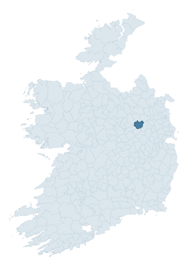
Where this barony sits in the Republic of Ireland
Geology and preservation
Bedrock geology shapes the landscape long before any settlement begins — controlling soil drainage, agricultural potential, the survival of upstanding monuments, and the preservation of buried archaeology. The figures below come from the Geological Survey Ireland 1:100,000 bedrock map.
The bedrock underlying Delvin is predominantly limestone (94% of the barony by area), laid down during the Carboniferous period (100% by area, around 359 to 299 million years ago). Limestone is the most heritage-rich bedrock in Ireland. It supports fertile, well-drained soils that favoured dense Early Medieval settlement and Norman manorial agriculture, and it weathers into karst features — sinkholes, caves, swallow holes, and souterrains — that frequently carry archaeology. Where peat overlies limestone, organic preservation can be exceptional. The single largest mapped unit is the Lucan Formation (68% of the barony's bedrock).
Rock type composition
Largest mapped unit: Lucan Formation (68% of the barony)
Placename evidence
Logainm records 21 heritage-diagnostic placenames for Delvin, drawn from townland and civil-parish names across the barony. The dominant stratum is Early Christian ecclesiastical — cill-, teampall-, and domhnach-prefixed names that record the dense network of early church foundations established between the fifth and tenth centuries. The leading diagnostic roots are cill- (15 — church), lios- (2 — ringfort or enclosure), and dún- (1 — hilltop fort or promontory fort). This is below the ROI average of 30.7 heritage placenames per barony, suggesting either lighter survey coverage or a townland-naming tradition that draws more on generic landscape vocabulary. The presence of multiple heritage strata side by side indicates layered occupation of the landscape across successive prehistoric and historic periods. Logainm records 106 placenames for Delvin (predominantly townland names). Of these, 21 (20%) carry one of the diagnostic Gaelic roots tracked above; the remainder draw on more generic landscape vocabulary that does not encode a heritage period.
Pre-Christian / Early Medieval Defensive
| Root | Count | Meaning |
|---|---|---|
| lios- | 2 | ringfort or enclosure |
| dún- | 1 | hilltop or promontory fort |
Early Christian Ecclesiastical
| Root | Count | Meaning |
|---|---|---|
| cill- | 15 | church (early) |
| díseart- | 1 | hermitage |
| gráinseach- | 1 | monastic farm / grange |
Burial, Ritual, and Norse-Contact
| Root | Count | Meaning |
|---|---|---|
| carn- | 1 | cairn |
| gall- | 1 | foreigner — Norse settlement marker |
Other baronies in Westmeath
- Fartullagh
- Corkaree
- Clonlonan
- Moyashel And Magheradernon
- Kilkenny West
- Brawny
- Athlone South
- Coolestown — Offaly
- Fartullagh
- Ballaghkeen North — Wexford
See all 280 baronies in the Republic of Ireland Heritage Tool.

Explore further
Grounding History: 10 Maps of Northern Ireland’s Past
If you’re interested in Irish heritage more widely, the companion report for Northern Ireland brings together the analysis of all 462 NI wards into one place through 10 high-quality maps — covering monument density, archaeological periods, placename heritage, terrain, wetland, and the historic landscape at first survey. Take a look.
About this profile
Click any section below to expand.
What is a barony?
A barony is a historic administrative unit in Ireland, broadly equivalent to an English hundred. The 280 baronies used here are from the OSi 2019 National Statutory Boundaries (generalised 20m), covering the 26 counties of the Republic of Ireland. Baronies derive from the Norman period, were formalised in the 17th century, and have not been redrawn for statistical purposes. They vary enormously in area, from compact urban baronies in Dublin to vast upland baronies in Connacht, and should not be compared by raw site count without accounting for area differences.
What counts as a site?
This profile combines three distinct heritage registers, each with its own definition of what constitutes a recordable site:
- Archaeological sites (NMS). The National Monuments Service Sites and Monuments Record (SMR) catalogues every known archaeological monument or site of archaeological interest in the Republic, from prehistoric burial mounds and ringforts to medieval churches and post-medieval defensive works. Inclusion does not require legal protection — only that the site has been identified, surveyed, and assessed as having archaeological value. A separate subset of these sites lies within a recorded protection zone, which gives them statutory protection under the National Monuments Acts.
- Listed buildings (NIAH). The National Inventory of Architectural Heritage records buildings of architectural, historical, archaeological, artistic, cultural, scientific, social, or technical interest. Each surveyed structure is appraised on a five-tier scale: International, National, Regional, Local, and Record-Only. The NIAH appraisal is informational rather than strictly statutory, but it underpins local-authority Record of Protected Structures (RPS) listings.
- Heritage placenames (Logainm). Logainm is the authoritative database of Irish placenames maintained by the Placenames Branch. This profile applies a heritage-diagnostic classifier to the Irish-language form of each townland name, flagging roots that signal defensive sites (ráth-, lios-, dún-, caiseal-, cathair-), ecclesiastical foundations (cill-, teampall-, domhnach-, mainistir-), prehistoric burial-ritual features (tuaim-, carn-, leaba-), or Norse-contact settlement (gall-). Townlands without one of these diagnostic roots are not flagged here — they may still carry historical significance, but that significance is not encoded in the name itself.
Editorial principles
The narrative sections of this profile follow several explicit principles:
- Evidential. Every claim about this barony’s heritage character is anchored in the underlying register data. Where a site count, a placename count, or a percentile rank is cited, it is computed from the source datasets at export time, not estimated.
- Comparative. Counts and metrics are reported alongside their percentile rank against the other 279 ROI baronies. A barony with 50 ringforts in absolute terms could be unusually high or unusually low depending on its size and regional context; percentile ranking removes that ambiguity.
- Transparent on limits. Where a register has known coverage gaps, survey biases, or data-quality issues that affect this barony’s figures, the profile flags them rather than presenting the numbers as definitive.
- No interpretation beyond what the data supports. The narrative does not speculate about historical events, social dynamics, or cultural meaning beyond what the recorded heritage and placename evidence directly attests.
Data caveats and limits
- NMS Sites and Monuments Record is the product of survey campaigns conducted at different intensities across different counties and decades. Some baronies have been surveyed more thoroughly than others, and absolute counts should be read in that light. Sites destroyed by development before survey are typically not represented; sites in heavily forested or upland terrain are sometimes under-recorded.
- NIAH coverage is broadly complete for the Republic of Ireland but the survey was conducted on a rolling county-by-county basis, and the most recent appraisal date varies. Buildings demolished or substantially altered after their original survey may still appear in the register; conversely, recent buildings of merit may not yet have been appraised.
- Logainm classification applies a deliberately conservative pattern-matching approach to the Irish-language townland forms. The classifier prioritises true positives over recall: a townland may carry a heritage signal that the classifier doesn’t recognise, particularly where the diagnostic root has been heavily anglicised or where the townland name draws on a less common term. The 60,000+ townland records and ~9,800 classified placenames give a substantial signal at barony scale, but individual townland names should be checked against Logainm directly for definitive interpretation.
- Period attribution. The chronological distribution reflects only those NMS sites that carry a recognised period attribution in the source data. Sites listed as “Unknown” period are excluded from the dated subset.
- Boundary changes. Some baronies have undergone minor boundary adjustments since their 19th-century definition; the OSi 2019 generalised boundaries used here are the current statutory definition and may differ slightly from historical maps in border areas.
- Bedrock geology is mapped at 1:100,000 scale, which means local variation within a barony — small pockets of different rock type, mineral veins, alluvium overlying bedrock — is generalised. The dominant-system and rocktype figures are area-weighted, so a barony reading “70% Carboniferous limestone” may still contain small but archaeologically important pockets of older or younger rock. Around 3% of GSI polygons do not match the lexicon and contribute no rocktype or system attribution.
Data sources
- National Monuments Service — Sites and Monuments Record (SMR) https://data.gov.ie/dataset/national-monuments-service-archaeological-survey-of-ireland
- National Inventory of Architectural Heritage (NIAH) https://data.gov.ie/dataset/national-inventory-of-architectural-heritage-niah-national-dataset
- Logainm — Placenames Database of Ireland https://www.logainm.ie/
- Ordnance Survey Ireland — National Statutory Barony Boundaries 2019 https://data-osi.opendata.arcgis.com/
- EURODEM — European Digital Elevation Model https://www.mapsforeurope.org/datasets/euro-dem
- ESA WorldCover https://esa-worldcover.org/en
- Geological Survey Ireland — 1:100,000 Bedrock Geology https://www.gsi.ie/en-ie/data-and-maps/Pages/Bedrock.aspx
Explore more: Search any of the 280 ROI baronies, browse by historical province, or read the methodology and data sources for the full Republic of Ireland Heritage Tool.