Kells Lower is a barony of County Meath, in the historical province of Leinster (Irish: Ceanannas Íochtarach), covering 146 km² of land. The barony records 234 NMS archaeological sites and 60 NIAH listed buildings, placing it at around the 39th percentile among 280 ROI baronies for sites per km². This means it is in the lower half of all baronies for sites per km². Dated archaeological evidence runs from the Neolithic through to the Modern, spanning 8 of 9 archaeological periods, placing the barony in the 74th percentile among 280 ROI baronies for chronological depth. This means it is in the top third of all baronies for chronological depth. The largest dated subset of recorded sites dates to the Early Medieval. Logainm flags 30 placenames in the barony as carrying a recognised heritage root; the largest share — around 50% — are names associated with pre-christian defensive.
Heritage at a glance
Percentile rankings throughout this profile compare each barony only against the other 279 Republic of Ireland baronies.
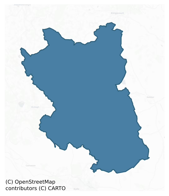
The recorded heritage of Kells Lower
The National Monuments Service Sites and Monuments Record (SMR) is the statutory inventory of archaeological sites for the Republic of Ireland, maintained by the Department of Tourism, Culture, Arts, Gaeltacht, Sport and Media. Sites recorded here include earthworks, ringforts, megalithic tombs, ecclesiastical remains, and post-medieval features; not every record is legally protected, but each is registered as a monument of archaeological interest.
The National Monuments Service records 234 archaeological sites in Kells Lower, putting it at the 39th percentile among 280 ROI baronies for sites per km². This means it is in the lower half of all baronies for sites per km². Protection coverage is near-universal — 231 sites (99%) fall within a recorded monument protection zone, indicating an extensively surveyed landscape. The dominant category is defensive sites — ringforts, enclosures, hillforts, and stone forts (139 sites, 59% of the record). Ringfort – rath is the most prevalent type, making up 44% of the barony's recorded sites (102 records) — well above the ROI average of 20% across all baronies where this type occurs. Ringfort – rath is an earthen ringfort enclosed by a bank and external ditch — the most common Early Medieval farmstead, broadly dated 500–1000 AD. Other significant types include Enclosure (10) and Church (9). Enclosure is a banked or ditched feature of uncertain type, used as a catch-all where the original function cannot be determined from surface evidence; Church is a building used for public Christian worship, of any date from c. 500 AD onwards. Across the barony's 146 km², this gives a recorded density of 1.60 sites per km².
Most common monument types
Hover or tap a monument type to see its definition.
| Type | Count |
|---|---|
| Ringfort – rath an earthen ringfort enclosed by a bank and external ditch — the most common Early Medieval farmstead, broadly dated 500–1000 AD | 102 |
| Enclosure a banked or ditched feature of uncertain type, used as a catch-all where the original function cannot be determined from surface evidence | 10 |
| Church a building used for public Christian worship, of any date from c. 500 AD onwards | 9 |
| Graveyard a burial area associated with a church, in use from the medieval period onwards | 8 |
| Earthwork an unclassified earthen structure with no diagnostic features that allow a more specific classification | 7 |
| House – indeterminate date a habitation building whose date cannot be determined from available evidence | 7 |
| Standing stone a deliberately set upright stone, used variously as a Bronze/Iron Age burial marker, route marker or commemorative monument | 6 |
Chronological distribution
The dated archaeological record for Kells Lower spans from the Neolithic through to the Modern, with activity attested across 8 of 9 archaeological periods. This is the 74th percentile across ROI baronies for chronological depth — an above-average span. Every period from earliest to latest is represented in the record — an unbroken sequence of dated activity across the full chronological span. Activity concentrates most heavily in the Early Medieval (112 sites, 58% of dated material), with the Iron Age forming a secondary peak (44 sites, 23%). A further 40 recorded sites (17% of the overall NMS register for the barony) carry no period attribution — appearing as 'Unknown' in the bar chart below. This typically reflects either records that pre-date the standardised period vocabulary or sites awaiting specialist dating review, rather than a genuine absence of chronological evidence.
Sample of recorded monuments
Show 25 sample monuments (of 234 total)
A representative sample of 25 recorded monuments drawn from the barony’s 234 total NMS entries. Sites within a recorded monument protection zone and rarer site types are prioritised so the list shows a meaningful cross-section rather than only the most common type. Each entry shows the official Sites and Monuments Record reference number and the description published by the National Monuments Service.
Megalithic tomb – court tomb
Located towards the bottom of a SW-facing slope. A subrectangular cairn (dims 40m NW-SE: 15m NE-SW) incorporates at the NW end the remains of the gallery of a three chambered court-tomb (L 6.3m; Wth 2.3m). A single…
Located towards the bottom of a SW-facing slope. A subrectangular cairn (dims 40m NW-SE: 15m NE-SW) incorporates at the NW end the remains of the gallery of a three chambered court-tomb (L 6.3m; Wth 2.3m). A single court stone is exposed to the N of the entrance jambs. (Eogan 1958, 179-81)
The above description is derived from the published 'Archaeological Inventory of County Meath' (Dublin: Stationery Office, 1987). In certain instances the entries have been revised and updated in the light of recent research.
Compiled by: Michael Moore
Date of revision: 31 August 2018
Cist
Located on a small NE-SW spur that overlooks the headwaters of a small NW-SE stream, which is c. 90m to the SW. A short cist (dims 0.61m E-W; 0.41m N-S: H 0.28m) containing a ribbed bowl Food Vessel and the cremated…
Located on a small NE-SW spur that overlooks the headwaters of a small NW-SE stream, which is c. 90m to the SW. A short cist (dims 0.61m E-W; 0.41m N-S: H 0.28m) containing a ribbed bowl Food Vessel and the cremated remains of an adolescent aged 12-15 was discovered in 1947. The location remains uncultivated (Digitalmap). (Barron 2011)
The above description is derived from the published 'Archaeological Inventory of County Meath' (Dublin: Stationery Office, 1987). In certain instances the entries have been revised and updated in the light of recent research.
Compiled by: Michael Moore
Date of revision: 31 August 2018
Megalithic tomb – portal tomb
Situated in a slight col with higher ground c. 120m to the N and at Cairnhill c. 180m to the S with lower ground c. 230m to the W and c. 250m to the E where there are N-S streams that coalesce c. 700m to the S. A large…
Situated in a slight col with higher ground c. 120m to the N and at Cairnhill c. 180m to the S with lower ground c. 230m to the W and c. 250m to the E where there are N-S streams that coalesce c. 700m to the S. A large roofstone (dims 3.7m x 3.4m; T 0.8m) is supported by a S portal stone (dims 1.5m x 0.4m; H 1.6m), with what may be a collapsed door stone nearby as well as two smaller upright stones (Eogan 1958, 183-4). It located just on the W side of a NNW-SSE field bank. (ÓNualláin 1983, 99)
The above description is derived from the published 'Archaeological Inventory of County Meath' (Dublin: Stationery Office, 1987). In certain instances the entries have been revised and updated in the light of recent research.
Compiled by: Michael Moore
Date of revision: 31 August 2018
Megalithic tomb – wedge tomb
Situated at the SE end of a broad NW-SE ridge. It is incorporated into the bank of a large enclosure (ME002-037002-) at W. It consists of an unroofed gallery (max. dims 3.4m NE-SW; 1.2m NW-SE) that opened to the SW…
Situated at the SE end of a broad NW-SE ridge. It is incorporated into the bank of a large enclosure (ME002-037002-) at W. It consists of an unroofed gallery (max. dims 3.4m NE-SW; 1.2m NW-SE) that opened to the SW where the gallery is widest and closed by a single stone (L 1.8m; H 0.45m). (Eogan 1958, 182-3) `
The above description is derived from the published 'Archaeological Inventory of County Meath' (Dublin: Stationery Office, 1987). In certain instances the entries have been revised and updated in the light of recent research.
Compiled by: Michael Moore
Date of revision: 31 August 2018
Castle – tower house
According to the Civil Survey (1654-6) Henry Betagh owned 429 acres at Newcastle in 1640 and on the premises was ‘a ruinous castle’ (Simington 1940, 301). Henry also owned 132 acres in Corbogg, but other members of the…
According to the Civil Survey (1654-6) Henry Betagh owned 429 acres at Newcastle in 1640 and on the premises was ‘a ruinous castle’ (Simington 1940, 301). Henry also owned 132 acres in Corbogg, but other members of the family owned most of the rest of the parish (ibid. 299-302). The castle is not indicated on any OS map, but it is marked on a manuscript map (ms: 21 F 14 (43) in NLI. It is situated on a local rise. One wall (L c. 7m N-S; T 1.5m; H c. 2m) with a fragment of a curving tower at its N end but no architectural features survives incorporated into the W wall of a farm building. This is probably the W wall of a bawn.
The above description is derived from the published 'Archaeological Inventory of County Meath' (Dublin: Stationery Office, 1987). In certain instances the entries have been revised and updated in the light of recent research.
Date of revision: 10 June 2016
Promontory fort – inland
Situated on a rise on the E-facing slope of Mullacreven Hill. This is a triangular grass-covered area with rock outcrop (dims c. 50m NW-SE; c. 50m NE-SW at NW) with the apex at SE and steep natural slopes on the NE and…
Situated on a rise on the E-facing slope of Mullacreven Hill. This is a triangular grass-covered area with rock outcrop (dims c. 50m NW-SE; c. 50m NE-SW at NW) with the apex at SE and steep natural slopes on the NE and S sides. It is protected by a slight earth and stone bank on the NW side, which has entrance gaps towards the SW (Wth of base 1.9m) and NE (Wth of base 2.2m) ends. There is a similar bank on the NE-facing slope below the summit. At the centre on top there is a house site (int. dims 5.5m NE-SW: 2.2m NW-SE) defined by low earthen banks (Wth 1.3m; H 0.4m) with a doorway (Wth 0.7m) on the NW side. Just E of its E corner is a second house (int. dims 4.7m NNW-SSE; 2.1m plus ENE-WSW) defined by slight earthen banks (Wth 1.5m; H 0.3m), but its W side is entirely missing. There is a small house site (int. dims 4.35m NNW-SSE; 2.5m ENE-WSW) on a terrace down the NE-facing slope and outside the bank here. It has gaps at its SW and SE angles, and a path leads down the slope from the latter. There is a fourth house structure (int. dims 7.1m WNW-ESE; 3.6m NNE-SSW) defined by earthen banks (Wth 3m; H 0.4m) at the base of the slope at the SE angle.
The above description is derived from the published 'Archaeological Inventory of County Meath' (Dublin: Stationery Office, 1987). In certain instances the entries have been revised and updated in the light of recent research.
Compiled by: Michael Moore
Date of revision: 5 September 2018
House – Neolithic
Located on a rise towards the bottom of a NW-facing slope with a NW-SE stream c. 70m to the NW. An occupation level was identified by Claire Cotter on the line of a Bórd Gáis pipeline from Dunleer, Co. Lough, to…
Located on a rise towards the bottom of a NW-facing slope with a NW-SE stream c. 70m to the NW. An occupation level was identified by Claire Cotter on the line of a Bórd Gáis pipeline from Dunleer, Co. Lough, to Mullagh, Co. Cavan. It proved to be a Neolithic house with a Bronze Age phase, and was excavated (E000633) by Eoin Halpin. The house was rectangular (dims c. 10m x 6m) divided into two rooms, the E (dims 6m x 5.5m) with a doorway (Wth 1m) at E to the exterior and an internal doorway (Wth 1.5m) to the W room, the full extent of which did not survive and it may be that the W end was open. Three post-holes on the central axis and the load-bearing post-and-plank N and S walls supported the roof. A pit in the E room was filled with burnt stone and ash. Charcoal samples from the foundation trench produced calibrated determinations of 3971-3706 BC and 3936-3697 BC. A Bronze Age urn burial (ME005-105001-) was inserted in the floor of the E room. A gully (Wth c. 0.4m; D 0.1m) c. 2m to the E was C-shaped (dims c. 7m N-S; c. 6m plus E-W) and may have formed an associated enclosure. Just 2m N of this was an irregularly-shaped stony platform (dims c. 10m E-W; 5m N-S). Amongst the finds were sherds of Neolithic pottery. (Halpin and Gowen 1991; Halpin 1992; Gowen 1992)
Compiled by: Michael Moore
Date of upload: 5 September 2018
Barrow – pond barrow
Located on the summit of a NW-SE ridge, it is described as a ‘Fort’ but not represented within a rectangular wood on the 1836 and 1912 editions of the OS 6-inch map but the wood has been removed without trace. This is a…
Located on the summit of a NW-SE ridge, it is described as a ‘Fort’ but not represented within a rectangular wood on the 1836 and 1912 editions of the OS 6-inch map but the wood has been removed without trace. This is a circular, slightly dished (D 0.4-0.6m) and grass-covered area (diam. 18m N-S; 18m E-W) with some tree-stumps defined by a wide earthen bank (Wth of base 4-8m; int. H 0.4-1.2m; ext. H 0.9m). There is no visible fosse or entrance.
The above description is derived from the published 'Archaeological Inventory of County Meath' (Dublin: Stationery Office, 1987). In certain instances the entries have been revised and updated in the light of recent research.
Compiled by: Michael Moore
Date of revision: 22 February 2019
House – fortified house
This is a National Monument (No. 256), and it is located in a broad valley with a small canalised N-S stream c. 60m to the E. Robertstown is a Barnwall manor and the graveslab of Alexander Barnwall who died in 1596 is…
This is a National Monument (No. 256), and it is located in a broad valley with a small canalised N-S stream c. 60m to the E. Robertstown is a Barnwall manor and the graveslab of Alexander Barnwall who died in 1596 is in Robertstown church (ME011-005—-) c. 250m to the NNE. The motte (ME011-004—-) is c. 260m to the NW. According to the Civil Survey (1654-6) Margaret Barnwall, a widow and an Irish Papist, owned 530 acres at Robertstown in Kilbeg parish in 1640, and on the premises were ‘a castle, a church out of repair, a mill, a fishing weare and some cabbins’. She owned a further 130 acres at Carlanstowne in the same parish (Simington 1940, 307-09). Gerald Barnwell of Robertstown, perhaps her late husband, is recorded as the proprietor of over a thousand acres known as Ballybreaghy in Moybologe parish further to the NW but in Kilmore diocese (ibid. 313). The house may have been occupied into the nineteenth century as it is depicted as a roofed structure on the 1836 ed. of the OS 6-inch map.
This is a rectangular three storey and attic house (ext. dims c. 11.3m N-S; 8.45m E-W) with good quoins, which has two-storey rectangular turrets at the NW and SE angles supported from the first floor by continuous machicoulis in the Scottish style. The NW turret is also at an angle of a bawn which extended to the N and E, and a later wing was added immediately N of the original house. The original entrance is a lintelled doorway (Wth 1.01m; H 1.8m) with a yett in the N wall. The…
Bridge
The NE-SW bridge (Wth 7.4m) over the Owenroe or Moynalty River is not represented on the Down Survey maps (1655-8) but the bridge may have been built before the end of the century on the route from Kells to Co. Cavan.…
The NE-SW bridge (Wth 7.4m) over the Owenroe or Moynalty River is not represented on the Down Survey maps (1655-8) but the bridge may have been built before the end of the century on the route from Kells to Co. Cavan. It has six rounded arches (at N: Wth 2.4m) but the bridge was widened and the NW side (Wth 4m) has now settled lower than the SE (Wth 3.4m). There are five break-waters on the upstream side and the parapet is level but there are no pedestrian refuges.
Compiled by: Michael Moore
Date of upload: 9 April 2019
Castle – ringwork
Located on a low rise in an undulating landscape, with Staholmog parish church (ME011-025—-) c. 250m to the E. This is a raised and circular but slightly dished grass-covered area (diam. 48m N-S; 44m E-W) defined by…
Located on a low rise in an undulating landscape, with Staholmog parish church (ME011-025—-) c. 250m to the E. This is a raised and circular but slightly dished grass-covered area (diam. 48m N-S; 44m E-W) defined by an earthen bank S-SW and NW-NNE (Wth of base 10m; int. H 0.8m; ext. H 0.9m) but largely by a scarp (at N: Wth 4m; H 1.5m; at S: Wth 4m; H 3m) with trees and bushes. There is no visible fosse but the ramp entrance (Wth of base 2.3m) is at SE. Modern structures impinge on the base of the scarp SE-SW and a field bank is built at its base SW-NNE, from where a straight NNW-SSE road bank truncates the scarp slightly NNE-E.
The above description is derived from the published 'Archaeological Inventory of County Meath' (Dublin: Stationery Office, 1987). In certain instances the entries have been revised and updated in the light of recent research.
Compiled by: Michael Moore
Date of revision: 9 April 2019
Barrow – bowl-barrow
Situated in a relatively low-lying position in an undulating landscape. This is a circular, grass-covered and rounded mound (diam. of base 30m E-W; H 6m) planted with trees and with a drystone revetment (H 1m) at its…
Situated in a relatively low-lying position in an undulating landscape. This is a circular, grass-covered and rounded mound (diam. of base 30m E-W; H 6m) planted with trees and with a drystone revetment (H 1m) at its base
The above description is derived from the published 'Archaeological Inventory of County Meath' (Dublin: Stationery Office, 1987). In certain instances the entries have been revised and updated in the light of recent research.
Compiled by: Michael Moore
Date of revision: 9 April 2019
Settlement deserted – medieval
Foundations of at least two stone structures, one measuring 16m by 5.5m visible to the E of church (ME005-094—-) and south of motte (ME005-093—-). Quarrying may have destroyed others. A sunken roadway (W 11m) runs E…
Foundations of at least two stone structures, one measuring 16m by 5.5m visible to the E of church (ME005-094—-) and south of motte (ME005-093—-). Quarrying may have destroyed others. A sunken roadway (W 11m) runs E from the structures. (Graham 1974, 49).
The above description is derived from the published 'Archaeological Inventory of County Meath' (Dublin: Stationery Office, 1987). In certain instances the entries have been revised and updated in the light of recent research.
Date of revision: 10 December, 2014
Stone sculpture (present location)
From King (1987, 302) Tomb-chest? c. 1690. Four fragments of a table tomb lie scattered around the older part of staholmock graveyard and a fifth is mounted on the north wall of the modern cemetery. This latter shows a…
From King (1987, 302) Tomb-chest? c. 1690. Four fragments of a table tomb lie scattered around the older part of staholmock graveyard and a fifth is mounted on the north wall of the modern cemetery. This latter shows a male figure, naked except for a loin cloth, in the ‘orans’ position (Roe 1970, 213; Ní Shúilliobháin 1970, 222). Three other pieces are the remains of a panel with an elaborated achievement of arms, (Fleming impaling ?Cross or Chetwode), and the remaining piece is a support for a table tomb. The two decorated pieces probably formed the end panels of the tomb. Dimensions: H 0.62m; Wth 0.66m.
Compiled by: Michael Moore
Date of upload; 22 May, 2014
Amended: 7 August, 2014
Burial ground
Located on a steep S-facing slope on top of a NE-SW ridge. It is described in italic lettering on the 1836 and 1908 editions of the OS 6-inch map as a graveyard. It is in the parish of Moybologe in Kilmore diocese, and…
Located on a steep S-facing slope on top of a NE-SW ridge. It is described in italic lettering on the 1836 and 1908 editions of the OS 6-inch map as a graveyard. It is in the parish of Moybologe in Kilmore diocese, and it has no known ecclesiastical connections. This is a neglected grass-covered rectangular area (dims c. 55m NW-SE; c. 50m NE-SW) defined by earthen banks (at NW: Wth of base 5.2m; Wth of top 2.8m; int. H 1.7m; ext. H 1.5m) with trees and an internal ditch or fosse (at NW: Wth of top 4.6m; Wth of base 1.6m; D 0.4m). There is an outer masonry wall and gateway on the NW side. The few headstones date largely from c. 1850 to c. 1900, and there are also plain grave-markers.
Compiled by: Michael Moore
Date of upload: 21 November, 2016
Sheela-na-gig
From Guest (1936, 118): 'Sheela-na-gig buried in the ground and recorded by Guest in 1935 as in ‘Kilmainham, on the borders of Louth-Meath : buried in a churchyard (ME005-028001-) near the railway station, at least…
From Guest (1936, 118): 'Sheela-na-gig buried in the ground and recorded by Guest in 1935 as in ‘Kilmainham, on the borders of Louth-Meath : buried in a churchyard (ME005-028001-) near the railway station, at least forty years ago. (From private information)’
Compiled by: Caimin O’Brien
Date of upload: 29 May 2012
Ecclesiastical enclosure
Situated on the S side of what was once an island in Emlagh bog. The site of the early monastery of Emlagh is within a subrectangular graveyard (ME011-039001-). About 60m from this enclosure and at base of knoll on…
Situated on the S side of what was once an island in Emlagh bog. The site of the early monastery of Emlagh is within a subrectangular graveyard (ME011-039001-). About 60m from this enclosure and at base of knoll on which it is situated is slight scarp or ditch (Wth c. 5m; D 0.2-0.4m) N-E-S, which may form part of an ecclesiastical enclosure.
Compiled by: Michael Moore
Date of upload: 31 July, 2014
Causeway
The site of the early monastery and the site of the parish church of Emlagh is situated on the S side of what was once an island in Emlagh bog. The island in the Red moor of Emlogh is marked on the Down Survey (1656-8)…
The site of the early monastery and the site of the parish church of Emlagh is situated on the S side of what was once an island in Emlagh bog. The island in the Red moor of Emlogh is marked on the Down Survey (1656-8) barony map of Kells with a causeway extending NW towards Cravelltonne (Gravelstown), which is probably now occupied by the road. For the Down Survey barony map see this web-page accessed on 31 July, 2014http://downsurvey.tcd.ie/down-survey-maps.php#bm=Kells&c=Meath
Compiled by: Michael Moore
Date of upload: 31 July, 2014
Bullaun stone
Located c. 15m W of the Roman Catholic church of the Sacred Heart in Kilmainhamwood. This is a sandstone cylinder (dims of top 0.57m x 0.48m; H 0.58m) with a rounded basin (dims 0.36m x 0.33m; max. D 0.23m). The stone…
Located c. 15m W of the Roman Catholic church of the Sacred Heart in Kilmainhamwood. This is a sandstone cylinder (dims of top 0.57m x 0.48m; H 0.58m) with a rounded basin (dims 0.36m x 0.33m; max. D 0.23m). The stone has been roughly cut back to a rough cylinder (dims of base 0.36m x 0.23m), and portion of the rim has been damaged.
Compiled by: Michael Moore
Date of upload: 1 August, 2014
Cross-inscribed stone
Just E of the church (ME011-043—-) there is a stone (Wth 0.4m; max. H 0.66m; T 5-11cm) that has an inscribed cross (H 13cm; Wth 12cm) with bar-terminals on one face.
Compiled by: Michael Moore
Date of upload:…
Just E of the church (ME011-043—-) there is a stone (Wth 0.4m; max. H 0.66m; T 5-11cm) that has an inscribed cross (H 13cm; Wth 12cm) with bar-terminals on one face.
Compiled by: Michael Moore
Date of upload: 11 December, 2014
Building
Situated on a SE-facing slope and on the summit of motte (ME005-080—-). The foundations of large oval grass-covered structure (int. dims 7m E-W; c. 4.5m N-S) defined by a small earthen bank (Wth 1.3m; H 0.3m) with an…
Situated on a SE-facing slope and on the summit of motte (ME005-080—-). The foundations of large oval grass-covered structure (int. dims 7m E-W; c. 4.5m N-S) defined by a small earthen bank (Wth 1.3m; H 0.3m) with an entrance on the S side is at the S edge of the summit.
Compiled by: Michael Moore
Date of revised upload: 5 September, 2018
Bawn
The NW turret of the fortified house (ME011-006—-) is built partly on the W wall of a bawn that extended to the N and E of the original house. Gun-loops in this turret covered the W walls of the house and the bawn.…
The NW turret of the fortified house (ME011-006—-) is built partly on the W wall of a bawn that extended to the N and E of the original house. Gun-loops in this turret covered the W walls of the house and the bawn. Only this W wall of the bawn is partly preserved in the N wing added to the house, with a single light at the ground floor.
This is a monument in state ownership: No. 256.
Compiled by: Michael Moore
Date of upload: 23 August, 2016
Pit-burial
A pit burial containing an unusually small vase urn (H c. 0.22m) was inserted in the floor of the Neolithic house (ME005-105—-). (Halpin and Gowen 1991, 38; Gowen 1992, 27)
Compiled by: Michael Moore
Date of…
A pit burial containing an unusually small vase urn (H c. 0.22m) was inserted in the floor of the Neolithic house (ME005-105—-). (Halpin and Gowen 1991, 38; Gowen 1992, 27)
Compiled by: Michael Moore
Date of upload: 5 September 2018
Water mill – unclassified
Located on the E bank of a NNW-SSE section of the Barora River that is also known as the Owenroe and sometimes as the Moynalty River. Archaeological monitoring (07E0942) of a water scheme at Moynalty village identified…
Located on the E bank of a NNW-SSE section of the Barora River that is also known as the Owenroe and sometimes as the Moynalty River. Archaeological monitoring (07E0942) of a water scheme at Moynalty village identified a ditch (Wth 2.75m; D 0.8m) c. 6m from the river and running parallel with it. The watercourse has a corner of a stone structure (int. dims 1.75m plus; 1.7m plus) on its W side. The structure appears to have been sunk in the ground and has a stone floor. No dating material was recovered but the structure could be one of the two mills described as 'waste' in the Civil Survey (1655-6) for Co. Meath (Simington 1940, 299). An outflow pipe was diverted and the structure is preserved in situ. The corn-drying kiln (ME011-050002-) is c. 8m to the NE. (Clutterbuck 2009, 4-6; 2012)
Compiled by: Michael Moore
Date of upload: 3 April, 2019
Ringfort – rath
Situated on a slight rise on top of a fairly broad hill. This was described in 1969 as a scrub-covered D-shaped area (dims c. 30m NE-SW; 15.5m NW-SE) defined by a scarp (at SE: H 1.4m) and a slight berm (at SE: Wth…
Situated on a slight rise on top of a fairly broad hill. This was described in 1969 as a scrub-covered D-shaped area (dims c. 30m NE-SW; 15.5m NW-SE) defined by a scarp (at SE: H 1.4m) and a slight berm (at SE: Wth 0.5m) that melds into the natural slope. The entrance was a ramp (Wth of base 2m) at ESE, and the monument was truncated by a NE-SW farm lane at NW. Inside the surviving part was a hut-site (diam. 6m) defined by as light bank (Wth of base 1.9m; int. H 0.25m; ext. H 0.55m). The visible monument had been removed by 2000 (OSAP). Archaeological testing (05E0635) by K. Campbell c. 60m to the WSW produced no related material (excavation.ie 2005:1164).
The above description is derived from the published 'Archaeological Inventory of County Meath' (Dublin: Stationery Office, 1987). In certain instances the entries have been revised and updated in the light of recent research.
Compiled by: Michael Moore
Date of revision: 31 August 2018
Amended: 29 January 2021
Listed buildings
The National Inventory of Architectural Heritage (NIAH) is a state survey appraising buildings of architectural, historical, archaeological, artistic, cultural, scientific, social, or technical interest. Each surveyed structure receives a rating from International (the highest, for buildings of European importance) through National, Regional, Local, and Record-Only.
The NIAH records 60 listed buildings in Kells Lower (30th percentile across ROI baronies). All recorded buildings carry Regional or lower grading; the barony does not contain any structures appraised as being of National or International architectural importance. Construction dates concentrate most heavily in the Late Georgian (1800-1830) period. The most-recorded building type is house (16 examples, 27% of the listed stock).
Terrain and environment
Mean elevation across the barony is 105m — the 62nd percentile among 280 ROI baronies for elevation. This means it is in the upper half of all baronies for elevation. Elevation matters for heritage because higher-altitude baronies typically favour defensive monuments — ringforts and hilltop forts placed on prominent ground — while lowland baronies are more likely to carry the dense settlement and church networks of intensive agricultural landscapes. A maximum elevation of 251m gives the barony meaningful vertical relief. Mean slope is 4.0° — the 59th percentile among 280 ROI baronies for slope. This means it is in the upper half of all baronies for slope. Slope is a key control on both land use and archaeological preservation: steep ground resists ploughing and tends to preserve earthworks intact, while gentle slopes favour intensive cultivation that damages or destroys surface archaeology over time. The Topographic Wetness Index averages 10.4, the 33rd percentile among 280 ROI baronies for wetness. This means it is in the lower half of all baronies for wetness. Drainage matters for heritage because poorly-drained ground preserves organic archaeology (wooden trackways, leather, textiles, and on rare occasions human remains) far better than free-draining soil; well-drained ground favours arable use but destroys organic material rapidly. The land cover is dominated by improved grassland (85%) and woodland (12%).
Terrain measurements
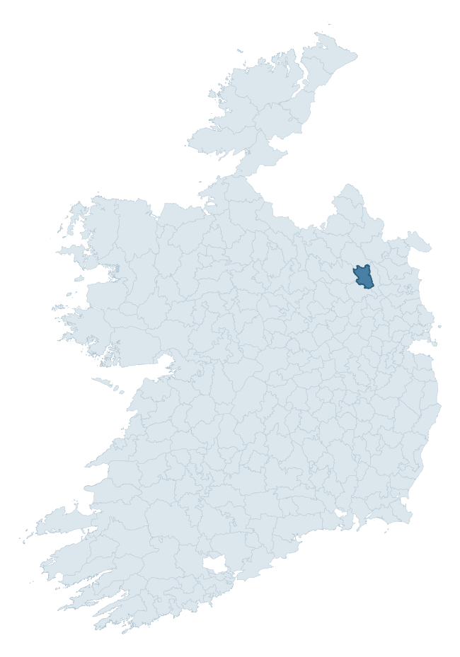
Where this barony sits in the Republic of Ireland
Geology and preservation
Bedrock geology shapes the landscape long before any settlement begins — controlling soil drainage, agricultural potential, the survival of upstanding monuments, and the preservation of buried archaeology. The figures below come from the Geological Survey Ireland 1:100,000 bedrock map.
The bedrock underlying Kells Lower is predominantly greywacke (58% of the barony by area), laid down during the Silurian period (59% by area, around 444 to 419 million years ago). Greywacke is a hard, dark, fine-grained sandstone that weathers to thin upland soils. Greywacke baronies typically carry sparser settlement archaeology but provide high-quality building stone visible in older field walls and farm buildings. A substantial secondary geology of limestone (18%) adds further variety to the underlying landscape. The single largest mapped unit is the Clontail Formation (34% of the barony's bedrock).
Rock type composition
Largest mapped unit: Clontail Formation (34% of the barony)
Placename evidence
Logainm records 30 heritage-diagnostic placenames for Kells Lower, drawn from townland and civil-parish names across the barony. The dominant stratum is pre-Christian and Early Medieval defensive — ráth-, lios-, dún-, and caiseal-prefixed names that mark Iron Age and early historic settlement. The leading diagnostic roots are ráth- (8 — earthen ringfort), cill- (8 — church), and lios- (4 — ringfort or enclosure). This is broadly in line with the ROI average of 30.7 heritage placenames per barony. The presence of multiple heritage strata side by side indicates layered occupation of the landscape across successive prehistoric and historic periods. Logainm records 129 placenames for Kells Lower (predominantly townland names). Of these, 30 (23%) carry one of the diagnostic Gaelic roots tracked above; the remainder draw on more generic landscape vocabulary that does not encode a heritage period.
Pre-Christian / Early Medieval Defensive
| Root | Count | Meaning |
|---|---|---|
| ráth- | 8 | earthen ringfort |
| lios- | 4 | ringfort or enclosure |
| dún- | 3 | hilltop or promontory fort |
Early Christian Ecclesiastical
| Root | Count | Meaning |
|---|---|---|
| cill- | 8 | church (early) |
| bile- | 1 | sacred tree / boundary marker |
Burial, Ritual, and Norse-Contact
| Root | Count | Meaning |
|---|---|---|
| carn- | 4 | cairn |
| feart- | 1 | grave mound |
| sián- | 1 | fairy mound |
| gall- | 1 | foreigner — Norse settlement marker |
Other baronies in Meath
- Moyfenrath Upper
- Dunboyne
- Fore
- Ratoath
- Slane Upper
- Skreen
- Duleek Lower
- Ballinacor North — Wicklow
- Geashill — Offaly
- Moyfenrath Lower
See all 280 baronies in the Republic of Ireland Heritage Tool.

Explore further
Grounding History: 10 Maps of Northern Ireland’s Past
If you’re interested in Irish heritage more widely, the companion report for Northern Ireland brings together the analysis of all 462 NI wards into one place through 10 high-quality maps — covering monument density, archaeological periods, placename heritage, terrain, wetland, and the historic landscape at first survey. Take a look.
About this profile
Click any section below to expand.
What is a barony?
A barony is a historic administrative unit in Ireland, broadly equivalent to an English hundred. The 280 baronies used here are from the OSi 2019 National Statutory Boundaries (generalised 20m), covering the 26 counties of the Republic of Ireland. Baronies derive from the Norman period, were formalised in the 17th century, and have not been redrawn for statistical purposes. They vary enormously in area, from compact urban baronies in Dublin to vast upland baronies in Connacht, and should not be compared by raw site count without accounting for area differences.
What counts as a site?
This profile combines three distinct heritage registers, each with its own definition of what constitutes a recordable site:
- Archaeological sites (NMS). The National Monuments Service Sites and Monuments Record (SMR) catalogues every known archaeological monument or site of archaeological interest in the Republic, from prehistoric burial mounds and ringforts to medieval churches and post-medieval defensive works. Inclusion does not require legal protection — only that the site has been identified, surveyed, and assessed as having archaeological value. A separate subset of these sites lies within a recorded protection zone, which gives them statutory protection under the National Monuments Acts.
- Listed buildings (NIAH). The National Inventory of Architectural Heritage records buildings of architectural, historical, archaeological, artistic, cultural, scientific, social, or technical interest. Each surveyed structure is appraised on a five-tier scale: International, National, Regional, Local, and Record-Only. The NIAH appraisal is informational rather than strictly statutory, but it underpins local-authority Record of Protected Structures (RPS) listings.
- Heritage placenames (Logainm). Logainm is the authoritative database of Irish placenames maintained by the Placenames Branch. This profile applies a heritage-diagnostic classifier to the Irish-language form of each townland name, flagging roots that signal defensive sites (ráth-, lios-, dún-, caiseal-, cathair-), ecclesiastical foundations (cill-, teampall-, domhnach-, mainistir-), prehistoric burial-ritual features (tuaim-, carn-, leaba-), or Norse-contact settlement (gall-). Townlands without one of these diagnostic roots are not flagged here — they may still carry historical significance, but that significance is not encoded in the name itself.
Editorial principles
The narrative sections of this profile follow several explicit principles:
- Evidential. Every claim about this barony’s heritage character is anchored in the underlying register data. Where a site count, a placename count, or a percentile rank is cited, it is computed from the source datasets at export time, not estimated.
- Comparative. Counts and metrics are reported alongside their percentile rank against the other 279 ROI baronies. A barony with 50 ringforts in absolute terms could be unusually high or unusually low depending on its size and regional context; percentile ranking removes that ambiguity.
- Transparent on limits. Where a register has known coverage gaps, survey biases, or data-quality issues that affect this barony’s figures, the profile flags them rather than presenting the numbers as definitive.
- No interpretation beyond what the data supports. The narrative does not speculate about historical events, social dynamics, or cultural meaning beyond what the recorded heritage and placename evidence directly attests.
Data caveats and limits
- NMS Sites and Monuments Record is the product of survey campaigns conducted at different intensities across different counties and decades. Some baronies have been surveyed more thoroughly than others, and absolute counts should be read in that light. Sites destroyed by development before survey are typically not represented; sites in heavily forested or upland terrain are sometimes under-recorded.
- NIAH coverage is broadly complete for the Republic of Ireland but the survey was conducted on a rolling county-by-county basis, and the most recent appraisal date varies. Buildings demolished or substantially altered after their original survey may still appear in the register; conversely, recent buildings of merit may not yet have been appraised.
- Logainm classification applies a deliberately conservative pattern-matching approach to the Irish-language townland forms. The classifier prioritises true positives over recall: a townland may carry a heritage signal that the classifier doesn’t recognise, particularly where the diagnostic root has been heavily anglicised or where the townland name draws on a less common term. The 60,000+ townland records and ~9,800 classified placenames give a substantial signal at barony scale, but individual townland names should be checked against Logainm directly for definitive interpretation.
- Period attribution. The chronological distribution reflects only those NMS sites that carry a recognised period attribution in the source data. Sites listed as “Unknown” period are excluded from the dated subset.
- Boundary changes. Some baronies have undergone minor boundary adjustments since their 19th-century definition; the OSi 2019 generalised boundaries used here are the current statutory definition and may differ slightly from historical maps in border areas.
- Bedrock geology is mapped at 1:100,000 scale, which means local variation within a barony — small pockets of different rock type, mineral veins, alluvium overlying bedrock — is generalised. The dominant-system and rocktype figures are area-weighted, so a barony reading “70% Carboniferous limestone” may still contain small but archaeologically important pockets of older or younger rock. Around 3% of GSI polygons do not match the lexicon and contribute no rocktype or system attribution.
Data sources
- National Monuments Service — Sites and Monuments Record (SMR) https://data.gov.ie/dataset/national-monuments-service-archaeological-survey-of-ireland
- National Inventory of Architectural Heritage (NIAH) https://data.gov.ie/dataset/national-inventory-of-architectural-heritage-niah-national-dataset
- Logainm — Placenames Database of Ireland https://www.logainm.ie/
- Ordnance Survey Ireland — National Statutory Barony Boundaries 2019 https://data-osi.opendata.arcgis.com/
- EURODEM — European Digital Elevation Model https://www.mapsforeurope.org/datasets/euro-dem
- ESA WorldCover https://esa-worldcover.org/en
- Geological Survey Ireland — 1:100,000 Bedrock Geology https://www.gsi.ie/en-ie/data-and-maps/Pages/Bedrock.aspx
Explore more: Search any of the 280 ROI baronies, browse by historical province, or read the methodology and data sources for the full Republic of Ireland Heritage Tool.