Carbery West (East Division) is a barony of County Cork, in the historical province of Munster (Irish: Cairbrigh Thiar (an Roinn Thoir)), covering 329 km² of land. The barony records 816 NMS archaeological sites and 305 NIAH listed buildings, placing it at around the 71st percentile among 280 ROI baronies for sites per km². This means it is in the top third of all baronies for sites per km². Dated archaeological evidence runs from the Mesolithic through to the Modern, spanning 9 of 9 archaeological periods, placing the barony in the 92nd percentile among 280 ROI baronies for chronological depth. This means it is in the top tenth of all baronies for chronological depth. The largest dated subset of recorded sites dates to the Early Medieval. Logainm flags 40 placenames in the barony as carrying a recognised heritage root; the largest share — around 58% — are names associated with pre-christian defensive.
Heritage at a glance
Percentile rankings throughout this profile compare each barony only against the other 279 Republic of Ireland baronies.
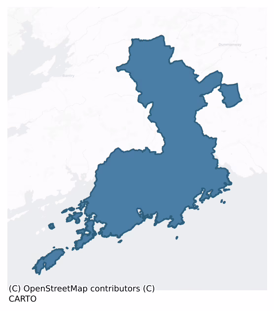
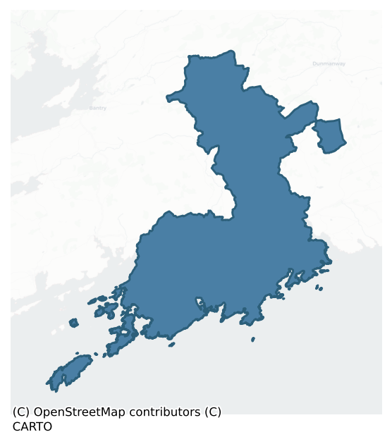
The recorded heritage of Carbery West (east Division)
The National Monuments Service Sites and Monuments Record (SMR) is the statutory inventory of archaeological sites for the Republic of Ireland, maintained by the Department of Tourism, Culture, Arts, Gaeltacht, Sport and Media. Sites recorded here include earthworks, ringforts, megalithic tombs, ecclesiastical remains, and post-medieval features; not every record is legally protected, but each is registered as a monument of archaeological interest.
The National Monuments Service records 816 archaeological sites in Carbery West (East Division), putting it at the 71st percentile among 280 ROI baronies for sites per km². This means it is in the top third of all baronies for sites per km². Protection coverage is near-universal — 761 sites (93%) fall within a recorded monument protection zone, indicating an extensively surveyed landscape. The dominant category is defensive sites — ringforts, enclosures, hillforts, and stone forts (298 sites, 37% of the record). Ringfort – rath is the most prevalent type, making up 19% of the barony's recorded sites (154 records), broadly in line with the ROI average of 20% across all baronies where this type occurs. Ringfort – rath is an earthen ringfort enclosed by a bank and external ditch — the most common Early Medieval farmstead, broadly dated 500–1000 AD. Other significant types include Burial ground (68) and Souterrain (65). Burial ground is an area set apart for burial that is not associated with a church, in use from the medieval period onwards; Souterrain is an underground stone-built passage and chamber, generally Early Medieval and often associated with ringforts as a defensive or storage feature. Across the barony's 329 km², this gives a recorded density of 2.48 sites per km².
Most common monument types
Hover or tap a monument type to see its definition.
| Type | Count |
|---|---|
| Ringfort – rath an earthen ringfort enclosed by a bank and external ditch — the most common Early Medieval farmstead, broadly dated 500–1000 AD | 154 |
| Burial ground an area set apart for burial that is not associated with a church, in use from the medieval period onwards | 68 |
| Souterrain an underground stone-built passage and chamber, generally Early Medieval and often associated with ringforts as a defensive or storage feature | 65 |
| Standing stone a deliberately set upright stone, used variously as a Bronze/Iron Age burial marker, route marker or commemorative monument | 58 |
| Hut site a low stone or earthen foundation enclosing a small circular or oval area, generally interpreted as a former dwelling, of any date from prehistory to the medieval period | 52 |
| Enclosure a banked or ditched feature of uncertain type, used as a catch-all where the original function cannot be determined from surface evidence | 40 |
| Fulacht fia a horseshoe-shaped Bronze Age burnt mound built around a sunken trough beside a water source, traditionally interpreted as a cooking site | 36 |
Chronological distribution
The dated archaeological record for Carbery West (East Division) spans from the Mesolithic through to the Modern, with activity attested across 9 of 9 archaeological periods. This places Carbery West (East Division) in the top 8% of ROI baronies for chronological depth — few baronies record evidence across as many distinct archaeological periods. Every period from earliest to latest is represented in the record — an unbroken sequence of dated activity across the full chronological span. Activity concentrates most heavily in the Early Medieval (245 sites, 44% of dated material), with the Iron Age forming a secondary peak (142 sites, 25%). A further 256 recorded sites (31% of the overall NMS register for the barony) carry no period attribution — appearing as 'Unknown' in the bar chart below. This typically reflects either records that pre-date the standardised period vocabulary or sites awaiting specialist dating review, rather than a genuine absence of chronological evidence.
Sample of recorded monuments
Show 25 sample monuments (of 816 total)
A representative sample of 25 recorded monuments drawn from the barony’s 816 total NMS entries. Sites within a recorded monument protection zone and rarer site types are prioritised so the list shows a meaningful cross-section rather than only the most common type. Each entry shows the official Sites and Monuments Record reference number and the description published by the National Monuments Service.
House – vernacular house
The Archaeological Survey of Ireland (ASI) is in the process of providing information on all monuments on The Historic Environment Viewer (HEV). Currently the information for this record has not been uploaded. To…
The Archaeological Survey of Ireland (ASI) is in the process of providing information on all monuments on The Historic Environment Viewer (HEV). Currently the information for this record has not been uploaded. To access available information for research purposes please make an appointment in advance with the Archive Unit (open Fridays 10.00 am – 5.00 pm), Department of Culture, Heritage and the Gaeltacht, The Custom House, Dublin 1 D01W6XO or email nmarchive@chg.gov.ie.
Kiln – corn-drying
Immediately W of Castle Donovan (CO119-017002-) atop low E-W ridge, on E bank of stream. Stone-lined lintelled flue (H 0.5m; L 1.3m; Wth 0.63m), facing E, leads to circular drying chamber (H 1.15m; 1.11m E-W; 1.03m N-S)…
Immediately W of Castle Donovan (CO119-017002-) atop low E-W ridge, on E bank of stream. Stone-lined lintelled flue (H 0.5m; L 1.3m; Wth 0.63m), facing E, leads to circular drying chamber (H 1.15m; 1.11m E-W; 1.03m N-S) covered by capstone held on three support stones 0.2m over top of chamber walling. Set within trapezoidal stone-faced rubble platform (2.93m E-W; 2.95m N-S at wide end to W); set within low circular mound (5.9m N-S; 5.75m E-W).
The above description is derived from the published 'Archaeological Inventory of County Cork. Volume 1: West Cork' (Dublin: Stationery Office, 1992). In certain instances the entries have been revised and updated in the light of recent research.
Date of upload/revision: 14 January 2009
Stone circle – five-stone
In pasture, on shoulder of NW-facing lower slopes of Milane hill. Circle complete; interior filled with field stones. Stones are 0.9m to 1.15m L, 0.3m to 0.7m T and 0.7m to 1.3m H. Internal measurement along main…
In pasture, on shoulder of NW-facing lower slopes of Milane hill. Circle complete; interior filled with field stones. Stones are 0.9m to 1.15m L, 0.3m to 0.7m T and 0.7m to 1.3m H. Internal measurement along main axis,aligned NE-SW, is 2.7m. Pair of standing stones (CO120-00101-) to SW. (O Nualláin 1984, 43, no. 88)
The above description is derived from the published 'Archaeological Inventory of County Cork. Volume 1: West Cork' (Dublin: Stationery Office, 1992). In certain instances the entries have been revised and updated in the light of recent research.
Date of upload/revision: 14 January 2009
Stone circle – multiple-stone
In rough pasture on N-facing slope 1.4km SW of Curraghalicky lake. One stone stands at site of monument, 0.9m L, 0.4m T and 0.4m H. OS Name Book (1841) records ….'a druidical circle here consisting of eleven stones…
In rough pasture on N-facing slope 1.4km SW of Curraghalicky lake. One stone stands at site of monument, 0.9m L, 0.4m T and 0.4m H. OS Name Book (1841) records ….'a druidical circle here consisting of eleven stones placed in a ring about a central one varying in height from 21/2 to 3 feet'. (O Nualláin 1984, 20, no. 27; Roberts 1988, Ch. 6, no. 5)
The above description is derived from the published 'Archaeological Inventory of County Cork. Volume 1: West Cork' (Dublin: Stationery Office, 1992). In certain instances the entries have been revised and updated in the light of recent research.
Date of upload/revision: 14 January 2009
Designed landscape – ornamental lake
The Archaeological Survey of Ireland (ASI) is in the process of providing information on all monuments on The Historic Environment Viewer (HEV). Currently the information for this record has not been uploaded. To…
The Archaeological Survey of Ireland (ASI) is in the process of providing information on all monuments on The Historic Environment Viewer (HEV). Currently the information for this record has not been uploaded. To access available information for research purposes please make an appointment in advance with the Archive Unit (open Fridays 10.00 am – 5.00 pm), Department of Culture, Heritage and the Gaeltacht, The Custom House, Dublin 1 D01W6XO or email nmarchive@chg.gov.ie.
Designed landscape – tree-ring
The Archaeological Survey of Ireland (ASI) is in the process of providing information on all monuments on The Historic Environment Viewer (HEV). Currently the information for this record has not been uploaded. To…
The Archaeological Survey of Ireland (ASI) is in the process of providing information on all monuments on The Historic Environment Viewer (HEV). Currently the information for this record has not been uploaded. To access available information for research purposes please make an appointment in advance with the Archive Unit (open Fridays 10.00 am – 5.00 pm), Department of Culture, Heritage and the Gaeltacht, The Custom House, Dublin 1 D01W6XO or email nmarchive@chg.gov.ie.
Bee-boles
Nine lintelled bee boles (H 0.66m; Wth 0.53m) on S elev of low N wall of an originally terraced walled garden. Bee boles vary in size but similiar in design.
The above description is derived from the published…
Nine lintelled bee boles (H 0.66m; Wth 0.53m) on S elev of low N wall of an originally terraced walled garden. Bee boles vary in size but similiar in design.
The above description is derived from the published 'Archaeological Inventory of County Cork. Volume 1: West Cork' (Dublin: Stationery Office, 1992). In certain instances the entries have been revised and updated in the light of recent research.
Date of upload/revision: 14 January 2009
Historic town
A relatively small settlement cluster is marked on the 1655-9 Down Survey map of Carbury Barony to the E of a river which is spanned by a bridge (CO141-161—-) (Hib. Reg.). The 1655-59 Down Survey map of Creagh Parish…
A relatively small settlement cluster is marked on the 1655-9 Down Survey map of Carbury Barony to the E of a river which is spanned by a bridge (CO141-161—-) (Hib. Reg.). The 1655-59 Down Survey map of Creagh Parish depicts a cluster of dwellings to the E of the river in the area where the modern Main Street is located. This cluster of dwellings stood on the E side of the river which formed the townland and parish boundary. The terrier of the Down Survey parish map recorded that in Gortnaclohy are ‘Scituate a ruined Castle [CO141-094—-] & a Church [CO141-142—-] with an Orchard and Garden with a Mill [CO141-135—-] and Many Cabins’ (NLI, Ms. 712-3). Judging by its location on the map, it probably represents a mid-17th century precursor of the present day town of Skibbereen. The historic town of Skibbereen was described in the Urban Survey of Cork as follows; 'Established as a market town on the lands of Sir Walter Coppinger who secured the right to hold a fair in the area in 1615. Originally two separate settlements, divided by a small stream, the present town combines the parishes of Bridgetown to the west and Creagh or Staplestown to the east. Skibbereen was formerly an important centre for the manufacture of textiles, particularly wool and linen, its location on the south back of the Ilen river gave the town access to Baltimore Harbour from where corn and flour were exported. An extensive brewery was established here in 1809 which supplied the surrounding are…
Rock art
Located 1.4m outside entrance to cashel (CO142-070001-); cup-marked stone (CO142-070005-) in interior. Flat slab (l 1.6m; Wth 1.36m; H 0.13m) supported by smaller stones. Decoration includes twenty-five cupmarks, one…
Located 1.4m outside entrance to cashel (CO142-070001-); cup-marked stone (CO142-070005-) in interior. Flat slab (l 1.6m; Wth 1.36m; H 0.13m) supported by smaller stones. Decoration includes twenty-five cupmarks, one dumb-bell motif and two cupmarks wtih penannular circles. According to Somerville (1931, 8-9) the stone was originally face downwards and was over turned in 1869 to reveal the cup-marks.
See attached screenshots of 3D model of the rock art panel created by archaeology.ucc. 3D model can be accessed at the Sketchfab website: https://skfb.ly/EvwY
The above description is derived from the published 'Archaeological Inventory of County Cork. Volume 1: West Cork' (Dublin: Stationery Office, 1992). In certain instances the entries have been revised and updated in the light of recent research.
Date of upload/revision: 14 January 2009
House – early medieval
Discovered during excavation of enclosure (CO142-091001-) at Carrigillihy. O'Kelly (1951, 69-86) describes wall foundations (max. H 2 feet) of a drystone-built house (ext. L 28 feet; Wth ext. 28 feet; L int. 20 feet;…
Discovered during excavation of enclosure (CO142-091001-) at Carrigillihy. O'Kelly (1951, 69-86) describes wall foundations (max. H 2 feet) of a drystone-built house (ext. L 28 feet; Wth ext. 28 feet; L int. 20 feet; Wth int. 17 feet); long axis WNW-ESE: there are two opes, opposite each other on the shorter wall. He dates the site to the Early Christian period or later.
The above description is derived from the published 'Archaeological Inventory of County Cork. Volume 1: West Cork' (Dublin: Stationery Office, 1992). In certain instances the entries have been revised and updated in the light of recent research.
Date of upload/revision: 14 January 2009
Religious house – Franciscan friars
On a NE-facing slope, close to the shore, on the E side of Sherkin island. This Franciscan priory was founded by Fineen O'Driscoll in 1449 though building probably did not commence until the 1460s (Gwynn and Hadcock…
On a NE-facing slope, close to the shore, on the E side of Sherkin island. This Franciscan priory was founded by Fineen O'Driscoll in 1449 though building probably did not commence until the 1460s (Gwynn and Hadcock 1988, 258-9). Described by Cochrane (1912, 6) as 'of moderate dimensions', the ruins consist of a church with domestic buildings around a cloister to the N. The church consists of a nave and chancel separated by an inserted tower, and a transept to the S of the nave, with two side chapels, separated from the nave by an arcade of three pointed arches on square piers. The E and W windows of the church are now missing their tracery, which was of 'switch-line type, but its sub-arches were round' (Leask 1960, Vol. 3, 107). The surviving windows in the transept and side chapels have twin pointed lights with a central mullion. The tower (H c. 15m) is very low by Franciscan standards; there is a vault over the ground level, pointed ribbed arches facing the nave and chancel, and the pointed terminal of the rib to the SE is decorated with a vine leaf motif.
The Friary was burnt in 1537 (Conlan 1988, 141) and subsequently repaired; the domestic buildings show evidence of many alterations and additions. The E range is vaulted over the ground floor; the W range ground was also vaulted but it has now collapsed. The S wall of the N range are gone; on inspection a neat pile of rubble in the centre of the garth had been built from 'an accumulation of debris' by the Board of…
Barracks
The Archaeological Survey of Ireland (ASI) is in the process of providing information on all monuments on The Historic Environment Viewer (HEV). Currently the information for this record has not been uploaded. To…
The Archaeological Survey of Ireland (ASI) is in the process of providing information on all monuments on The Historic Environment Viewer (HEV). Currently the information for this record has not been uploaded. To access available information for research purposes please make an appointment in advance with the Archive Unit (open Fridays 10.00 am – 5.00 pm), Department of Culture, Heritage and the Gaeltacht, The Custom House, Dublin 1 D01W6XO or email nmarchive@chg.gov.ie.
Radial-stone enclosure
In pasture, on crest of low ridge of outcropping rock. Enclosure bounded on W by old road. Eighteen radially-set stones protrude 0.45-1.15m above surface of bank, c. 2m Wth, which encloses subcircular area c. 22m N-S by…
In pasture, on crest of low ridge of outcropping rock. Enclosure bounded on W by old road. Eighteen radially-set stones protrude 0.45-1.15m above surface of bank, c. 2m Wth, which encloses subcircular area c. 22m N-S by c. 25m E-W. Occurrence of three opposing pairs of stones suggests two concentric lines. Interior of monument level. Known locally as "lios", not as burial ground, though so named, apparently incorrectly, on OS 6 inch maps. Burial ground (CO150-055—-) 250m to S.
The above description is derived from the published 'Archaeological Inventory of County Cork. Volume 1: West Cork' (Dublin: Stationery Office, 1992). In certain instances the entries have been revised and updated in the light of recent research.
Date of upload/revision: 14 January 2009
Megalithic tomb – unclassified
Situated on gentle N-facing slope 1km N of inner reaches Tragumna Bay. Single orthostat (H 1.2m), stands at W end of N side ruined chamber, aligned E-W; collapsed c. 1980 when number of boulders dumped at E end.…
Situated on gentle N-facing slope 1km N of inner reaches Tragumna Bay. Single orthostat (H 1.2m), stands at W end of N side ruined chamber, aligned E-W; collapsed c. 1980 when number of boulders dumped at E end. Roof-stone fell between single S sidestone, which collapsed outwards, and second N sidestone, pushing its E end out to NE. Earth and stone at W end of chamber may be field clearance. Cannot be classified with certainty; interpretation as wedge-tomb would not be inconsistent with present evidence. (Roberts 1988, Ch. 2, no. 38 "Drishanemore")
The above description is derived from the published 'Archaeological Inventory of County Cork. Volume 1: West Cork' (Dublin: Stationery Office, 1992). In certain instances the entries have been revised and updated in the light of recent research.
Date of upload/revision: 14 January 2009
Gate lodge
Abandoned 2-storey gate lodge on S side of Liss Ard estate; central archway, with chamber over; castellated with round corner turrets.
The above description is derived from the published 'Archaeological Inventory of…
Abandoned 2-storey gate lodge on S side of Liss Ard estate; central archway, with chamber over; castellated with round corner turrets.
The above description is derived from the published 'Archaeological Inventory of County Cork. Volume 1: West Cork' (Dublin: Stationery Office, 1992). In certain instances the entries have been revised and updated in the light of recent research.
Date of upload/revision: 14 January 2009
School
Ashlar-built school house on W side of Baltimore; central 2-bay, 2-storey residential quarters, single storey, 2-bay classroom projections to right and left. Hipped roof. Large tripartite windows with hood…
Ashlar-built school house on W side of Baltimore; central 2-bay, 2-storey residential quarters, single storey, 2-bay classroom projections to right and left. Hipped roof. Large tripartite windows with hood mouldings.
The above description is derived from the published 'Archaeological Inventory of County Cork. Volume 1: West Cork' (Dublin: Stationery Office, 1992). In certain instances the entries have been revised and updated in the light of recent research.
Date of upload/revision: 14 January 2009
Fortification
Small promontory at mouth of inlet projecting E into Castlehaven. Neck defined by two rock cut fosses leaving an intervening ridge (H 1.2m). Possible draw-bridge support. Inner fosse (Wth 4m) flat bottomed; defined on…
Small promontory at mouth of inlet projecting E into Castlehaven. Neck defined by two rock cut fosses leaving an intervening ridge (H 1.2m). Possible draw-bridge support. Inner fosse (Wth 4m) flat bottomed; defined on seaward side by vertical rock face (H c. 3.5m) with low ramp at S end. Warrant issued 1651 to Co. Richard Townshend (Porter 1984, 130) describes construction of new fortification to defend Castlehaven which probably refers to this site. No visible surface trace of structure described within.
The above description is derived from the published 'Archaeological Inventory of County Cork. Volume 1: West Cork' (Dublin: Stationery Office, 1992). In certain instances the entries have been revised and updated in the light of recent research.
Date of upload/revision: 14 January 2009
Gateway
Subrectangular stone (H 1.4m; 1.23m x 0.1m) long axis NNE-SSW. Perforation (diam. 0.05m) near top of stone. May have been used as gate pier.
The above description is derived from the published 'Archaeological…
Subrectangular stone (H 1.4m; 1.23m x 0.1m) long axis NNE-SSW. Perforation (diam. 0.05m) near top of stone. May have been used as gate pier.
The above description is derived from the published 'Archaeological Inventory of County Cork. Volume 1: West Cork' (Dublin: Stationery Office, 1992). In certain instances the entries have been revised and updated in the light of recent research.
Date of upload/revision: 14 January 2009
Passage tomb art
Stone (H 4'5"; Wth 1'3") decorated with spirals, chevrons and serpentiform lines in the manner of passage tomb art (O'Kelly 1949, 8-10). Discovered c. 1880 during field clearance on Cape Clear Island and removed to…
Stone (H 4'5"; Wth 1'3") decorated with spirals, chevrons and serpentiform lines in the manner of passage tomb art (O'Kelly 1949, 8-10). Discovered c. 1880 during field clearance on Cape Clear Island and removed to Sherkin Island where it was re-discovered in 1945; presented to UCC and now in Cork Public Museum (CO074-170—-). Possibly associated with passage tomb (CO153-010—) to SE (O'Leary 1989, 124-6).
Decorated stone described by O'Kelly (1949, 8-10) as follows; 'The decorated stone here described, first came to light some seventy-five years ago. It was found when stones were being cleared from a field in the townland of Glen, in Clear Island off the coast of Co. Cork. The stone is a fairly straight-sided slab of grey-green coarse-grained slate, its maximum dimensions being 4' 5" [1.34m] high, 1' 3" [0.38m] wide and 3" [0.07m] thick. It is decorated on one face only and the ornament appears to have covered the greater part of the surface. However, a large thin lamina has been flaked off the lower third of the stone carrying with it portion of the design. The decorated face is smooth and the ornament which was executed in a pock technique (possibly the lines were rubbed afterwards), is deeply scored and very clearly visible. The design consists of spirals, chevrons and serpentiform lines, the ends of the various devices often running right to the edges of the slab. At the top a single zig-zag or chevron runs horizontally across the face. Down along the left-ha…
Pillar stone
In a field known locally as 'Gort Maoláin'. This monument constitutes the site of the pillar stone known locally as 'Cloch Maoláin' (CO153-019003-).
The above description is derived from 'The Archaeological Inventory…
In a field known locally as 'Gort Maoláin'. This monument constitutes the site of the pillar stone known locally as 'Cloch Maoláin' (CO153-019003-).
The above description is derived from 'The Archaeological Inventory of County Cork. Volume 5' (Dublin: Stationery Office, 2009).
Date of upload: 22 December 2009
Lighthouse
To SW of Signal Tower (CO153-022002-) on S side of island, enclosed by high stone wall. Roofless 3-storey light house; circular in plan (int. diam. 3.65m; wall thickness 1.2m), granite facade with corbelled supported…
To SW of Signal Tower (CO153-022002-) on S side of island, enclosed by high stone wall. Roofless 3-storey light house; circular in plan (int. diam. 3.65m; wall thickness 1.2m), granite facade with corbelled supported parapet. Dwellings and out-offices attached. Passage way leads to signal tower to NE.
The above description is derived from the published 'Archaeological Inventory of County Cork. Volume 1: West Cork' (Dublin: Stationery Office, 1992). In certain instances the entries have been revised and updated in the light of recent research.
Date of upload/revision: 14 January 2009
Leper hospital
According to Lee (1996, 32), in Clear-island parish, near Skibbereen, there is a townland called 'Gortnalour', meaning the field of the lepers. Lee (ibid.) suggests that a leper hospital or colony may have formerly…
According to Lee (1996, 32), in Clear-island parish, near Skibbereen, there is a townland called 'Gortnalour', meaning the field of the lepers. Lee (ibid.) suggests that a leper hospital or colony may have formerly existed here. According to local tradition, a field, known as 'Gortnalour', was the location of this leper hospital or colony. This field was identified by the landowner. There are, however, no visible remains of any features in this field and there is no further local information.
The above description is derived from 'The Archaeological Inventory of County Cork. Volume 5' (Dublin: Stationery Office, 2009).
Date of upload: 22 December 2009
Cross-inscribed stone
Within a network of field boundaries (CO153-033002-) on the W side of Clear Island. An upright stone (H 0.85m; Wth 0.57m; T 0.31m), orientated NW-SE, stands on the remains of a NW-SE field boundary. On the eroded and…
Within a network of field boundaries (CO153-033002-) on the W side of Clear Island. An upright stone (H 0.85m; Wth 0.57m; T 0.31m), orientated NW-SE, stands on the remains of a NW-SE field boundary. On the eroded and lichen-covered SW face of the stone is an indistinct inscribed cross (H 0.4m; Wth 0.31m) with traces of rounded terminals.
The above description is derived from 'The Archaeological Inventory of County Cork. Volume 5' (Dublin: Stationery Office, 2009).
Date of upload: 22 December 2009
Ogham stone
A possible ogham stone was recorded by the landowner in the fosse of a ringfort (CO141-125—-). No visible trace of it survives and its current whereabouts are unknown.
Compiled by: Paul Walsh
Date of upload: 12…
A possible ogham stone was recorded by the landowner in the fosse of a ringfort (CO141-125—-). No visible trace of it survives and its current whereabouts are unknown.
Compiled by: Paul Walsh
Date of upload: 12 January 2010
Ringfort – rath
In pasture, on level ground above S-facing slope. Circular area (32m N-S; 30m E-W) enclosed by earthen bank (H 1.6m); external fosse (D 0.5m). Bank stone-faced externally SSE->E; internally to SE. Cattle gap in bank to…
In pasture, on level ground above S-facing slope. Circular area (32m N-S; 30m E-W) enclosed by earthen bank (H 1.6m); external fosse (D 0.5m). Bank stone-faced externally SSE->E; internally to SE. Cattle gap in bank to NE and SW; possible entrance to SE (Wth 2.8m). Stone foundations of rectangular hut sites: one (CO119-014001-) in NW quadrant (6.4m E-W; 6m N-S); second (CO119-014002-) adjoining ESE bank (5m N-S; 6m E-W).
The above description is derived from the published 'Archaeological Inventory of County Cork. Volume 1: West Cork' (Dublin: Stationery Office, 1992). In certain instances the entries have been revised and updated in the light of recent research.
Date of upload/revision: 14 January 2009
Listed buildings
The National Inventory of Architectural Heritage (NIAH) is a state survey appraising buildings of architectural, historical, archaeological, artistic, cultural, scientific, social, or technical interest. Each surveyed structure receives a rating from International (the highest, for buildings of European importance) through National, Regional, Local, and Record-Only.
The NIAH records 305 listed buildings in Carbery West (East Division), the 88th percentile across ROI baronies for listed-building density. The highest-graded structure include 1 of National significance. The Republic holds 937 National-graded buildings in total, so this barony accounts for around 0% of the national total. Construction dates concentrate most heavily in the Victorian (1830-1900) period. The most-recorded building type is house (175 examples, 57% of the listed stock).
Terrain and environment
Mean elevation across the barony is 85m — the 46th percentile among 280 ROI baronies for elevation. This means it is in the lower half of all baronies for elevation. Elevation matters for heritage because higher-altitude baronies typically favour defensive monuments — ringforts and hilltop forts placed on prominent ground — while lowland baronies are more likely to carry the dense settlement and church networks of intensive agricultural landscapes. The barony reaches 505m at its highest point — a vertical span of more than 420m within its boundary, indicating significant topographic diversity. Mean slope is 6.4° — the 88th percentile among 280 ROI baronies for slope. This means it is in the top fifth of all baronies for slope. This is consistently steep terrain by ROI standards, the kind of landscape that tends to preserve upstanding archaeological features well. Slope is a key control on both land use and archaeological preservation: steep ground resists ploughing and tends to preserve earthworks intact, while gentle slopes favour intensive cultivation that damages or destroys surface archaeology over time. Localised maximum slopes reach 17°, typical of stream-cut valleys, escarpments, or coastal bluffs within the wider landscape. The Topographic Wetness Index averages 9.6, the 10th percentile among 280 ROI baronies for wetness. This means it is in the bottom fifth of all baronies for wetness. This is well-drained ground by ROI standards — typical of upland or steeply-sloping country that sheds water rapidly. Drainage matters for heritage because poorly-drained ground preserves organic archaeology (wooden trackways, leather, textiles, and on rare occasions human remains) far better than free-draining soil; well-drained ground favours arable use but destroys organic material rapidly. The land cover is dominated by improved grassland (76%) and woodland (19%). In overall character, this is steeply-sloping terrain at modest elevation, with land use dominated by improved grassland.
Terrain measurements
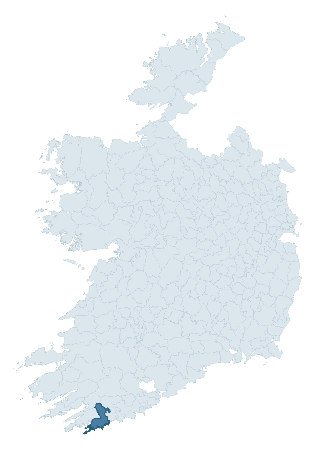
Where this barony sits in the Republic of Ireland
Geology and preservation
Bedrock geology shapes the landscape long before any settlement begins — controlling soil drainage, agricultural potential, the survival of upstanding monuments, and the preservation of buried archaeology. The figures below come from the Geological Survey Ireland 1:100,000 bedrock map.
The bedrock underlying Carbery West (East Division) is predominantly sandstone (59% of the barony by area), laid down during the Devonian period (72% by area, around 419 to 359 million years ago). Sandstone weathers to free-draining, moderately fertile soils that supported Early Medieval ringfort agriculture and later manorial estates. The rock itself is a major source of building stone — visible in churches, tower houses, and farm buildings across the barony's historic landscape. A substantial secondary geology of siltstone (31%) and mudstone (10%) adds further variety to the underlying landscape. The single largest mapped unit is the Castlehaven Formation (31% of the barony's bedrock).
Rock type composition
Largest mapped unit: Castlehaven Formation (31% of the barony)
Placename evidence
Logainm records 40 heritage-diagnostic placenames for Carbery West (East Division), drawn from townland and civil-parish names across the barony. The dominant stratum is pre-Christian and Early Medieval defensive — ráth-, lios-, dún-, and caiseal-prefixed names that mark Iron Age and early historic settlement. The leading diagnostic roots are cill- (15 — church), lios- (9 — ringfort or enclosure), and ráth- (7 — earthen ringfort). This is above the ROI average of 30.7 heritage placenames per barony. The presence of multiple heritage strata side by side indicates layered occupation of the landscape across successive prehistoric and historic periods. Logainm records 334 placenames for Carbery West (East Division) (predominantly townland names). Of these, 40 (12%) carry one of the diagnostic Gaelic roots tracked above; the remainder draw on more generic landscape vocabulary that does not encode a heritage period.
Pre-Christian / Early Medieval Defensive
| Root | Count | Meaning |
|---|---|---|
| lios- | 9 | ringfort or enclosure |
| ráth- | 7 | earthen ringfort |
| dún- | 4 | hilltop or promontory fort |
| caiseal- | 3 | stone ringfort |
Early Christian Ecclesiastical
| Root | Count | Meaning |
|---|---|---|
| cill- | 15 | church (early) |
| mainistir- | 2 | monastery |
Burial, Ritual, and Norse-Contact
| Root | Count | Meaning |
|---|---|---|
| gall- | 3 | foreigner — Norse settlement marker |
Other baronies in Cork
- Kerrycurrihy
- Carbery East (east Division)
- Kinalea
- Bantry
- Barretts
- Courceys
- Condons And Clangibbon
- Coshmore And Coshbride — Waterford
- Moyarta — Clare
- Muskerry East
See all 280 baronies in the Republic of Ireland Heritage Tool.

Explore further
Grounding History: 10 Maps of Northern Ireland’s Past
If you’re interested in Irish heritage more widely, the companion report for Northern Ireland brings together the analysis of all 462 NI wards into one place through 10 high-quality maps — covering monument density, archaeological periods, placename heritage, terrain, wetland, and the historic landscape at first survey. Take a look.
About this profile
Click any section below to expand.
What is a barony?
A barony is a historic administrative unit in Ireland, broadly equivalent to an English hundred. The 280 baronies used here are from the OSi 2019 National Statutory Boundaries (generalised 20m), covering the 26 counties of the Republic of Ireland. Baronies derive from the Norman period, were formalised in the 17th century, and have not been redrawn for statistical purposes. They vary enormously in area, from compact urban baronies in Dublin to vast upland baronies in Connacht, and should not be compared by raw site count without accounting for area differences.
What counts as a site?
This profile combines three distinct heritage registers, each with its own definition of what constitutes a recordable site:
- Archaeological sites (NMS). The National Monuments Service Sites and Monuments Record (SMR) catalogues every known archaeological monument or site of archaeological interest in the Republic, from prehistoric burial mounds and ringforts to medieval churches and post-medieval defensive works. Inclusion does not require legal protection — only that the site has been identified, surveyed, and assessed as having archaeological value. A separate subset of these sites lies within a recorded protection zone, which gives them statutory protection under the National Monuments Acts.
- Listed buildings (NIAH). The National Inventory of Architectural Heritage records buildings of architectural, historical, archaeological, artistic, cultural, scientific, social, or technical interest. Each surveyed structure is appraised on a five-tier scale: International, National, Regional, Local, and Record-Only. The NIAH appraisal is informational rather than strictly statutory, but it underpins local-authority Record of Protected Structures (RPS) listings.
- Heritage placenames (Logainm). Logainm is the authoritative database of Irish placenames maintained by the Placenames Branch. This profile applies a heritage-diagnostic classifier to the Irish-language form of each townland name, flagging roots that signal defensive sites (ráth-, lios-, dún-, caiseal-, cathair-), ecclesiastical foundations (cill-, teampall-, domhnach-, mainistir-), prehistoric burial-ritual features (tuaim-, carn-, leaba-), or Norse-contact settlement (gall-). Townlands without one of these diagnostic roots are not flagged here — they may still carry historical significance, but that significance is not encoded in the name itself.
Editorial principles
The narrative sections of this profile follow several explicit principles:
- Evidential. Every claim about this barony’s heritage character is anchored in the underlying register data. Where a site count, a placename count, or a percentile rank is cited, it is computed from the source datasets at export time, not estimated.
- Comparative. Counts and metrics are reported alongside their percentile rank against the other 279 ROI baronies. A barony with 50 ringforts in absolute terms could be unusually high or unusually low depending on its size and regional context; percentile ranking removes that ambiguity.
- Transparent on limits. Where a register has known coverage gaps, survey biases, or data-quality issues that affect this barony’s figures, the profile flags them rather than presenting the numbers as definitive.
- No interpretation beyond what the data supports. The narrative does not speculate about historical events, social dynamics, or cultural meaning beyond what the recorded heritage and placename evidence directly attests.
Data caveats and limits
- NMS Sites and Monuments Record is the product of survey campaigns conducted at different intensities across different counties and decades. Some baronies have been surveyed more thoroughly than others, and absolute counts should be read in that light. Sites destroyed by development before survey are typically not represented; sites in heavily forested or upland terrain are sometimes under-recorded.
- NIAH coverage is broadly complete for the Republic of Ireland but the survey was conducted on a rolling county-by-county basis, and the most recent appraisal date varies. Buildings demolished or substantially altered after their original survey may still appear in the register; conversely, recent buildings of merit may not yet have been appraised.
- Logainm classification applies a deliberately conservative pattern-matching approach to the Irish-language townland forms. The classifier prioritises true positives over recall: a townland may carry a heritage signal that the classifier doesn’t recognise, particularly where the diagnostic root has been heavily anglicised or where the townland name draws on a less common term. The 60,000+ townland records and ~9,800 classified placenames give a substantial signal at barony scale, but individual townland names should be checked against Logainm directly for definitive interpretation.
- Period attribution. The chronological distribution reflects only those NMS sites that carry a recognised period attribution in the source data. Sites listed as “Unknown” period are excluded from the dated subset.
- Boundary changes. Some baronies have undergone minor boundary adjustments since their 19th-century definition; the OSi 2019 generalised boundaries used here are the current statutory definition and may differ slightly from historical maps in border areas.
- Bedrock geology is mapped at 1:100,000 scale, which means local variation within a barony — small pockets of different rock type, mineral veins, alluvium overlying bedrock — is generalised. The dominant-system and rocktype figures are area-weighted, so a barony reading “70% Carboniferous limestone” may still contain small but archaeologically important pockets of older or younger rock. Around 3% of GSI polygons do not match the lexicon and contribute no rocktype or system attribution.
Data sources
- National Monuments Service — Sites and Monuments Record (SMR) https://data.gov.ie/dataset/national-monuments-service-archaeological-survey-of-ireland
- National Inventory of Architectural Heritage (NIAH) https://data.gov.ie/dataset/national-inventory-of-architectural-heritage-niah-national-dataset
- Logainm — Placenames Database of Ireland https://www.logainm.ie/
- Ordnance Survey Ireland — National Statutory Barony Boundaries 2019 https://data-osi.opendata.arcgis.com/
- EURODEM — European Digital Elevation Model https://www.mapsforeurope.org/datasets/euro-dem
- ESA WorldCover https://esa-worldcover.org/en
- Geological Survey Ireland — 1:100,000 Bedrock Geology https://www.gsi.ie/en-ie/data-and-maps/Pages/Bedrock.aspx
Explore more: Search any of the 280 ROI baronies, browse by historical province, or read the methodology and data sources for the full Republic of Ireland Heritage Tool.